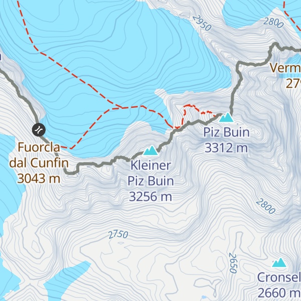
Piz Buin Pitschen (Rumantsch) or Kleiner Piz Buin (German) is a peak in the Silvretta Alps. The Piz Buin Pitschen lies western of his higher neighbor the Piz Buin Grond or Großer Piz Buin.
The summit forms the border between Switzerland and Austria and is the second highest peak in Vorarlberg, a state of Austria, and the sixth highest peak of the mountain range after the Piz Linard, the Fluchthorn, the Piz Buin Grond, the Verstanclahorn and the Piz Fliana.
The first ascent was made 1868 by O.W. Stein and his guide Christian Jann.
The nearest mountain hut is Ehemalige Zollwachhütte located 1 231m/4 037ft ENE of the summit.
By elevation Kleiner Piz Buin is
# 9 out of 414 in Region Engiadina Bassa/Val Müstair # 2 out of 664 in Bezirk Bludenz # 2 out of 1003 in Vorarlberg # 8 out of 321 in the Silvretta Alps
By prominence Kleiner Piz Buin is
# 65 out of 414 in Region Engiadina Bassa/Val Müstair # 64 out of 664 in Bezirk Bludenz # 96 out of 1003 in Vorarlberg # 34 out of 321 in the Silvretta Alps
We use GPS information embedded into the photo when it is available.
3D mountains overlay
Adjust mountain panorama to perfectly match your photos because recorded by camera photo position might be imprecise.
Move tool
Rotate tool
Zoom
More customization
Choose which peak labels should make into the final photo and what photo title should be.
Next
Photo Location
Satellitte
Flat map
Relief map
Latitude
Longitude
Altitude
OR
Latitude
°'''
Longitude
°'''
Apply
Register Peak
Peak Name
Latitude
Longitude
Altitude
Register
Teleport
PeakVisor
This 3D model of Sagarmatha National Park in Nepal was made using the PeakVisor app topographic data. The mobile app features higher precision models worldwide, more topographic details, and works offline. Download PeakVisor maps today.
Download OBJ model
PeakVisor
The download should start shortly. If you find it useful please consider supporting the PeakVisor app.
PeakVisor for iOS and Android
Be a superhero of outdoor navigation with state-of-the-art 3D maps and mountain identification in the palm of your hand!