Scan the QR code and open PeakVisor on your phone
Doubs Nature Park is a protected area and outdoor recreation destination located in northwestern Switzerland. The park lies in the Jura Mountains, along the country’s border with France. There are 26 named mountains in the park, the highest and most prominent of which is Gros Crêt (1,276 m/4,186 ft)
Doubs Nature Park is a protected mountainous region that lies partially within the cantons of Jura, Neuchâtel, and Bern in northwestern Switzerland. The northwestern border of the park is the Doubs River, which separates Switzerland and France.
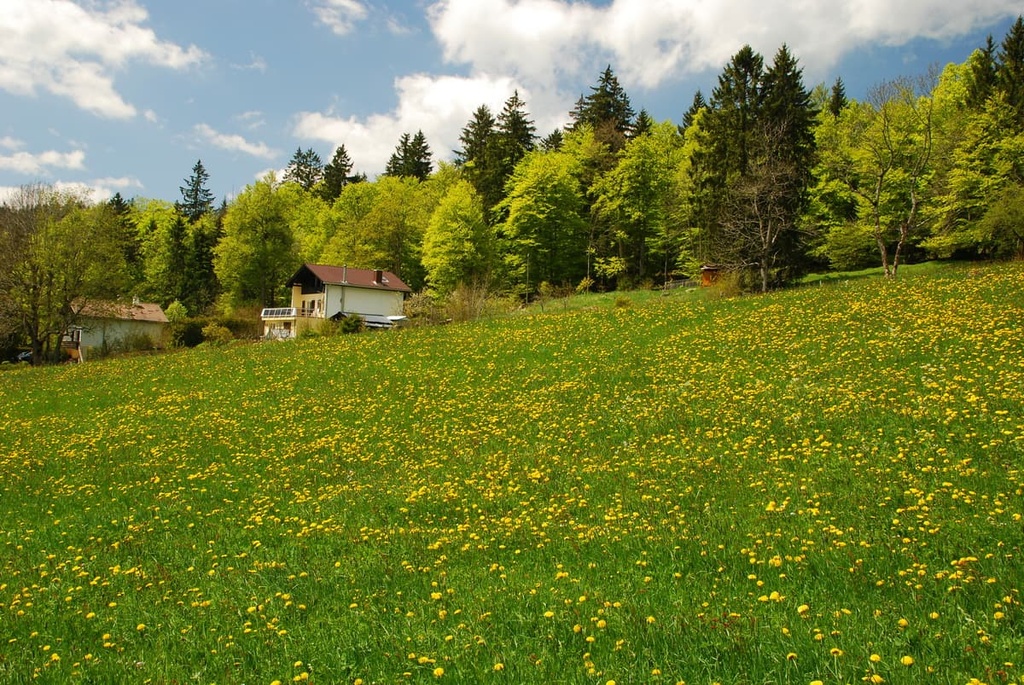
The park encompasses nearly 300 square kilometers (116 square miles) of rugged terrain in the south of the Freiberge Plateau. Within the park lie 16 communities and a plethora of stunning landscapes.
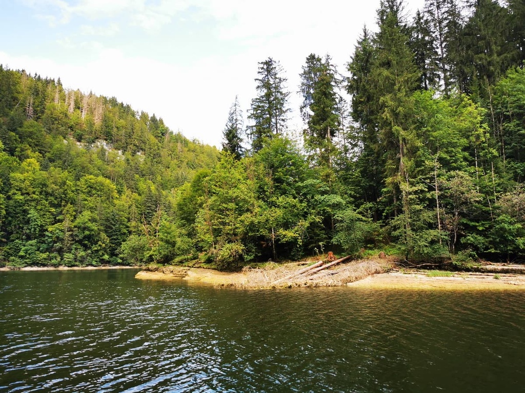
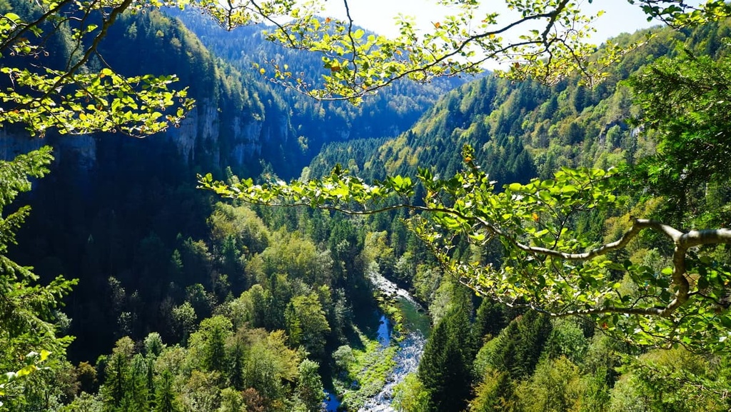
Doubs Nature Park covers much of the land between the communities of Les Brenets in Neuchâtel and Saint-Ursanne in Jura. The northern region of the park is marked by the magnificent canyon of the Doubs River.
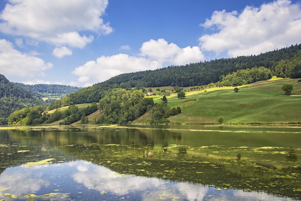
While steep cliffs dominate this northern portion of the park, the rest of the park is home to densely forested hillsides, vast plateaus, and pastured woodlands. Shaped by years of farming and horse husbandry, the land is full of deep gorgers, ponds, and moors. Isolated farms and pastures can also be found throughout the park’s varying landscapes.
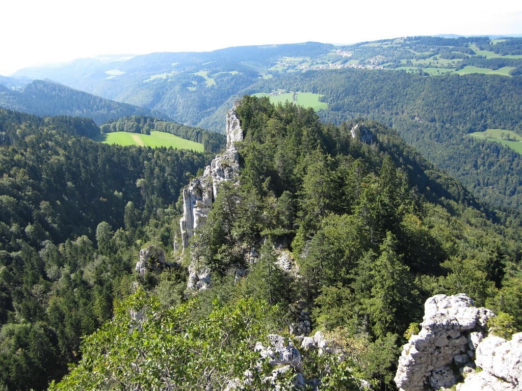
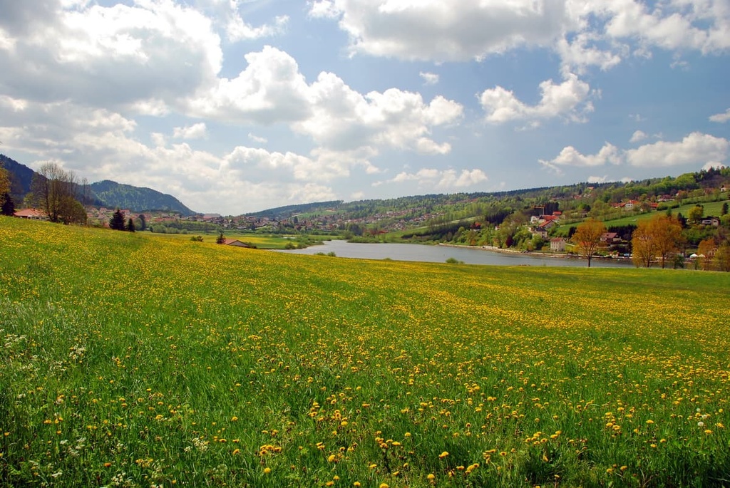
Some of the higher elevations in the park are free of trees, offering hikers views of the surrounding Jura Mountains and Swiss Plateau alongside Lake Bienne and Lake Neuchâtel down below. On a clear day, hikers may see views of the Alps along the southern edge of the country.

Additionally, Doubs Nature Park lies near a number of other parks in the region. Chasseral Nature Park and Gruyère Pays-d'Enhaut Regional Nature Park are located directly to the south of the park while Jura Vaudois Nature Park is situated to the southwest.
The peaks within Doubs Nature Park are part of the Jura Mountains, which cover much of northwestern Switzerland.
The Jura Mountains began forming around 65 million years ago during the Cenozoic Era. During this time, the Alps also began forming as a result of the Alpide orogeny.
This major mountain building event occurred as the supercontinents of Laurasia and Gondwana began drifting toward one another. As the two tectonic plates collided, the ancient Tethys Ocean that separated them receded, transforming the ocean floor into the rugged peaks of the Alps.
This collision also helped shape the landscape throughout present-day Switzerland. Both the Jura Mountains and the Swiss Plateau were slowly uplifted over the course of millions of years.
The Jura Mountains were further created by a major deformational thrust that occurred during the Pliocene Epoch, around 5.3 to 2.6 million years ago. Situated in the southeastern portion of the range, this thrust helped form the base of the range.
The mountain building of the Jura Mountains was a result of two monumental thrusts. The first thrust shaped the peaks in present day France while the second thrust formed many of the peaks on the Swiss side of the range. However, rock-wise, a majority of the Jura Mountains feature alternating layers of limestone and marl.
Major peaks found within the park include Gros Crêt, Le Point de Vue, Mont Rossat, and Mont Russelin.
Doubs Nature Park is home to a variety of both flora and fauna. The multitude of landscapes throughout the park allow for an abundance of ecosystems to thrive.
Tree species found throughout the park include yew, European beech, hazel, Sycamore maple, and various species of pine tree. The plateaus and hillsides of the park are also home to populations of ivy, spleenwort, clovers, sweet woodruff, and early purple orchid. Various grasses can also be found throughout the moors and wetlands of the region.
Some of the many mammals that you can spot in the park include western roe deer, wild boar, Alpine ibex, common hedgehog, fallow deer, and brown hare. Visitors may also occasionally spot the northern chamois and Eurasian otter.
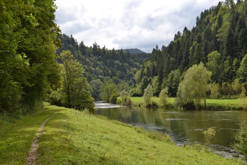
The Doubs River, along with nearby lakes, are home to a Doubs zebra trout, grayling, pike, and whitefish. Ducks are common throughout the park along with various songbirds and swallows. As far as birds go, long-eared owls and white storks are some of the most notable species to inhabit the region.
Human history near Doubs Nature Park dates back to at least 13,000 BCE. There is archeological evidence of early human inhabitation in the region in the form of a Magdalenian hunting camp.
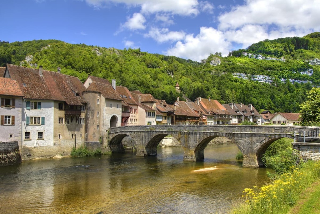
During their reign, the Roman Empire conquered land throughout present day Switzerland, including what is now Doubs Nature Park. The Romans built a road connecting Biel/Bienne to Petinesca that passed over the Jura Mountains and through the current park boundaries. Even after the fall of the Roman Empire, many of the towns and cities they established continued to prosper and grow.
The Burgundians invaded the region during the fifth century declaring it part of Upper Burgundy. From the sixth through the eighth centuries, the Germanic speaking Alamanni people began settling around Lake Bienne, which is located just to the south of the park.
In the centuries that followed, the land was ruled by the Bishopric of Basel, followed by the Counts of Neuchâtel and later the Counts of Neuchâtel-Nidau. The Bishop of Basel ruled over the city of Biel/Bienne from the eleventh century to the eighteenth century. During the nineteenth century, the land in the park became part of the Swiss Confederation.
The land within the park has a rich history of both watchmaking and Freiberger horse breeding. The Freiberger horse originated around 200 years ago in the Jura region of the park. The horse was traditionally used for agricultural purposes and is now used for riding, sports, and other recreational uses.
Besides visiting the historical sites in the region, visitors can enjoy horseback riding, mountain biking, hiking, cross-country skiing, and snowshoeing while at Doubs Nature Park.
Doubs Nature Park is home to numerous trails for hiking and outdoor recreation. Here are some of the most popular trails and regions in the park:
The Le Noirmont Trail is a popular route in the northern region of the park. The trail is 15 km (9.4 miles) long and has 831 m (2,726 ft) of elevation gain. The loop starts in Le Noirmont before descending into the nature park. After passing along the river, the route climbs the Sommêtres ridge.
From the ridge, a cliff drops down into the valley below. Viewpoints along the route offer views of the Jura Mountains and the Doubs valley. Much of the trail passes through the forested hillsides of the region.
Grande Traversée du Jura Segment 4 is a point-to-point trail that follows along the northern edge of the park, passing into France between Biaufond to Villers-le-Lac. The trail is 28 km (17.4 miles) long with 1,152 m (3,779 ft) of elevation gain. The route features forested landscapes, waterfalls, and the Doubs River.
This portion of trail is part of the longer Grande Traversée du Jura, which travels 420 km (261 miles) across the Jura Mountains. The route is often used for mountain bikepacking, but can also be used for hiking and backpacking.
La-Chaux-de-Fonds - Le Locle is a point-to-point trail in the park that travels between the two cities of La-Chaux-de-Fonds and Le Locle. The route is 13 km (8 miles) long and has 341 m (1,118 ft) of elevation gain.
Situated in the southwestern region of the park, the trail gently winds through the forested hillsides of the region. The route can be used for hiking or mountain biking, and it can be extended to reach the summit of Pouillerel, which lies between the two cities.
Looking for a place to stay near Doubs Nature Park? Here are some of the best nearby cities and villages to check out during your trip.
Delémont lies to the east of the northern stretches of the park, and it is the capital city of the canton of Jura. The city has around 12,000 residents and is surrounded by the forested hillsides of the Jura Mountains.
Remnants of the once-medieval town are well-preserved throughout the city. Historical sites to see in the town include the former summer residence of the Prince-Bishop of Basel, the medieval town gates, the church of St. Marcel, the Porte au Loup, and the Porte de Porrentruy.
The Chappuis-Fähndrich Museum in Delémont alos offers visitors a chance to look back at the history of both the town and the canton of Jura. The old town district is even home to the Jurassic Museum of Art and History.
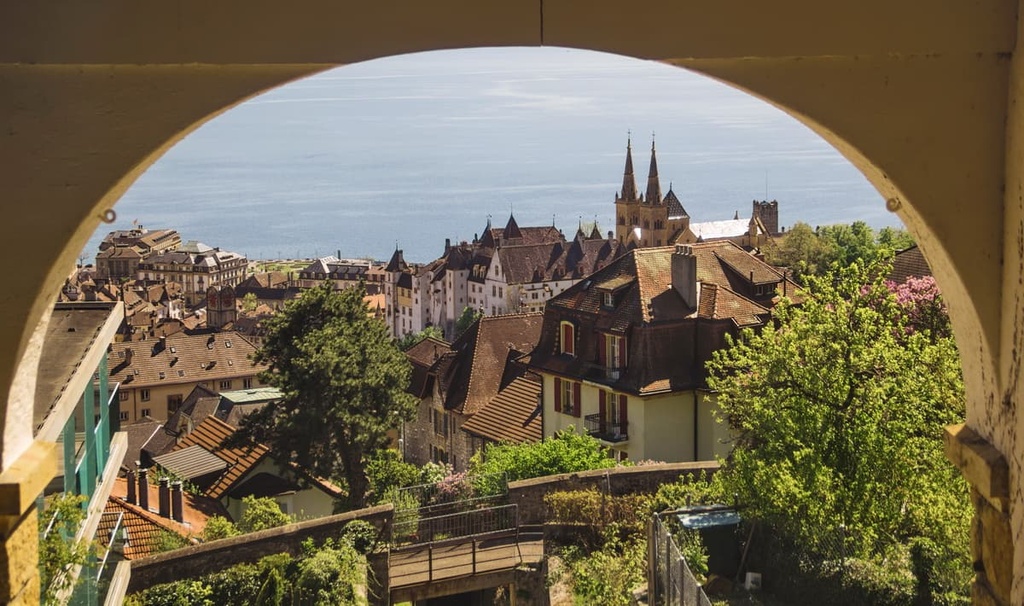
Neuchâtel is the capital city of its namesake canton, Neuchâtel, and it lies to the south of Doubs Nature Park. The city is home to around 45,000 residents, and it is located along the shores of Lake Neuchâtel. Perhaps best known for being the center of watchmaking in Switzerland, Neuchâtel also boasts numerous tourist sites that are well worth checking out.
Local shops, restaurants, and bars line the old town district of Neuchâtel while the medieval town center features buildings dating back to the twelfth century. Other sites worth visiting include the Museum of Art and History, which is located in the Palais des Beaux-Arts (Palace of the Fine Arts). Neuchâtel is also home to the Laténium, the country’s largest archeological museum.