
Scan the QR code and open PeakVisor on your phone
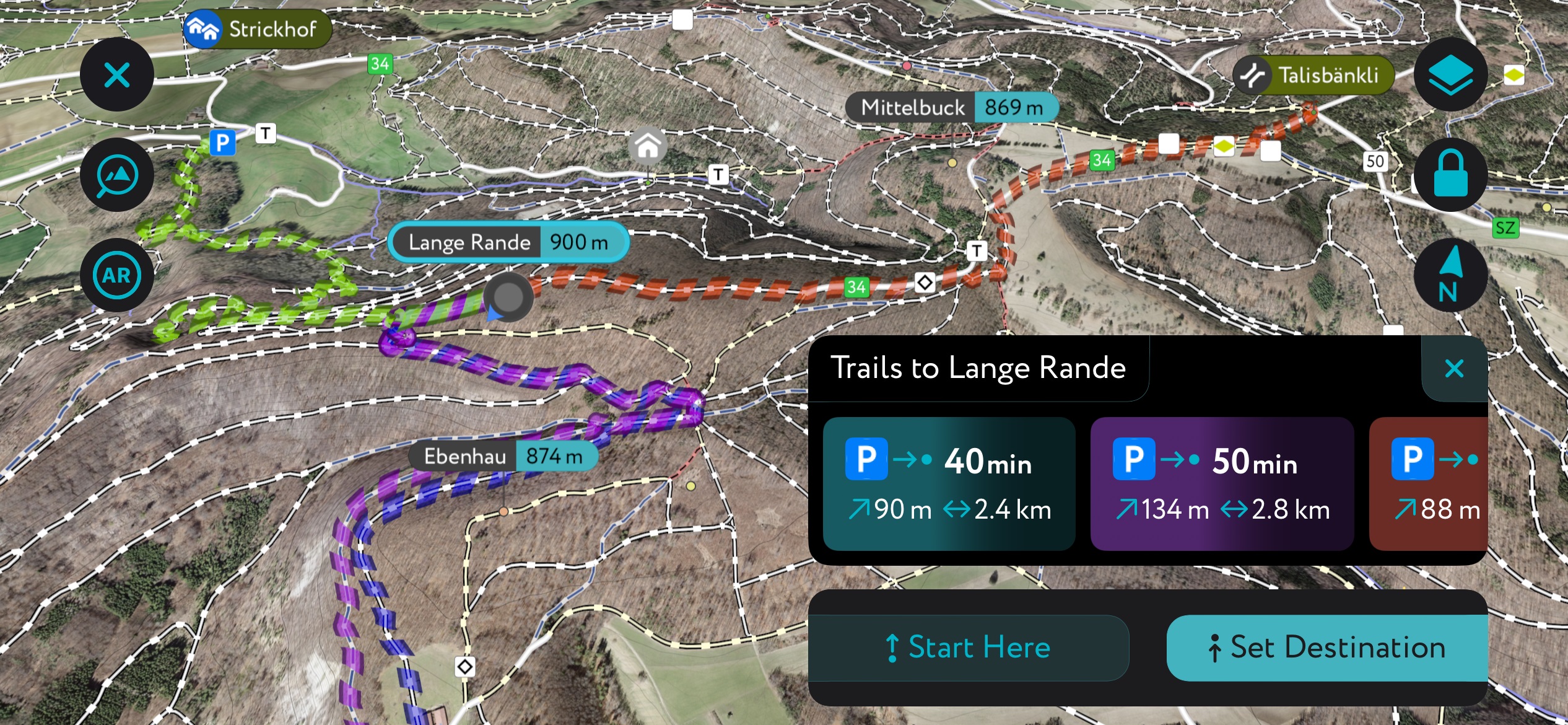
Schaffhausen Regional Nature Park has 109 named peaks. The highest is Lange Rande at 900 m. Other notable peaks include Schlossrande, Chrisling and Ebenhau.
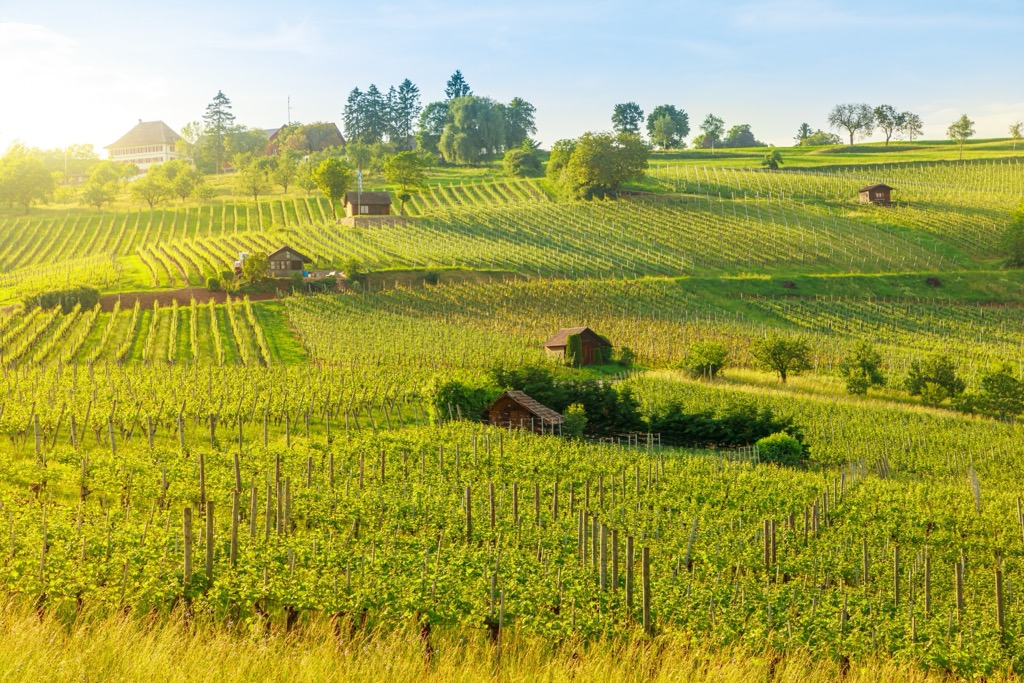
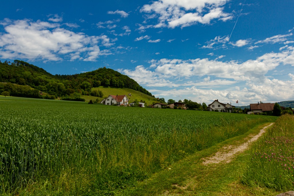
Schaffhausen Regional Nature Park is a 213 square kilometer (82 sq. mi) natural space in northern Switzerland’s Schaffhausen canton. The park is known for its verdant valleys, the rolling Randen hills, and a smattering of farms and vineyards nestled along the Rhine River. Switzerland’s first and only cross-border park, Schaffhausen also stretches into two municipalities of neighboring Germany. The park is home to 109 named peaks, all low in elevation. Lange Rande (900 m / 2,953 ft) is the highest point. The most prominent is Wannenberg (661 m / 2,169 ft), with 181 meters (593 ft) of topographic prominence.
Schaffhausen’s geography is characterized by the low, rolling hills of the Randen range, as well as green river valleys dotted with farms, vineyards, and small villages along the northern shores of the Rhine river, which turns east at the Swiss border and runs west-east past Schaffhausen.
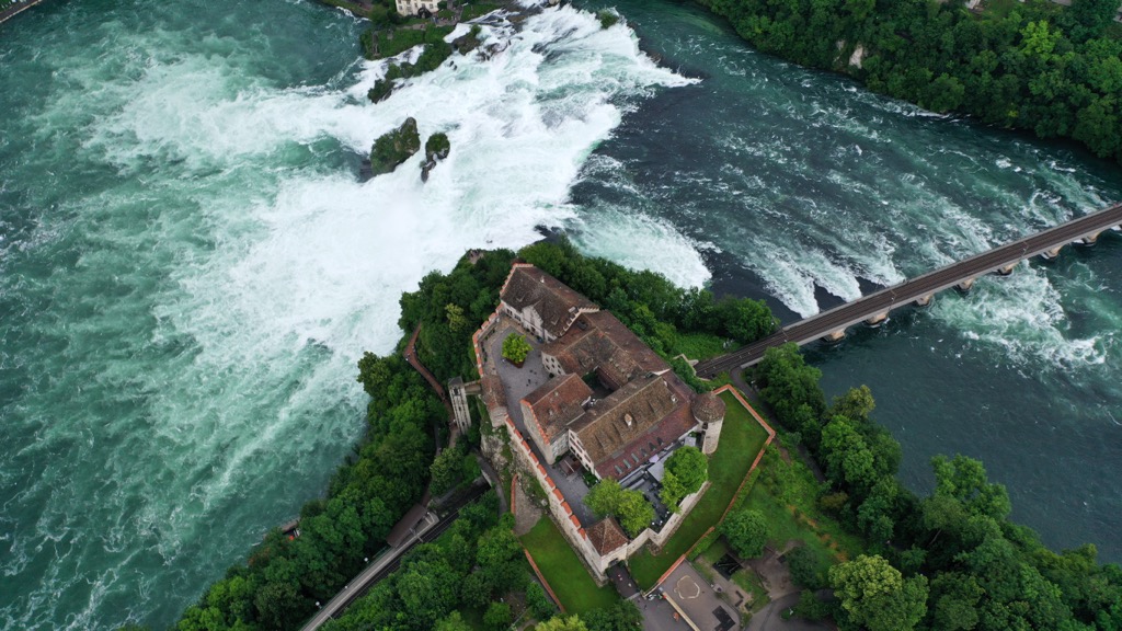
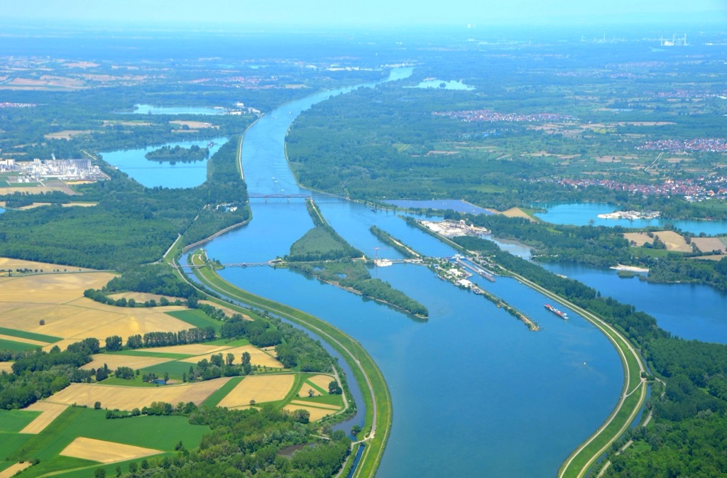
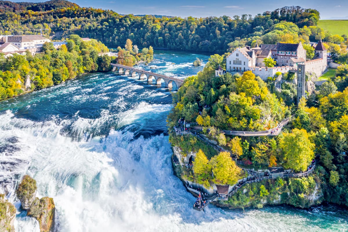
Just outside the park, at the border of the Schaffhausen and Zürich cantons, lies the mighty Rhine Falls, the most powerful waterfall in Europe, with an average flow of 600 cu. m/s (21,000 cu ft/s). The falls are 23 meters (75 ft) high and 150 meters (490 ft) wide.
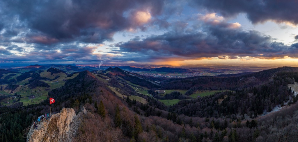
Schaffhausen’s Randen hills are a subrange of the Plateau (or Tabular) Jura. The Plateau Jura is the northeasternmost extension of the Jura Mountains, which run for 360 kilometers (225 mi) along the French-Swiss border. The park's terrain is predominantly characterized by these foothills, offering a mix of gentle slopes and more rugged, forested hills.
The tallest peak in Schaffhausen Regional Nature Park, Lange Rande (900 m / 2,953 ft), is the second-highest in all of the Schaffhausen canton, after Hagen (912 m / 2,292 ft).
Climatically, Schaffhausen Regional Nature Park experiences a temperate oceanic climate, with no dry season and a warm summer. The average temperature in the park ranges from around 0°C (32°F) during the winter months to a mild 25°C (77°F) in the summer. These temperatures and the park’s low elevation (Lange Rande, at 900 m [2,953 ft], is the highest point) facilitate year-round exploration.
Precipitation is relatively evenly distributed throughout the year, with slightly higher rainfall during the summer months due to thunderstorms. The total average annual rainfall is 983 mm (38.7 in). This consistent moisture level contributes to lush natural vegetation. Some snowfall occurs in the winter, especially at higher elevations, offering winter sports opportunities.
Like the rest of Schaffhausen canton, Schaffhausen Regional Nature Park is part of the Swiss Plateau, a geomorphic region that defines northern Switzerland. In particular, Schaffhausen lies on the Randen Plateau sub-region.
The foundation of Schaffhausen's landscape was laid during the Mesozoic era, particularly in the Jurassic period, approximately 200 to 145 million years ago. During this time, the region was covered by a shallow sea that stretched across much of what is now Europe.
The sediment deposited by this ancient sea formed the limestone and marl layers characteristic of the Jura foothills. These sedimentary rocks are rich in fossils, including ammonites and other marine organisms.
The end of the Mesozoic and the beginning of the Cenozoic era, around 66 million years ago, marked a period of significant geological upheaval. Tectonic movements associated with the Alpine orogeny, the mountain-building event that created the Alps, also affected the Schaffhausen region. These movements caused the uplifting and folding of the sedimentary layers, shaping the Jura Mountains and contributing to the rolling hills in the park today.
During the Quaternary period, particularly in the last 2.6 million years, the landscape underwent further transformation due to the ice ages. Glaciers advanced and retreated multiple times, sculpting the valleys and hills, eroding the rock, and depositing glacial till and moraines.
The Rhine Glacier, in particular, played a pivotal role in carving out the present course of the Rhine River and creating features such as the Rhine Falls (Europe's largest waterfall, mentioned above) and Lake Constance, one of the largest freshwater lakes in Europe.
As the glaciers retreated for the last time around 10,000 years ago, they left behind a dramatically altered landscape. The glacial meltwaters contributed to the formation of the river valleys and shaped the fertile plains that now support the park's rich biodiversity. Lakes and wetlands formed in depressions left by the ice, creating habitats for various plant and animal species.
Schaffhausen Regional Nature Park is home to a range of flora and fauna. Broadleaf forests dominate the region, composed primarily of beech, oak, and maple trees. The open valleys are often filled with wildflowers like orchids, bellflowers, and gentians, as well as herbs like meadowsweet (Filipendula ulmaria).
Some of the most common plants seen in the Schaffhausen region are, in order, the European beech (Fagus sylvatica), sycamore (Acer pseudoplatanus), Himalayan balsam (Impatiens glandulifera), common hazel (Corylus avellana), European ash (Fraxinus excelsior), and English ivy (Hedera helix).
Along the banks of the Rhine and other water bodies within the park, riparian forests and wetland vegetation, including reeds and willows, are crucial for maintaining the health of aquatic ecosystems.
The park's wooded regions are home to typical European temperate forest mammals, such as western roe deer (Capreolus capreolus), European or brown hare (Lepus europaeus), and alpine chamois (Rupicapra rupicapra) in the higher elevations.
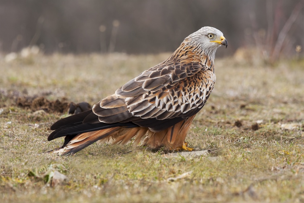
Birds include the mighty red kite (Milvus milvus), a large bird of prey with a 175 cm (69 in) wingspan, the neon-green European greenfinch (Chloris chloris), and the mute swan (Cygnus olor). Aquatic mammals like the Eurasian beaver (Castor fiber) and the Eurasian river otter (Lutra lutra) are familiar sights along the Rhine and other water bodies, as are plenty of fish, such as the common chub (Squalius cephalus).
Archaeological findings suggest that the Schaffhausen canton has been inhabited since the Paleolithic era, with settlements becoming more permanent during the Neolithic period, around 4300 BCE. These early inhabitants were hunters and gatherers before transitioning to agriculture, marking the beginning of a more settled way of life.
The region gained strategic importance during the Roman Empire, around the first century, due to its location along the Rhine, which served as a natural border and trade route. Evidence of Roman influence can be seen in the remnants of villas, roads, and fortifications scattered throughout the park. After the fall of the Roman Empire in 476 AD, the area saw the rise of the Alemanni tribes and later fell under the control of the Frankish Empire during the sixth century.
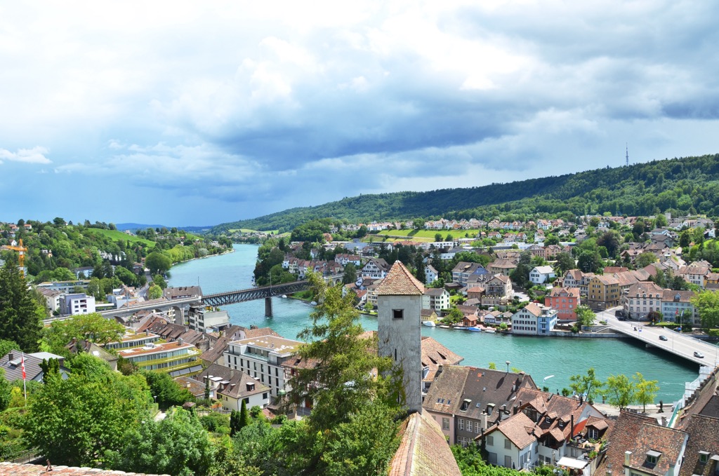
The Middle Ages were a significant period for the Schaffhausen area, culminating in the establishment of the eponymous city of Schaffhausen in the 11th century. The city soon became a vital center of trade and governance, with its wealth and influence evident in the medieval architecture that still defines its character.
During the late Middle Ages, Schaffhausen joined the Swiss Confederation (1501), affirming its strategic and political significance in the region. This period was characterized by prosperity, thanks in part to its location on trade routes and the Rhine River, which facilitated commerce and the exchange of ideas.
The Industrial Revolution of the 1800s brought economic transformation, with Schaffhausen emerging as a hub for manufacturing and innovation. This era saw the construction of the first railway in the area (1857) and the development of industries such as watchmaking and machinery, which remain essential to the local economy. Mining was once a booming industry here, and you can still see many defunct pit mines commonly used to source “bean ore,” a colloquial name for the local variety of limonite.
The canton’s constitution was written in 1876 and is still in use today, save for a revision in 1895. Schaffhausen Regional Nature Park is currently home to approximately 29,000 people and spans 15 municipalities (13 of these are Swiss, while two are German).
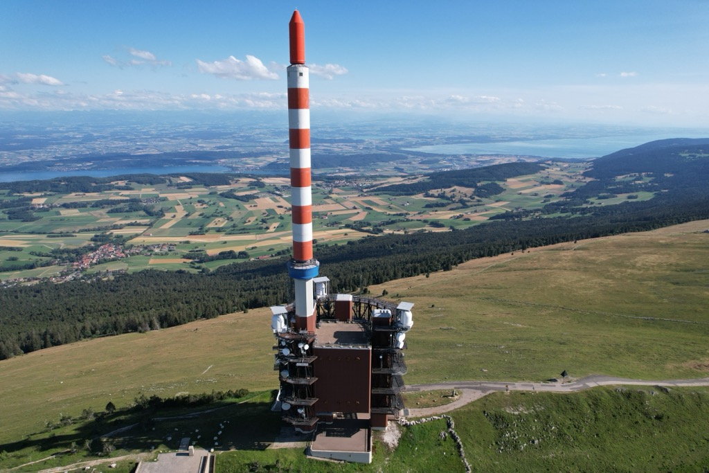
Hikers can summit the highest peak in Schaffhausen Regional Nature Park, Lange Rande (900 m / 2,953 ft), via several trails in all directions. Regardless of the route you choose, you’ll be looking at somewhere between 2.4 to 3.2 kilometers (1.5 to 2 mi) and somewhere between 100 meters (330 ft) and 300 meters (985 ft) of elevation gain. The easiest route is from the Siblinger Randenhaus restaurant and observation point due south.
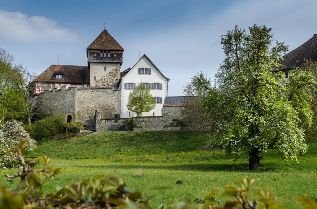
A 20-kilometer (12.7-mile) gravel trail connects the town of Schaffhausen to the nearby medieval town of Stein am Rhein. The route takes most hikers around four to five hours to complete. It’s a picturesque, mellow trail with little elevation gain, running along the Rhine past a number of small villages, vineyards, pastures, and woods. Be sure to stop to see the historic Unterhof Castle in Diessenhofen around the halfway mark.
This 19-kilometer (11.8 mi) loop trail takes hikers through four small villages (Bibern, Hofen, Altdorf, and Opfertshofen) along vineyards and past a number of historic sites.
Notable stops along the Reiatweg include the Museum of Typewriters (housing over 400 typewriter models) in Hüttenleben, the brickworks in Hofen (once the region's largest employer, this factory supplied bricks for the Federal Parliament building in Bern), and the northernmost inhabited point in Switzerland, the Egghof above Sottenegg. Above Opfertshofen village, views stretch northeast into Germany’s Hegau region, famous for its smattering of extinct volcanoes.
Schaffhausen is the capital of Schaffhausen canton, the largest city in the region, and one of only four Swiss cities north of the Rhine (the others being Neuhausen am Rheinfall, Neunkirch, and Stein am Rhein). Nearly half of Schaffhausen canton’s population (37,000) lives in the eponymous city.
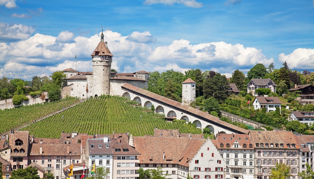
The city is notable as a railway line connection for much of the surrounding region. It also has a number of historical sights and Renaissance-era buildings, particularly the Munot fortress, a ring-shaped castle dating to the 1500s that dominates the central old town.
The town was tragically accidentally bombed by the United States military during the Second World War after 50 B-24 bomber aircraft veered from German airspace into Switzerland due to navigational mistakes. (The planes were meant to target the German town of Ludwigshafen am Rhein, 235 kilometers [146 mi] north). Forty civilians were killed and nearly 300 injured in the resulting bombing, and much of the old town was damaged.
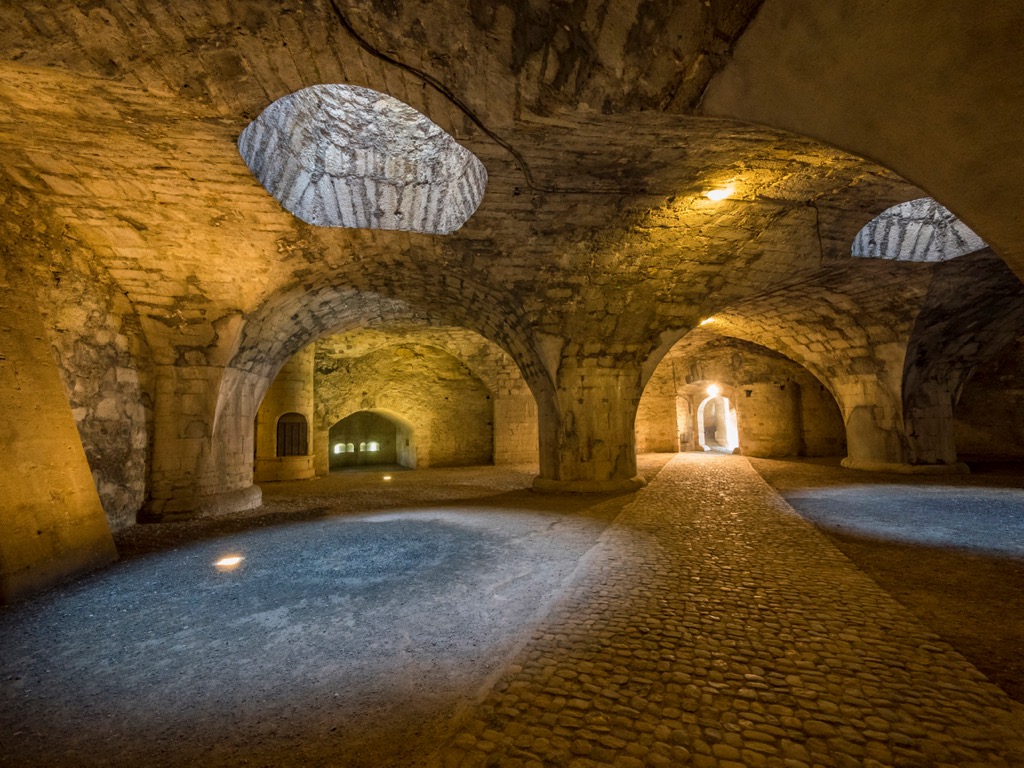
In total, Schaffhausen has 35 buildings or sites listed as Swiss national heritage destinations. In addition to the “old town” or Altstadt, and the Munot castle, another notable site is the Kloster Allerheiligen (All Saints Abbey), a Benedictine monastery dating to 1049. Today, the monastery is a museum and also houses an archaeological collection. Other sights include the IWC museum (a collection put on by the legendary high-end Swiss watchmaker, headquartered in town) and the Stemmler Museum, an eclectic collection of animal pelts, skeletons, stuffings, and other artifacts.
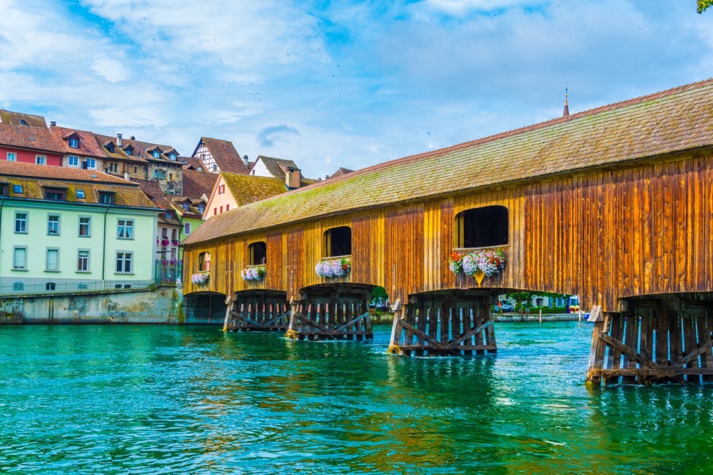
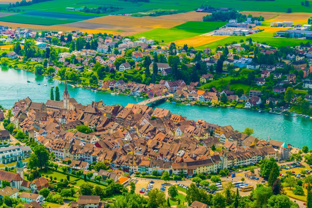
The medieval town of Stein am Rhein (pop. 3,500) is located in eastern Schaffhausen canton. Filled with medieval architecture, frescoes, and with the ancient city walls and gates still partially standing, a visit to Stein am Rhein is a step back in time. A four-hour walk east along the Rhine takes visitors to Stein am Rhein from Schaffhausen.
Must-see sites include the monastery church of St. Georg, the Burg Hohenklingen castle perched above the town, and the medieval clock tower. Stein am Rhein’s historic buildings are so well-maintained that in 1972, it received an award (the Wakker Prize) for the preservation of its architectural heritage; Stein am Rhein is unique in Switzerland (and rare in Europe) in terms of the sheer quantity of notable preserved historic structures in a compact space.


The highest peak in Schaffhausen Regional Nature Park is Lange Rande, at 900 m.
Notable peaks in Schaffhausen Regional Nature Park include Lange Rande, Schlossrande, Chrisling, Ebenhau and Mittelbuck.


