
Scan the QR code and open PeakVisor on your phone
Zurich is home to 493 named mountains. The highest is Schnebelhorn at 1,291 m.
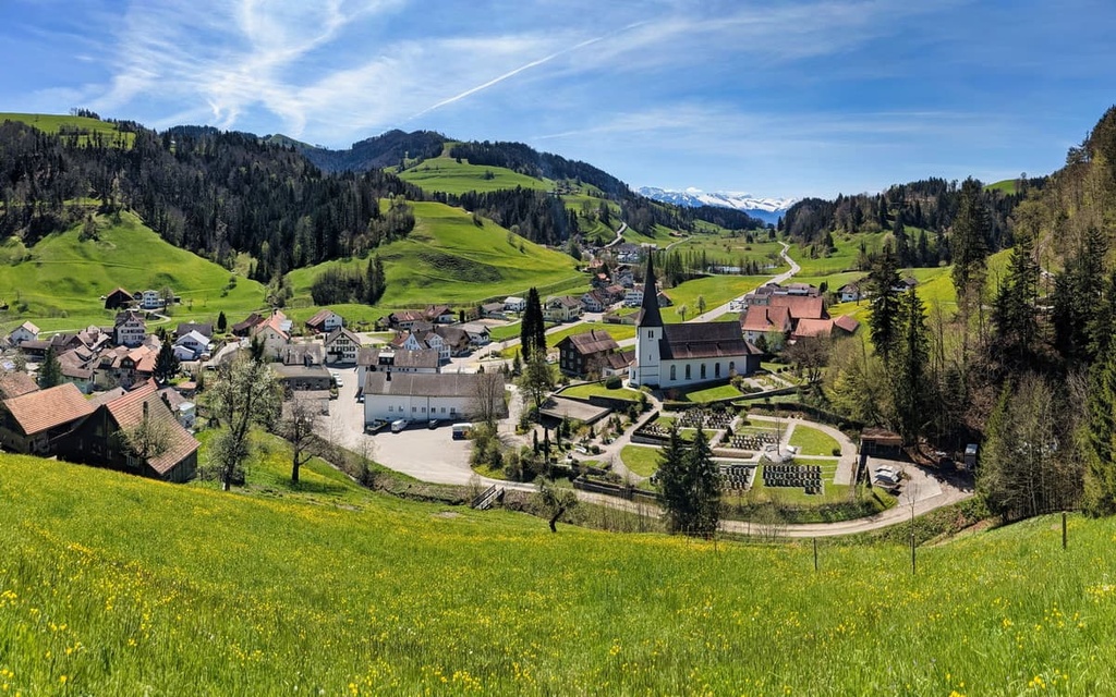
Zurich is a canton in the Central Plateau of Switzerland that boasts an extraordinary diversity of landscapes from lakes and rivers to forests, moors, and Alpine foothills. There are 493 named mountains in the canton of Zurich, the highest of which is Schnebelhorn (1,291 m/4,236 ft) and the most prominent of which is Lägern (866 m/2,841 ft).
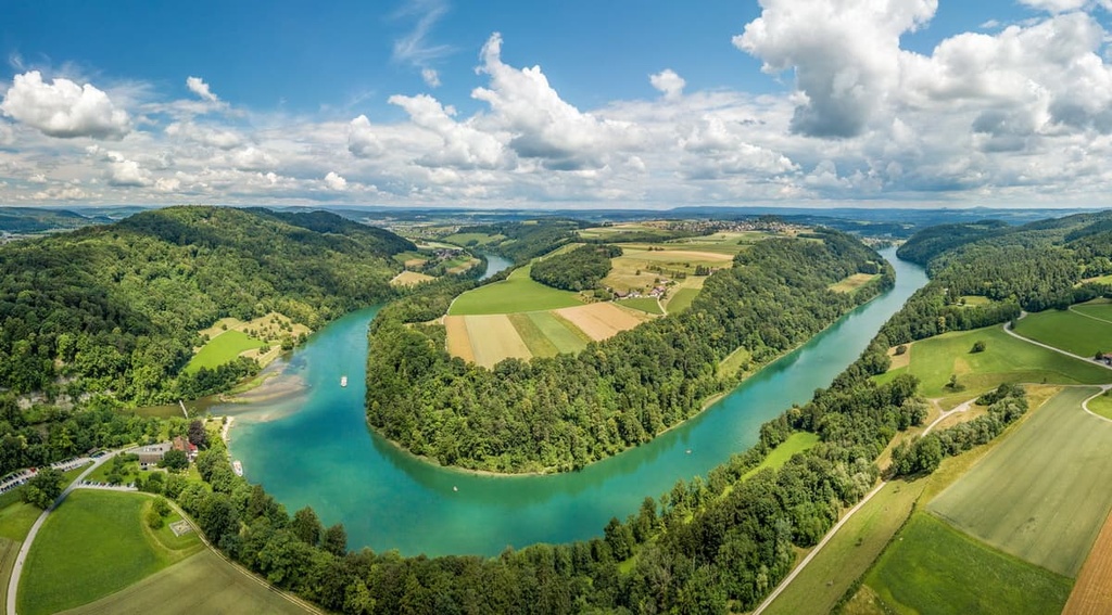
Zurich (Zürich) is a canton located in northeastern Switzerland. It has an area of 1,729 sq. km (668 sq. mi), of which about 80 percent is considered productive land, including about 505 sq. km (195 sq. mi) of forest. Approximately 72 sq. km (28 sq. mi) of the canton’s total area is covered in lakes, primarily Lake Greifen, Lake Pfäffikon, and part of Lake Zurich.
The canton of Zurich is the seventh-largest canton in Switzerland, and it has a population of 1.56 million people. It is, therefore, the most populous canton in Switzerland. It is home to Zurich, the canton’s capital city, and its urban agglomeration, which occupies the largest part of the canton. In addition to the capital, there are 31 other cities in Zurich.
The canton of Zurich is mostly located in the Swiss Mittelland. However, the extreme southeast of the canton is pre-Alpine in character, and the extreme northwest is home to part of the easternmost Jura foothills.
Zurich borders the canton of Schaffhausen and the state of Baden-Württemberg in Germany to the north as well as the canton of Aargau to the west, the cantons of Zug and Schwyz to the south, and the cantons of Thurgau and St. Gallen to the east. The canton of Zurich is also located on the border of the greater region known as Eastern Switzerland.

The highest mountain in the canton of Zurich is the Schnebelhorn, which has an elevation of 1,292 m (4,238 ft). Other well-known peaks in the Zurich Oberland include Bachtel and Hörnli. The local mountain of the city of Zurich, Uetliberg, belongs to the Albis subrange, which rises to elevations of up to 915 m (3,001 ft). Meanwhile, Lägern, which is located in the northwestern part of the canton, is a foothill of the Jura Mountains.
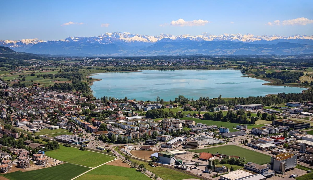
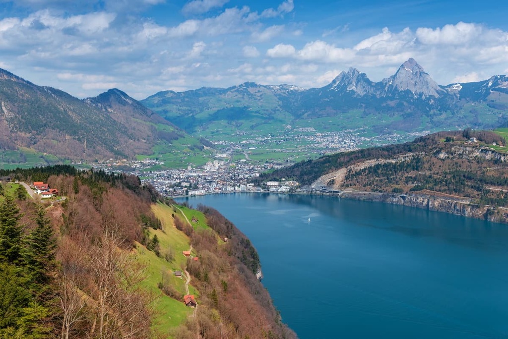
The largest body of water in the canton is the elongated Zürichsee (Lake Zurich), which extends into the southern area of the canton where it also crosses the border into the neighboring cantons of Schwyz and St. Gallen.
Other major lakes in the canton include Greifensee and Pfäffikersee. The Türlersee, Katzensee, Lützelsee, and Husemersee are some smaller, yet notable, bodies of water in the canton.
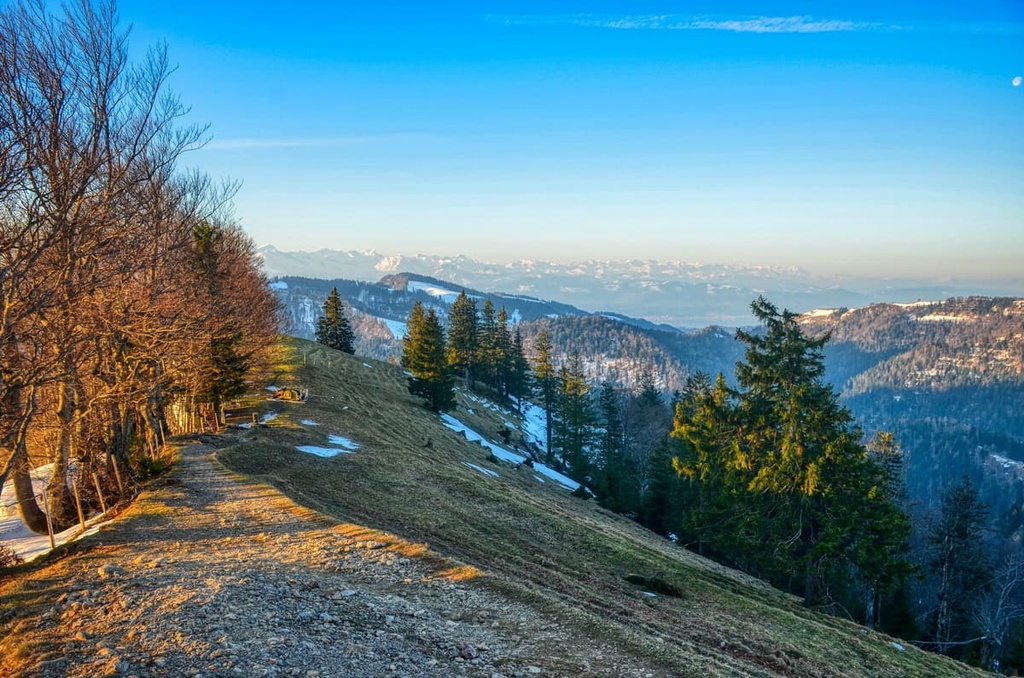
The hilly and forested Zurich Oberland is a popular recreational area that’s suitable for hiking. The Sternenberg region and the Hörnli are easily accessible all year round. Therefore, they are ideal destinations for anyone who doesn’t like to wait for spring, when the snow has melted at higher elevations, to start hiking again.
Switzerland has a fascinating geology and a great diversity of landscapes that includes everything from the crescent-shaped Alps and the Central Plateau to the Jura Mountains.
Due to an extensive history of drilling for oil and gas in the region, the rock sequences in the Swiss Plateau are relatively well known. The Swiss Plateau is located between the Jura in the north and the Alps in the south, and it extends from Lake Constance to Lake Geneva.
The crystalline basement rock in the region is located deep beneath the Swiss Plateau. It is covered by sedimentary sequences from the Mesozoic (mainly marine sediments such as limestones and clays). Above it lies the so-called Molasse Basin, which consists of eroded material (rock fragments, sand, silt, and clays) from the developing Alps.
In the final phase of the Alpine orogeny, the Earth's crust sank under the weight of the mountains, and a depression was formed in the Alpine foreland. For about 30 million years, this depression was continuously filled with eroded material that was transported northward by the rivers from the Alps, forming the Molasse Basin in the process.
In the Early Paleogene period (formerly known as the early Tertiary period), about 60–40 million years ago, the area of today's Swiss Plateau was a karstified limestone plateau that sloped slightly to the south. In the millions of years that followed, this plateau was flooded twice by the sea due to uplift and subsidence processes in connection with the formation of the Alps.
Therefore, the corresponding rock deposits in the area are distinguished as being primarily marine molasse and freshwater molasse. The latter should not be understood as being composed entirely of sediments from freshwater lakes but mainly as the site of deposits caused by river systems and wind transport (thus it is, to some degree, a “continental molasse”).
This eroded material from the Alps was deposited in lakes and river valleys; therefore, there are two types of molasse in the region: marine and freshwater molasse.
These sediments were deposited according to grain size. In particular, finer particles like clay were transported far into the sea, up to the edge of today's Jura. Coarser particles could not float in the rivers for as long so they settled in the rivers near the Alps, for example, as gravel beds.
Marine molasse is fine-grained and we can find it today in rocks like marl, sandstone, siltstone, and clay. Freshwater molasse has coarser-grained components and is found in rocks such as nagelfluh and sandstone.
Additionally, some of the rock layers found in the region are rich in fossils. For example, freshwater molasse often contains fossils of leaves, freshwater snails, and shells while marine molasse typically contains marine snails, shells, and shark teeth.
Seawater eventually flooded the depression formed in the Swiss Plateau during the last phase of the Alpine orogeny. Sediments were subsequently deposited in the region about 35 to 30 million years ago. These sediments are now found within the marls and sandstones that are part of the Lower Marine Molasse.
Increased uplift of the Alps about 30 million years ago transported larger amounts of erosional material into the Molasse Basin. As a result, the sea retreated and the land underneath was exposed to the elements.
The retreat of the sea in the region also led to the deposition of a sizable amount of sediment. Much of this sediment was deposited mainly in river beds approximately 30 to 20 million years ago, and they now are part of rocks within the Lower Freshwater Molasse.
Coarser-grained sediments in the region eventually formed into nagelfluh, a type of conglomerate rock. In a later phase of Alpine folding, the molasse rocks near the Alps were compacted, shifted, and uplifted out of the molasse basin (e.g., at Rigi).
When the sea level rose in the region about 20 million years ago, the Swiss Plateau was once again flooded and underwater. Around 20 to 18 million years ago, Upper Marine Molasse sediments were deposited in this narrow, shallow sea. These sediments eventually formed sandstone and marl.
Between 18 and 14 million years ago, the sea retreated again. During this time, many lakes and rivers were formed in the Central Plateau, and large alluvial fans at Hörnli and Napf filled with a lot of gravel.
Extensive alluvial plains started to form in the region, too, due to the widespread deposition of sand, silt, and mud. These sediments of the Upper Freshwater Molasse were later compacted into conglomerates such as conglomerates, sandstones, and marls.
Unconsolidated rocks (gravel, boulders, sand, silt, clay) that were deposited by ice sheets during the glacial maximums of the last two million years were transported by rivers and glaciers and they now overlie the molasse. Glaciers and meltwater have great erosive power, and, as a result, they have significantly shaped the topography of the Swiss Plateau over the last few million years.
This erosive power of glaciers and meltwater can be seen in the many elongated lakes that extend from south-southeast to north-northwest along the edge of the Alps and whose bedrock often lies beneath thick layers of unconsolidated rock.
These unconsolidated glacial rocks do not provide a solid bedrock and they make construction difficult, but they do provide resources in the form of gravel and drinking water. Occasionally, mammoth teeth are found in these unconsolidated glacial rocks.
In more recent times, the western part of the midland was again strongly uplifted. As a result, the sediments of the Upper Marine and Freshwater Molasse were largely eroded away.
The Mittelland received its present topography as a result of glacial erosion that took place during the last glacial maximum. In particular, the Rhine-Linth glacier had a huge impact on the topography of present-day Zurich. The glacier deepened and widened already existing valley depressions and created new valleys throughout the canton.
For example, the Limmat Valley and the Glatt Valley are filled with gravel that dates back to this period of glaciation. However, the subsequent Würm glaciation had a much larger impact on the landscape in the canton.
During this time, about 20,000 years ago, a large moraine formed, closing Lake Zurich to the north. We can still see this moraine today in the ridge of high ground that’s located between the lake and the Sihl Valley. This moraine is also evidenced by the high ground near the Lindenhof in the old town and by the Burghölzli.
The canton of Zurich is home to nearly 500 named mountains. Some of the most important peaks in the canton include:
The canton of Zurich has a treasure trove of gorgeous and valuable landscapes. These landscapes are of great importance in the region, both as habitats for plants and animals and as recreational areas for humans.
Due to their ecological and cultural importance, a sizable amount of the canton’s natural landscapes are under local protection and are part of nature reserves. Here’s a quick look at the different natural regions in Zurich.
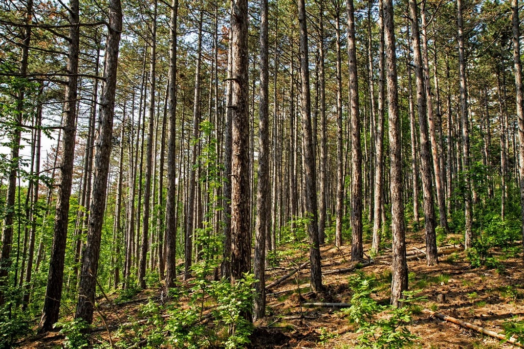
If you want to experience a northern Swiss forest in its most pristine form, the Sihlwald Nature Reserve is the right place for you.
The Sihlwald features a beech forest of approximately 1,100 ha (2,718 acres) in size that once covered about 80 percent of Central Europe. It is a rare example of a large, original forest in the Swiss midlands. Due to its native forest wilderness, the forest is unique in Europe.
The Katzenseen cantonal nature reserve is a living landscape of great biological and scenic value. The area consists of two small lakes, Hänsiried and Allmend Katzensee.
The Linth Glacier formed the landscape in the reserve during the last glacial maximum about 15,000 years ago. It is today characterized by its extensive fen zones, small areas of high moorland, and alder-birch swamp forests.
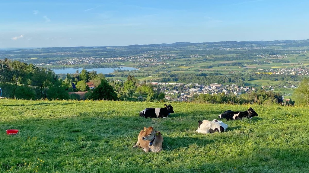
Lake Pfäffikon is part of a popular nature reserve. The entire lake, as well as the shore around the lake, is under local protection. The lake landscape of Lake Pfäffikon is today one of Switzerland's most valuable lake and moor landscapes.
The Uetliberg has been an important recreational area in Zurich for several centuries. The striking molasse chain of the Uetliberg features a diverse natural landscape with its pronounced ridges, rocky outcrops, debris cones, hollows, and ravines.
This diverse habitat provides a superb home to many wildlife species. Wildlife in Uetliberg includes roe deer, wild boar, red deer, fox, badger, stone marten, brown hare, and marmot.

Forests, swamps, small lakes, and overgrown river courses once shaped a large part of the prehistoric landscape in the canton of Zurich. Although such stretches of land are not conducive to settlement in every respect, traces of human life in the canton can be traced back to the Stone Age.
In 1931, a stone box grave was uncovered by researchers in the Zurich region. Its impeccably grouted slabs of red Glarus Verrucano rock contained two skeletons with a height of 145 cm (57 in) and some flint objects, including a small knife, a dagger blade, a small greenstone ax, and five arrowheads. Researchers also uncovered another smaller set of artifacts from the Bronze age in the Zurich and Winterthur areas.
The Urnfield culture was a Late Bronze Age culture of Central Europe that lived, among other places, in the area of present-day Switzerland. In large parts of Europe, the Urnfield Culture succeeded the Tumulus Culture and was replaced by the Hallstatt Culture.
The Urnfield culture was eventually driven out of the region by Celtic tribes, such as the Helvetii, after whose language some of the older and larger villages of Alemannic Switzerland (German-speaking Switzerland) are still named.
The Helvetii settled along the many lakes and rivers in what is now Switzerland and established a series of over 400 villages and a dozen fortified towns. They lived in the region until the arrival of the Romans.
After their defeat at Geneva by Julius Caesar, the Helvetii were forced back into the conflict zone by the Romans, and their territory became a province of the Empire in 15 BCE.
Roman rule of the region lasted until the Helvetian province, after a slow infiltration, finally fell under the control of the Germanic Burgundians and Alemanni in around 400 CE. But the Helvetian Celts remained in the region, living side by side with the newcomers.
The actual Roman era in Zurich began in 15 BCE. The entire Helvetic territory was made part of the province of Gaul and connected to the rest of the empire by a vast network of roads.
During the first century CE, the Romans succeeded in moving the imperial border from the Rhine to a line near the rivers Main and Danube. This brought about a quiet and relatively military-free time for Helvetia.
Around the middle of the third century, the Romans had to move their imperial border back to the Rhine under pressure from the Alemanni, a Germanic-speaking confederation of people. The resident population, which was a blend of Celts and Romans, probably mixed with the immigrating Alemanni around this time.
After the fall of the Western Roman Empire, the Franks ruled the region of Zurich. Eventually, the region came under the control of the Habsburgs.

In 1351, Zurich allied itself with other neighboring cantons to form the Old Swiss Confederation. At the end of the Middle Ages, the city of Zurich ruled over the whole of today's canton of Zurich. In 1798, the Helvetic Republic was proclaimed and it united the country under a central power, thereby eliminating the complete self-government of the cantons.
The short-lived Helvetic Republic was followed by the new Swiss Confederation in 1803. However, it took quite a few decades of mediation and restoration to create the Switzerland and the canton of Zurich that we know of today.
Zurich is home to some wonderful destinations with idyllic landscapes, beautiful mountains, and plenty of wildlife. The following is a list of some of the best trails and hikes that the region of Zurich has to offer.
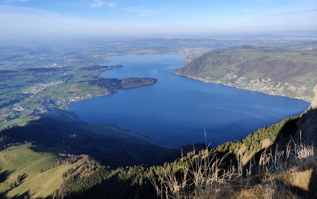
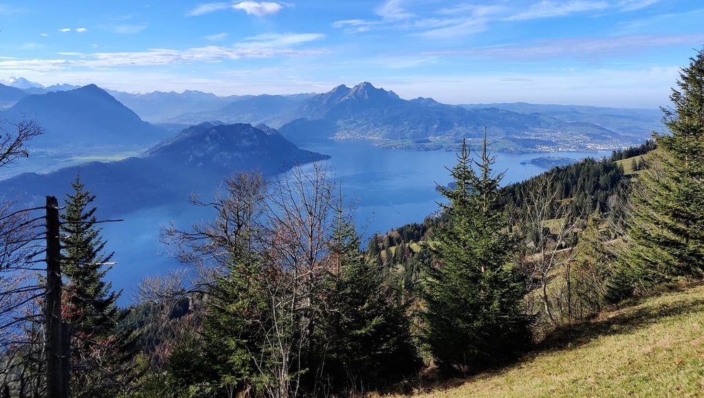
This high-elevation hike called the Rigi Panorama Trail features views of Lake Lucerne and Lake Zug. It also offers a chance to see the imposing Alps in the distance. To hike this trail, you’ll start at the Arth-Goldau station, where the Rigi Railway takes you to Rigi Wölfertschen-First.
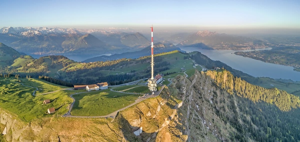
From Wölfertschen-First, the trail leads along the track of the former Scheideggbahn. This track is easily recognizable thanks to the old railroad bridge, short tunnel, and discarded wagon that you’ll pass as you hike. This scenic route runs along the slope of the nearby mountain and it offers a lot of shade within the forest itself.
The Stoos Ridge Walk offers views over 10 lakes and countless alpine peaks. This hike begins with a ride on the funicular, which takes guests to the car-free village of Stoos at 1,300 m (4,265 ft) above sea level. A short walk through the small mountain village of Stoos leads to the chairlift, which takes hikers to the summit of Klingenstock.
From Klingenstock, the Stoos Ridge Walk takes you along a scenic ridge with panoramic views. You’ll eventually make your way to Fronalpstock, where you’ll find a restaurant, observation deck, and playground. From Fronalpstock, you can take a chairlift back down to Stoos.

This unique hike over the Pfannenstiel ridge offers the most beautiful views of Lake Zurich. From Forch station, you climb to the edge of the forest. Here, a broad view opens up over Lake Greifen to the Zurich Oberland.
While walking on comfortable forest roads, you’ll descend towards Toggwil. As you exit the forest above the hamlet, the view of Lake Zurich becomes clear in the distance.
In Toggwil, the varied path through the Meilemer Tobel begins. This path winds past many boulders and reaches the ruins of Friedberg Castle. While walking, you can also see a large waterfall on the edge of the ravine.
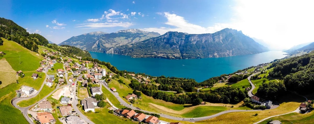
On the High Trail Amden, which travels above Lake Walen, hikers can treat themselves to an adventure with magnificent views. This hike begins with a ride on the Mattstock chairlift that takes you up to the Walau mountain station.
From the chairlift, the trail leads across extensive alpine meadows in the direction of Hintere Höhe. The following section of the trail runs largely through protected moorland. Hikers can then enjoy magnificent views of the Toggenburg and the Alpstein mountains and the Glarus Alps as well as the turquoise-blue Walensee as they make their way to Arvenbüel.
The Ridge Hike Lägern takes you from Regensberg near Zurich to Baden. Every child in Zurich knows of this hike because it is an absolute classic destination for school excursions.
The village of Regensberg and its little castle can be reached from Zurich via Dielsdorf in about 40 minutes. From here, the route first passes through a magnificent forest as it makes its way steadily uphill.
Soon afterward, the pretty forest path becomes rockier and steeper as you make your way to the Lägern, a narrow ridge. After some time, hikers may choose to either complete the trail down the ridge or continue back toward the starting point. While this trail isn’t particularly exposed, walking the ridge itself requires some surefootedness because it takes you on sloping terrain.

The Ybriger 7-Egg Trail is a high-elevation trail with impressive views of the high Alps and the region’s lakes and valleys. The hike begins with the cable car ride to the Seebli mountain station.
From here, you walk to Spirstock, where you’ll get a view of the Muota Valley, Stoos, Lake Zurich, and the Zurich Oberland. From Spirstock, the trail continues past the Laucheren-Chappeli to Windegg and over Sternenegg to Ibergeregg pass.
The trail continues from Ibergeregg to Müsliegg via the path from Stäglerenegg to Holzegg, which travels along the foot of Gross Mythen. The last section of this adventure is the descent to Brunni, which you can shorten by taking a comfortable cable car ride back to your starting point.
Flumserberg is a mountain located on Lake Walen that’s particularly popular among outdoor recreationalists in the region. You can get to Flumserberg from Zurich in just 40 minutes. Once there, you can head out on any one of a number of trails and enjoy the scenic views.
There are over 150 km (93 mi) of hiking trails and about 13 km (8 mi) of bike trails on the mountain itself. During the winter months, there’s also a ski resort on Flumserberg (it’s technically located in Sankt Gallen) that offers dozens of ski slopes for visitors to enjoy.
For the most adventurous hikers among us, the 7-summit tour on Flumserberg is recommended. This 14 km (8.6 mi) long day hike spoils you with breathtaking panoramic views of the impressive Churfirsten, Lake Walen, and the Spitzmeilen area.

For skiing and snowboarding enthusiasts, there are 5 ski resorts in Zurich, which are located in the east of the canton. However, the largest ski resort in Zurich, Skilift Steg (Steg im Tösstal), has just 5 km (3 mi) of slopes and 2 ski lifts. The main major ski resorts near Zurich with dozens of km (mi) of slopes and ski lifts are the following, which you can reach in less than 1:30 h by car:
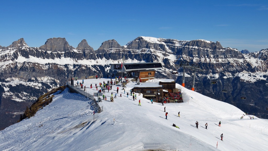
Check the Zurich ski resorts map on the larger Switzerland ski resorts map in the World Mountain Lifts section of the site. It includes information about open ski lifts / slopes in Switzerland in real-time with opening dates and hours. There are also year-round cable cars, funiculars, cog railways, aerial tramways, and all other types of mountain lifts.
If you’re coming to the region of Zurich and you need a place to stay, here are some of the best places to check out in the region.
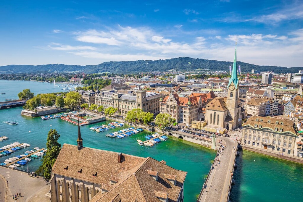
The city of Zurich is the economic and educational center of Switzerland and the canton of Zurich.
Located in the heart of Europe, the city offers all the amenities of a cosmopolitan metropolis without losing its rustic flair. The city of Zurich has a population of around 420,000 people and is the largest city in Switzerland. Thanks to its major train station and its airport, the city of Zurich is also a continental transportation hub.
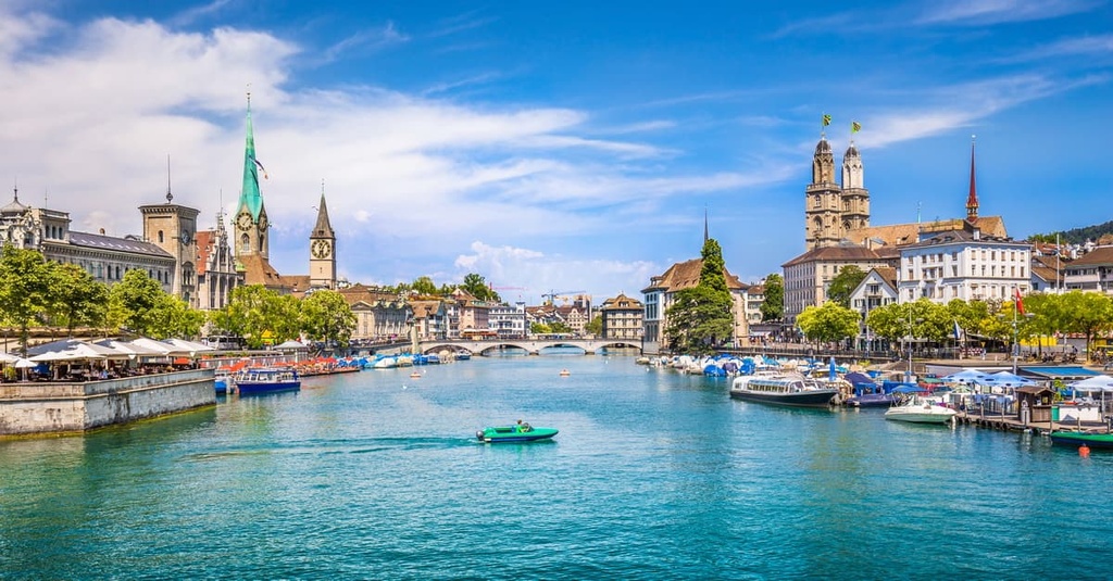
Despite its small population compared to other major metropolises in Europe, Zurich is counted among the world's most important cities. With its location on the shores of Lake Zurich, its well-preserved medieval old town, and its diverse cultural and nightlife scene, it is also a center of tourism in the region.
In fact, Zurich’s location on the shores of its namesake lake combines creative city life with a wonderful natural setting. With its countless events, diverse museums, and lively nightlife, Zurich radiates energy and excitement day and night.
And if you’re looking for recreation opportunities in Zurich, you can reach the Swiss mountains in less than an hour from the city itself. You can find more than 117 hotels and many Airbnbs in Zurich, too. But be aware: Zurich is one of the most expensive cities in the world, so budget accordingly!
Winterthur has transformed itself from an industrial city into a community with a rich cultural scene. In fact, it is the sixth-largest city in Switzerland, with over 100,000 inhabitants.
The city offers a selection of different cultural and entertainment sites, including its 17 museums. With its quaint old town and many unique cafes, restaurants, and bars, the city of Winterthur offers plenty of variety for visitors to appreciate.
Winterthur is very well connected to the country’s train network, and in just over 20 minutes you can be in Zurich. In Winterthur, there are also plenty of hotels and Airbnbs to choose from if you’re in need of accommodations during your stay in the region.


Yes. Zurich has 493 named mountains. The highest is Schnebelhorn at 1,291 m.
The highest mountain in Zurich is Schnebelhorn, at 1,291 m.
Zurich has 493 named mountains.


