Scan the QR code and open PeakVisor on your phone
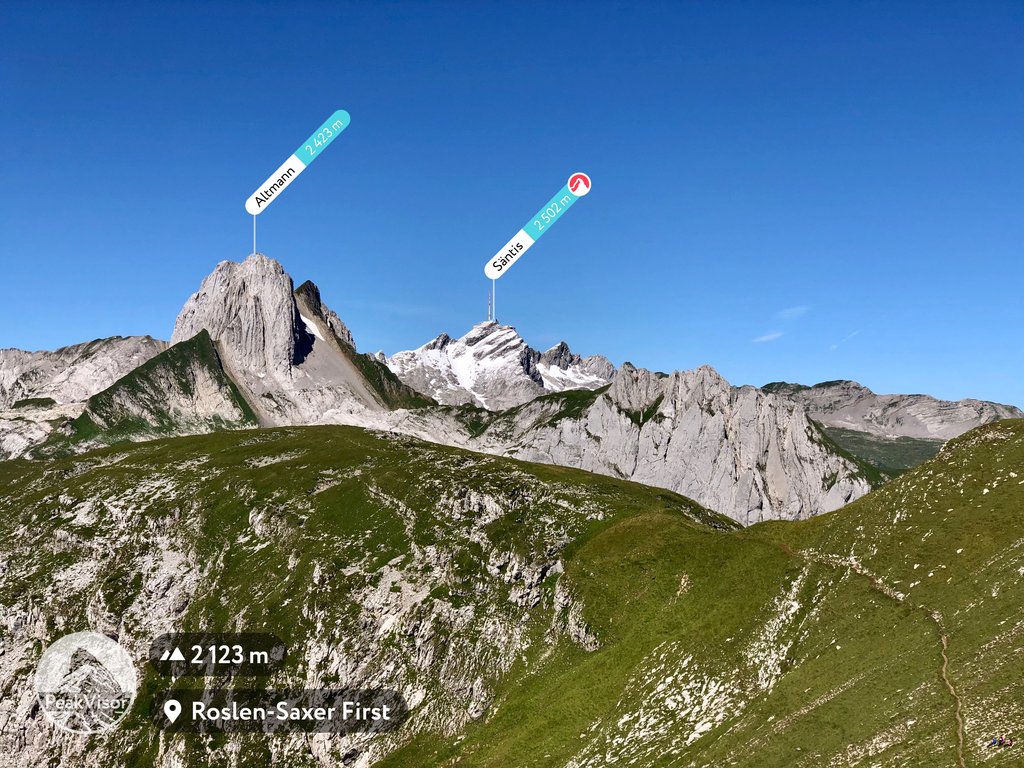
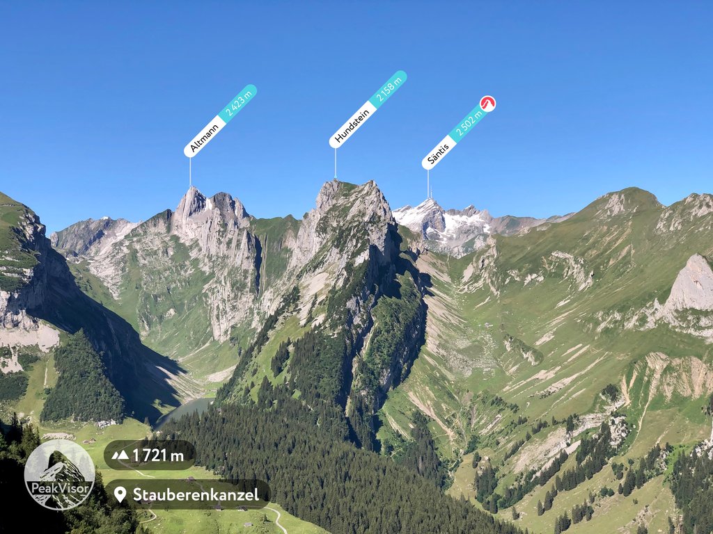
Appenzell Ausserrhoden is a canton located in northeastern Switzerland. The canton is known as a half canton, along with neighboring Appenzell Innerrhoden. There are 32 named peaks with the tallest and most prominent being Säntis at 2,502 m (8,209 ft) tall with 2,012 m (6,601 ft) of prominence.
Appenzell Ausserrhoden is one of the 26 cantons of Switzerland. The canton covers 243 sq. km (94 sq. miles) in the northeastern portion of the country. The region is considered a “half-canton” with the other half being Appenzell Innerrhoden.
Together these two half-cantons form an enclave within the canton of Sankt Gallen (St. Gallen). Lake Constance (Bodensee) lies to the north of the canton, extending into the nearby countries of Austria and Germany.
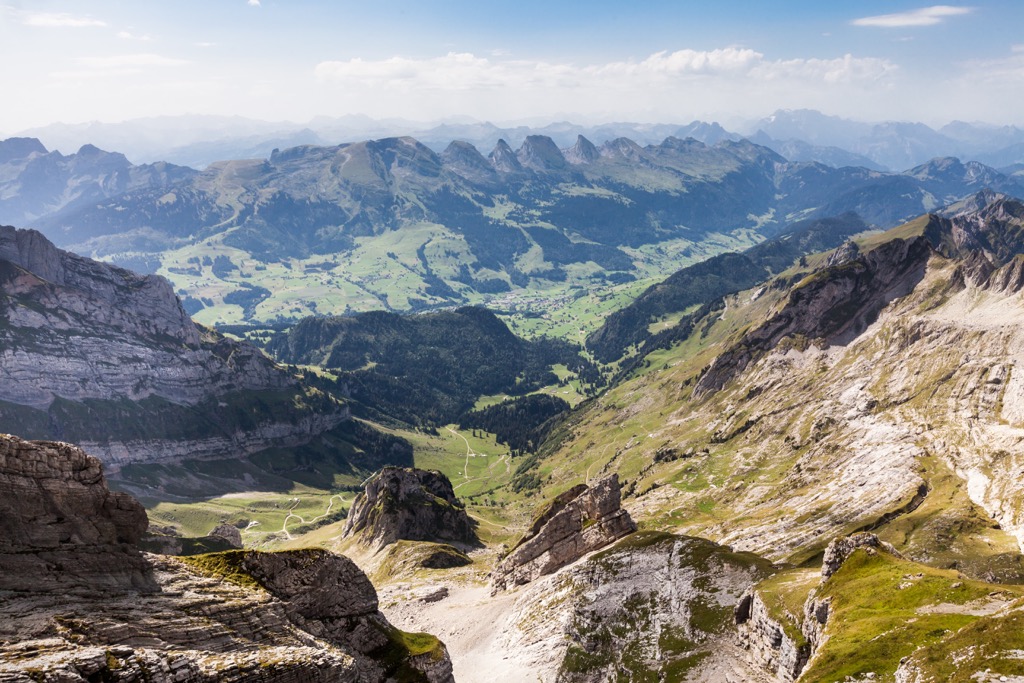
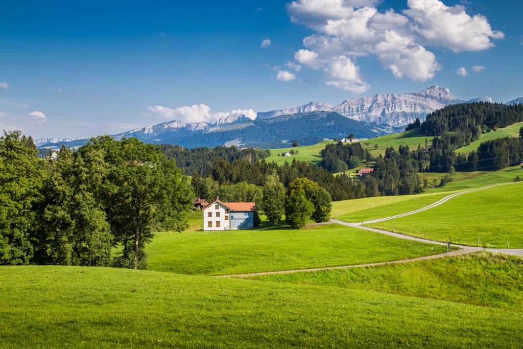
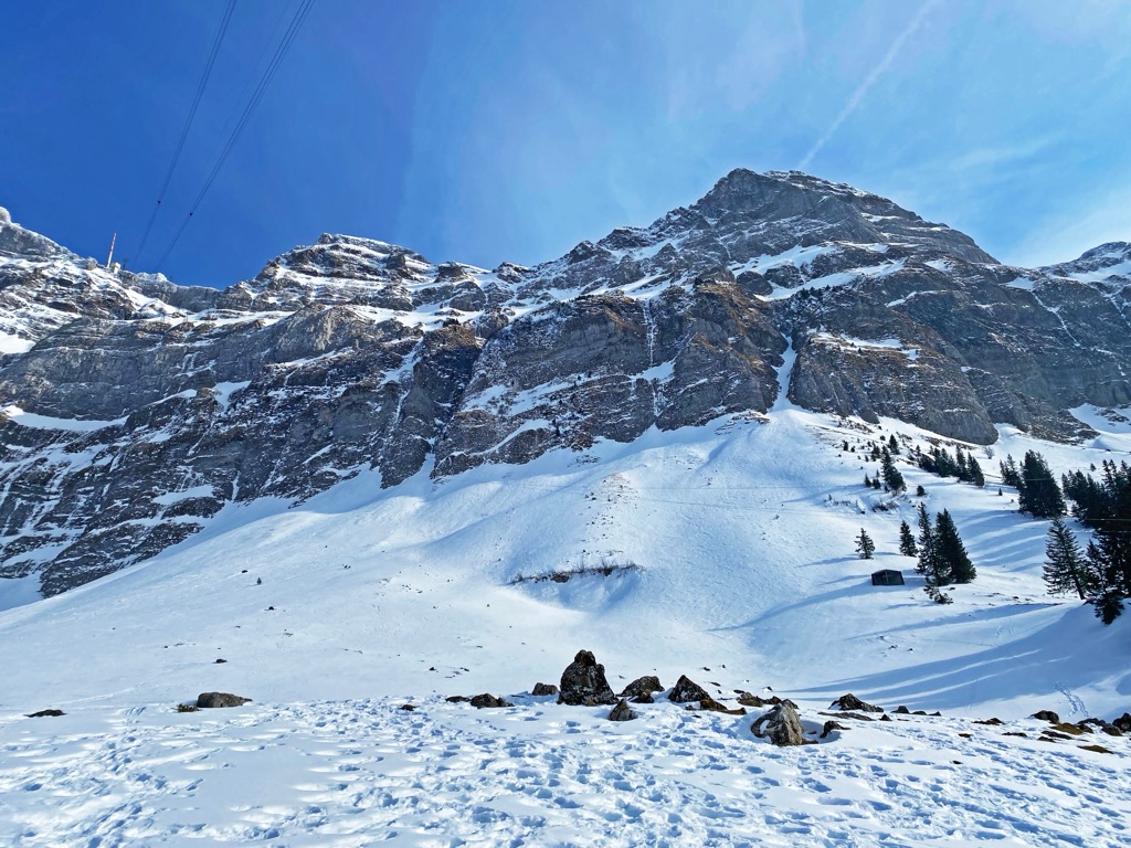
The geography of the canton is marked by rolling alpine foothills of the Alpstein massif, a subgroup of the Appenzell Alps. Grassy hills mark the northern stretches of the canton that reach near Lake Constance. Much of the region also features densely forested landscapes.
Changes in elevation become more dramatic in the southern stretches of the canton as the foothills slowly transition into the Alpstein massif. Major bodies of water in the region include the Urnash which joins the Sitter before flowing into Thur. The Necker marks the southern boundary of the canton while natural land features separate the two half cantons.
Appenzell Innerrhoden lies directly to the east while St. Gallen completely encompasses the two half cantons. The cantons of Thurgau and Zurich lie to the west while Schwyz and Glarus are situated further south.
Additionally, Appenzell Innerrhoden is located near a number of major protected areas in the country. The Swiss Tectonic Arena Sardona lies in the nearby Sankt Gallen. Some of the closest nearby parks include Parc Ela, Beverin Nature Park, and Swiss National Park, situated to the southeast.
The peaks and ridgelines found within the canton are part of the Appenzell Alps, a subrange of the greater Alps. The Alps span to the south of the canton and cover the southern portion of the country.
More specifically the major peaks are part of Alpstein, a further subgroup of the Appenzell Alps. The Alpstein massif spans across Appenzell Ausserrhoden, Appenzell Innerrhoden, and Sankt Gallen which encompasses the two half cantons.
The Alpstein Massif, along with the rest of the Alps, began forming during the Alpine orogeny around 65 million years ago. This major mountain building event formed many other ranges including the Pyrenees, Himalaya, Karakoram, Caucus, Atlas, Carpathians, and the Hindu Kush.
Before the formation of the Alps, the Tethys Ocean once lay between the supercontinents known as Laurasia and Gondwana. In current geography, the Tethys Ocean was situated between the continents of Africa and Europe.
As the tectonic plates continued to shift, the ocean slowly retreated, leaving behind marine sediment, and the two continents began drifting towards one another. As the two plates collided, immense pressure forced the Earth’s crust upwards while recumbent folds formed the rugged Alps.
The Swiss Plateau, which defines the northern stretches of Switzerland, was slowly uplifted to its current height during this time period. Limestone and sandstone are common throughout the canton and the rest of the Alps. These relatively brittle rocks are what have shaped the ranges’ rugged peaks and ridgelines.
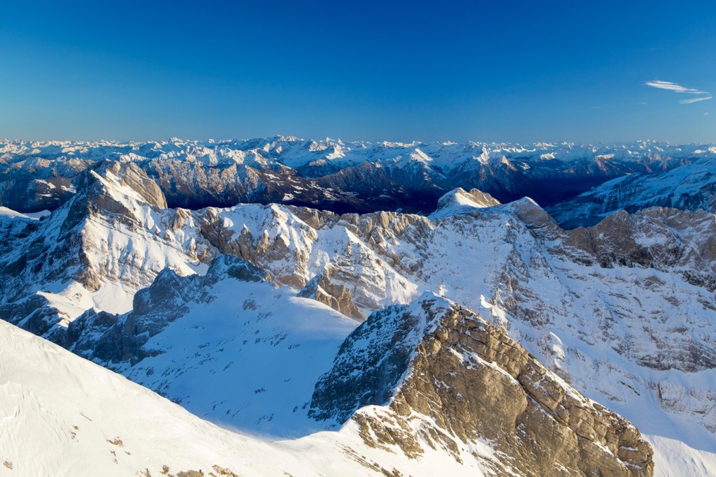
During the last glacial maximum, the Alps were heavily glaciated. Glacial retreating and melting carved out the lush and sweeping valleys found in the canton and the other foothills of the Alps.
Major peaks within Appenzell Ausserrhoden include Säntis, Girenspitz, Hundwiler Höhi, Gäbris, and Hochalp.
The changes in elevation found within the canton allow for a variety of both flora and fauna to thrive. Lower elevations often consist of valleys used for agricultural purposes including dairy farming and cattle breeding.
Flora found in the valleys include Norway spruce, oak, and tilia. Higher elevations feature silver fir, European beech and sycamore maple trees. Wildflowers thrive throughout the canton during the summer months, reaching some of the highest peaks.
Some of the flowers found within the canton include the common cornflower, germander speedwell, butterfly bush, meadow sage, common yarrow, and white clover.
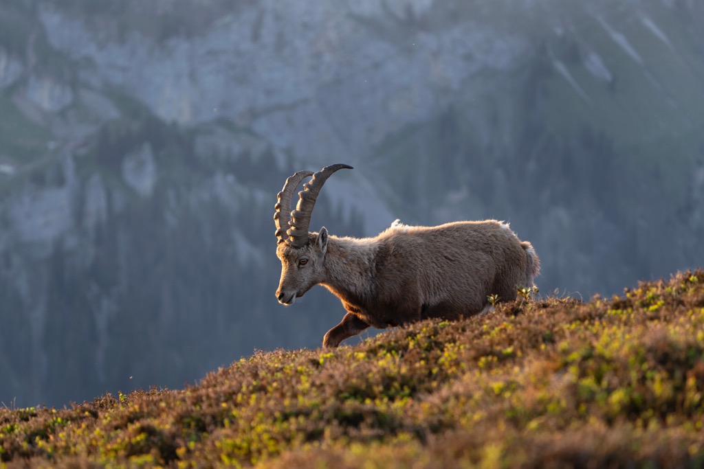
The surrounding mountains allow for a variety of fauna to thrive within the canton. One of the most common mammals is the western roe deer. Other mammals include the northern chamois, alpine ibex, alpine marmot, brown hare, red deer, and Eurasian red squirrel.
At lower elevations, often near the towns and villages, live multiple species of bat, shrew, and vole. Some common bird species include the red kite, tufted duck, water pipit, Eurasian kestrel, and golden eagle.
Humans have inhabited the land surrounding Appenzell Ausserrhoden for thousands of years. Evidence of early human settlements estimates that humans lived in the region as early as 12,500 BCE. Settlements around Lake Constance date back to the Neolithic and Bronze ages.
Settlements in Appenzell began during the seventh and eighth centuries CE. A majority of these early settlements were situated along the river Glatt. The monastery of St. Gallen was established during the eighth century CE and heavily influenced the region.
The first mention of Herisau, the capital of the canton, was in 907 CE while Appenzell was first mentioned in 1071 CE. The term Appenzell translates to the “estate of the abbot” which in this case refers to the Abbey of St. Gall.
In 1360 the communities of the region began having debates and arguments surrounding taxes and grazing rights. The abbot and the farmers of the region both wanted to join the Swabian League and eventually did in 1377.
Backed by the Swabian League, Appenzell refused to pay more than their share of gifts and tithes to the Abbot Kuno von Stoffen. Frustrated with this new resistance, Kuno made an agreement with the Habsburgs in 1392. In 1401 Appenzell made an alliance with St. Gallen to protect their personal freedom.
The Appenzell War lasted from 1403-1410 and in 1411 Appenzell was placed under the protection of the Swiss Confederation. Appenzell did not officially become part of the confederation until 1513.
Religious differences following the Counter-Reformation led to the division of the canton into the half-cantons still established today. Appenzell Innerrhoden was predominantly Roman Catholic while Appenzell Ausserrhoden was primarily Protestant.
From the sixteenth century to the twentieth century linen production was a vital part of the canton’s economy. Railroad construction between 1875 and 1913 helped the population of the region grow to 57,973 in 1910. Today the population of the canton is around 55,310.
Appenzell Ausserrhoden is home to numerous trails for hiking and outdoor recreation. Here are some of the most popular trails in the canton:
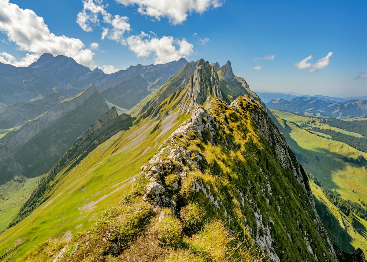
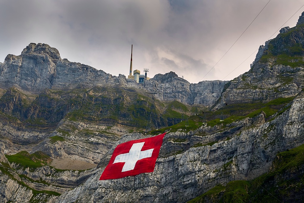
The Schwägalp - Säntis trail is one of the most stunning routes in the canton. The trail begins in Schwägalp, situated in the valley of Säntis. While the trail can be completed as an out and back, a cable car can be used for the descent or the ascent for those unable to make the trek by foot.
Hikers are rewarded with stunning views throughout the Alpstein massif, grassy valleys, forested patches and alpine lakes. At the summit are panoramic views of the canton along with a restaurant. The point to point hike is 4.5 km (2.8 miles) long with 1,044 m (3,425 ft) of elevation gain.

The Ebenalp - Schäfler - Seealpsee - Wasserauen trail is a point-to-point route that follows along below the Alpstein massif. The route begins at the Ebenalp cable car stop and follows a gentle path towards the Schäfler Inn followed by the Schäfler summit.
Hikers have breathtaking views throughout the route of rocky cliffs, patches of forest, lakes, and rolling grassy valleys. Views of the Seealpsee are among the most spectacular in the canton. This point-to-point route is 9.8 km (6.1 miles) in length and features 384 m (1,259 ft) of elevation gain.
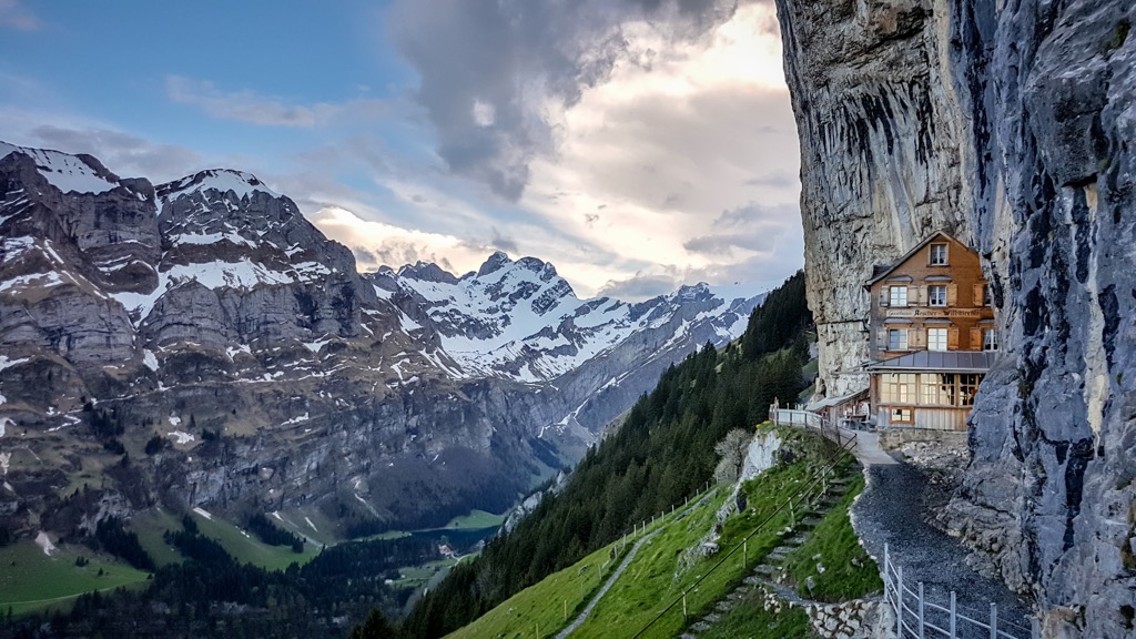
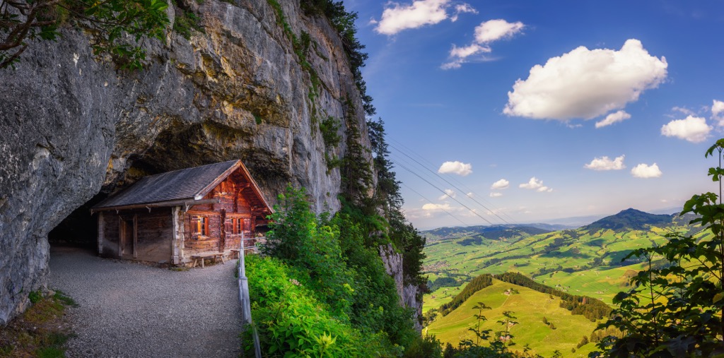
Though much shorter than other routes in the region, the Wildkirchli Caves offer a unique experience that is accessible to most. The trail begins at the Wasserauen-Ebenalp cable car.
The route then travels 400 m before reaching two separate caves. After the caves the trail continues onward to the historic and famous Äscher-Wildkirchli mountain restaurant, nestled into the mountain side. The entire route is 1.3 km (0.8 miles) in length and features 113 m (370 ft) of elevation gain.
For skiing and snowboarding enthusiasts, there are more than 10 ski resorts in Appenzell Ausserrhoden, which are located throughout the canton.
The largest ski resort in Appenzell Ausserrhoden is Skigebiet Ebenalp Horn (Luftseilbahn Wasserauen-Ebenalp) with more than 10 km (6 mi) of slopes and more than 5 ski lifts. Other smaller areas for skiing in Appenzell Ausserrhoden include Sollegg–Appenzell, Grub-Kaien, and Alpsteinblick–Gonten. These are also the main ski resorts near Herisau and Trogen—two capitals of the canton.
Check the Appenzell Ausserrhoden ski resorts map on the larger Switzerland ski resorts map in the World Mountain Lifts section of the site. It includes information about open ski lifts / slopes in Switzerland in real-time with opening dates and hours. There are also year-round cable cars, funiculars, cog railways, aerial tramways, and all other types of mountain lifts.
Looking for a place to stay in Appenzell Ausserrhoden? Here are some of the best cities and villages to check out in the canton:
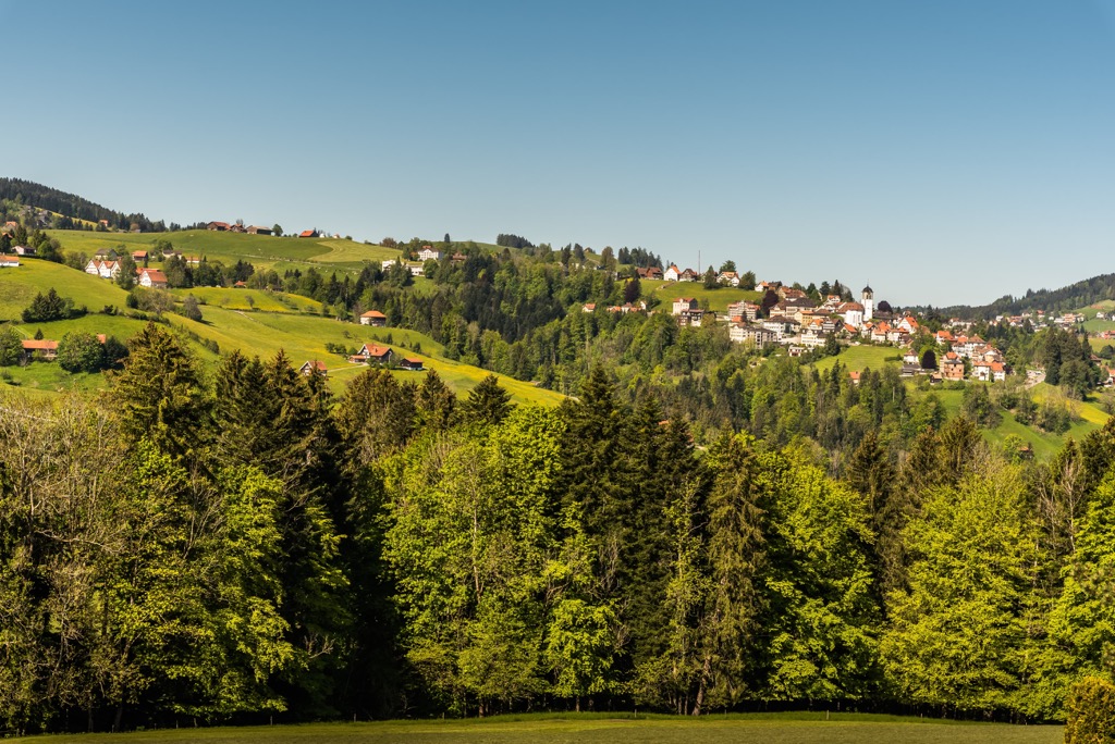
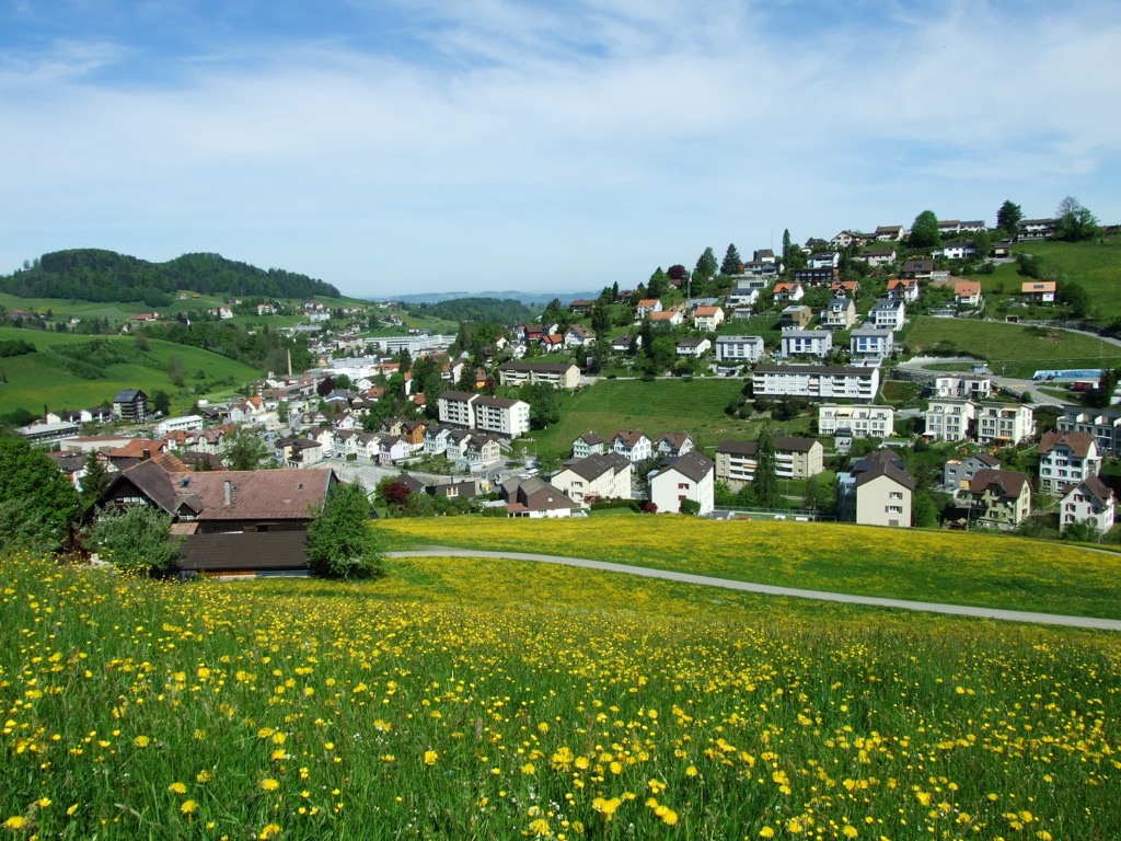
Herisau is the capital city of Appenzell Ausserrhoden and marks one of the oldest settlements in the region. Originally a market town, today Herisau is home to 16,000 residents. The quaint town offers easy access to the Alpstein massif which towers above nearby.
The downtown offers local shops and restaurants as well as many notable fountains. Some of the most beautiful facades in the region can be found at Haus Wetter and Haus zur Rose. The Herisau Museum showcases the region’s textile history. Young children can also enjoy exploring the Sedel Kiinderparadies, or kid’s paradise.
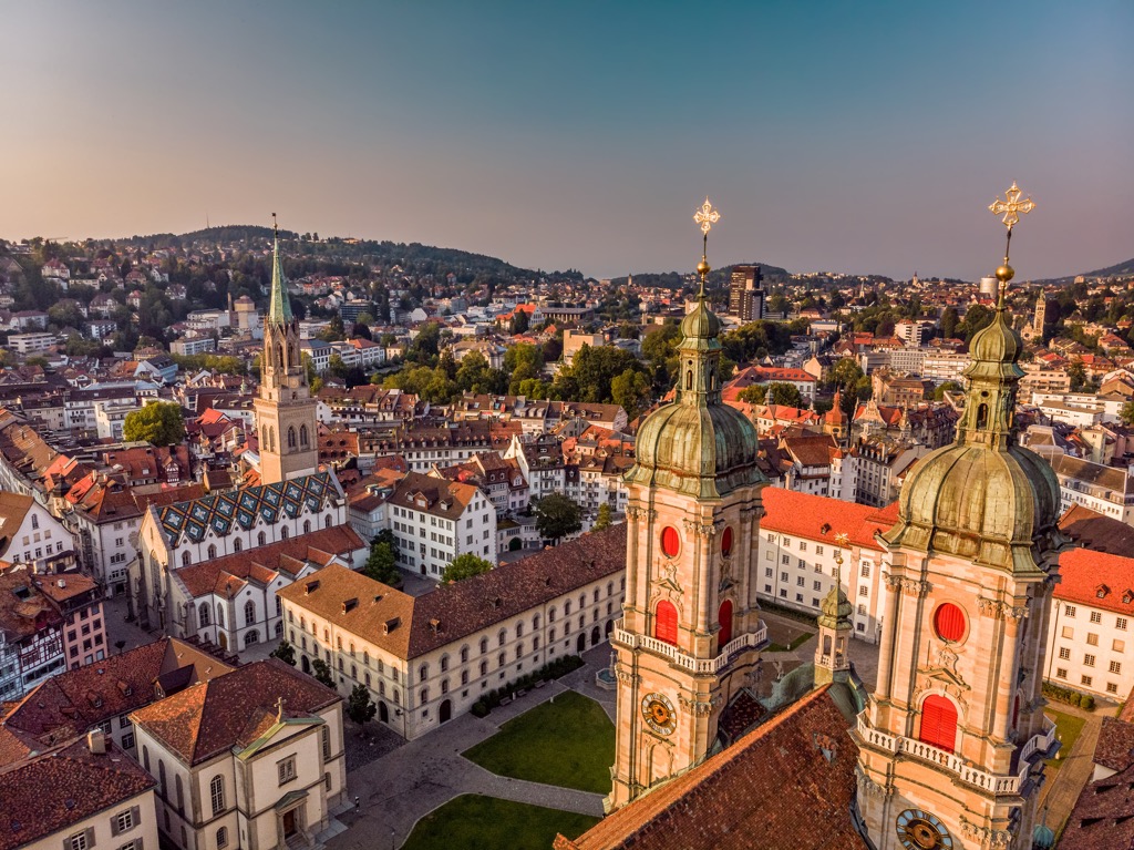
Though not in Appenzell Ausserrhoden, the city of Sankt Gallen marks the capital of its namesake canton. The city is home to around 170,000 inhabitants, making it the most populous city in the region and a hub for eastern Switzerland. The University of St. Gallen is in the city and is often noted as being one of the best business schools in all of Europe.
The Abbey of Saint Gall UNESCO World Heritage Site is a major tourist attraction in the region, showcasing some of the history of the region, including Appenzell. Other sites in the city include Drei Weieren, Wildlife Park Peter and Paul, Natural History Museum St. Gallen, and the Abbey Library of Saint Gall. Situated near the country’s eastern border, Sankt Gallen provides easy access to Germany, Austria, and Liechtenstein.