Scan the QR code and open PeakVisor on your phone
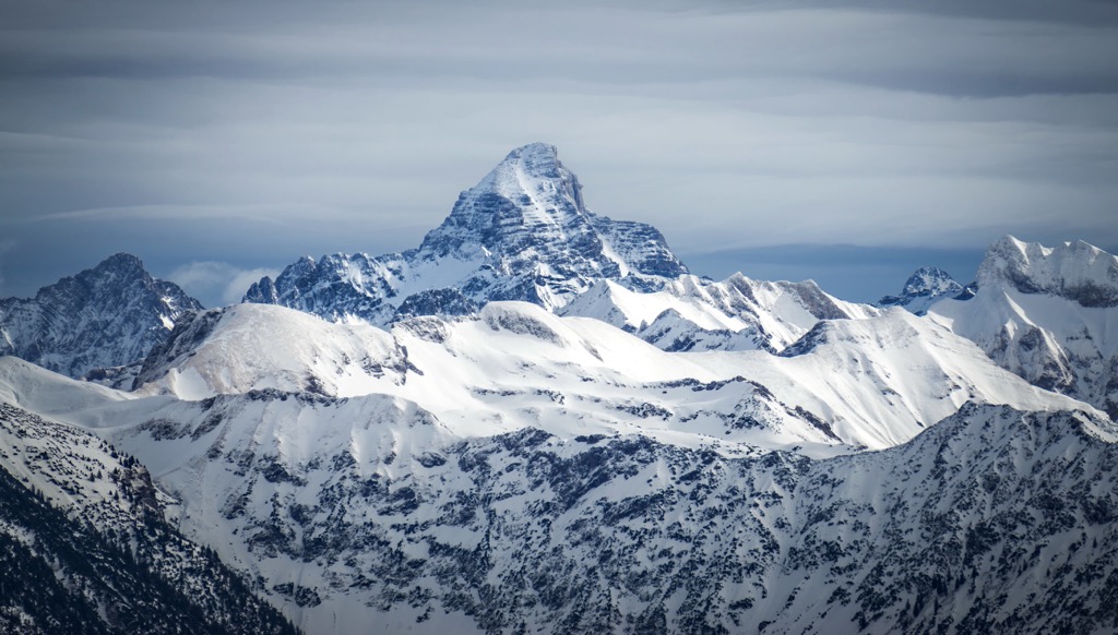
Allgäuer High Alps (German: Allgäuer Hochalpen) is a nature reserve located in the southwestern tip of Germany. The mountainous terrain marks one of the largest reserves in the country. The tallest peak is Hochfrottspitze at 2,649 m (8,690 ft) tall while the most prominent is Hochvogel with 573 m (1,880 ft) of prominence.
Allgäuer High Alps (German: Allgäuer Hochalpen) is situated in the extreme southwestern region of Germany, along the country’s border with Austria. The nature reserve encompasses nearly all of the Allgäu Alps, which are part of the greater Northern Limestone Alps.
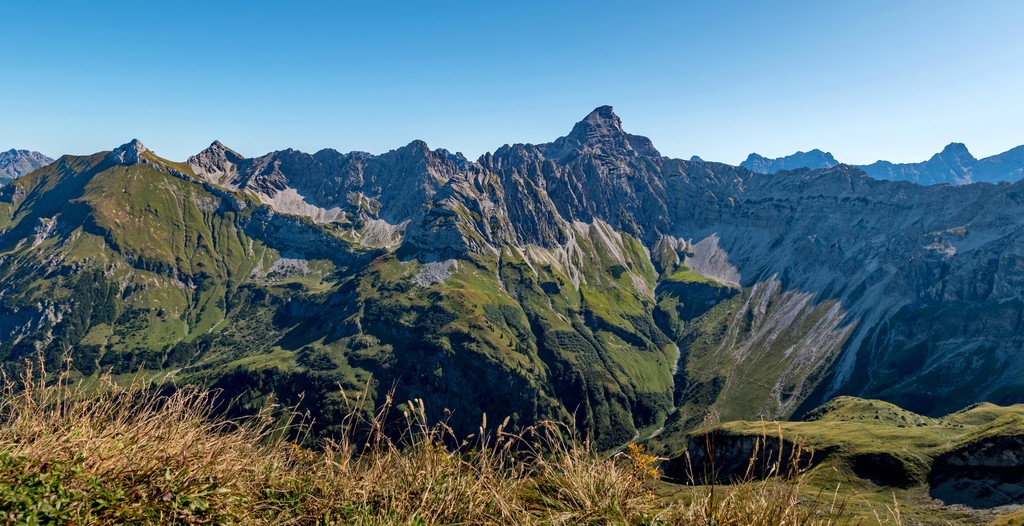
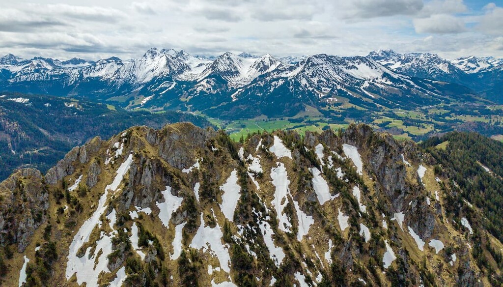
The reserve features some of the most mountainous terrain in the entire country, including some of the tallest peaks in all of Germany. The main ridgeline in the reserve lines along the southern edge of the range, with the tallest peaks in the Allgäu Alps being located in Austria.
This reserve spans 20,724 ha (207 sq. km, 80 sq. miles) across southwestern Germany.
The Austrian border marks the southern and eastern boundaries of the reserve. Just north of the reserve lies the Ostrach River while the Iller River marks the western boundary. Both of these rivers originate in the Northern Limestone Alps before traveling north through Germany.
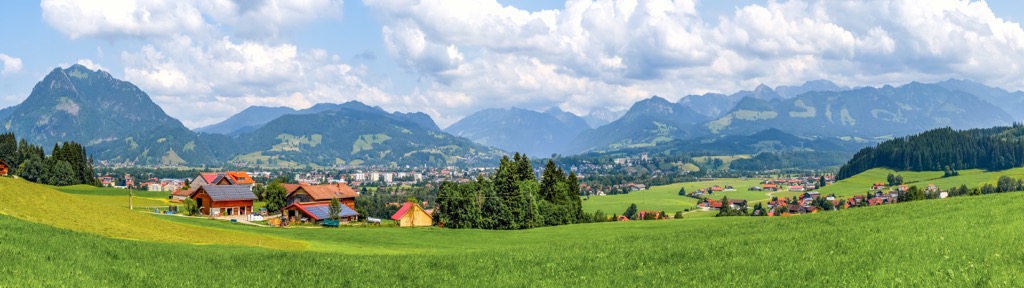
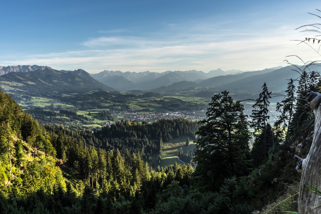
Allgäuer High Alps marks one of the most varied landscapes in the country, featuring dramatic changes in elevation and numerous vegetation zones throughout. The entire reserve lies within the western stretches of the free state of Bavaria.
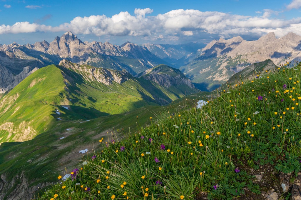
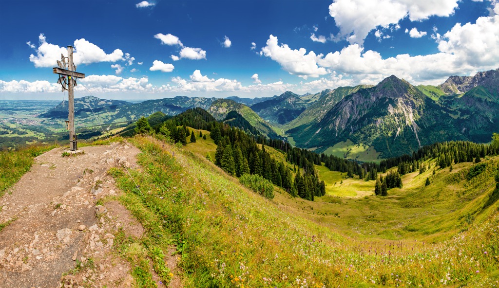
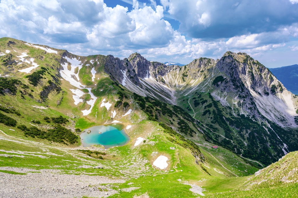
Craggy peaks and rugged ridge lines mark the highest points in the region. These unique rock formations are met with steep grass mountains (German: Grasberge). Instead of densely forested hillsides, many of the hills in the reserve are marked by these extremely steep grass slopes.
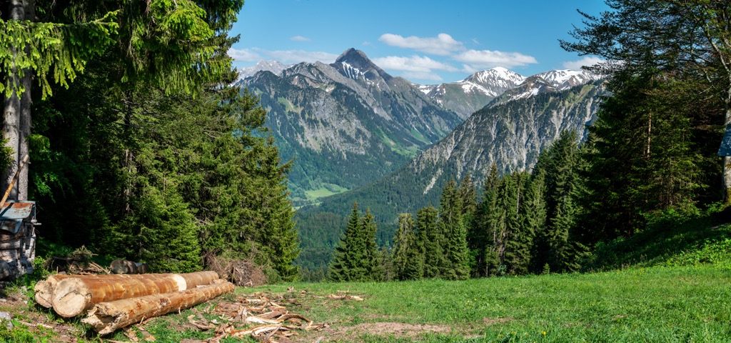
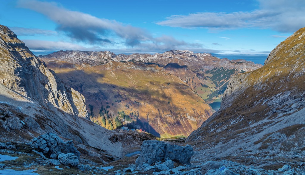
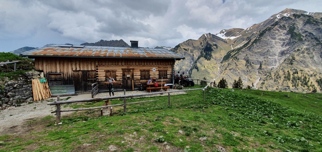
Various creeks and streams flow throughout the reserve, with headwaters being fed by the annual snowpack in the peaks. There are numerous mountain huts dotted throughout the reserve, with defined hiking paths connecting them.
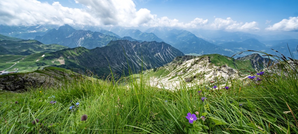
Amidst the steep peaks lie lush alpine meadows, full of blooming wildflowers during the summer months. Hikers are likely to spot grazing cows amidst these more flatter sections of terrain. The ski lifts and gondola at the nearby Nebelhorn - Oberstdorf ski resort, provide hikers with further access to the terrain.
The Bregenz Forest Mountains lie west of the reserve while the Lechquellen Mountains are to the southwest. South of Allgäu Alps are the Lechtal Alps with the Ammergau Alps in the east. North of the reserve lies the Alpine Foreland.
Allgäuer High Alps is located near numerous other areas for outdoor recreation. West of the park lies Nagelfluhkette Nature Park while the Ammergau Alps Nature Reserve is situated to the east. The Verwall Protected Area is situated to the south in Austria.
Peaks in the reserve are part of the Allgäu Alps, which span across Austria and Germany. The range is also a subrange of the larger Northern Limestone Alps, which run along the border between these two countries. The Northern Limestone Alps mark a subrange of the greater European Alps.
Elevations in the reserve range from around 825 m (2707 feet) up to the summit of Hochfrottspitze. The geological history of the Allgäu Alps and neighboring subranges is similar to that of the larger Alps.
These rocks within the reserve are up to 250 million years old. The entire Allgäu region was once covered by a shallow sea. As the sea slowly retreated over the course of millions of years, mineral deposits were left behind, which would eventually form the bedrock for the range.
The peaks began forming during the Alpine Orogeny. This major mountain building period began 65 million years ago. As the African and Eurasian plates collided with one another, the Earth’s crust was thrust upwards, forming the Alps and its many subranges.

This collision forced the mineral sediment to continually fold, forming the limestone for which the Northern Limestone Alps are named after. Other common rocks found in the range include dolomite, sandstone, and marl.
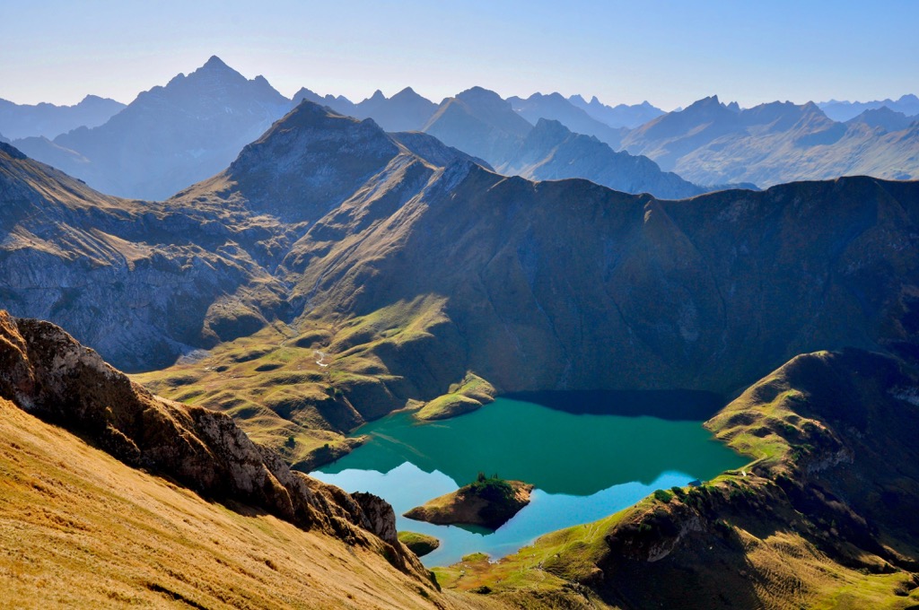
Widespread glaciation across the Limestone Alps further shaped the landscape. Continual erosion and glacial retreating left behind the sweeping valleys, glacial cirques and steep terrain that defines the region.

Major peaks within the reserve include Hochfrottspitze, Hochvogel, Höfats Westgipfel, Imberger Horn, and Nebelhorn.
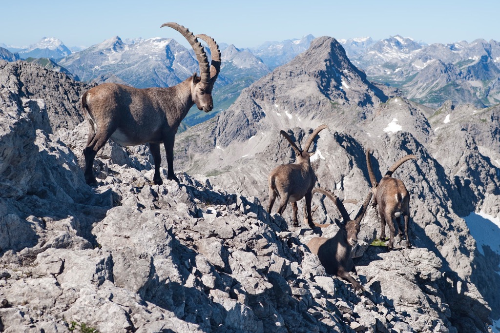
The varied landscape and remote nature of the region has allowed a variety of both flora and fauna to thrive in the region. The large amounts of fauna has made the Allgäuer High Alps a popular spot for wildlife photographers.
Some of the most common animals found in the area include alpine marmots, ibex, chamois, wood grouse, and black grouse. Birds of prey such as golden eagles are also common. Hikers are also likely to spot dairy cows grazing amidst the alpine pastures during the warmer months of the year.
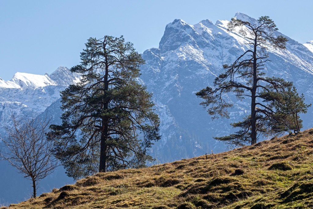
Birch and fir trees can be found at lower elevations though a majority of the region is free of tree coverage, featuring low growing grasses, shrubs, and flowers.
The grasslands and meadows are dotted with Alpine rose rhododendron, glacier buttercup, flour primrose, and spring gentian. Lichen can be found amidst the steep peaks and in rocky scree fields.
The Allgäuer High Alps Nature Reserve lie within the Allgäu, a region of land in Swabia. Humans are thought to have lived throughout the region for thousands of years.
The region that is now part of Swabia in southern Germany was traditionally part of the La Tène culture during the Iron Age. During the rule of the Roman Empire, the surrounding region was part of the Raetia province.
During the third century, groups of Alamanni people began to expand throughout the region, traveling east of the Rhine river in the pre-Alps. Over the following few centuries the Alamanni people were ruled by kings until falling under the rule of the Franks.
Throughout the ninth and tenth centuries, Swabia was part of the Holy Roman Empire and developed into an important center for High German. Following the execution of Conradin of the Hohenstaufen dynasty, the Duchy of Swabia broke up into smaller family units.
The Swabian League was formed in 1488 and ruled over the region until 1534 when the Reformation resulted in the league being disbanded. The Imperial Recess of 1803 drastically changed the region and culture of Swabia.
During the early nineteenth century, Bavaria remained independent and was not incorporated into the North German Confederation of 1867. After France declared war on Prussia, Bavaria joined forces with the rest of Germany and became part of the German Empire.
Bavaria became the Free State of Bavaria following the abolition of monarchy after World War I. During World War II the town of Sonthofen, just north of the reserve, was bombed as it was the location of a Nazi Party training center for young men.
After World War II the town of Sonthofen was home to the United States Constabulary school and later a basic training center for the United States Air Force. The southern district of Oberallgäu was established in 1972, merging the previous districts of Sonthofen and Kempten.
The Allgäuer High Alps Nature Reserve was formed in 1992, further protecting the region for its biodiversity, natural beauty, and for scientific research.
Allgäuer High Alps is home to a plethora of hiking trails. Here are some of the most popular trails in the reserve:
Zum Schrecksee is a challenging and stunning hike situated in the northeastern corner of the reserve. The trail begins by climbing through the forested hills of the valley before reaching the alpine terrain.
Here the trees give way to rolling grassy hills and craggy peaks. The trail climbs steadily to the lake where hikers can take in the stunning views or go for an ice cold dip. Due to the elevation there can often be snow on the route until early summer. This out and back hike is 16.4 km (10.2 miles) long and features 1,177 m (3,861 ft) of elevation gain.
This stunning hike begins just south of Oberstdorf and begins with a steep climb. Once above the treeline, hikers have views of the surrounding Alps and Oberstdorf down below. After reaching the summit of Rubihorn the loop trail begins descending.
The trail passes along the eastern edge of Unterer Gaisalspee before looping back to the starting point. Round trip the loop hike is 15.6 km (9.7 miles) long and features 1,192 m (3,910 ft) of elevation gain.
This point to point trail begins south of Oberstdorf and travels south. The first few kilometers of the route have a steady incline before a steep ascent above the treeline. The trail passes along Seealpsee, marking one of the most stunning lakes in the region.
From the lake the trail continues to climb up to the top of the gondola. Hikers can descend via the gondola or opt for taking the gondola up and hiking down this route. From the valley up to the gondola, this point to point route is 13.4 km (8.3 miles) and features 1,225 m (4,019 ft) of elevation gain.
Those looking for a less strenuous hiking route should note that there is a gondola from Oberstdorf up into the alpine terrain. From there hikers have numerous options for shorter hiking trails with minimal amounts of elevation gain compared to hiking up from the valley.
Looking for a place to stay near Allgäuer High Alps Nature Reserve? Here are some of the best cities and villages to check out near in the region:
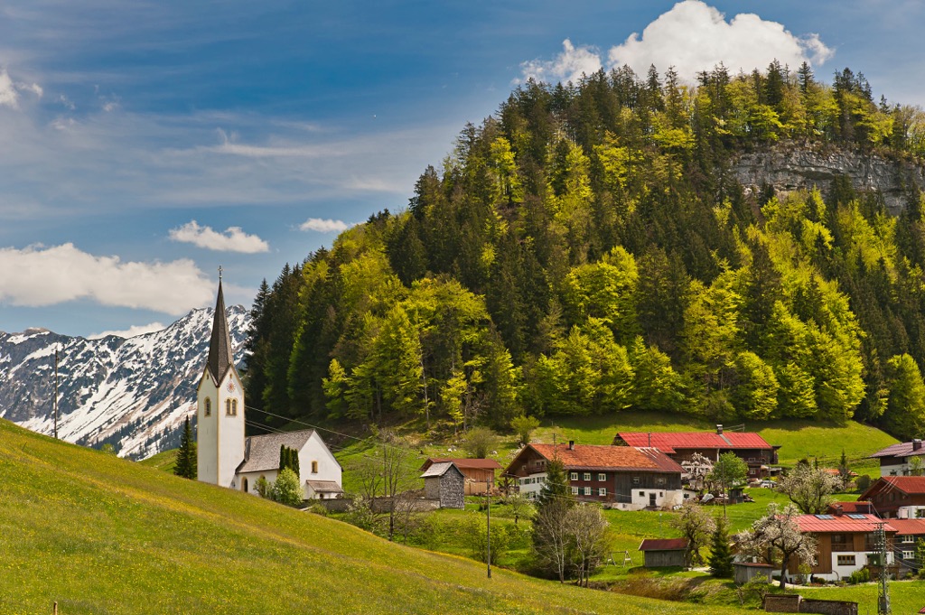
Oberstdorf is nestled along the western edge of the nature reserve. Home to around 10,000 residents, Oberstdorf marks the southernmost settlement in all of Germany. The town is a hub for hiking and skiing with the Oberstdorf gondola situated along the southern edge of the town.
Surrounded by the Bavarian Alps, the town boasts quick access to 200 km (125 miles) of hiking trails throughout the alpine terrain. During the winter months the town flourishes as a tourist hub, boasting 130 km (81 miles) of ski slopes and 75 km (47 miles) of cross country ski trails.
The quaint town features a plethora of local shops, restaurants, and historic buildings along with the Bergschau Museum. The Nebelhorn mountain towers above the town, and features a few bars and restaurants that can be accessed via the gondola, offering some of the best views of the region.
The town of Sonthofen lies just north of Oberstdorf. Home to around 22,000 residents, it marks the southernmost town in Germany. Sonthofen was awarded the Alpine City of the Year in 2005 due to its close proximity to the Alps.
Besides ample opportunities for outdoor recreation, Sonthofen is also known for its production of milk and cheese. Dairy farming has also grown into a tourist attraction for the town. Sites in the area include Heimathaus Sonthofen, which showcases the history of the region, the Starzlacklamm gorge, and Ökokurpark which features native flora and fauna.