
Scan the QR code and open PeakVisor on your phone
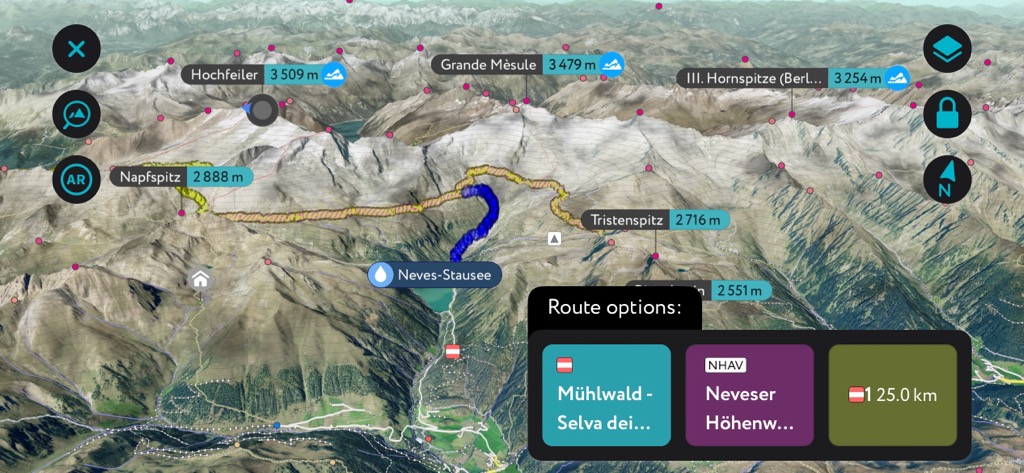
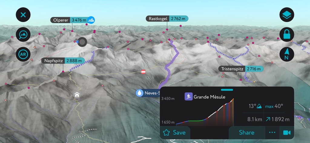
The Zillertal Alps include 802 named peaks. The highest is Hochfeiler at 3,510 m. Other notable peaks include Grande Mèsule, Olperer and Hochferner.
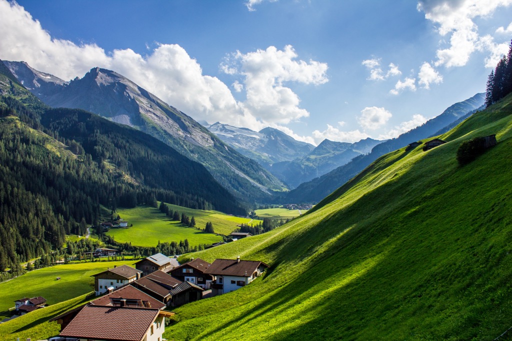
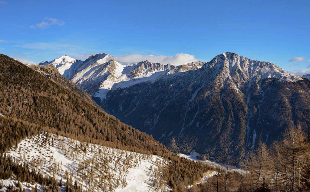
The Zillertal Alps (German: Zillertaler Alpen, Italian: Alpi Aurine) is a mountain range straddling the Italian-Austrian border. Its varied high-altitude trails and numerous 3,000ers make it one of the Central Eastern Alps' best hiking areas.
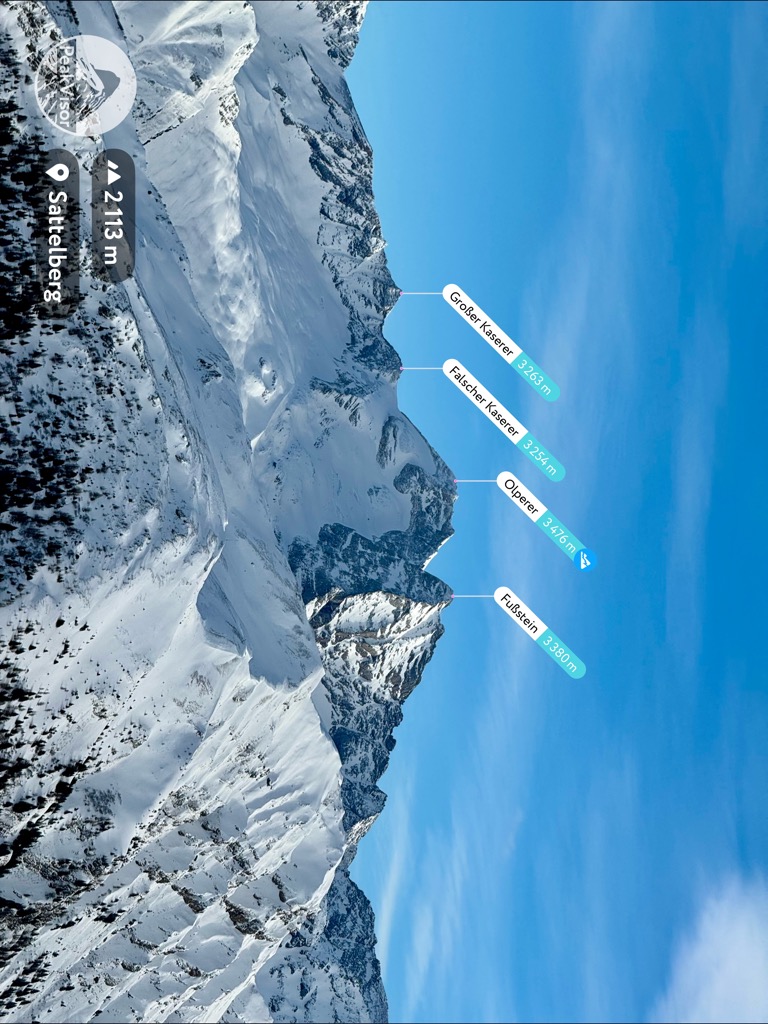
There are 802 named mountains in the Zillertal Alps. Hochfeiler (Gran Pilastro) (3,510 m / 11,516 ft) is the highest point. The most prominent mountain is Olperer (3,476 m / 11,404 ft).
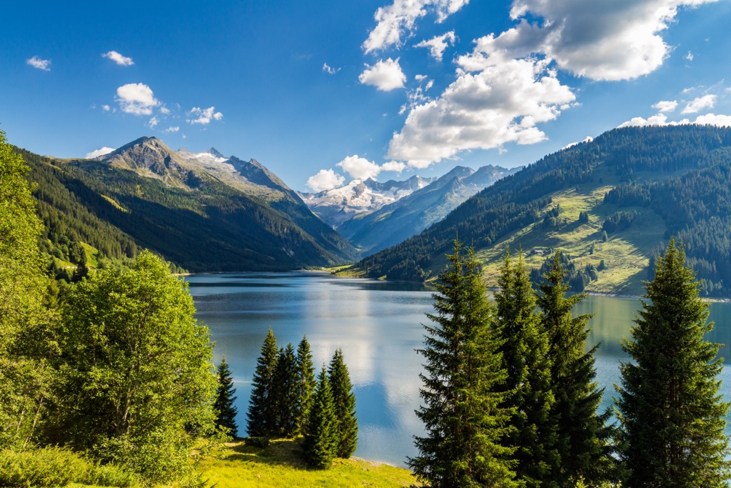
The Zillertal Alps are approximately 56 km (35 mi) long, extending in a northeasterly direction from Italy's South Tyrol into Austria's Tyrol. The Brenner Pass (1,370 m / 4,494 ft) separates the Zillertal Alps from the Ötztal Alps to the west. The High Tauern (Hohe Tauern) marks the end of the Zillertal Alps to the east.
The Zillertal Alps take their name from the Ziller Valley. The 55.7 km (34.6 mi) long Ziller River, a tributary of the Inn River, drains the Ziller Valley.
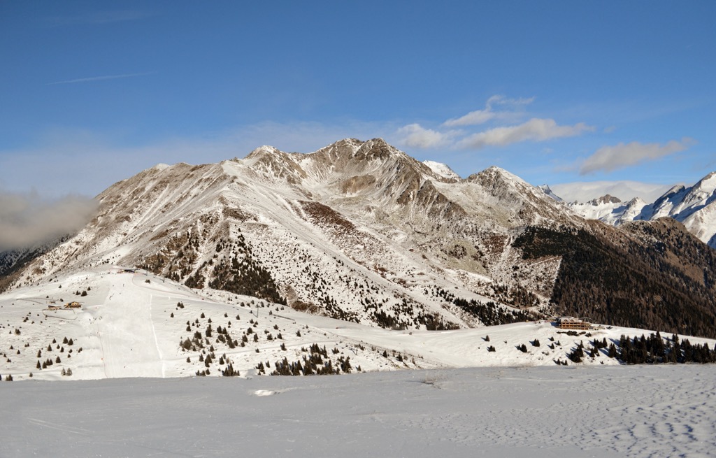
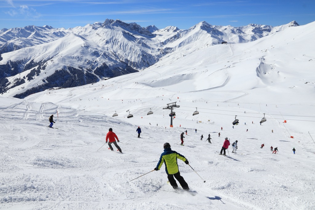
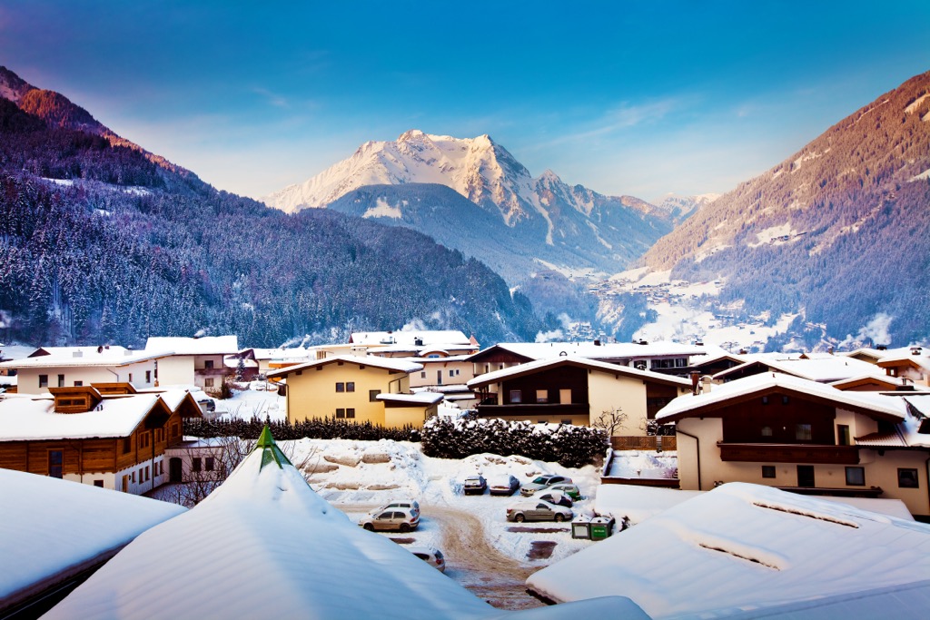
The Zillertal Alps is a popular winter sports destination with many ski resorts dotted across the Zillertal, including Gerlos, Mayrhofen, and Tux.
The Zillertal Alps is a diverse mountain range split into four main sub-groups.
The Zillertal Main Ridge (Zillertaler Hauptkamm) is the centerpiece of the Zillertal Alps. It's home to many of the range's highest mountains, including the Zillertal Alps' highest summit, Hochfeiler (Gran Pilastro).
The Zillertal Main Ridge is itself subdivided into several notable ridges. These minor ridges include Hochstellerkamm and its namesake Hochsteller (3,098 m / 10,164 ft), and Greinerkamm and its namesake Großer Greiner (3,201 m / 10,502 ft).
The Tux Main Ridge (Tuxer Hauptkamm) lies west of the Zillertal Main Ridge and is a popular ski area. It's located almost entirely within Tyrol. Both the Tux Main Ridge and Zillertal Main Ridge fall within the boundaries of the Zillertal Alps High Mountain Nature Park (Hochgebirgs-Naturpark Zillertaler Alpen).
The Tux Main Ridge's highest summit is Olperer, the most prominent peak in the Zillertal Alps. The Tux Main Ridge includes the Tuxer Joch, an ancient 2,338 m (7,670 ft) high mountain pass that links the lower Ziller Valley to the north of the Brenner Pass.
The Reichenspitze Group (Reichenspitzegruppe) is the easternmost group of Zillertal Alps. It takes its name from the group's highest summit, Reichenspitze (3,303 m / 10,836 ft), on the border between Tyrol and Salzburg.
Several arêtes link Reichenspitze to surrounding summits, including the Gabler (3 263 m / 10 705 ft) to the northeast, Wildgerlosspitze (3,280 m / 10,761 ft) to the northwest, and Richterspitze (3,052 m / 10,013 ft) to the south.
Some of the Reichenspitze Group's summits fall within the Rieserferner-Ahrn Nature Park (Parco Naturale Vedrette di Ries-Aurina), including Vetta d'Italia (Klockerkarkopf) (2,911 m / 9,551 ft).
The Pfunderer Mountains (Monti di Fundres) are the most westerly group of the Zillertal Alps. The group is located almost entirely within South Tyrol and spans the Zillertal Alps' southwestern and central areas.
Pfunderer Mountains contains several 3,000ers, including its highest peaks, Wilde Kreuzspitze (Picco della Croce) (3,135 m / 10,285 ft), Napfspitze (Cima Cadini) (3,155 m / 10,315 ft), Grabspitz (Cima Grava)(3,062 m / 10,045 ft). Additionally, this mountain group boasts the best Italian ski resorts in the Zillertal Alps, such as Gitschberg Jochtal.
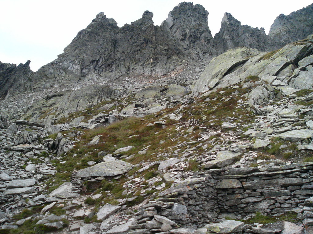
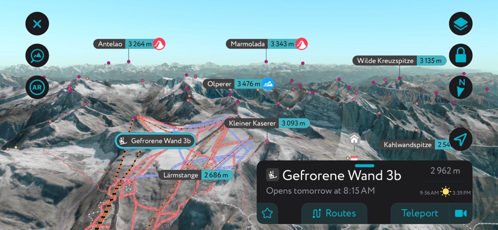
The Zillertal Alps are part of the Central Eastern Alps, the most glaciated chain in the Eastern Alps. Among the glaciers in the Zillertal Alps are Tuxer Ferner and Riepenkees, which sit at the top of the Tux Valley, reaching heights of 3,250 m (10,660 ft) on Gefrorene-Wand-Spitzen's (3,287 m / 10,787 ft) saddle. They're among Austria's most popular ski areas.
The Alpine Orogeny, an ongoing mountain-building event, formed the Zillertal Alps. At the start of the Late Mesozoic roughly 66 million years ago, the African, Arabian, and Indian Plates collided with the Eurasian Plate. Convergent movement between these plates helped create the Alps.
The Alpine Orogeny has had a widespread effect on the Earth's topography, building mountain ranges stretching from the Atlas Mountains in North Africa to the Himalayas.
The Zillertal Alps are made primarily from granite gneiss. Other rocks, including schists and amphibolites, are also present.
Partly due to their composition, the Zillertal Alps are home to some of the highest mountains in the Central Eastern Alps. The Zillertal Alps' highest peak, Hochfeiler / Gran Pilastro, is one of the top ten highest mountains in the Central Eastern Alps.
Other notable summits in the Zillertal Alps include Große Möseler (Grande Mèsule) (3,480 m / 11,417 ft), Hochferner (3,470 m / 11,385 ft), and Turnerkamp (Cima di Campo) (3,416 m / 11,207 ft).
The glaciated slopes of the Zillertal Alps and the woodlands of the Ziller Valley are home to a variety of wildlife, from specially adapted reptiles to vibrant flowers.
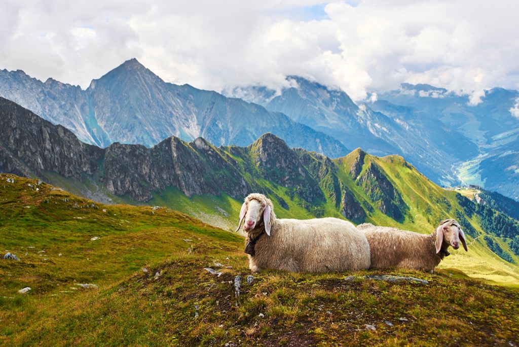
The Zillertal Alps are home to many mountain-dwelling mammals, including ibex, chamois, mouflons, red deer, and marmots. There are no wolves and lynxes in the Zillertal.
Many bird species call these high Alpine slopes home, including bearded vultures, black grouses, peregrine falcons, golden eagles, and kestrels. Smaller elusive birds in the Zillertal Alps include rock ptarmigans, Alpine choughs, wallcreepers, and Alpine accentors.
There are two venomous snake species: nose-horned vipers and common European adders. Common European adders are far more prevalent and less dangerous. The nose-horned viper is considered one of Europe's most dangerous snakes.
Other notable reptile and amphibian species native to the Zillertal Alps include Alpine newts, Alpine salamanders, and slowworms. Alpine salamanders are unique as they're the only European amphibian to give birth to fully developed offspring.
Zillertal Alps' lakes and rivers are home to many fish species that are popular with anglers, such as brown trout, rainbow trout, char, and carp.
The forests of the Zillertal Alps are typical, consisting primarily of mixed coniferous woodlands. Norway spruces, silver firs, mountain pines, and European beeches mainly comprise the Zillertal Alps' montane forests.
Scots pines, European larches, and black pines are present in the Zillertal Alps' coldest areas. The forests on the lower slopes of the Zillertal Alps feature deciduous broadleaf trees such as Irish oaks and downy oaks.
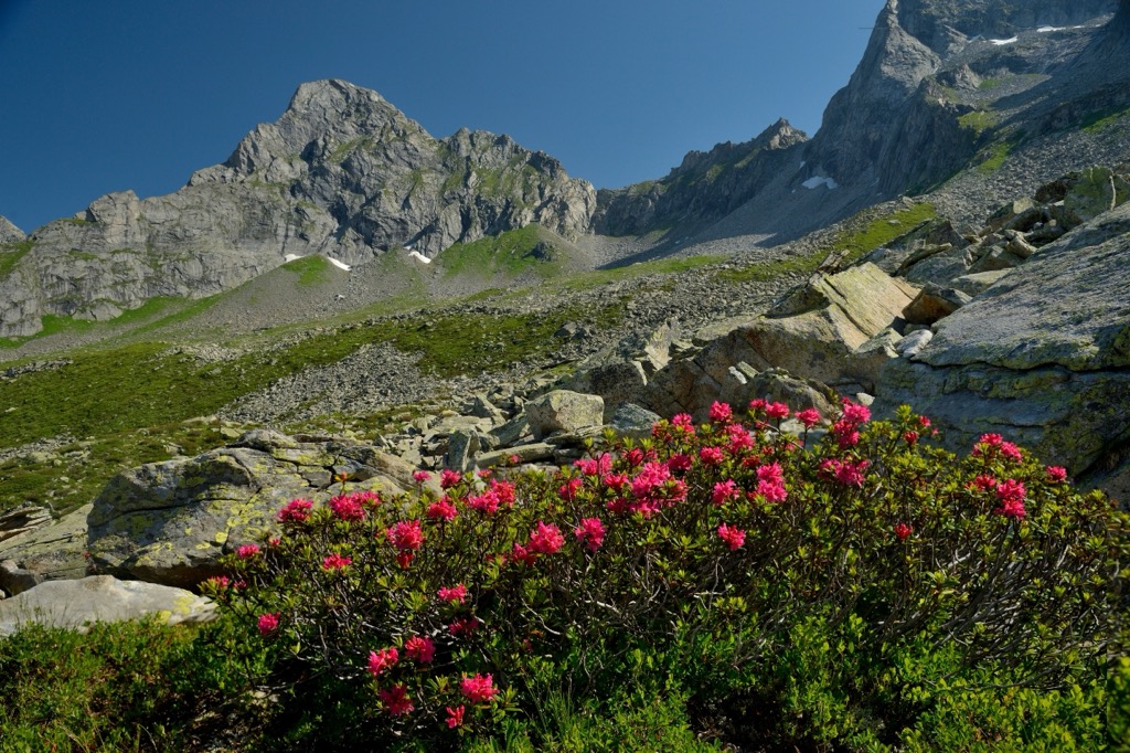
There are an estimated 1,500 plant species in the Ziller Valley alone. Common notable plants that grow across the Zillertal Alps include gentians, edelweiss, and cyclamen.
The Zillertal Alps are home to hundreds of endangered and protected plant species, such as downy burdocks, plumeless thistles, round-leaved sundews, and Swiss violets.
Species endemic to the Zillertal Alps and the surrounding area include Bavarian gentian, glacial buttercups, and Alpine roses. Many of these endemic species can be found across the alpine tundras, high above the Zillertal Alps' treeline.
The Zillertal Alps' position along the Italian-Australian border means it has a well-documented and often debated mountain climbing history.
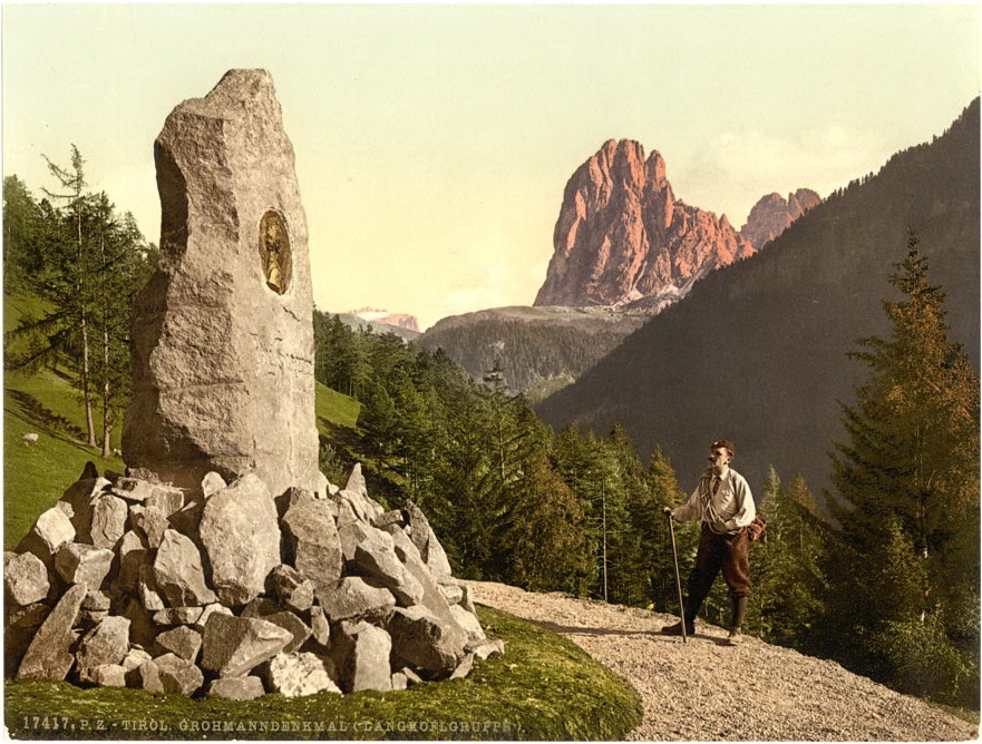
Paul Grohmann, mountaineering pioneer and co-founder of the Austrian Alpine Club (Österreichischer Alpenverein), was the first to scale many of the Zillertal Alps' highest peaks.
The Zillertal Alps' highest mountain, Hochfeiler (Gran Pilastro), was first summited on 24 July 1865, ten days after the first successful ascent of the Matterhorn (4,478 m / 14,692 ft).
Mountain guides Peter Fuchs and Georg Samer of San Giacomo in Vizze di Dentro accompanied Grohmann to the summit. They followed the northwestern ridge to the summit of Hochfeiler, now considered one of the mountain's standard routes.
Just over two years after reaching Hochfeiler's summit on 10 September 1867, Grohmann became the first to reach Olperer's peak. Grohmann was joined by Georg Samer and Gainer Jackl, following the southeastern ridge to the summit.
Große Möseler, the Zillertal Alps' second-highest summit, was first scaled in the mid-19th century. Mountaineers believed Schwarzenstein (Sasso Nero) (3,369 m / 11,053 ft) was the Zillertal Alps' highest mountain. It wasn't until Austrian explorer Anton von Ruthner stood atop Schwarzenstein that he realized nearby Große Möseler was significantly higher.
The first successful ascent of Große Möseler was by Englishmen Francis Fox Tuckett and Douglas William Freshfield on 16 June 1865. Accompanied by Swiss guides, they reached the summit crossing over the lower Möselekopf (3,389 m / 11,119 ft).
After Fox Tuckett and Freshfield reached the summit, they had the same realization as Anton von Ruthner. Große Möseler wasn't the Zillertal Alps' highest mountain, with Hochfeiler (Gran Pilastro) looming to the west.
Vetta d'Italia (Klockerkarkopf) in the Reichenspitze Group is famous for being Italy's northernmost point. On 16 July 1904, Italian irredentist Ettore Tolomei, his brother Ferruccio, and several mountain guides reached the Vetta d'Italia's summit.
Believing himself to be the first to reach the summit, nationalist Tolomei considered it his right to name the mountain and claim it for Italy. Tolomei carved an enormous "I" into the slopes, hoping to influence future shifts in the Italian-Austrian border.
During this period, Tolomei was writing his "Handbook of local names in South Tyrol" (Prontuario dei nomi locali dell'Alto Adige), a book detailing Italian toponyms of assimilated territories following wars of independence and eventually the First World War. The book became an essential piece of literature for future fascist regimes and was approved for official use by Benito Mussolini.
However, it was later revealed that Tolomei wasn't the first to reach the Vetta d'Italia's summit. Krimml mountaineers Franz Hofer and Fritz Koegel reached the summit on 10 July 1895, nearly ten years before Tolomei, when the mountain was still entirely within the Austro-Hungarian Empire.
The naming of Vetta d'Italia (Klockerkarkopf) is still a point of contention. In 2012, the Greens of South Tyrol/Alto Adige political party suggested renaming Vetta d'Italia as Vetta d'Europa (Europagipfel) to remove any reference to Tolomei's fascist beliefs.
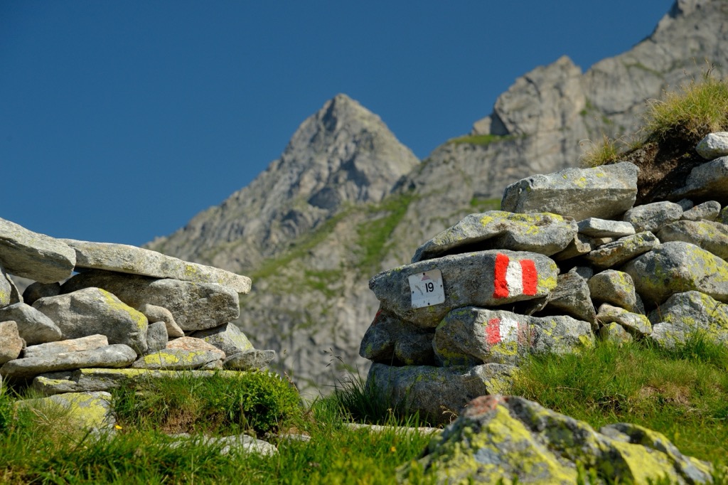
With its heavy snowfall and many 3,000ers, the Zillertal Alps are a beautiful yet potentially hazardous hiking destination.
While hiking in the Zillertal Alps, bring appropriate hiking gear and ample food and water. Ensure you carefully map your route, check local weather forecasts, and use a GPS if necessary.
The Zillertal Alps High Mountain Nature Park (Hochgebirgs-Naturpark Zillertaler Alpen) is the Zillertal Alps' primary park, covering an area of approximately 422 sq km (163 sq mi). The protected area was established in 1991.
With an elevation difference between 1,000 m (3,280 ft) and 3,510 m (11,515 ft), the Zillertal Alps High Mountain Nature Park offers lots of variety for hikers. It encompasses the Zillertal Main Ridge and Tux Main Ridge, stretching from the Austrian village of Ginzling to the summit of Hochfeiler (Gran Pilastro) (3,510 m / 11,516 ft).
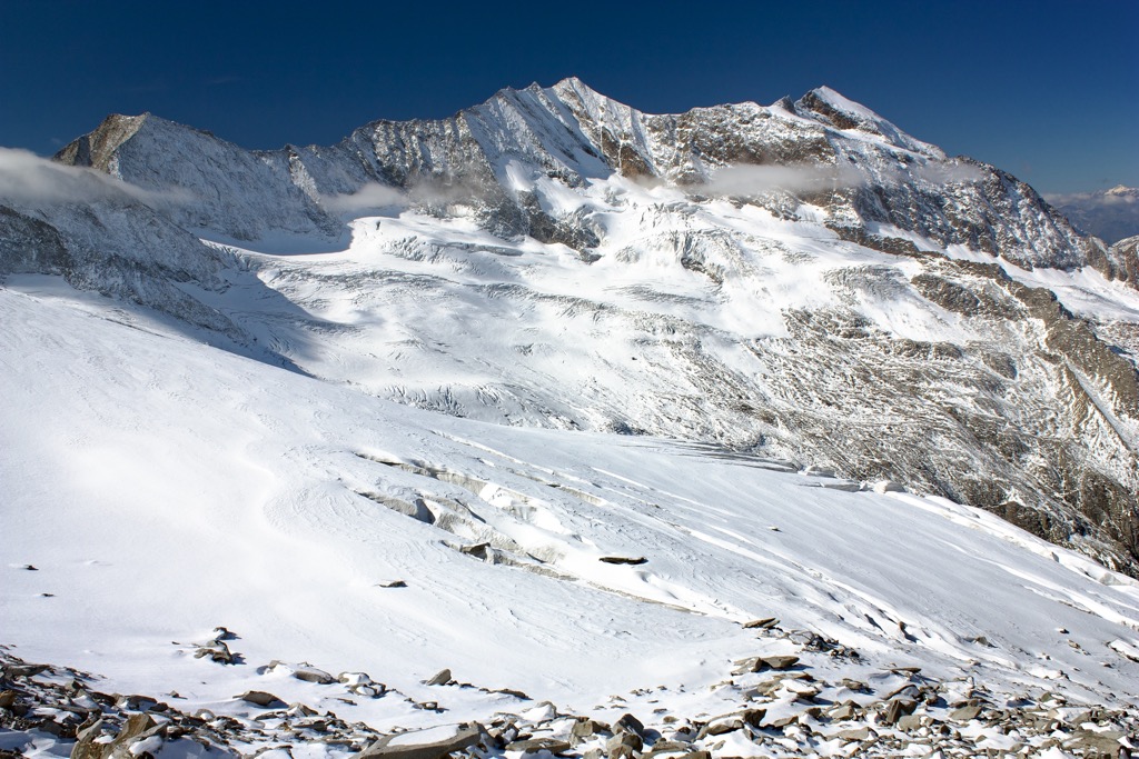
The Zillertal Alps' highest mountain, Hochfeiler, is at the park's southern end. It's one of the most impressive mountains in the Central Eastern Alps, with its vertical 300 m (984 ft) high snow-covered north face.
There are two standard routes up Hochfeiler, the most popular of which starts from near San Giacomo in the Val di Vizze (Pfitschtal) on the Italian side of the border. You can pick up the trail from the car park 2 km (1.2 mi) northeast of Moassl Waterfall (Cascata Moassl).
The walk is demanding and exposed in places, but it isn't very technical. The route initially leads over a glacier before ascending onto Hochfeiler's southwestern ridge. You can see the Dolomites, the Stubai Alps, and the Venediger Group from Hochfeiler's summit. This out-and-back trail is approximately 17 km (10.5 mi) in length.
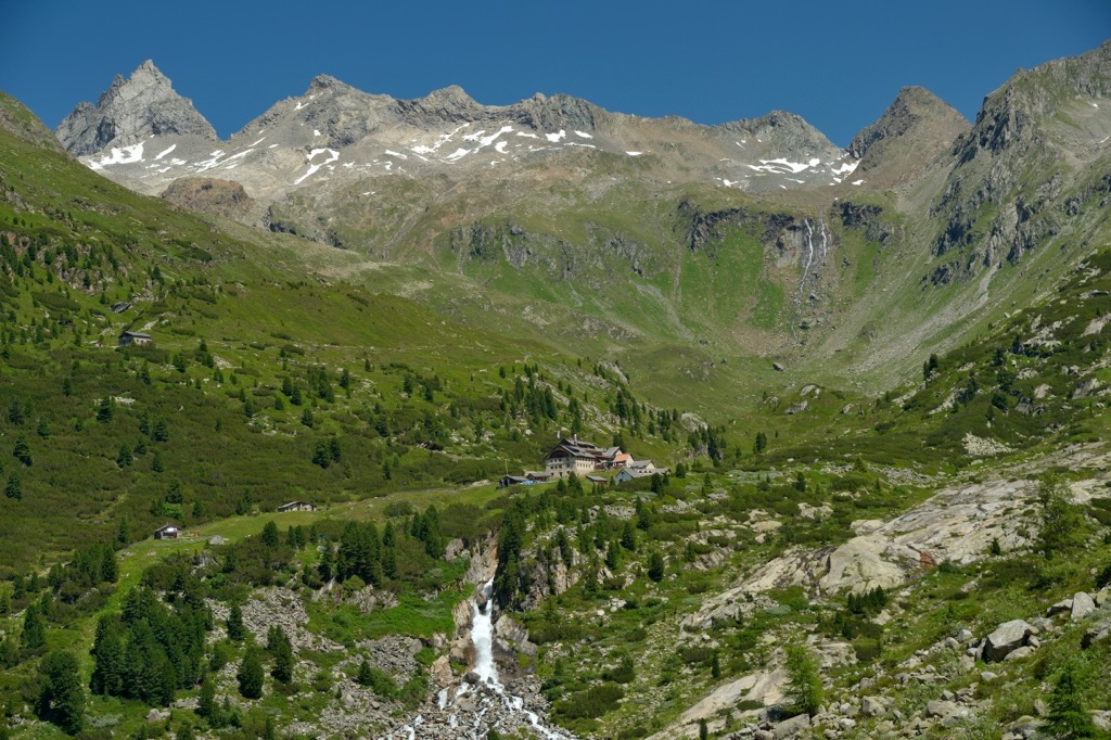
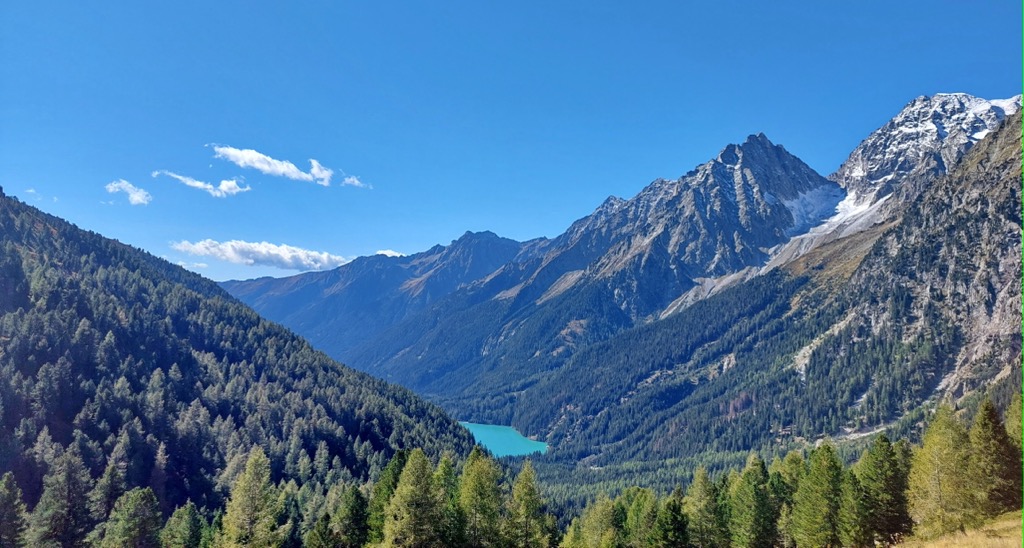
Another popular hike that leads to one of the most famous viewpoints in the Zillertal Alps is from the Schlegeis reservoir (Schlegeisspeicher) to Friesenberghaus (2,498 m / 8,195 ft). This area is home to the Hintertux Glacier, one of the Zillertal Alps' best ski areas, with summer skiing opportunities.
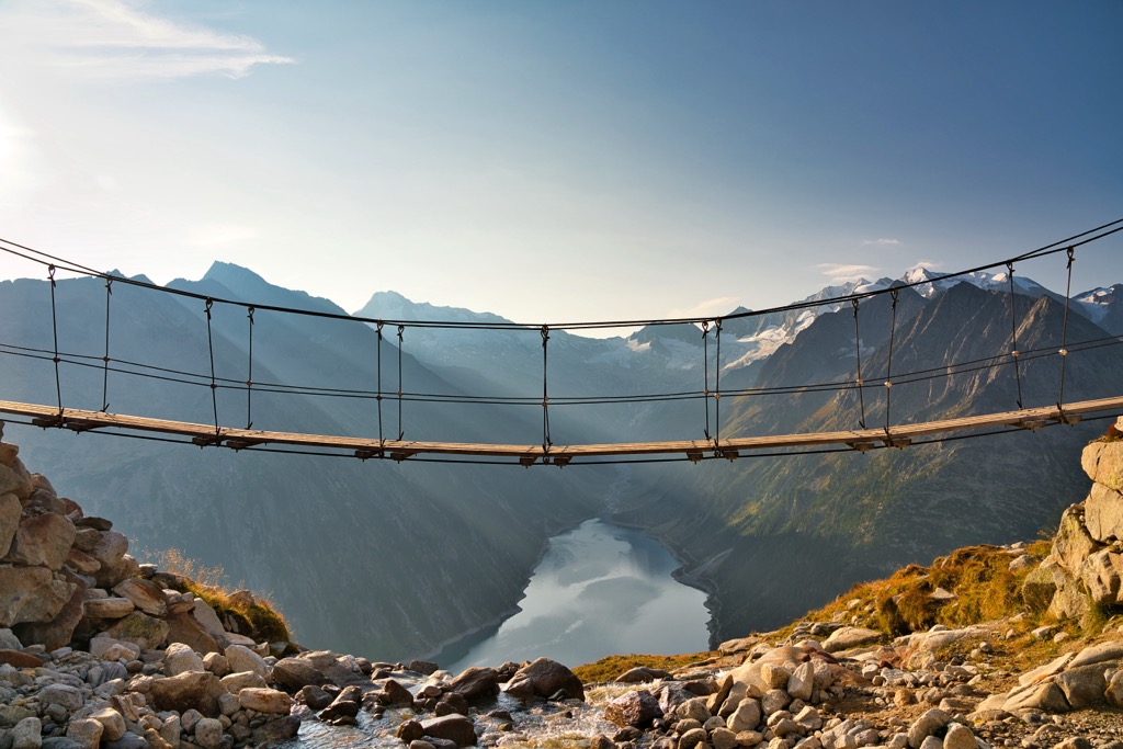
This challenging looped trail leads first up to Friesenberghaus overlooking Friesenbergsee before descending via Olpererhütte (2,389 m / 7,837 ft). Nearby, you'll find a suspension bridge that affords spectacular views of Schlegeisspeicher and surrounding mountains like Greinerkamm's Großer Greiner.
You can pick up this trail from Olpererhütte Hike Trailhead. This looped trail is approximately 14 km (8.6 mi) in length.
Other popular mountains in the Zillertal Alps High Mountain Nature Park include Großer Löffler (Monte Lovello) (3,378 m / 11,083 ft), Hochsteller (3 098m / 10,164 ft), and Rotbachlspitze (Croda Rossa) (2,897 m / 9,505 ft).
Rieserferner-Ahrn Nature Park (Parco Naturale Vedrette di Ries-Aurina) covers an area of 313 sq km (120 sq mi), encompassing parts of the High Tauern, such as the Rieserferner Group and Venediger Group.
The park's northern end is part of the Reichenspitze Group, which includes Vetta d'Italia and Italy's snowiest valley, Ahrntal. Vetta d'Italia's political history and stunning views make it one of the park's most famous mountains.
Vetta d'Italia is almost always scaled from the south, thanks to the relatively short marked trail that leads to the summit. The northern route involves a long, demanding trek from Krimml.
You can scale Vetta d'Italia on a day trek from Casere, but it's better to climb the mountain over two days, spending the night at Rifugio Tridentina (Birnlückenhütte) (2,441 m/8,009 ft). It's also possible to extend your hike from Vetta d'Italia to Pfaffenschneidkopf (2,918 m / 9,573 ft).
From the Vetta d'Italia, you'll have an incredible view of the Ahrntal below. This trail is approximately 22 km (13.5 mi) in length.
Other notable mountains within Rieserferner-Ahrn Nature Park include Dreiherrnspitze (Picco dei Tre Signori) (3,499 m/11,480 ft), Rammelstein (Montone) (2,483 m/8,146 ft), and Magerstein (Monte Magro) (3,273 m/10,738 ft).
Austria's largest park, High Tauern National Park (Nationalpark Hohe Tauern), covers an area of 1,856 sq km (716 sq mi). It's adjacent to Rieserferner-Ahrn Nature Park and contains several of the highest mountains in the Reichenspitze Group.
Several summits in the Reichenspitze Group form a ridge that runs from north to south along High Tauern National Park's western boundary, including Richterspitze (3,052 m / 10,013 ft), Zillerspitze (3,092 m/10,144 ft), and the group's highest summit, Reichenspitze.
Richterspitze is the most popular of these summits as it's easily accessible and features impressive glaciers and rock formations. Just to the southwest of Richterspitze is Hohenau Alm, a famous tourist destination nicknamed the "Little Tibet of Zillertal."
The best place to start this walk is from the Richterhütte (2,367 m / 7,765 ft). Alternatively, you can plan a longer walk from Krimml, passing the stunning Krimml Waterfalls (Krimmler Wasserfälle).
From atop Richterspitze, you'll have incredible views along the Reichenspitze Group's knife-edge ridge. The walk to the summit of Richterspitze from Richterhütte is roughly 5.5 km (3.5 mi) in length.
Another mountain in the Reichenspitze Group worth climbing is Rosskopf (2,845 m / 9,334 ft). Located just east of the group's main ridge, Rosskopf offers stunning vistas of numerous mountains, with Großvenediger (3,657 m / 11,998 ft), Großer Gabler (Monte Forca Grande) (2 574m/8 445ft), and Großer Geiger (3,360 m / 11,023 ft) a few of the highlights.
The quickest way to reach Rosskopf's summit is from the Zittauer Hütte (2,328 m / 7,637 ft), which is roughly 5 km (3 mi) south of the Familienhotel Finkau (1,420 m / 4,659 ft). This walk takes roughly 2 hours from the Zittauer Hütte.
Other Reichenspitze Group mountains in High Tauern National Park include Wildgerlosspitze (3,280 m / 10,761 ft), Hahnenkamm (3,209 m / 10,528 ft), and Mannlkarkopf (2,870 m / 9,416 ft).
At the Zillertal Alps' southwestern end on the Italian side of the border is the Pfunderer Mountains. This mountain group contains several 3,000ers, the highest of which is Wilde Kreuzspitze (Picco della Croce) (3,135 m / 10,285 ft).
Wilde Kreuzspitze (Picco della Croce) can be climbed either from the north via the Sterzinger Hütte - Rif. Vipiteno (2,346 m / 7,697 ft) or from the south via Fane Alm. The southern route is Wilde Kreuzspitze's normal route. It's not a technical climb, but you'll need high fitness levels to complete the loop in one day.
You can pick up this trail from the Fane Alm car park (Parcheggio Malga Fane). The path up Wilde Kreuzspitze is well-defined and signposted as paths 17b and 18. You can spend the night at the Brixner Hütte - Rifugio Bressanone (2,307 m / 7,569 ft) if you're planning a multi-day excursion in the Pfunderer Mountains. From the Brixner Hütte, it's also possible to scale Wurmaulspitze (3,022 m / 9,915 ft).
From Wilde Kreuzspitze's summit, you'll enjoy wide-reaching views of the Zillertal Alps, with Hochfeiler and Grabspitz visible to the north. This looped trail takes around 6 or 7 hours to complete.
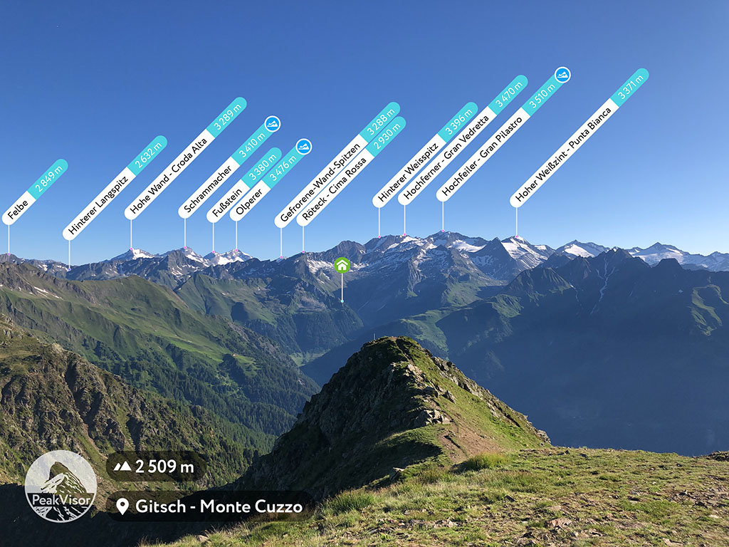
Gitsch (Monte Cuzzo) (2,510 m / 8,235 ft) is one of the Zillertal Alps' most popular mountains due to its accessibility and infrastructure. The surrounding Gitschberg Jochtal is one of the Zillertal Alps' best vacation destinations, with 37 beautiful pastures and a ski area with 15 lifts.
Cable cars run up the Gitch, and atop the mountain is a viewing platform with a telescope, allowing you to appreciate spectacular views of nearby peaks and valleys.
You can pick up the trail to Gitsch from Maranza to the south. Midway through your ascent, you'll pass by Gitschhütte (2,208 m / 7,247 ft), where you can take a breather. This trail is approximately 4 km (2.5 mi) in length.
Other popular summits in the Pfunderer Mountains include Napfspitze (Cima Cadini) (3,155 m / 10,315 ft), Eidechsspitze (Cima di Terento) (2,738 m / 8,983 ft), and Seefeldspitz (Cima di Campolago) (2,719 m / 8,921 ft).
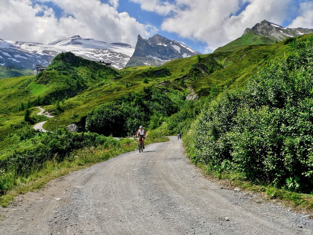
The Berlin High Trail (Berliner Höhenweg) is one of the most rewarding long-distance treks in the Zillertal Alps. This circular route leads mainly through the Zillter Alps High Mountain Nature Park, from Finkenberg in a clockwise direction to Edelhütte (2,238 m / 7,342 ft) just west of Ahornspitze (2,976 m / 9,763 ft). You can also extend your walk to Mayrhofen by 14 km (8.5 mi).
The trail is approximately 71 km (44 mi) long and is completed in seven stages across seven days. With 6,600 vertical meters to ascend, the Berlin High Trail is demanding and requires lots of preparation to complete successfully.
On the Berlin High Trail between Kasseler Hütte (2,177 m / 7,142 ft) and Edelhütte, with the trail’s red and white markers visible.
You'll find many lodges and refuges to stay at along the route, including Furtschaglhaus (2,295 m / 7,530 ft) and the largest mountain hut in Tyrol, the Berliner Hütte (2,041 m / 6,699 ft).
Highlights from the Berlin High Trail include views of Schlegeisspeicher, the summit of Schönbichler Horn (3,133 m / 10,279 ft), and the Gigalitzturm (2,978 m / 9,770 ft) rock spire.
Other long-distance hiking trails in the Zillertal Alps worth checking out include the Pfunderer High Route (Pfunderer Höhenweg), the Peter Habeler Route, and the Trans-Alpine Crossing.
Home to over 150 glaciers, numerous 3,000ers, and Italy’s snowiest valley, the Zillertal Alps is one of Europe's best regions for year-round winter sports.
Notable ski resorts worth visiting in the Zillertal Alps include:
Some of Italy and Austria's best alpine villages and ski resorts are tucked away high in the Zillertal Alps.
Innsbruck Airport is the nearest international airport to all of the Zillertal Alps' main settlements, located around 75 km (46.5 mi) from Mayrhofen.
Mayrhofen is the largest settlement in the Zillertal, with just under 4,000 people. It's located adjacent to the Hintertux Glacier, making it one of the region's most popular winter sports destinations.
With an elevation of over 3,250 m (10,660 ft), the Hintertux Glacier offers year-round skiing opportunities. The entire Mountopolis by Mayrhofner Bergbahnen ski zone is home to 60 lifts and 142 km (88 mi) of pistes.
Penken (2,094 m / 6,873 ft) and Ahornspitze are popular for skiing and have gondola systems. The Ahornbahn has a capacity of 160 people and is Austria's largest cable car.
Mayrhofen is also the perfect base from which to explore the Zillertal. The town acts as the terminus for the 32 km (20 mi) long Zillertalbahn railway line, which connects Mayrhofen to Jenbach.
Tux is located in the Schwarz district of Tyrol near several 3,000ers that form the Tux Main Ridge, including Olperer, Hoher Riffler (3,231 m / 10,600 ft), and Gefrorene-Wand-Spitzen (3,288 m / 10,787 ft). It sits on the rim of the Tuxertal at an elevation of 1,281 m (4,203 ft).
Tux receives the second-most annual visitors in the Zillertal Alps after Mayrhofen. It's a popular summer ski destination, with the Tuxer Ferner on your doorstep.
One of the most fascinating natural attractions near Tux is the Spannagel Cave (Spannagelhöhle), which, at 10 km (6 mi) in length, is the largest natural cave in the Central Austrian Alps.
A bus service runs from Mayrhofen Station to Tux. There's also a free seasonal bus in the Tuxertal that runs between the Hintertux and Vorderlanersbach.
Gerlos is the third-most-popular winter vacation destination in the Zillertal Alps. Perched on the edge of High Tauern National Park, Gerlos is a stone's throw from the famous Krimml Waterfalls.
Gerlos attracts skiers worldwide due to its proximity to Zillertal Arena, the range's largest ski area with 150 km (93 mi) of slopes and 52 lifts. It's estimated over 500,000 people visit Gerlos in winter alone. The Reichenspitze Group is less than 20 km (12 mi) from Gerlos if you're planning a hiking excursion during your visit.
A seasonal bus service connects Gerlos with Zell am Ziller. A main road also connects Gerlos to Mittersill and Mayrhofen.


The highest peak in the Zillertal Alps is Hochfeiler, at 3,510 m.
The Zillertal Alps have 802 named peaks.


