
Scan the QR code and open PeakVisor on your phone
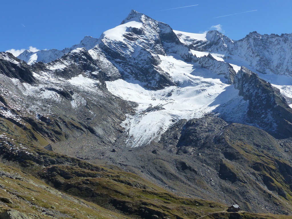
Rieserferner-Ahrn Nature Park has 174 named peaks. The highest is Dreiherrnspitze at 3,499 m. Other notable peaks include Rötspitz, Hochgall - Monte Collalto and Schneebiger Nock.
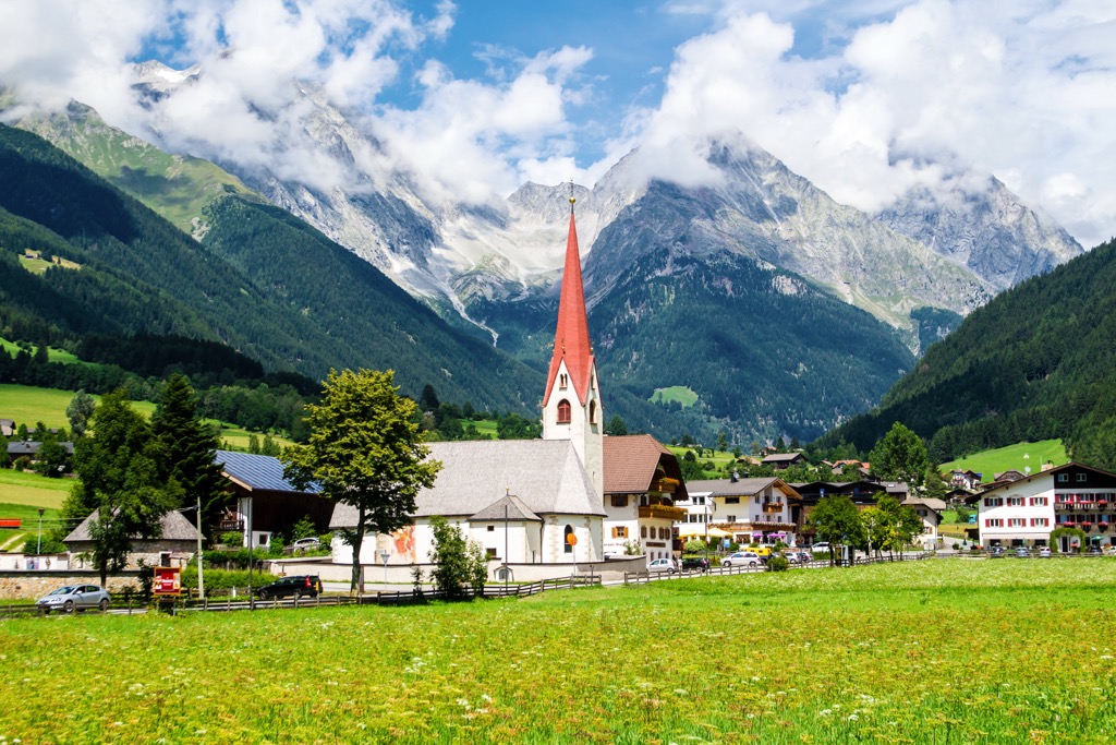
Visit Italy’s northernmost point and scale some of the highest summits in the High Tauern at Rieserferner-Ahrn Nature Park.There are 174 named mountains in Rieserferner-Ahrn Nature Park. Dreiherrnspitze (3,499 m/11,480 ft) is the highest point. The most prominent mountain is Hochgall - Monte Collalto (3,436 m/11,272 ft).
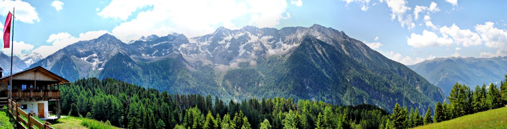
Rieserferner-Ahrn Nature Park (Parco Naturale Vedrette di Ries-Aurina/ Naturpark Rieserferner-Ahrn) is a nature park located in South Tyrol, Italy. It rests on the Austro-Italian border, covering an area of approximately 313 sq km (120 sq mi). The park is spread across the following comunes: Ahrntal, Gais, Sand in Taufers, Percha, Rasen-Antholz, and Prettau.
High Tauern National Park (Nationalpark Hohe Tauern) borders Rieserferner-Ahrn Nature Park to the north. Together with nearby nature and national parks, Rieserferner-Ahrn Nature Park is part of one of Central Europe's largest interconnected protected areas at roughly 2,475 sq km (955 sq mi) in area.
Rieserferner-Ahrn Nature Park partially takes its name from the Rieserferner Group (Gruppo delle Vedrette di Ries/Rieserfernergruppe). This small mountain range forms part of the Central Alps's High Tauern (Alti Tauri/Hohe Tauern). There are 38 peaks over 3,000 m (9,842 ft) in elevation in Rieserferner-Ahrn Nature Park.
At the northern end of Rieserferner-Ahrn Nature Park is the Ahrn Valley (Valle Aurina/Ahrntal), Italy's snowiest and northernmost valley. Rieserferner-Ahrn Nature Park is renowned for its snowfall and contains the highest percentage of glaciers of any South Tyrolean nature park.
At the northern end of the park between Ahrn Valley and Rein Valley (Reintal) is the Durreck Group (Durreckgruppe), a mountain massif that includes several well-known mountains like Dreieckspitze (Triangolo di Riva) (3,031 m/9,944 ft).
Further to the northeast is the Venediger Group (Venedigergruppe). The Venediger Group is home to Dreiherrenspitze, the park's highest summit. To the north of the Venediger Group is Italy's northernmost point, the Vetta d'Italia (Klockerkarkopf) (2,912 m/9,554 ft).
Important landmarks in Rieserferner-Ahrn Nature Park include the Riva Waterfalls (Cascate di Riva/Reinbachfälle), a series of three waterfalls, the largest of which is over 50 m (160 ft) high. Another landmark is the Earth Pyramids of Platten (Piramidi di Plata/Erdpyramiden von Platten), a series of spire-like natural sand towers capped with stones.
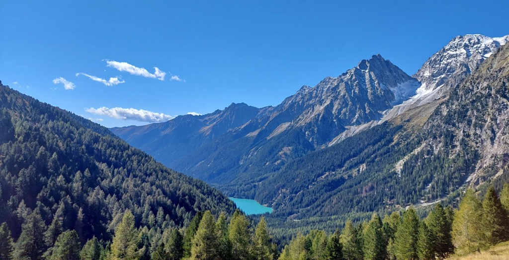
Antholzer See (Lago d'Anterselva) is the largest lake in Rieserferner-Ahrn Nature Park and the third-largest natural lake in South Tyrol, with a surface area of 43 ha (104 acres).
Notable settlements in and around Rieserferner-Ahrn Nature Park include Burneck, Rasen-Antholz, and Riva di Tures.
A part of the Central Alps, Rieserferner-Ahrn Nature Park formed during the Alpine orogeny. The Alpine orogeny is a mountain-building event that began during the Late Mesozoic approximately 60 million years ago and is ongoing in some Alpine regions.
The area which is now Rieserferner-Ahrn Nature Park began forming around 60 million years ago when the small Adriatic Plate separated from the African continent. The Adriatic Plate moved north, colliding with the Eurasian Plate and overriding it by approximately 150 km (93 mi).
The convergent movement between the Adriatic Plate and Eurasian Plate caused subduction at the edge of Europe, pushing land into the hot magma of the Earth's mantle.
Roughly 30 million years later, the Eurasian Plate penetrated the African Plate through existing fissures from past tectonic activity. This movement created an African and Eurasian geological fusion with igneous tonalite masses partially covering the existing African gneiss zone.
Over the next 20 million years, the tonalite overlay of the African slab eroded, exposing the gneiss and shale below. Remnants of the Adriatic Plate formed into a series of three Austroalpine nappe stacks extending from Brenner (Brennero) to Katschberg, known geologically as the Hohe Tauern Window.
Today, Rieserferner-Ahrn Nature Park is one of Italy's snowiest and most glaciated parks. It's home to over three dozen summits over 3,000 m (9,842 ft), including Rötspitze (Pizzo Rosso) (3,495 m/11,467 ft), Schneebiger Nock (Monte Nevoso) (3,357 m/11,017 ft), and Durreck (Cima Dura) (3,135 m/10,295 ft).
From the snowy floor of the Ahrntal to high mixed coniferous forests, Rieserferner-Ahrn Nature Park is home to an array of habitats where flora and fauna thrive. Read on to learn about Rieserferner-Ahrn Nature Park's wildlife.
Some of the largest mammal species hikers are likely to encounter in Rieserferner-Ahrn Nature Park include chamois, red deer, and roe deer. Other smaller mammals present include mountain hares, alpine marmots, foxes, badgers, and pine martens.
The forests of Rieserferner-Ahrn Nature Park are home to many bird species, such as siskins, crossbills, woodpeckers, and nutcrackers. Elusive Eurasian pygmy owls and western capercaillies also succeed in the park's mixed forests.
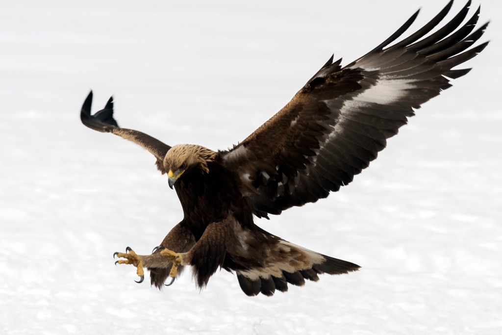
On the park's pastures nests one of northern Italy's most highly protected bird species, the golden eagle. Water pipits are one of the common birds found on Alpine pastures.
The mountain flowers that grow across the Alpine pastures attract various insects, including bumblebees, beetles, grasshoppers, dragonflies, and butterflies.
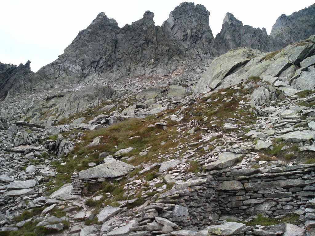
Most of Rieserferner-Ahrn Nature Park's landscape consists of meadows, mixed coniferous forests, rocky slopes, and glaciers.
Spruces dominate the park's montane forests between 800 m (2,624 ft) and 1,400 m (4,593 ft). Larches are present in sunnier areas where there are fewer spruces. Some deciduous trees can be found here as well, including mountain ashes.
Spruces, Swiss pines, and larches constitute most of the forests between 1,900 m (6,233 ft) and 2,200 m (7,217 ft). In humid areas, mountain pines and green alders are present.
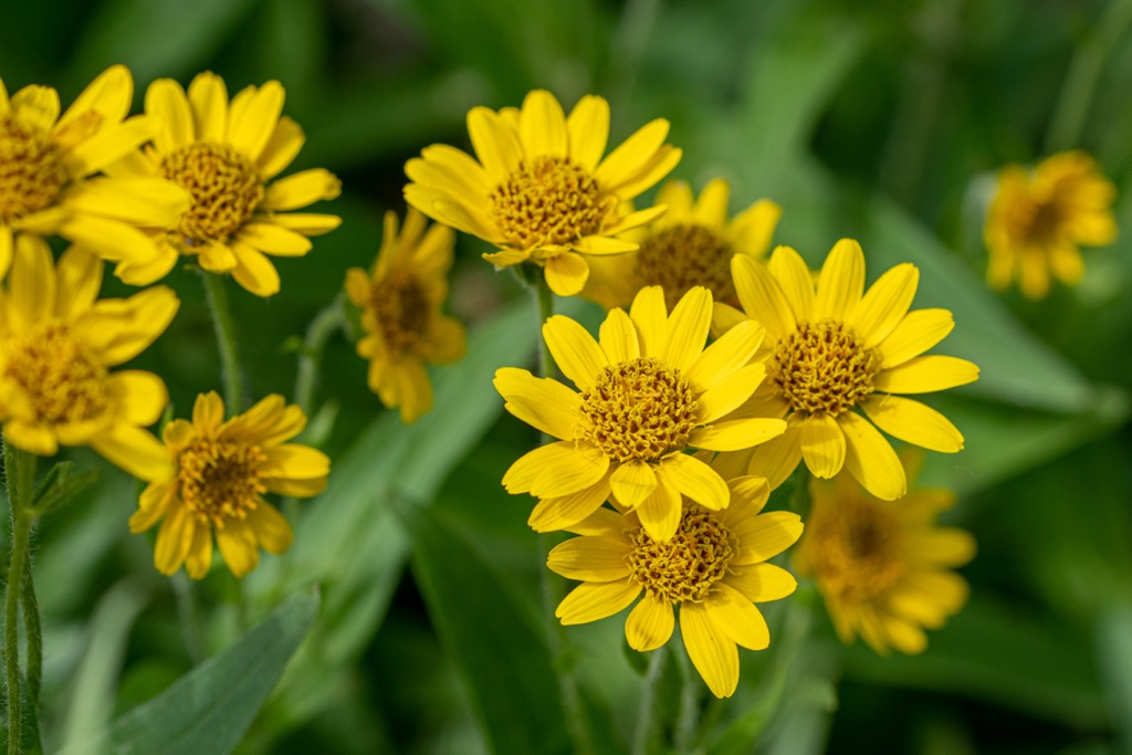
Across the meadows and pastures of Rieserferner-Ahrn Nature Park grow many flowering plants, such as cat's feet, arnicas, golden cinquefoils, and bearded harebells.
Alpine rock jasmine is a common plant above 3,000 m (9,842 ft). Other plant species hike could encounter high on the Rieserferner Group's rocky high mountain outcrops include Alpine toadflax, red saxifrage, and musky saxifrage.
During the Middle Ages, humans traveling between Pinzgau and Zillertal first settled in Rieserferner-Ahrn Nature Park. Remnants of Austrian Pinzgau culture and traditions can be identified in the region. For example, many farmhouses are built with a small bell tower, typical of the Pinzgau region.
Over time farmhouses grew into hamlets, usually centered around a small church and a few artisans. Despite its elevation and unforgiving conditions, Ahrntal has been an area of heavy traffic for over 1,000 years.
On the Krimmler Tauern high mountain pass, the remnants of the old international trade route are still visible. This international trade route linked regions on either side of the Alps. One of the most important links was between Salzburg and northern Italy. Wine and salt were among the most commonly traded commodities.
Transhumance farming was another reason why the Ahrntal was a busy area. To this day, farmers still move their livestock from Alpine pastures towards Salzburg, sometimes through deep snow. Large Alpine pastures exist on the slopes above the treeline, where cattle graze in the summer.
Rieserferner-Ahrn Nature Park first came to the public's attention as a tourist and hiking destination in the late nineteenth century. In the late 1800s, the magazine for the German-Austrian Alpine Association wrote a piece on Rieserferner-Ahrn Nature Park, which raised awareness about the area's beauty.
Rieserferner-Ahrn Nature Park was established in 1998 to protect the culture and nature of the Ahrntal and the surrounding mountains and valleys.
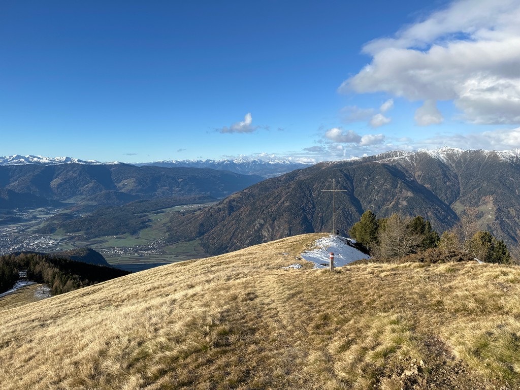
Rieserferner-Ahrn Nature Park is one of the lesser-known parks in South Tyrol, often overshadowed by the nearby High Tauern National Park and the Dolomites.
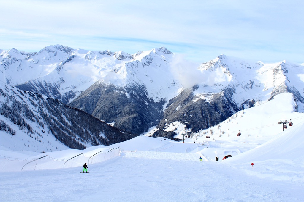
As a result, it's a peaceful hiking destination if you're looking to avoid the crowds and reconnect with nature. Due to the abundance of snow in Rieserferner-Ahrn Nature Park, it's also a popular location for ski tours.
Due to its isolated location and snowy conditions, hikers should come well-prepared when visiting Rieserferner-Ahrn Nature Park. Bring appropriate hiking gear, warm clothing, and plenty of food and water. Note mountain huts along your intended route, and inform others of your itinerary. Check local weather forecasts before hiking in Rieserferner-Ahrn Nature Park.
Read on to learn about some of the best hikes in Rieserferner-Ahrn Nature Park.
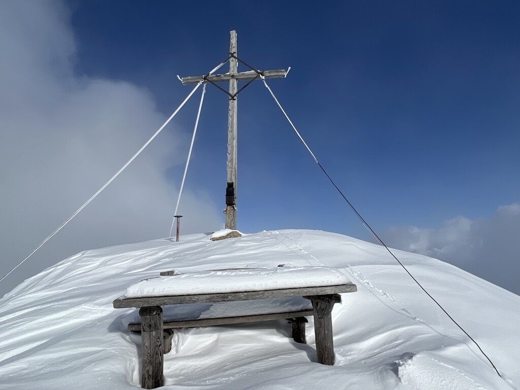
Dreiherrnspitze (3,499 m/11,480 ft), or Picco dei Tre Signori, one of the most famous and climbed mountains in the Venediger Group. The mountain takes its name from being the historic tripoint between the earldoms of Tyrol, Görz, and the Bishop of Salzburg.
The highest summit in the park, Dreiherrnspitze's normal route can be accessed on its western flank from within Rieserferner-Ahrn Nature Park. Dreiherrnspitze is a demanding mountain only suitable for experienced mountaineers, with crampons, ice axes, and ropes necessary.
You can pick up the trail to Dreiherrnspitze from Rifugio Giogo Lungo (Lenkjöchlhütte) (2,603 m/8,540 ft). The best way to reach Rifugio Giogo Lungo is on the No. 11 trail from Casere (Kasern). The hike from Casere to Rifugio Giogo Lungo takes approximately 3 hours.
The route up Dreiherrnspitze's western flank from Rifugio Giogo Lungo is considered the easiest and is rated PD (not very hard) on the Swiss Alpine Club's (SAC) mountaineering scale. Part of this walk leads over the Umbalkees glacier, but the route is well-marked.
Most of the mountain's difficulty is further on the ascent, when you'll need to watch for crevasses and snow cornices. The steep slope onto the summit ridge is hazardous, with conditions worsening depending on the amount of snow. The hike from Rifugio Giogo Lungo to Dreiherrnspitze takes approximately 6 hours to complete.
The Vetta d'Italia (Klockerkarkopf) (2,912 m/9,554 ft) marks the northernmost point in Italy, making it a must for many hikers visiting Rieserferner-Ahrn Nature Park. It's located at the eastern end of the Zillertal Alps, near the Birnlücke pass, which connects to High Tauern.
Due to its position between the Zillertal Alps and the Venediger Group, Vetta d'Italia affords breathtaking views, especially from Großvenediger (3,657 m/11,998 ft) to Rötspitze (Pizzo Rosso) (3,495 m/11,467 ft).
The Vetta d'Italia is almost exclusively climbed from its southern side due to the relatively short, marked trail that leads to the summit. The route from the north is a long, arduous walk from Krimml.
It's possible to climb the Vetta d'Italia in a day from Casere, but it's more comfortable to complete this tour in two days with an overnight stay at Rifugio Tridentina (Birnlückenhütte) (2,441 m/8,009 ft) on Bockegg (2,441 m/8,009 ft).
From Rifugio Tridentina the trail climbs steeply uphill to the Vetta d'Italia. From the Vetta d'Italia, it's possible to continue to the summit of Cima del Prete (Pfaffenschneidkopf) (2,917 m/9,573 ft). This walk is approximately 22 km (13.5 mi) in length.
Rammelstein (2,483 m/8,146 ft), or Montone, is located on the edge of the Puster Valley (Val Pusteria/Pustertal), one of the Alps' largest longitudinal valleys. It's the local mountain of Percha (Perca), usually climbed from nearby Vila di Sopra (Oberwielenbach) to the south.
Rammelstein is a challenging but rewarding mountain, offering panoramic views of the Puster Valley and the Rieserferner Group. In the distance, you can spot the Zillertal Alps and the Dolomites.
From car park 1 in Vila di Sopra (Parcheggio P1 Vila di Sopra), follow the No. 1 path before turning right at the Gönneralm signpost onto the No. 6 path. The trail continues past the Gönneralm mountain hut (1,975 m/6,479 ft), through forests, and over Hochnall (2,338 m/7,671 ft).
From Rammelstein's summit cross, you'll have views of some famous mountains, with Austria's highest mountain, Großglockner (3,798m/12,461 ft), to the northeast and Cima di Campo (Turnerkamp) (3,415 m/11,207 ft to the northwest. This out-and-back hike is approximately 12.5 km (7.7 mi) in length.
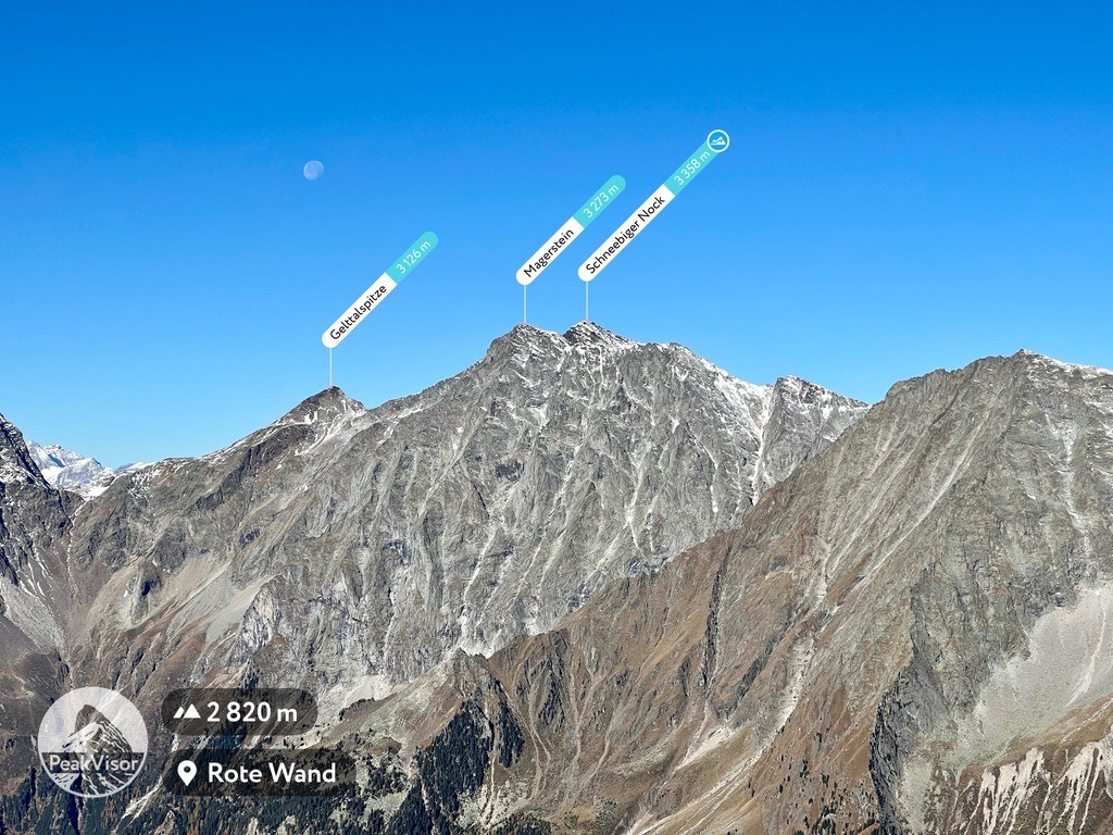
Magerstein (3,273 m/10,738 ft), or Monte Magro, is the third-highest mountain in the Rieserferner Group. While it's one of the easiest of Rieserferner-Ahrn Nature Park's top ten highest mountains, full hiking equipment is recommended even during summer.
Magerstein affords a spectacular view of the Ahrn Valley below and the surrounding summits. Several famous mountains are visible from Magerstein: Hochgall (Monte Colallto) (3,436 m/11,273 ft) and Wildgall (Collaspro) (3,273 m/10,738 ft) to the northeast, and Fernerköpfl (Pizzo delle Vedrette) (3,249 m/10,659 ft) and Schneebiger Nock (Monte Nevoso) (3,358 m/11,017 ft) to the northwest. The Dolomites provide a sublime backdrop to the south.
One of the best routes to Magerstein is from Riva di Tures (Rein in Taufers) near Campo Tures (Sand in Taufers). From the sawmill, you'll climb the Gelt Valley on the No. 3 trail to Vedrette di Ries (Rieserfernerhütte). The hike is about 3 hours and an overnight stay is advised.
Soon after the hut, you'll leave the trail for the summit of Fernerköpfl. From Fernerköpfl, you'll follow the rugged ridge over Frauenköpfl (3,251 m/10,666 ft). It's also possible to descend to the glacier below, where you'll need to watch for crevasses. From Frauenköpfl, Magerstein is just further along the ridge.
You'll descend the same way you came. This hike is approximately 18 km (11 mi) in length.
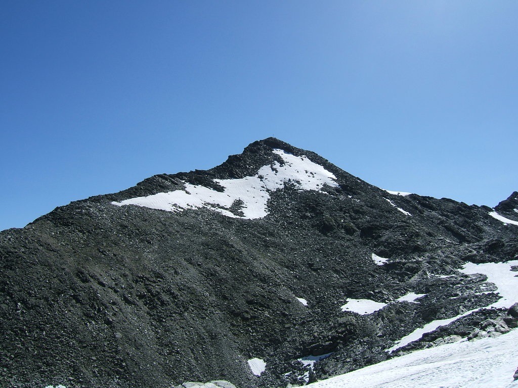
The Rieserferner Group's northernmost 3,000er, Dreieckspitze (Triangolo di Riva) (3,031 m/9,944 ft) forms a natural boundary between Rieserferner-Ahrn Nature Park and High Tauern National Park. Dreieckspitze is also commonly known as Dreieggspitze.
Dreieckspitze is one of the most impressive mountains in the Ahrn Valley, with its distinct triangular summit. It's also one of the easier of Rieserferner-Ahrn Nature Park's 3,000ers to climb.
The hike up starts from the entrance to the Knutten Valley (Valle dei Dossi/Knuttental), about 2 km (1.25 mi) from Riva di Tures (Rein in Taufers). This scenic hike starts by following the No. 9 trail towards Knuttenalm. The trail runs alongside the Knuttenbach stream to Lago di Gola (Klammlsee).
You'll follow the No. 9A hiking trail from the lake to the Bärenluegscharte mountain pass. From the foot of the Bärenluegspitze (2,960 m/9,711 ft), climb east to the summit cross of Dreieckspitze.
Dreieckspitze's summit affords some excellent panoramas, with the Zillertal main ridge and the Durreck Group clearly visible. You'll descend back to the Bärenluegscharte, before following the No. 9A hiking trail to the scenic Kofler Lakes (Koflersee). Then the No. 9 trail leads you past Obere Kofleralm where you'll take the No. 8A trail back to your starting point.
This hike is approximately 18.5 km (11.5 mi) in length.
The Ahrntal and the surrounding valleys contain some of the prettiest settlements in South Tyrol. Read on to learn about the main cities and towns in Rieserferner-Ahrn Nature Park.
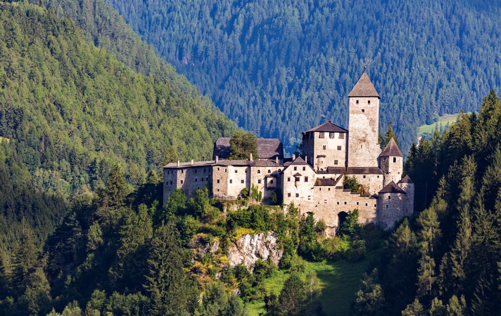
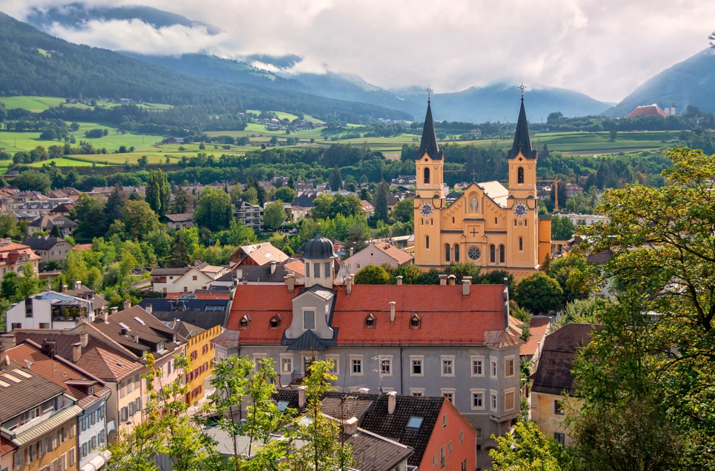
Brunico / Bruneck is the nearest town to Rieserferner-Ahrn Nature Park and the capital of the Puster Valley. Bruneck has many impressive sights and is famous for its historical charm, including the thirteenth-century Bruneck Castle, which sits upon a hill overlooking the town.
Its position near several nature parks means Burneck offers endless outdoor opportunities. For example, Fanes-Sennes-Braies Natural Park (Parco naturale Fanes-Sennes-Braies/Naturpark Fanes-Sennes-Prags) and Puez-Odle Nature Park (Parco naturale Puez Odle/Naturpark Puez-Geisler) are less than 35 km (21.5 mi) from Burneck.
One of the biggest draws of Bruneck is its top-notch ski resort, the Kronplatz (Plan de Corones). The resort features 32 lifts and 120 km (74.5 mi) of slopes. Bruneck is located approximately 20 km from Rieserferner-Ahrn Nature Park.
Rasen-Antholz (Rasun-Anterselva) is a municipality located on the southeastern flank of Rieserferner-Ahrn Nature Park within the Antholz Valley (Antholztal). It's renowned as a mecca for biathlon enthusiasts, having hosted the Biathlon World Championships six times. It will host the biathlon event during the 2026 Winter Olympics.
Rasen Antholz is close to several famous natural landmarks, including the Earth Pyramids of Platten and the Klammbach Waterfall (Klammbach Wasserfall/Cascate Klammbach). The beautiful Antholzer See sits at the northern end of the valley.
Riva di Tures (Rein in Taufers) is a small village spread across the Riva Valley (Rivatal) at the heart of Rieserferner-Ahrn Nature Park.
It's one of the park's most popular tourist destinations, famed for its location at the foot of the Reiserferner Group's highest mountain, Hochgall. Riva di Tures is also home to the Riva Waterfalls, the highest and most impressive falls in the nature park.
The village attracts wintersport fans thanks to its small family ski resort, which is part of Skiworld Ahrntal. You'll find 2 ski lifts and 4 km (2.5 mi) of slopes in Skiworld Ahrntal - Riva di Tures.
Rieserferner-Ahrn Nature Park contains one main ski resort, Skiworld Ahrntal. This resort consists of two main sites, Klausberg and Speikboden. There are also town ski lifts and minor pistes at Weißenbach and Riva di Tures. Skiworld Ahrntal has a total of 21 lifts, 74 km (46 mi) of slopes, and 18 ski huts.
Skiworld Ahrntal - Klausberg is the northmost of Skiworld Ahrntal's two sites. It has the highest cable car that accommodates eight people in South Tyrol. You'll find 11 lifts and 33 km of slopes in Skiworld Ahrntal - Klausberg. The ski area is situated between 1,050 m (3,445 ft) and 2,510 m (8,235 ft) in elevation.
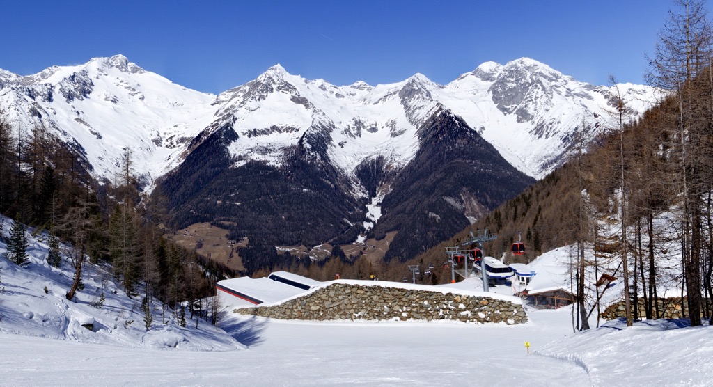
Skiworld Ahrntal - Speikboden is south of Klausberg in Costa di Tures (Drittelsand). It has 8 lifts and 40 km (25 mi) of slopes. Speikboden's valley ski run is one of the longest in South Tyrol at 8 km (5 mi) with an elevation difference of 1,450 m (4,757 ft). Skiworld Ahrntal - Speikboden is located between 950 m (3,116 ft) and 2,400 m (7,874 ft) in elevation.


The highest peak in Rieserferner-Ahrn Nature Park is Dreiherrnspitze, at 3,499 m.
Notable peaks in Rieserferner-Ahrn Nature Park include Dreiherrnspitze, Rötspitz, Hochgall - Monte Collalto, Schneebiger Nock and Untere Rötspitze.


