Get PeakVisor App
Sign In
Search by GPS coordinates
- Latitude
- ° ' ''
- Longitude
- ° ' ''
- Units of Length

Yes
Cancel
❤ Wishlist ×
Choose
Delete
The Villgraten Mountains (Villgratner Berge), also known as the Deferegg Alps (Deferegger Alpen), are a mountain subgroup straddling the Austrian-Italian border. Often overlooked in favor of the High Tauern's (Hohe Tauern) more famous subgroups, the Villgraten Mountains are perfect for a peaceful outdoor adventure away from tourist hotspots. There are 239 named mountains in the Villgraten Mountains; the highest and most prominent is Weiße Spitze (2,962 m / 9,717 ft).
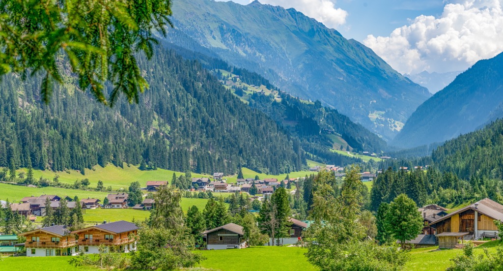
The Villgraten Mountains are split between Italy's South Tyrol and Austria's Tyrol. They extend for roughly 55 km (34 mi) from the Iseltal in the east to the Antholzer Tal in the west. The Villgraten Mountains are bound by the Defereggental to the north and the Pustertal to the south. Around two-thirds of the Villgraten Mountains are in Austria, and the remainder are in Italy.
A subgroup of the High Tauern in the Eastern Central Alps, the Villgraten Mountains are distinctly different and less impressive from the surrounding range. None of their summits exceed 3,000 m (9,842 ft) in elevation, and there is little to no glaciation — one of the High Tauern's defining features. Along with the higher Rieserferner Group, they form the southern boundary of the High Tauern.
The subgroups of the High Tauern that surround the Villgraten Mountains are:
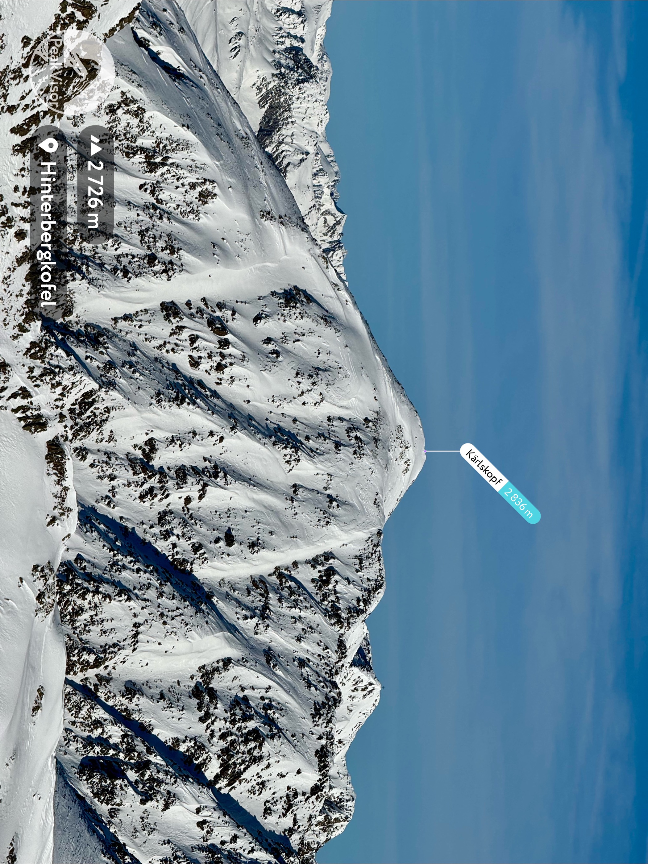
The Villgraten Mountains lie just outside High Tauern National Park, another reason they're less popular with tourists than the rest of the range. The Carnic and Gailtal Alps and the Dolomites also border the Villgraten Mountains.
The Villgraten Mountains take their name from the Villgratental, a side valley of the Pustertal located at the center of the subgroup. The Hochgrabe Group, which runs down the center of the Villgraten Mountains, separates the Villgratental from the Winkeltal.
One of the best reasons to visit the Villgraten Mountains is their views of the surrounding subgroups, which aren't impeded by the high glaciers around Großvenediger (3,657 m / 11,998 ft) and Großglockner (3,798 m / 12,461 ft). The Gsiesertal on the western side of the Villgraten Mountains is also popular for skiing in winter.
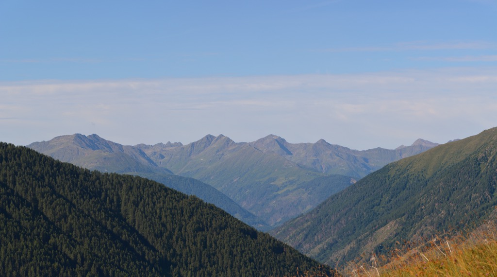
Numerous charming small mountain lakes throughout the subgroup are worth seeing, the largest of which is the Antholzer See (Lago di Anterselva) on the northwestern border, with a surface area of roughly 43 hectares (107 acres).
The largest settlement in the Villgraten Mountains is Lienz on the subgroup's eastern tip, with a population of around 11,000. Several alpine villages are within the subgroup's interior, including Innervillgraten, Außervillgraten, Santa Maddalena Vallalta, and San Martino.
Despite having characteristics different from those of the rest of the High Tauern at first glance, the Villgraten Mountains are clearly part of the range if you dig a little deeper.
The subgroup is on the southern edge of the Hohe Tauern Window, a geological structure unique to the region formed from hard metamorphic rock. Most of the rocks in the Villgraten Mountains are gneiss, schists, granites, and limestones.
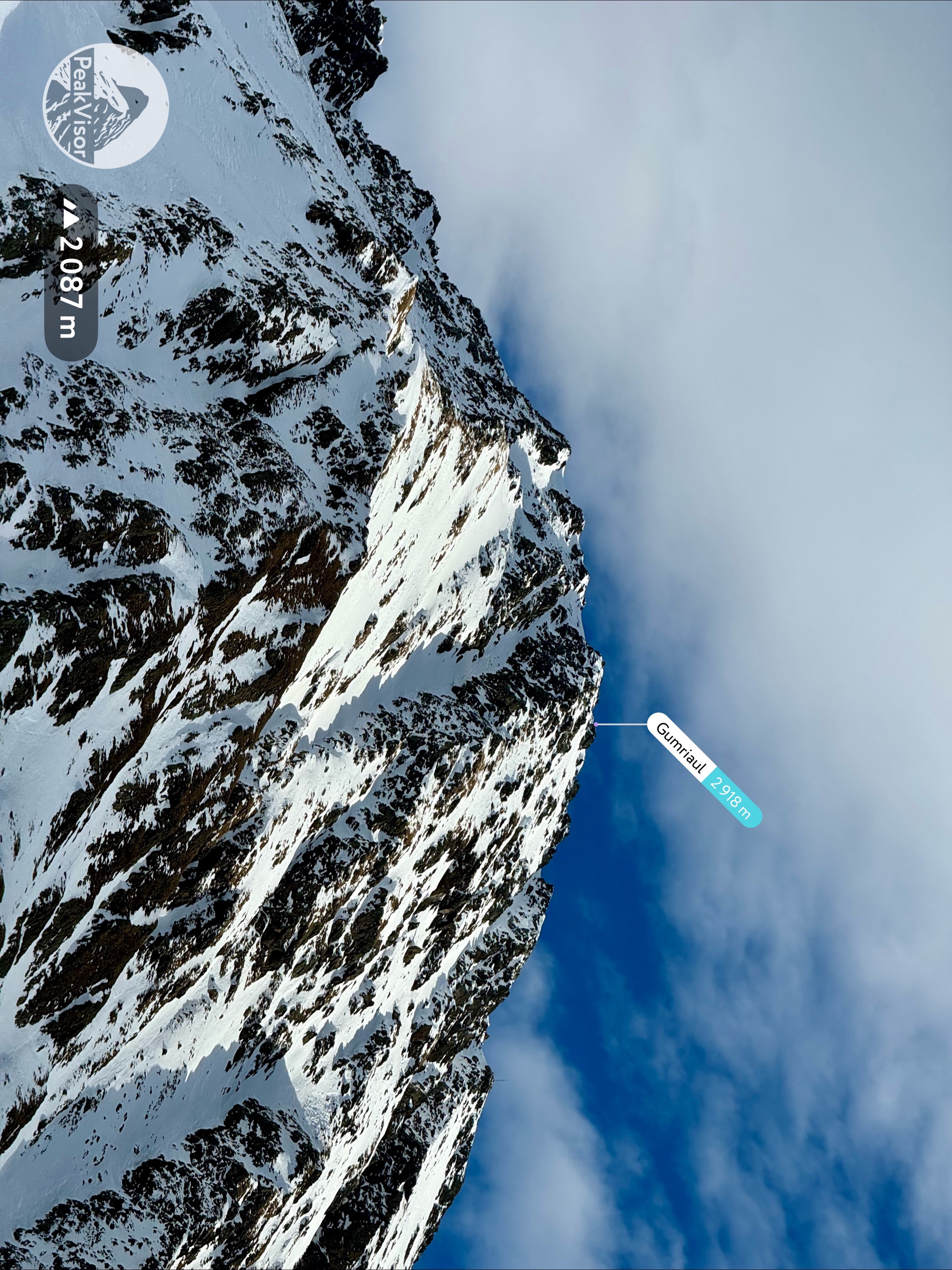
The High Tauern formed along with the rest of the Alps approximately 66 million years ago during the Alpine Orogeny. This mountain-building event occurred when the African, Arabian, Indian, and Cimmerian tectonic plates collided with the Eurasian Plate to the north.
The Alpine Orogeny closed the ancient Tethys Sea, which once covered large parts of the Alps, and convergent movement between the plates created the modern range. Many other of the world's most significant mountain ranges, including the Himalayas, the Carpathian Mountains, and the Pyrenees, were also formed because of the Alpine Orogeny.
There is no "defining" mountain in the Villgraten Mountains — most of the highest mountains in the range are of similar height to Weiße Spitze, including Rote Spitze (2,956 m / 9,698 ft), Hochgrabe (2,951 m / 9,682 ft) and Großes Degenhorn (2,946 m / 9,665 ft).
The Villgraten Mountains are neighbors to the High Tauern National Park, Austria's largest national park and one of its most biologically diverse areas.
Many high-mountain mammal species inhabit the Villgraten Mountains. Ibex stand upon seemingly insurmountable slopes, marmots whistle in the wind, and chamois nurse their kids on clifftops.
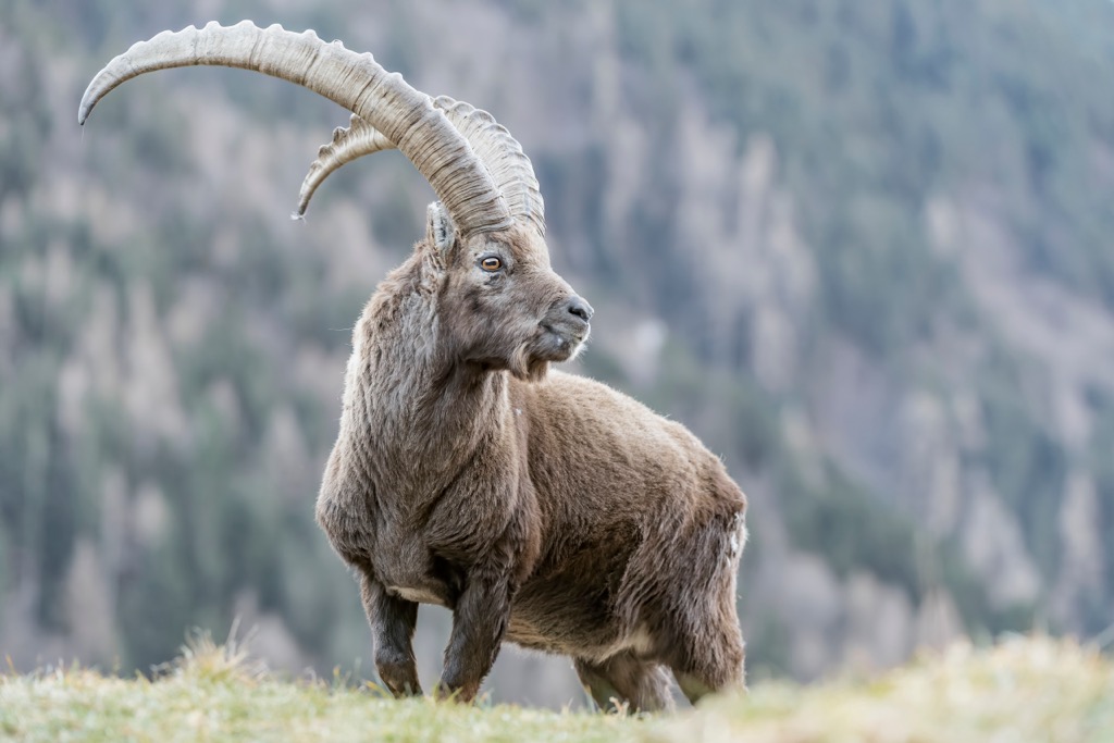
Brown bears and gray wolves are known to frequent the Villgraten Mountains. While hikers should take precautions in case they encounter a bear, the chances are slim.
Other notable mammal species in the Villgraten Mountains include red deer, red foxes, mountain hares, and Eurasian pygmy shrews.
The Villgraten Mountains' mountainsides and extensive forests are ideal habitats for a wide array of bird species. The bearded vulture is the largest bird species in the subgroup, with a wingspan of up to 2.8 m (9.3 ft).
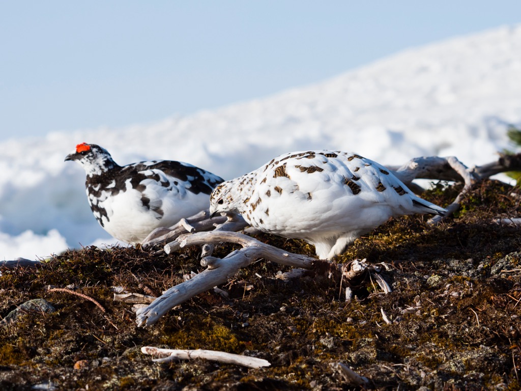
Other significant bird species in the Villgraten Mountains include golden eagles, Eurasian kestrels, rock ptarmigans, alpine choughs, Alpine accentors, and wallcreepers.
Common European adders are the only venomous snake hikers are likely to encounter in the Villgraten Mountains. Its bite is painful but rarely lethal. It can be found at elevations up to 3,000 m (9,842 ft), usually hiding under rocks or in foliage. Other reptile and amphibian species include Alpine salamanders, European toads, and Alpine newts.
Over 3,500 plant species grow across the High Tauern, which is heavily forested with numerous alpine pastures.
At montane levels within the Villgraten Mountains, between 700 m (2,296 ft) and 900 m (2,952 ft) in elevation, deciduous mixed forests dominate the landscape, with spruce the most common tree.
Above 1,500 m (4,921 ft) in elevation at subalpine levels, hardier larch-stone pine forests are prevalent. Swiss stone pines are rare in the Alps but present across the High Tauern. They can survive temperatures up to -30°C (-22°F) and live up to 1,000 years.
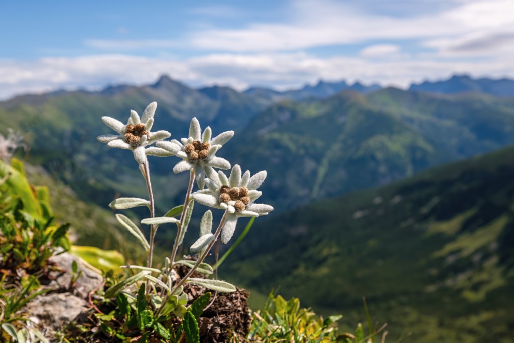
Above the treeline, alpine pastures devoid of large plants, except the occasional shrub, cover the landscape. Here, a wide variety of flowering plants blossom, like edelweiss, Bavarian gentians, rusty-leaved alpenroses, and Rudolph's saxifrage. Glacier buttercups are among the highest flowering plants in the Alps, growing at as high as 4,000 m (13,123 ft) in elevation.
Adolf Schaubach first outlined the Villgraten Mountains in 1845 in his classification book, The German Alps. Schaubach considered the range a southern subgroup of the Rieserferner Group and Tefferecker Mountains.
It wasn't until 1887 that Austrian geographer August Böhm von Böhmersheim first called the range by its current name in his classification of the Eastern Alps. The Villgraten Aps were officially recognized by the Alpine Club classification of the Eastern Alps (AVE) in 1984.
During the Second World War, Italy annexed the Villgraten Mountains and renamed them the Monti di Casies. However, this name was not official but rather a translation by prominent fascist Italian politician Ettore Tolomei.
The human hiking history of the Villgraten Mountains is not well documented — most of the range's peaks are low and relatively straightforward to climb. The first ascents were likely undocumented and completed by locals long ago. That said, the first documented ascents of the Villgraten Mountains' highest summits, Weiße Spitze and Rote Spitze, were by local mountaineer J. Erlsbacher in 1894.
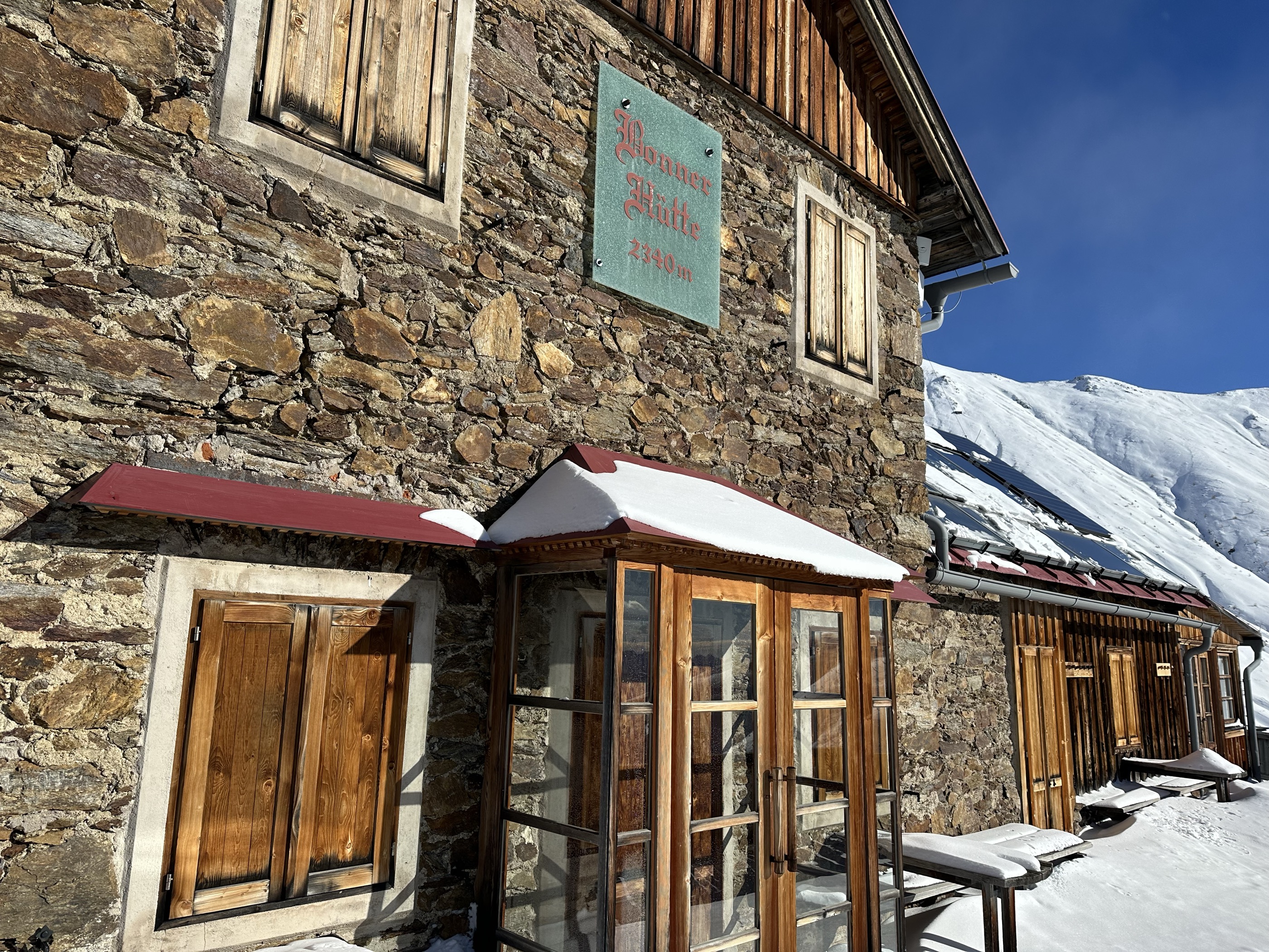
Hiking in the Villgraten Mountains became increasingly popular around the time of Erlsbacher's first ascents of its highest summits. In 1895, German and Austrian Alpine Club chairman Josef A. Rohracher opened the Hochsteinhütte (2,025 m / 6,644 ft) in 1984 and the Bonner Hütte (Rifugio Bonner) (2,340 m / 7,677 ft) in 1896.
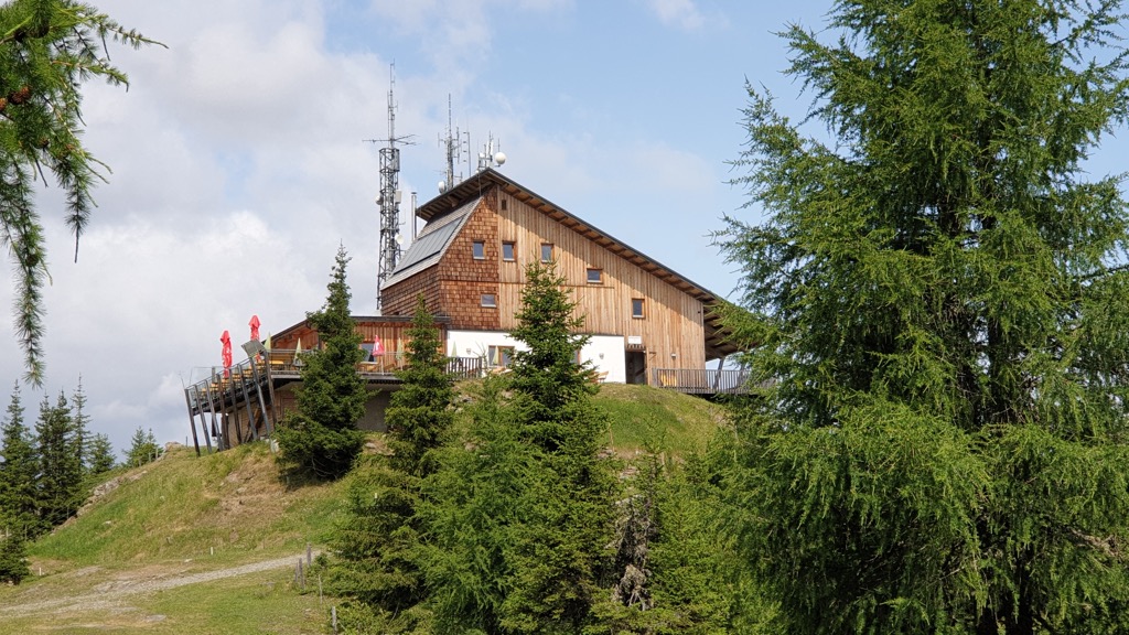
The highest mountain huts in the Villgraten Mountains, the Hochsteinhütte and Bonner Hütte (Rifugio Bonner), provided club members with easier access to mountains like Böses Weibele (2,521 m / 8,271 ft) and Toblacher Pfannhorn (Corno di Fana) (2,663 m / 8,737 ft). These huts also made it easier for ski tourers to explore the popular Pustertal and Villgratental valleys.
The Villgraten Mountains are a peaceful hiking area within the High Tauern. However, less popularity means less infrastructure, making this subgroup potentially dangerous if you're underprepared.
Ensure you bring the correct equipment and plenty of provisions when hiking in the Villgraten Mountains. Map your route carefully, check local weather forecasts, and inform others of your itinerary.
You can learn more about the International Climbing and Mountaineering Federation climbing grades mentioned in this guide here.
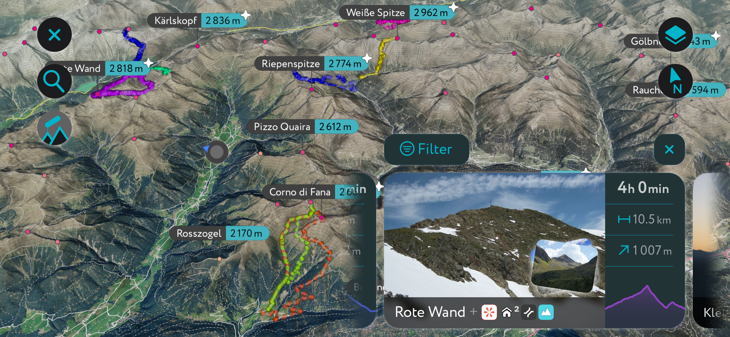
Check out the app to find thousands of trails, peaks, cabins, and even parking areas worldwide. It’s all on here. You can also upload .gpx files if we don't already have a trail on our servers. The PeakVisor app is available for iOS and Android; give it a shot and discover our visually stunning 3D Maps, adding a new dimension to your alpine adventures.
Rote Spitze (2,956 m / 9,698 ft) is the Villgraten Mountains' second-highest summit, with its neighbor Weiße Spitze (2,962 m / 9,717 ft) just 6 m (19 ft) higher.
Rote Spitze is situated at the center of the range, overlooking the Arntal side valley of the Villgratental. Its central position provides idyllic views of the Dolomites to the south and the High Tauern to the north.
Despite being slightly lower than Weiße Spitze, Rote Spitze is arguably a more popular summit, thanks to marked paths from both the Defereggental and Villgratental to the north and south.
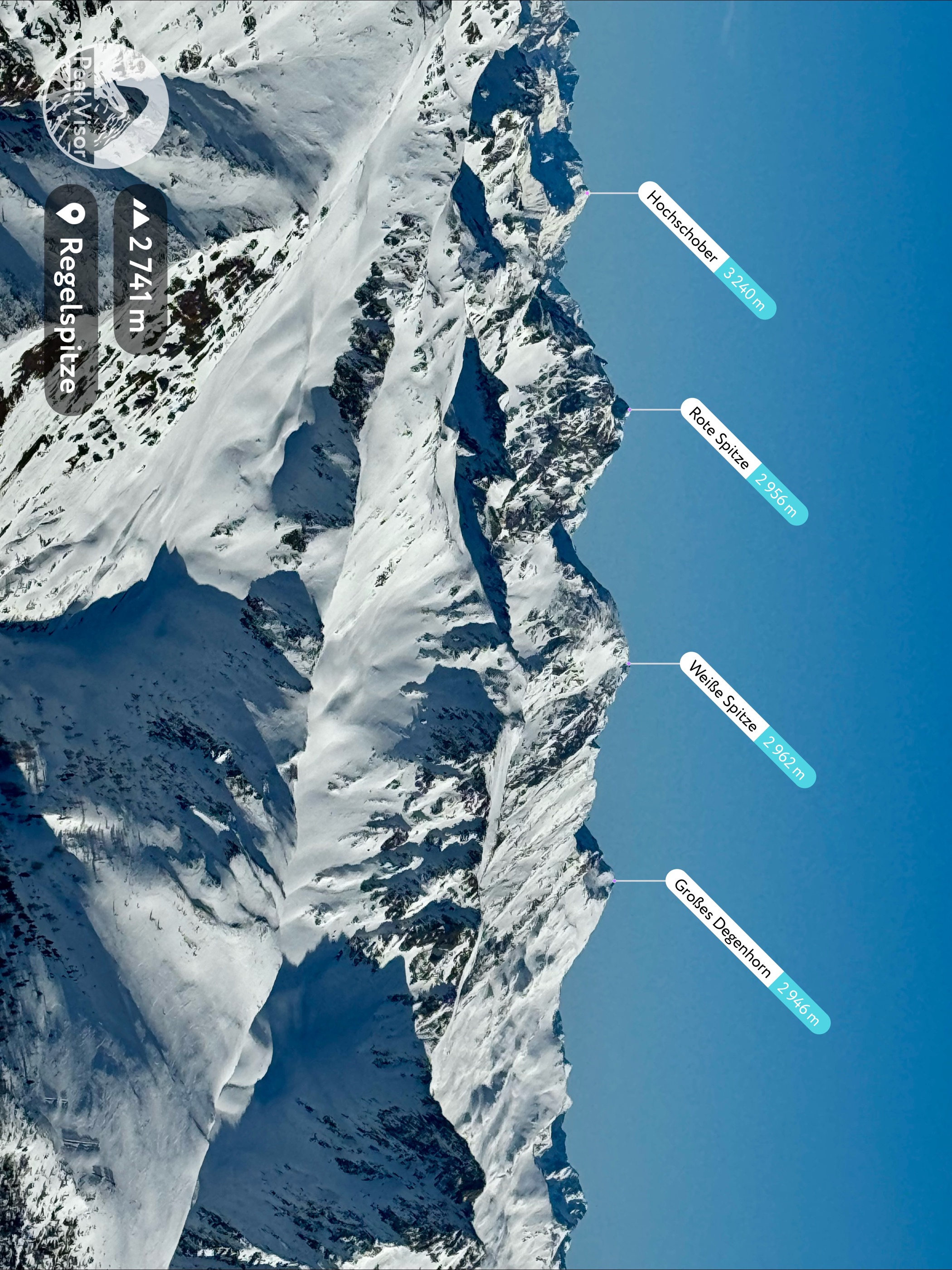
Both summits are similar in structure, and it's possible to scale them simultaneously on a UIAA climbing grade II from the Villgratental. Between Weiße Spitze and Rote Spitze is the Schlötterlenke mountain pass (2,730 m / 8,957 ft).
One of two normal routes to Rote Spitze is from the Unterstalleralm to the south within Villgratental. Follow the no. 16 marked trail across the Oberstalleralm and up onto the mountain's ridge, an exposed section with secured ropes. After this section, the hike to the summit is straightforward.
The hike from Unterstalleralm to Rote Spitze is moderately difficult and is 10.2 km (6.3 mi) long.
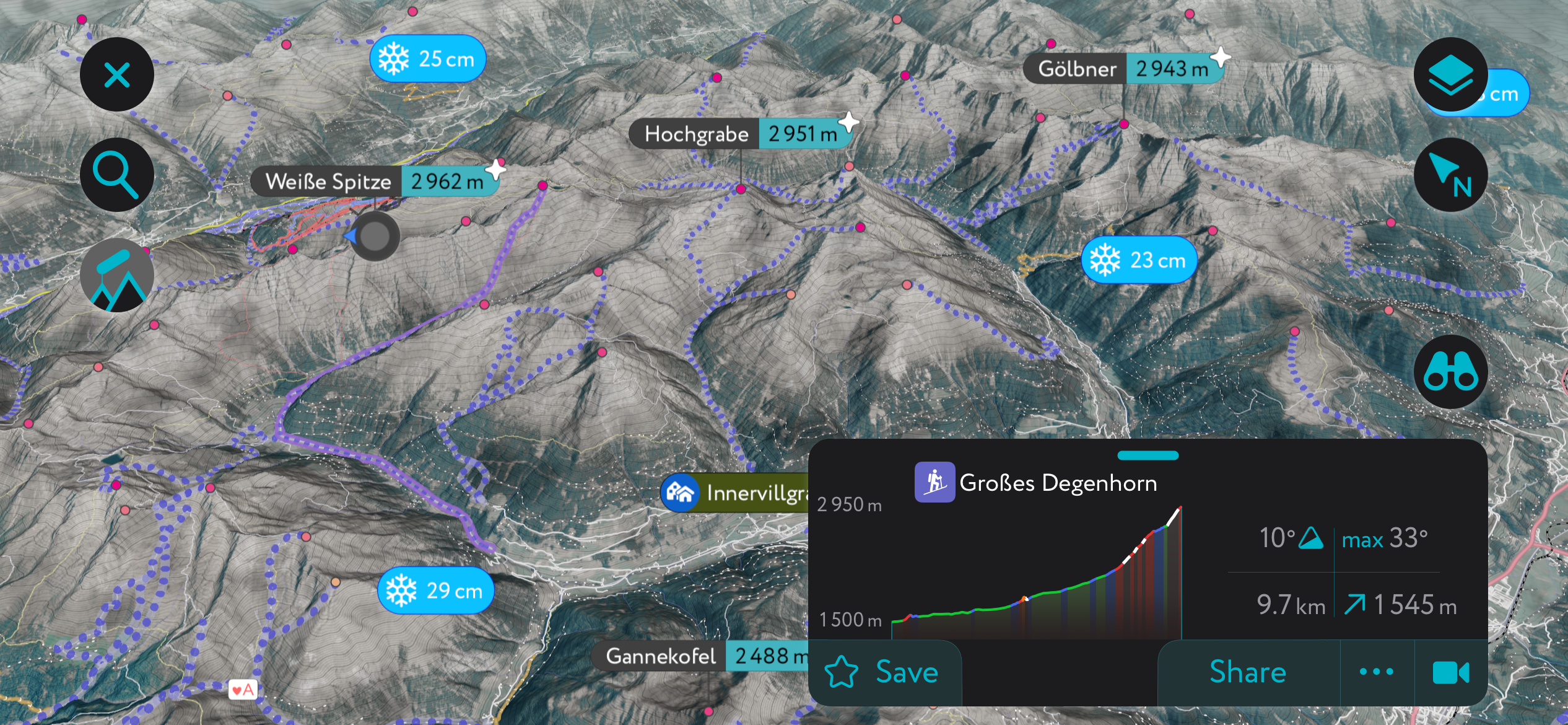
Großes Degenhorn (2,946 m / 9,665 ft) is the fourth-highest summit in the Villgraten Mountains, just east of Weiße Spitze. The higher but less attractive Hochgrabe (2,951 m / 9,682 ft) is on a side ridge that branches south.
Relatively isolated, Großes Degenhorn provides 150 km (93 mi) of panoramas, with the Carnic Alps Main Ridge to the south, the Dolomites to the southwest, and the entire High Tauern to the north.
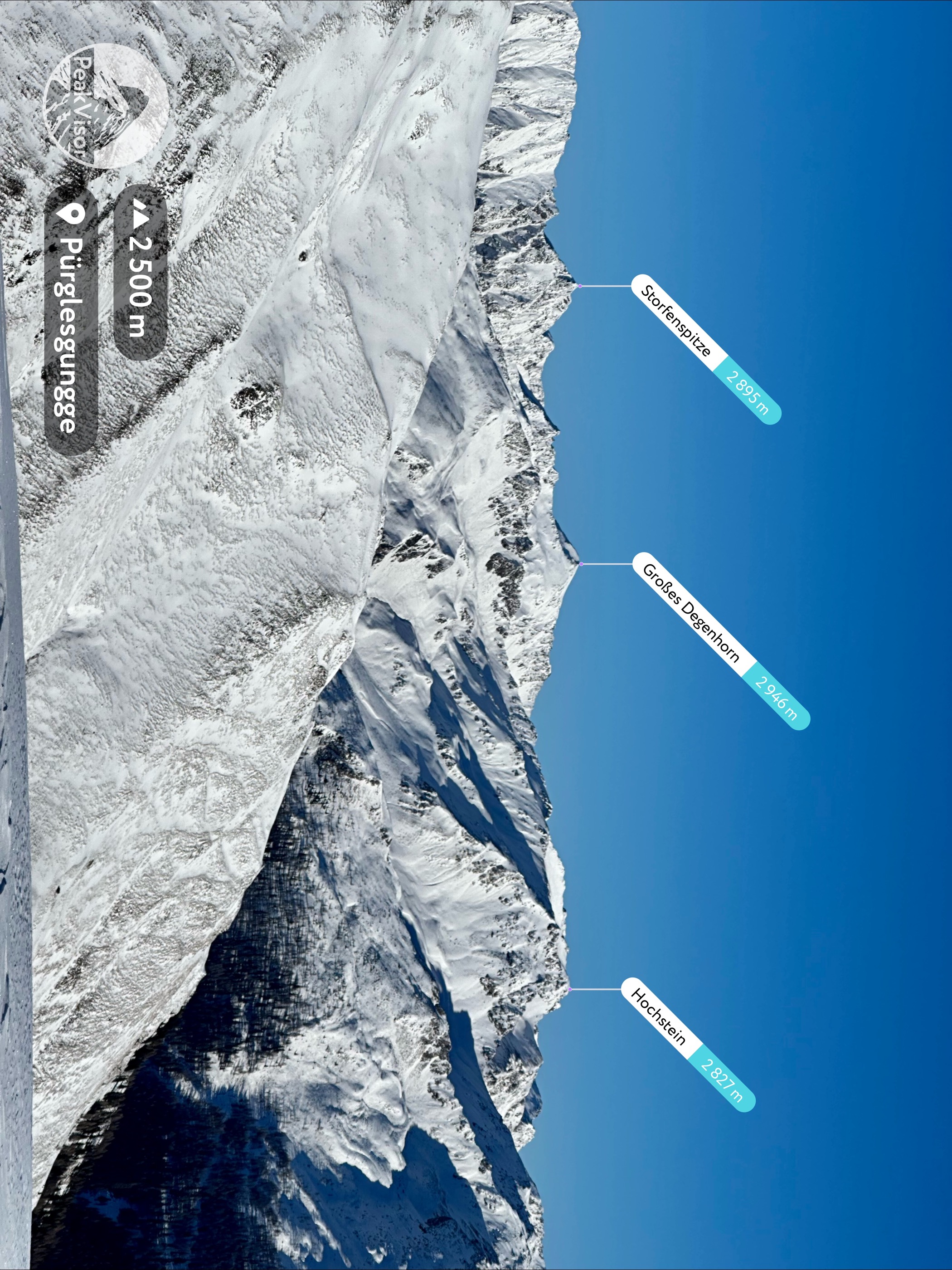
The normal route to Großes Degenhorn is fairly leisurely, thanks partly to the Brunnalmbahn cable car, which takes you up to Wassermythos Ochsenlacke, a popular recreation area. Follow the signposted trails towards Ochsenlenke (2,744 m / 9,003 ft), where there are spectacular views of the Defereggental.
Continuing along the path, you'll come across another highlight of this hike, Degenhornsee, a mountain lake that beautifully reflects the surrounding summits.
You'll soon reach Großes Degenhorn's summit via Kleines Degenhorn (2,849 m / 9,347 ft). Return the way you came. This hike from Brunnalm to Großes Degenhorn is approximately 10 km (6.2 mi) long.
Toblacher Pfannhorn (Corno di Fana) (2,663 m / 8,737 ft) is perched on the Austrian-Italian border and is among the highest southern peaks in the Villgraten Mountains. It's located at a distinct bend in one of the longest ridges in the subgroup, overlooking the Pustertal, offering uninterrupted views of many nearby mountains.
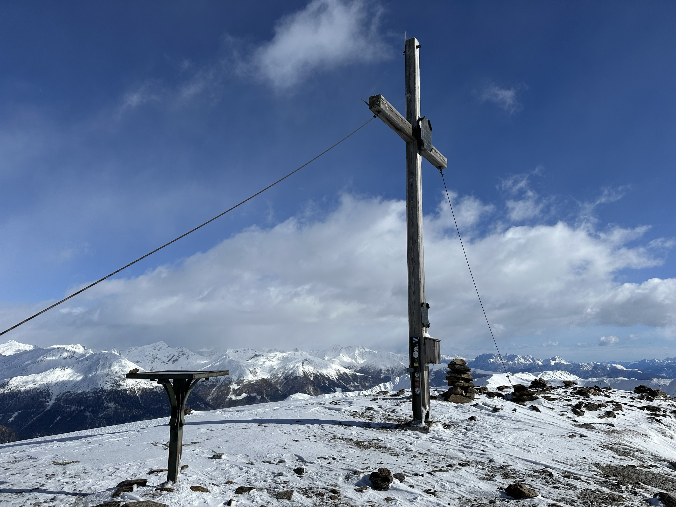
Toblacher Pfannhorn has become one of the most famous mountains in the range for two reasons: it has excellent views and is a simple, relaxing hike. One of the best routes to Toblacher Pfannhorn is from Kalkstein to the northeast.
Follow the trail from Alfenalm (1,710 m / 5,610 ft) to Ruschletalm (1,914 m / 6,280 ft). Cross the Alfneralm and climb uphill to Pfanntörl (2,505 m / 8,219 ft). Walk along Toblacher Pfannhorn's northwestern ridge to reach its summit cross. Descend the way you came. The hike from Kalkstein to Toblacher Pfannhorn is roughly 9.8 km (6 mi) long.
Lutterkopf (Monte Luta) (2,145 m / 7,037 ft) is one of the most popular summits on the Italian side of the Villgraten Mountains. Sandwiched between the Val di Casies and the Valle Anterselva, Lutterkopf is a grassy, gently sloping peak equally popular for hiking and ski touring.
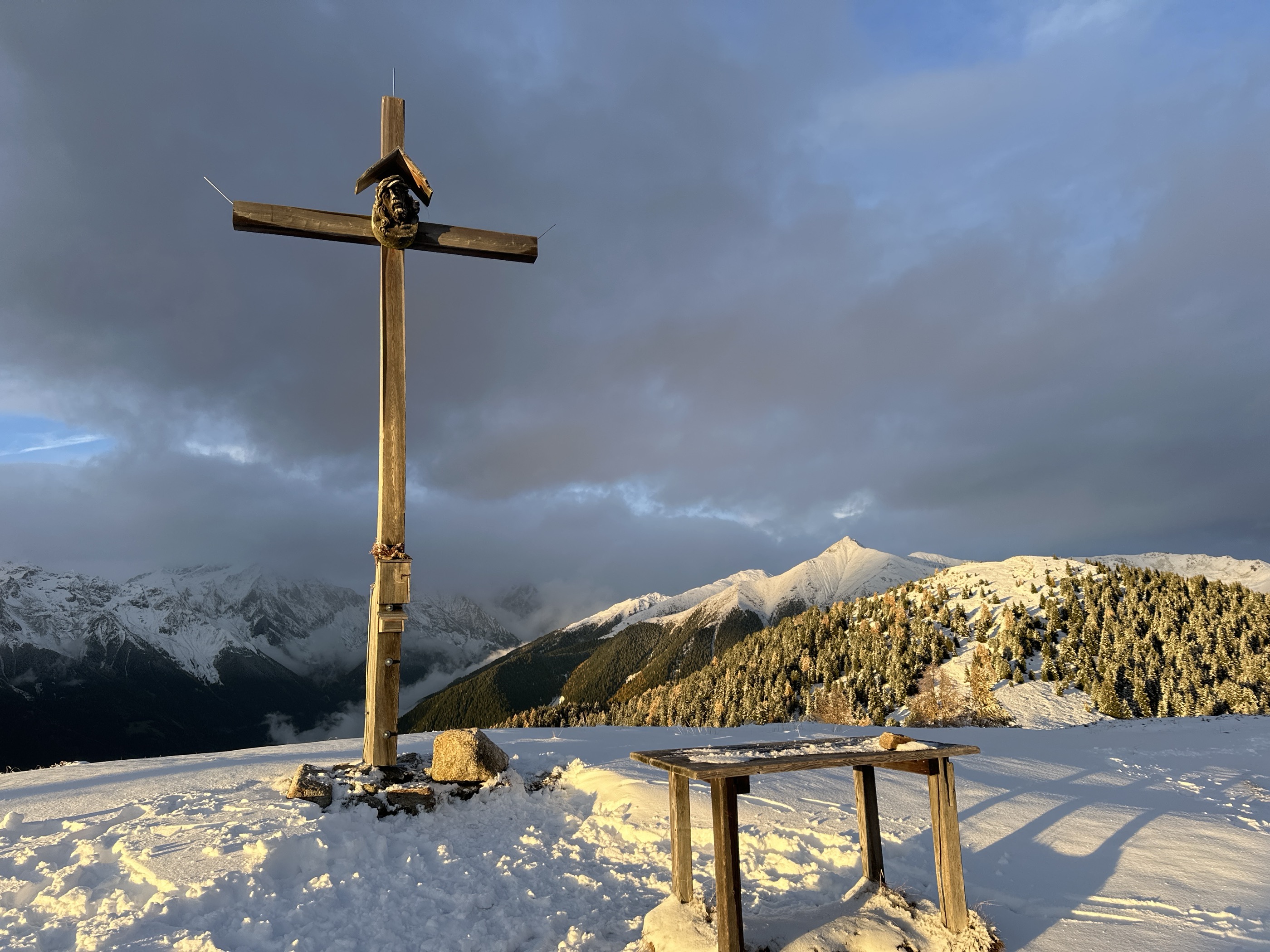
Lutterkopf is easy to climb but well worth visiting. Its summit affords outstanding panoramas of the Dolomites and the Upper Pustertal. One of the most popular routes up Lutterkopf is from the car park above Mudlerhof at roughly 1,584 m (5,196 ft).
Start by following trail no. 31 until it diverges to the right towards Lutterkopf. From Lutterkopf's summit, continue along the ridge on trail no. 31 and follow trail no. 33 until you reach Taistner Alm (Alpe di Tesido). Then follow trail no. 38A back to your starting point. The trail from Mudlerhof to Lutterkopf is approximately 10 km (6.2 mi) long.
Böses Weibele (2,521 m / 8,271 ft) and Hochstein (2,057 m / 6,749 ft) are two mountains at the far eastern end of the Villgraten Mountains overlooking Lienz. They're easy to climb and access, with Hochstein forming part of the Lienz Ski Resort. Böses Weibele's summit provides views of Lienz to the east and the Gailtal Alps to the south.
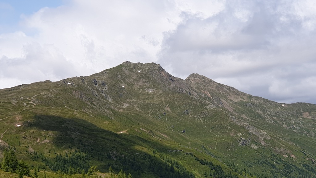
Somewhat confusingly, two other nearby mountains share the name or a similar name to Böses Weibele: Böses Weibele (Rosenköpfl) (2,599 m / 8,527 ft) in the Carnic and Gailtal Alps and Böses Weibl (3,119 m / 10,233 ft) in the Schober Group.
The most popular route to Böses Weibele begins from the Parkplatz Hochsteinhütte. It's worth noting this is a toll road. The route leads over an alpine pasture along the mountain ridge, following trail no. 9. You'll reach Böses Weibele's summits via Rastl (2,416 m / 7,927 ft).
Descend the way you came. The hike from the Parkplatz Hochsteinhütte to Böses Weibele is approximately 8.8 km (5.5 mi) long.
Several minor ski resorts are dotted across the Villgraten Mountains, which are terrific locations for skiing without large crowds. All significant ski resorts are on the Austrian side of the border.
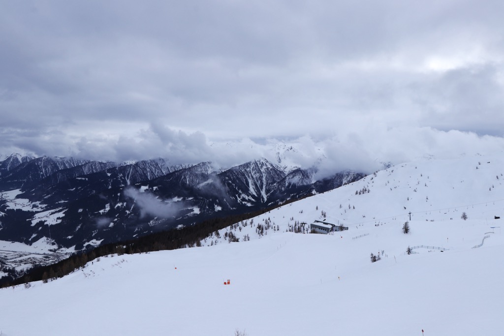
The main ski resorts in the Villgraten Mountains are as follows:
Despite being relatively unknown compared to the surrounding High Tauern, the Villgraten Mountains' valleys and mountains offer several unforgettable ski tours. The Villgratental stands out as being especially excellent for off-piste skiing.
Here's a quick guide to a couple of the most popular Villgraten Mountains ski tours and some new features that make the PeakVisor App perfect for planning your next winter getaway.
Rotes Kinkele (2,763 m / 9,065 ft) is one of the classic ski-touring mountains encircling the Villgratental. With alpine pastures, serene forest trails, and idyllic slopes, Rotes Kinkele's ski tour offers everything you could want from a winter off-piste adventure in the Villgraten Mountains. The best time to attempt this ski tour is between December and April.
You can pick up this ski tour from Schettlet, the highest farmland in East Tyrol (Osttirol). Alternatively, you can start from Arntal. Both routes lead to Kamelisenalm and across the south-facing slopes of the valley.
The tour follows the mountain's summer trail, traversing Rotes Kinkele's short northern ridge to the summit. Descend via the summer trail. This ski tour of Rotes Kinkele is approximately 4.6 km (2.8 mi) long.
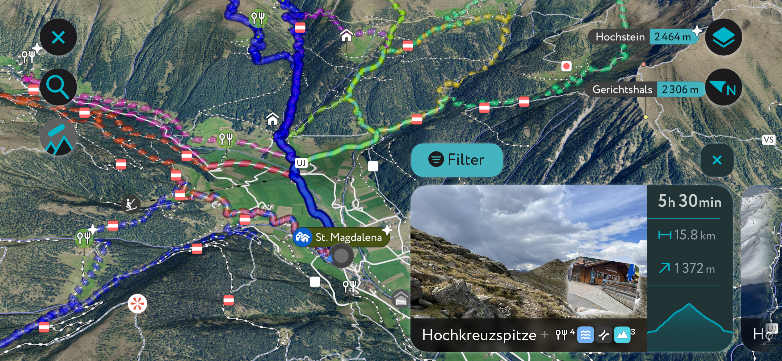
Hochkreuzspitze (2,739 m / 8,986 ft) is excellent if you're searching for a ski tour starting within the Defereggental. Following toboggan runs and forest trails, Hochkreuzspitze's ski tour is nice and varied, with its summit affording panoramas of the Sexten Dolomites and the Gsiesertal. The best time to attempt this ski tour is between January and April.
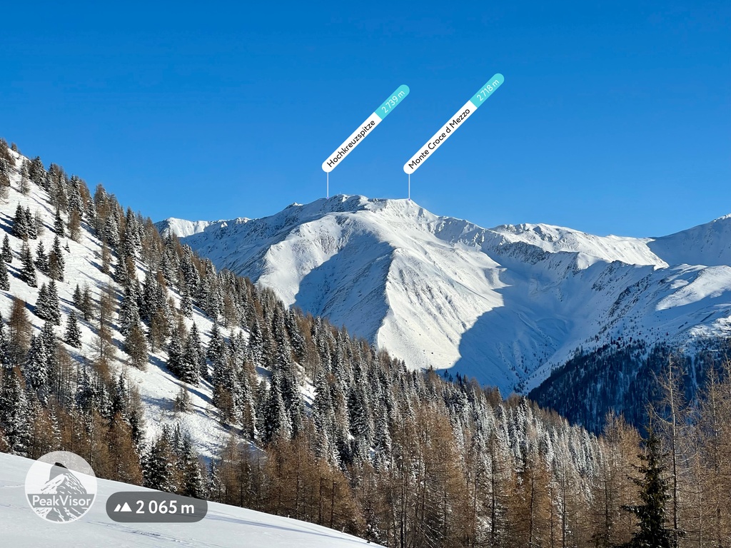
This ski tour of Hochkreuzspitze starts from Mariahilf-Kapelle to the west of St Jakob in Defereggen. From Rinderschinken, you'll follow the toboggan runs south past Schlieten Hitte (1,691 m / 5,548 ft). Continue along the same green-signposted trail until you reach a fork in the trail, from which you head towards Stalle Alm.
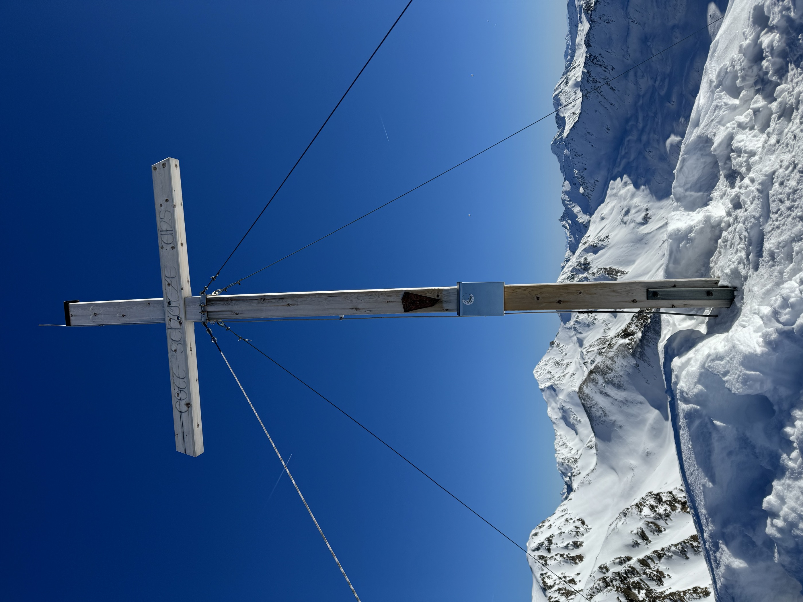
Eventually, you'll loop west to the Pfoischarte (2,607 m / 8,556 ft), from which you'll head northwest, zig-zagging up the mountain slopes to reach Hochkreuzspitze. As its name suggests, a large cross marks Hochkreuzspitze's summit. Descend the way you came. This ski tour from Mariahilf-Kapelle to Hochkreuzspitze is approximately 8 km (5 mi) long.
Sandwiched between the hugely popular High Tauern and the otherworldly Dolomites, the Villgraten Mountains are at the heart of the European Alps, one of our most thoroughly mapped areas.
You can now get the latest weather forecasts and snow depths directly through the PeakVisor App. We've also added the latest information on hundreds of mountain huts worldwide, including opening hours, dining options, and overnight accommodation.
The new "Discover" feature highlights the best hiking routes and ski tours in your area, making it easier than ever to plan the perfect adventure.
The Villgraten Mountains offer a variety of places to stay, from quaint villages tucked away in sweeping valleys to the largest settlements in East Tyrol.
Salzburg Airport is the nearest international airport to the Villgraten Mountains, located roughly 170 km (105 mi) northeast of Lienz.
Lienz is the largest settlement in East Tyrol, with a population of just under 12,000. It's on the eastern tip of the Villgraten Mountains, where the Isel and Drava rivers meet.
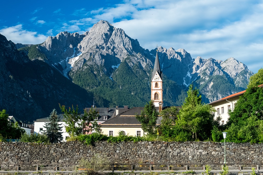
Encircled by the stunning Lienzer Dolomites with the Villgraten Mountains to the east, the Schober Group to the north, and the Gailtal Alps to the south, Lienz is an ideal base for hikers. Lienz is located within 10 km (6 mi) of popular mountains like Hochstein, Spitzkofel (2,717 m / 8,914 ft), and Kreuzkofel (2,694 m / 8,839 ft).
Lienz is easily accessible, sitting on a road junction between the Felbertauernstraße and the Drautalstraße. The Drava Valley Railway (Drautalbahn) connects Lienz to Vienna and Villach.
Sillian is the second-largest settlement in the Villgraten Mountains. It's significantly smaller than Lienz, with a population of just over 2,000. Sillian is located on the southern boundary of the Villgraten Mountains within the Hochpustertal.
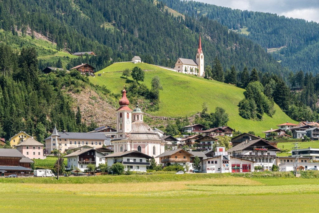
A small market town, Sillian is perfect for skiers — a cable car leads directly up neighboring Thurntaler (2,408 m / 7,900 ft), which is part of Sillian's ski resort. Sillian is also a starting point for the 168 km (104 mi) long Carnic Alps High Trail.
Famous mountains within 10 km (6.2 mi) of Sillian include Hornischegg (Monte Arnese) (2,549 m / 8,366 ft), Toblacher Pfannhorn, and Hochrast (Pausa Alta) (2,436 m / 7,992 ft).
Sillian is connected by train to major towns like Lienz, Bolzano, and Villach.
Innervillgraten is the largest settlement in the interior of the Villgraten Mountains, with just under 1,000 people. Innervillgraten came to national attention in the 1980s following the alleged murder of local lumberjack Pius Walder, which has been adapted into several films and books.
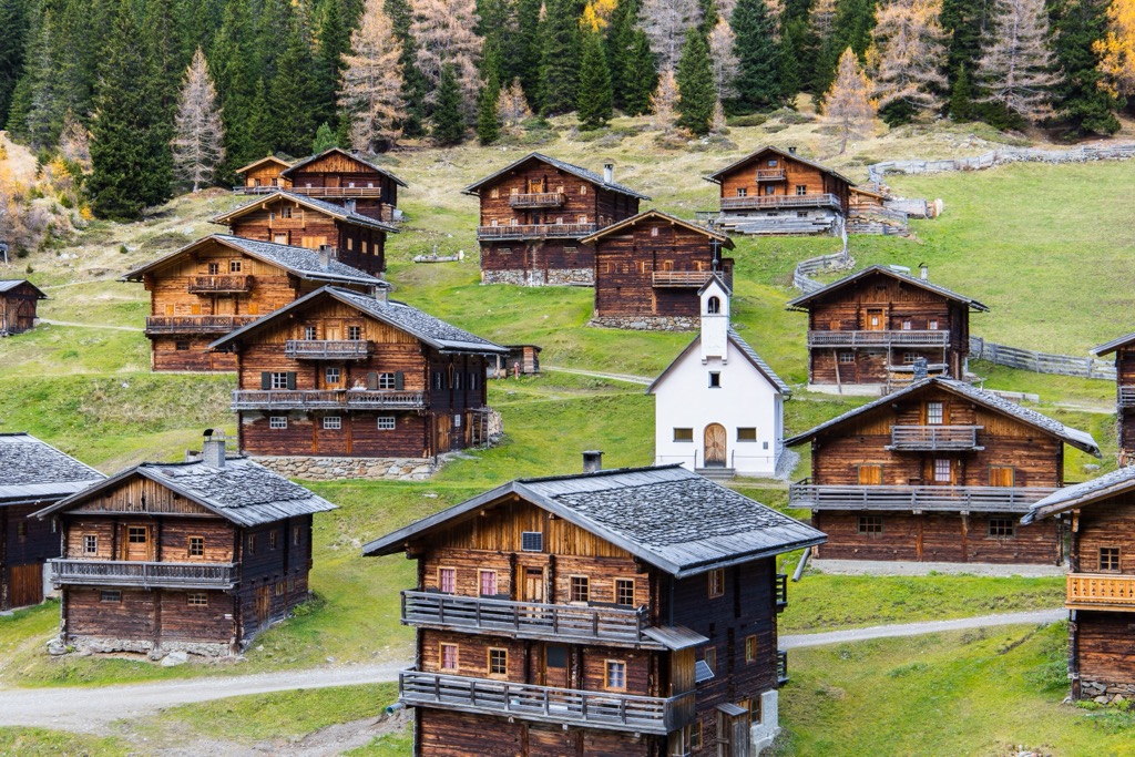
Innervillgraten is home to several hotels and guesthouses and is perfectly positioned for exploring the best mountains around the rim of the Villgratental, including Großes Degenhorn, Hochgrabe, and Toblacher Pfannhorn.
Explore Villgraten Mountains with the PeakVisor 3D Map and identify its summits.


