
Scan the QR code and open PeakVisor on your phone
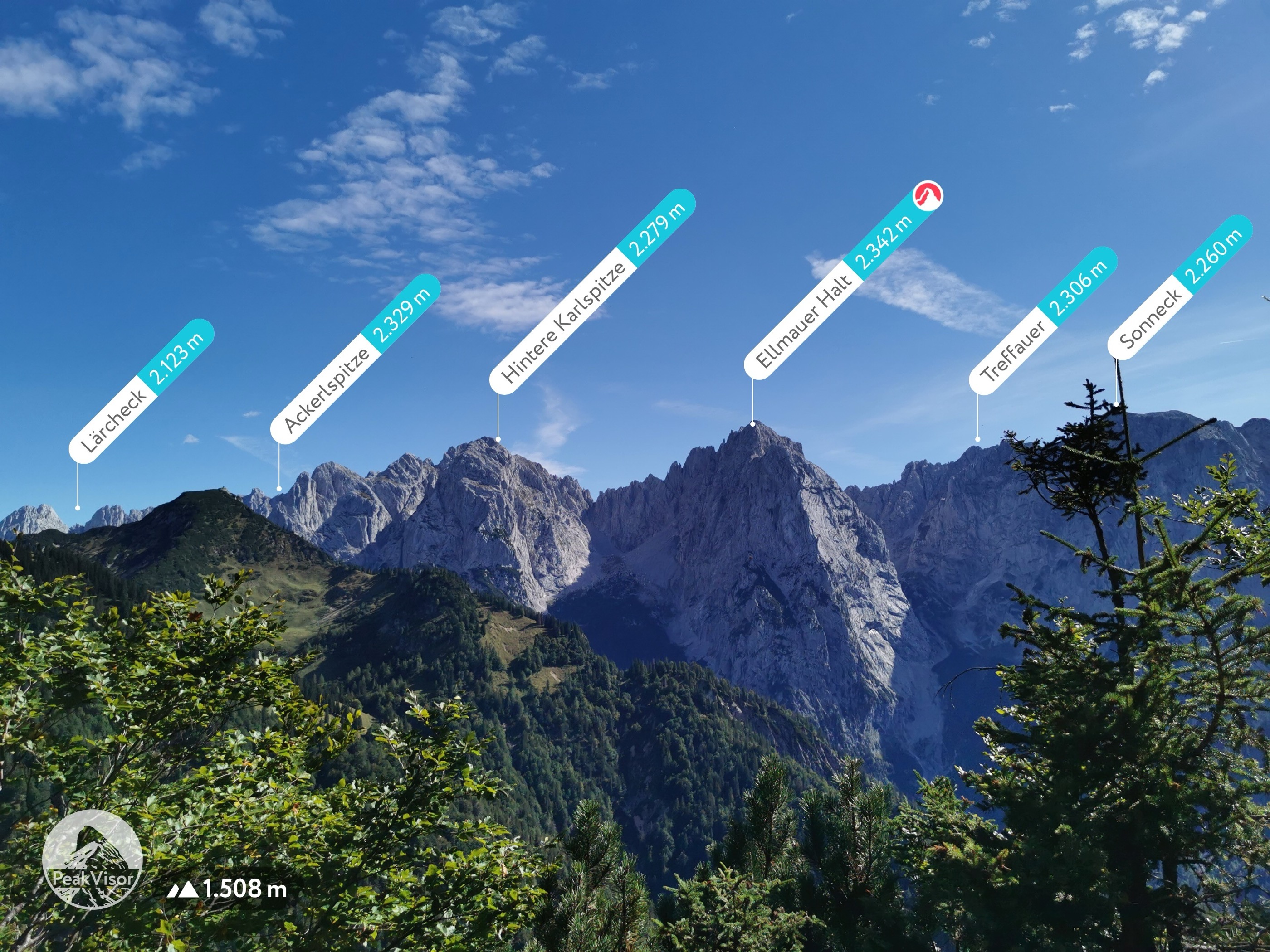
The Wilder Kaiser include 93 named peaks. The highest is Ellmauer Halt at 2,342 m. Other notable peaks include Ackerlspitze, Treffauer and Gamshalt.
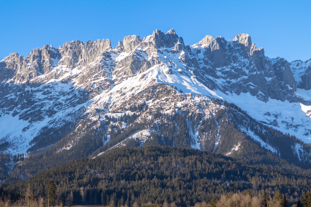
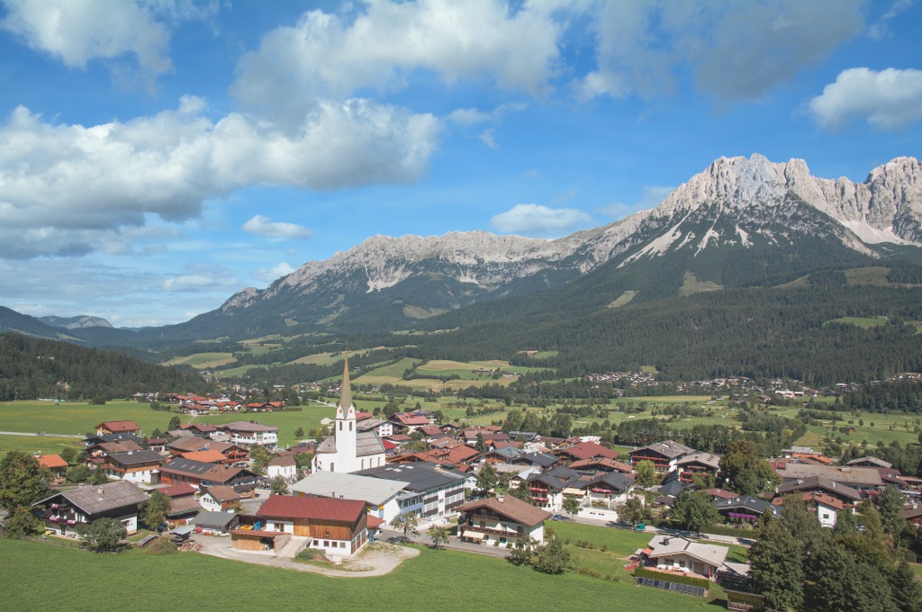
The Wilder Kaiser is a mountain range in Tyrol, Austria, that forms part of the Kaiser Mountains (Kaisergebirge). The Wilder Kaiser offers world-famous rock climbing routes, spectacular scenery, and one of Europe's highest-rated ski areas — all within an hour's drive of Munich, Innsbruck, and Salzburg. There are 93 named mountains in the Wilder Kaiser. The highest and most prominent mountain is the Ellmauer Halt (2,344 m / 7,690 ft).
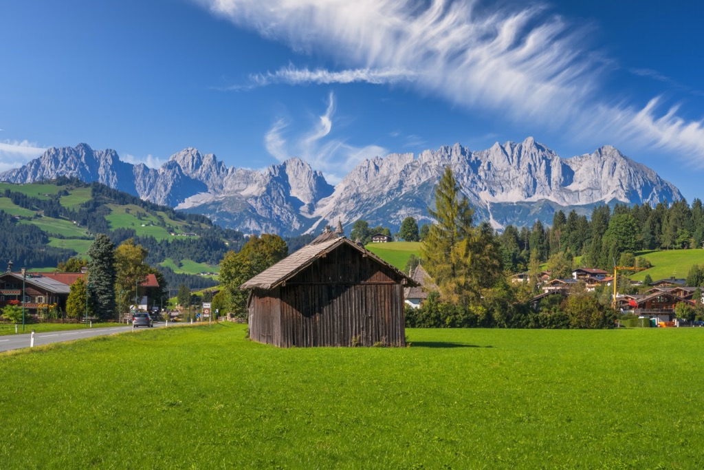
The Wilder Kaiser is one of two main ridges comprising the Kaiser Mountains in eastern Tyrol, spanning approximately 20 km (12.5 mi) from east to west between Kufstein and Sankt Johann in Tirol. Wilder Kaiser is the southern of these two ridges and is separated from the northern Zahmer Kaiser by the Kaiserbachtal to the east and the Kaisertal to the west on either side of the Stripsenjoch (1,574 m / 5,164 ft)
The Wilder Kaiser is higher than the Zahmer Kaiser and home to the three highest summits in the group: the Ellmauer Halt, Ackerlspitze (2,329 m / 7,641 ft), and Treffauer (2,304 m / 7,559 ft). All major summits in the Wilder Kaiser and Zahmer Kaiser fall within the boundaries of the 92.6 sq km (35.7 sq mi) Kaiser Mountains Nature Reserve (Kaisergebirge Naturschutzgebiet).
The Kaiser Mountains are part of the Northern Limestone Alps and are surrounded by five other groups:
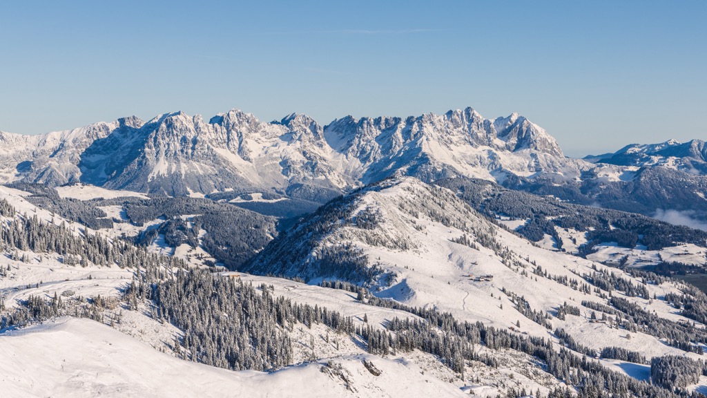
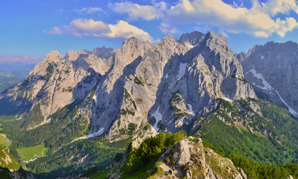
Despite being the third-highest range in the vicinity, the Kaiser Mountains are among the lowest and smallest groups in the Alps, with no summits exceeding 2,350 m (7,710 ft).
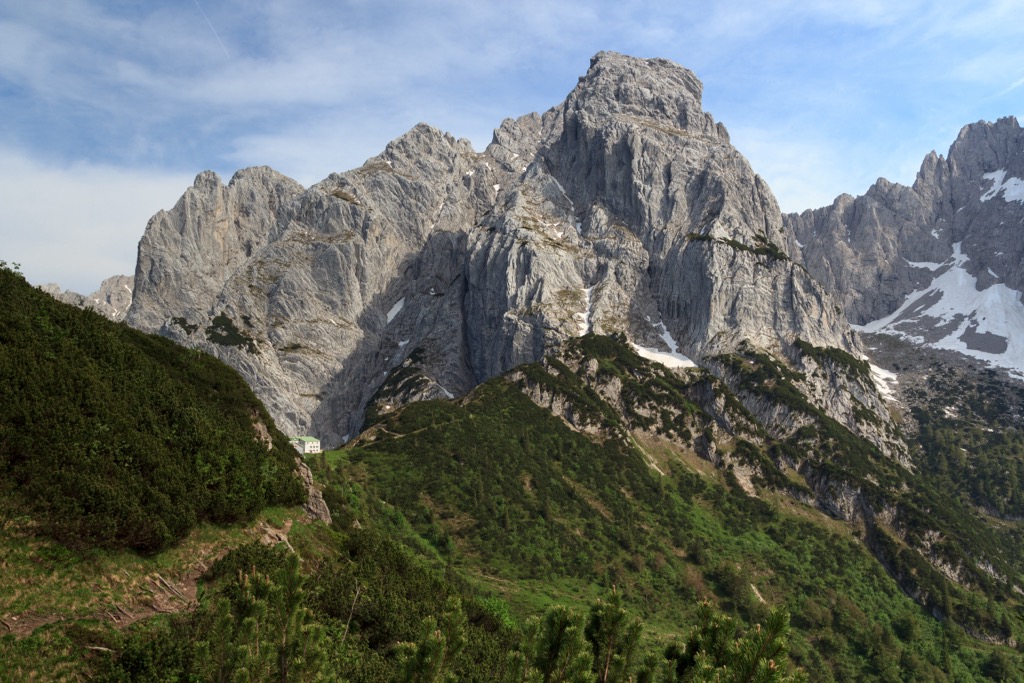
The Wilder Kaiser more than makes up for its modest height with its sheer rock faces and numerous climbing opportunities. Its rugged topography draws in adrenaline-seekers from around the globe who want to try their hand at some of the most famous rock-climbing routes in the Northern Limestone Alps, like Fleischbank (2,187 m / 7,172 ft) and Totenkirchl (2,190 m / 7,185 ft).
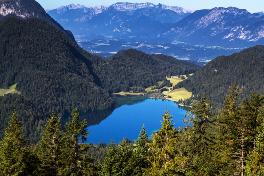
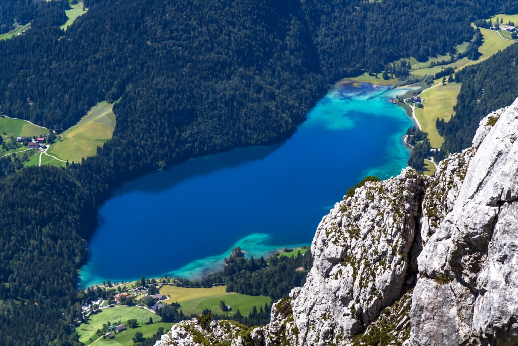
The largest lake in the Wilder Kaiser is Hintersteiner See, covering an area of 56 hectares (140 acres). It's located southwest of the Wilder Kaiser near the Scheffauer (2,111 m / 6,926 ft) and is a popular public swimming spot.
Kufstein, the second-largest settlement in Tyrol, is easily the largest settlement near the Wilder Kaiser. Its population is nearly double that of its next largest town, Sankt Johann in Tirol.
Popular ski resort villages in the Wilder Kaiser include Ellmau, Going, Scheffau, and Söll. These villages are adjacent to the SkiWelt Wilder Kaiser, the Wilder Kaiser's main ski area.
The Wilder Kaiser began forming approximately 250 million years ago during the Early Triassic when the region lay underneath the ancient shallow Tethys Sea.
The Wilder Kaiser's basement is composed of sandstone, including Bunter sandstone, formed from sediment deposited on the Tethys's seafloor. These sandstones lay atop the greywacke zone, a band of hard sandstone comprising the entire North Limestone Alps' basement layer.
The Wilder Kaiser's summits consist primarily of Wetterstein limestone (Wettersteinkalk) and dolomite. Wetterstein limestone, formed from reef sediment under the Tethys Sea, is up to 1,000 m (3,280 ft) thick in the Wilder Kaiser, matching the maximum height of the range's rock faces.
The Scheffauer at the Wilder Kaiser's eastern end is one of the best places to study the range's geological makeup. Here, geologists have identified fossilized tubes of green algae, and the summit comprises fossilized sponges and coral reefs.
At the top of the Wilder Kaiser's rock strata is Main Dolomite (Hauptdolomit), named due to its thickness compared to underlying dolomite in the Alps. Main Dolomite formed in shallow lagoons during the Late Triassic and is dark in color due to high concentrations of algae growth.
The Alpine Orogeny, a mountain-building event that commenced approximately 66 million years ago, closed the Tethys Sea and moved the Wilder Kaiser into its current position.
Convergent movement between the Arabian, African, Indian, and minor Cimmerian tectonic plates to the south with the Eurasian plate to the north created the Wilder Kaiser and the Alps. The Alpine Orogeny also helped create many other mountain ranges across Eurasia and North Africa, including the Himalayas, the Carpathians, and the Atlas Mountains.
The Wilder Kaiser is part of the Kaisergebirge Nature Reserve, protecting the range's natural diversity and pristine lakes and rivers.
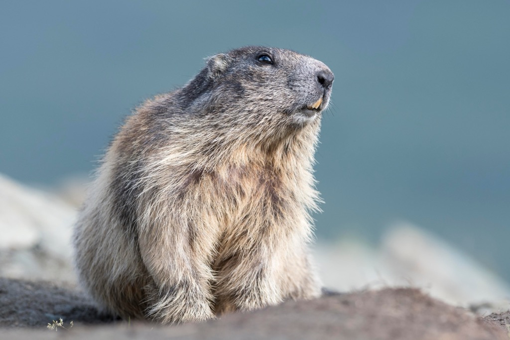
Chamois and marmots are among the most common mammals hikers will encounter high up in the Wilder Kaiser. Snow voles and mountain hares also live on the mountain slopes but are more elusive. Within the Wilder Kaiser's forests, red deer, roe deer, squirrels, foxes, and badgers hide amongst the foliage.
A wide variety of bird species thrive within the Wilder Kaiser. Predatory species include golden eagles, pygmy owls, northern goshawks, and Eurasian sparrowhawks. Other bird species include red-breasted flycatchers, wood warblers, alpine choughs, crag martins, alpine willow tits, alpine wallcreepers, capercaillies, and ravens.
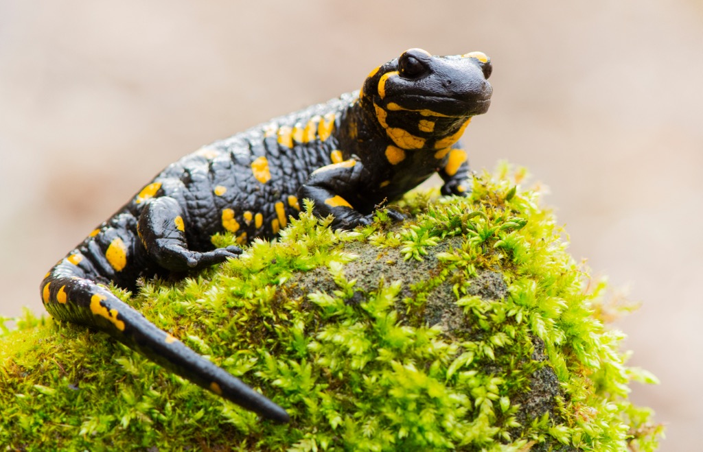
The common European adder is the only venomous snake species in the Wilder Kaiser. It's usually found hiding in bushes or under rocks and can live at over 3,000 m (9,842 ft) in elevation. Its bite is painful but rarely fatal. Other reptile and amphibian species in the Wilder Kaiser include fire salamanders, alpine salamanders, and smooth snakes.
The last glacial period isolated several insect and mollusk species within the Kaiser Mountains, which are considered endemic to the region. These species include a yellow-green earthworm (Allobobophora smaragdina) and a species of door snail.
The Wilder Kaiser boasts roughly 940 flowering plant species, 400 moss species, and 100 fungi species. As with the whole of Austria, the Wilder Kaiser is heavily forested, with forest compositions varying with elevation.
The Wild Kaiser's lowest forests are made up of beeches, white firs, and spruces. At higher elevations within the submontane, ashes, sycamore maples, and alders are more common. At the highest elevations up to the treeline, mountain pines flourish alongside dwarf shrubs like alpenroses.
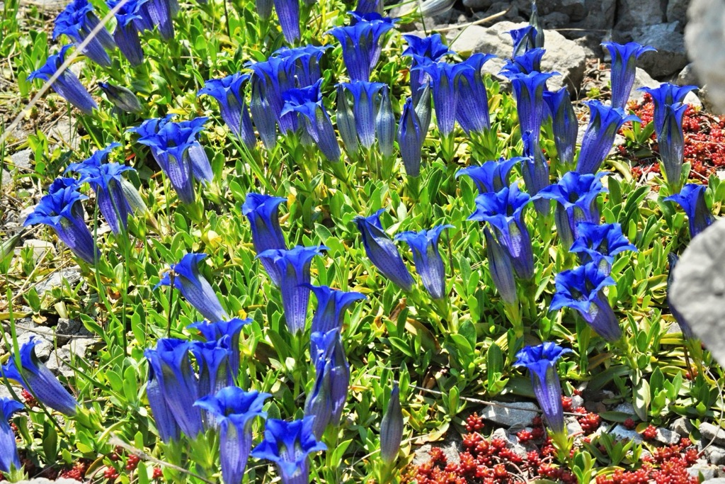
Atop the Wilder Kaiser's summits, alpine meadows reign supreme. Here, an array of flowering plants blossom across these expansive tundras, including edelweiss, yarrows, red vanilla orchids, trumpet gentians, mountain arnica, primroses, and pasque flowers.
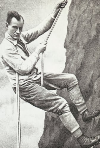
In the mid to late 19th century, the Kaiser Mountains became a hub for the Munich-based climbing community. The range's sheer limestone walls were perfect for developing hiking techniques and testing the skills of top climbers.
Hans Dülfer, considered one of the fathers of free climbing and creator of the Dülfer Seat abseiling technique, spent several years in the 1910s within the Wilder Kaiser. Its tricky technical climbs helped push Dülfer to develop several groundbreaking climbing techniques.
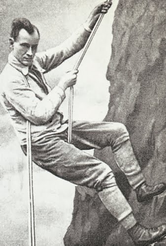
In 1911, Dülfer made the first ascent of one of Totenkirchl's chimneys, which is now nicknamed Dülfer's Chimney. In 1913, he became the first person to climb Totenkirchl's difficult western face.
One of Dülfer's crowning achievements was climbing the gap between Christaturm (2,233 m / 7,326 ft) and the Fleischbank solo, graded UIAA V+ on modern climbing scales. Other climbers considered the best of their generation, including Paul Preuß, also honed their skills in the Wilder Kaiser.
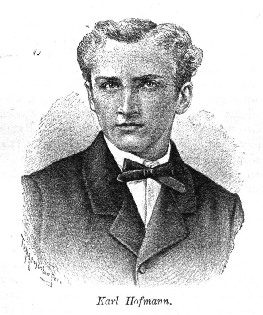
The Ellmauer Halt's first documented ascent by a tourist was on June 29, 1869, by Karl Hofmann, with local Johann Schlechter as a guide. They ascended from Wochenbrunneralm (1,081 m / 3,547 ft) via the Rote Rinnscharte (2,100 m / 6,890 ft).

Hofmann was co-founder of the German Alpine Club and is credited with many first ascents, including Hochgall (3,436 m / 11,273 ft), the Rieserferner Group's highest summit.
The Wilder Kaiser also played a role in making mountain climbing recognized internationally. Fritz Wiessner, one of the first mountaineers to attempt K2 (8,611 m / 28,251 ft), made the first ascent of Fleischbank's southeast face (VI+) at age 25. Wiessner was among the world’s best climbers; his ascent up Fleischbank was one of the hardest ascents recorded at the time. His K2 expedition nearly summitted, 11 years before Herzog et al reached the top of Annapurna and marked the first ascent of an 8,000-meter peak. Weissner emigrated to the United States in 1929 to help raise the American Alpine Club's (AAC) stature and was an active member of the East Coast climbing community into his mid-eighties.
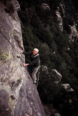
In 1977, the Pumprisse route of Fleischbank became the first ascent in the Eastern Alps to be graded UIAA VII. Reinhard Karl and Helmut Kiene were the first to complete this route. Reinhard Karl is famous for being the first German to climb Mount Everest (8,848 m / 29,031 ft).
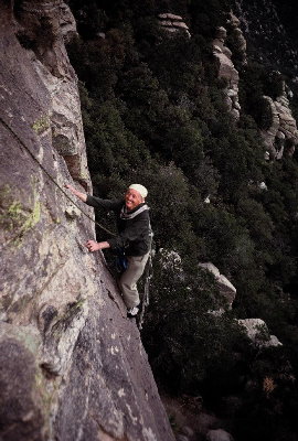
Many other extreme climbing routes opened in the Wilder Kaiser in the 1970s and 1980s, the hardest of which is the Des Kaisers neue Kleider (The Emperor's New Clothes) on Fleischbank, graded UIAA X+.
These climbing routes, coupled with improved skiing and hiking infrastructure, have further increased the Wilder Kaiser's popularity over the decades.
Award-winning hiking trails, world-famous climbing routes, and one of the largest ski areas in Europe await visitors in the Wilder Kaiser.
Due to falling rocks, wearing a helmet when hiking or climbing on many of the Wilder Kaiser's peaks is essential. Ensure you bring appropriate hiking gear and plenty of provisions. Map out your route carefully, check local weather forecasts, and inform others of your itinerary. The best time to climb the Wilder Kaiser's summits is June to October.
You can learn more about the rock climbing scales in this guide here.
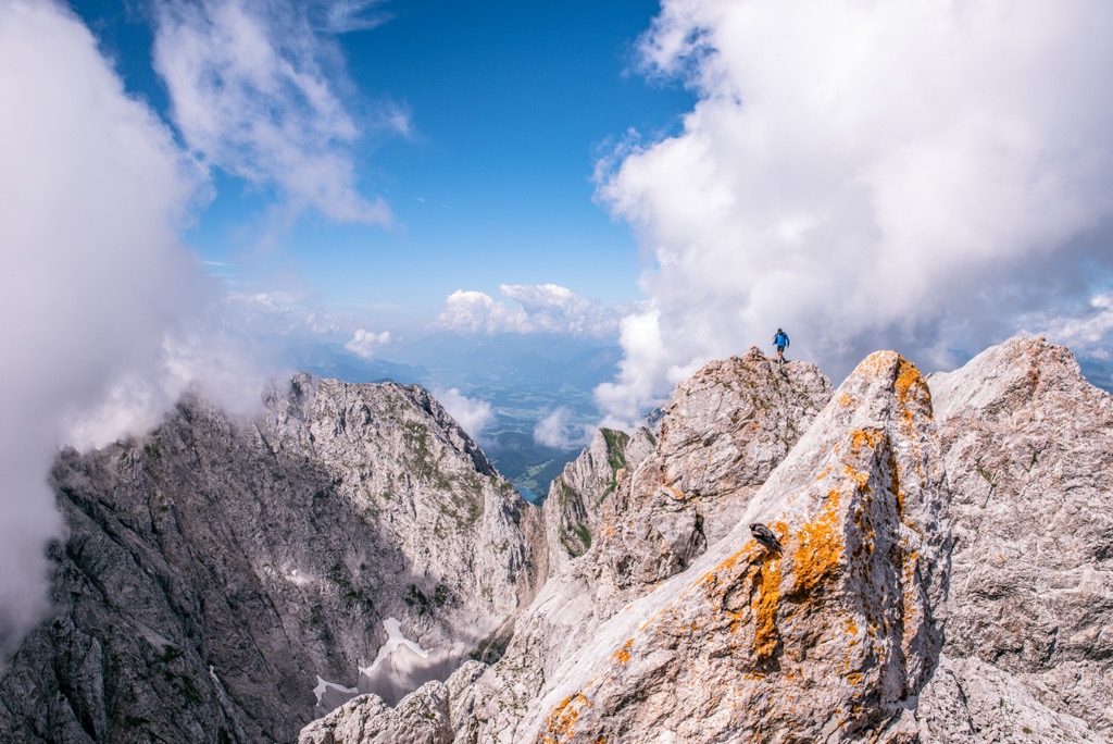
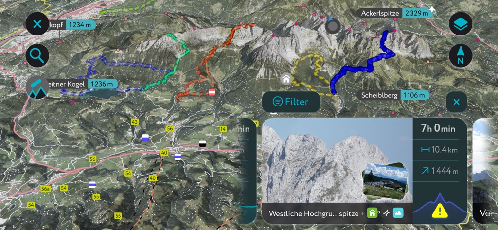
The Ellmauer Halt (2,344 m / 7,690 ft) is the Kaiser Mountains' highest summit and one of the range's most popular climbs. It's located at the center of the Wilder Kaiser to the west of the Ellmauer Tor (1,980 m / 6,496 ft) and the Kapuzenturm (2,303 m / 7,556 ft) rock needle.
An isolated central summit, the Ellmauer Halt provides one of the finest panoramas of the Kaiser Mountains. The Ellmauer Halt's normal route begins at Wochenbrunneralm (1,081 m / 3,547 ft) in Ellmau.
Rockfalls are common on the Ellmauer Halt, so helmets are a must. A climbing harness and via ferrata set are recommended. The Ellmauer Halt's normal route includes some UIAA I - II scrambles but nothing too technical.
From Wochenbrunneralm, follow trail 825 to Gruttenhütte (1,620 m / 5,315 ft) before ascending the Hochgrubach gravel cirque. Then, you'll climb the Gamsängersteig via ferrata to reach Jägerwand below the Rote Rinnscharte.
Then, you'll navigate a gorge with steel cable supports and climb a short ladder to reach Babenstuberhütte (2,296 m / 7,533 ft) and the Ellmauer Halt. Descend the way you came.
The normal route from Wochenbrunneralm to the Ellmauer Halt is approximately 9.3 km (5.7 mi).
Ackerlspitze (2,329 m / 7,641 ft) and Maukspitze (2,231 m / 7,319 ft) are neighboring summits east of the Ellmauer Halt overlooking the Kaiserbachtal Valley.
The Wilder Kaiser's second-highest mountain, Ackerlspitze (2,329 m / 7,641 ft), is a towering summit with the picturesque Griesener Cirque (Griesenerkar) to its north. From the summit are breathtaking views of Going, the Hohe Tauern, and the western Wilder Kaiser.
Ackerlspitze flanked by Östliche Hochgrubachspitze (2,284 m / 7,493 ft) and Westliche Hochgrubachspitze (2,277 m / 7,470 ft), Stefan.straub, CC BY-SA 4.0, via Wikimedia Commons
You can pick up the trail to Ackerlspitze and Maukspitze from the Tannbichl Wanderparkplatz. This hike includes rock climbing sections graded between UIAA I and II+.
Follow the 826 trail towards Obere Regalm (1,230 m / 4,265 ft). The trail continues through pine forests to Ackerlhütte and onto the Niedersessel. The Niedersessel includes a UIAA grade I climb 20 m (65 ft) along the criques edge and up a sheer rock face to reach the Hochsessel.
From the Ackerlschneid saddle (2,121 m / 6,959 ft), more low-grade climbing is required to reach Ackerlspitze. You'll then return to the saddle and follow the exposed ridge to Maukspitze. To descend, you'll follow the southeastern trail from Maukspitze to the Niedersessel and descend the way you came.
The hike from Tannbichl to Ackerlspitze and Maukspitze is approximately 13 km (8 mi).
Despite being one of the Wilder Kaiser's lowest peaks, the Scheffauer (2,111 m / 6,926 ft) is among the most visited in the range. It sits at the far western end of the Wilder Kaiser, overlooking the Hintersteiner See.
Its north and south faces include sheer 600 m (1,968 ft) high rock faces, making Scheffauer an imposing yet sublime mountain to conquer. From the summit are spectacular views of the Inntal Valley and Hintersteiner See. It's worth noting that the Scheffauer's secured ropes are not tensioned in winter.
You can climb the Scheffauer via its north and south faces. The most popular routes are the Widauersteig (north face) and its normal route (south face) from Bärnstatt in Scheffau via Steiner Hochalm (1,258 m / 4,127 ft). The Widauersteig route passes by Kreuzbichl (1,120 m / 3,937 ft), a popular viewpoint.
The normal route via the south face is longer yet easier, with just a few secured rope passages graded UIAA I. From the car park near Bärnstattalm (3,005 ft), follow the signposts for Scheffauer to Steiner Hochalm. Then, follow the 814a until you reach the turning for Scheffauer.
The route then becomes more complex, with secured ropes on a steep area called Wasserloch. From atop the Scheffauer's ridge, there is a short hike to the summit. Descend the way you came.
The normal route to the Scheffauer from Bärnstattalm is approximately 8 km (5 mi).
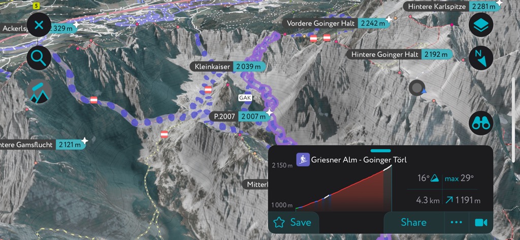
Hintere Goinger Halt (2,192 m / 7,191 ft) is one of the Wilder Kaiser's most accessible summits despite being only 150 m (492 ft) shorter than Ellmauer Halt. It's a double summit, along with Vordere Goinger Halt (2,242 m / 7,356 ft), located just east of Ellmauer Tor near Karlspitzen (2,281 m / 7484 ft) and the Fleischbank.
Hintere Goinger Halt is one of the most visited summits in the Wilder Kaiser because of its height and easy ascent. The summit affords stunning views of the Hohe Tauern to the south, the Steinerne Rinne cirque, and Lake Chiemsee. A helmet is needed when climbing Hintere Goinger Halt.
The hike to Hintere Goinger Halt begins at Wochenbrunneralm (1,081 m / 3,547 ft). Follow the path to Gaudeamushütte and continue along the 812/813 trail towards Ellmauer Tor. From the Jubiläumssteig junction, follow the 812 trail to Ellmauer Tor. This section is steep and secured with steel ropes.
From Ellmuer Tor, follow signposts for Hintere Goinger Halt to the east. Some easy climbs up serpentines lead to the summit. Descend the way you came.
The hike from Wochenbrunneralm to Hintere Goinger Halt is approximately 9 km (5.6 mi).
The Kaiserkrone is a multi-day circular trail around the Wilder Kaiser, covering 58 km (36 mi) across five stages. With an altitude difference of over 4,000 m (13,123 ft), the Kaiserkrone includes visits to the finest mountain huts and viewpoints in the Wilder Kaiser.
Along your journey, you'll enjoy vistas of some of the Kaiserkrone's most famous mountains, including Totenkirschl, Fleischbank, Scheffauer, Ellmauer Halt, and Zettenkaiser (1,968 m / 6,457 ft). Großglockner (3,798 m / 12,461 ft, Lake Chiemsee, the Karwendel, Kitzbühel Alps, and the Leogang Mountains (Leoganger Steinberge) are among the best far-flung views from the Kaiserkrone.
The Kaisekrone also traverses several peaks, including Baumgartenköpfl (1,698 m / 5,571 ft), Tristecken (1,702 m / 5,584 ft), Feldberg (1,813 m / 5,948 ft), and Gscheuerkopf (1,280 m / 4,199 ft).
The five stages of the Kaiserkrone are as follows:
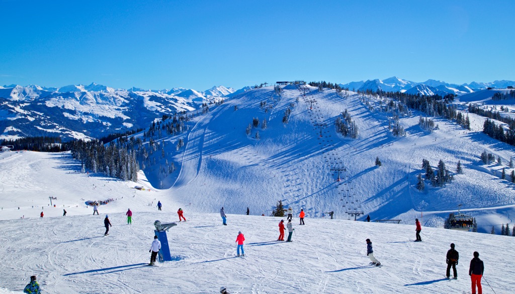
The Wilder Kaiser has one main ski resort: SkiWelt Wilder Kaiser-Brixental. It's part of one of Austria's largest ski resorts, with over 275 km (171 mi) of slopes and 81 ski lifts. Ellmau, Going, Scheffau, and Söll are all resort villages within SkiWelt.
Away from the famed SkiWelt resort, the Wilder Kaiser boasts exhilarating off-piste tours for skiers of all abilities.
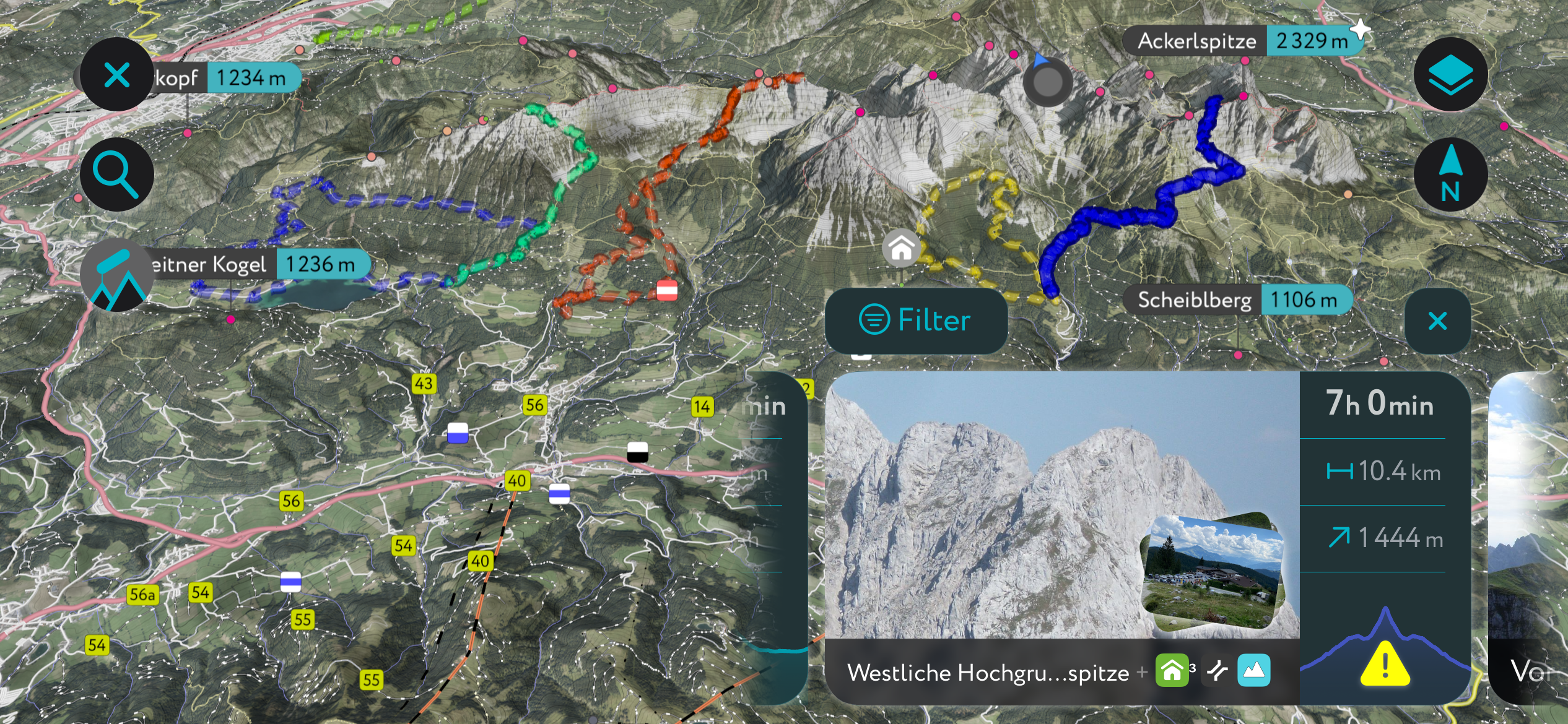
The Wilder Kaiser is in the middle of one of our most carefully mapped areas, with hundreds of detailed ski tours to discover across the Alps.
Here's a peek at a couple of the best ski tours in the Wilder Kaiser and some of the new features available on the PeakVisor App.
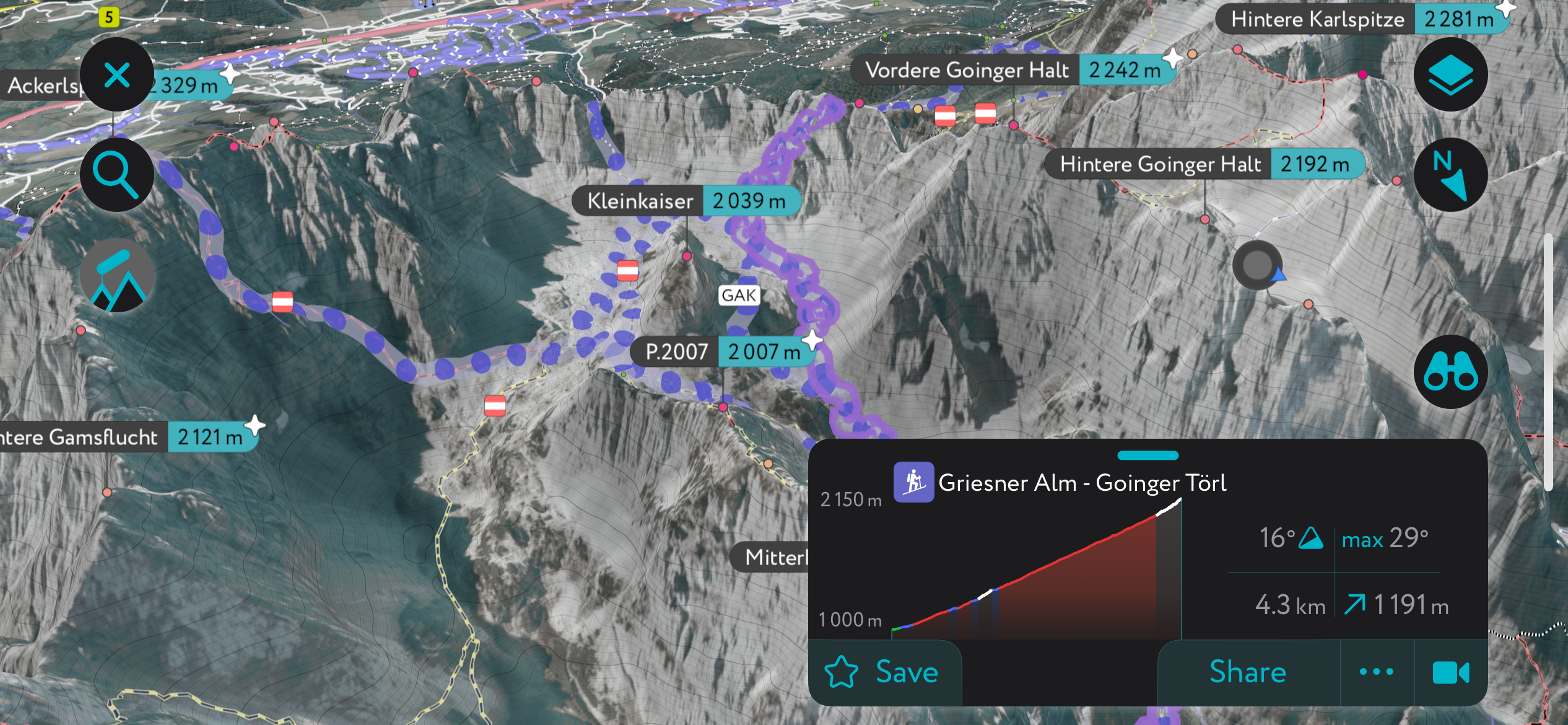
The beautiful Griesenerkar, or Griesener Cirque, via the Goinger Scharte (2,004 m / 6,575 ft) pass is one of the Wilder Kaiser's classic ski tours.
This north-facing tour is steep in places and best suited for experienced skiers. You can adjust your route depending on conditions and your ability. Due to the risks of avalanches, you should only undertake this tour later in the season or if you’re exceptionally confident in the snowpack’s stability.
Starting from the Griesener Alm (1,024 m / 3,360 ft), you'll head south through meadows and forests, following the path towards the Fritz-Pflaum-Hütte (1,865 m / 6,119 ft).
At the cirque, stay left to reach the Fritz Pflaum Hut and head west along the Griesenerkar's south side to reach Goinger Scharte. Alternatively, you can opt for a shorter tour by staying right to reach the saddle below Goinger Scharte and climbing directly up one of the cirque's gullies.
The Goinger Scharte has a 35° to 45° gradient and a narrow gully, making this part of the tour only suitable for experienced skiers. This tour is roughly 5 km (3 mi) and takes around 3 hours.
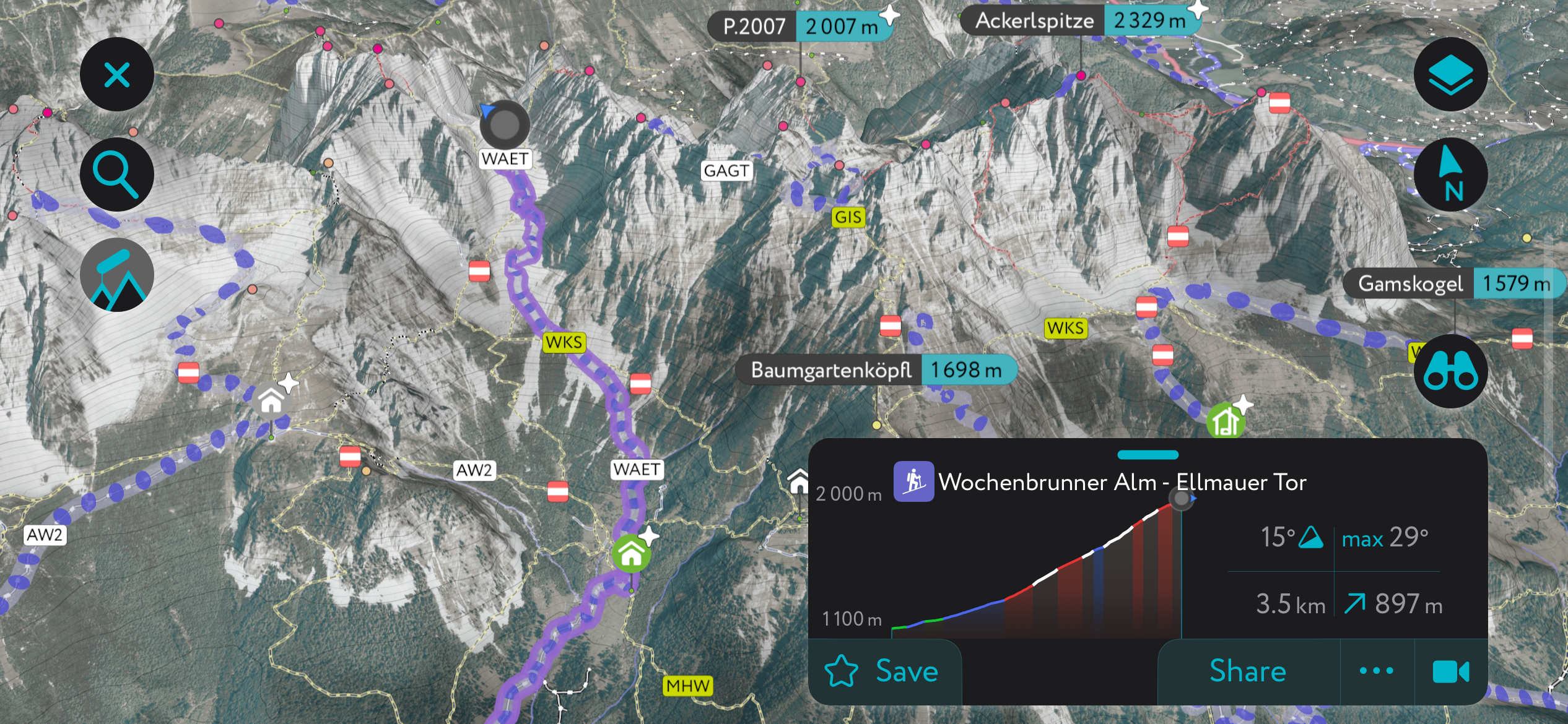
Another hugely popular tour of one of the Wilder Kaiser's sensational cirques is the climb through the Kübelkar via Ellmauer Tor (1,980 m / 6,496 ft).
Ellmauer Tor is not quite as steep as the Goinger Scharte but does have sections with 33° to 38° gradients. It's a south-facing tour, meaning conditions are usually good in spring — it's one of the best ski tours to undertake in March or April.
From Wochenbrunneralm (1,081 m / 3,547 ft), follow the trail north past Gaudeamushütte (4,144 ft), which is closed during winter. You'll enter on the right side of Kübelkar before climbing to Ellmauer Tor. From Ellmauer Tor, it's also possible to skin to Hintere Goinger Halt. Descend the way you came.
This ski tour of Ellmauer Tor is a 7 km (4.3 mi) round trip, and it takes around 2 hours to reach Kübelkar.
Need fresh ideas for your next outdoor adventure? The PeakVisor App provides the latest regional maps and information, helping you get the lowdown on your local area.
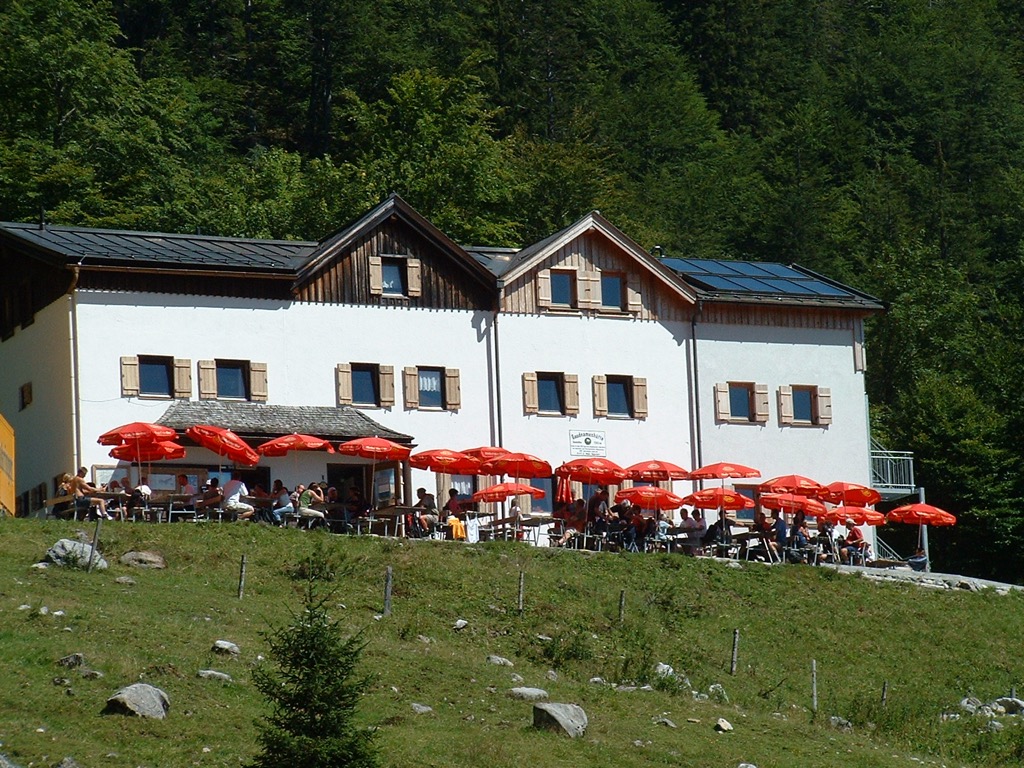
Download the PeakVisor App for up-to-date weather reports in any destination across the Alps, including snow depths. Plus, we've been hard at work adding the details of hundreds of mountain huts, with information on opening hours, overnight accommodation, and dining options.
Whether you're looking to stay in a major town or a quaint alpine village high in the mountains, the Wilder Kaiser has you covered.
Salzburg Airport is the nearest international airport to the Wilder Kaiser, located 73 km (45 mi) northeast of Ellmau.
Kufstein is the second-largest town in Tyrol, with a population of around 20,000. It lies northwest of the Wilder Kaiser, between the Kaiser Mountains and Brandenberg Alps.
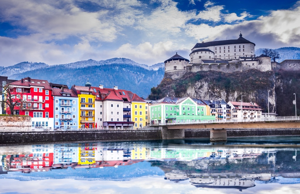
Kufstein is a charming town in the shadow of the Kufstein Fortress, believed to have been built in the 12th and 13th centuries. Its location to the west of the Wilder Kaiser means it's within 10 km (6 mi) of many of the Wilder Kaiser's most popular hiking areas, including Scheffauer, Ellmauer Halt, and Hintersteiner See.
Kufstein is a well-connected transport hub. Autobahns lead to Munich and Innsbruck, and the Kufstein Railway Station connects Kufstein to Munich, Verona, Venice, Bratislava, and more.
At the heart of the Leukental Valley is the Wilder Kaiser's second-largest town, Sankt Johann in Tirol. It's situated on the southeastern edge of the range, perfectly positioned between the Kaiser Mountains, the Kitzbühel Alps, and the Lofer and Leogang Mountains.
Just south of Sankt Johann is the Kitzbüheler Horn (1,996 m / 6,549 ft), one of the most popular hiking and skiing destinations in the Kitzbühel Alps. Sankt Johann is a quaint market town whose town center affords sweeping views of the surrounding ranges.
Sankt Johann is at a major traffic junction, with main roads connecting Wörgl and Salzburg. Plus, it's on the Salzburg-Tyrol Railway Line, with trains to Munich, Wörgl, and Salzburg.
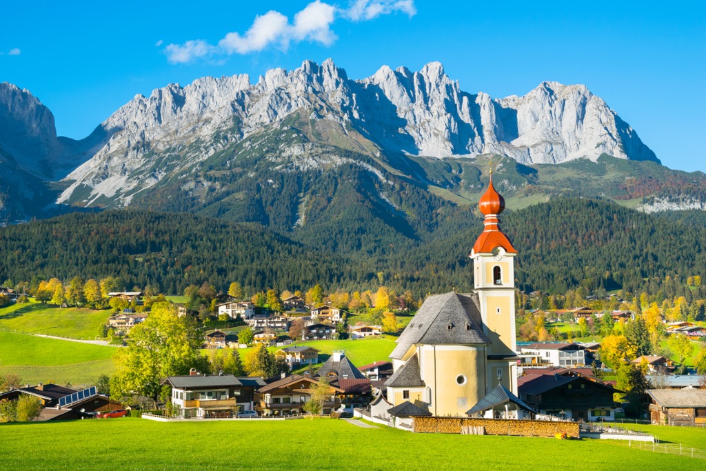
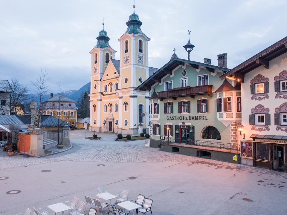
Ellmau is the largest of the Wilder Kaiser's SkiWelt resort villages, with a population of over 2,800. It's located roughly 10 km (6 mi) from Sankt Johann and Kufstein on the range's southern boundary.
Ellmau is the ideal base for Wilder Kaiser skiers, with several drag lifts and gondolas running directly into the mountains from the village. Hohe Salve (1,829 m / 6,001 ft), home to some of the Kitzbühel Alps' most popular ski slopes, is roughly 8 km (5 mi) from Ellmau.
Local buses are available from Ellmau to Kufstein and Sankt Johann in Tirol. The nearest autobahn is in Kufstein.


The highest peak in the Wilder Kaiser is Ellmauer Halt, at 2,342 m.
The Wilder Kaiser have 93 named peaks.


