
Scan the QR code and open PeakVisor on your phone
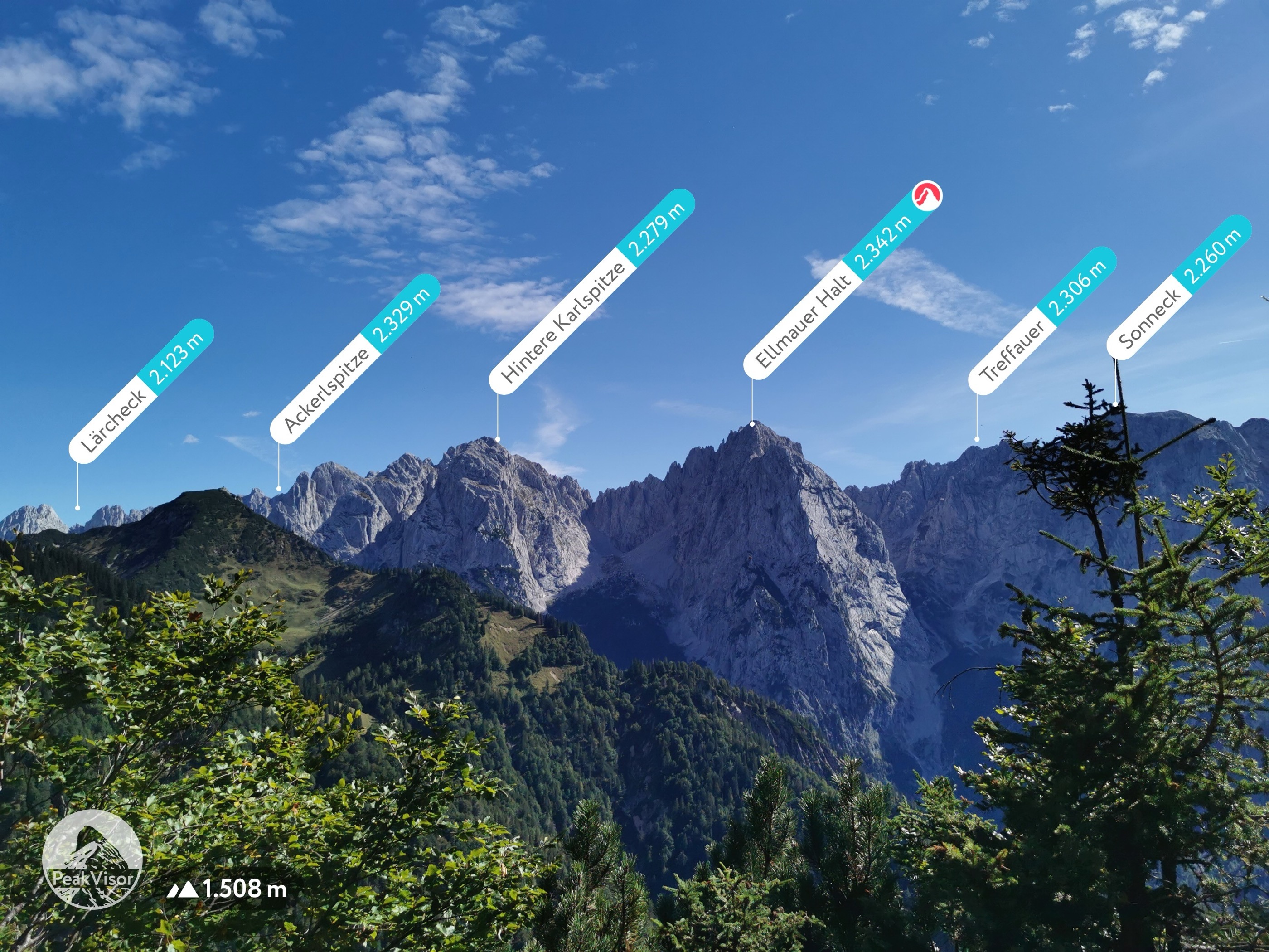
Kaiser Mountains Nature Reserve has 108 named peaks. The highest is Ellmauer Halt at 2,342 m. Other notable peaks include Ackerlspitze, Treffauer and Gamshalt.
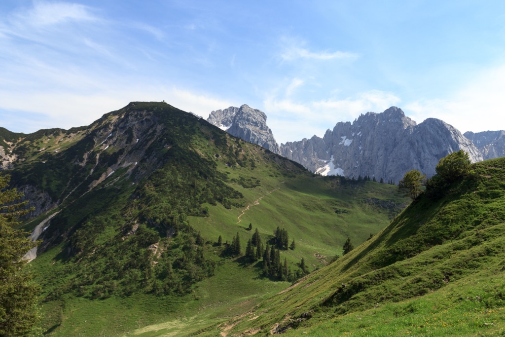
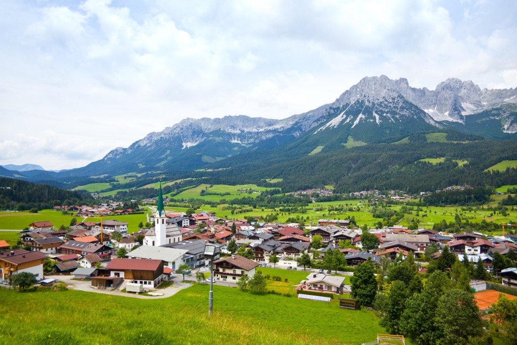
The Kaiser Mountains Nature Reserve (Naturschutzgebiet Kaisergebirge) is a protected area of the Kaiser Mountains in Tyrol, Austria. Undisturbed by roads and ski resorts, it is a popular destination for hikers and skiers looking to reconnect with nature. The reserve has 108 named mountains, the highest and most prominent of which is the Ellmauer Halt (2,344 m / 7,690 ft).
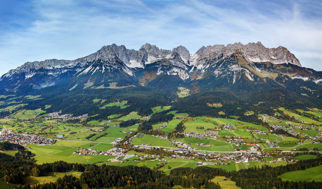
The 92.6 sq km (35.7 sq mi) Kaiser Mountains Nature Reserve encompasses all major peaks in the Kaiser Mountains' (Kaisergebirge) two main ridges: the northern Zahmer Kaiser and the southern Wilder Kaiser. It's located within the municipalities of Ebbs, Ellmau, Going, Kirchdorf in Tirol, Kufstein, Scheffau, St. Johann in Tirol, and Walchsee.
The Stripsenjoch (1,573 ft / 5,164 ft) connects the Zahmer Kaiser and the Wilder Kaiser with the Kaisertal to the west and the Kaiserbachtal to the east. The nature reserve is between 480 m (1,574 ft) and 2,344 m (7,690 ft) in elevation.
The Zahmer Kaiser is the lower of the two ridges, only once exceeding 2,000 m (6,561 ft) in elevation at Vordere Kesselschneid (2,002 m / 6,568 ft). The Wilder Kaiser is home to the highest summits in the Kaiser Mountains: the Ellmauer Halt, the Ackerlspitze (2,329 m / 7,641 ft), and the Treffauer (2,304 m / 7,559 ft).
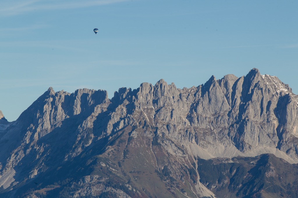
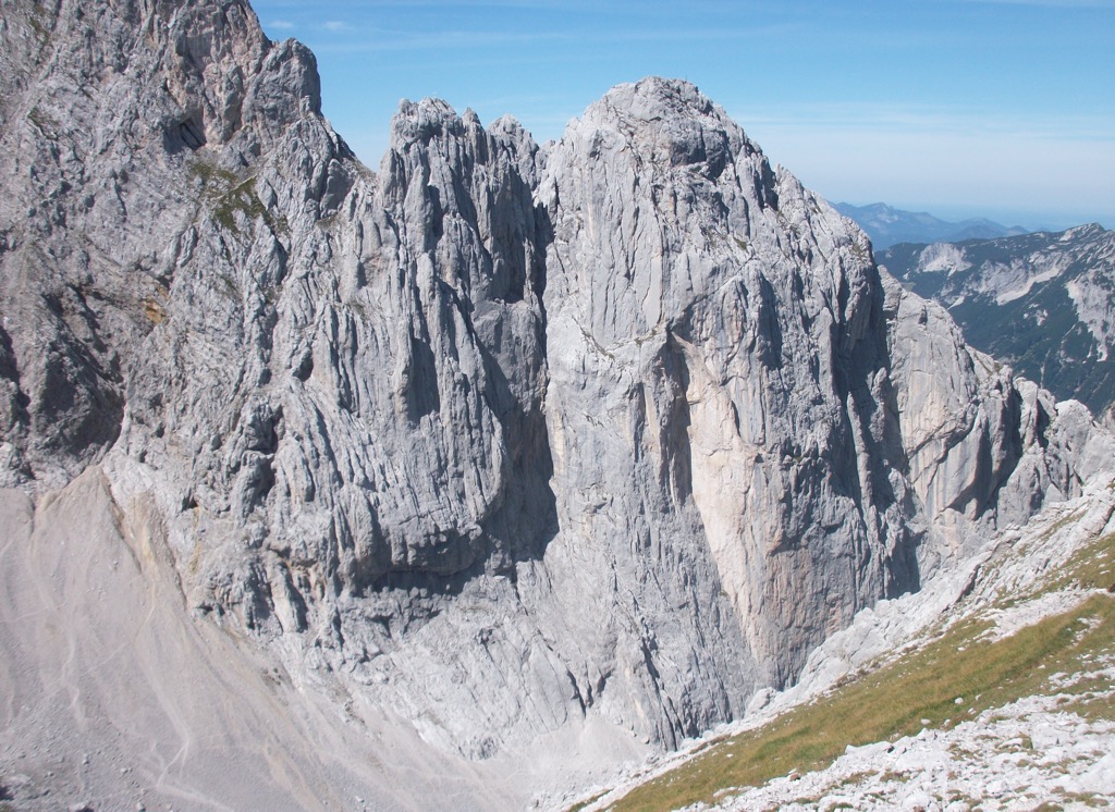
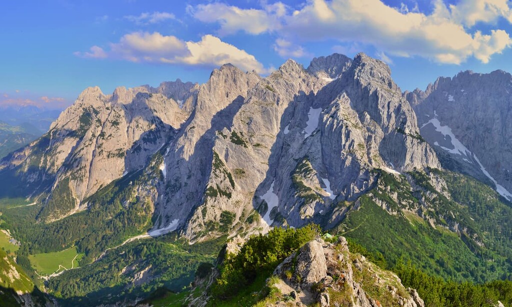
The range's karstic limestone structure means it's full of jagged peaks, attracting hikers and mountain climbers from around the world. Some of the most famous and challenging rock climbing routes in the Northern Limestone Alps are within the Kaiser Mountains Nature Reserve, including the Fleischbank (2,187 m / 7,172 ft) and the Totenkirchl (2,190 m / 7,185 ft).
As it's a protected area, the Kaiser Mountains Nature Reserve has little to no infrastructure — there's only one road, the Kaisertalstraße, which runs from Ebbs through the Annatunnel into the Kaisertal. Additionally, there's only one chairlift, the Kaiserlift Kufstein, which runs to the Brentenjoch (1,207 m / 3,960 ft). Most mountains in the Kaiser Mountains Nature Reserve are accessible only by foot.
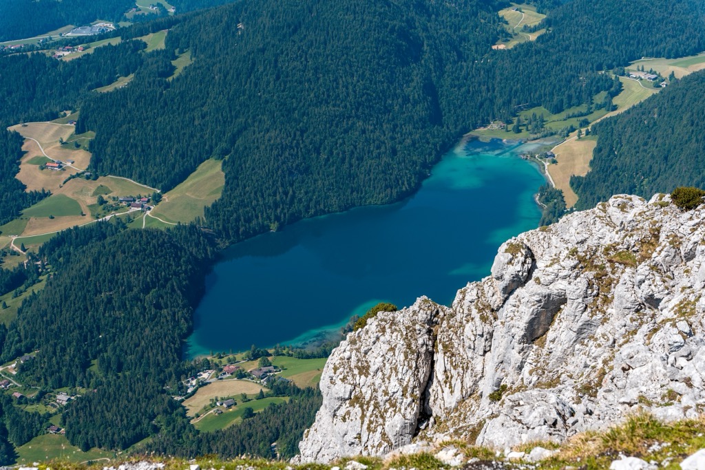
The largest lake in the Kaiser Mountains Nature Reserve is Hintersteiner See. It's located southwest of the Scheffauer (2,111 m / 6,926 ft) and is a popular spot for a swim after hiking in the nearby mountains.
There are no significant settlements within the Kaiser Mountains Nature Reserve. The settlements of Kaisertal have only been accessible by car since 2008, thanks to the Kaisertalstraße. Kufstein, the second-largest settlement in Tyrol after Innsbruck, is located on the nature reserve's western boundary.
The Kaiser Mountains are composed primarily of Wetterstein limestone and dolomite. These sedimentary rocks formed when the range lay underneath the shallow Tethys Sea during the Late Triassic over 220 million years ago.
Marine sediment from reef lifeforms, such as corals, bivalves, and sponges, was deposited on the Tethys' sea floor and compacted over millions of years, forming the Wetterstein limestone found throughout the Kaiser Mountains. Wetterstein limestone can be up to 1,000 m (3,280 ft) thick, which roughly correlates to the Kaiser Mountains' maximum height from ground level.

The Alpine Orogeny, which occurred roughly 66 million years ago, shaped the Kaiser Mountains and the rest of the Alps. This mountain-building event occurred due to convergent movements between the African, Arabian, Indian, and Cimmerian tectonic plates to the south and the Eurasian Plate to the north.
The Alpine Orogeny closed the Tethys Sea and folded the Kaiser Mountains into their current position. The Würm glaciation between 115,000 and 10,000 years ago eroded the hollow dolomite and limestone across the Kaiser Mountains, creating extensive moraine fields.
Protected from widespread development and tourism, the Kaiser Mountains Nature Reserve is a haven for Tyrolean flora and fauna.
The Kaiser Mountains are home to some of the Eastern Alps' most iconic high-altitude specialists. Marmots, instantly identifiable due to their high-pitch whistling, can be spotted hiding on the high slopes. Chamois are regularly seen navigating the range's seemingly insurmountable slopes with ease.
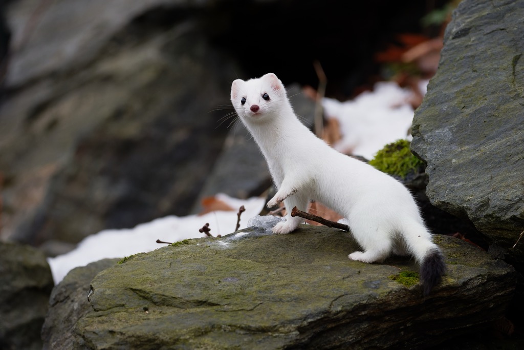
Other notable mammals in the Kaiser Mountains Nature Reserve include red deer, dormice, red squirrels, stoats, foxes, and badgers.
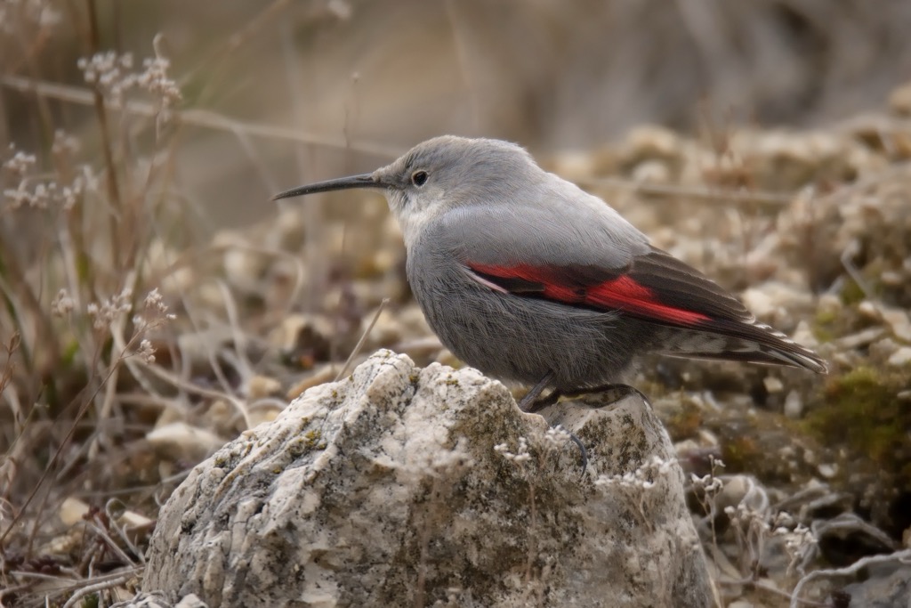
Undisturbed by humans, dozens of rare bird species nest within the Kaiser Mountains. The largest species is the bearded vulture, which has a wingspan exceeding 2.5 m (8.2 ft).
Other notable raptors include Eurasian sparrowhawks, golden eagles, Eurasian goshawks, and tawny owls. Smaller birds include alpine willow tits, alpine choughs, lesser redpolls, wood warblers, and wallcreepers.
The common European adder is the only venomous snake in Tyrol. It can be found at up to 3,000 m (9,842 ft) in elevation and usually stays hidden under bushes and stones. Its bite requires medical attention but is seldom lethal. Other significant amphibian and reptile species include fire salamanders, smooth snakes, and common lizards.
The last glacial period in the Kaiser Mountains isolated several animal species, meaning they're endemic to the range. Examples include a species of yellow-green earthworm (Allobobophora smaragdina) and a species of door snail.
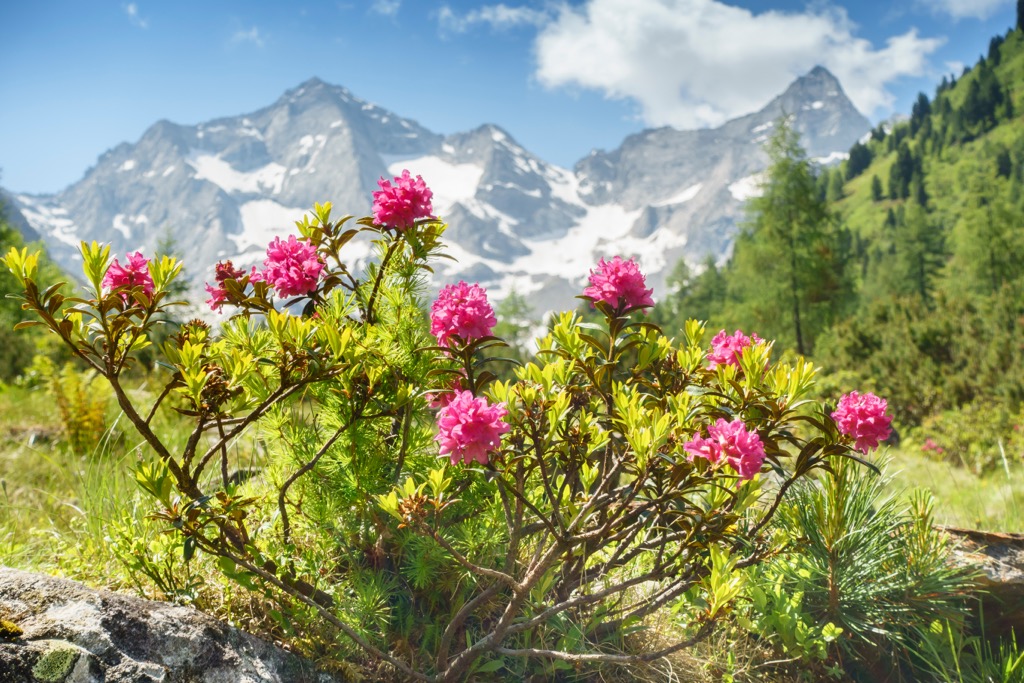
The Kaiser Mountains boast a high rate of plant diversity — there are over 940 flowering species and 400 moss species. As with nearly half of Austria, the Kaiser Mountains are heavily forested.
Mixed forests composed of beech, fir, and spruce are most common within the valleys at low elevations. Above 1,000 m (3,280 ft), sycamores, alders, and ashes mingle within the mixed forests.
At the highest elevation in the harshest climate, hardier trees like mountain pines dominate the landscape. One of the most famous trees in the Kaiser Mountains is an ancient fir north of the Scheffauer, thought to be over 300 years old.
Above the treeline are alpine pastures interspersed with dwarf shrubs and flowering plants. Many vibrant flowering species carpet the alpine pastures, adding a touch of color to the range's gray limestone slopes.
Notable flowering plants in the Kaiser Mountains include Alpen roses, glacial buttercups, monkshood, edelweiss, Bavarian gentians, and pasque flowers.
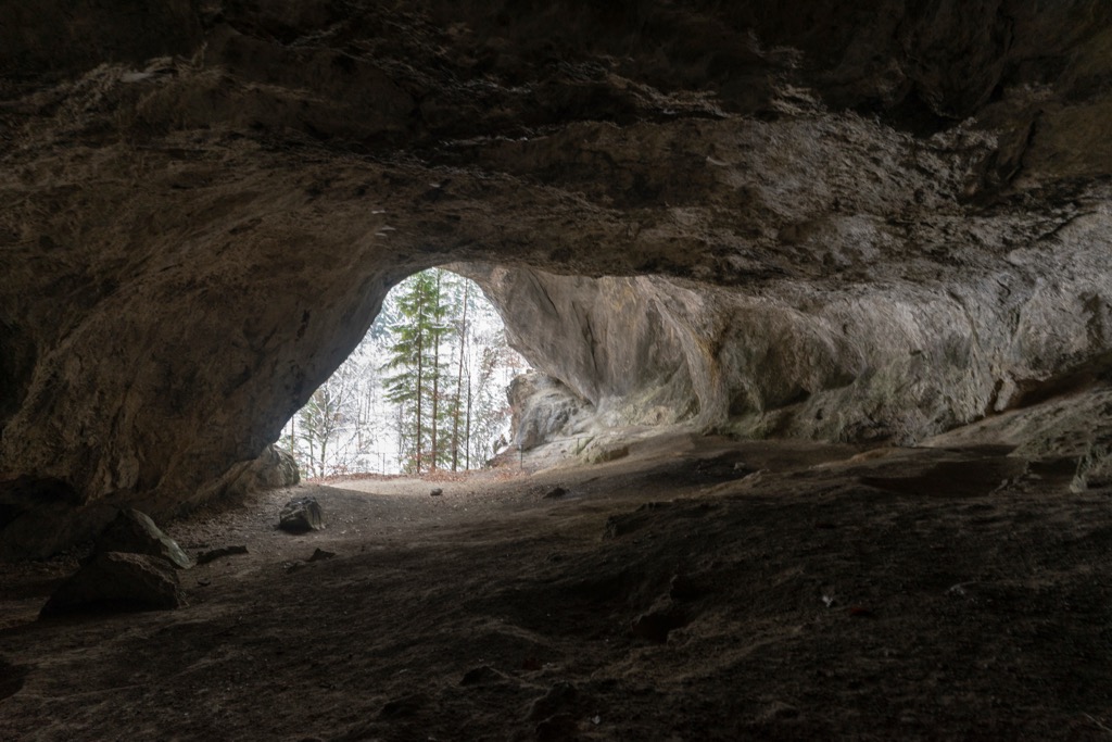
The Kaiser Mountains Nature Reserve is important to the region's ancient history. It's home to the Tischofer Cave (Tischofer Höhle) in the Kaisertal, where archeologists uncovered tools made from cave bear bones dating back between 27,000 and 28,000 years. It's the oldest proven inhabited human site in Tyrol.
During the mid-19th century, the Kaiser Mountains became the focal point of the Munich-based mountain climbing community. Many of the most decorated climbers of the period honed their skills in the Kaiser Mountains.
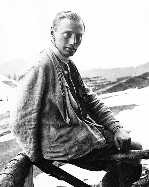
One of the most notable climbers during this period was Hans Dülfer, a pioneer of abseiling (rappelling) and the inventor of the Dülfersitz rappel. He's widely considered to be one of the fathers of free climbing. Paul Preuß, one of the pioneers of solo climbing, also spent time in the Kaiser Mountains at the turn of the 20th century. In 1911, Preuß became the first person to climb Totenkirchl solo without any safety equipment or aids, which was a groundbreaking feat at the time.
While the first ascents of the Kaiser Mountains aren't well-documented, there are records of mountaineers completing new climbing routes for the first time. For example, Hans Dülfer became the first person to climb the gap between the Fleischbank and Christaturm (2,233 m / 7,326 ft) solo, a UIAA V+ graded climb by modern standards.

Local environmentalist Franz Nieberl first proposed a nature reserve in the Kaiser Mountains in the 1920s. His main goal was to prevent the range from being overdeveloped, as it was already becoming popular due to its beauty and climbing opportunities. The Kaiser Mountains Nature Reserve was established on April 19, 1963, following a government referendum.
Where you're exploring the Zahmer Kaiser and the Wilder Kaiser, the Kaiser Mountains Nature Reserve boasts numerous unforgettable hiking and climbing opportunities.
We recommend wearing a helmet when hiking in the Kaiser Mountains due to frequent rockfalls. Bring plenty of provisions and appropriate hiking/climbing equipment. Check local weather forecasts, map your route carefully, and inform others of your itinerary.
You can learn more about the UIAA rock climbing scales mentioned in this guide here. You'll find information on Austrian via ferrata grades here.
At PeakVisor, we love information. That’s why we write articles like this one.
Check out the PeakVisor app for even more information on thousands of additional hikes, ski tours, and ski resorts across the Alps. In fact, we’ve compiled information on all publicly maintained walking tracks worldwide, formatted onto our 3D maps.
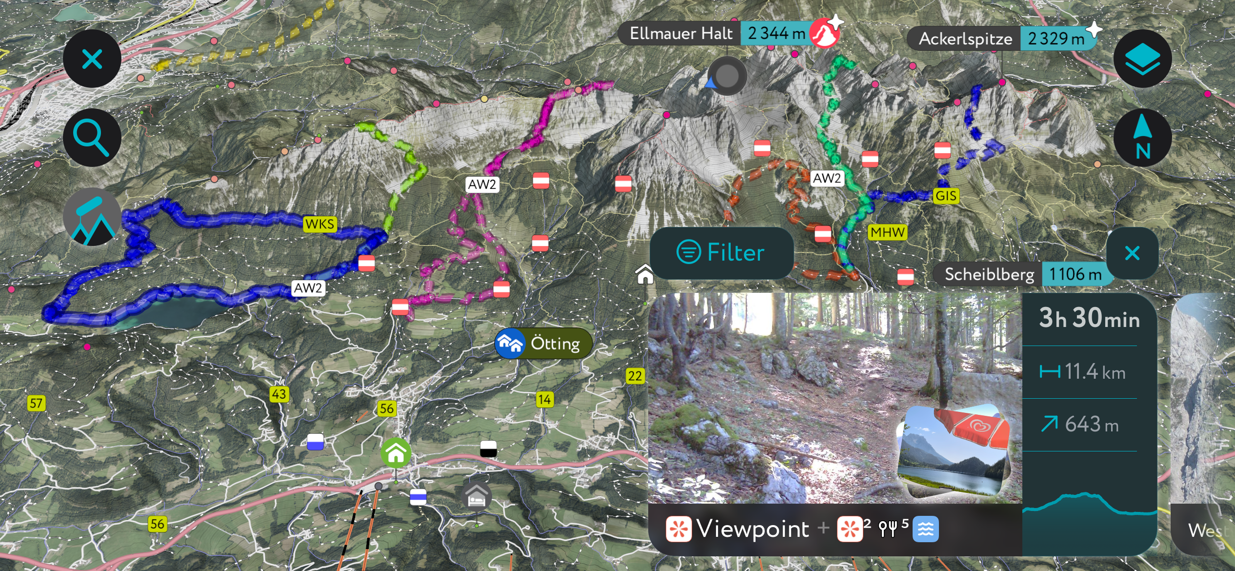
PeakVisor started as a peak identification tool but we’ve evolved into purveyors of the finest 3D maps available. We continue to expand our offerings. You can track your hikes directly on the app, upload pictures for other users, and keep a diary of all your outdoor adventures.
Most recently, the PeakVisor App has included up-to-date weather reports, including snow depths, at any destination. We've also been hard at work adding the details of hundreds of mountain huts, including information on overnight accommodation, dining options, and opening hours. You can also use our Hiking Map on your desktop to create .GPX files for routes to follow later on the app.
The Ellmauer Halt (2,344 m / 7,690 ft) is the highest summit in the Kaiser Mountains. It’s situated at the center of the Wilder Kaiser ridge between the Ellmauer Tor (1,980 m / 6,496 ft) and the Kapuzenturm (2,303 m / 7,556 ft) rock needle.
The Ellmauer Halt is one of the range's most famous climbing destinations, with two popular klettersteigs (via ferratas): Gamsängersteig and Kaiserschützensteig. You'll have uninterrupted views of the entire Kaiser Mountains from the Ellmauer Halt's summit, with the spectacular Kitzbühel Alps to the south.
The normal route to the Ellmauer Halt's summit is via the Gamsängersteig. You can pick up this route from the Wochenbrunneralm (1,081 m / 3,547 ft). Alpine experience, a head for heights, and sure-footedness are needed to climb the Ellmauer Halt. We recommend bringing a helmet and via ferrata equipment.
Start by following trail no. 825 to Gruttenhütte before ascending the Hochgrubach cirque. You'll then reach the Gamsängersteig, which includes a climb up scree slopes and a set of iron steps implanted into the rock called the Jägerwand-Steppe.
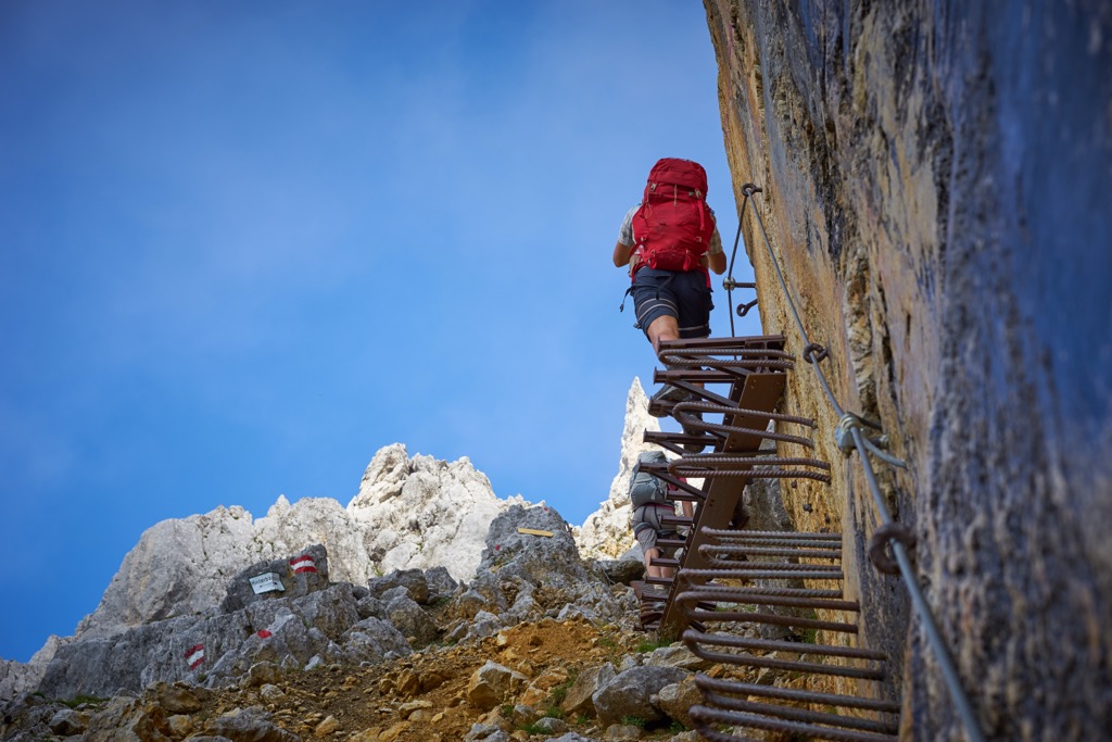
Just before reaching Babenstuberhütte (2,296 m / 7,533 ft), you'll have the choice between an exposed climb across a rock terrace or a climb up a short ladder in a narrow gorge. Descent the way you came. The Ellmauer Halt's normal route is approximately 9.3 km (5.7 mi) round-trip.
The Scheffauer (2,111 m / 6,926 ft) is one of the lowest yet most popular peaks in the Wilder Kaiser. It lies on the western side of the Wilder Kaiser to the west of the Hackenköpfe (2,126 m / 6,975 ft).
With daunting 600 m (1,968 ft) sheer rock faces and overlooking the serene Hintersteiner See, it's clear why the Scheffauer is such a popular mountain. The Scheffauer also provides incredible views of the Inntal and the Brandenberg Alps to the southwest.
You can tackle Sceffauer from the north or the south. The southern route to the Scheffauer is the normal route. Alternatively, there's an exciting klettersteig (via ferrata) called the Widauersteig to the north.
The normal route to the Scheffauer begins from Bärnstatt in Scheffau via Steiner Hochalm (1,258 m / 4,127 ft). This route passes Kreuzbichl (1,120 m / 3,937 ft), a popular viewpoint.
The southern route is longer but less challenging than the northern route — only a few UIAA I-graded secure rope passages exist. You can pick up the southern route to the Scheffauer from the car park near Bärnstattalm (915 m / 3,005 ft).
Follow the signposts for the Scheffauer as far as Steiner Hochalm. Then, follow trail no. 814a until the turning for the Scheffauer. After this turning, the route becomes more complex, with the most tricky secure rope sections around Wasserloch.
From atop the Scheffauer's ridge, it's a straightforward walk to the summit. Descend the way you came. The hike up the Scheffauer is approximately 8 km (5 mi) long.
The Pyramidenspitze (1,998 m / 6,552 ft) is the second-highest peak in the Zahmer Kaiser and easily its most frequented summit. A karstic, forested mountain, the Pyramidenspitze sits along the Zahmer Kaiser's main ridge overlooking the Kaisertal to the south.
You can climb the Pyramidenspitze on a one-day or two-day tour. One of the most popular routes to the Pyramidenspitze is a looped tour from the Aschinger Alm (969 m / 3,182 ft) in Ebbs to the mountain's north. It's a challenging route that includes an A/B graded via ferrata.
You'll start by walking clockwise towards Winklkar, passing the Jovenalm (1,343 m / 4,406 ft) and the Winklalm (1,192 m / 3,914 ft). At the Winklalm, follow the path towards the Pyramidenspitze. Here, you'll tackle the route's A/B grade via ferrata, which is steel ropes secured in places.
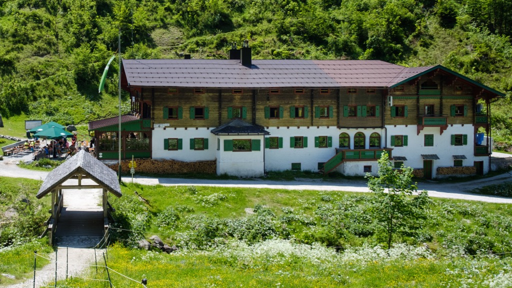
The route continues west, passing the summit of Elferkogel (1,925 m / 6,316 ft) and descending to the Vorderkaiserfeldenhütte (1,384 m / 4,541 ft), the best place to spend the night along this looped trail.
You'll then continue back towards Ebbs, passing over the Musikantensteig and by the Berggasthof Kölnberg (875 m / 2,874 ft). The Pyramidenspitze looped tour is approximately 15.5 km (9.6 mi) long.
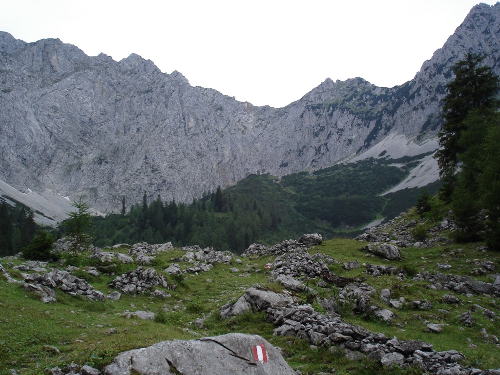
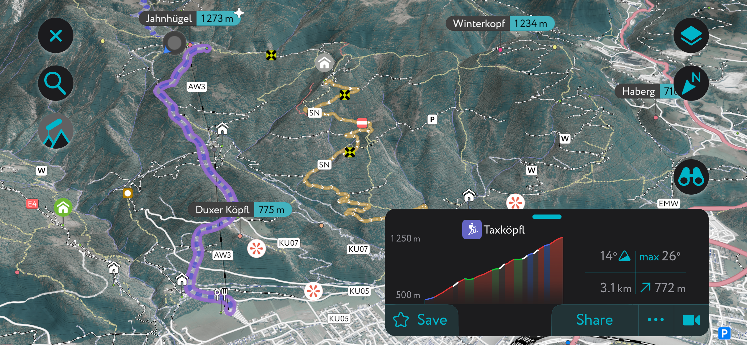
The Stripsenkopf (1,807m / 5,928 ft) is a forested mountain within the Zahmer Kaiser directly north of the Kaiserbachtal. It's one of the most popular summits in the range as it poses no great difficulty and provides remarkable views of nearby mountains, including the Karlspitzen (2,281 m / 7,484 ft), the Totenkirchl (2,190 m / 7,185 ft), and the Sonneck (2,260 m / 7,410 ft).
The normal route leads from the Griesner Alm (1,024 m / 3,360 ft) via Stripsenjochhaus (1,602 m / 5,256 ft) to the Stripsenkopf. This out-and-back route is approximately 7 km (4.3 mi) long.
Alternatively, you can combine the Stripsenkopf with the Feldberg (1,813 m / 5,948 ft) for a looped tour of the Zahmer Kaiser's eastern half. This tour is more difficult than the Stripsenjoch's normal route and includes secured rope sections.
From the Griesner Alm car park, follow the trail to Ranggen Hochalm and climb uphill through pine forests to the summit of the Feldberg. Then, follow the narrow ridge path over Tristecken (1,702 m / 5,584 ft) to reach the Stripsenkopf.
Follow the narrow right-hand path near the via ferratas to Stripsenjochhaus and back to your starting point. This looped tour of the Stripsenkopf and the Feldberg is approximately 9.3 km (5.7 mi).
The Kaiserkrone is the longest hiking trail in the Kaiser Mountains Nature Reserve, covering 58 km (36 mi) across five stages. It takes in the Wilder Kaiser's highlights, passing over rugged summits and past the range's finest mountain huts.
Along this comprehensive tour of the Wilder Kaiser, you'll have panoramas of some of the most famous sights in the surrounding Alps, with Großglockner (3,798 m / 12,461 ft) and Lake Chiemsee visible. You'll also be treated to views of nearby ranges, including the Kitzbühel Alps, the Leogang Mountains, and the Karwendel.
The Kaiserkrone includes several mountains, including a tour of the Stripsenkopf and the Feldberg. Other mountains included on the Kaiserkrone include Ursulablick (1,242 m / 4,075 ft), Gscheuerkopf (1,280 m / 4,199 ft) and Baumgartenköpfl (1,698 m / 5,571 ft)
The five stages of the Kaiserkrone are as follows:
As a protected area with little to no infrastructure, the Kaiser Mountains Nature Reserve does not contain ski resorts. However, parts of nearby ski resorts border the Reserve.
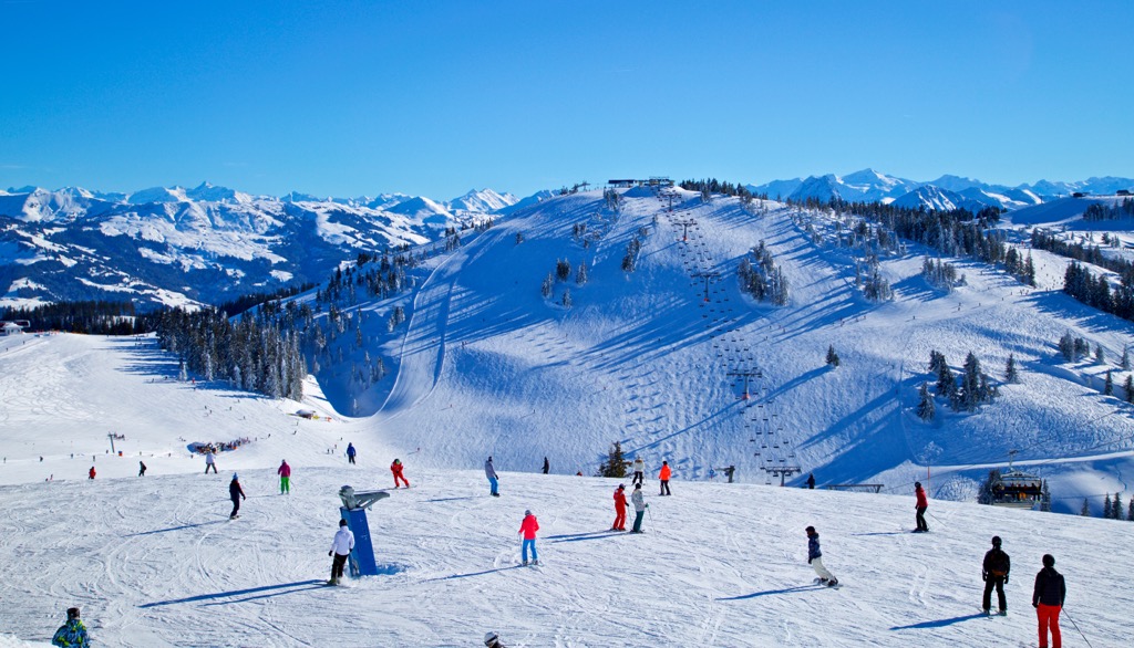
The SkiWelt Wilder Kaiser-Brixental, part of Austria's largest interconnected ski area, is located on the nature reserve's southern boundary at Ellmau, Going am Wilder Kaiser, and Scheffau. The SkiWelt has over 275 km (170 mi) of pistes and 81 modern ski lifts.
Another small ski resort, Zahmer Kaiser - Durchholzen, is on the Kaiser Mountains Nature Reserve's northern boundary at Durchholzen. It's home to 15 km (9.3 mi) of slopes and 9 lifts.
Uninterrupted by roads and towns, the Kaiser Mountains Nature Reserve is perfect for ski touring in solitude. Here's a brief look at a couple classic ski tours in the Kaiser Mountains Nature Reserve.
The ski tour from Kufstein to Brentenjoch (1,207 m / 3,960 ft) is an enjoyable and leisurely experience for skiers of all abilities. You'll climb gentle ski slopes in the shadow of the Kaiserlift Kufstein, with several mountain huts inviting you in to warm up on your ascent and descent.
The ski tour to Brentenjoch starts at the Kaiserlift Parking Platz. You'll pass the Berggasthof Hinterduxerhof (737 m / 2,421 ft), then the Duxer Alm (897 m / 2,946 ft), ending the tour at the Weinbergerhaus (1,271 m / 4,173 ft) near Brentenjoch. There's negligable risk of avalanches along this out-and-back ski tour. This ski tour from Kufstein to Brentenjoch is approximately 3 km (1.8 mi) long.
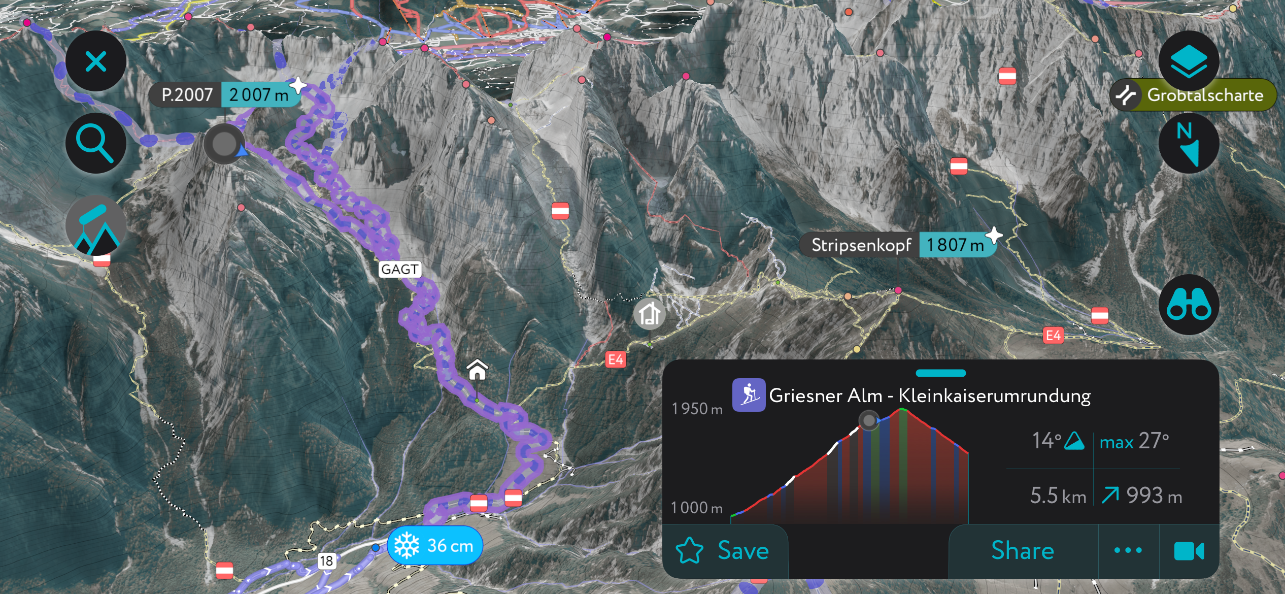
The tour of the Griesenerkar, or the Griesener Cirque, via the Goinger Scharte (2,004 m / 6,575 ft) is among the most famous and popular tours in the Kaiser Mountains. Due to the risks of avalanches, this tour is best undertaken later in the season.
This north-facing tour features a steep descent from the cirque, which makes for an exhilarating finale. Overall, it provides excellent ski terrain around the Griesenerkar, with a peaceful initial climb through pine forests. You can easily adjust this tour to suit your experience and snow conditions.
From the Griesner Alm (1,024 m / 3,360 ft), head south through forests towards the Fritz-Pflaum-Hütte (1,865 m / 6,119 ft). Keep left at the cirque to reach Fritz-Pflaum-Hütte, and then head west along Griesenerkar's south side to reach Goinger Scharte.
You can shorten this tour by staying right before the Fritz-Pflaum-Hütte to reach the saddle below Goinger Scharte before climbing one of the cirque's gullies.
Featuring a 35° to 45° gradient and a narrow gully, this tour is only suitable for experienced skiers. This tour of Griesenerkar is approximately 5 km (3 mi) long.
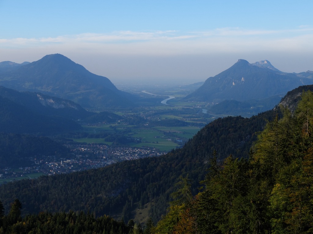
Despite the lack of settlements in its interior, the Kaiser Mountains Nature Reserve is surrounded by some of Tyrol's largest towns and most popular resorts.
Innsbruck International Airport is the nearest airport to the Kaiser Mountains Nature Reserve, located approximately 81 km (50 mi) to the southwest of Kufstein.
Kufstein is the second-largest town in Tyrol after the state capital, Innsbruck, with a population of around 20,000. Sat on the western edge of the Kaiser Mountains Nature Reserve, Kufstein provides easy access to the finest mountains in the range, with the likes of the Pyramidenspitze, the Sonneck, and the Ellmauer Halt all within 10 km (6.2 mi).
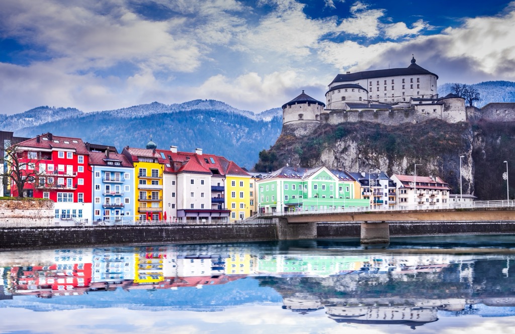
Kufstein itself is a picturesque town on the Inn River overlooked by the historic Kufstein Fortress (Festung Kufstein), which dates back to at least the 13th century. Its nickname is the "Pearl of Tyrol" due to its cobblestone old town, world-class dining options, and beautiful nearby wilderness.
Kufstein railway station connects Kufstein with Vienna, Bregenz, Innsbruck, and Berlin. You can easily reach Kufstein by car on the A12 autobahn between Innsbruck and Rosenheim.
Sankt Johann in Tirol, or simply St. Johann, is a large resort town southeast of the Kaiser Mountains Nature Reserve. It has a population of around 9,800 people. Sankt Johann is one of the best places to stay if you're looking to explore the Wilder Kaiser, with the Ellmauer Halt, the Sonneck, the Ackerlspitze, and the Scheffauer, all within 15 km (9.3 mi).
Tucked away in the Leukental, St. Johann is sandwiched between several mountain ranges, making it the ideal base for discovering many of Tyrol's finest mountains. To the east are the Lofer and Leogang Mountains, and to the south are the Kitzbühel Alps and the Kitzbüheler Horn (1,996 m / 6,549 ft).
The St. Johann ski area offers 10 ski lifts and 40 km (25 mi) of pistes extending up Kitzbüheler Horn. Sankt Johann is located on the Salzburg-Tyrol Railway, connecting to Innsbruck, Salzburg, and Munich via Wörgl.
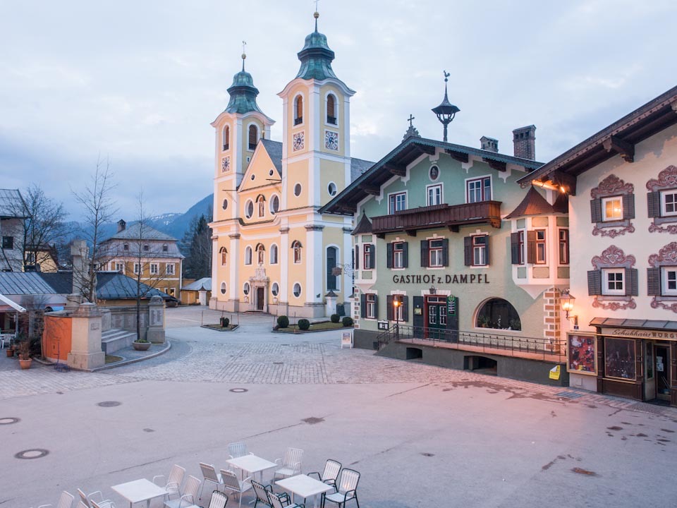
Ellmau is the largest of the three main ski resort towns that line the Kaiser Mountains' southern boundary. The municipality has a population of roughly 2,800 people.
Along with Going and Scheffau, Ellmau is part of the SkiWelt. Its 20 km (12.4 mi) of pistes extend south into the Kitzbühel Alps, and gondolas reach as far as Hohe Salve (1,829 m / 6,001 ft). Year-round, Ellmau is a popular tourist destination with numerous accommodation options.
Ellmau is easily reachable by car from Kufstein, Sankt Johann, and Innsbruck.


The highest peak in Kaiser Mountains Nature Reserve is Ellmauer Halt, at 2,342 m.
Notable peaks in Kaiser Mountains Nature Reserve include Ellmauer Halt, Ackerlspitze, Treffauer, Gamshalt and Östliche Hochgrubachspitze.


.jpg)