Scan the QR code and open PeakVisor on your phone
Nationalpark Sächsische Schweiz (Saxon Switzerland National Park) is a protected forested region known for its striking sandstone structures. Situated in eastern Germany, the park is, in many ways, an extension of Bohemian Switzerland National Park in the Czech Republic. There are 928 named mountains in the park. The tallest and most prominent is Silberblick at 558 m (1,831 ft) in elevation with 234 m (768 ft) of prominence.
Saxon Switzerland National Park is situated in east-central Germany, along the country’s border with Czechia. The park spans 94 sq, km (36 sq. mi) and lies within the Elbe Sandstone Mountains. Together with nearby Bohemian Switzerland National Park, the region is often known simply as Saxon Switzerland.
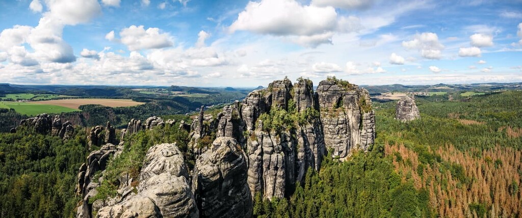
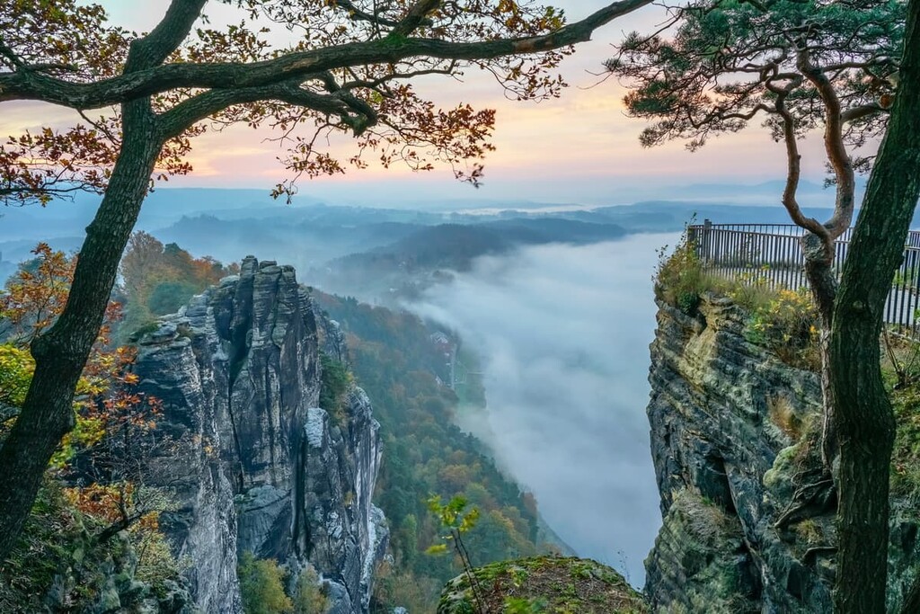
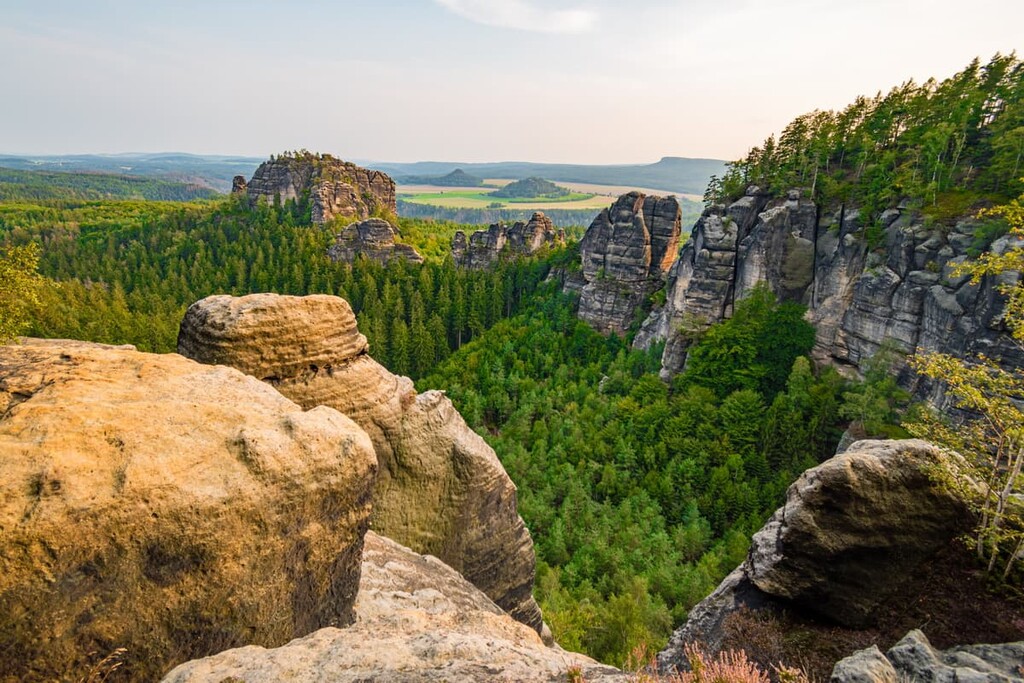
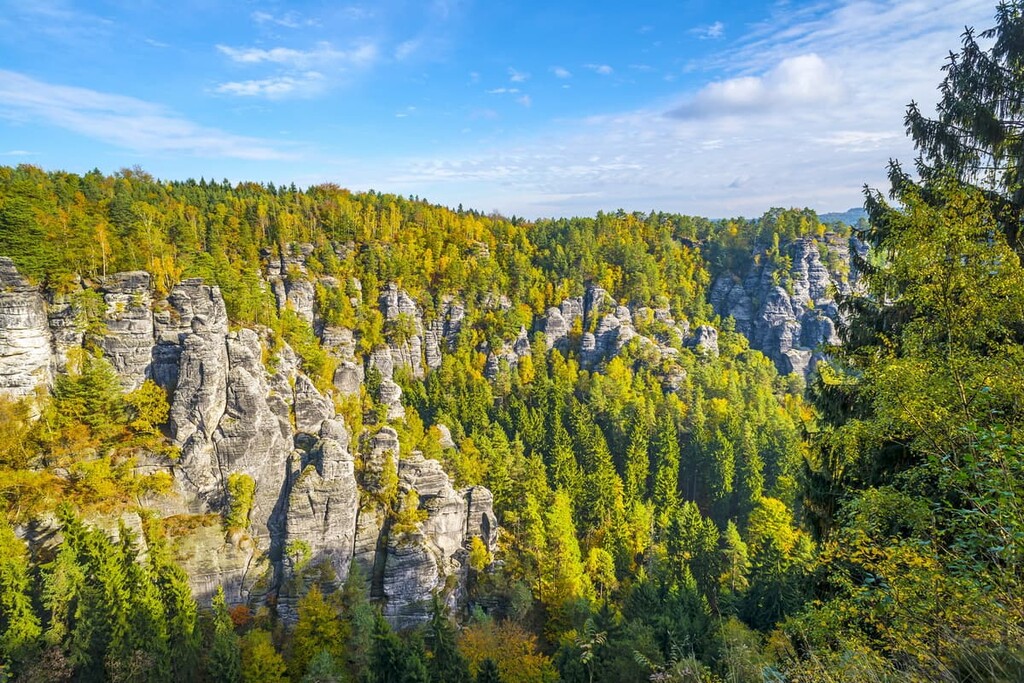
The landscape of the park is marked by its rolling forested hills interspersed with deep sandstone canyons. Amidst these canyons also lie towering sandstone formations, which define the region.
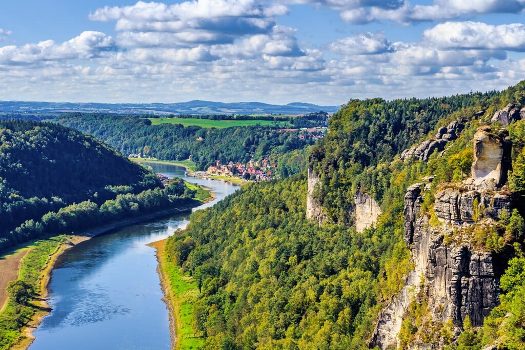
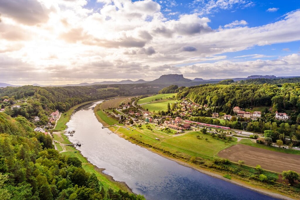
The Elbe River runs along the southern edge of the park, and is a defining feature throughout Saxon Switzerland. The ravines of the park are met with table mountains and steep cliff faces, which attract rock climbers from around the world.
While many of the trails wind through the forest, or along the Elbe River, various hiking routes also lead up to castles and viewpoints atop the sandstone peaks.
Additionally, Saxon Switzerland National Park is located near other popular parks. Bohemian Switzerland National Park lies directly southeast of Saxon Switzerland while České středohoří Protected Landscape Area is located to the south and Krkonoše National Park is located to the east.
The Elbe Sandstone Mountains run throughout Saxon Switzerland National Park and are often referred to as the Elbe Sandstone Highlands. While a majority of the range is in Germany, part of the peaks extend into the Czech Republic.
These peaks which define both the park and the region as a whole, offer a look into the land’s geological history. Millions of years ago, the land was once part of the sea floor. During the Cretaceous period, mineral deposits were carried by bodies of water into the region.
As the Cretaceous sea retreated, a large plateau was left behind made up of sedimentary rocks. Over the course of millions of years, the bedrock of the region was slowly eroded away, leaving behind the deep gorges and sandstone formations that we see today.
Pressure and uplift from the Karsdorf Fault, in the southern region of the Elbe Sandstone Mountains ,changed the angle of the Elbe River. This shift allowed for an increase in erosional force from the river and continued erosion of the canyons.
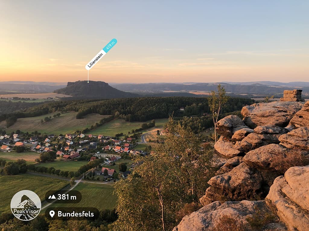
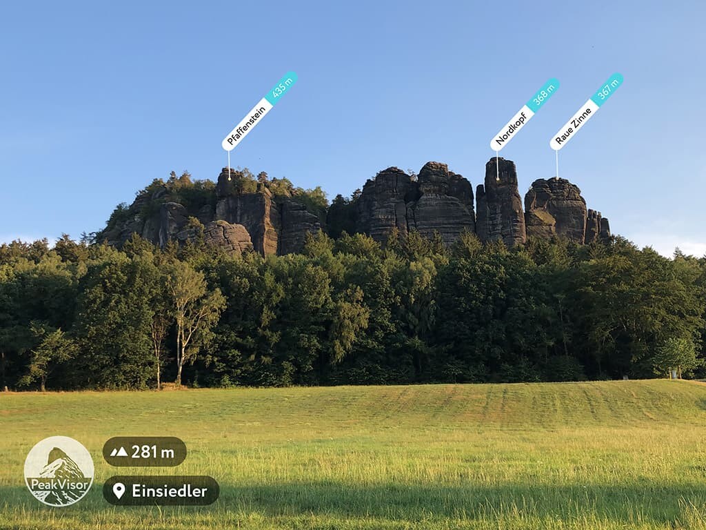
Major peaks within the park include Silberblick, Großer Winterberg, Rozpolcený roh, Citadela, Lilienstein, and Hohe Liebe.
The Saxon Switzerland region is known for its “upside-down” climate zones. The steep canyons have resulted in cooler temperatures at lower elevations. Thus, the higher elevations in the park have warmer temperatures and higher density of both flora and fauna.
The forested hills throughout the park are covered densely with ridge pine forests while the basalt hills are home to beech forests. Smaller plant species include the Labrador tea plant, nine-leaved toothwort, and holewort.
Various species of ferns, mosses, and fungus can be found in the shady depths of the park’s many deep valleys. Near the rivers and streams visitors can spot brown trout along with five species of salamanders.
The pine forests are home to woodpeckers, owls, peregrine falcon and black stork. Other common animal species include the red deer, otter, bat, and eagle owl. Both lynx and wild boar inhabit the region, though spotting one is rare in the daylight.
The region of Saxon Switzerland has been inhabited for thousands of years by Germanic, Celtic, and Slavic tribes. Many of these groups lived in small communities until the Dark Ages, beginning in 500 CE.
During the Middle Ages, the land was ruled by various Slavic groups and was part of the Kingdom of Bohemia. Around 1000 CE, Saxon Switzerland marked the border between the Nisane, Milzane, and Dacine tribes.
After the twelfth century, the land was further developed by Germanic speakers. In the centuries that followed, numerous castles and fortresses were built, many of which are still standing or have remains in the park.
In 1888, the first major rock climb in the region was recorded. A continual interest in exploring the land fueled the idea of protecting Saxon Switzerland as early as the 1800s.
The beginning of the nineteenth century brought tourism to Saxon Switzerland. One of the first trolleybuses that ran through the park attracted visitors to witness the unique and historic landscape.
Eventually in 1990, Saxon Switzerland became a designated national park. Today, the park is visited frequently due to its close proximity to Dresden.
Saxon Switzerland National Park is home to numerous trails, many of which are accessible for both hiking and biking. Here are some of the most popular trails and regions in the park:
The Falkenstein, Schrammsteine und Großer Winterberg trail is 20 km (12.4 mi) long with 748 m (2,454 ft) elevation gain. The loop trail takes hikers along some of the most unique rock formations in the park.
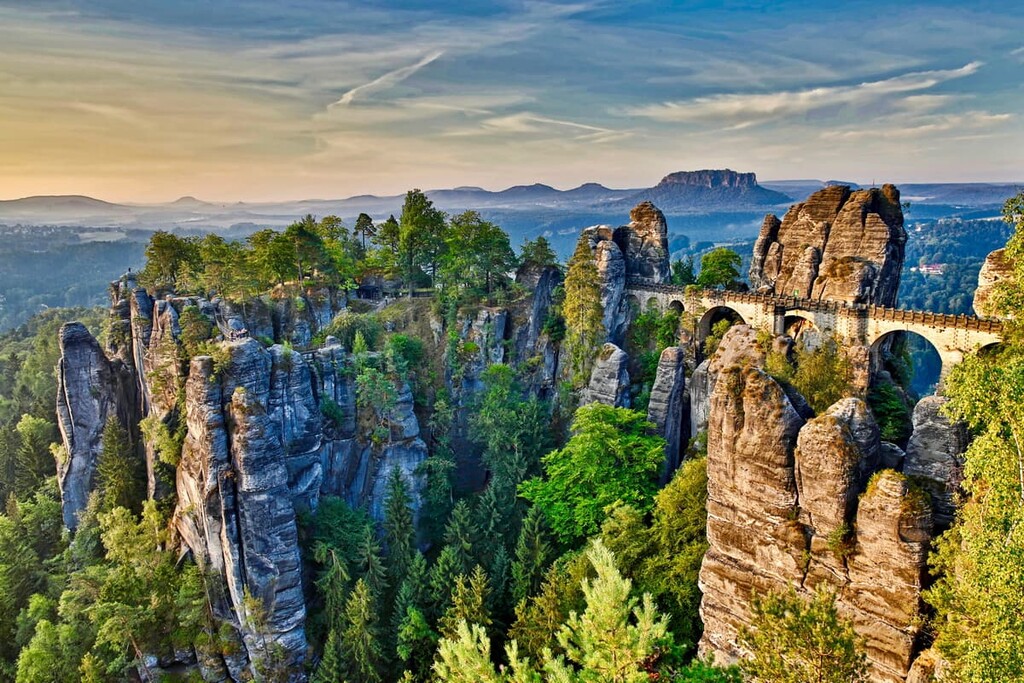
The Schrammsteine is a group of rocks known for its unique and dramatic features. The trail also leads through the forest and along many deep gorges. It is a challenging hike that showcases the numerous landscapes of the park.
The Bastei, Amselsee, and Hohnstein loop leads hikers throughout much of the northern section of the park. The trail is 24 km (15 miles) long with 1,010 m (3,313 ft) elevation gain.
After starting along the Elbe River, the trail winds through the forest before leading hikers to views of the blackbird waterfalls and the Hohnstein Valley.
Mittelalter-Tour zur Felsenburg Neurathen und den Schwedenlöchern trail is a short loop at 6.4 km (4 miles) with 277 m (908 ft) elevation gain.
Though the trail is shorter than many in the park, it offers impeccable views of both the natural and manmade landscape of the region. Views of the Elbe River quickly lead hikers to the medieval castle of Neurathen before reaching the Bastei bridge, both nestled amidst the sandstone formations.
Looking for a place to stay near Saxon Switzerland National Park? Here are some of the best cities and villages to check out in the region:
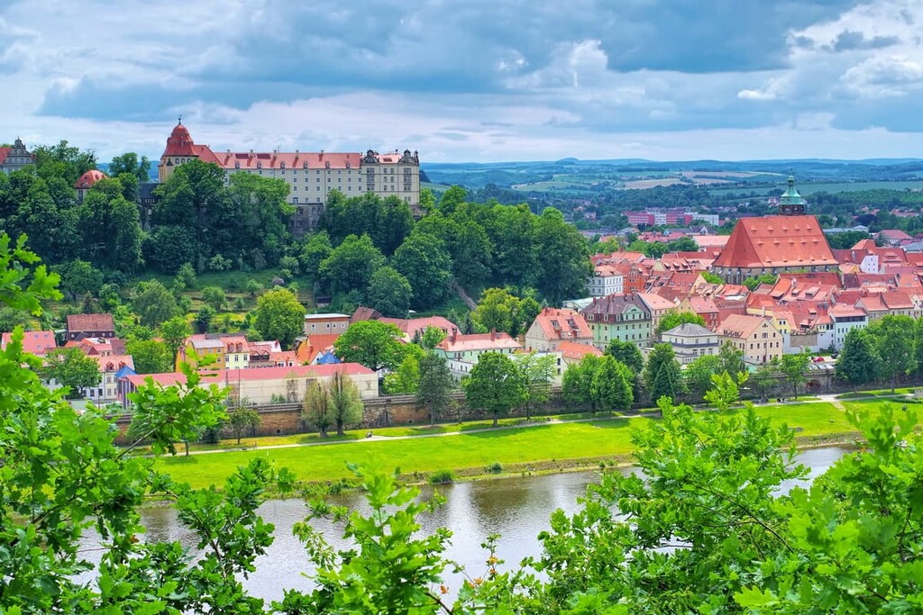
Located directly east of the park lies the city of Pirna. The city is part of the Free State of Saxony and has a population of around 38,000. Though small, the city acts as a gateway into Saxon Switzerland National Park.
The medieval town center attracts both art lovers and outdoor enthusiasts to the region. Besides hiking, the city is home to terraced gardens, romantic walks along the Elbe River, and Zuschendorf Castle.
Dresden is just a 40 minute drive to the north of Saxon Switzerland National Park. The city has a metro population of 1.3 million people and it serves as the capital of the Free State of Saxony.
Dresden is one of the most visited cities in Germany and for good reason: the city is home to over 30 museums, major universities, and a thriving music scene.
The Dresden Frauenkirche is a popular tourist site after being reopened in 2005, following its reconstruction. Other well-known sites include Dresden Royal Palace, Semper Opera, and Pillnitz Palace and Gardens.