Scan the QR code and open PeakVisor on your phone
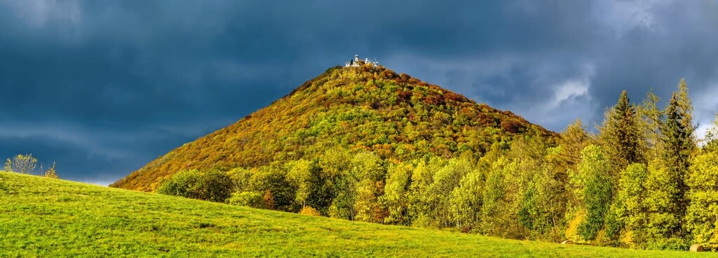
CHKO České středohoří, also known as Central Bohemian Uplands or Central Bohemian Highlands Protected Landscape, is the second largest protected landscape area in the Czech Republic. This diverse area is home to 309 named mountains and some stunning landscapes in northwestern Czechia. The tallest and most prominent peak is Milešovka at 837 m (2,746 ft) with 619 m (2,031 ft) of prominence.
CHKO České středohoří is situated in the northwestern region of the Czech Republic. The protected landscape area spans over 1000 sq. km (386 sq. mi) of land in Czechia near the country’s border with the state of Saxony in Germany.
České středohoří is the main mountain range that runs through the park, and it is part of the larger Ore Mountains. The Ore Mountains travel across the northern region of the park, marking the boundary between the Czech Republic and Germany.
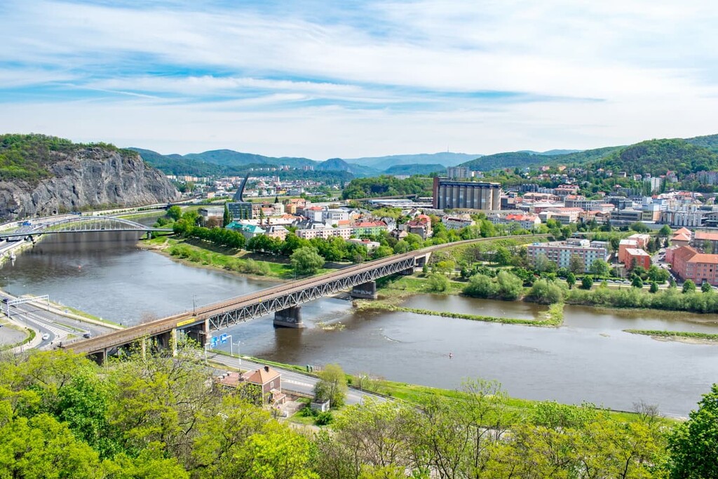
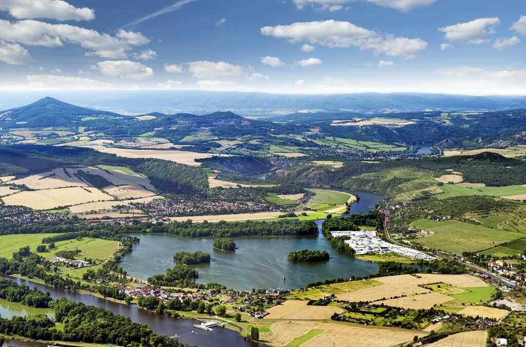
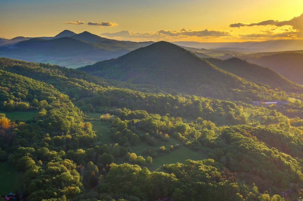
Another defining feature of the region is the Elbe River, which winds through the foothills of the protected landscape. Elevations in the park range from a low of around 120 m (394 ft) up to the summit of Milešovka. While some of the rolling hills are forested, others are filled with grasslands and farmlands.
The sharp peaks of the mountains frame the backdrop for the gentle hillsides and wide valleys. Vineyards and orchards can also be found throughout the region, particularly near the Elbe River and its tributaries.
CHKO České středohoří is located near other parks and protected areas. Both Bohemian Switzerland National Park and Saxon Switzerland National Park lie to the north, while Krkonoše National Park and Karkonosze National Park lie to the east, CHKO Český ráj is located to the southeast and Brdy Protected Landscape Area is situated to the south.

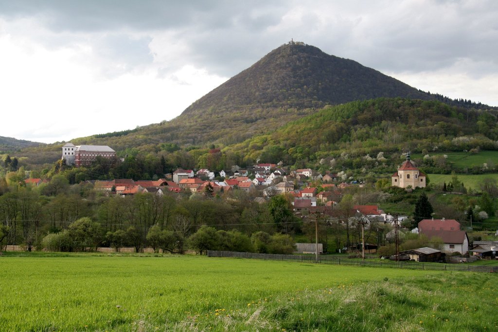
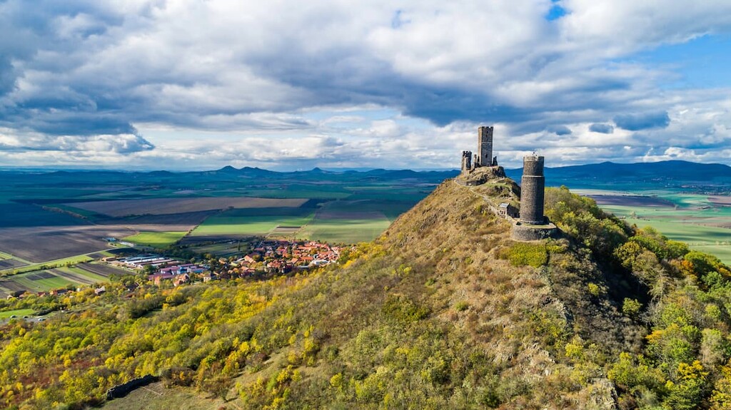
The Central Bohemian Uplands span 70 km (43 miles) across the northwestern part of Czechia and were formed by volcanic activity. Along the Ohře river lies the Ohárecký rift. This rift allowed for magma to surface millions of years ago.
Volcanic cones began to take shape in the region over 20 million years ago. The cones pushed through the soft sandstone layers in the region, giving rise to the peaks that are visible today.
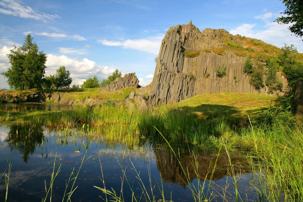
Erosion of the surrounding sandstone left behind the sweeping valleys within the region. The Elbe River is responsible for the shaping of one of the most iconic valleys in the country, Porta Bohemica, also known as the Gate of Bohemia.
Besides sandstone, garnet is a common occurrence throughout the landscape. Found in the metamorphosed rocks, garnet has been mined throughout CHKO České středohoří.
Major peaks within the protected landscape include Milešovka, Hradišťany, Sedlo, Pařez, and Kleč.
The rolling hills of České středohoří are covered with various feather-grasses while the rocky landscapes in the park are home to many different orchids. The woodlands in the region contain small deciduous trees.
While oak trees can be seen throughout the region, beechwoods are no longer present, though they can be found in Germany which lies to the north.The lush vegetation of the region allows for a wide range of fauna to thrive.
European beavers can be spotted along the Elbe river while European ground squirrels are found throughout the landscape. Numerous species of swallows inhabit the forested regions along with many other smaller songbirds.
The ladybird spider, damon blue butterfly, and European green lizard are a few of the many threatened species who live in the highlands, too.
Humans have inhabited the České středohoří region for thousands of years. The presence of humans dates back to the Paleolithic period with settlements surrounding the fertile river valleys.
Populations continued to grow in the surrounding farm lands. Around the tenth century CE, settlements began to form in the higher elevations of the region. Deforestation for farming purposes shaped much of the landscape that is apparent today.
German settlers populated the region after the Thirty Years War. The Industrial Revolution brought exponential growth and production to the region in an effort to produce more food.
In the 1930s, Germans occupied the land and forcibly removed the Czech people. After the end of World War II, the Germans were then forced to leave and return to what was then East Germany. These transitions led to abandoned villages, and a disconnect between the people in the region.
Today the number of farms have greatly diminished as populations decrease. While small communities still exist, many of the homes in the region are not lived in throughout the entire year as many are used as vacation homes.
CHKO České středohoří is home to numerous trails for hiking and other outdoor activities. Here are some of the most popular trails in the protected landscape:
The Milešovka Trail allows hikers to reach the summit of the tallest peak in the region, Milešovka. This route is 6.4 km (4 miles) long and has 468 m (1,535 ft) of elevation gain.
Leaving from Milešov, the trail climbs through the forested hillside before reaching the summit. Accessible throughout the year, visitors have panoramic views of the České středohoří from the top of Milešovka. From the summit, visitors can see patches of forest that are intermixed with farmlands amidst the dozens of surrounding peaks.
Situated in Raná, north of Louny, lies Vrchol Raná. This loop trail is 2.7 km (1.7 miles) long and has 155 m (508 ft) of elevation gain. The trail climbs along a packed pathway amidst the grassy hillside before reaching the summit. The Ohre river can be seen south of the peak along with Lenešický rybník.
Třebušín–zřícenina Kalich is a hiking route that’s located just north of Třebušín. The trail is a short 3.2 km (2 miles) out-and-back with 195 m (639 ft) elevation gain.
After a few gradual switchbacks, the trail reaches the summit of Kalich. Hikers can look out from the summit over the surrounding rolling hills with Sedlo peak off to the east.
Looking for a place to stay near CHKO České středohoří? Here are some of the best cities and villages to check out in the region:
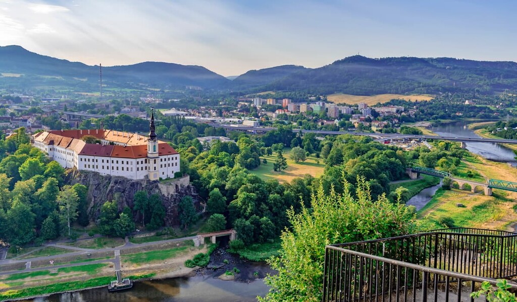
Located on the northern edge of České středohoří lies Děčín. The city dates back over 1,000 years and today has a population of just under 50,000 people. Děčín also provides easy access to Bohemian Switzerland National Park.
The Děčín castle is another popular tourist site as it overlooks the Elbe River before it travels northward into Germany. While repairs have been made to many of the buildings in the city, structures at higher elevations help preserve the history of the land. Other sites include the old town bridge and sheep bridge.
On the eastern edge of the protected area lies Ústí nad Labem. Today the city has over 90,000 residents and is an active river port. Ústí nad Labem is a lively city that is full of Czech culture.
Střekov Castle overlooks the Elbe River and offers an ideal viewpoint of the region. The castle is also home to a museum, showcasing the history of the surrounding area. Besides its close proximity to outdoor activities, like hiking and rock climbing, Ústí nad Labem is full of cafés, restaurants, and wineries.