Scan the QR code and open PeakVisor on your phone
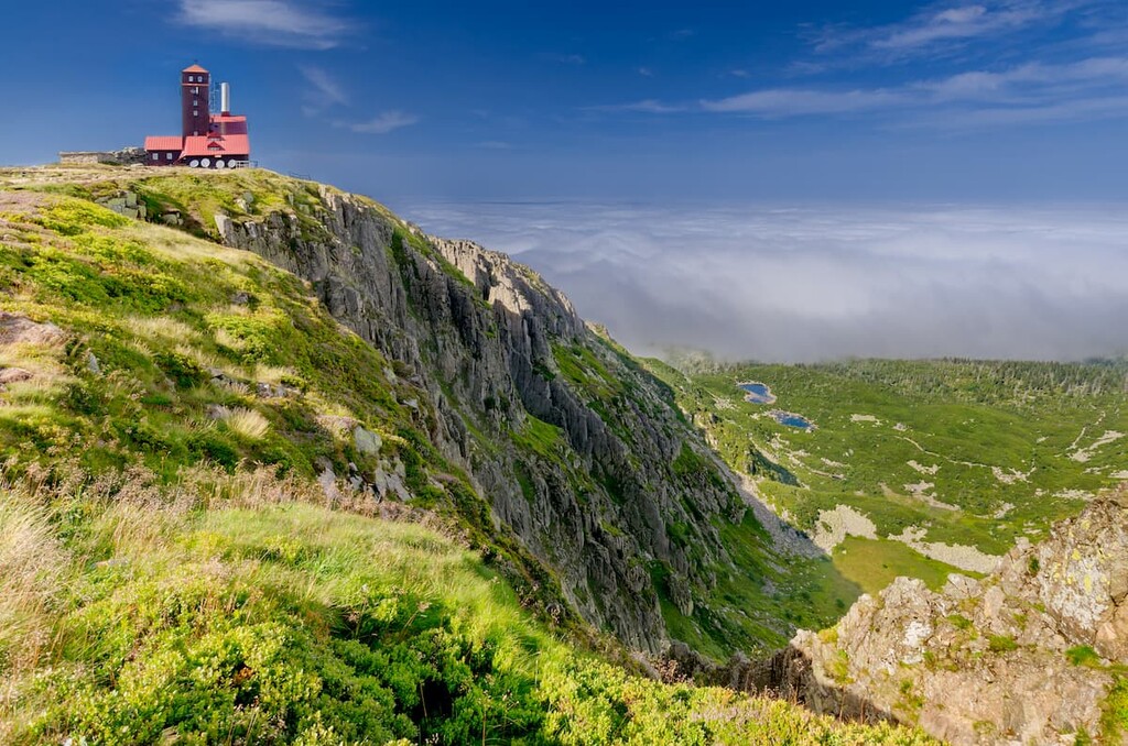
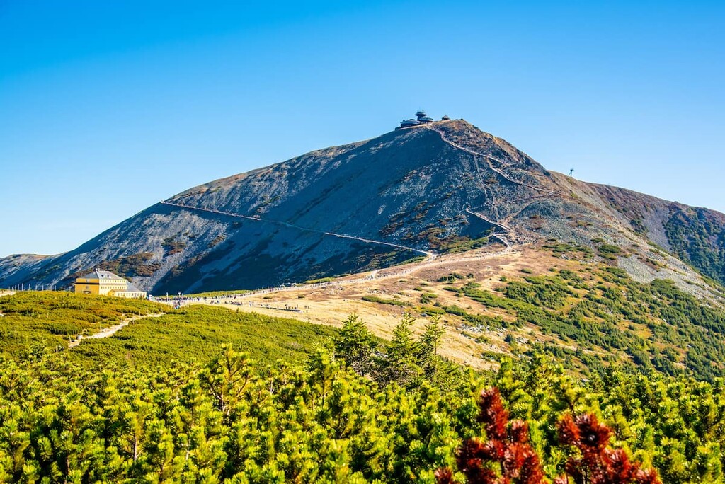
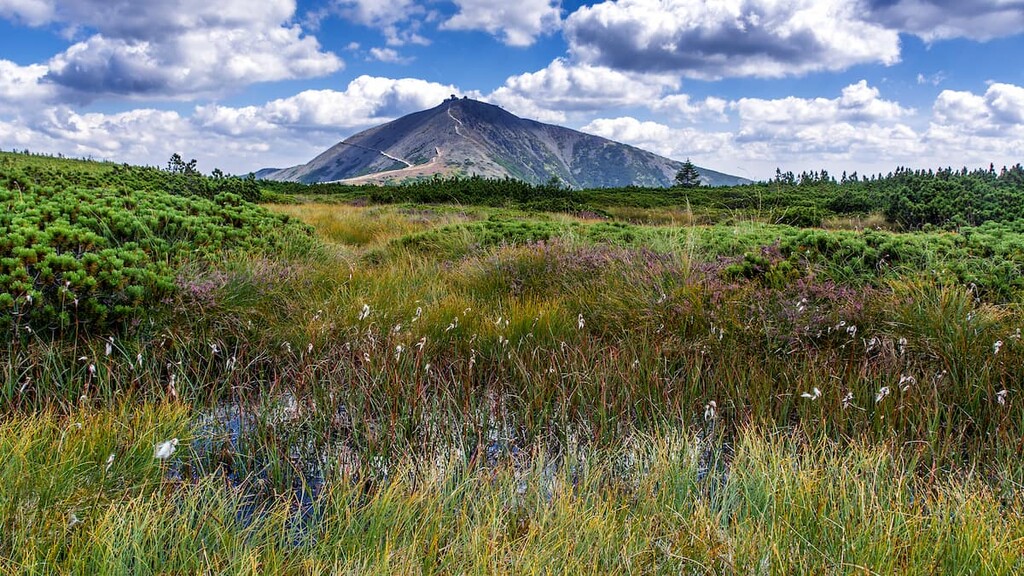
Karkonosze National Park is a mountainous region located in southwestern Poland along the country’s border with the Czech Republic. The park’s towering peaks have given the region the nickname the “miniature Alps.” There are 72 named mountains in the park, the tallest and most prominent of which is Sněžka (Śnieżka). The peak has an elevation of 1,603 m (5,259 ft) and a prominence of 1,188 m (3,898 ft).
Karkonosze National Park is situated along the southwestern border of Poland. The park spans 55.76 sq. km (21.53 sq. miles) of land across the region.
The landscape of the park is dominated by the Karkonosze Mountains, which are part of the larger Sudetes Mountains. The Karkonosze Mountains are home to the highest peaks in the Sudetes and are characterised by their rugged mountains and glacial kettles.
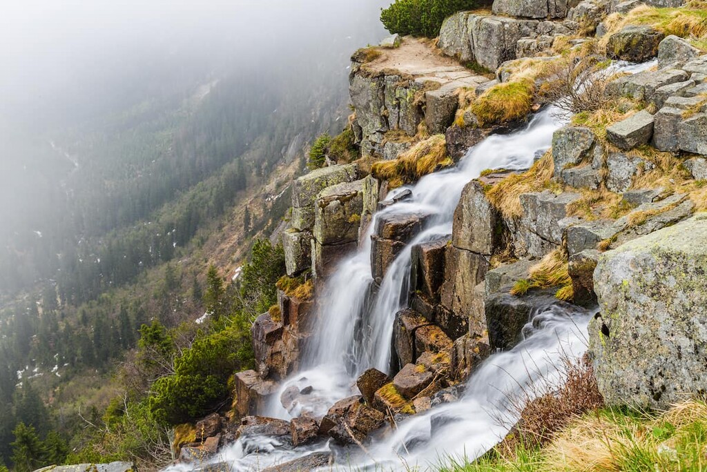
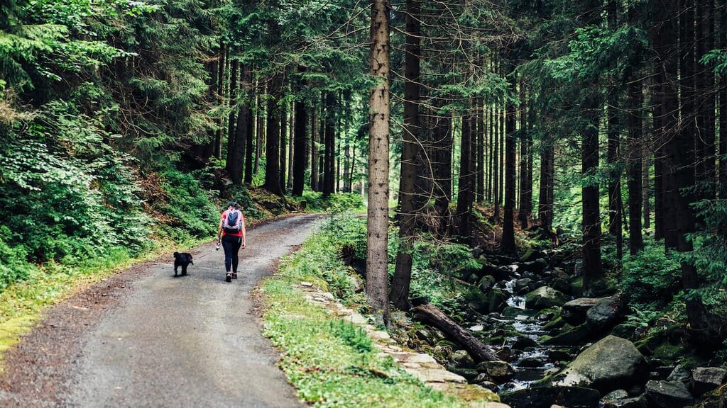
While the peaks create a stunning backdrop in Karkonosze National Park, over half of the region is covered in forested sections. Streams, lakes, rivers, and large boulders are dotted throughout the forest along with fields of peat bog.
The rugged peaks and abundance of waterfalls attract visitors to the landscape each year. Sněžka (Śnieżka) is located on the border between the two countries. Not only is it the tallest peak in the park, but also the tallest mountain in the Czech Republic.
Additionally, Karkonosze National Park is located near other parks in Poland and Czechia. In particular, Krkonoše National Park lies directly south, Rudawy Landscape Park is to the northeast, and Bóbr Valley Landscape Park is to the north.
The Karkonosze Mountains (also known as Krkonoše Mountains and Giant Mountains), are the defining feature of the park.
The range extends 36 km (22 miles) across western Poland. The peaks that are present today began forming around 300 million years ago with the Variscian tectonic movements. Millions of years of erosion began carving out the range that we see today.
During the Alpine orogeny, the central peaks in the range were uplifted even further, and are now home to the tallest elevation areas in the park.
The Pleistocene brought about the most recent period of glaciation in the region. As these glaciers receded, the Karkonosze Mountains were carved out even further, leaving behind wide ridgelines, dome shaped peaks, and deep river valleys.
Major peaks within the park include Sněžka (Śnieżka), Luční hora, Praděd, Studniční hora, Wielki Szyszak (Vysoké Kolo), and Klínovec.
Karkonosze National Park is not home to a wide range of fauna. Though the park isn’t known for an abundance of wildlife, visitors can still witness some fantastic animal species as local wildlife populations begin to grow.
Groups of red deer, roe deer, otter, and fox are slowly repopulating the region. The park is also home to over 15 species of bats. Other flying animals include pygmy owl, boreal owl, and alpine accentor..
One of the highlights of the park is its population of mouflons, as the species is rarely found in other parts of the country. They look similar to bighorn sheep and were introduced to the region at the beginning of the twentieth century.
The region was once covered by hardwood forests whose population has greatly decreased due to logging and human development. Today much of the forest is dominated by spruce trees.
The park’s close proximity to coal-burning power plants have left the soil drained of many nutrients, limiting the amount of thriving flora. Higher elevations in the park are home to various grasses, lichen, and moss.
The rugged peaks in what is now Karkonosze National Park didn’t become populated until the High Middle Ages. Some of the first settlements of the region date back to around 1000 CE. Populations slowly began to rise during the twelfth century CE.
Colonization of the foothills began in the thirteenth century with the arrival of Slavic settlers, followed shortly after by Germanic settlers. Though small villages began to grow, they were primarily located within the foothills of the range, where farming was much easier.
The fourteenth and fifteenth centuries brought further exploration of the region as local communities searched for precious metals within the mountain range. Mines began to open amidst the Karkonosze Mountains in the sixteenth century.
Mass deforestation also took place during this time as the population continued to grow. Large estates were continually being built along the foothills of the range, many of which are still standing today.
In order to protect and restore the land, Karkonosze National Park was established in 1959 and was later expanded to its current size. Both Karkonosze National Park and Krkonoše National Park were declared a UNESCO biosphere reserve in 1992.
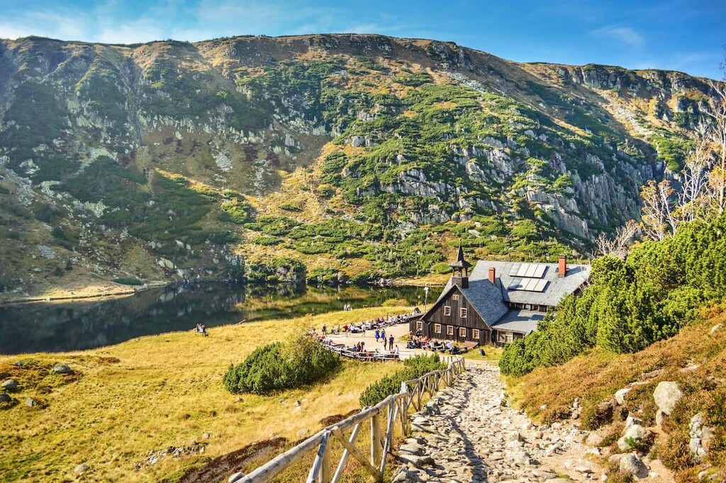
Karkonosze National Park is home to numerous trails for hiking and biking. Here are some of the most popular trails and regions in the park:
The Śnieżka Okólnik trail is one of the most popular loop trails in the park. The route extends for some 19.5 km (12.1 miles) and has about 1,020 m (3,349 ft) of elevation gain.
The trail winds through the forested foothills of the park while passing along numerous lakes. Throughout the trail visitors can see numerous rock formations while traveling along ridgelines which offer views of the park.
This point to point trail is 9.8 km (6 miles) long with 485 m (1,590 ft) of elevation gain. The trail climbs steadily through the forest before reaching the base of Szrenica.
The descent of the route follows along Szrenicki Potok river while passing through fields of wildflowers during the summer months.
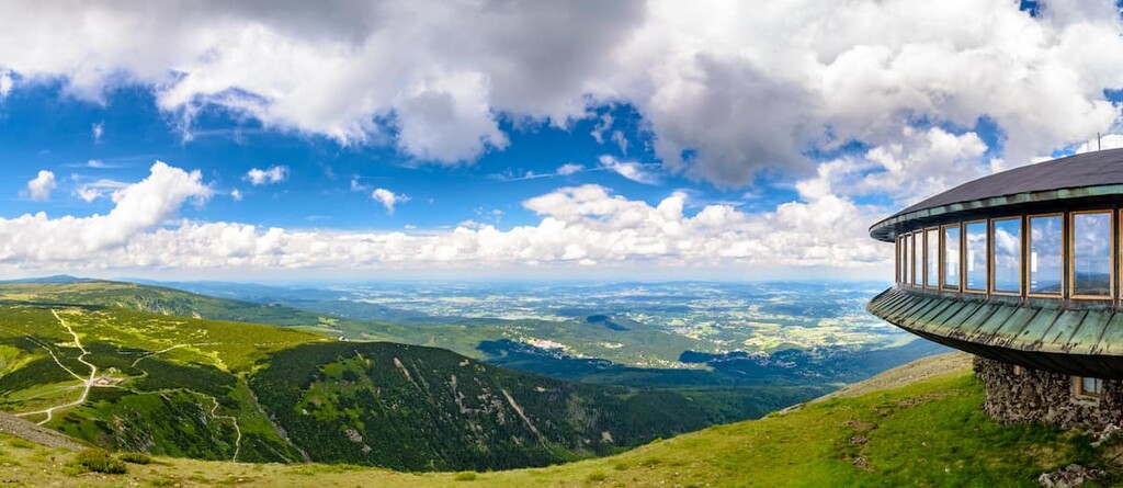
Jakuszyce-Karpacz Trail is one of the highlights of the entire park. The trail spans 54.4 km (33.8 miles) and has 2,136 m (7,007 ft) of elevation gain. The route travels from one end of the park to the other, traversing the spine of the Karkonosze Mountains.
Parts of the trail are paved while other sections are quite rocky. Hikers will get to summit some of the tallest peaks in the park allowing for impeccable views of both Poland and the Czech Republic.
Looking for a place to stay near Karkonosze National Park? Here are some of the best cities and villages to check out in the region:
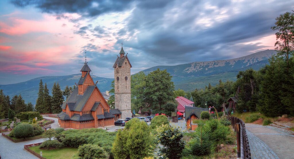
Situated along the eastern edge of the park lies the town of Karpacz. The small town has a population of around 4,500 people and it is known as a “winter capital” of Poland. While surrounded by hiking trails in the summer, the town is located in Jelenia Góra county near a number of skiing areas during the winter months.
A thirteenth century chapel (Vang Stave Church) is situated in the town amidst the many hotels and local restaurants. Catering to local and international tourists, alike, the town of Karpacz allows for easy access to the many trails throughout the park.
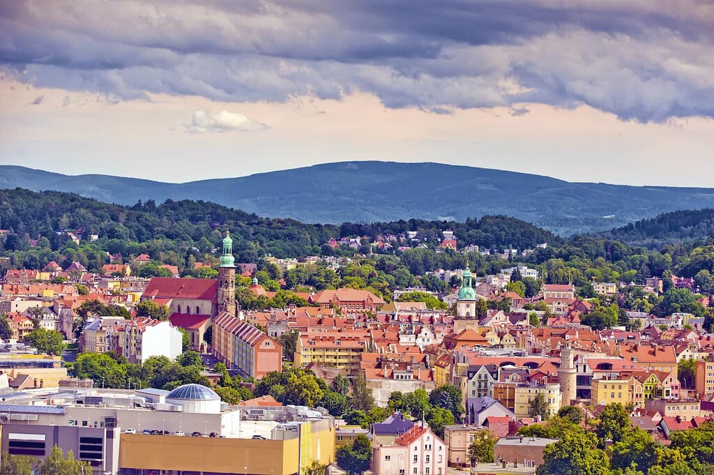
The city of Jelenia Góra is located to the north of Karkonosze National Park. The city has a population of around 80,000 people, and it acts as the main gateway into the park and the rest of the Karkonosze Mountains.
The old town district dates back to the tenth century and is one of the few places in the region left untouched by World War II. Important cultural sites such as Chojnik Castle and Wojnowska Tower are scattered throughout the small city. The Karkonosze National Park headquarters are also located in the city.