
Scan the QR code and open PeakVisor on your phone
Black Forest National Park (German: Nationalpark Schwarzwald) is a forested region located in extreme southwestern Germany near the French border. The park runs along the main crest of the Northern Black Forest. There are 60 named mountains; the tallest peak is Dreifürstenstein, at 1,155 m (3,789 ft) tall, while the most prominent is Badener Höhe, with 178 m (584 ft) or prominence.
Black Forest National Park (German: Nationalpark Schwarzwald) is in southwestern Germany in the state of Baden-Württemberg. The park lies near the country’s border with France. Black Forest National Park covers 10,062 hectares (100.62 km2; 38.85 sq mi) of land. The park is divided into two separate areas located 3.5 km (2.1 miles) away.
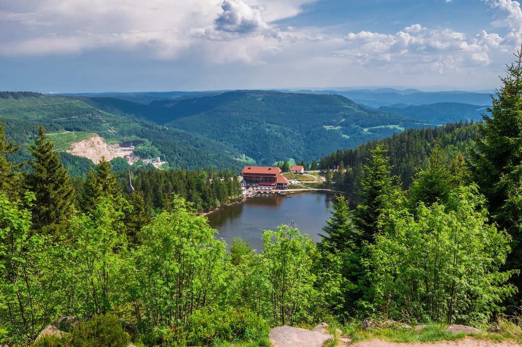
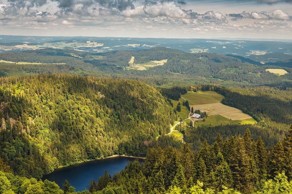
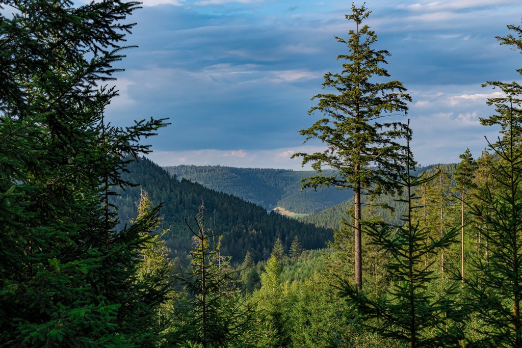
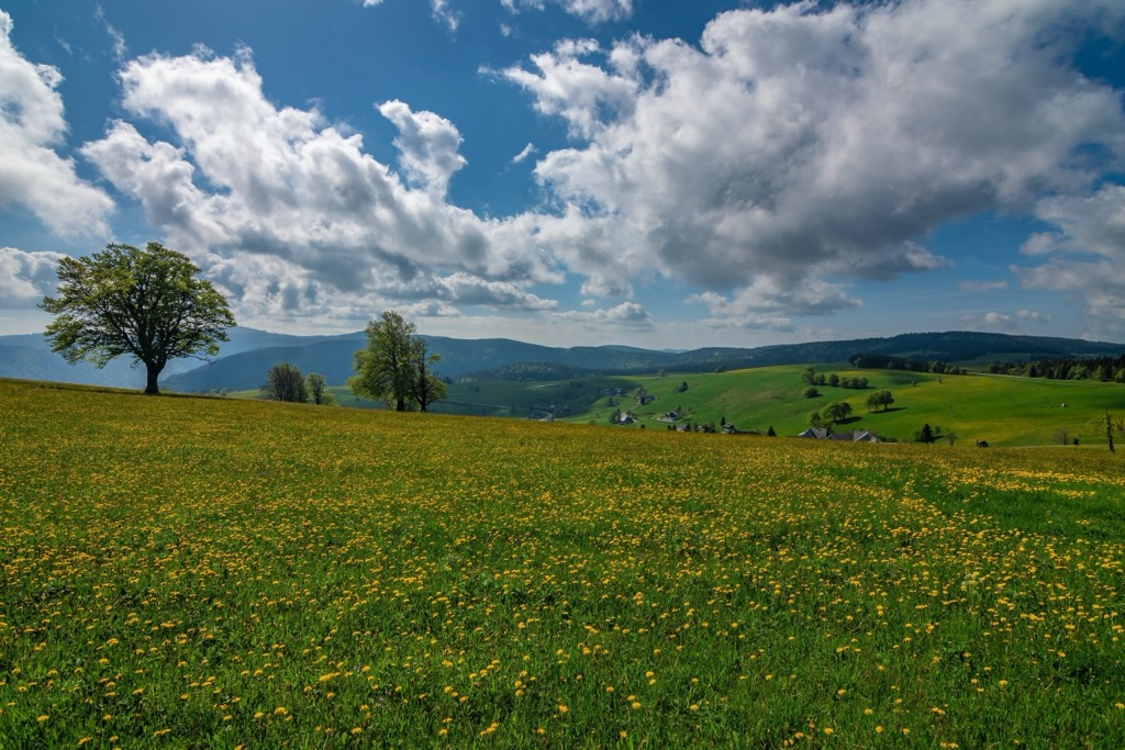
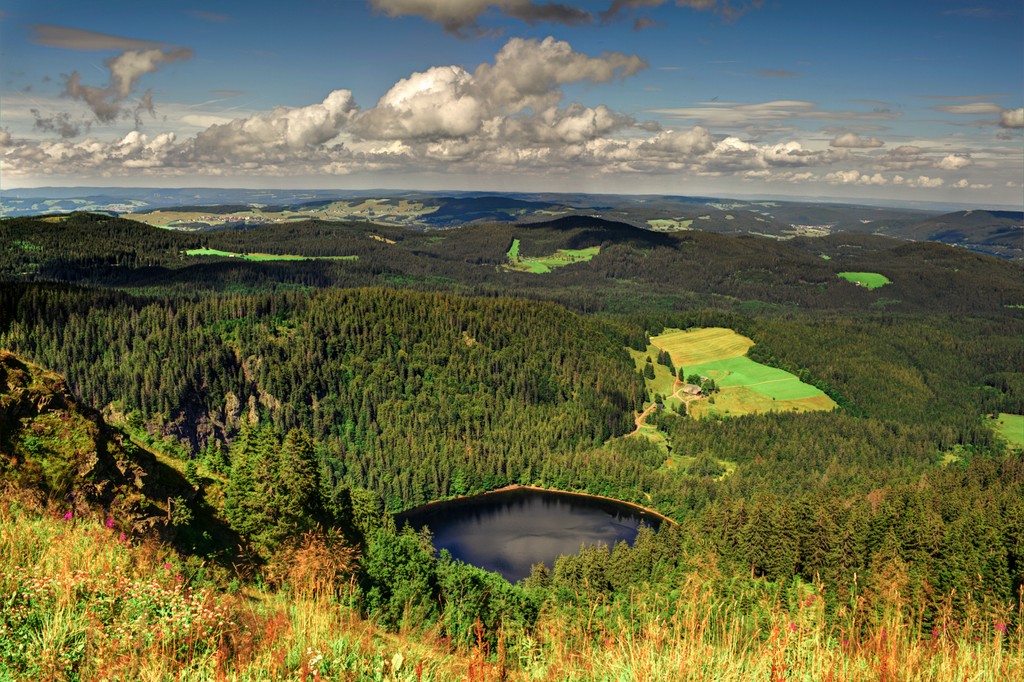
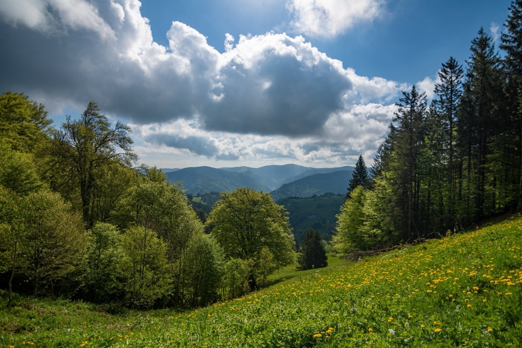
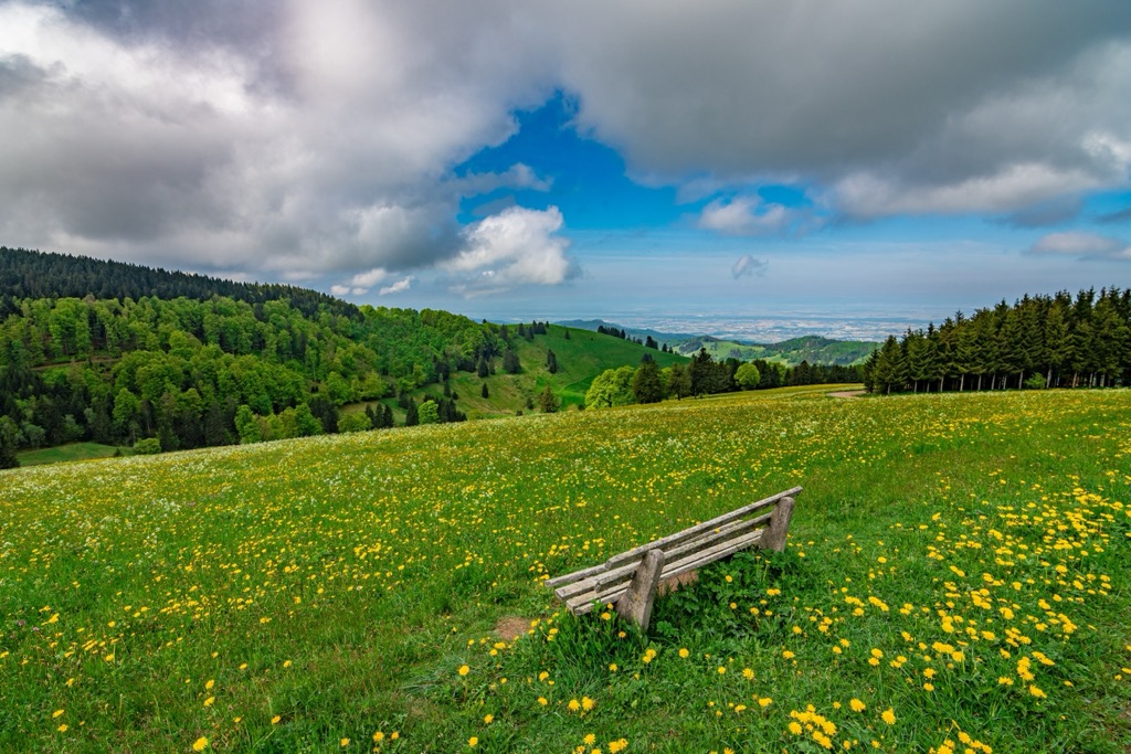
The park features one of the more pristine sections of the more extensive Northern Black Forest. The entire Black Forest region features two Nature Parks and one National Park. Similarly to other parts of the forest, ridgelines, densely forested slopes, meadows, small creeks, and streams dominate the landscape.
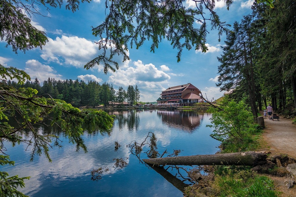
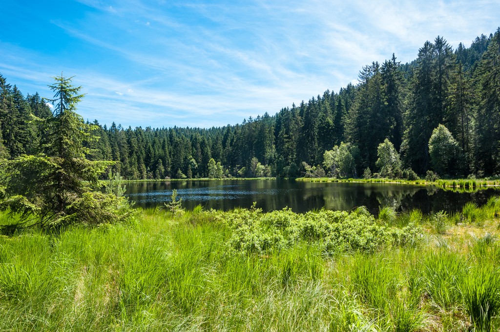
Elevations rise steeply from the valley floor up to the ridgelines. These elevation changes are more dramatic along the park’s western edge, with the eastern edge featuring more gradual slopes. Amidst the series of ridgelines and forested valleys lie numerous tarns and ponds.
The headwaters of the Murg River are in the southern portion of the park. The river flows north, separating the Black Forest from the Murg Valley to the east.
Black Forest National Park is near various other parks and protected regions. The park lies within the Central/North Black Forest Nature Park (German: Naturpark Schwarzwald Mitte/Nord). Schönbuch Nature Park lies to the east, while Ballons des Vosges Regional Nature Park is to the west in France.
The park’s mountains are part of the more extensive Northern Black Forest (Schwarzwald). Despite its name, the Black Forest also includes a mountain range spanning southwestern Germany. The range runs in a north-to-south fashion across Baden-Württemberg.
The range’s geological base consists of crystalline bedrock dating back to the Variscan orogeny. The outer lays of rock are sandstone, while the range's core is a mix of gneiss and granite.
The uplifting of the region resulted from the downfaulting of the Upper Rhine Plain, which lies to the west. During the Eocene epoch, either side of the plain was uplifted, with the Black Forest along the eastern side and the Vosges to the west.
During several of the recent Pleistocene ice ages, much of the Black Forest was heavily glaciated. The main ridgeline became more defined after the advance and retreat of the ice sheet. Hikers can spot remnants of this glaciation through the various cirques and tarns visible in the park.
Significant peaks within the park include Dreifürstenstein, Badener Höhe, Hoher Ochsenkopf, Vogueskopf, and Altsteigerskopf.
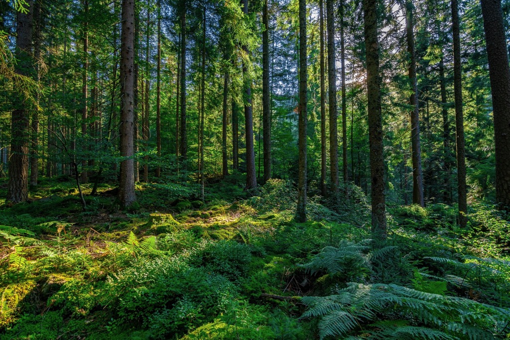
Black Forest National Park is home to a variety of plant and animal species. Fir, spruce, and beech trees comprise most of the forested areas. The acidic soil makes it difficult for some vegetation to survive, although the humid climate is ideal for various mosses and ferns.
The park’s mammals include deer, pine marten, and various species of bats. Many birds inhabit the region; the forest is home to the peregrine falcon, the fastest bird in the world, and the pygmy owl, which is the smallest owl in Europe.
The Black Forest National Park has a long and rich human history, dating back thousands of years. The forest has held numerous names, depending on who settled throughout the surrounding region.
The present state of Baden-Württemberg marks part of the traditional territories of Baden, Prussian Hohenzollern, and Württemberg. The Roman Empire invaded and later occupied Württemberg around 100 CE. By the third century, the Alemanni people had forced the Romans to retreat past the Rhine and Danube rivers.
The Holy Roman Empire came to power in the centuries after the fall of Rome. The majority of the region remained Roman Catholic, even after the Protestant Reformation, which was much more dominant in northern Germany.
Remnants of seventeenth and eighteenth-century military fortifications remain throughout the Black Forest region. During the nineteenth century, a burgeoning population had deforested nearly the entire region. In the following two centuries, agricultural became less prominent and many of the slopes returned to their forested state. Most of the replanted trees were Spruce, which dominate the landscape today.
Following the end of World War II, the Allies went on to establish three states in the region: Württemberg-Hohenzollern, Baden, and Württemberg-Baden. While the United States occupied Württemberg-Baden, France occupied the other two states. The three states became part of the Federal Republic of Germany in 1949.
A few years later in 1952, the three states voted to merge, officially forming Baden-Württemberg. The Black Forest National Park was established in 2014 and is the state’s first national park.
Black Forest National Park is home to numerous hiking trails. Here are some of the most popular trails in the park:
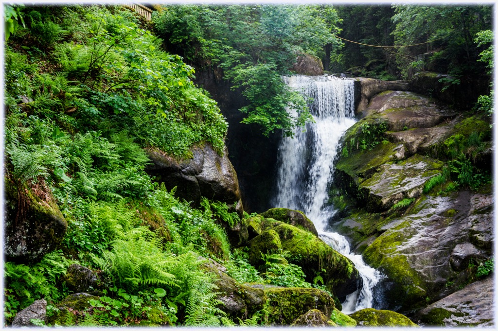
The All Saints Waterfall is a shorter hiking trail along the Lierbach River in the southern portion of the park. The stunning falls are some of the most impressive in the entire Black Forest, and the trail is very accessible for families.
Hikers can also explore the beautiful remnants of the All Saints Monastery along the route. Numerous steps along this trail can become slippery after rain or snowfall. This out-and-back is 0.7 km (0.4 miles) long and features 33 m (108 ft) of total elevation gain.
The Herrenwiesersee, Badener Höhe und Seekopf Rundweg trail follows near the Black Forest High Road that runs along the park’s central ridgeline. Hikers wind through the densely forested spruce hillsides before reaching the Herrenwies See.
This trail then passes along the summits of Badener Höhe and Seekopf. From the summit, hikers have stunning views of the surrounding forest and the small villages below. This loop trail is 8.4 km (5.2 miles) long and features 328 m (1,076 feet) of total elevation gain.
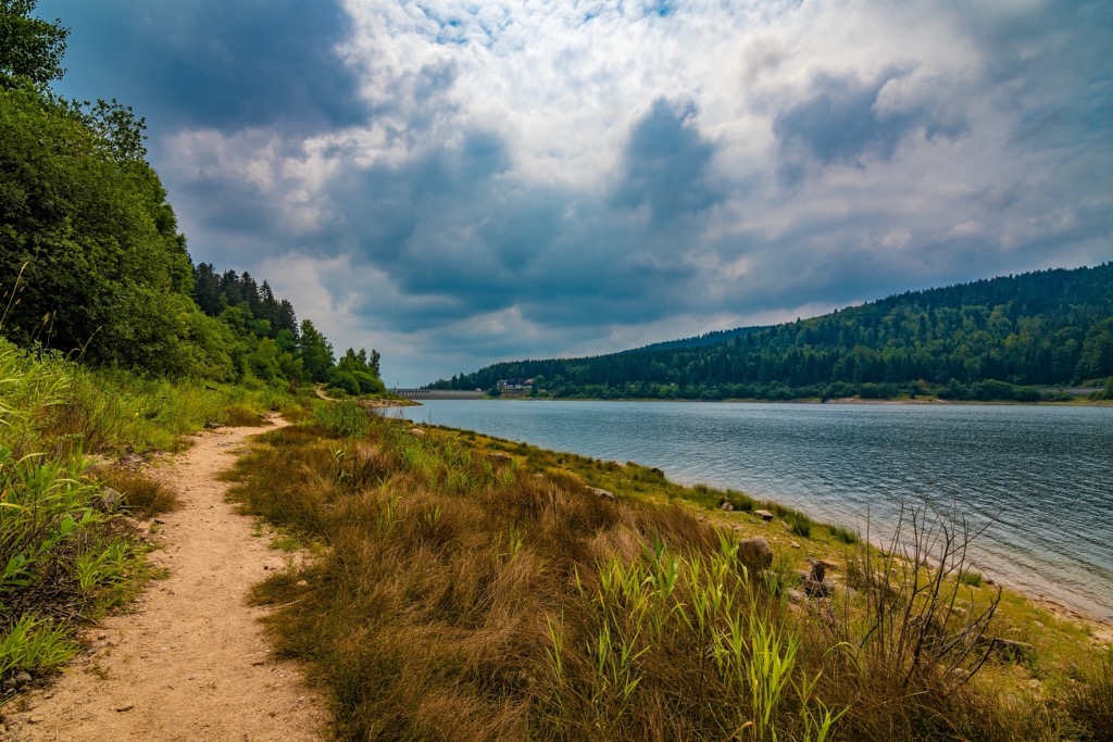
This loop trail leads around the Schwarzenbachtalsperre, the largest reservoir in the northern and central regions of the Black Forest.
The trail has numerous small climbs and descents throughout and passes along the reservoir dam. This loop is 6.3 km (3.9 miles) long and features 208 m (682 feet) of total elevation gain.
Looking for a place to stay near the Black Forest National Park? Here are some of the best towns and cities to check out near the park:
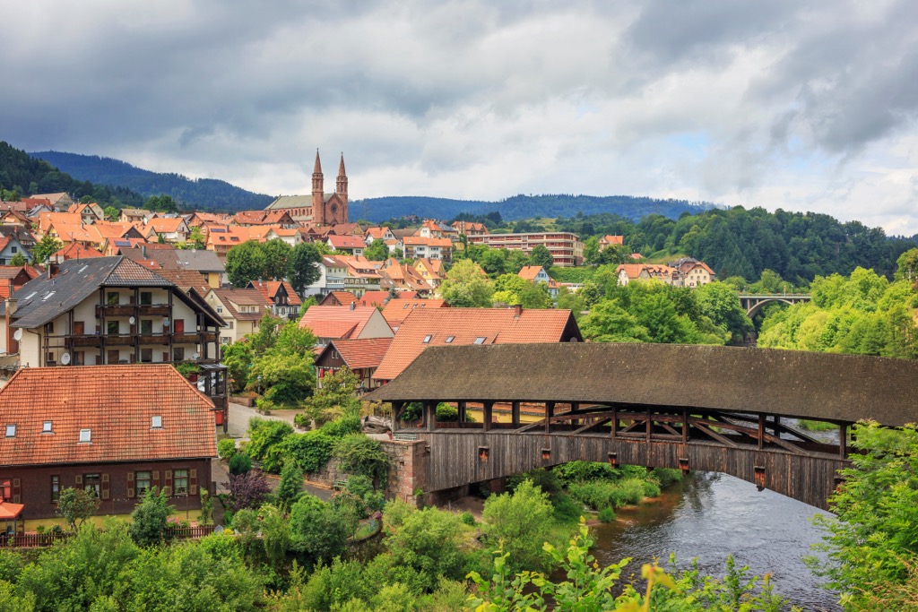
The town of Forbach lies along the northeastern edge of the park. Situated along the Murg, Forbach is a quaint mountain town home to around 5,000 residents.
Many trails and paths run through Forbach, connecting it to other towns and villages within the Black Forest. Besides outdoor recreation, Forbach is home to numerous attractions, including the Murgtal Museum, St. Bernhardus Church, St. Valentin Church, a wooden covered bridge over the Murg, and dozens of fountains throughout the downtown streets.
Stuttgart lies northeast of the national parkland and is the closest major city. Stuttgart is the capital and the largest city in Baden-Württemberg. Situated along the Neckar River, the city is home to over 635,000 residents, making it the sixth-largest city in Germany.
Stuttgart is spread across the region's hillsides, featuring a contrast of buildings and vineyards all within proximity. Known as the “cradle of the automobile,” Stuttgart is home to numerous museums and magazine publications centered around automobiles.
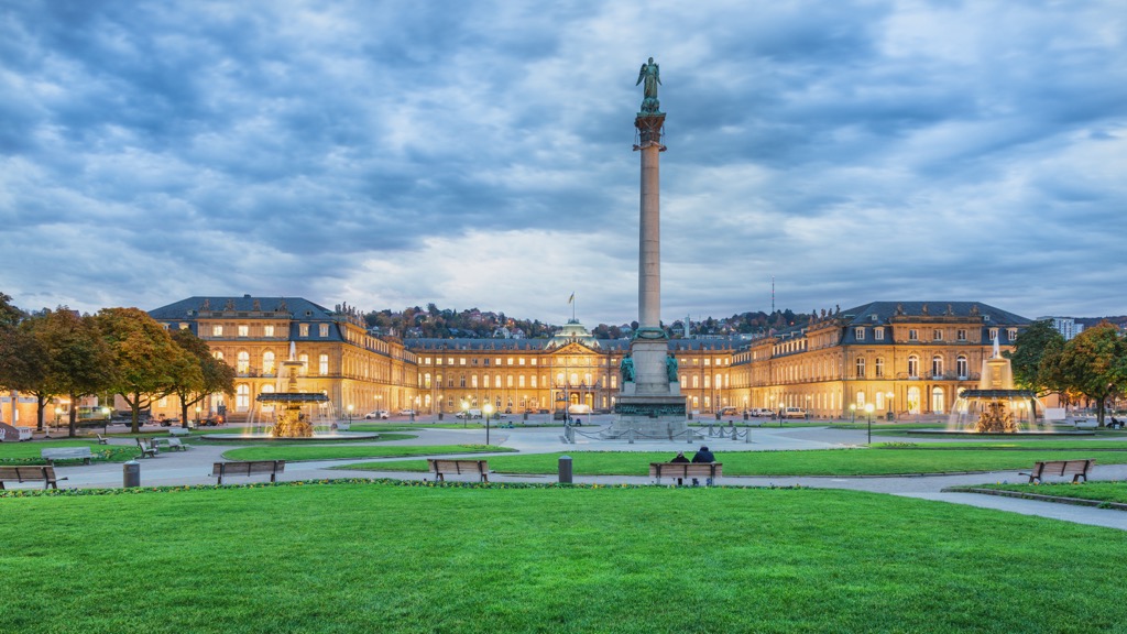
Stuttgart is now surrounded by one of the largest wine-growing regions in the country and features stunning architecture throughout the city streets. Some popular museums include the State Museum of Natural History Stuttgart, the Mercedes-Benz Museum, the Porsche Museum, and the Stuttgart Art Museum.


