Scan the QR code and open PeakVisor on your phone
Mont Mars Nature Reserve (Riserva Naturale Mont Mars) is located in the Aosta Valley region of Italy. Despite its small size, Mont Mars is the region’s largest nature reserve. There are 7 named mountains in Mont Mars Nature Reserve. The highest and the most prominent mountain in the reserve is Monte Mars (2,600 m/8,530 ft).
Mont Mars Nature Reserve is situated in the Aosta Valley region of northwestern Italy, along the region’s border with Piedmont. The reserve was established in 1993 and is located in the municipality of Fontainmore.
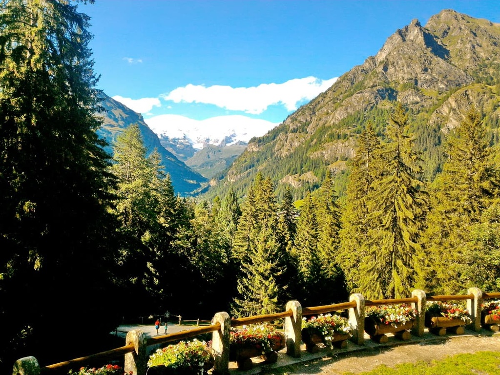
Set in the Lys and Pacoulla valleys, Mont Mars Nature Reserve spans a humble 3.9 sq. km (1.5 sq. mi) from the hamlet of Pillaz to the summit of Monte Mars (2,600 m/8,530 ft). Despite its small size, Mont Mars Nature Reserve offers incredible scenery and plenty of hikes for visitors to enjoy.
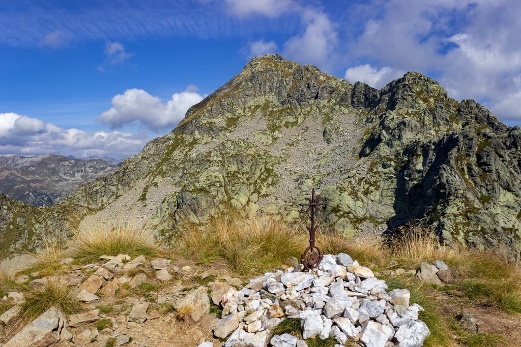
The summit of Monte Mars dominates the area with its imposing pyramidical 2,600 m (8,530 ft) peak rising above a landscape of scree and steep walls. Monte Mars is the highest peak in the park as well as the highest peak of the Biellese Alps, which is a subrange of the Pennine Alps.
The reserve is located on the watershed divide of the Lys and Elvo valleys, the latter of which is situated across the regional border in the province of Biella within the Piedmont region.
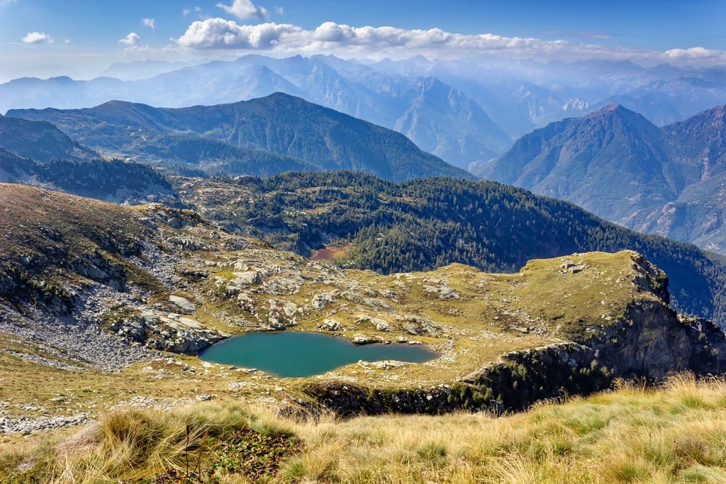
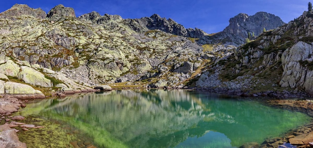
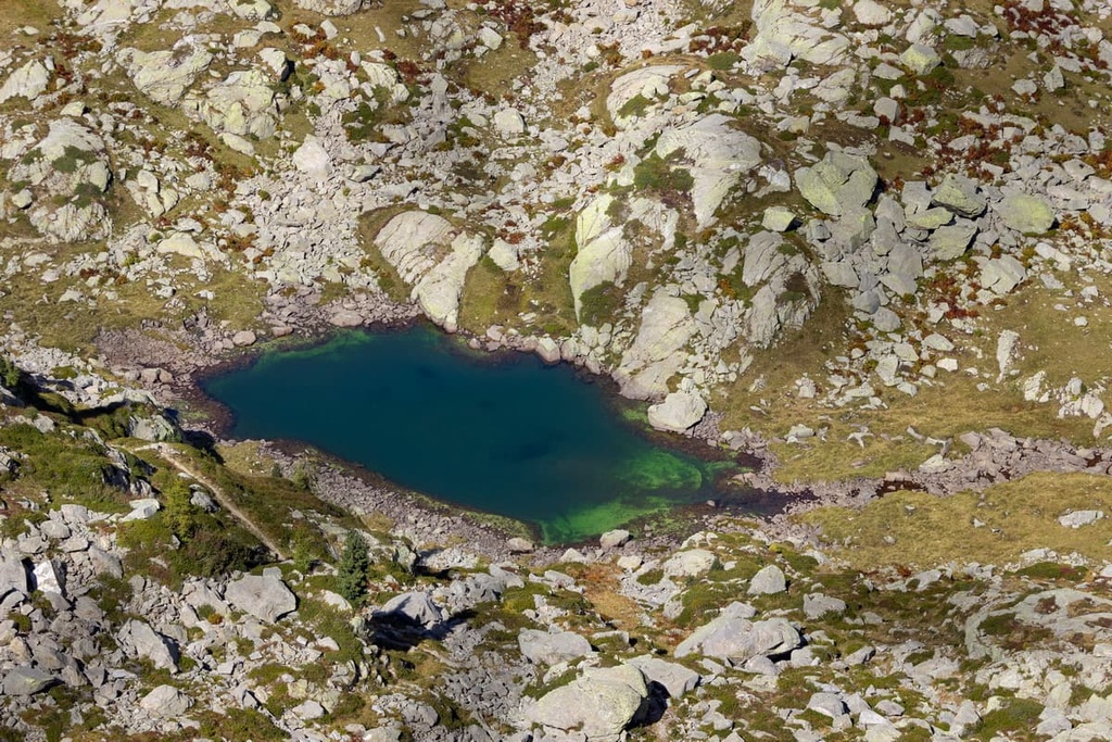
Mont Mars Nature Reserve is part of the Biellese Alps, a subrange of the Pennine Alps. Within the reserve, there are multiple morphologies of glacial origin, including a succession of stepped rock basins that now house peat bogs and small lakes.
In the snowfield located in the small cirque at the foot of Monte Mars’ northern slopes, you can find scant traces of the ancient glacier that would have occupied the valley until around 10,000 years ago. A few of the many rocks that can be found in the reserve include mica schists from the Sesia-Lanzo area as well as white marble and various dark basic rocks.
Some of the main lakes found in Mont Mars Nature Reserve include Lake Vargno, Lac Bonel, Lei long lakes, and Lago della Barma.
A variety of typical Alpine environments can be found in Mont Mars Nature Reserve, such as woods, shrublands, pastures, rocky walls, wetlands, and lakes. Due to the presence of the Pacoulla stream, the area is also rich in plant life.
The lower part of the valley is home to larch and deciduous forests that are intermittently populated by shrubs such as rhododendrons, blueberries, and fragrant dwarf junipers. Higher up the valley, amongst the scree and Alpine pastures, there are also purple gentians, arnica montana, negritella, and mountain lilies to be found in the summer months.
The rare Austrian leopard’s bane can be found in rocky areas within the reserve while aquatic species, such as white water crow-foot (a water ranunculus), can also be found in the lake Lei Long basin wetlands.
As far as fauna goes, the animals that you’ll see in Mont Mars Nature Reserve vary widely depending on the specific ecosystems that you’re traveling through.
In the reserve’s wetlands and lakes, you’ll find the common frogs and dippers. Alpine pastures in Mont Mars are instead home to rock partridges, water pipits, redstarts, ptarmigans, black grouse, and Alpine chaffinches as well as chamois, marmots, hares, foxes, and common vipers.
Human history in Mont Mars Nature Reserve is evident in the reserve’s many pathways, which showcase the stone working skills of the ancient people who once lived in this area.
There is also a local pilgrim path that crosses the park, which has been used for at least the past 500 years. This pilgrim path, which is called the Oropa Procession, starts in the hamlet of Pillaz. It travels along a historic mule track that leads to the Oropa Sanctuary in the Province of Biella.
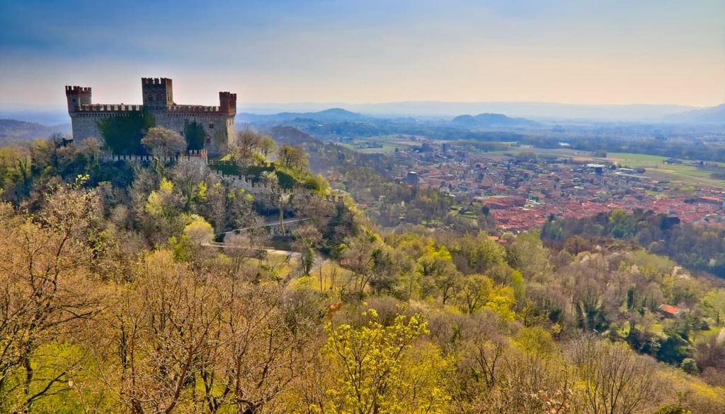
In the area surrounding the reserve, you can also find countless villages, chapels, and castles, all of which help to blend architecture and history with the surrounding natural landscape.
Furthermore, traditional black bread is still baked in this small corner of Aosta Valley. The bread was traditionally baked once a year at the beginning of winter as part of a collective feast that was historically held in the region’s small villages.
There are also many myths and legends linked to this part of Aosta Valley that have been passed down through generations. Some of these myths revolve around the nearby Lys torrent, where legend has it that there are threatening giants, devils, and dragons.
You can learn more about the village and the park at the visitor center based in Mont Mars Nature Reserve. Here, you can hear more about the fauna of the park and the pilgrim route that passes through it. There’s also a mid-mountain ecomuseum located close to the reserve’s entrance in the small hamlet of Pra dou Sas.
Despite its small size, Mont Mars Nature Reserve offers 40 km (24 mi) of hiking trails along ancient mule tracks and footpaths.
All of the trails in the reserve feature official route markers that boast a yellow flag with black lettering. Once inside the reserve, you’ll also find informational panels that provide great background information about the local environment.
With that in mind, here are some of the best hikes to check out during your next visit to Mont Mars Nature Reserve:
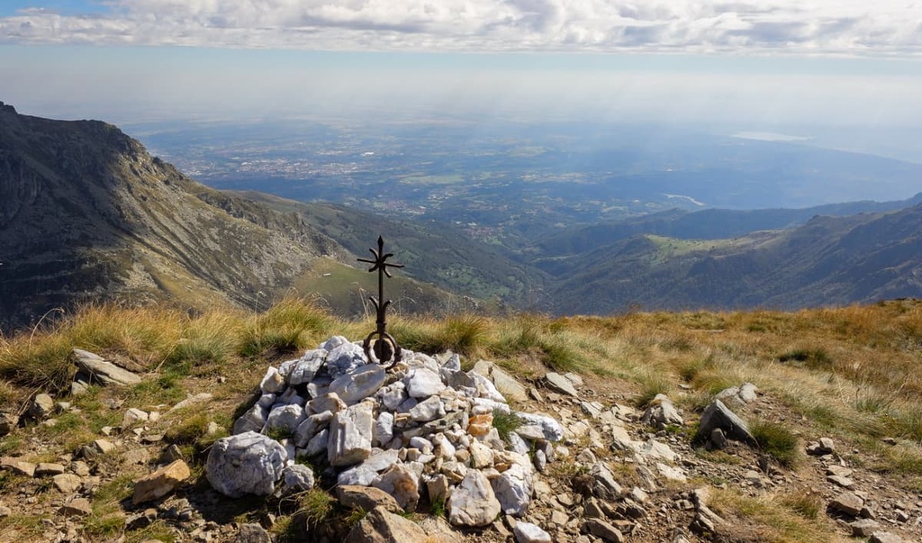
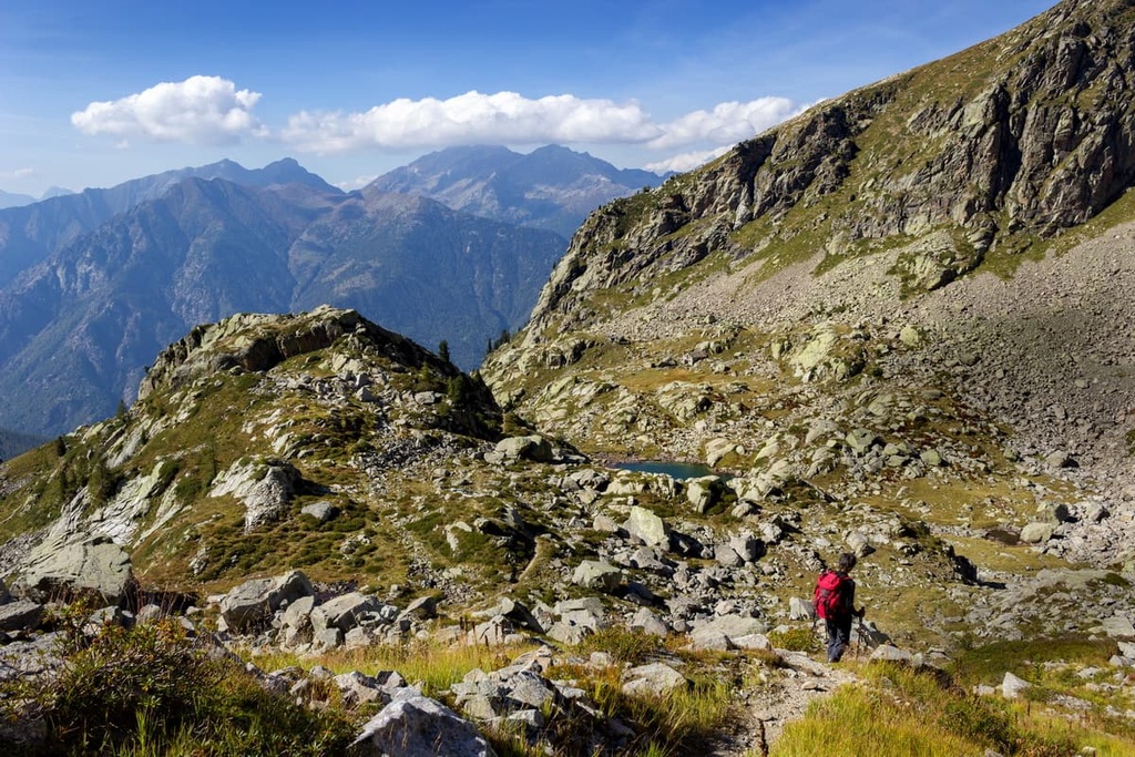
The Tour du Mont Mars is an 8.5-hour long loop route that features 1,190 m (3,904 ft) of elevation gain. It is best suited for experienced hikers and it offers breathtaking panoramas of Monviso, Gran Paradiso, Mont Blanc, Matterhorn (Cervino), and Monte Rosa.
This route starts at Plan Courmarial and it runs along Lake Vargno before reaching Lake Long. It eventually makes its way to Monte Mars before descending down toward the Gaudin lakes and rifugio Coda. From the rifugio, the route continues to Colle Carisey before finally descending back to Plan Courmarial.
The Lakes Route is an enjoyable hiking trail that departs from Lake Vargno and takes you to some interesting destinations, such as Lake Long, Lake Bonel, and Lake della Barma. The entire walk takes around three hours to complete and has 645 m (2,116 ft) of elevation gain.
This route starts at Plan Coumarial and takes you to the summit of Mont Mars. From the trailhead, you’ll follow the signpost for the 2D route that takes you through dense fir and larch forests before opening up to a viewpoint over the valley. The path alternates between pastures and woodlands where you can see rhododendrons blooming in late June.
Next up, you’ll pass by Punta Leretta (1,950 m/6,397 ft) before making your way up to Pian du Juc pasture (2,043 m/6,702 ft). Then, you’ll follow the northwest ridge of Monte Mars up to the summit along a narrow path that’s often difficult to spot among rocks and scree.
From the summit, you can spot the peaks of Monviso, Gran Paradiso, Mont Blanc, Matterhorn (Cervino), and Monte Rosa.
There are many small towns and B&Bs available in the area around Mont Mars Nature Reserve. Here are some of the most convenient towns with access to Mont Mars that are worth stopping by during your travels.
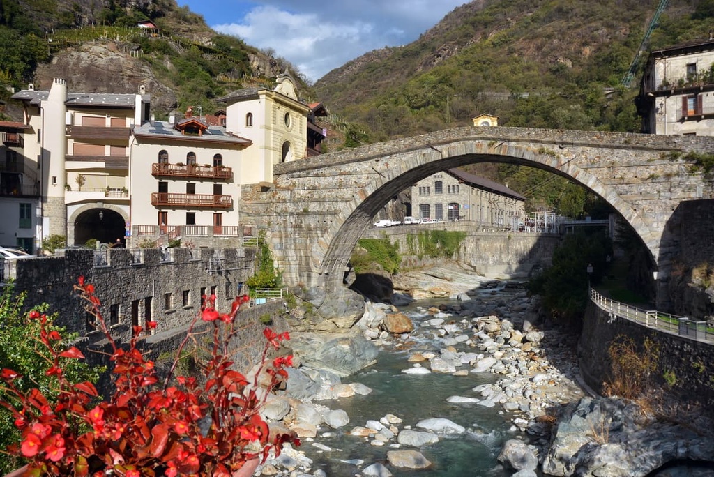
Named after its namesake Roman bridge, Pont-Saint Martin is the first municipality that you’ll reach upon arriving in Aosta Valley from Piedmont. The town is home to two ruined medieval castles: Castle Pont-Saint Martin, and Castle Suzey.
Pont-Saint Martin is easily reached by car, bus, or train. It is an excellent base for anyone who wants to access the Lys Valley and discover various other places within the region.
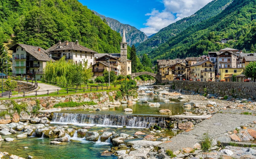
Fontainemore is the second municipality that you’ll reach as you make your way to the Lys Valley. Traces of its ancient rural culture are still visible in the form of stone and wooden buildings, frescoed chapels, and ancient mule tracks.
In Fontainemore, you can visit the mid-mountain ecomuseum and the Guillemore Bridge. The town also provides easy access to Mont Mars Nature Reserve.
Other activities that you can enjoy around Fontainemore include canyoning routes, via ferrata, and hiking trails. In winter, typical activities that you can enjoy in the area include snowshoeing, skiing, and cross country skiing.
Although it’s located in Piedmont, Ivrea is the closest large settlement to Mont Mars Nature Reserve. The town is located on the border with Aosta Valley along the road that leads into the region.
Ivrea is also home to the famous Battle of the Oranges, which allegedly originates from medieval times and is celebrated to commemorate the overthrow of an evil duke. The event involves a lot of orange throwing for three days during carnival in the lead-up to Shrove Tuesday and is believed to be the largest organized food fight in Italy.