Scan the QR code and open PeakVisor on your phone
Located in the heart of the Cottian Alps, Val Troncea Natural Park (Parco Naturale della Val Troncea) is a peaceful protected area that makes for an excellent outdoor adventure destination. There are 21 named mountains in Parco Naturale della Val Troncea, the highest and most prominent of which is Punta Rognosa (3,280 m/10,761 ft).
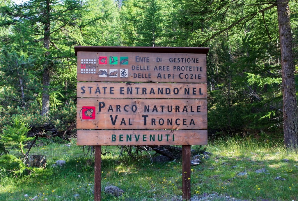
Val Troncea Natural Park was created in 1980 to preserve the region’s natural environment as well as for educational, scientific, cultural, and tourism purposes.
The park is located in the province of Turin in the region of Piedmont in northern Italy, close to the French border. The entirety of the Val Troncea Natural Park lies within the municipality of Pragelato, which owns 89 percent of the park’s land.
Val Troncea Natural Park is surrounded by a collection of peaks over 3,000 m (9,842 ft) in elevation for most of its perimeter, and it covers an area of around 33 sq. km (13 sq. mi).
The park is actually located in Val Chisone, which is home to the source of the Chisone stream. Chisone’s waters originate from the slopes of both Monte Barifreddo and Monte Appenna.
Val Troncea Natural Park is located in Val Chisone, which itself is composed of gently sloping grass and woodland-covered slopes on its right side. These gentle slopes stand in stark contrast with the rugged rock walls and faces of the left side of the valley.
This difference in topography is due to the glacial erosion that took place in the valley about 200,000 and 15,000 years ago. These glaciers carved out the valley that can be seen today, giving it a U-shaped profile.
The various rocks in the park, which include limestone, clay, and marl, derive from sediments from the seabed of the ancient Tethys Sea. This sea once covered the area that is now Piedmont until around 200 million years ago.
The remains of ancient coral reefs can be seen in Monte Motta as dolomitic outcrops. Meanwhile, green-colored igneous rocks that originated from submarine lava flows are on display in the Colle del Beth and Colle Arcano hills. These igneous rocks also emerged in the Colle Clapis pass where they originated from the cooling of magma within rocks beneath the ocean floor.
Historically, copper has also been found in the prasinites of Colle de Beth. This copper was mined toward the end of the nineteenth century.
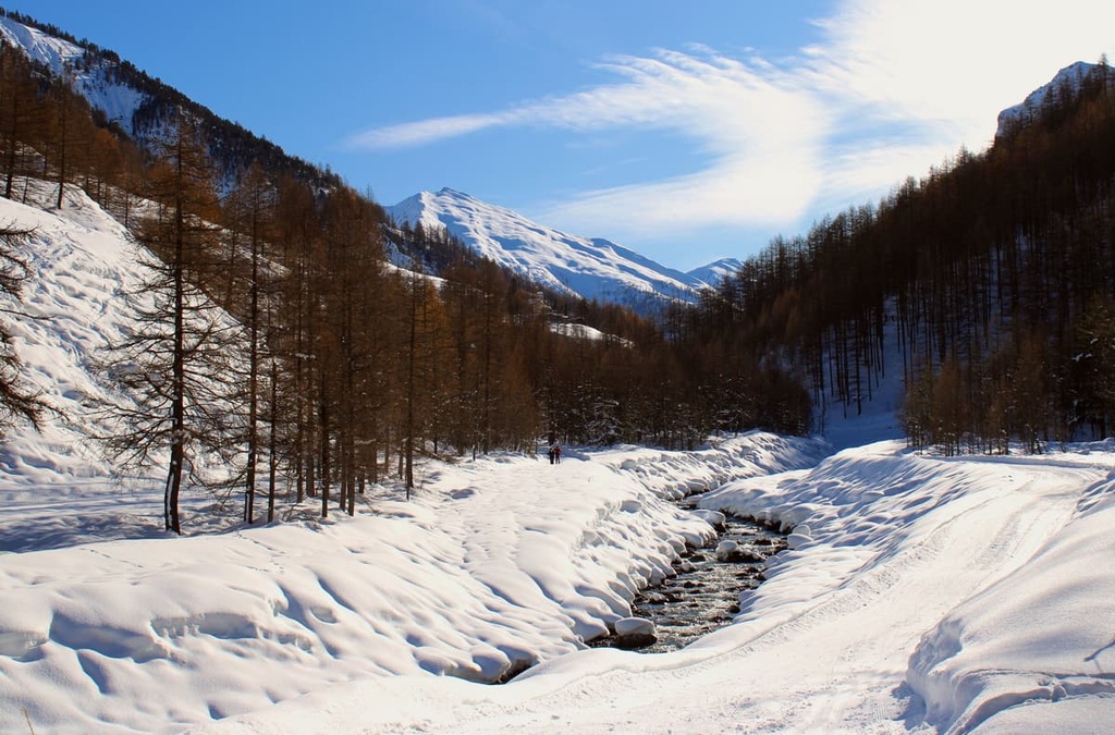
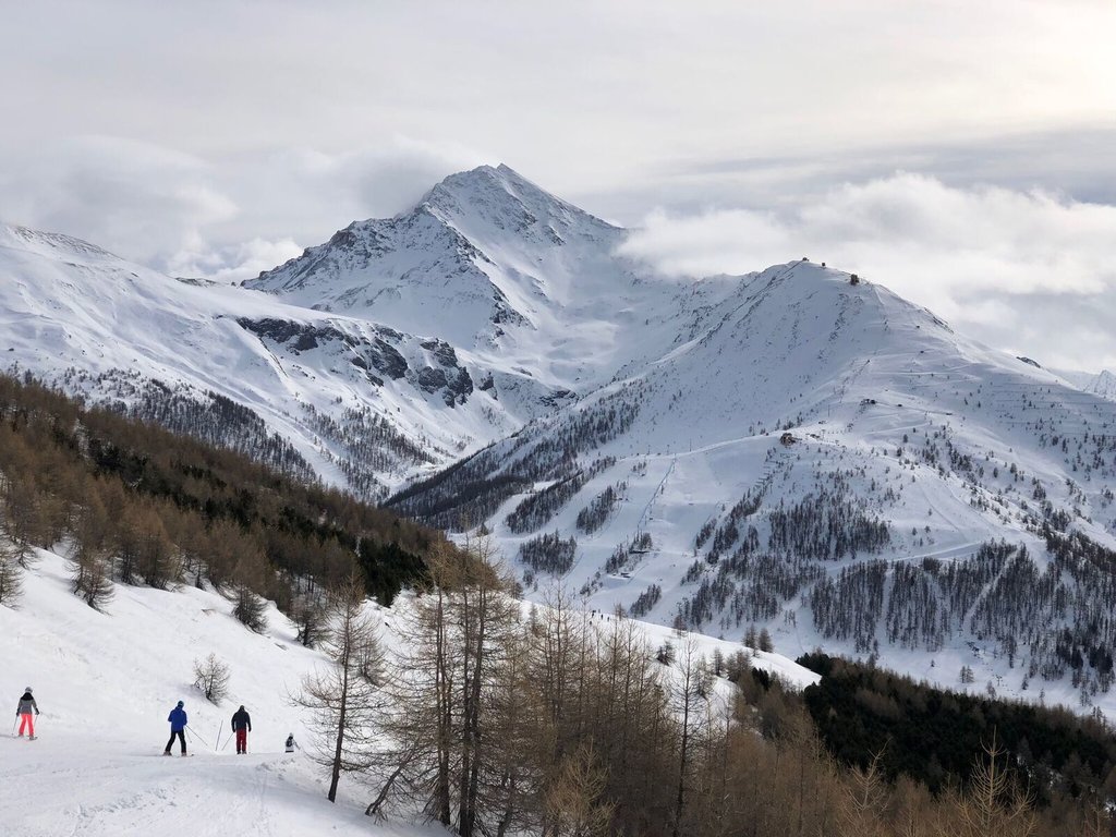
Val Troncea has a climate typical of Piedmont, with cold winters that lend themselves well to skiing and winter activities. It also features cool summers that are perfect for hiking and other summer activities. Rainfall is modest in the region due to the positioning of the valley.
Val Troncea Natural Park is home to a rich variety of Alpine flora and typical Alpine fauna.
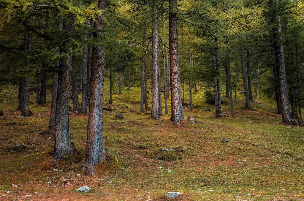
Vegetation in Val Troncea Natural Park consists primarily of woodlands that feature larch and stone pine, though there are also birch and aspen trees on the valley floor. Undergrowth such as juniper, rhododendron, blueberry, and green alder also populate the landscape.
The most ecologically diverse and interesting woodlands in the park can be found on steep rocky slopes, which have historically been the most difficult for humans to access.
The area that is now part of the park has been exploited for timber since the seventeenth century. During that time, large quantities of timber were used in the construction of the nearby Fenestrelle Fort and in the building of the region’s mines.
Additionally, Val Troncea Natural Park is rich in alpine species such as edelweiss, alpine asters, purple fescue, and alpine astragalus. At higher elevations, there are also many resilient grass and shrub species that are well-adapted to the region’s sometimes challenging weather conditions.
The wildlife found in Val Troncea Natural Park is home to wildlife that’s typical of this part of the Alps. For example, you may see chamois, wild boar, ibex, roe deer, and red deer.
Furthermore, some of the many birds you might spot while hiking through the park include the golden eagle, peregrine falcon, kestrel, little owl, and ptarmigan.
Human history in Val Troncea Natural Park extends back thousands of years. There are archeological records in the area that date back to when the region was primarily home to shepherds and hunters before the rise of the Roman Republic.
Additionally, the region has long been home to a Christian movement called the Waldensians (Valdenses), which originated during the twelfth century CE in France. Other notable valleys in the region with sizable Waldensian communities include Val Pellice and Val Germanasca.
For many centuries, the area that is now Val Troncea Natural Park was actually the source of much contention between the Kingdom of France and the Duchy of Savoy. It became part of France in the early seventeenth century. The valley became part of Savoy later that same century. Afterward, it eventually became part of Italy, where it remains to this day.
The valley experienced a surge in economic activity in the nineteenth century after the discovery of copper in Colle del Beth. Mining in the region ended by the early twentieth century after a 1904 avalanche buried 81 miners.
Once the mines closed, the valley depopulated and communities that were once thriving villages became quiet mountain pastures. Nowadays, few traces remain of the eighteenth and nineteenth-century rural dwellings that once populated the area as they have been abandoned since the 1920s.
There are two visitor centers in the park that provide visitors with plenty of information about the park’s nature, geology, and history. The park was formally established in 1980 and it has been open to visitors ever since.
Val Troncea Natural Park is open all year round. However, note that there are some special protected areas where visitors aren’t allowed to leave the designated footpaths or bring dogs. The rest of the park is dog-friendly.
There are 22 walking paths in the park that are marked and signposted. Each designated path leads through different environments in the park. In the winter months, the park also offers cross-country skiing on groomed trails.
Here are a couple of the best hikes in Val Troncea Natural Park to check out during your next trip to the region.
The trail to L’Alpe del Meys is an out-and-back route that starts from the hamlet of Seytes. It follows a dirt track alongside the Chisone stream and crosses through Troncea. The path eventually brings you to a fountain and an information panel explaining the local flora and fauna.
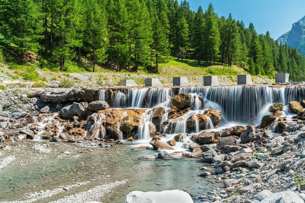
The path becomes steeper as you reach the Lendiniera waterfall. From here, you’ll carry on until you reach pastures where you might spot marmots. Afterward, you’ll enter a sparse larch forest, and then you’ll arrive at the bergeria. Here, you can buy local butter and cheeses while enjoying sweeping panoramic views of Monte Barifreddo, Monte Appenna, and Monte Platasse.
The Sentiero del Beth is an out-and-back route that allows you to experience some of the most beautiful views that the park has to offer. Along the way, you’ll also have the chance to learn more about the valley’s history and former mines.
This itinerary takes around 5 hours to complete, and it starts from Troncea. From here, you’ll follow path #320 along the old miner’s mule tracks, which will bring you to Colle del Beth. The path has several information boards with details about the mines in the area, along with information about the surrounding natural environment.
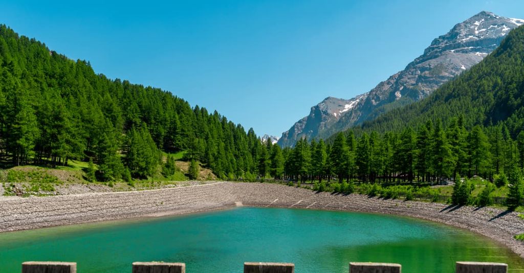
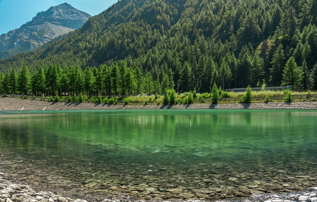
Once at Colle del Beth, you will find the old mining barracks as well as the Beth Lakes (Laghi del Beth), which are of glacial origin.
There are many small Alpine villages and towns in the region around Val Troncea Natural Park for visitors to enjoy. Here are some of the best places to stay during your next trip to the region.
The regional capital of Piedmont, Turin is a great base for anyone who wants to see more of this amazing corner of northern Italy. From Turin, you can reach the park in around an hour and a half by car. Turin also has an international airport, making it an easy place to get to from all over the world.
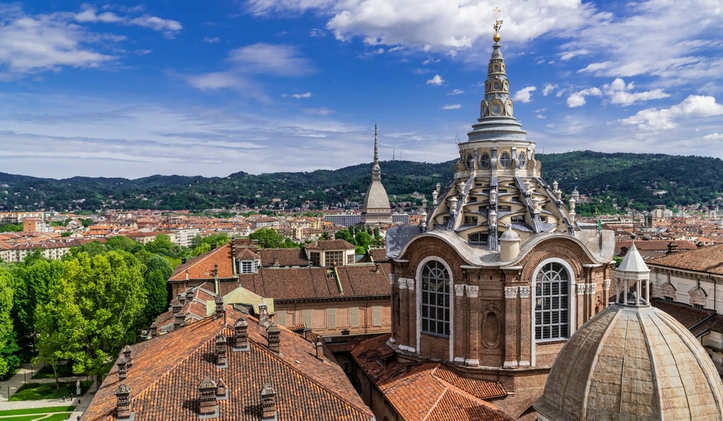
Turin is a large city with countless restaurants, bars, and interesting sites to visit. Some of the best places to check out in Turin are the Egyptian Museum and the National Museum of Cinema, both of which are located in the Mole Antonelliana building.
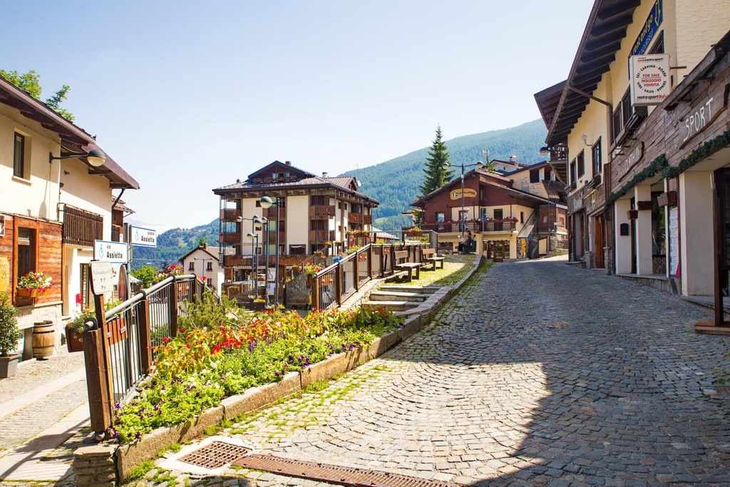
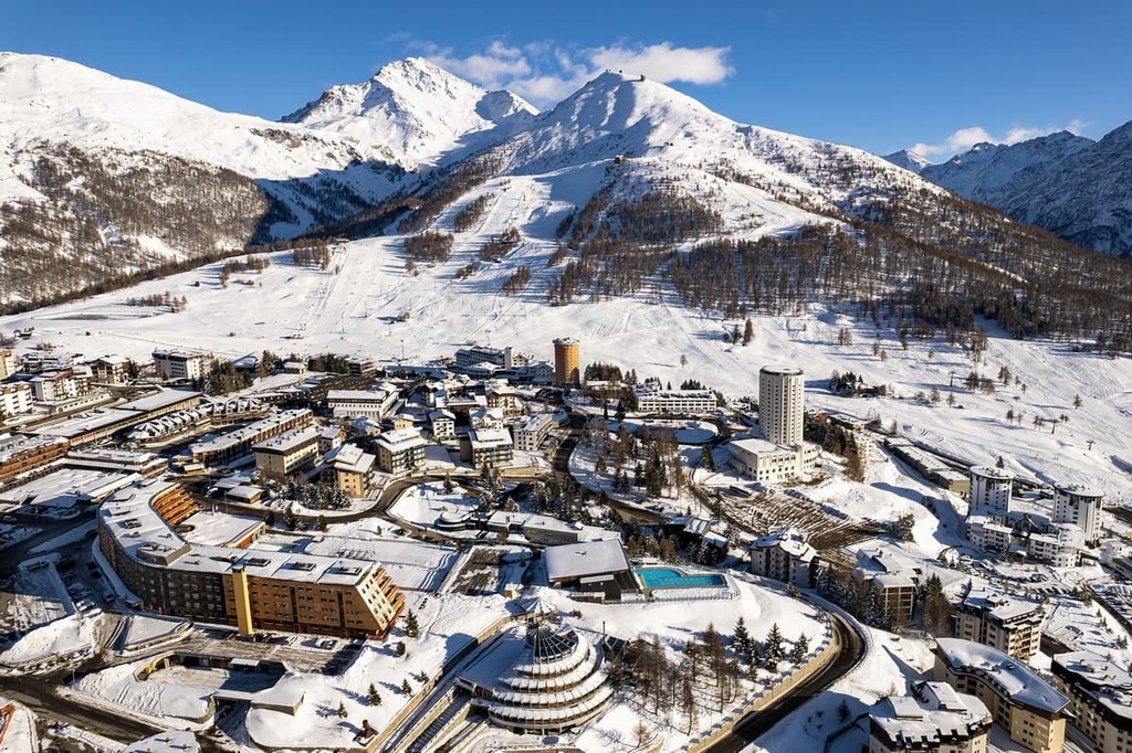
A popular ski resort in winter, Sestriere is an ideal place to stay if you want to visit Val Troncea Natural Park. There are plenty of amenities and activities to enjoy in the town, including Europe’s highest elevation 18-hole golf course.
Since the town is located across two valleys, there are plenty of hiking options in the vicinity of Sestriere. The town is also a terminus for stages of both the Tour de France and Giro d'Italia cycling races.
Sauze d’Oulx is another popular ski resort in the winter months that’s located near Val Troncea Natural Park. It is also a great destination for summer activities like cycling, rafting, and hiking.
You can easily get from Sauze d’Oulx to Val Troncea Natural Park by road in under an hour. If you’re staying in Sauze d’Oulx and want to seek out more adventure, you can also check out the many hiking routes that are available in the nearby Gran Bosco Natural Park.