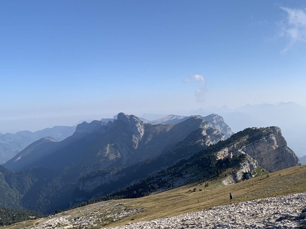
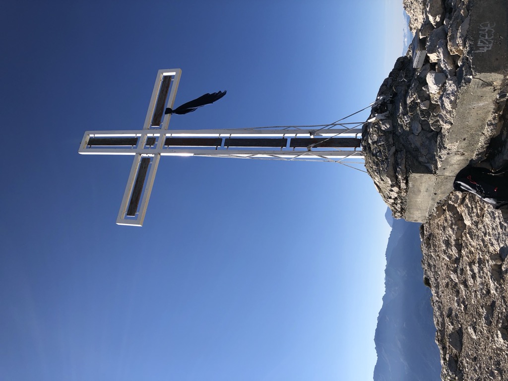
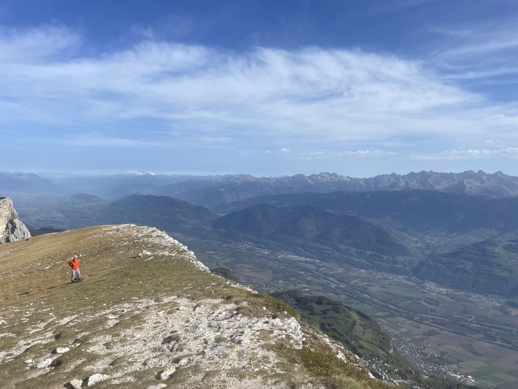
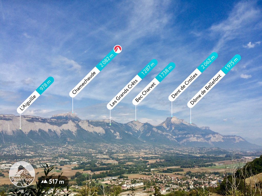
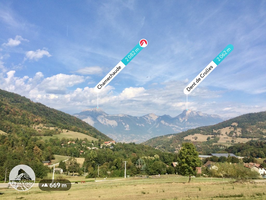
The Dent de Crolles (French pronunciation: [dɑ̃ də kʁol]) is a karstic mountain (2,062 m) of the Chartreuse Mountains range, 17 kilometres (11 miles) north east of Grenoble, Isère, France. The mountain has a characteristic "tooth-like" profile; the French word dent means "tooth". de Crolles is derived from the town of Crolles, located next to the peak. The Dent de Crolles is easily recognizable from the Isère Valley (Grésivaudan) near Grenoble.
There's a hiking trail (T2) leading to the summit. Dent de Crolles is one of the 1 peaks along the Dent de Crolles par le Trou du Glaz.
The nearest mountain hut is Cabane du Berger located 975m/3 199ft ENE of the summit.
By elevation Dent de Crolles is
# 1 out of 28 in Réserve naturelle des Hauts de Chartreuse # 2 out of 175 in Parc naturel régional de Chartreuse # 2 out of 159 in the Chartreuse Mountains
By prominence Dent de Crolles is
# 61 out of 9907 in Auvergne-Rhône-Alpes # 1 out of 28 in Réserve naturelle des Hauts de Chartreuse # 3 out of 175 in Parc naturel régional de Chartreuse # 17 out of 1415 in Isère # 21 out of 1273 in the Savoy Prealps # 3 out of 159 in the Chartreuse Mountains
We use GPS information embedded into the photo when it is available.
3D mountains overlay
Adjust mountain panorama to perfectly match your photos because recorded by camera photo position might be imprecise.
Move tool
Rotate tool
Zoom
More customization
Choose which peak labels should make into the final photo and what photo title should be.
Next
Photo Location
Satellitte
Flat map
Relief map
Latitude
Longitude
Altitude
OR
Latitude
°'''
Longitude
°'''
Apply
Register Peak
Peak Name
Latitude
Longitude
Altitude
Register
Teleport
PeakVisor
This 3D model of Sagarmatha National Park in Nepal was made using the PeakVisor app topographic data. The mobile app features higher precision models worldwide, more topographic details, and works offline. Download PeakVisor maps today.
Download OBJ model
PeakVisor
The download should start shortly. If you find it useful please consider supporting the PeakVisor app.
PeakVisor for iOS and Android
Be a superhero of outdoor navigation with state-of-the-art 3D maps and mountain identification in the palm of your hand!