Scan the QR code and open PeakVisor on your phone
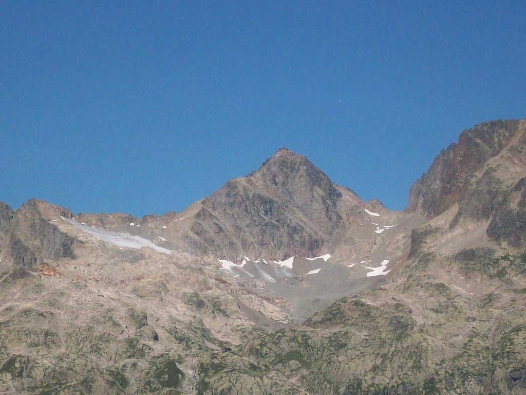
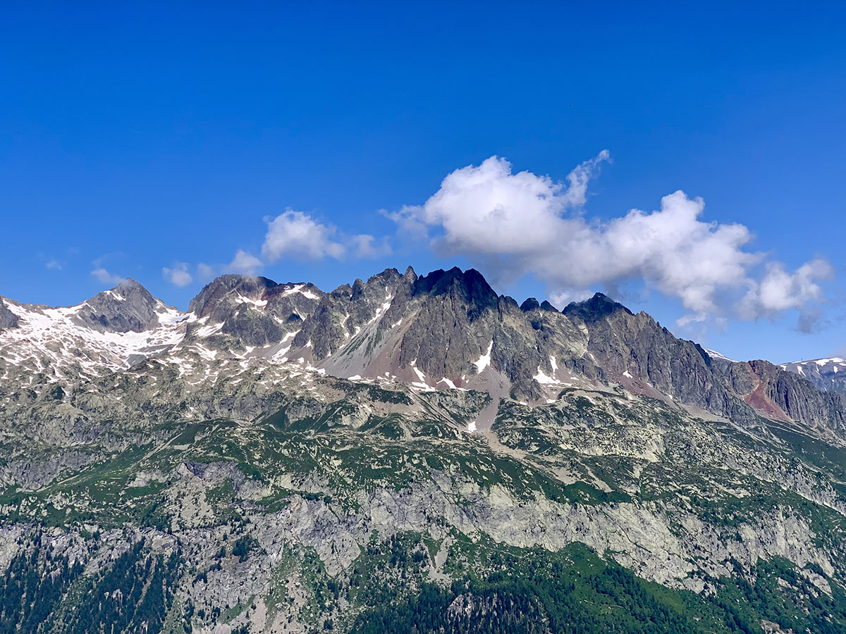
There are 16 named mountains in Réserve naturelle des Aiguilles rouges. The highest and the most prominent mountain is Aiguille du Belvédère.
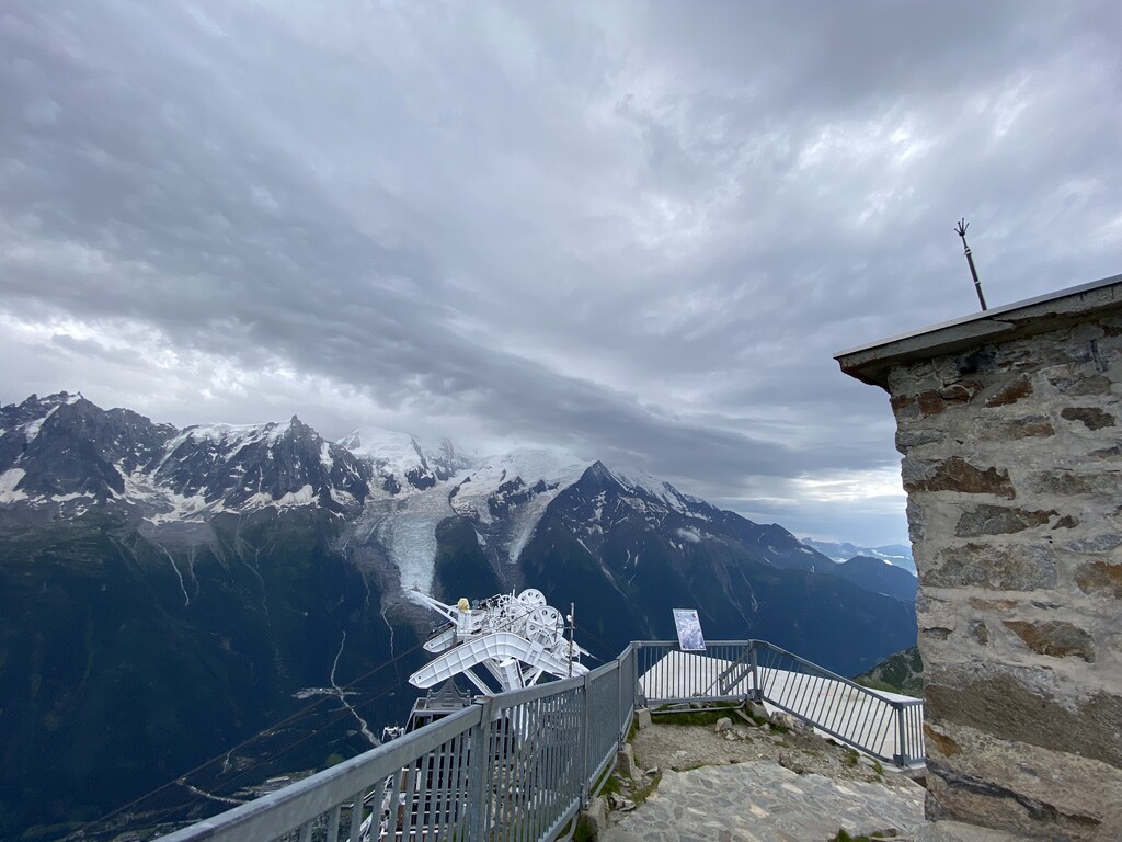
The National Nature Reserve des Aiguilles Rouges is a reserve which covers a large part of the Aiguilles Rouges massif that lies close the Mont-Blanc massif situated in Haute-Savoie. The Aiguilles Rouges, in other words, the Red Peaks, refer to the iron-rich terrain which gives it its colour. In the reserve, there are 569 species of plants and 355 species of animals, 17 lakes and 250km of hiking trails.
The nature reserve is one of the best locations to go to for superb views of the Mont Blanc massif. Unsurprisingly, as a result of the 360 panoramic views of the surrounding mountains, the highest point in the Aiguilles Rouges range is named Belvédère, which roughly translates as a beautiful viewpoint.
The nature reserve was created in 1974 and spans an area of 3,276 hectares. It is managed by the ASTERS association (working under the Act for the Preservation of Rare or Sensitive Species and Territories). ASTERS also maintains the other areas of natural beauty in the Haute-Savoie region.
The nature reserve is home to typical mountainous plants and animal species that can be found in the French Alps, such as the Alpine ibex, chamois, and the golden eagle. Hikers can discover some endemic flora such as sundews, martagons, and many varieties of orchids. This diversity is one of the main reasons why the nature reserve was initially created.
There are multiple lakes situated within the nature reserve, such as Lac Blanc, Lac Cornu and Lac du Brévent.
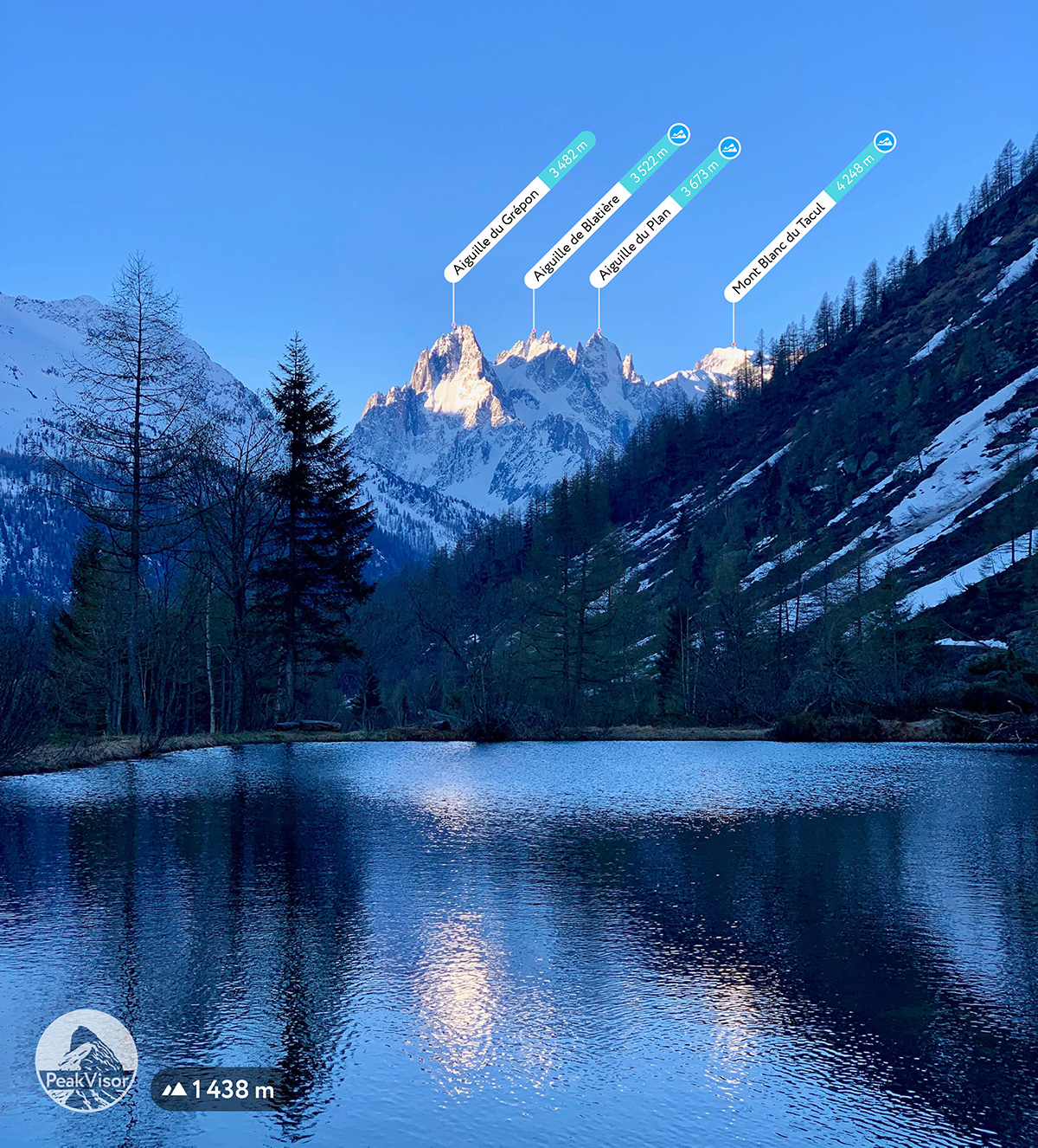
A small lake at the Col des Montets
At the Col des Montets pass, there's an information cabin open throughout the summer months to welcome visitors. A ‘discovery path’ was created and maintained since 1976 with the purpose of giving an overview of the natural areas of the nature reserve and the Alps in general. The cabin and the path are a part of the environmental education of the reserve and help to inform the public on how to respectfully enjoy nature with little to no negative impact.
The nature reserve can be accessed by road at the Col des Montets, where there is a designated parking zone to leave your vehicle. There are several hikes into the reserve beginning from the pass.
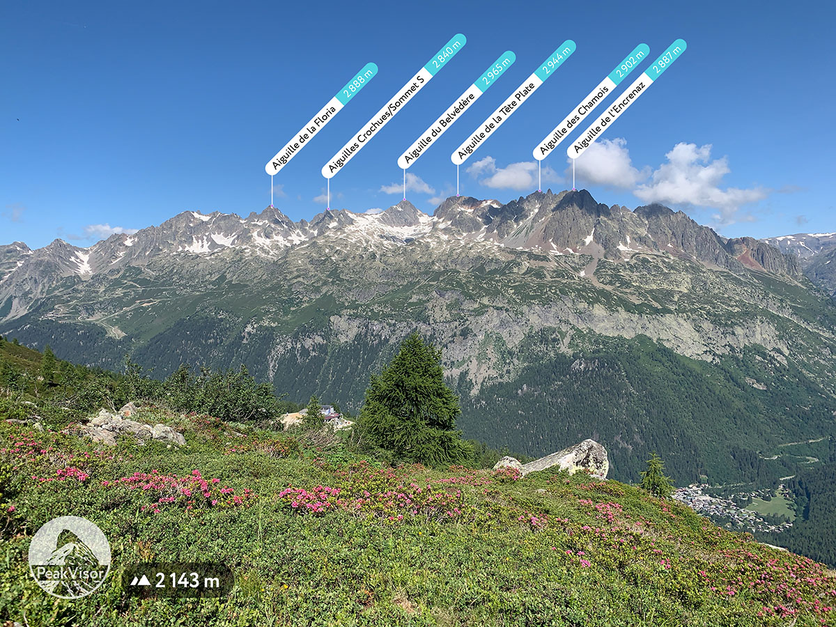
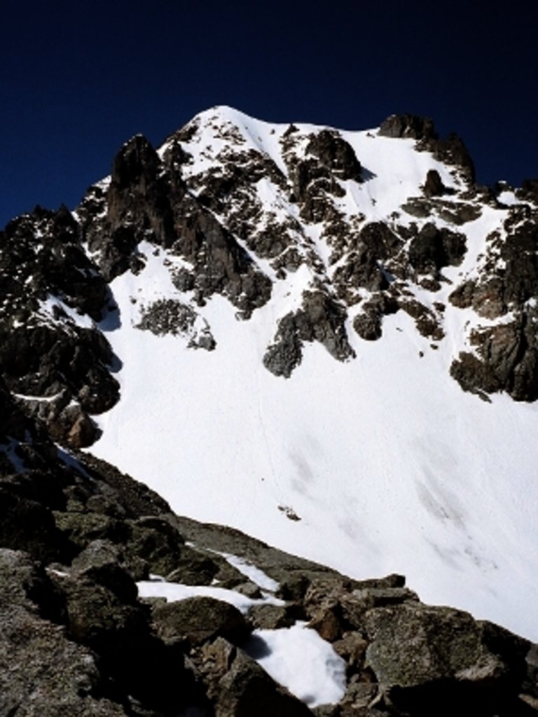
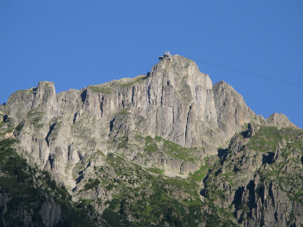
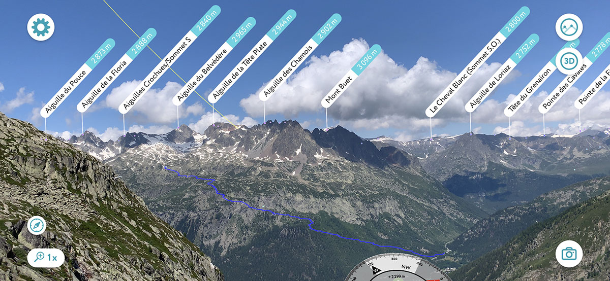
Aiguilles rouges major peaks: Aiguille de la Floria, Aiguille du Belvédère, Aiguille de la Tête Plate, Aiguille des Chamois, Aiguille de l'Encrenaz
One all-day hike starts from the Col des Montets and heads south-west towards Lac de Chéserys and Lac Blanc. Taking the botanic trail to the left of the information centre, follow the trail to Gouille de la Remuaz. From here, continue to the first of the lakes - Lac des Chéserys - you should be able to snap a photo of the spectacular Mont Blanc reflected in the ice-cold mountain water.
After traversing a rocky section, head towards Lac Blanc, around 20 minutes farther on from the Chéserys. Here will be your first view of the refuge of Lac Blanc - a perfect place for a mid-hike picnic! Once you’re well rested, you can head back on the same trail towards the Col des Montets. This hike is recommended for intermediate to experienced hikers. The total distance is 11km, with 1000m of vertical elevation up to an altitude of over 2,400m. The hike is best attempted in the summer months as excessive snowfall can make the route much more difficult without proper equipment.