
Scan the QR code and open PeakVisor on your phone
Parc Naturel Régional du Vercors has 633 named peaks. The highest is Rocher rond at 2,453 m. Other notable peaks include Tête de Vachères, Roc de Garnesier and Tête de Plate Longue.
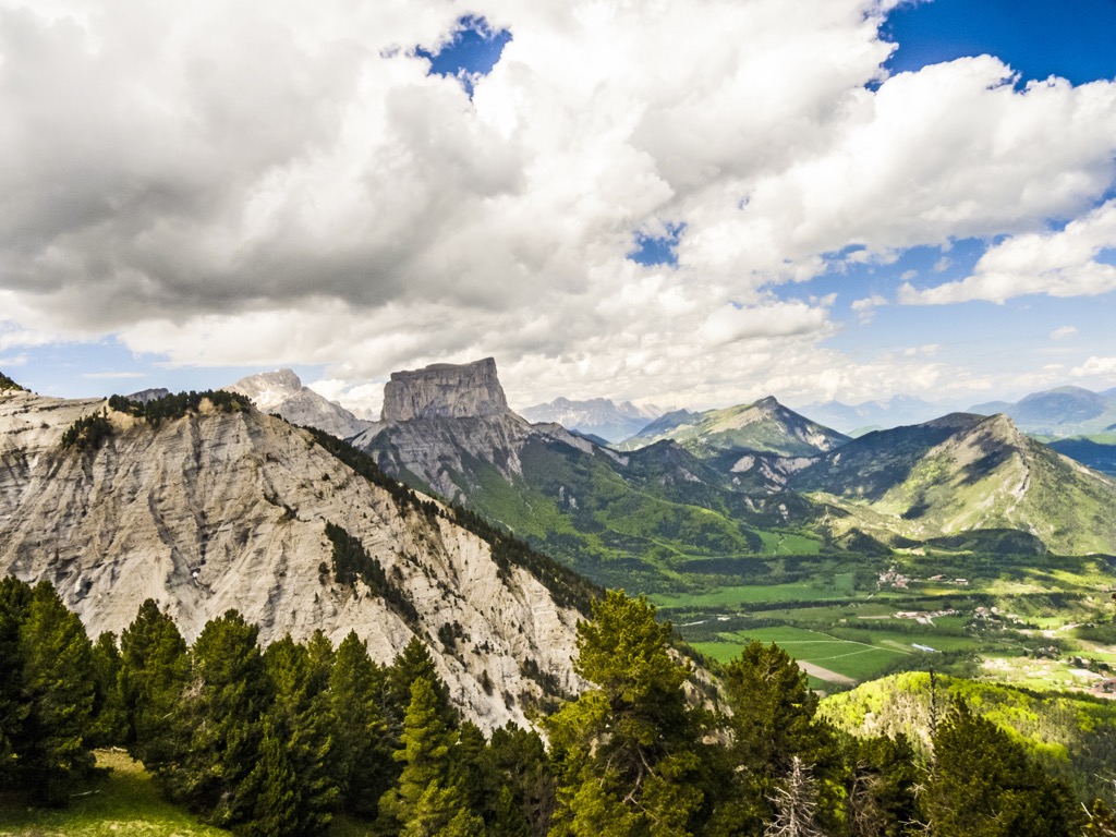
The Parc Naturel Régional du Vercors is a preserve in the Western Alps of Southeastern France. The park covers 205,806 hectares (508,558 acres) on the Vercors Massif and part of the Dévouley Massif. The Rocher Rond (2,453 m / 8,048 ft) is the tallest peak, while the Grand Veymount (2,341 m / 7,680 ft) is the most prominent (1,171 m / 3,842 ft). Due to abundant limestone, the region features numerous caves and played a vital role during World War II as a secure and defensible position for the French Resistance. Vercors has become a popular tourist destination for skiing, hiking, and spelunking (exploring caves), and several picturesque villages mainly rely on tourism, forestry, and shepherding. In 1970, the area was officially declared a regional natural park. Grenoble, an academic research-oriented urban center, straddles the park's northeastern border and is the nearest city.
The Vercors is in southeastern France, within the administrative region of Rhône-Alpes, spanning two departments: Isère and Drôme. It is one of 58 regional nature parks in France. Technically speaking, the park’s boundaries include not only the namesake Vercors Massif but also part of the neighboring Dévouley Massif.
The city of Grenoble straddles the park’s northeastern border. Across this northern valley sits the Massif du Chartruesse, the origin of the celebrated French wildflower digestif. To the east is the Lac de Monteynard-Avignonet, a dammed river that had filled the deep valley with turquoise-hued glacial runoff.
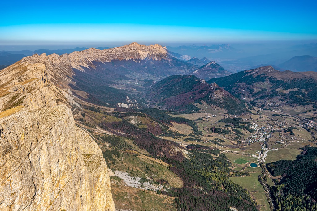
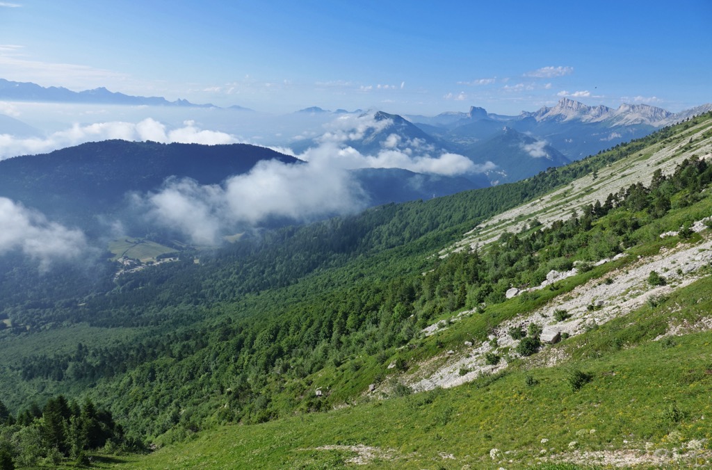
Across the lake is the legendary Massif des Écrins, plainly visible from high points within the Vercors. Pastoral farmland and rolling hills extend to the park’s south and west. The attractive city of Valence sits in the valley to the park’s west. The park is also the headwaters for a few small rivers, including La Bourne, La Gervanne, and the Furon.
The Vercors is part of the French ‘Prealps,’ or foothills. The highest point in the park, the Rocher Rond, is 1700 m (5577 ft) lower than the highest point in the neighboring Écrins Massif (Barre des Écrins 4,102 m / 13,458 ft). The park’s altitude varies from 180 m (590 ft) at its lowest point to 2,453 m (8,048 ft) at the highest.
The Alpine Orogeny, which occurred between 64 and 2.5 million years ago, created the European Alps (as well as many other ranges throughout Europe and Asia). Like the rest of the Alps, the Vercors region is the product of those forces.
The orogeny resulted from the African and Indian plates colliding with the Eurasian plate, forcing the crust upwards. In many places, the orogeny is ongoing - namely, the Himalayas, because the Indian plate has only recently collided with Eurasia and continues to exert force on the crust. Even at a few tens of millions of years old, the Alps are still young, hence the towering, jagged peaks and low valleys.
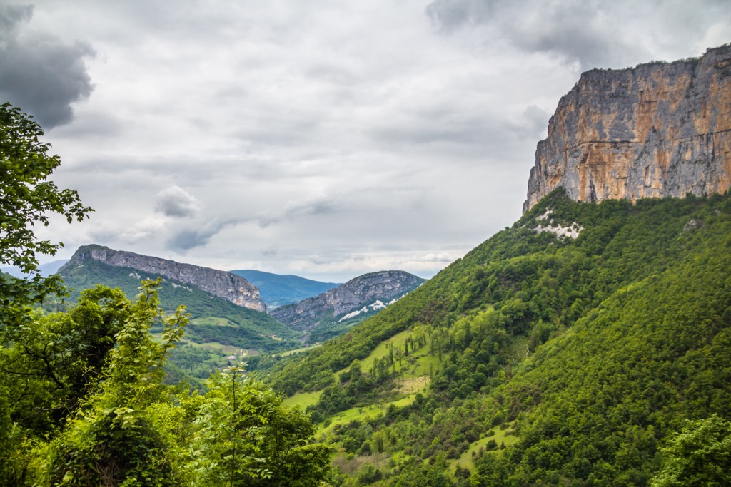
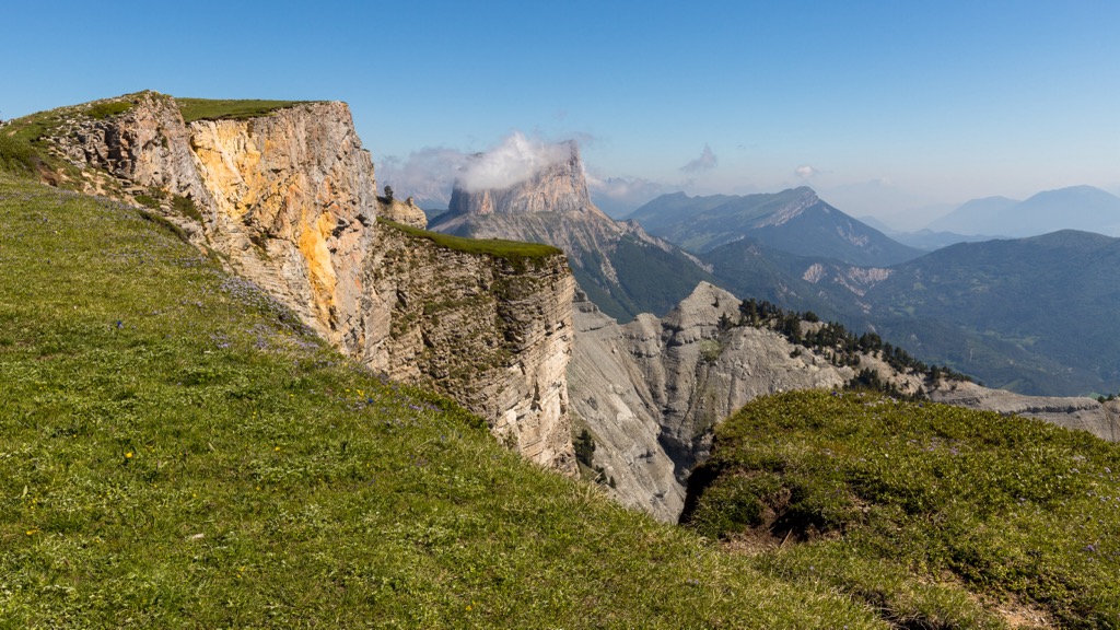
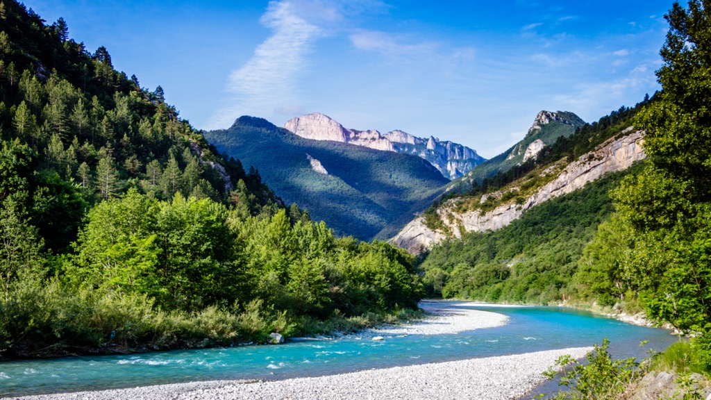
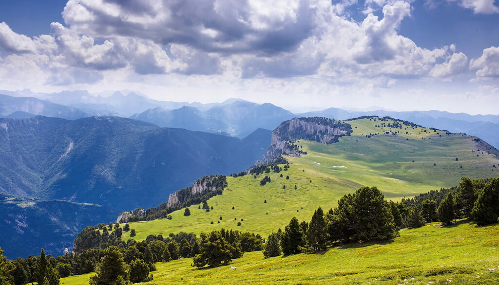
However, Vercors is unique within the Alps due to the concentration of limestone. Over 90% of the park’s surface is covered in white limestone, which has eroded over time to produce a stunning combination of jagged spires, gorges, sheer cliff faces, and, of course, the vast network of caves that Vercors is famous for. Additionally, the rivers of Vercors have formed several deep gorges as waters slowly dissolve the limestone that forms the Massif.
Limestone is conducive to the development of caves, and almost all caves in the world have formed from cavities within this type of rock. Rainwater naturally bonds with carbon dioxide in the air to create a small amount of carbonic acid. Thus, rain checks in as a weak acid on the pH scale. As rainwater percolates through the porous limestone, it slowly dissolves the rocks, creating the caverns we appreciate today.
Glaciation has, to some extent, shaped every valley in the Alps. Glaciers have ebbed and flowed over the past 2.5 million years. No glaciers have lived in the Vercors since the last Ice Age, but the valleys surrounding the Massif are the product of glaciation. Additionally, many lakes in the alpine region are the product of ancient glaciers. Overall, however, Vercors has less evidence of glacial influence than the higher massifs to the east.
The tallest peaks in the park include:
The Vercors hosts an extraordinary diversity of flora and fauna, matched by few other massifs in France. The park is especially conducive to wildlife diversity due to its mid-range altitude and remote nature. Vast forests and abundant moisture have fostered an idyllic habitat featuring the most celebrated species of the Alps. Over 70 mammal, 150 bird, and 1,500 plant species call the Vercors home.
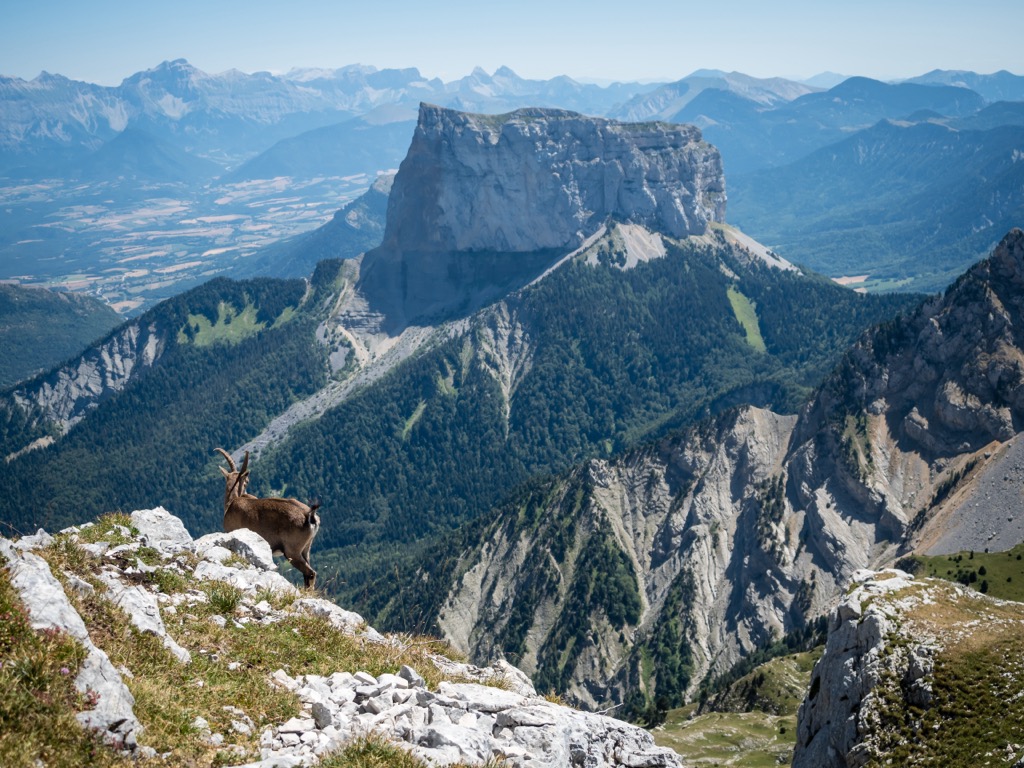
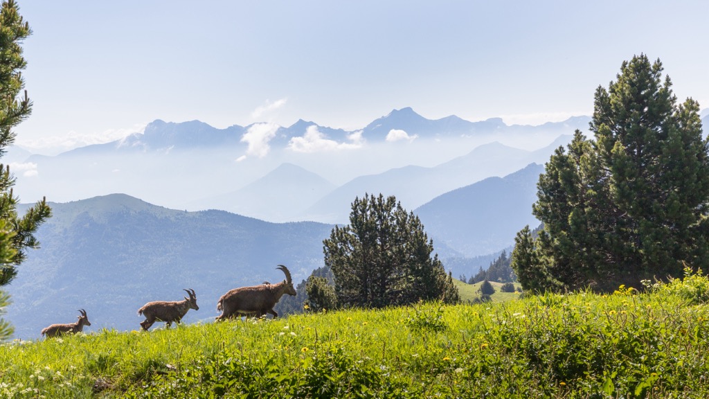
The Vercors is habitat to all six large wild ungulates of the French Alps: chamois, red deer, roe deer, mouflon (alpine bighorn sheep), wild boar, and ibex. It’s one of the few places in France where Ibex still form a herd. In the largest pack, lucky visitors can see 50 or more males roaming the slopes. It’s no wonder why the majestic Ibex remains the emblem of the Vercors.
You will also find gray wolves, lynxes, golden eagles, bearded vultures, tawny vultures, owls, falcons, woodpeckers, ermines, hares, foxes, squirrels, marmots, and many other animals. Black crows, a.k.a. Alpine Chough, soar amongst the rocky spires and peaks.
Well-known plant species include lavender, blue thistle, and génépi (used to make a hard liquor called a ‘digestif’). Wildflowers are rampant throughout the meadows, particularly where livestock graze and fertilize the ground. Edelweiss and a range of different orchids contribute to the patina of colors along these alpine meadows.
Anatomically modern humans probably arrived around 40,000 years ago. Due to the cave networks, the Vercors region offers many traces of these early ancestors. Check out the Musée de la Préhistoire du Vercors to discover more about this period.
Celtic tribes settled in this part of the Alps, followed by Roman conquerors. After the fall of Rome, the farming villages of the Vercors faced plague, famine, and religious wars. Nevertheless, the Vercors was spared the worst carnage due to its remote nature and gentle pastoral existence. The region saw more stability beginning in the 17th century. Many of the villages appear little changed from this era.
During the Second World War, the Vercors became a stronghold for the French Resistance. Like our Neolithic ancestors, these fighters took refuge in the defensible cave systems throughout the massif. Currently, the area is home to around three hundred Resistance monuments, which include a memorial center and the remnants of a destroyed village.
The Vercors region has been a tourist attraction for centuries, much longer than the official designation as a park. Incredibly, the village of Saint-Antoine-l'Abbaye has been listed as a historical monument since 1840, mainly in commemoration of an abbey that has received visitors since the 11th century.
The region has recently built several ski stations, including Autrans, Lars-en-Vercors, and Villard-de-Lans-Corrençon. Lifts serve more than 500 km of piste spread across many small regional resorts.
Eighty-five communes are home to 53,000 residents within the park's borders, a testament to the vitality of the local economy. The communities of the Vercors continue to focus on their pastoral roots. Sheep and goat herding remains a primary economic driver, as it has been for thousands of years. As a result, the area is a bastion of locally produced agricultural goods, such as fresh vegetables, honey, meat, and cheese.
Fortunately, no large-scale industry, such as mining or industrial agriculture, has rooted itself in the region. Agriculture and wildlife have adapted to coexist relatively peacefully within the park.
The Vercors region has become renowned for its vast networks of extraordinary caverns. There are caves, like the rock outcroppings you may have explored around town as a child.
Then there are caves, like the ones with stalactites, stalagmites, underground rivers, and endemic cave-adapted species missing their eyeballs. The Vercors is host to both phenomena but is famous for the latter. Here are two of the most famous passages.
Every year, approximately 100,000 visitors are drawn to the Choranche cave, where they can marvel at the natural wonders while following well-paved paths under the guidance of cave experts. The section open for tourism has been thoughtfully illuminated since 2013, using modern LED technology to create a spectacular visual experience.
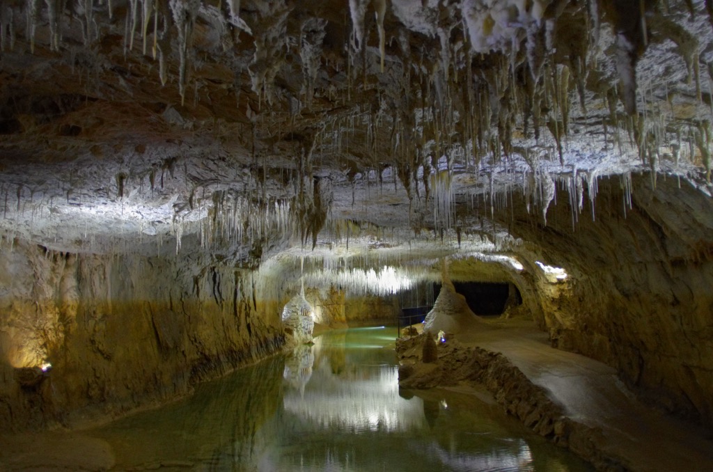
One of the notable features is the abundance of delicate fistulae hanging from the ceiling, resembling slender straws. These fistulae grow at the spectacularly lethargic rate of 5cm per century. Like stalactites, they form through the continuous trickle of water that gradually deposits minerals.
The longest recorded fistula stretch for an impressive 3.2 m. Over millions of years, stalactites and stalagmites of various sizes have formed and, in some instances, have merged to create magnificent columns.
Within the cave system is a grand chamber known as the "cathedral," spanning about 50 by 80 m. This awe-inspiring space is adorned with numerous terraced formations resembling cascading stairs. These formations, called rimstone dams, are composed of calcite and are created as water steadily drips from the ceiling. The water collects in underground lakes and then trickles down through these dams, creating a fascinating and surreal underground world.
Located near the Choranche cave, Gournier offers an opportunity for autonomous diving. It is important to note that these findings can only be made by diving into water-filled passages.
Prior experience in night diving and proficient buoyancy control is essential in this environment. Unlike Grotte de Choranche, this experience is reserved only for dedicated or professional spelunkers. Even then, you may still be required to hire a guide. However, the environment is genuinely other-worldly, on par with a trip to the bottom of the ocean.
The Gournier is renowned for having the most beautiful underground river in the world, extending up to 15 kilometers. The water depth is between three and five meters and is cold, ranging from 8 to 10°C.
Stalagmites rest on the cave floor, while stalactites hang from the ceiling. The cave walls feature calcium deposits, a common characteristic of caves, indicating that the water level must have been significantly higher over extended periods. Divers will be captivated by the "Medusa," a stalactite formation resembling a jellyfish.
Several expeditions in this cave have been documented and shared on YouTube, offering captivating glimpses into their discoveries. Notably, French scientist Barnabé Fourgous made a significant find - an exceptionally preserved fossilized bear skeleton that dates back over 30,000 years. The cave's unique conditions have contributed to its remarkable state of preservation. Additionally, certain sections of the cave system contain evidence of prehistoric human activity.
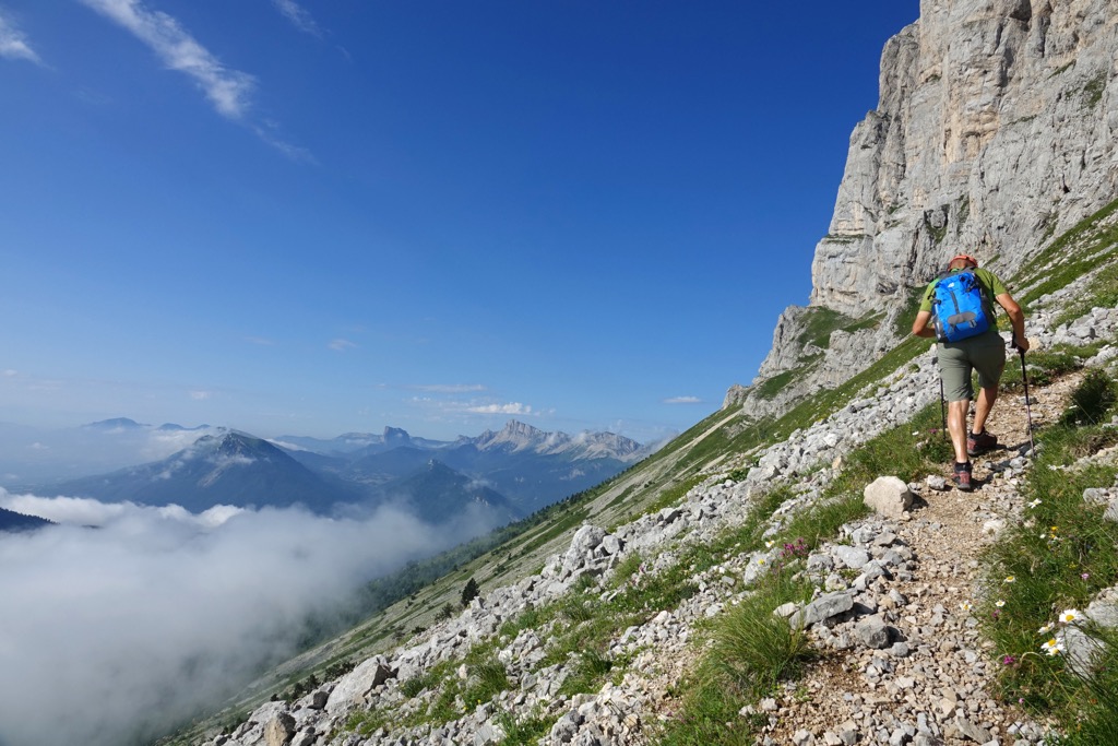
You don’t have to be a cave enthusiast to enjoy nature in the Vercors. Brimming with wilderness and bucolic villages, the Vercors is a mecca for hikers. Here are a few options at various difficulty levels.
Embark on a picturesque family hike from the village of Villard-de-Lans, leading to the charming Pont de l'Amour on the La Fauge stream within the Vercors Regional Nature Park. This easy, 4.2-km loop trail traverses scenic forest paths to the Fauge waterfall, a delightful cascade nestled amidst the woods. No significant difficulties exist, although the route does climb 185 m (600 ft) up to the falls. The optimal season is from March through October, and dogs are permitted as long as they are kept on a leash.
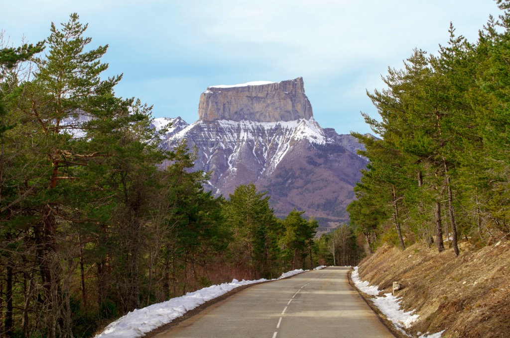
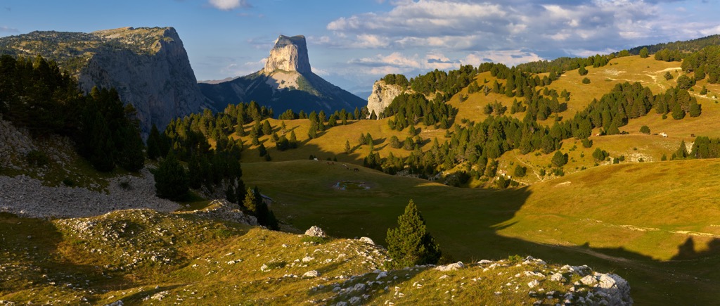
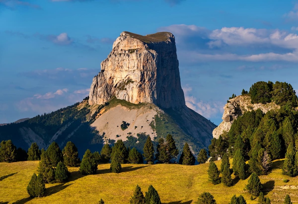
Situated in Chichilianne, between Grenoble and Gap, Mont Aiguille proudly juts out like a sharp tooth. It’s striking in an Alps region where the mountains mostly have a mellower character. As one of the seven wonders of the Dauphiné, Mont Aiguille holds significant appeal for climbing and Via Ferrata enthusiasts.
Be prepared for a challenging 17.9-km (11.1 miles) loop with over 1,100 m (3,700 ft) of elevation gain. Despite the relatively short distance, it takes hikers several hours to complete the route due to the elevation. The trail is typically snow-free from April through October. Dogs are prohibited on this trail.
This challenging, multi-day route checks out at 132.4 km (83 miles), with over 6000 m (20,000 ft) of elevation gain. Start in Grenoble, cross the entire Vercors from north to south, and finish in the picturesque village of Beaufort-sur-Gervanne. Like any GRs in France (Grand Randonees), this trail is perfect for backpacking, camping, and hut-to-hut adventures.
One of the advantages is relative solitude - encounters with other visitors are far less likely than in other regions of the Vercors. However, this hike also takes you through various tourist destinations, such as the Choranche Cave and the village of Pont-en-Royens. The ideal season is from May to October; no dogs are allowed.
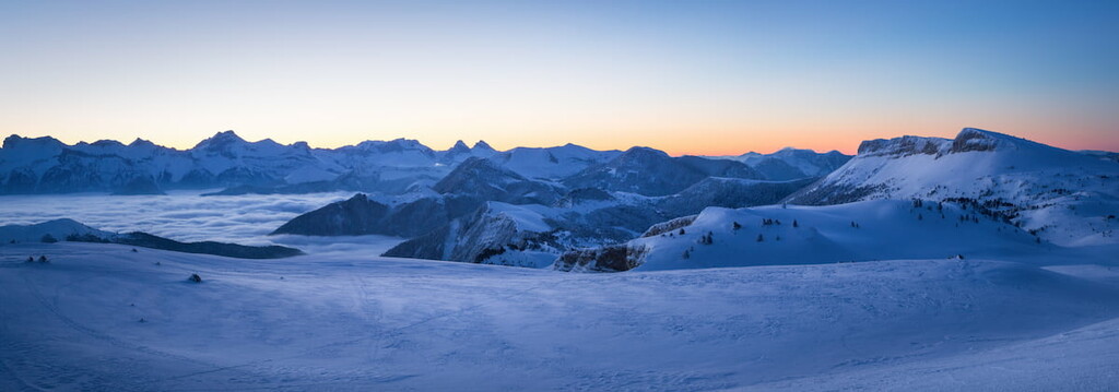
Several ski resorts exist within park boundaries. Most are very small, local hills with limited terrain and vertical. However, if it’s charm and lack of crowds you’re seeking, the ski villages of the Vercors may be perfect. The largest area is the connected villages of Villard de Lans and Corrençon en Vercors, with about 125 km (78 miles) of pistes.
With vast, treeless valleys throughout the park, the Vercors is also an excellent place for Nordic, or cross-country, skiing.
The Villard/Corrençon resort boasts an expansive alpine ski area spanning 125 km (78 miles), making it the largest in the Vercors region.
Skiers can indulge in various slopes suited to different preferences, ranging from broad and gentle terrain to more challenging steeps. Surrounded by picturesque canyons, fir trees, rocks, and undergrowth, the resort offers a breathtaking natural setting. Skiers can navigate enchanting forest passages and powder fields with panoramic vistas.
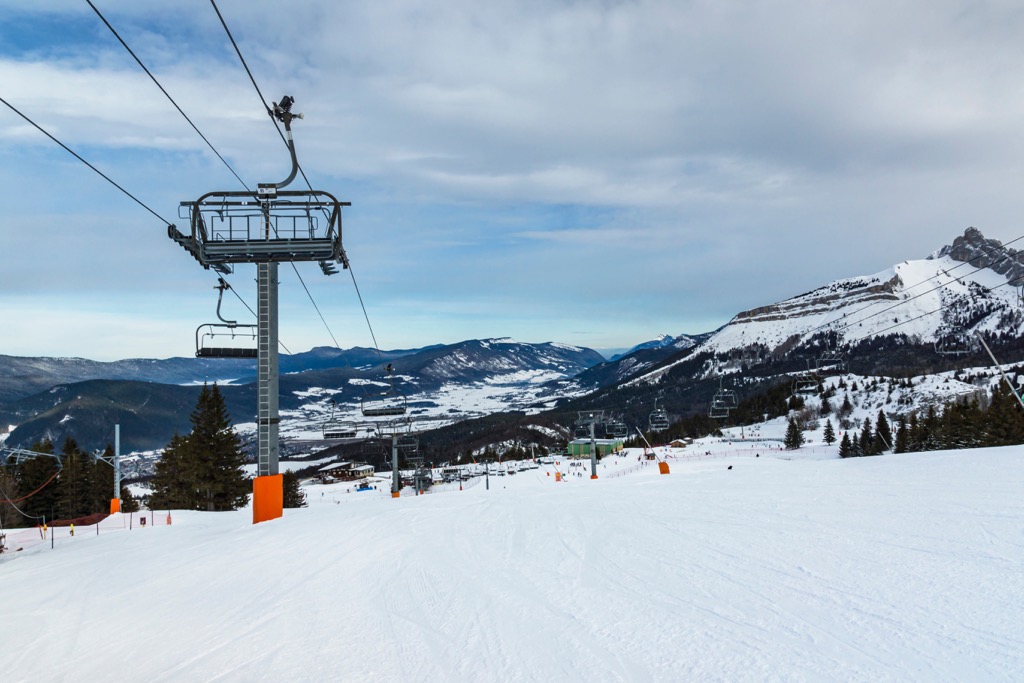
Unlike most other Vercors resorts, the area has state-of-the-art, competitive, and efficient facilities, ensuring optimal snow coverage and a comfortable skiing experience.
The only downside is the low elevation. Situated between 1000 - 2000 m (3,300 - 6,600 ft), the resort increasingly gets rain and low-coverage snow years. Once upon a time, this was a decent elevation for a ski resort in France, but no longer. However, the Vercors are the first mountains that storms hit when they come from the west, and they can receive significant snowfalls. Covering up the groomers only takes one or two of these storms.
It’s difficult to pinpoint specific villages because the park contains dozens of ancient hamlets, each of which would be one of the most famous villages in a newer country like the U.S. or Canada. I choose two of the more well-known villages for starters - don’t worry, though, nothing here is garishly touristy. Just watch out during August - it’s the European vacation, and it can get busy.
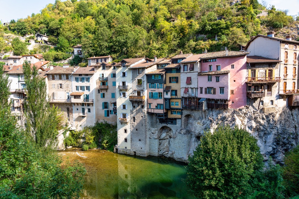
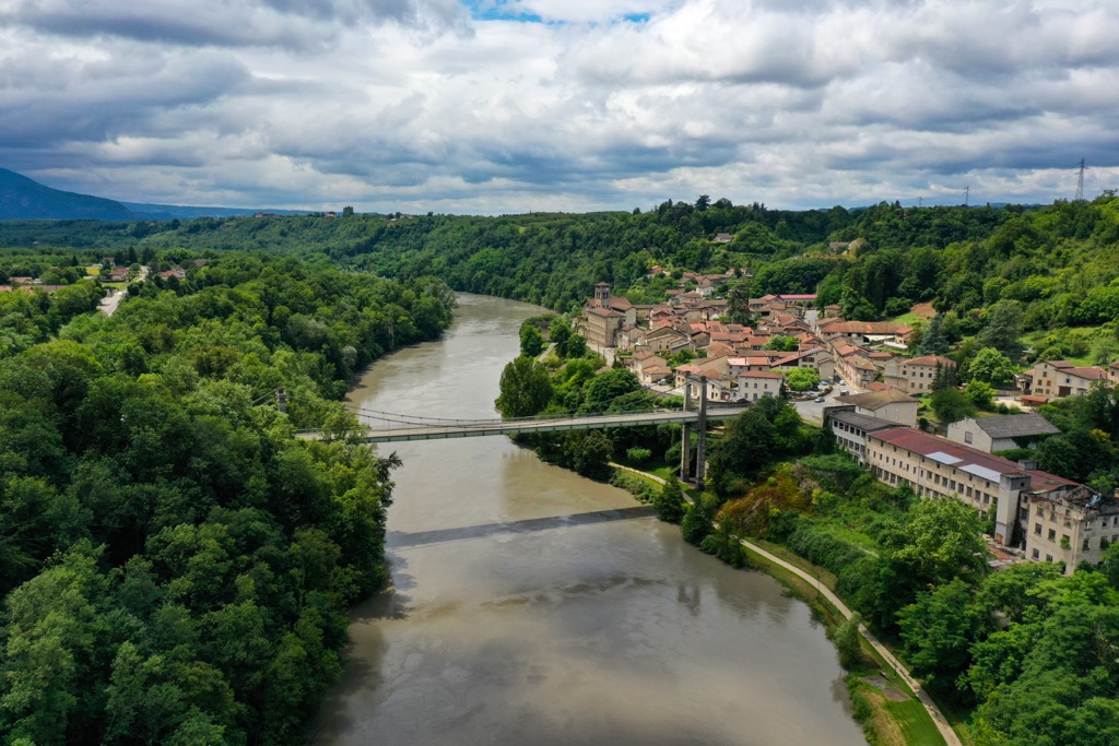
Pont-en-Royans is the most famous - and beautiful - village in the Vercors. The town's principal attraction is the lines of medieval houses perched on cliffs above the scenic river. In nature, the most significant interest is undoubtedly the Choranche Cave (100,000 visitors per year).
The best day in Pont-en-Royans is simply walking around the village and appreciating the 16th-century architecture. Grab lunch or dinner at one of several lovely restaurants, but don’t expect to find anything other than French cuisine.
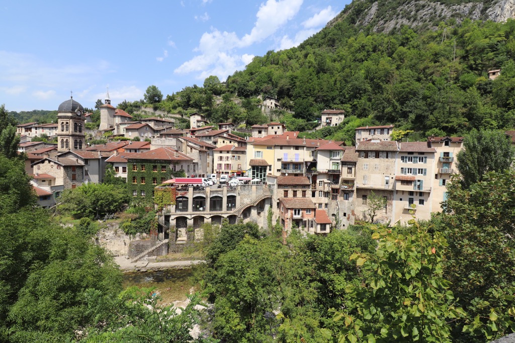
After exploring the village, traverse the route between Pont-en-Royans and Villard-de-Lans, which passes through the stunning Gorges de la Bourne. However, it is essential to exercise caution due to the road's challenging nature.
In a nearby village, Beavoir-en-Royans, you'll find the Convent des Carmes and its enchanting garden - the Jardin des Carmes. Designed in the medieval style, it consists of three sections. The "Jardin des simples" showcases a variety of herbs and aromatic plants, while the "Jardin Potager" features ancient vegetable varieties. Lastly, the "Verger" boasts a diverse collection of apple, pear, cherry, and plum trees.
La Sône is a small village of 600 just outside the boundary of Vercors Park. It’s on the Isère River, not far from Pont-en-Royans.
The attractive village is dominated by a medieval castle, the Château de la Sône. This 14th-century structure harkens back to an era of knights and armor; unfortunately, it’s closed to the public, so you can’t explore inside.
The Jardin des Fontaines Pétrifiantes showcases an abundance of water formations and a diverse array of plant life, ingeniously arranged in interactive pathways and creatively repurposed objects. The garden uniquely features petrification on the tufières—remarkable natural formations meticulously sculpted by the flowing waters of springs. A tastefully designed botanical garden complements the rocks.
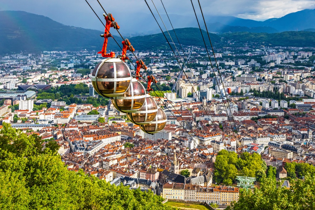
If you visit the Vercors, you will likely pass through Grenoble. While not the most beautiful French city, Grenoble has a certain charm, and it’s worth spending a day here to experience the vibe.
The city has an intellectual atmosphere due to its status as an academic research hub. There are also plenty of artists, musicians, and bohemian culture. Grenoble has a great music scene for a medium-sized city. Restaurants of every sort - not just French cuisine - are clustered throughout the downtown.
With every necessity readily available and plenty of affordable hotels, Grenoble is an excellent place to stage a visit to the Vercors. You can also access the park using public transportation. Buses leave the Gare de Grenoble several times a day.


The highest peak in Parc Naturel Régional du Vercors is Rocher rond, at 2,453 m.
Notable peaks in Parc Naturel Régional du Vercors include Rocher rond, Tête de Vachères, Roc de Garnesier, Tête de Plate Longue and La Rama.


