Scan the QR code and open PeakVisor on your phone
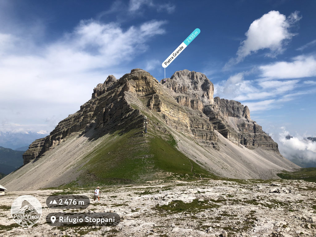
Adamello—Brenta Nature Park is an incredibly diverse protected area in northern Italy, where nature has done a great job creating forests, valleys, passes, meadows, lakes, glaciers, and the mountains. There are 307 named mountains in this park, the highest and the most prominent of which is Cima Presanella (3,556 m / 11,666 ft).
The name of Adamello—Brenta consists of the names of the two large mountain groups that make up the park’s territory: the Adamello—Presanella Alps and the Brenta Group. Additionally, these are also the names of the highest peaks in these mountain groups: Cima Adamello (3,539 m / 11,611 ft) and Cima Brenta (3,151 m / 10,338 ft).
In my opinion, the Presanella was unfairly omitted from the name of the park, but this was likely done just to shorten its length. Also, Presanella is a smaller group when compared to the other mountains in the region.
When you go to the park, however, just don't forget about the Presanella group (especially because the Cima Presanella is the highest peak in the entire park, as we just have learned).
The Adamello—Brenta Nature Park (Parco naturale dell'Adamello—Brenta) is one of the largest nature parks in northern Italy. It has an impressive area of 620 square kilometers (240 sq. mi). The park was founded in 1967.
One of the main features of the park is that it is also a geopark in the worldwide Unesco Global Geoparks Network. The system was created to preserve the geological heritage of the Earth. In total, there are just 75 such parks in Europe in 26 countries, and 161 parks in 44 countries worldwide.
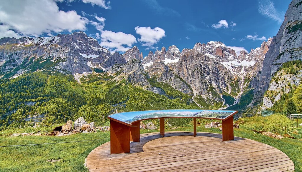
I would say that Geopark Adamello—Brenta is like a magnet for nature, ecotourism, and outdoor enthusiasts. The park allows you to relax and recuperate, and inspire your own creativity.

The territory of the park consists of two unequal parts: Adamello—Presanella is the larger, Brenta is smaller. These two territories are connected by a small strip of protected land in the northern part of the park.
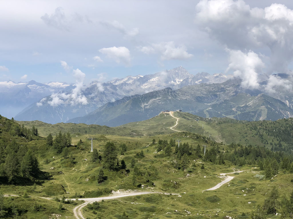
Like many other groups and parks in Italian Alps, the Adamello Geopark lies between two regions: Lombardy and Trentino—Alto-Adige. The park can be easily reached from Bolzano, Bormio, Sondrio, Bergamo, Brescia, Desenzano del Garda, Rovereto and Trento in around 2 hours by car or train.
There are many mountain groups, which borders the park: the Ortler Alps, the Sobretta-Gavia Group, and the Nonsberg Group in the north; the Bergamo Alps in the west; the Fiemme Mountains in the east. The Adamello—Presanella Alps in the south stretches down towards Iseo Lake, where it is adjacent to the Garda Mountains and the Vicentine Alps.
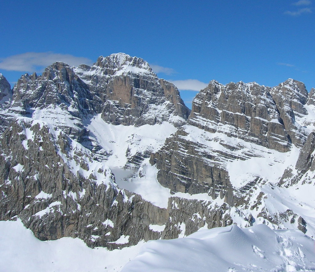
In terms of geology, the territory of the Adamello—Brenta Geopark is also divided into two parts: Adamello—Presanella, which is a granite massif, and the Brenta group, which consists mainly of hard dolomite. In general, the geology of the different rocks in the park is a testament to a long history that extends for some 350 million years from the Paleozoic era.
If you look at the park from above from an airplane (which, by the way, you can easily do if you fly from northern Europe to Verona), the Adamello group resembles an open hand, where the center of the palm is a glacier and the fingers are mountain ranges that run almost parallel to each other to the south of the glacier; between the finger-ranges are valleys. But let’s look closer.
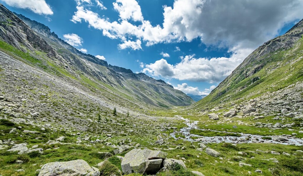
The main valleys in the park are Val Algone, Val Ambiez, Val Brenta, Val di Borzago, Val di Breguzzo, Val di Fumo, Val di Daone, Val di San Valentino, Val di Tovel, Val Genova, Val Manez, Val Meledrio, and Val Nambrone, among others.
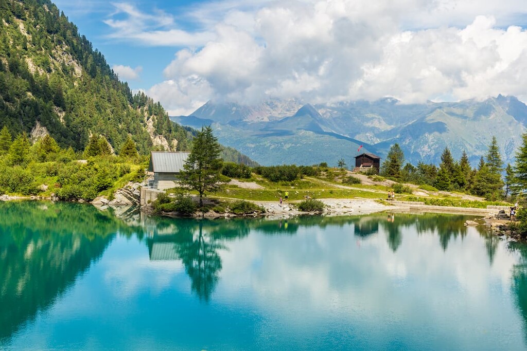
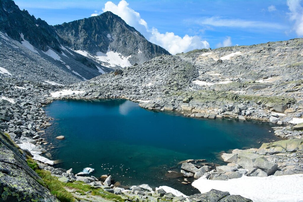
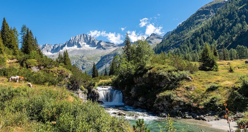
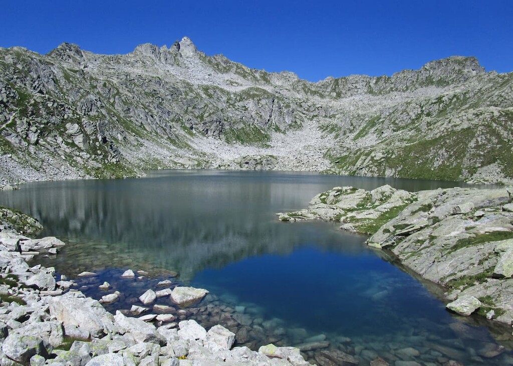
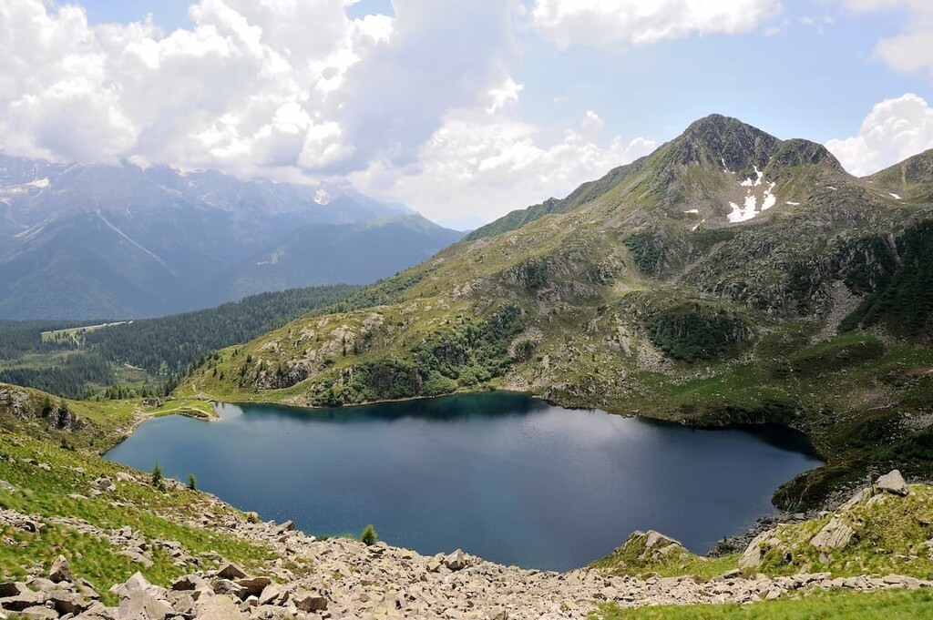
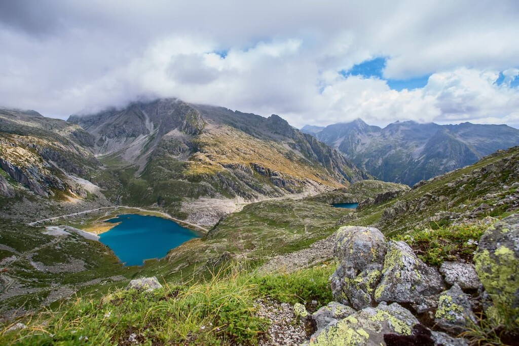
The valleys of the park are rich in water resources. In the mountain group of Adamello, there are 44 lakes, including such lakes as Lago di Lares, Nambino, Ritorto, Serodoli, Nero, Lambin, Malghette, Cornisello, San Giuliano, and Valagola. There are also the groups of small lakes like Laghi di San Giuliano, for example.
At the same time, there are just four lakes in the Brenta group—Tovel, Spinale, laghetto di Asbelz and Molveno—but all are very beautiful.
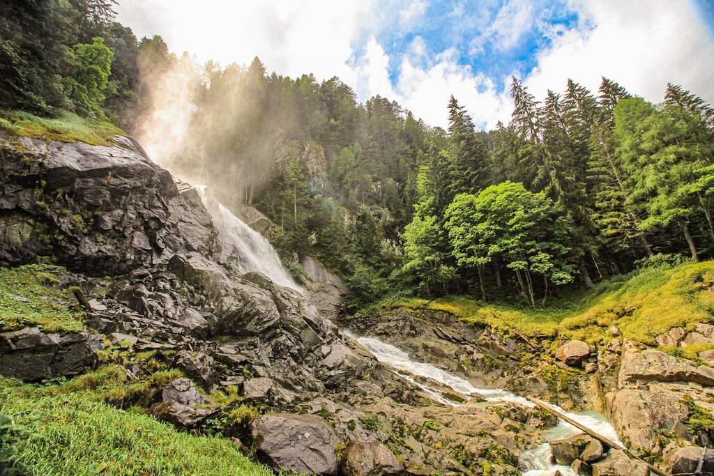
In addition to the lakes and streams in the region, the park has more than 30 waterfalls (cascata in Italian). One of the highest is the waterfall Nardis in Val Genova at 95 m (311 ft) in height. Other famous waterfalls are Boion de l'Ors, La Canavacia, Grasei, Casol, Cioch, and Mandron, among others.
Additionally, you can come visit one of the many wonderful valleys by traveling over one of dozens of passes in the region. The major passes in the park include:
Just remember that some of these passes are not only road and hiking passes, but they are also high mountain passes that are frequently covered with snow and ice.
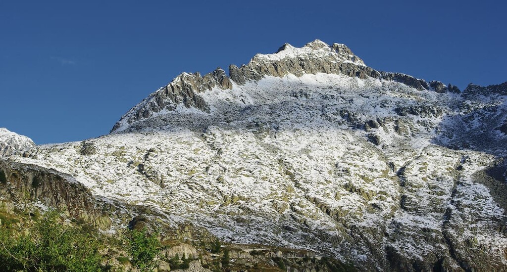
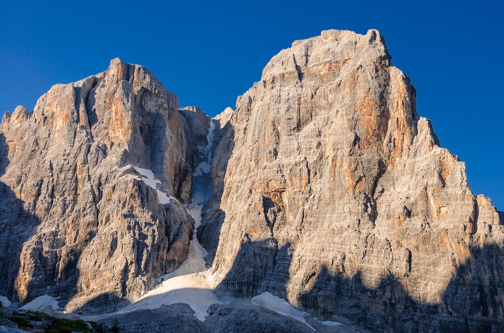
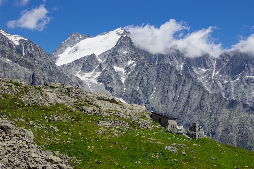
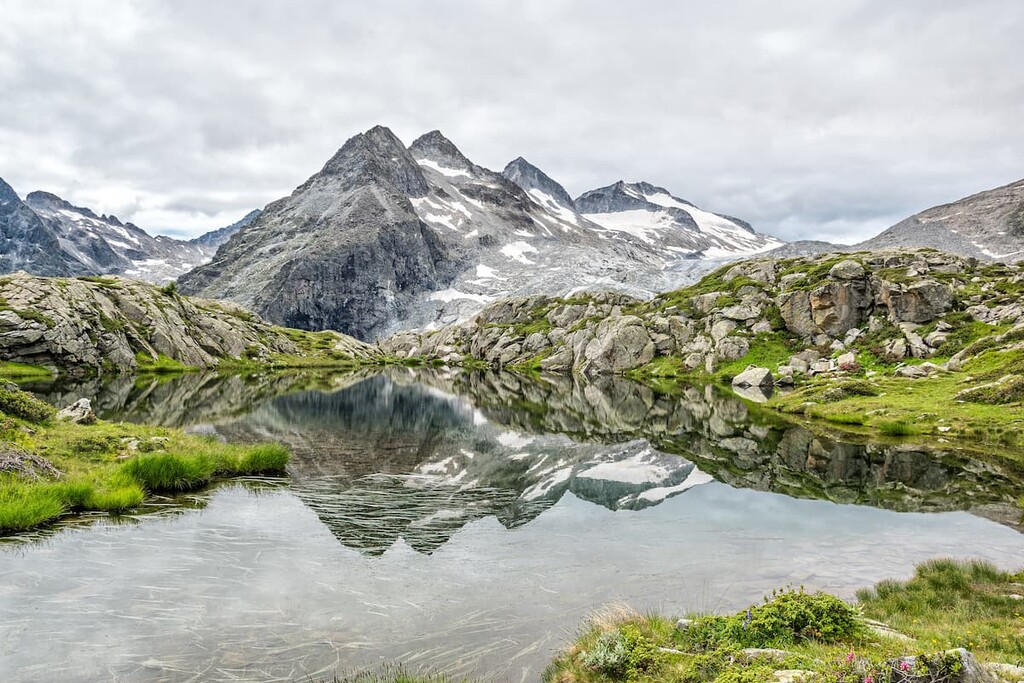
The main natural feature of the park is its glaciers. The largest glacier is the Adamello Glacier, which is also the largest in Italy and one of the largest in Europe with an area of 16.4 sq. km (6.3 sq. mi). It is also the deepest (270 m / 885 ft) in Italy. The glacier also includes the Mandrone Glacier (10.46 sq. km / 4.03 sq. mi). However, it lost about 2,000 m (6,561 ft) of its territory since the nineteenth century, becoming considerably thinner, according to the study of the local scientists.
The second, third, and fourth largest glaciers in the park in terms of area are Lobbia (5.8 sq. km / 2.2 sq. mi), Lares (4.1 sq. km / 1.6 sq. mi), and Presanella (2.6 sq. km / 1 sq. mi).
The other most famous glaciers in the park are much smaller, such as the Ambiez and Agola glaciers, which are 0.19 sq. km (0.07 sq. mi) and 0.04 sq. km (0.01 sq. mi) in size, respectively. Other famous glaciers worth mentioning are Brenta, Folgorida, Niscli, Amola, 12 Apostoli, Brentei, Camosci, Cop di Breguzzo, Cop di Casa, Corno di Lago Scuro, Crozzon, Folletto.
In total, there are 92 glaciers in the Adamello—Presanella Alps with an area of 35.6 sq. km (13.7 sq. mi) and 42 glaciers in the Brenta Group with a total area of 1.1 sq. km (0.4 sq. mi).
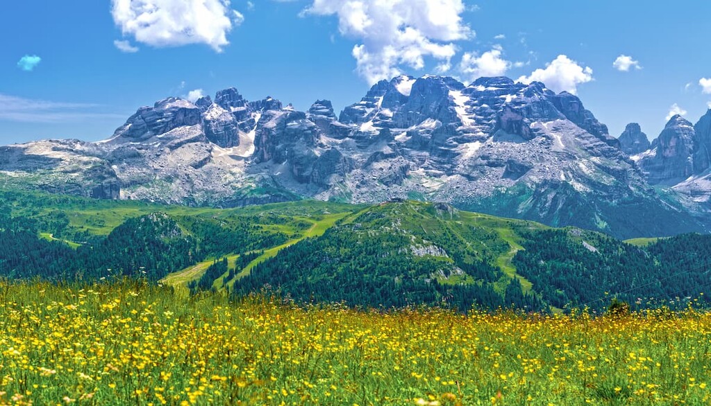
The flora and fauna of the Adamello—Brenta Geopark are extremely rich, thanks to the environmental integrity and variety of its territory. But it is also very typical to the Southern Limestone Alps.
The park is home to more than 1,200 species of plants. Up to 2,000 m (6,561 ft) in elevation, there are mostly coniferous forests of spruce, larch, and pine, which occupy one-third of the territory of the park.
There are also beech forests and mixed forests where you can see maple, cornelian, rowan, hazel, willow, hornbeams, downy oak, flowering ash, beech, and other trees. In total, it’s estimated that there are 25 million trees in the park.
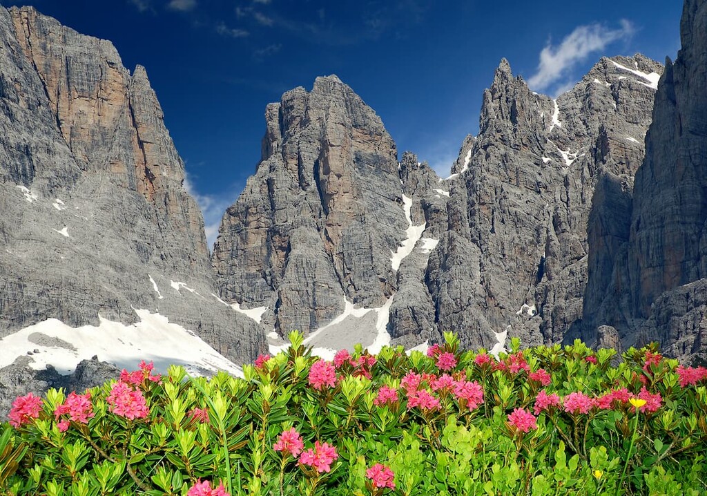
Above the treeline, there are alpine meadows where many, many alpine flowers bloom between late spring and the end of the summer.
Higher up on the slopes, just above the meadows, there are only rocks. However, shrubs and also some flowers, such as juniper, rhododendron, azalea of the Alps, alpine camedrio, creeping willow, and famous edelweiss and the boreal linnea flowers, grow between the rocks. These flowers are unique examples of plants that survived the last major glaciation.
The Parco naturale dell'Adamello—Brenta has a large population of ibex chamois but they can also be found in other parts of the Alps.
What's more interesting, however, is that the park is home to one of the largest populations of brown bears in Europe, which currently has 50 bears. The park has a project to recreate the population. From 1991 to 2002, 10 bears were released into the wild. However, you probably don't want to meet them on the trail, right? Brown bear is also the symbol of the park.
The park is also home to other animals that are commonly found in the Alps: foxes, badgers, beech martens, martens, ermines, weasels, deer, mouflon, squirrel, marmot, and hare. The birdlife in the park includes white partridge, black grouse, eagle, buzzard, goshawk, sparrowhawk, honey buzzard, and many other birds.
Meanwhile, the different amphibians and reptiles found are also very typical for the alpine environment. These include alpine newt, mountain frog, viviparous lizard, asp, and marasso. As far as fish go, the numerous lakes and waterways in the park host typical cold-water fish, such as the alpine char, marble trout, and brown trout.
In the Alpine Club classification of the Eastern Alps (AVE) both groups belong to the Southern Limestone Alps, numbered 49 and 51 respectively. Then, each of the park groups, including the smaller Presanella, is divided into several more subgroups (as classified by Italian system SOIUSA):
The mountain peaks of the park were first climbed two centuries ago, mostly by English climbers. Indeed, the earliest climbers in the region ventured up to the mountain summits long before the park was established as a state institution, which now attracts thousands of tourists each day. Since then, every corner of the park has been visited by humans.
I'll tell you a little about the first documented ascents of the three peaks in the park, from which its name is formed, although, of course, these were not the first such attempts on some of the highest peaks in the region:
The first ascent was made on August 27, 1864, by three English professional climbers, Douglas William Freshfield, M. Beachcroft, and James Douglas Walker. The famous alpine guide François Devouassoud of Chamonix, France, and local porter B. Delpero from the town of Vermiglio in the north of the mountain group, where the expedition began, also accompanied them.
That day they also climbed the neighboring mountains Cima Gabbiolo (3,458 m / 11,348 ft) and Cima di Vermiglio (3,457 m / 11,345 ft).
The first ascent of Cima Adamello was made on September 16, 1864 by a team consisting of four people: the Austrian climber Julius von Payer, local guides from the Rendena Valley Girolamo Botteri and Giovanni Caturani, and the porter Antonio Bertoldi.
The expedition started from the Genova Valley a week early, but in the beginning the climbers mistakenly went to the two lower peaks in next to Adamello thinking of them as the highest peak: Cima Meridionale del Dosson (3,439 m / 11,283 ft), and Corno Bianco (3,434 m / 11,266 ft).
The first ascent of Cima Brenta was made by the aforementioned Douglas William Freshfield in August 1871 (the exact day is unknown). He was accompanied by another Englishman, Francis Fox Tuckett, and a French guide, Henri Devouassoud of Chamonix—the brother of François Devouassoud.
They climbed the mountain from the west side by the glacier. Since then, other climbers have established a number of different routes to the summit.

As you can see, the first ascents of these mountains were done by a small group of climbers. "At that time it was such a job to make discoveries of unexplored lands," as a friend of mine, an outdoor enthusiast from Chukotka on the edge of Siberia, Russia, said in response to my question about how all these explorers managed to achieve so many impressive feats in such a short period of time.
Indeed, at that time, expeditions were sent to the mountains to attempt a whole series of climbs, rather than for a single summit. This was especially true of climbers from the more distant countries in relation to the Alps, like England, where people would travel to the Alps for many months at a time in order to attempt as many peaks as possible in one trip..
Other major peaks in Adamello—Brenta Geopark include:

Furthermore, the park ranges in elevation from 477 to 3,558 m (from 1,564 to 11,673 ft) above sea level.
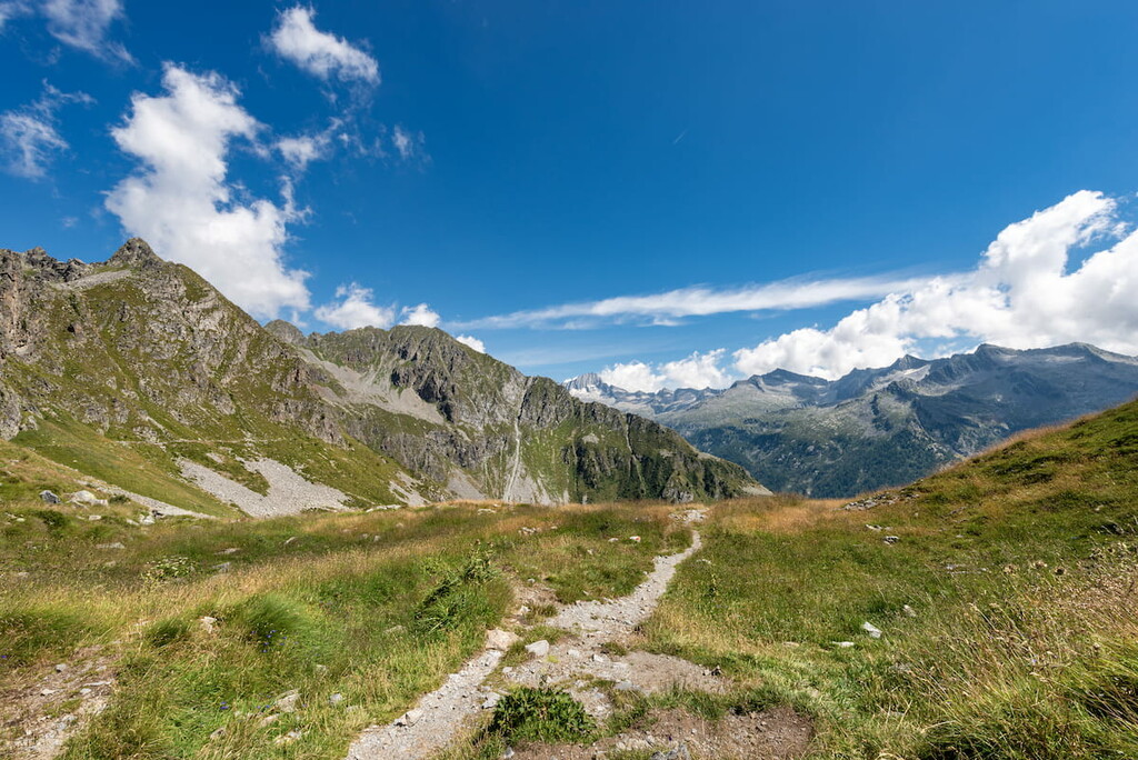
The main hiking areas of the park can also be divided according to the natural division between the Adamello—Presanella and Brenta groups.
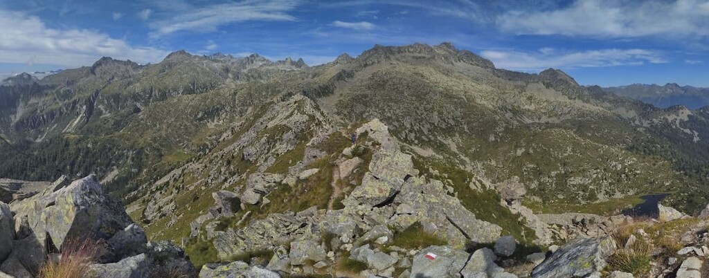
In total, the trails network is more than 700 km (434 mi) long. Note that the routes of this park include many via ferratas, which require special equipment, such as helmets for head protection, carabiners to fasten to the metal ropes, and webbing step ladders (etriers) for hard-to-reach areas.
There are many via ferrata in the Brenta Group, in particular, so be mindful of this when planning your trip.
Next, I will list here the main routes of varying levels of difficulty in the central, western and eastern parts of the park:
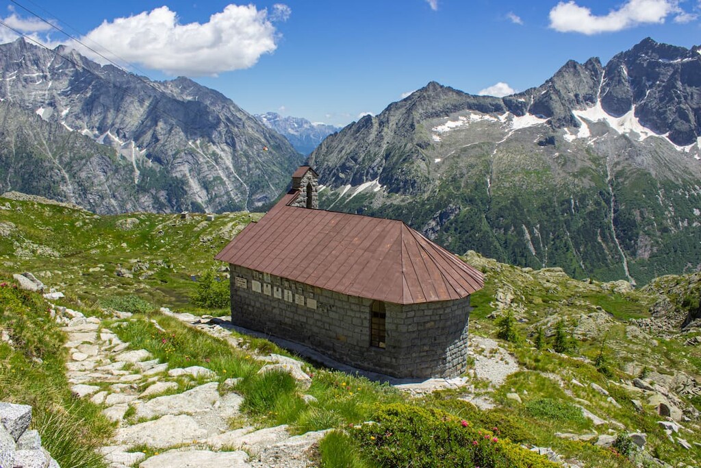
The Five Lakes Trek is the most popular trek in the park. There are several reasons for this: First, it is a one-day trek; second, you can start this trek at the tourist center of the entire park where a cable car (Five Lakes Express/Cinque Laghi Express) will take you to the beginning of the route; and, finally, the trek is simply beautiful as it travels to five lakes in the Presanella Group.
The route runs at an elevation of over 2,000 m (6,561 ft). If you go clockwise, you will pass lakes Ritort, Lambin, Nero, Gelato, and Serodoli, as well as a group of three small lakes called Tre Laghi, Alto, and Malghette.
Along the way, you will see mountain peaks such as Monte Ritorn, Monte Nambrone, Cima Ritorno, Cima Serodoli, Monte Nambino, Cima di Laste, Cima Schulz.
In my opinion, the route is not easy; rather it is rated as moderate. You will need good physical fitness to walk it in one day. It's best to start early in the morning and to take plenty of water with you because if the water from the lakes were drinkable, all the hikers who have done the route before you would have drunk it by now.
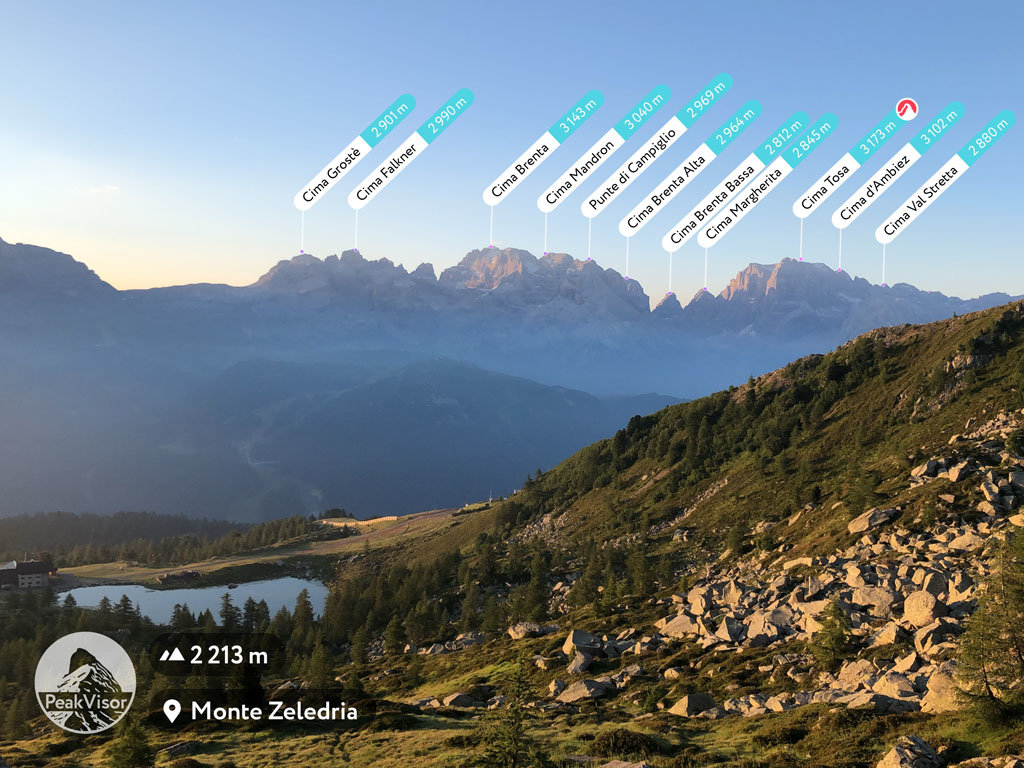
A fun and less physically demanding alternative to the previous trek, the brief hike to Mount Zeledria (2,427 m / 7,962 ft) offers a stunning view of the entire Presanella and Brenta groups.
From the top of Mount Zeledria, you can also see all five lakes from the previous trek and many others. The trek also is quite popular because it also starts in the Madonna di Campiglio village.
Local people say that it is good to summit the mountain not one, but two times—at sunset and at sunrise—so you can compare the views. Just keep in mind that the ascent is short but steep. You will also need to complete a simple via ferrata that is about just 2–3 m (6.5-9.8 ft) long so that you can pass a short rock ledge (consider it a little adventure).
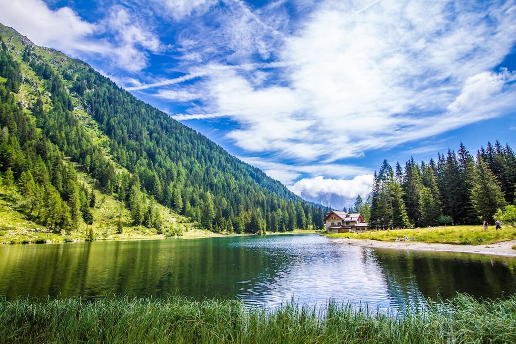
Near Monte Zeledria you can stay in rifugio Viviani Pradalago, a cozy, family-run mountain hut right on the small alpine Pradalago lake.
This is a moderately difficult route in the heart of Adamello Geopark that takes you to its three main natural wonders, all of which are named Mandrone. These features include a lake, a mountain (3,283 m / 10,771 ft), and a glacier, the latter of which is part of the larger Adamello Glacier that you will also see.
The trail begins at the parking space at the Malga Bedole at the very end of the Genova Valley. Keep in mind that, during the high season, you need to book a place for your car in advance.
The nearest parking lot is located at Ponte Verde at the entrance of the valley, and the nearest town Pinzolo is 20 km away from the starting point. Before July 2020 there was a shuttle bus, but service was suspended until at least July 2021. Therefore, you should seek out updated information about park services before planning your trip.
In addition to mountains, glaciers, forests, and waterfalls, the main attraction of the route is small, but great museum dedicated to the Adamello glaciers: The Glaciological Center "Julius Payer" (Il Centro Glaciologico "Julius Payer"), which is named after the same Austrian alpinist who was the first to climb the mountain Adamello.
At the museum, you will learn more about one of the largest glaciers in Europe from the informational signs that you can check out during your hike.
The museum was made in 1994 and renovated in 2004 by the Trentino's Alpinists Society (Societa Alpinisti Tridentini, SAT) and the staff of the Science Museum of Trento (Museo delle Scienze di Trento, MUSE). At the same time it is an observation point and a logistic base for courses and appointments of training for the members of the SAT and sections of Italian Alpine Club (Club Alpino Italiano).
The finish point of the route is the Mandrone Lake. Here, the stunning mountain peaks and their glaciers are beautifully reflected in the waters of the lake.
At the end of the hike, you can return the same way you came and make it a day trip, or you can stay overnight at the rifugio Citta di Trento al Mandrone at 2,400 m (7,874 ft). Since the rifugio is located near the lake, you can take time for yourself when you’re there to watch the beautiful sunsets and sunrises.
The Adamello High Trail is a long, difficult hiking route that takes you through the entire Adamello mountain group.
The name "High Trail" refers to the name of the most popular similar route in the Dolomites: Alta Via. But the Adamello Trail is also marked with just the number 1 (which is also its second name). The route was created in 1969 as a part of “The Grand Italian Trail” (Sentiero Italia) project.
This route can be taken from north to south, or vice versa. It will take you approximately 9 days to complete, and, along the way, you can spend your nights in the mountain huts.
Important: This trail is generally well marked. But, some sections are difficult to follow, so basic orientation skills are required. Hiking this trail also requires excellent physical fitness and some mountaineering equipment for navigating the multiple via ferratas. The good news is that there are no glaciers on the trail, which would require even more climbing equipment.
Learn more about the trail from this official PDF document.
The Dolomiti di Brenta is a fantastic trek in Brenta group. The route consists of 11 sections with 7 additional variants. You can walk one, two or more sections during the day.
All sections of the trail are medium to advanced in difficulty, and they are designed for experienced hikers. There are also many via ferratas on the routes, so some special equipment is needed, including helmets, carabiners, and ropes. This also makes the trail a real adventure, which is worth a whole week's vacation, or, at the very least, a weekend.
You can complete the entire trek in 6 days (6 nights). Or you can tackle its individual sections or sub-variants to create a trip of of up to 2 or 3 days. For example, you can traverse the eastern borders of the group or the western borders, or you can hike only in the north or south.
While walking the route as a loop, you will see all the main mountain peaks, valleys, and passes of the Brenta group.
There are seven different visitor centers in the Parco naturale dell'Adamello—Brenta. The park’s staff call them “Park Houses,” quite a fitting name, if you ask me.
The main center is located at the entrance to the Val Genova. Before you visit, take note of its address and other important information:
Casa del Parco "Geopark" (Park House "Geopark")
Vicolo Cavallotti, 20, 38080, Carisolo, TN, Italy
Open from July 4 to September 6, then on weekends from September 12 to September 27. Closed on Mondays
Hours: 10:00—13:00 / 14:30—18:30
Tickets: full—€ 4.00; reduced—€ 2.00 for groups of at least 10 people, university students, children aged 3 to 14 years; family—€ 7.00
+390465/503053
Each other center also has its own name, which tells you what additional thematic information you can get there: Casa del Parco "C'era una volta" ("One upon a time"), which has a permanent ethnographic exhibit, as well as "Orso" ("Bear"), "Flora", "Fauna", "Acqua Life" ("Water Life") and "Lago rosso" ("Red Lake").
You can find information about all of these visitors centers and other useful information on the website of the Adamello—Brenta Park. You may also bookmark the page of the park on the website of all parks of Italy. The park also has an official app for iOS and Android to help guide visitors.
When hiking in the mountains of Adamello—Brenta Geopark, you can stay overnight in one of three traditional types of accommodation in the Alps: mountain huts, bivouacs, or campsites.
Mountain hut is "rifugio" in Italian. It is a big building where you will have a bed in a dormitory room for 4–12 people, breakfast and dinner, and a shower for €20–60 per night. Bivouac is “bivacco” in Italian. It is a kind of a shelter: wooden or a stone small house or a metallic cabin. It is free to use. Learn more about rifugios and bivaccos from the local guide.
With more than 50 huts and bivouacs in such a large park, you won't have any problems finding lodging during your hike. You can find these huts and bivouacs directly in the PeakVisor app or, for example, on the official website of the Lombardy region, which is dedicated to this type of accommodation Rifugi.lombardia.it.
The campsites are also abundant in this region. This type of temporary accommodation is suitable for those who are not ready to spend 2–3 or more days at an altitude of 2000 m (6,161 ft) but don’t want to live in the city, either.
From these campsites, you can easily set off on day hikes into the mountains and then head back to camp where you can watch the sunsets and sunrises right from your bed, whether that’s a camping tent, cabin, or trailer. Here are some of your options:
Via di Sotto Pila, 4, 38026 Ossana TN, Italy
+390463751630
Località Velon, 38029 Vermiglio TN, Italy
+393495288269
Via Cavaione di Dentro, 9, 25050 Temù BS, Italy
+39036494219
Via Campeggio, 10, 25048 Edolo BS, Italy
+39036471694
Via Civico, 117, 38080 Darè TN, Italy
+390465801669
Località magnabò 2, 38086 Pinzolo TN, Italy
+393381919608
Viale Del Parco, 4, 38010 Andalo TN, Italy
+390461585753
Viale Dolomiti di Brenta, 1, 38086 Sant'Antonio di Mavignola, Campiglio TN, Italy
+390465507178
Via Lungo Lago, 27, 38018 Molveno TN, Italy
+390461586978
The park includes 39 municipalities, including 3 towns, which can be used as a base for recreation and hiking in the mountains of the park:
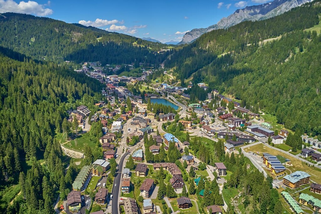
Madonna di Campiglio is a typical alpine ski village located 70 km (43.4 mi) from Trento, in the Rendena Valley, at an altitude of 1,522 m (4,993 ft). It is home to 822 people, but during the summer and winter tourist seasons the population increases ten-fold.
Madonna di Campiglio is the main tourist center for the entire area of the Adamello-Brenta Nature Park and it is the main point of access to both the Brenta Dolomites and the Adamello–Presanella Alps. In the village, you can take the cable car to the Passo Groste, which will take you directly to the northern end of the via ferrata network called Via Bocchette, or to the Five Lakes trail in the Adamello group.
The town has no special architectural or cultural attractions, so to not get bored between hiking or skiing trips, visit the Museum of the Alpine Guides and People of Campiglio, which showcases photographs, relics, and equipment used by local Alpine mountaineers. The museum is located in Chalet Laghetto, by a small lake in the center of the village.
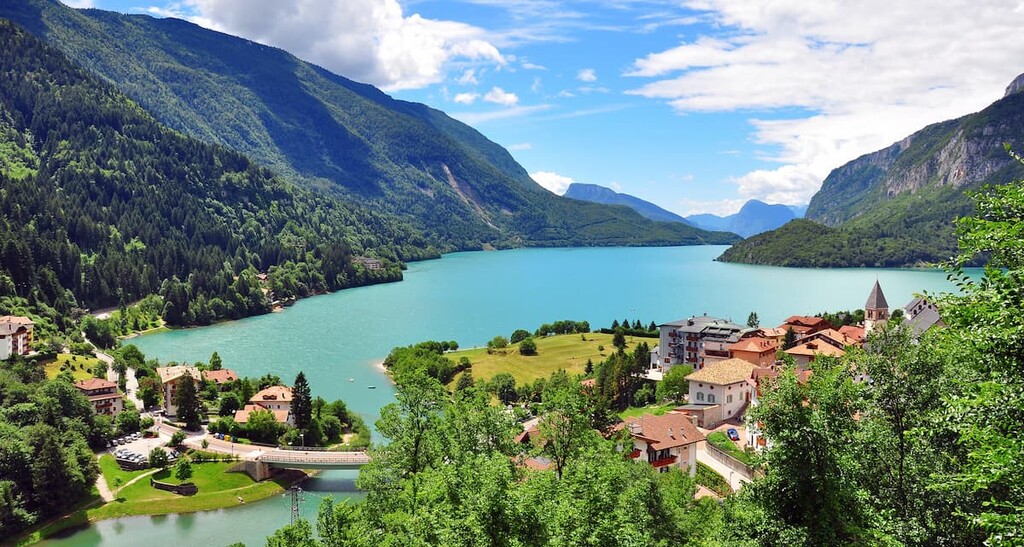
A small commune located some 40 km (25 mi) from the city of Trento, Molveno is located along the northern part of a picturesque lake of the same name at an elevation (864 m / 2,835 ft). The municipality has 1,138 residents.
Molveno is the main center of tourism in the Dolomiti di Brenta on the eastern side of the Adamello park. Despite the small size of the village itself, Molveno has everything to offer for outdoor recreationalists, including water sports, paragliding, and more.
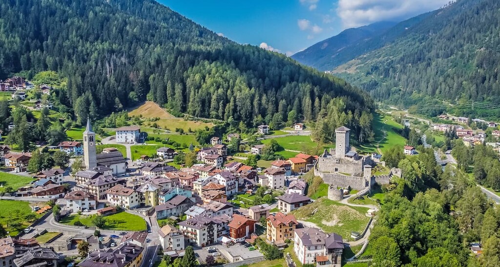
The main architectural and cultural attractions in the town are the two churches of San Vigilio and San Carlo Borromeo, built in the thirteenth and seventeenth centuries respectively; the "Napoleonic Forts", which are ruins of Austrian fortifications built to defend against the French military; and the seventeenth-century Saracini Palace—the aristocratic residence of the Saracini of Belfort counts from Trento.
A town on the northwestern boundaries of the park, Edolo is located in the upper part of the large Camonica Valley at an altitude of 720 m (2,360 ft), 45 km (27.9 mi) from the nearest city of Sondrio in the neighboring valley of the same name. The town is home to 4,466 people.
Edolo can be a starting point to hike in the northern part of the park. If you don't have a car, you can get here by train from Brescia in 2 hours.
But there's something to see in the city too: the river Oglio; the large artificial lake Benedetto, which is the source of power for the city; and, of course, the surrounding mountains. By the way, the town is also home to University of the Mountains (L'Università della Montagna), Milan's University department in Edolo that’s dedicated to the study of the mountain environment.
The main architectural and cultural attractions in the city are the two churches: San Giovanni Battista and Santa Maria Nascente. The latter is one of the oldest in the entire Camonica Valley. It also has the highest bell tower (68 m / 223 ft) in the valley. There are also two other churches of San Clemente alla Costa and San Sebastiano that are worth checking out.