
Scan the QR code and open PeakVisor on your phone
Chukotka Autonomous Okrug is home to 493 named mountains. The highest is Ishodnaya at 1,887 m.
The Chukotka Autonomous District may rightfully be called the World’s End, just like the notorious Captain Jack Sparrow saw it, just as you can tell by looking at Chukotka’s geographical location on a map. Chukotka is indeed placed at the very edge of the Eurasian continent. In total, there are 493 named mountains in the Chukotka Autonomous District. The highest is Mount Iskhodnaya (1887m) in the Chantal Range.
The mysterious land preserves the heritage of ancient civilizations as well as natural riches in the ice. Local natural and archaeological monuments are the world’s heritage. Severe climate and the permafrost scare away many tourists but at the same time they are utterly appealing to fans of adventure, new experiences and discoveries.
Islands, lakes, small mountains, and rocky capes are all testing strength here. Getting to some of them is a challenge, but the experience is well worth the effort.
Originally, the Chukotka National District was formed in 1930; the territory belonged to the Far North Region. Throughout its history, it was joined multiple times to the nearby regions. Finally, in 1992, it received its autonomy and modern name. Its main city and administrative centre is Anadyr.
Only 49,527 people live in this most underdiscovered region of the Russian Federation (as of 2020). The district has 3 cities, 15 villages and about 45 settlements.
Chukotka neighbours Sakha Yakutia Republic in the northwest, Kamchatka in the south, and the Magadan Region in the southwest. To the east runs the maritime border with the United States.
There are a great many traces of human habitation from prehistoric times in Chukotka. This fact amply indicates that once upon a time long ago Chukotka and Alaska were a single continent, part of which subsequently went under water, presumably 10 thousand years ago. Beringia is the name scientists give to this hypothetical continent. There is an assumption that the population of Chukotka began exactly through the sunken isthmus.
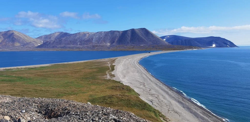
The Chukotka Autonomous District is located in the very northeast of the Russian Federation. Its possessions include the Chukotka Peninsula, part of the continent, as well as several islands: Romanov Island, Wrangel, Ayon, Herald and others. The extreme points of Russia are located in Chukotka: the easternmost point is Romanov Island, the eastern continental point is Cape Dezhnev. Here you can find the northernmost city of Russia - Pevek, as well as the easternmost city - Anadyr. The region is washed by the Chukchee and East Siberian seas of the Arctic Ocean and the Bering Sea that belongs to the Pacific Ocean.
The area of the entire Chukotka is 737,700 sq.km. The tiny bit of the Chukotka Peninsula, the area of which is only 49,000 sq.km., is located in two hemispheres of the Earth - the Western and the Eastern. By the way, it is the only part of Asia that has western longitude in the coordinate system. A nice feature of the geographical location of Chukotka is the fact that the residents of the peninsula have the right to enter the territory of neighbouring Alaska without a visa. From here you can easily reach the American coast which is only 86 kilometres across the Bering Strait.
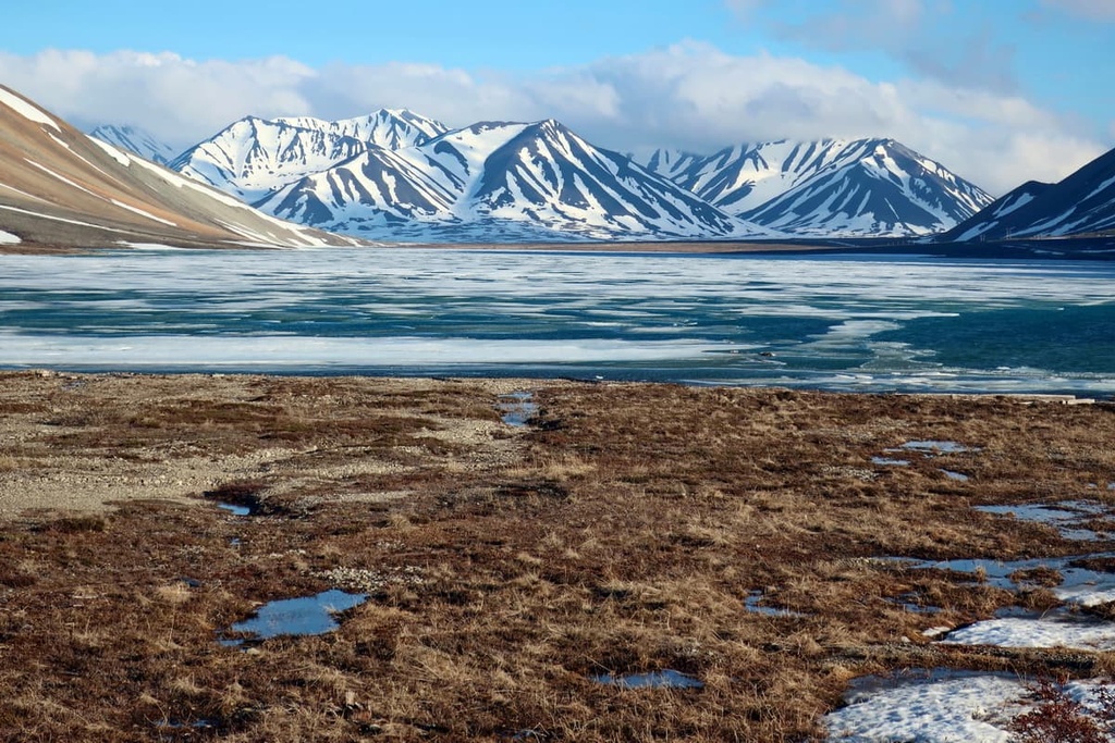
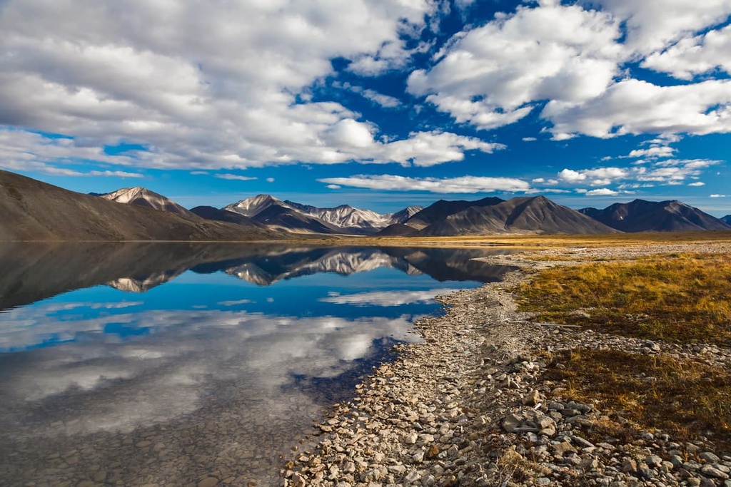
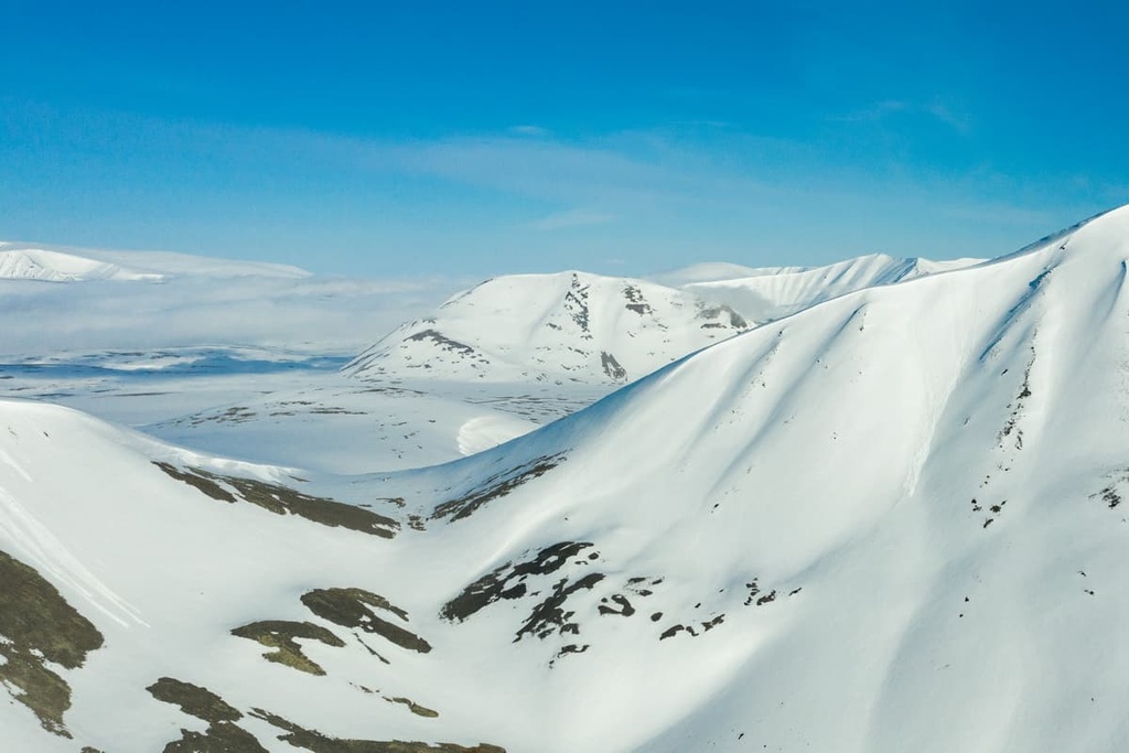
Chukotka is dominated by mountainous terrain
Low mountains with an average absolute height of 600-1000 metres form the Chukchi Plateau aka the Chukchi Highlands. The lowlands are not numerous and can only be found in the coastal part, and in the river valleys, the largest lowland is Anadyrskaya.
The Chukchi Plateau acts as the main watershed of the peninsula. One part of the rivers from it drains to the Arctic Ocean and the other goes to the Pacific Ocean. The central part of the region is occupied by the middle-altitude Anyuisky Plateau and the Anadyr Plateau which are surrounded by mountains higher than 1,000m mark. In the east stands the Chukchi Plateau.
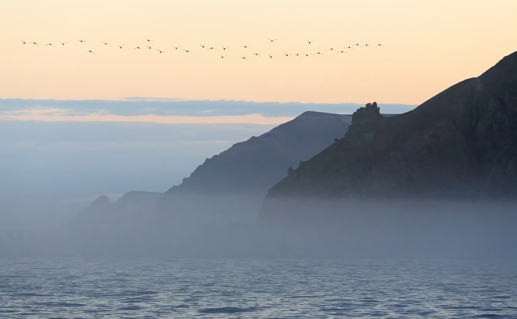
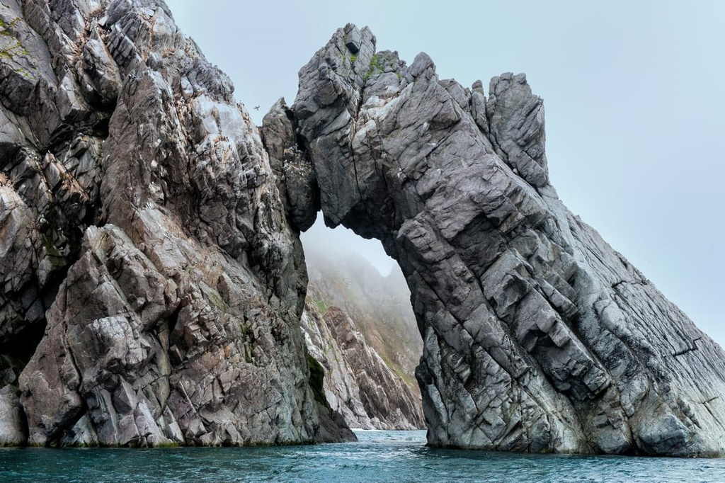
In total, there are 488 named mountains in the Chukotka Autonomous District. The highest is Mount Iskhodnaya (1887m) in the Chantal Range. The mountain is located near Providence Bay. The highlands abruptly drop to the ocean in this place, forming a series of steep cliffs and escarpments.
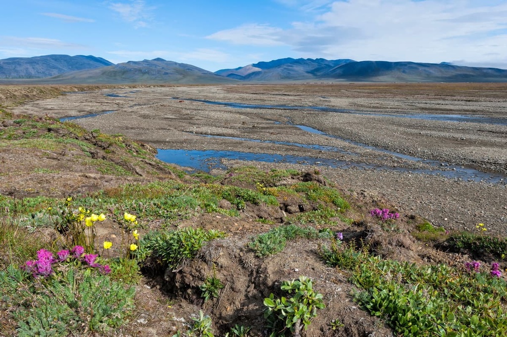
Chukotka is rich both in mineral and water resources. There are more than 8,000 rivers flowing through its lands, most of them are mountain rivers. Unlike most world mountain rivers, the streams here are quite special. They freeze-up for 7 to 8 months, their floods are harsh and high, the runoff is very uneven. There is quite marked seasonality in feeding and water regime. The rivers are predominantly fed by snow and rain. The names of the largest rivers of the Chukchi Peninsula are interesting, but not all of them are easy to remember: the Anadyr, Omolon, Amguema, Cheghitun, Ighelkveem, Ulyuveem, Ioniweem and others.
All local rivers and reservoirs freeze in September and do not open until early June. Some rivers freeze to the bottom during the winter! This leads to ice jams when ice breaks up because rivers in the lower reaches free from ice much later. Rivers in the plains also have a peculiarity: there is constant variability or wandering of the channel due to thawing of fossil ice and subsequent soil subsidence. As for rivers flowing into the ocean, they are usually exposed to sea tides, which sometimes causes a significant rise in the water level in the lower reaches, as well as their countercurrent flow.
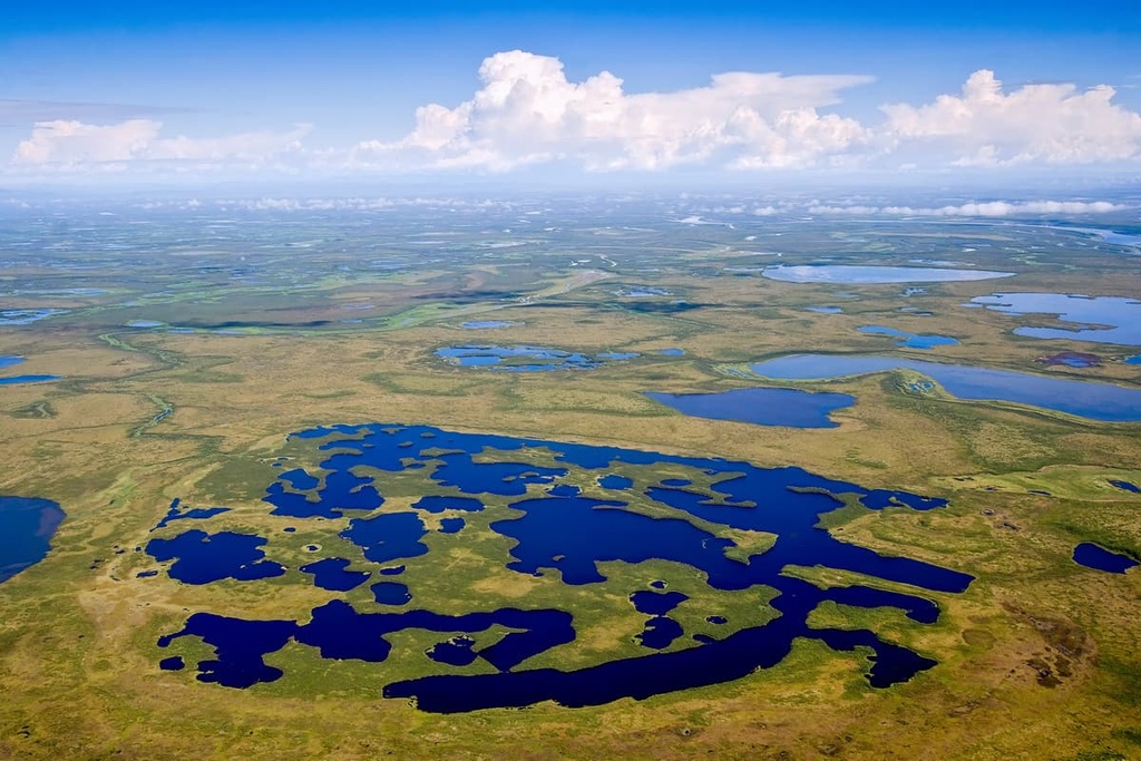
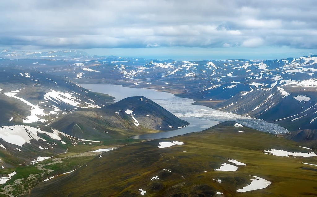
Chukotka has a very developed lake and marsh network. There are many coastal lakes in the region, which makes the water in them salty. Only a small number of lakes are located in the mountainous areas. The largest water bodies of the region are lakes Krasnoye, Koolen, Mainits, Pekulneiskoye, Koinighytghyn, Vaamochka, Yonai, and lake Elgygytgyn. The latter is the object of scientists' research studying millenia-long climate changes on the Earth. In the wintertime, the water in the lakes is covered by a thick layer of ice up to two metres thick. Almost all local lakes are flow-through, yet low-lying lakes often become overgrown, thus turning into marshes and swamps. Swamps are also concentrated along the beds of Chukotka's key rivers.
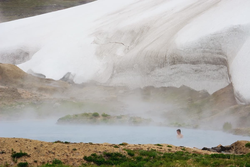
There have been discovered a large number of underground water reservoirs and thermal springs in Chukotka.
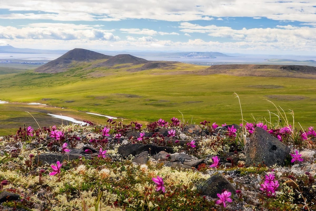
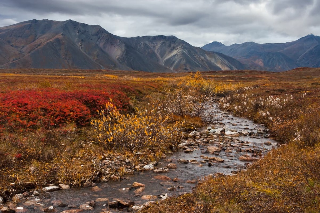
The Chukotka Peninsula is located within the tundra natural zone. However, the vegetation here is not monotonous and even more so, it is not that sparse. More than 900 species of higher plants, over 400 species of mosses and 400 species of lichens grow on the peninsula. There are very few forests in the region but shrubs are ample. Some dense patches of Daurian larch and dwarf birch are a rare sight, but you still come across them in Chukotka. Tundra vegetation teems with its typical representatives: alder, sedge, blueberry, lingonberry etc. Mosses and lichens can be considered as a peculiar floristic symbol of Chukotka. In the continental part of the Chukotka Autonomous District, there are unique relict species growing in the Tnekveem and Telekai groves.
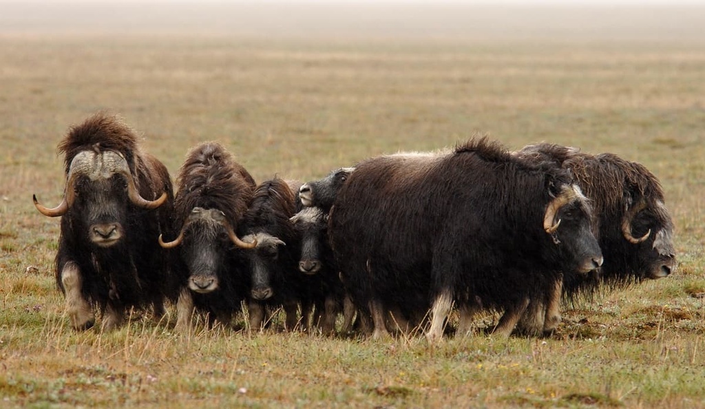
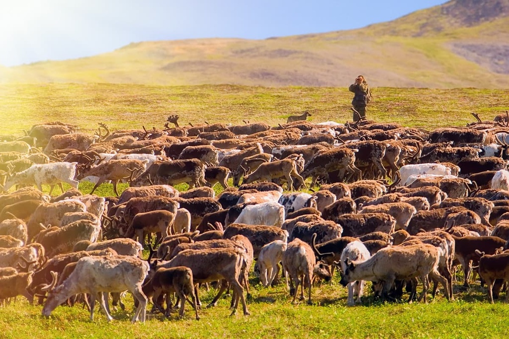
The animal world of Chukotka is also quite diverse. Typical local wildlife features reindeer, polar and brown bear, fox, polar wolf, hoofed lemming, polar hare, Arctic fox, lynx, Arctic ground squirrel, flying squirrel, chipmunk, wolverine, long-tailed ground squirrel, flying squirrel, chipmunk, wolverine, black-clawed marmot, sable, and ermine. There are snow rams in the mountainous areas and on Wrangel Island lives musk ox (Ovibos moschatus). The musk ox is an endangered species, whose population is reduced by, among others, wolves. They are thought to have been grazing with mammoths, hairy rhinoceroses and primitive bison in ancient times in an area stretching from Spain to Chukotka. And there were times in the history of the county when these interesting animals helped the reindeer shepherds to herd the reindeer. But it lasted only until one day when musk oxen had a problem and started kicking reindeer. Despite the fact that outwardly they seem to be quite good-natured, they are by no means safe for humans, just like any other large animal.
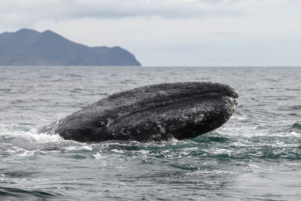
As to the flying wildlife, on the coast there live guillemots, sandpipers, gulls, teal, loons, and swans. In total, there are about 220 species of birds in the region. The sea waters are inhabited by a huge number of fish and shrimpю In the Bering Sea alone there are 402 species of fish. And sometimes whales come ashore. Coastal waters are inhabited by 9 species of cetaceans including humpback whale, grey whale, bowhead whale, fin whale, killer whale, white whale, minke whale, Dall's porpoise and harbour porpoise. There are 6 species of pinnipeds, such as spotted seal - Larga, Pacific walrus, Far Eastern bearded seal, striped seal - winged seal, ringed seal, and sea lion. Seven other marine mammal species also visit local waters, i.e. Arctic right whale and blue whale, narwhal aka sea unicorn, sperm whale, coalfish whale, northern flounder, northern fur seal. Unfortunately, many poachers hunt whales, which are included in the Red Book and are endangered species.
Speaking about the inhabitants of Chukotka, it is very important to mention such representatives of the animal world as polar bears.
The indigenous people of Chukotka and polar bear relationships are not about peaceful coexistence, the Chukchi historically have long been hunting polar bears. At one time it was necessary for survival. Skin, fat, skull, teeth, meat and sometimes even blood were all used. Some parts were eaten, some were used in the house and some for artwork. But there were also restrictions. For example, a family could take no more than one bear in two years and only with the permission of the eldest in the family or if you belonged to a family from a special bear clan. At the same time, an appropriate ritual was performed at the place of the hunt so that the bear's soul could be purified and harmoniously reborn.
To this day, some indigenous people still occasionally prefer to hunt bears. However, times are changing, and the polar bear is now protected by the state in order to preserve its population.
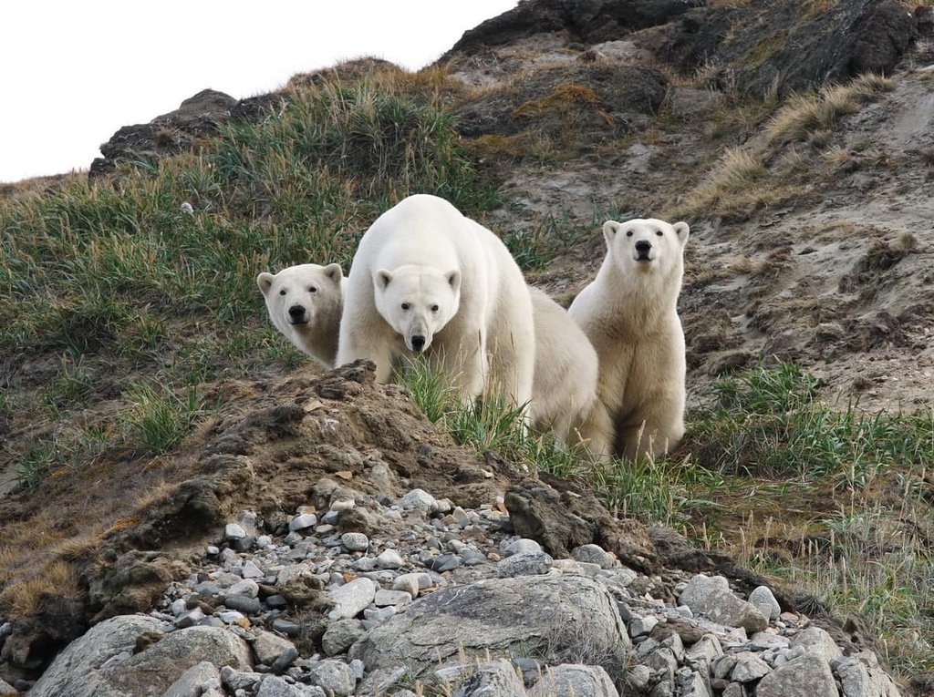
At all times it is important to remember that the polar bear is one of the most dangerous predators for humans. Therefore, it is better to avoid any encounters. When planning a trip to Chukotka, you should know some peculiarities of the area. For example, the residents of Rarkaipi village live surrounded by polar bears because the village is located on the migration path of these animals. Polar bears make a trip every year to Cape Kozhevnikov and then beyond it to get their food. Because of the unfrozen Chukchi Sea, the predators cannot hunt and as a result, they make a stopover in the village (sometimes 50-60 animals have stopped there). In such cases, all events in the village are cancelled, and one has to be always on the lookout. Unfortunately, more often than not, a bear that appears in a settlement is killed without even making an attempt to be driven away. Sometimes though, a bear is driven away from the village or captured and moved to other places, away from residential areas.
So how can you reduce the risk of encountering a predator? First of all, it is important to remember some basics.
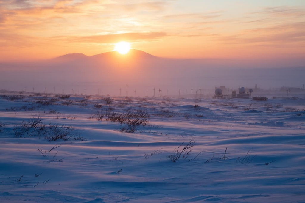
Chukotka is a land of permafrost, which is spread almost everywhere. Most of the territory is beyond the Arctic Circle. The climate here is harsh, subarctic, continental in the interior lands, and maritime on the coasts. Summer here is so short, only 2-3 months, that it seems as if winter lasts forever. During the cold season, the peninsula seems to turn into an icy desert. The average temperature in January is from -15°C (5F) to -39°C (-38.2F). The absolute minimum recorded was -61°C (-77.8F). The depth of the snow cover in the depressions can reach 2-3m.
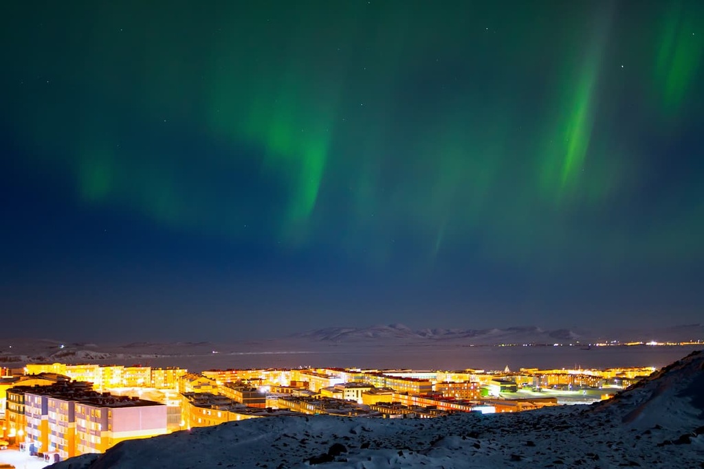
But nature delights with the most beautiful phenomenon - the northern lights!
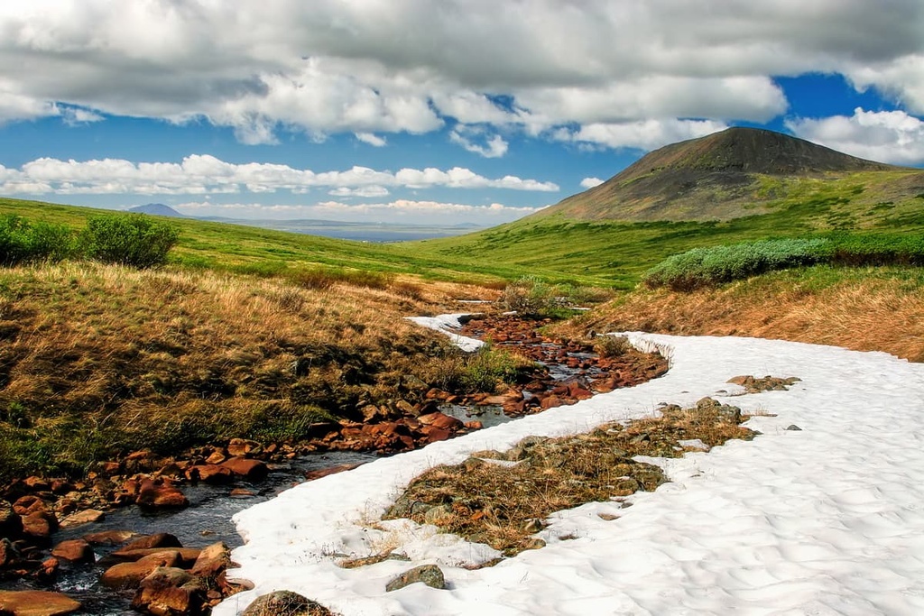
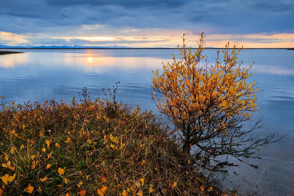
When summer comes, Chukotka seems to come alive and bloom with quite diverse vegetation and murmuring mountain streams. The average temperature in July is from +5°C (41F) to +10°C (50F). The absolute maximum recorded so far is +34°C (93.2F). At the same time, the summer time of the year is a polar day, as a result of which the innate sense of time is lost.
The climate of the region is unique in many aspects. The area is located in the place where two oceans meet, which generates a whirlpool of complex atmospheric circulations. This fact causes frequent snowfalls, storms, fogs, and winds that knock you off your feet.
It is due to these adverse weather conditions that local residents here measure time not in hours and minutes, but in days and weeks. After all, if, for example, fog hits, the route from the village to the city can take a whole week.
There have been registered many climatic records on the territory of the Chukotka Autonomous District, e.g. the minimum hours of sunshine, the maximum storms and hurricanes per year, the lowest for these latitudes radiation balance, the maximum average annual wind speed and the maximum frequency of hurricanes and storms (Cape Navarin).
Compared to other regions, life in Chukotka is not easy. It requires a lot of courage, steadfastness and calmness from the locals and even more so from the tourists. Those who dare to step out of their comfort zone and challenge the harsh conditions will be rewarded with vivid impressions from the polar landscapes and hospitality of the locals. Rest here is possible both in short, but bright summer and in cold, but very snowy winter. Travellers will be exposed to many absolutely non-trivial things. For example, they can live in a real yaranga or pull fish out of very icy water.
You can enjoy all kinds of outdoor activities, travel by water, take a cruise, go on hiking or join an ethnographic or scientific expedition. There is thriving historical tourism as well.
Chukotka attracts numerous scientific expeditions from different countries to study the life of small peoples, their trades and languages. Ornithologists come here to study birds, and oceanologists study the resources of the northern seas. For historians, the local territories offer endless opportunities for new discoveries - there are about five hundred archaeological sites, the study of which completely changes the traditional views on the development of civilizations. According to these data, the land of Chukotka was inhabited by people who were able to work the metal back in those distant times when there was no Ancient Greece or Ancient Rome.
Ethnography lovers can get acquainted with the customs, life and art of the Eskimos, Chukchi, Evenks and Koryaks. Tourists are most welcome to take part in national events and holidays: thanksgiving rites, festivals of sea hunters, folklore festivals, holidays of whale, first calf, young deer and many others.
In the summer, you can set off on a sea cruise from Anadyr to the Kanchalanesky and Anadyrsky estuaries, the Onemen Bay, to the mouths of the Velikaya and Anadyr rivers. On the cruise, you can watch the bird bazaars of Alyumka Island, seals and beluga whales playing in the cold northern waters. Cruise ships go from Kamchatka, the US and even Britain, they sail along the shores of the Providence Bay and Chukotka Peninsula. Stops are provided in the most interesting and informative places: endemic villages, archaeological sites, hot springs. Tourists go rafting, kayaking or hop in inflatable boats to go down Chukotka rivers in July and August.
However, don’t be fooled by the serenity, the peace and quiet of some landscapes. Any trip can turn into an extreme one in Chukotka, be it more or less long hiking or even skiing. In this case, you will discover your true worth, strength and endurance. The local mountains, hills, cliffs and other elevated places, combined with harsh weather conditions, provide excellent opportunities for this.
The Chukchi Plateau or Highlands is a system of medium-altitude ranges and ridges located in the central part of Chukotka. It is part of the East Siberian Upland. The mountains extend for 450 km. It is a real mountain country!
On the northern side, the ridges are formed mainly by shales, sandstones and granite flecks, whereas the southern side has mainly volcanogenic deposits. The Chukchi Plateau is rich not only in external beauty, but it also keeps many precious minerals and metals inside it. Here deposits of gold, silver, tungsten, tin, mercury, and coal have been discovered.
The local mountains include a number of so-called sub-ranges, the main of which include: the Shelag Ridge, the Pegtymel Ridge, the Ekvivatap Ridge, the Palyavaam Ridge, the Chantal Ridge, the Ekitik Ridge, the Pekulnei Ridge, the Iskaten Ridge, and the Genkanyi Ridge.
The highest point of Chukotka is Mount Iskhodnaya (1,877m). It is located on the Chantal Ridge. The ridge is bounded on the west by the bank of the Chantalveergyn river, which separates the Chantal from the Ekiatap Ridge. In the south, the Chantal Ridge borders with the Ekityk Ridge and in the north with the Palyavaam Ridge. The territory of the Chantal Ridge is deserted and uninhabited.
There is a rare but spectacular sight on the territory of the Bilibino district - the most famous volcano of Chukotka. The crater is 300m wide and 65m deep and it is situated on the so-called Volcano Mountain. The extinct volcano has many names: Anyuisky - after the river, which basin it belongs to, Moni - after the river, which originates on its slopes, Molodykh aka Young - because of the age of the group of explorers who discovered the volcano to the world, Ustiev - by the name of the leader of the group of the volcano scoverers. On the map it is referred to as Molodykh (Young), but people more often call it Anyuyisky. For a long time, it was thought that the volcano erupted just 500 years ago. But in 2009, volcanologists further investigated the volcano and did some dating of the samples of rocks and soil, which resulted in significant ageing of the volcano, now it is believed to be as old as 250 thousand years.
The Golden Ridge is a 65-km long mountain range. The highest point of the range is Mount St. John/St. Joannes (1,012m). It is located in the central part of Eastern Chukotka, near Anadyr city and on the opposite side of the estuary from Anadyr. It was here at the beginning of the 20th century that the first gold deposit was discovered in Chukotka. Gold was first mined by an American gold company, and later it was taken over by the Soviet miners. At that time the whole village called Zolotogorye, which is nowadays abandoned, was built on the ridge. The ridge is accessed by a rutted dirt road which begins after a section of tundra covering both slopes of the Raskokurkino Creek Valley. Near the southern part of the ridge stretches the village Ugolnie Kopi (Coal Works), not far from where there is a meeting point for rallies of inter-regional outdoors lovers. In addition, this is a great place to study the ancient flora and fauna. Here is the only location in the region with the remains of marine reptiles that lived about 87 million years ago.
Skiing is quite popular in Chukotka. The most favourable conditions with ski lifts and rental stations can be found on the slopes of Portovaya and Pionerskaya Mounts near the villages called Providence and Egvekinot. The ski resort near Egvekinot village is referred to by the locals as the Chukchi Sochi and is well frequented by those who love active recreation. To get there you must travel long distances, given that you must first fly to Anadyr. But despite this, just wishing to spend time there is enough. As an alternative to ski elevators, you can get hooked to a snowmobile to get to the slope, it can take up to 7 people at a time. You can also go for a ride on a snowmobile in the surrounding hills and enjoy the beauty of the local nature. On the mount is a monument to the heroes of World War II, and there is a church at the foot. In the summer season, in the vicinity of Egvekinot village you can do mountain trekking, and in the Bay of Krest you are most welcome to take therapeutic mud baths.
In Anadyr, there is a ski base called The West Side. It is customary for the base to be at the bottom of the slope, but not for the West side! Here it is located on top of St. Michael's Mountain whereas the piste is at the bottom. You can go up by the elevator or snowmobile. Yet, as practice shows, most skiers go up on foot.
The skiing and snowboarding season here is very long, given the impressive snow cover in the mountains and the long polar winter.
Check the Chukotka ski resorts map on the larger Russia ski resorts map in the World Mountain Lifts section of the site. It includes information about open ski lifts / slopes in Chukotka in real-time with opening dates and hours. There are also year-round cable cars, funiculars, cog railways, aerial tramways, and all other types of mountain lifts.
Chukotka can boast of the astounding natural areas (lakes, hot springs, uplands and volcanoes, bays, capes and others) which can survive the onslaught of humans. Thus, there are two federally protected sites - the Beringia National Park and the Wrangel Island State Natural Reserve. In addition, there are 5 wildlife reserves and 21 natural landmarks.
The wildlife sanctuaries include Lake Elgygytgyn, Ust-Tanyurersky, Chaun Bay, Swan, and Avtokuul.
Natural landmarks feature Anyuysky Volcano, Natural areas Amguemsky, Ayonsky, Pekulneisky, Pegtymelsky, Tnekveemsky and Telekaisky Grove, Pekulneisky, Palyavaamsky, Vankarem and Kozhevnikov Capes, Lake Achchen, Kluchevoy (Senyavinsky thermal mineral springs), Lorinsky Hot Springs, Termalny Resort, Routan Botanical Nature Area (on Routan Island), Chaplinsky, Kekurny (remnant settlement), Eastern (Uelensky Hot Springs), Chegitunsky, and Rauchuagytgyn Lake.
The Wrangel Island State Natural Reserve is located on the island of the same name at the junction of two seas, the East Siberian and the Chukchi Sea. It is the most famous island in the region. It was named in honour of the famous navigator and pioneer, Captain Ferdinand Wrangel. In the old days, the island was inhabited by people. However, the weather conditions there are so unbearable for humans that it is now abandoned, only the scientists and the military come here periodically. Another name of the island is Blizzard Island. Since there are no humans here, it has become a safe haven for wild animals. Here was formed the so-called natural zoo of the Arctic animals. There are so many polar bears here that the island is nicknamed by the locals "the maternity home of polar bears". Polar bears come en masse to the rocky shores to breed. The island is now a UNESCO World Heritage Site.
The Beringia National Park was established in 1993, several years after the USSR and US presidents signed an agreement on setting up an international park. Thus, the Bering Strait region was given a special status: the Beringia Park appeared in the east of Chukotka, and Bering Land Bridge Park appeared in the west of Alaska. In addition to protecting the unique ecosystems of Chukotka, the Russian reserve protects important historical monuments, such as the Eskimo sanctuaries and the dwelling sites of the ancient man.
Chukchi islands and capes are famous not only for picturesque landscapes but also for ancient artefacts, and are also many places for birds nesting and a rookery of walruses.
Chukchi rivers and lakes are amazing in their beauty and rich in their resources. Many lakes are filled with fresh water, rivers are teeming with fish, and on the banks of some reservoirs researchers have discovered the sites of ancient hunters.
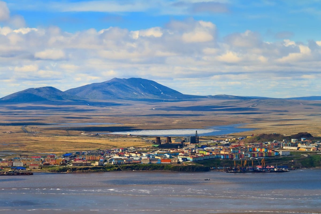
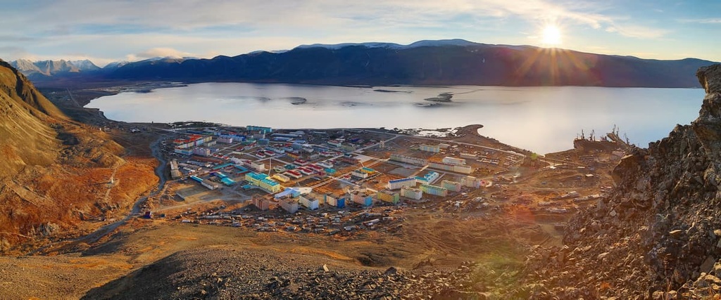
At the mouth of the Anadyr River is the largest city in Chukotka - Anadyr. The name of the river comes from the Yukaghir word "enu-en", which translates as "river".
The most popular lakes in the region are Lake Elghyghytghyn, Koolen, Krasnoe and Tytyl. Each has its own legend and history. By the way, some of them were formed in the places where meteorites landed.
The eastern part of the Chukotka Peninsula is generously sprinkled with hot mineral springs gushing out of the ground. Their healing waters are known to revitalise the body. There is no permafrost near the hot springs and the soil is well heated. This contributes to the fact that the local flora differs from the vegetation in other parts of the Chukotka Autonomous District.
The most famous and popular springs are:
Chukotka has lots in stock for lovers of archaeology. Scientists assume that ancient people hunted on the territory of the current Chukotka District back in the days of mammoths. A large number of historical sites of the peninsula are concentrated near the coast of the East Siberian Sea.
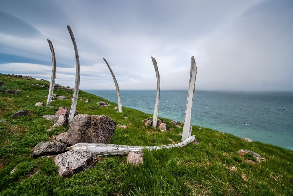
There is an ancient sanctuary called the Whale Alley on Itygran Island. This place is also called Chukchi Stonehenge. Here the Eskimos had built a kind of an alley from bowhead whale (Balaena mystecetus) skeletons stuck into the ground. The length of the alley is about 500m. It is assumed that the structure was created in the 14th century.
The Devil's Ravine on Wrangel Island has preserved to this day an ancient man's camp named after its location - a deep ravine in the flat part of the island.
In the village of Uelen and its surroundings, ancient Eskimo burial grounds have been found. The Chukchi revere these places and consider them sacred.
On the bank of the Pegtymel River, near Keinynei Mountain, there has been discovered a huge gallery of petroglyphs - the Pegtymel petroglyphs.
Near Lorino village, there is a historical and cultural complex called Masik. Excursions to the territory of the complex are held only in the warm season because groups of tourists can get there only by water.
There is a border regime on the territory of the Chukotka Autonomous District. With that said, the entry of foreign citizens to the part of the territory adjacent to the sea coast and the islands is regulated which means, it is necessary to obtain a permit from the border authorities of the Russian Federation in advance. Until 2018, this also applied to the citizens of Russia, but now only visits to Romanov, Herald and Wrangel Islands are regulated for them. In addition, to visit Chukotka, foreign citizens need permission from the FSB (Federal Security Service), it is usually requested from the local office of the Service.
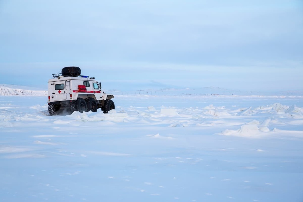
Chukotka Autonomous District is one of the few regions of Russia that is not connected with other regions by any land routes. Surely, there are roads, but they are quite few. Chukotka is best passable in winter when the water bodies are frozen. You should keep in mind that almost any off-road vehicle can get bogged down in the snow outside the paved winter roads. That is why all-terrain vehicles are the main and, one might say, the only way to travel comfortably across Chukotka in winter.
The most convenient way to get to Chukotka is by plane. There are many domestic air connections to Chukotka’s main settlements. From other countries, you can fly to three airports: Anadyr, Pevek, and Bilibino.
Preparing for a trip to Chukotka, you should consider the peculiarities of the local climate. In the east of the region, it is often foggy and cloudy. It is only natural that no planes fly in such conditions. Then the only option in the summer to get there or leave is to travel by ship. Or wait for the weather conditions to improve, with patience, because it may take several days to several weeks. Bear it in mind that you might be grounded for some days before you can return to the mainland.
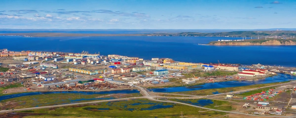
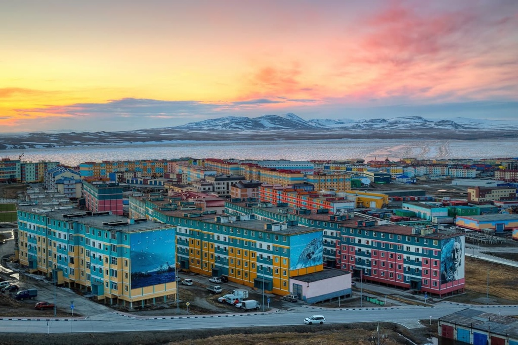
Anadyr, the capital of the Far North, loves only the bravest daredevils. Travellers come here to get acquainted with the culture of Chukotka, to see the beauty of the harsh region and to test themselves.
The city is located near the right bank of the river with the same name, on the coast of the Anadyr Bay which belongs to the Bering Sea.
Anadyr was founded in the late 19th century by a Russian military doctor and polar explorer Leonid Frantsevich Grinevetsky as a border post, which was then called the Novo-Mariynsk. The renaming to Anadyr occurred later, after the establishment of the Soviet government in the early 1920s. Then Anadyr received the status of Chukotka’s capital but it was not until 1965 that it was given the status of a city.
The highest point of Anadyr is Mount Verblyuzhka (Camelback). There is an observation deck on its top. From here you can see all the sights of the city, the estuary and the sea shore in the distance, residential areas and mountains surrounding the city.
Some landmarks have become the symbols of the city and made it highly recognizable.
The Museum Centre Chukotka Heritage exhibits a large collection of stuffed animals and birds, including polar bears, reindeer, seals, walruses, cormorants, sea parrots, etc. An interesting exhibition is devoted to the life of the Chukchi and Eskimos peoples. Mock homes, kayaks, traditional clothing made of hides, weapons - all these will immerse you into the history of Chukotka and experience Chukchi culture.
Monuments in Anadyr are dedicated to the key events from the history of the city and the country, as well as to the outstanding personalities who left their mark on the development of the city.
There are many religious places in Anadyr. Churches and consecrated monuments welcome Orthodox Anadyr residents and pilgrims. There is the Holy Trinity Cathedral, the Chapel of the Transfiguration, the All-Saints Chapel, and the Poklonnyi (Memorial) Cross. Holy Trinity Cathedral was built in the early 2000s. It is considered one of the largest functioning totally wooden Orthodox churches in the world. The building itself stands on permafrost, so each of its piles is equipped with a refrigeration unit that prevents the ground from melting in the summer. Experts predict that the cathedral will last at least 500 years.
Sports tourism is also well developed here. There are many sports facilities and recreation complexes for outdoor activities. The best sports complex is a skating rink which is open to everybody when it does not host any sports competitions.
Weather conditions in Anadyr often leave much to be desired. The sun rarely shines here, the sky is overcast with grey clouds, and in winter everything is in a white haze or blizzards, which greatly reduces the visibility. But the colours of the buildings are bright and vivid. The city has acquired this colourful appearance relatively recently since the local authorities decided to boost the spirits of the people living here. Its rainbow palette can be seen from Mount Verblyuzhka.
Few travellers make it to this permafrost city. But those who have made such a long way will have long lasting memories. Anadyr is a northern city with a hot heart.
Let us know of your impressions when you travel to Chukotka. We’d be happy to hear that at


Yes. Chukotka Autonomous Okrug has 493 named mountains. The highest is Ishodnaya at 1,887 m.
The highest mountain in Chukotka Autonomous Okrug is Ishodnaya, at 1,887 m.
Chukotka Autonomous Okrug has 493 named mountains.


