Scan the QR code and open PeakVisor on your phone
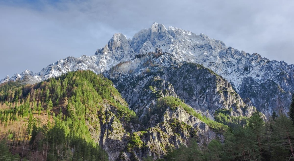
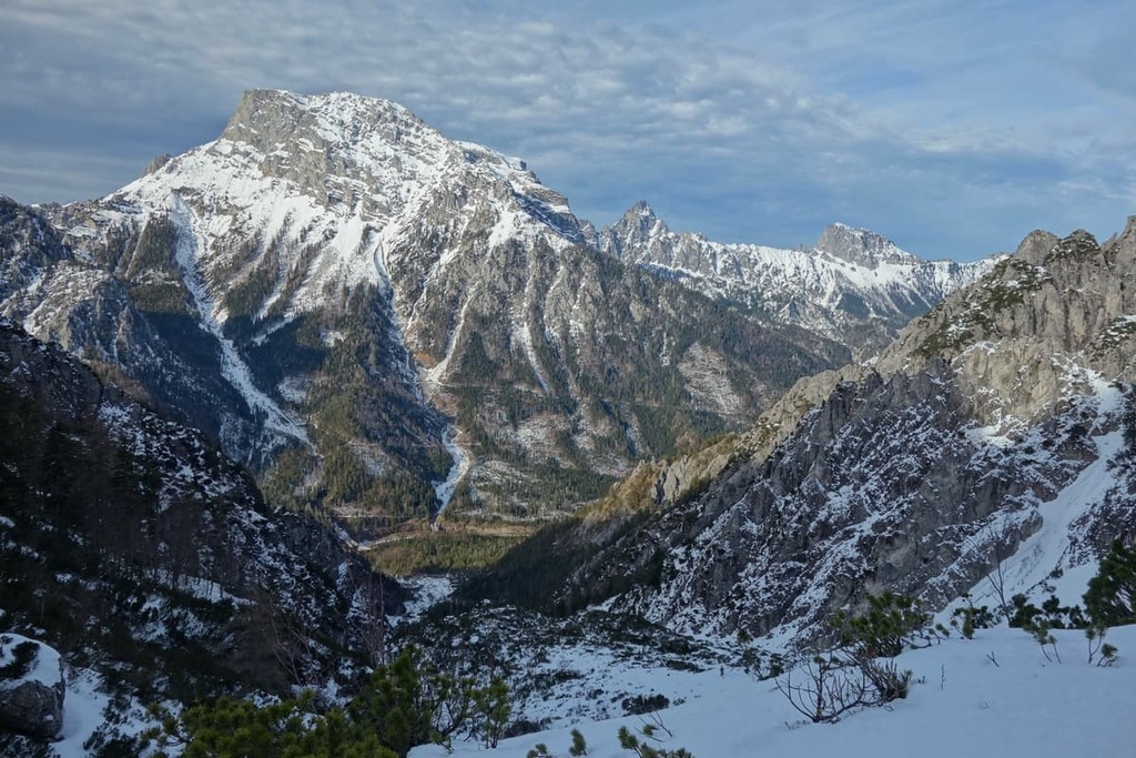
Gesäuse National Park is a national park located in the state of Styria in central Austria. The park is the youngest national park in Austria and it is home to one of the most mountainous areas in the central part of the country. It is home to 82 named mountains, the highest and most prominent of which is Hochtor (2,389 m/7,772 ft).
Gesäuse National Park is located in the Austrian state of Styria. It is made up of six communities and towns: Admont, Johnsbach, Weng, Hieflau, Landl and St. Gallen.
Spread over 120 sq. km (46 sq. mi), Gesäuse encompasses the most significant part of the Gesäuse Range. The Gesäuse Range is part of the Northern Limestone Alps and is the northeastern part of the Ennstal Alps.
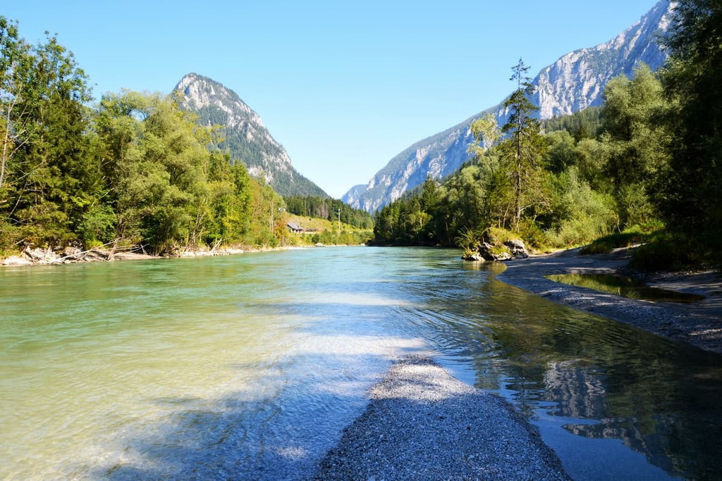
The Enns River flows through the park, creating a large valley. The so-called heart of the national park is the 16 km (10 mi) long gap through the Ennstal Alps created by the Enns River, which runs between Admont and Hieflau.
Like many national parks in Austria, Gesäuse is divided into two core zones: nature and conservation. The nature zone is untouched by humans. Its purpose is to let nature develop freely without any interference. Some farming and maintenance work is allowed so long as they follow strict regulations.
Gesäuse National Park is widely known for its fantastic mountain ranges and countless hiking and climbing opportunities. The mountains in the national park are divided into three sub-ranges:
Gesäuse National Park is Austria's youngest national park as it was founded in 2002. Apart from the Gesäuse, there are seven other nature parks in the state of Styria:
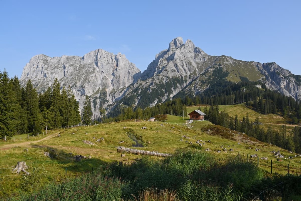
The Gesäuse Range is part of the Northern Limestone Alps. As the name suggests, the dominant type of rock found in this part of the Alps are limestones and dolomites. Due to their height, Hochtor, Buchstein, and Reichstein subgroups are part of the High Limestone Alps.
Approximately 250 to 200 million years ago, the Limestone Alps were formed in the ancient Tethys Ocean. About 200 to 145 million years ago, the supercontinent Pangea started to divide itself into the continents that we know of today.
Then, about 145 to 65 million years ago, the African continent moved to its current location. It took space from the Mediterranean Sea and other continents in the area, leading to the formation of the Alps.
The range formed as layers of sedimentary rock from the bottom of the ocean were pushed upward toward the surface. Due to the enormous pressure caused by this uplift, parts of the Limestone Alps overlapped over many layers for many kilometers. In some cases, the original layers of schists came through and built what we now know as the Grauwackenzone (Greywacke Zone).
Another important rock layer found in the park is the Raibler Schichten (Raibl Formation). The Raibl Formation dates back to the Triassic and it contains a large quantity of fossils.
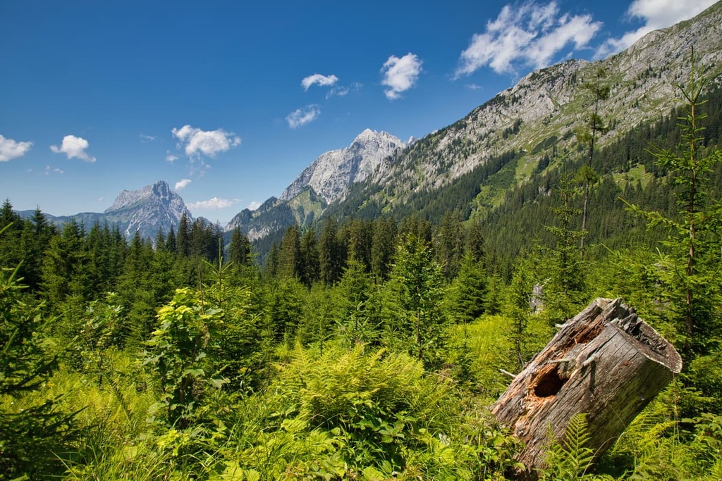
Gesäuse National Park is a remarkably biodiverse place. More than 50 types of orchid and 230 endemic animal species can be found in the park.
Some of the most notable plant species in the park include:
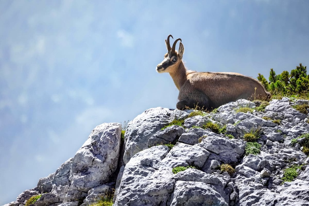
As mentioned above, the park is home to a large number of plants and animal species. It is home to animals such as chamois, otters, and tiger gray wagtails, among others. Over 1,234 butterfly species and more than 90 types of breeding birds can be found in the park, too.
Some of the most important animals that inhabit the park include:
Gesäuse National Park is Austria's youngest national park as it was founded in 2002. It is made up of the communities Admont, Johnsbach, Weng, Hieflau, Landl and St. Gallen.
The area covered by Gesäuse National Park has a long history of human settlement, particularly around the areas of Admont and Johnsbach.
Admont is one of Styria's oldest settlements. It was first mentioned in written texts in 859 CE when it was being referred to as Ademundi Vallis.
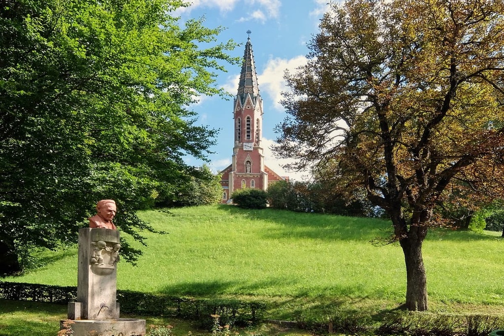
Admont is nowadays most famous for Admont Abbey, which was founded in 1074. It was as important then as it is today. A nunnery was added later around the twelfth century and was run until the end of the middle ages.
In the fifteenth and sixteenth centuries, the economy in Admont was powered by stone masonry. During this time, the locals built many monasteries and churches. In 1865, a fire destroyed parts of the town, and even most of Admont Abbey had to be rebuilt.
In 1873, the Rudolfsbahn, a train connecting Admont to other communities, was established and facilitated the area's economic development.
Meanwhile, Johnsbach is known as a mountain village in the Gesäuse Range. The history of human settlement in Johnsbach dates back to the Bronze Age. Archeological findings confirmed that approximately 3,500 years ago, the largest coal, iron, and steel industry in the eastern Alpine region was located in Johnsbach.
In 1139, Johnsbach was first mentioned in written texts. At the time, the Admont Abbey ruled the whole area. The main economic ventures in the region were farming and charcoal production. Today, Johnsbach is known as a popular mountain town.
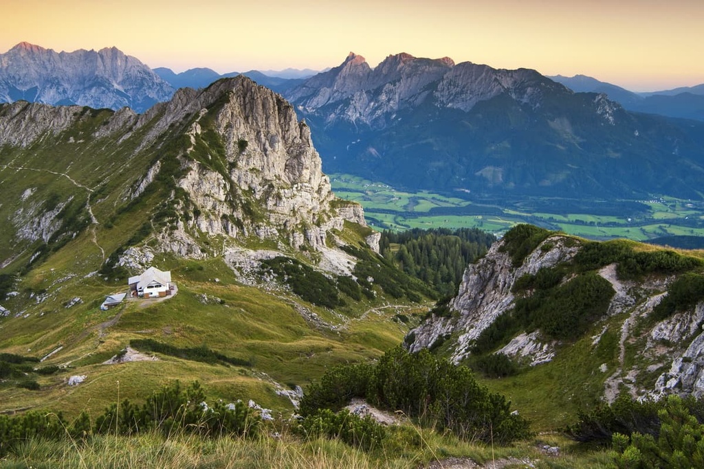
Gesäuse is every hikers and climber's dream. Due to its wide variety of mountains and forest paths, there’s something for everyone to enjoy in the park.
Here are some of the best hikes in Gesäuse to check out during your next trip:
The Palfau to Akogel round trip loop is a straightforward, family-friendly hike. It is popular because it offers many beautiful views over a relatively short distance.
The estimated duration for this hike is 3 hours and 40 minutes. It covers a distance of 9.1 km (6 mi), and it has an elevation gain of 602 m (1,975 ft).
This trail to Hochtor is a relatively tricky hike that’s best for experienced trekkers. The path leads up to the peak of the Hochtor, the highest peak in the park.
The estimated duration for this trail is 6 hours and 30 minutes. It covers a distance of 13.1 km (8 mi), and it has an elevation gain of 1,497 m (4,911 ft).

The Wasserloch Klamm Trail is of medium difficulty and leads to the most significant water-filled cave in all of Styria.
The trail features newly built paths that help reduce the risk of exploring these caves. Along the way, you will find waterfalls, suspension bridges, staircases, and simply beautiful nature. Approximately 76 m (249 ft) of the water-filled cave is explored by divers, but what is underneath remains a mystery until this day.
The estimated time needed for this trip is 2 hours and 40 minutes. It is 2.4 km (1.5 mi) long and only gains 358 m (1,175 ft) in elevation.
The Wilder John Trail is an adventurous hike for the whole family. It begins at the Weidendom parking lot along the river Johnsbach.
The entire trail is 3.5 km (2.2 mi) in length. But, note that the trail is only open from May to October, so be sure to plan ahead to avoid disappointment.

Gesäuse National Park has a lot to offer beyond its hiking trails. Here are some other noteworthy places to visit during your trip:
The visitor center Weidendom is not a natural spectacle but it is a spectacle nonetheless. It is located close to Johnsbach and it is a center for research, education, and leisure situated in Gesaeuse National Park.
At the visitor center, you can get lots of information about the national park, enjoy an educational movie, or regroup and use the space to view the beautiful nature around you.
The Johnsbach and Enns rivers offer plenty of opportunities for rafting, swimming, and kayaking in Gesäuse National Park and the surrounding area.
However, a guided tour is generally required for people who want to adventure on the rivers in the national park. That said, it is well worth booking a tour if you’re looking for a fun way to spend your time in Styria.
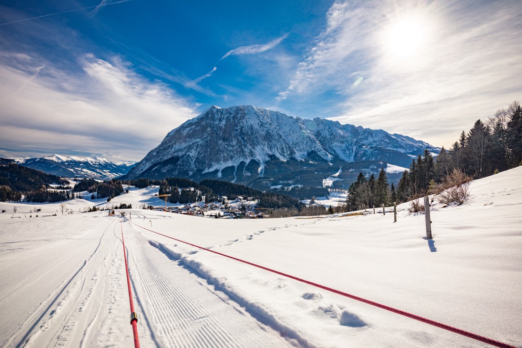
On the southern borders of the national park is a small ski resort—Johnsbach (Admont) with 1.2 km (0.7 mi) of slopes and 1 ski lift. However, this is not enough for proper skiing.
The nearest big resorts are Tauplitz-Bad Mitterndorf to the west of the park with 43.5 km (27 mi) of slopes and 17 ski lifts, as well as smaller Präbichl-Vordernberg to the east, Lachtal to the south, and Forsteralm-Waidhofen to the north. The closest major resort is Obertauern with more than 100 km (62 mi) of slopes and more than 25 ski lifts in the neighboring state of Salzburg.
Check the Styria ski resorts map, as well as the larger Austria ski resorts map in the World Mountain Lifts section of the site. It includes information about open ski lifts / slopes in Styria in real-time with opening dates and hours. There are also year-round cable cars, funiculars, cog railways, aerial tramways, and all other types of mountain lifts.
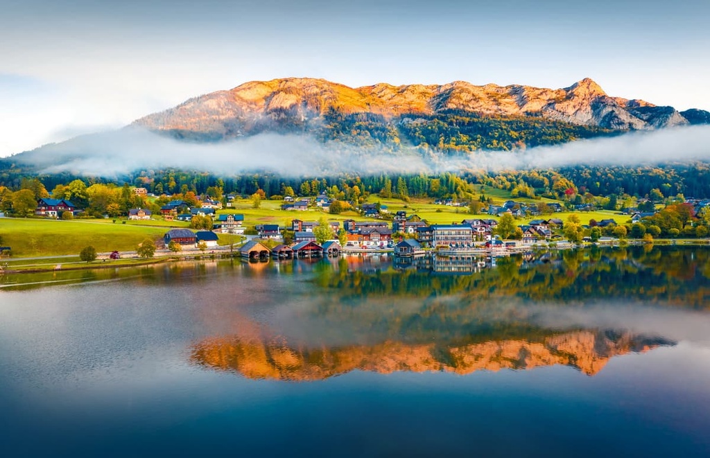
Gesäuse National Park is a vast nature area that encompasses six communities. Besides these communities, the park is located relatively close to some other major cities in towns in the region. Here are some of the best nearby cities to check out during your visit.
Graz is the capital of Styria and Austria's second-largest city. It is home to Austria's best-known universities and is a trendy hot spot for students.
Graz is not only famous for its universities but also its cultural sites. The historic city center is very well preserved and is listed as a UNESCO World Heritage Site. Graz has even been named the cultural capital of Europe in years past.
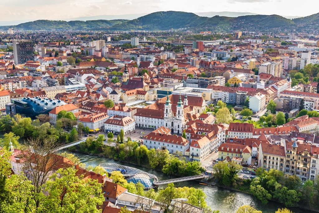
Due to the fact that Graz is such a large and famous city, it is relatively easy to get there by plane, car or train. You can fly directly to Graz and make your way to Gesäuse from there.
Mürzzuschlag is a relatively small town in Styria. It is a small community that is mainly known for its proximity to nearby ski resorts.
Due to its popularity as a skiing destination, it offers plenty of accommodation opportunities during the winter and summer months.
Liezen is the capital of the Styrian district of Liezen. It is located in Ennstal, making it a hotspot for mountain lovers.
This city offers opportunities to shop and dine when you’re not out in nature. It is the perfect destination for keen mountaineers and explorers due to its proximity to several mountains and its scenic location.