
Scan the QR code and open PeakVisor on your phone
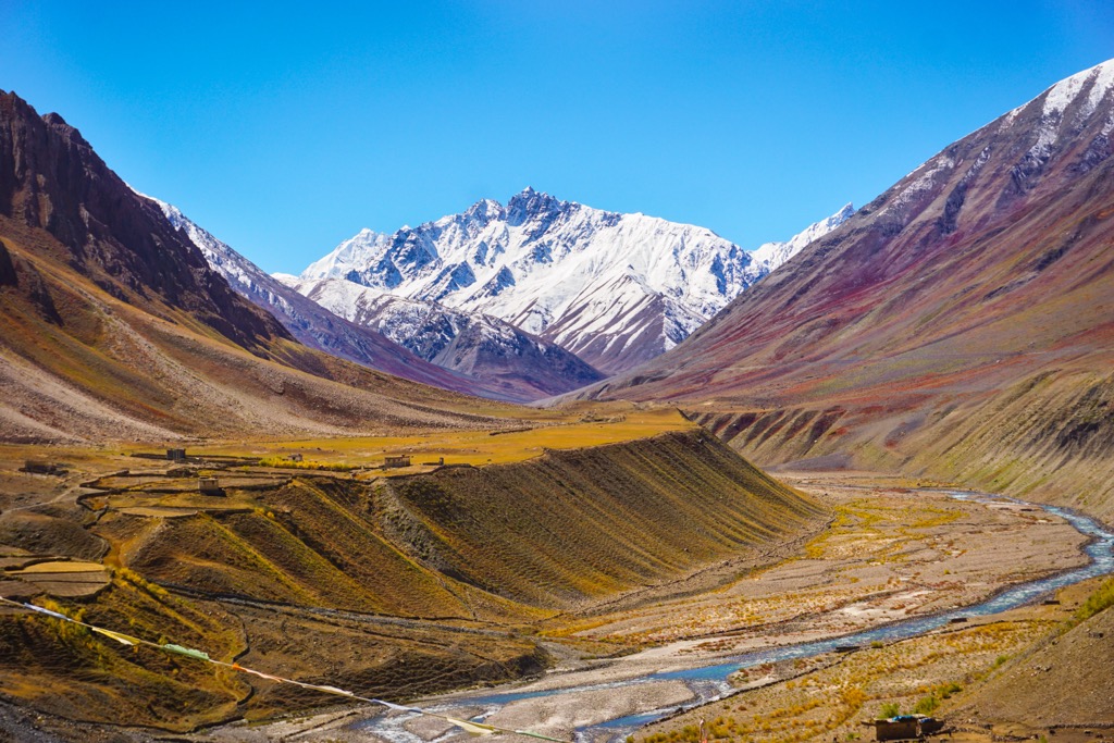
Khirganga National Park is a 710 square-kilometer (270 sq. mi) national park in the northern Indian state of Himachal Pradesh. Established in 2010, it is one of five national parks in Himachal Pradesh and the second largest after Great Himalayan National Park (755 sq. km / 292 sq. mi). Khirganga National Park is nestled in the Pavarti River Valley in Kullu District and primarily comprises rugged, high-elevation peaks, verdant valleys, and deep gorges. Of the 29 named peaks in the park, Parvati Parbat is the highest and most prominent (6,632 m / 21,759 ft).
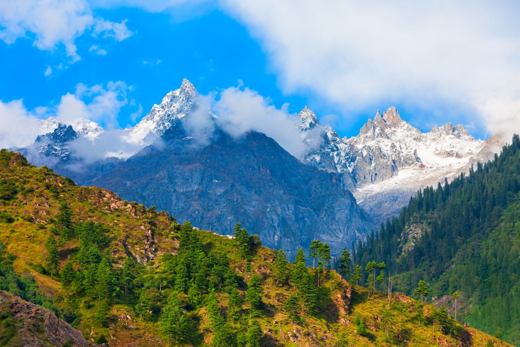
Like much of Himachal Pradesh, Khirganga National Park is extremely mountainous. Though the park is only home to 29 registered summits, all are high in elevation. Aside from Kaili Dhār (3,538 m / 11,608 ft), every named summit is at least 5,500 meters (18,000 ft).
The park’s highest and most prominent peak, the Parvati Parbat (6,632 m / 21,759 ft), is the second-most prominent mountain in all of Himachal Pradesh—and one of the most in all of India—with over 2,000 meters (6,500 ft) of prominence. (Himachal Pradesh’s most prominent summit is Shikar Beh, with 2,234 m or 7,320 ft.)
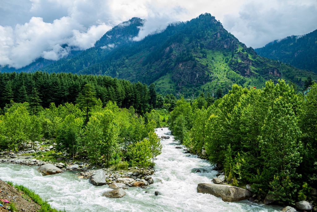
Khirganga exhibits a range of climatic conditions due to its altitude and location within the Himalayan range. From high peaks to low rivers, elevations in the park vary dramatically, leading to numerous biomes. The climate is subtropical in the park’s valleys and lower slopes, with warmer temperatures and broad-leaved forests. Ascending to higher elevations, the climate shifts to a colder alpine zone marked by coniferous forests and alpine meadows. Temperature variations are significant, ranging from far below freezing to 30°C (86℉) depending on season and altitude.
During the monsoon season (June to September), the area receives heavy rainfall, bringing lush greenery. However, this also presents challenges for trekking due to landslides and washouts. Winter, from December to February, brings snowfall, especially in the higher elevations. However, this also means that snow makes many trails inaccessible.
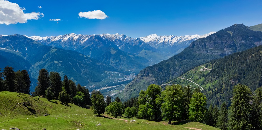
As a result, the best time to visit Khirganga National Park - like the rest of the Himalayas - is in the shoulder seasons, between April to June and September to November. During these months, the weather is stable and pleasant, offering clear skies and mild temperatures, ideal for outdoor activities like trekking. Indeed, the high-altitude climbing season also takes place during these months. Autumn, in particular, sees fewer tourists and more consistent conditions without the washouts that can sometimes occur in spring due to glacial runoff.

The state’s other three national parks are Pin Valley, to the east, Inderkilla, to the west, and Simbalbara. Proposals are underway to combine the national parks of Khirganga and Pin Valley with their larger contiguous neighbor, Great Himalayan National Park, in addition to a few neighboring wildlife sanctuaries. In 2022, park official Nishant Mandhotra told The Tribune that once this initiative is completed, the new park (still known as Great Himalayan) will become the third largest national park in India, with a total area of over 3,120 square kilometers (1,205 sq. mi).
As Great Himalayan is already a UNESCO World Heritage Site, the land of Khirganga will soon also fall into this category. The combined parks will include the origins of many prominent river systems, including the Jiwa Nal, Sainj, Tirthan, and Parvati rivers, all of which are headwater tributaries to the Beas—which flows through Kullu—and ultimately the Indus River, one of Asia’s longest.
Khirganga National Park is a part of the Middle Himalayan zone. The region forms part of the Himalayan belt created due to the collision of the Indian and Eurasian tectonic plates beginning around 50 million years ago. The force of the tectonic collision uplifted the Himalayan range, the highest mountain range on Earth.
Five major tectonic units run across Himachal Pradesh in northwest to southeast bands. The two northernmost of these, the Greater Himalayan Crystalline Complex and Tethyan Himalayan Sequence, run through Khirganga National Park.
The Greater Himalayan Crystalline Complex consists primarily of metamorphic rocks like paragneiss, schist, orthogneiss, staurolite, kyanite, sillimanite, and migmatite. Meanwhile, the Tethyan Himalayan Sequence is made up of sedimentary and igneous rocks, primarily varieties of granite. For more about the geologic history of this region, see our article on Himachal Pradesh.
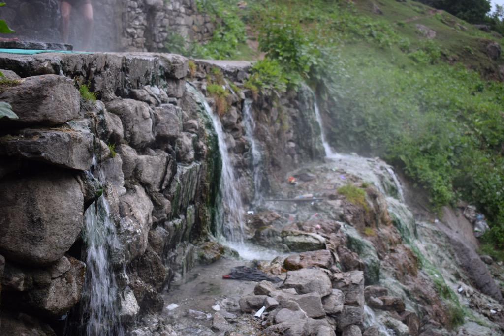
The famous hot springs of Khirganga, believed to have healing properties, are perhaps the most striking example of the geothermal activities that helped shape this area.
Khirganga National Park and its sister park (soon to be one entity), Great Himalayan National Park, are home to many flora and fauna. The park contains over 25 “Threatened” IUCN red-listed species of flora and many rare, threatened, and endangered species of fauna.
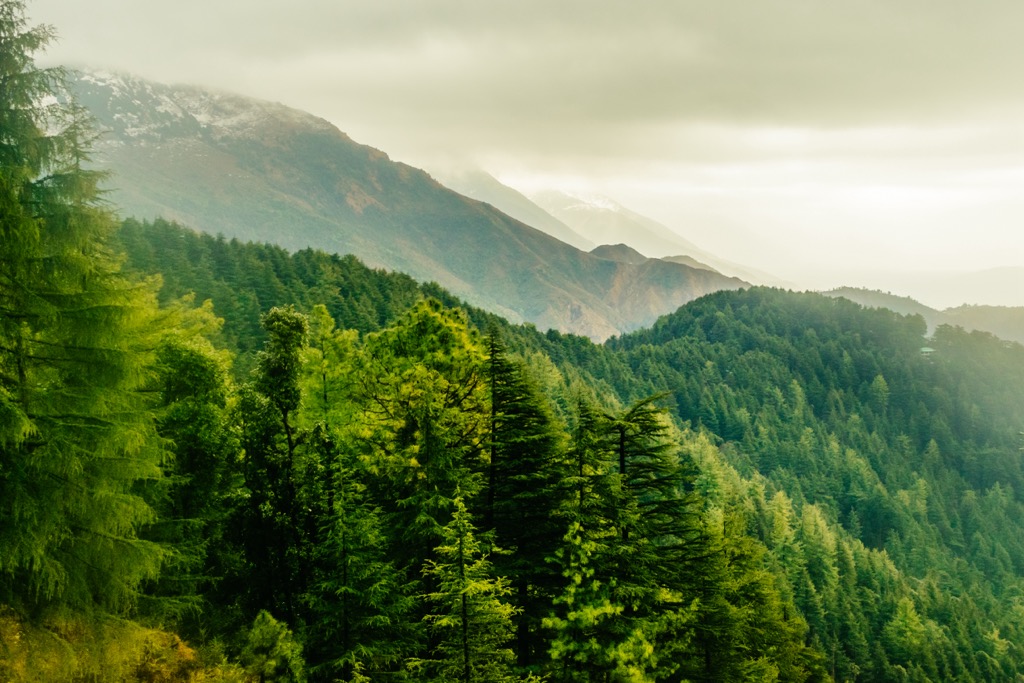
Broad-leaved trees dominate the park’s lower elevations. Examples include oak, maple, chestnut, and rhododendron, as well as juniper, birch, and poplar in the fertile valleys. Coniferous forests take over at higher elevations, with species like deodar, blue pine, and spruce. Above the treeline, the primary flora is a mixture of alpine meadows and shrubs.
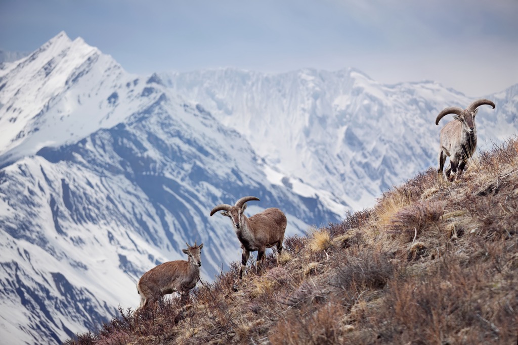
There are over 400 species of fauna in the park. Some of the most rare and threatened mammalian species found in the boundaries are Bharal or blue sheep (Pseudois nayaur), goral (Antilope goral), Himalayan musk deer (Moschus leucogaster), snow leopard (Panthera uncia), red serow (Capricornis rubidus), and Himalayan tahr (Hemitragus jemlahicus), a type of wild goat. In addition, the park has large populations of both Asiatic black (Ursus thibetanus) and Himalayan brown bears (Ursus arctos isabellinus).
Khirganga is home to many reptiles, including the venomous Himalayan pit viper (Gloydius himalayanus), the banded kukri snake (Oligodon arnensis), Himalayan keelback (Herpetoreas platyceps), and Himalayan ground skink (Ablepharus himalayanus).
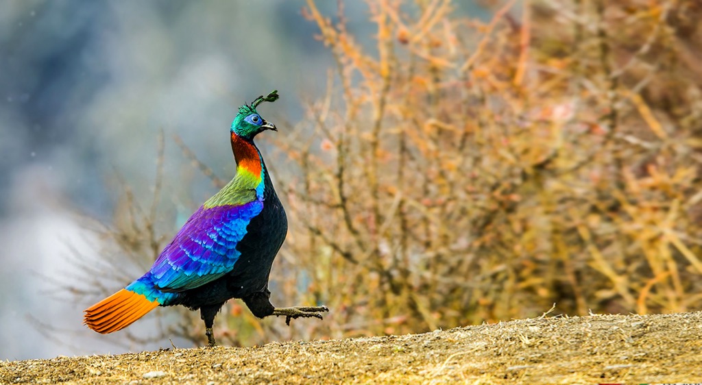
Primary examples of Khirganga’s avian life—of which there are more than 200 species—include the Western tragopan (Tragopan melanocephalus), a colorful pheasant that is also Himachal Pradesh’s state bird. The shiny, rainbow-plumed Himalayan monal (Lophophorus impejanus), game birds like the Himalayan snowcock (Tetraogallus himalayensis), and large birds of prey such as the golden eagle (Aquila chrysaetos) are also common.
The earliest inhabitants of Himachal Pradesh, including the Kols and the Mundas, established themselves in the mountains during the prehistoric era. These earliest settlers may have arrived from Africa as many as 65,000 years ago. Over tens of millenia, humans continued to arrive in various complex migrations around the Eurasian continent.
Initial settlement was followed by waves of other tribes, such as Bhotas, Kiratas, and eventually the Aryans, who migrated from Central Asia. These diverse groups brought distinct cultural practices and traditions, laying the foundations of the region's rich cultural heritage, which flourished during the “Indus Valley Civilization,” which lasted from 3300 BCE to 1300 BCE.
The post-Indus Valley period, marked by the Vedic era (1500 BCE to 500 BCE), saw the formation of small republics, or Janapadas, which eventually became part of the expansive Gupta Empire, which spanned almost the entirety of modern-day India until around 500 AD. The division of Himachal Pradesh into numerous chiefdoms in the subsequent periods led to a tapestry of independent political entities, which often faced invasions and conquests.
The arrival of the British in the 1800s and the subsequent inclusion of Himachal Pradesh under British dominion reshaped the region's political and cultural landscape. After India's independence in 1947, Himachal Pradesh underwent several administrative changes, first existing as a province, then merging with the more mountainous border areas of neighboring Punjab to become its own state in 1971.
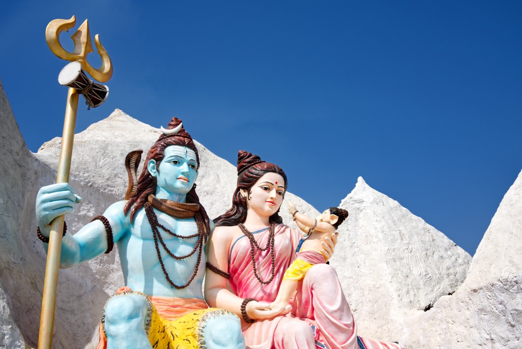
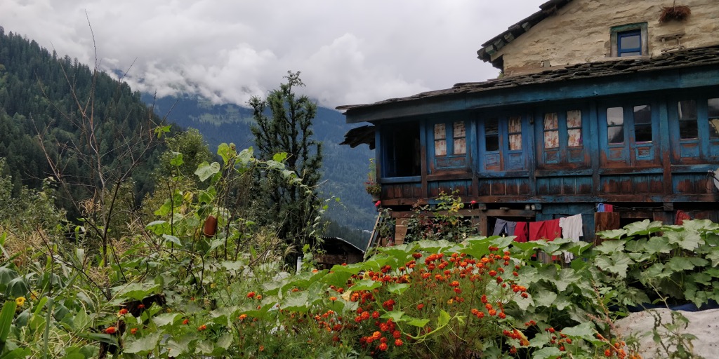
Within this broad historical context, the remote region of Khirganga National Park (founded in 2010) has changed surprisingly little over the centuries. Indigenous peoples such as the Gaddi and Kinnauri continue to coexist with the natural environment, though tourism has increased traffic to Kullu and the nearby valleys. The village of Khirganga in the Parvati Valley is said to be where Hindu deities Shiva and Parvati lived and meditated for thousands of years.
Khirganga sees surprisingly few visitors each year compared to the larger, more popular, and more accessible Great Himalayan National Park, part of the reason why the parks were merged.
Unfortunately, like much of India, the region is threatened by air and water pollution and poor waste management. Visitors can look at the extensive litter around Kullu, Manali, and the other settlements along the Beas River to see these sad truths.
This 11-kilometer (6.8 miles) hike begins in Barsheni (Barshaini) village, reachable by bus from Kullu, and takes visitors east to Khirganga, a small settlement just outside the national park, home to a famous hot spring and temple.
In addition to the hot springs and temple to Shiva, the route passes several popular sights, including the waterfall and temple at Rudra Nag and the hidden village of Pandupul. Though it is short, most visitors take at least two days to enjoy sights along the way and camp or stay in hostels in Khirganga overnight before returning. The route reaches an elevation of 2,956 m (9,700 ft). You can also hike up to the snowline in around three hours from Khirganga.
This lengthy one-way trek takes intrepid hikers from the Parvati Valley to Spiti over the Pin Parvati pass at 5,306 meters (17,408 ft). Exact distances vary depending on start and end point, but coming from the west, most hikers begin in Kullu, Manali, or Barsheni. Most travelers take at least six days to complete the trek in one direction with time for sightseeing, covering around 80 kilometers (50 mi) with 4,200 meters (14,000 ft) of elevation gain.
If you don’t have the time or energy to complete the full Pin Parvati, take a few days to see Mantalai Lake (4,116 m / 13,500 ft). In traditional Hindu mythology, it is believed to be the abode of Lord Shiva and the goddess Parvati and attracts many pilgrims.
From Khiganga, you can travel 18 kilometers (11 mi) to Tunda Bhuj, another 16 kilometers (10 mi) along steep rock faces to Thakar Kuan, and then 27 kilometers (16.7 mi) to Mantalai. Many folks choose to camp after passing Pandu Bridge at the halfway point. Once you arrive at Mantalai, spend as much time as you’d like camping in the grasslands beyond the lake.
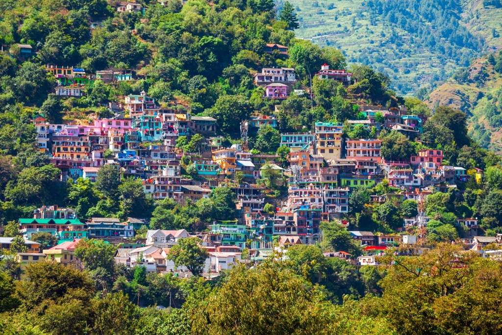
Along the banks of the southern-flowing Beas River, Kullu (pop. 18,500) is the largest town in the Kullu district and around 36 kilometers (22 mi) from Khirganga National Park. It is the only nearby town with an airport, operating daily flights from New Delhi and Chandigarh. Buses also travel to Kullu from the south. (By road, it is around seven hours from Chandigarh.)
The area around Kullu is renowned for beautiful temples—historically, both Buddhists and Hindus inhabited the valley—and vibrant festivals, including the famous Kullu Dussehra, a week-long festival usually held in September or October consisting of traditional foods, music, and dancing.
Traditional culture has reigned supreme here thanks to a long history of isolation. The name Kullu is derived from “Kulant Peeth,” which means “end of the habitable world.” In fact, Kullu only received its first motorable road in the 1950s. Kullu also serves as a starting point for treks to various Himalayan peaks. Traditional handicrafts, such as the Kullu shawls, are popular among visitors.
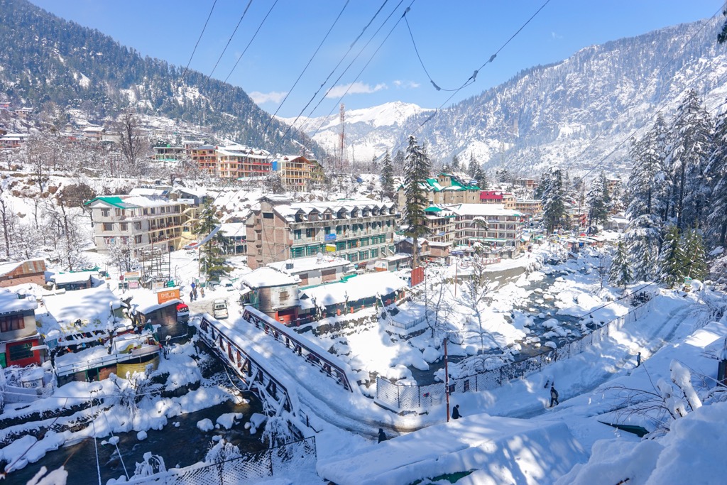
An hour by car north from Kullu will take travelers to the town of Manali (pop. 8,000), at the apex of the Beas River. The gateway to the lofty Solang Valley and Inderkilla National Park, the region around Manali is home to remote temples, rugged hillside villages, and spectacular outdoor attractions, particularly whitewater rafting, mountain biking, and ziplining.
Manali is laidback and mellow, with excellent traditional food, near-endless hiking, and pristine alpine air. (This author stayed at the Sitara Himalaya north of Manali in 2023 and can firmly recommend it.)
From Manali, only a handful of smaller settlements are left before the road goes underneath the mighty Goh Kincha (5,127 m / 16,821 ft) via the Atlal Tunnel. In years past, the only way across was Rohtang Pass, at 3,977 m (13,048 ft). The far side of the nine-kilometer (5.9 mi) Atlal Tunnel leads west to Jammu and Kashmir or north to Ladakh. Travelers can also head east towards Tibet to complete a clockwise circuit of Great Himalayan National Park and Khirganaga National Park.
Alternatively spelled “Kheer Ganga,” “Khir Ganga,” or “Kheerganga,” this tiny village (pop. 30-50) lies 36 kilometers (22 mi) west of the River Beas and Kullu, along the River Parvati.
It is home to hot springs and a famous temple, said to be where the son of Lord Shiva lived and meditated. Though there are no motorable roads leading to the village, Khirganga is a popular stopping point for hippies and international tourists, reachable via an 11-kilometer (6.8 mi) trek from the village of Barsheni along the Parbati River.


