
Scan the QR code and open PeakVisor on your phone
The Hengduan Mountains include 659 named peaks. The highest is Mount Gongga at 7,556 m. Other notable peaks include Zhōng Shān Fēng, Tài Shān and àI Dé Jiā.
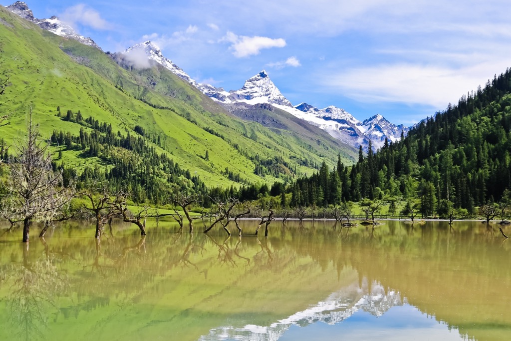
Sprawling over 600,000 sq km ( sq miles) in southwestern China, the Hengduan Mountains (横断山) is a group of mountain ranges with incredible cultural, ecological and scenic value. There are 659 named mountains and many more yet to be named. The highest and most prominent one is Mount Gongga(贡嘎山),which is also known as Minya Konka (7,556 m/ 24,790 ft).

The Hengduan Mountains are located in western Sichuanprovince, western Yunnanprovince and eastern Tibet, roughly from 22°N to 32°N and from 97°E to 103°E. Most of the region sits on the southeastern margin of the Qinghai-Tibetan Plateau, adjacent to the Himalayas to the east and reaching the border with Myanmar to the south.
The mountain ranges in Hengduan trend in a north-south direction, which is unique among the country’s biggest mountain ranges. They are made up of these seven ranges from east to west:
The mountains alternate with deep valleys with these big rivers that flow from the higher northern part to the lower southern side:
The last three rivers are known as the Three Parallel Rivers (三江并流), as they run very close to each other without merging. The parallel pattern lasts about 170 km (106 mi) over some of the most spectacular canyons in China.
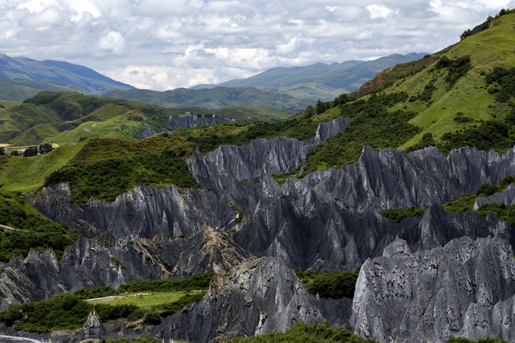
The Hengduan is a young group of mountain ranges developed together with the Qinghai-Tibetan Plateau and the Himalayas. The area used to be a vast ocean known as the Tethys Sea that separated India from Asia. Marine life flourished there and massive amounts of sediments accumulated.
When the Indian Plate subducted northward under the Eurasian Plate 55 million years ago, the Tethys Sea was forced upward to form the Himalayas and led to the uplift of the Qinghai-Tibetan Plateau. Meanwhile, the north-south collision released huge pressure that overflowed to the eastern and western sides.
The overflow encountered strong resistance on the eastern end from the Yangtze Plate (or South China Plate), resulting in violent distortions that produced the wavy creases and intervening gorges that make up the Hengduan Mountains.
The gorges provide an outlet for the hydrological systems of the Qinghai-Tibetan Plateau, and also allow the monsoons from the Indian Ocean and the Pacific Ocean to reach the plateau. The Nu Mountains serve as the water divide between the two oceans.
Glaciers are common to areas between 4,600 m and 5,600 m (15,100 ft and 18,400 ft) above sea level. They are monsoonal temperate glaciers since they are strongly affected by the monsoons that bring abundant precipitation to the area.
As the Indian Plate still moves northward with a velocity of about 5 cm (2 inches) per year, frequent seismic activities occur in the Hengduan Mountains. The most destructive of them was an 8.0 magnitude earthquake that struck central Sichuan province in 2008, leaving 87,000 people dead and 370,000 injured.
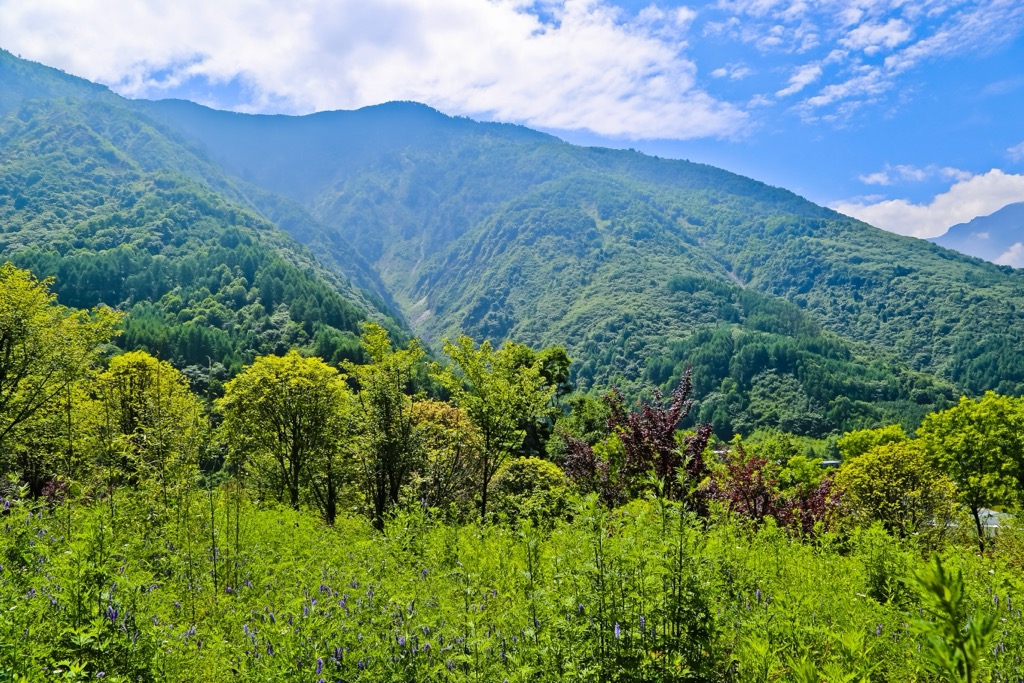
The Hengduan region is one of the 36 biodiversity hotspots on earth. It has by far the oldest continuous alpine ecosystem on earth, with a history of some 30 million years that gave it an early head start in evolution and diversification.
The intense monsoon rains have accelerated plant speciation by providing copious moisture and promoting erosion that carved the landscape into isolating plant communities with new species diverging.
Habitats in the region encompass alpine meadows and shrubs, alpine conifer and mixed forests, subalpine coniferous forests and subtropical evergreen forests. There are also freshwater habitats including wetlands, glacial lakes and rivers.
The mountains are estimated to harbor roughly 12,000 species of vascular plants, or about 40% of the species in China. At least 3,500 of them are endemic to the region. In particular, plant diversity in the alpine zone—the belt between the treeline and the snowline—is two to three times richer than that of any other alpine region.
The flowering plants in the mountains are especially well known. Many flowers commonly found in gardens, such as hydrangeas, lilies, geraniums and rose myrtles, had their origins in the Hengduan region.
The mountains are home to some iconic animals, such as the giant panda, the red panda, as well as the golden snub-nosed monkey and the black snub-nosed monkey, which live at the highest altitude of any non-human primate.
On the foothills of Gaoligong Mountains close to the border with Myanmar, a new species of gibbon was described in 2017 by a scientist who was a huge fan of Star Wars. He named it the skywalker hoolock gibbon, which has a very small range with a population of fewer than 200.
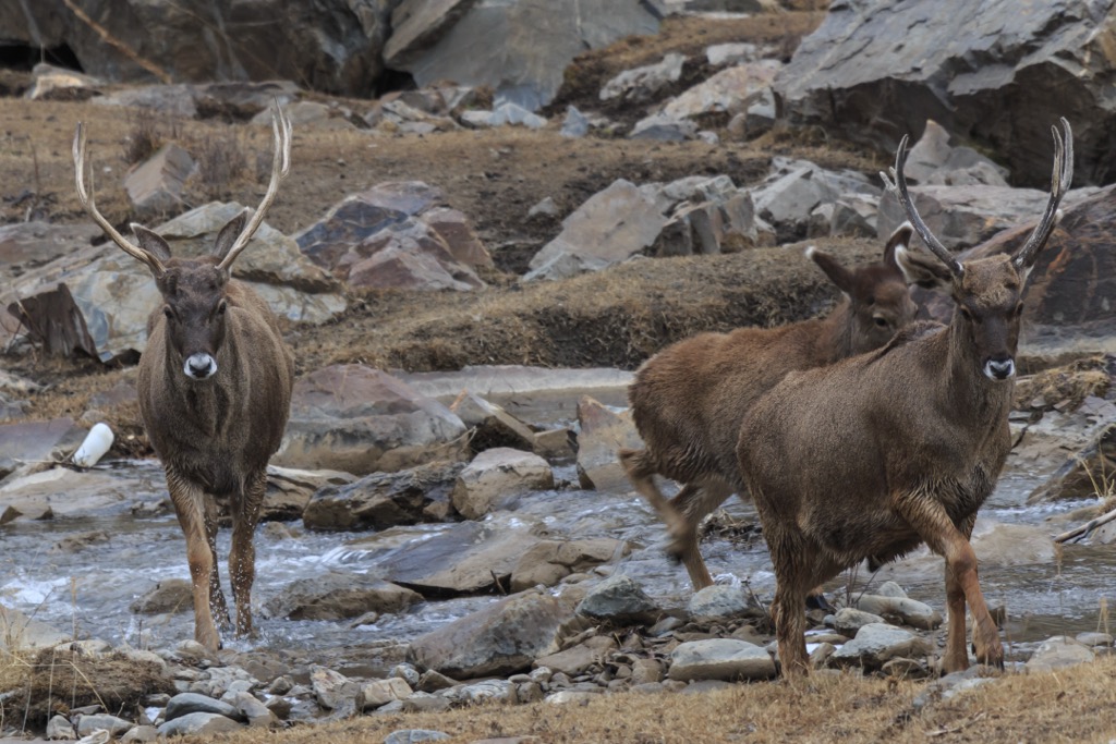
The Hengduan region supports sizable populations of hooved mammals such as musk deer, sika deer, white-lipped deer and the 300-kg (660-lb) takin, which is also known as the goat antelope.
The large herbivores sustain top predators like snow leopards and Bengal tigers. Indochinese tigers also used to live in the southern reaches of the mountains, but the last wild individual in China was killed in 2009.
The biodiversity of the Hengduan region is matched by its cultural diversity. More than twenty ethnic minority groups thrive in the mountains, representing the highest density of ethnicities in China.
The north-south trending mountains and valleys served as an ethnic corridor, funneling people migrating southward from the upper reaches of the Yellow River in northern China since 6,000 years ago.
As the migrants settled in different locations, gradually they became culturally differentiated and started to develop distinctive population systems and branches. Many ethnic groups still recall the history of their ancestors’ migration from the north in their epics and legends.
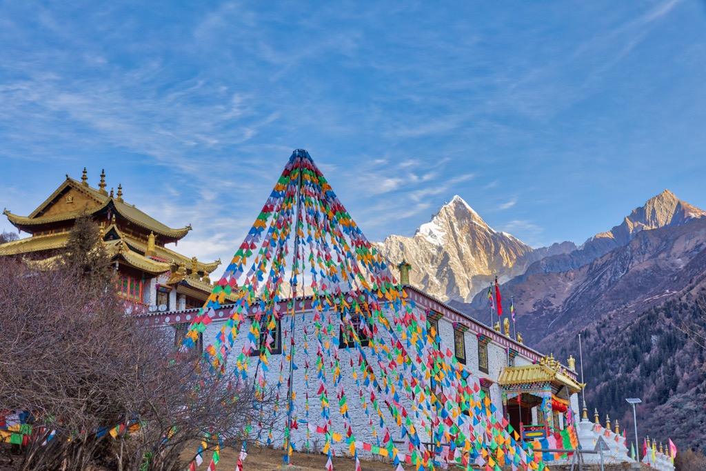
Ethnic Tibetans are widely distributed in the highlands. Lots of them still lead a pastoral life with their yaks, horses, sheep and goats in the shadow of the highest mountains, many of which are considered sacred.
The city of Dali (大理) in Yunnan province was the historical political center of the region. About 4,000 years ago, the Bai ethnic group (白族) began settling in the area, and founded the Kingdom of Nanzhao (南詔) in 738. Later it was replaced by the Kingdom of Dali, which lasted until 1253 when it surrendered to Mongolian invaders.
Dali is famous for its ancient Buddhist temples and pagodas, as the royalty of the Bai kingdoms were devout Buddhists. Among the 22 kings of the Dali Kingdom, nine abdicated the throne and became monks.
Nowadays, the largest settlement in the Hengduan Mountains is Lijiang (丽江), a multi-ethnic city of over a million people in northwestern Yunnan. It used to be a powerful chiefdom founded by the Naxi (or Nakhi) ethnic group (纳西族) about 800 years ago.
Naxi culture centers around Dongba (東巴), a shamanistic religion influenced by Tibetan Buddhism. The people’s unique written language, the Dongba script, is the world’s only pictographic script still in use.
Dali and Lijiang were important trading hubs on the Ancient Tea-Horse Road (茶马古道), or South Silk Road. The road was a network of caravan paths that formed in the late 6thcentury with Tibetan demand for Chinese tea and Chinese demand for Tibetan ponies.
The network not only linked Sichuan and Yunnan provinces to Tibet but extended all the way to the Middle East through Nepal and India. With over 10,000 km (6,210 mi) in length, it was the longest ancient trade road in the world.
The first Western explorers in the region were French missionaries who not only converted some locals to Catholicism but also brought exotic plants back to the West. The mountains became an ultimate destination for adventurous botanists and plant hunters, including Austrian-American Joseph Rock (1884-1962).
Rock’s explorations reputedly inspired writer James Hilton to depict a utopian valley in the Orient called Shangri-La in his 1933 novel Lost Horizon. Exactly where the valley was based on is not known, but the city of Zhongdian (中甸) in Yunnan officially changed its name to Shangri-La (香格里拉) in 2001.
The Hengduan Mountains showcase some of the crown jewels of China’s nature reserves. Here is an overview of the premier destinations.
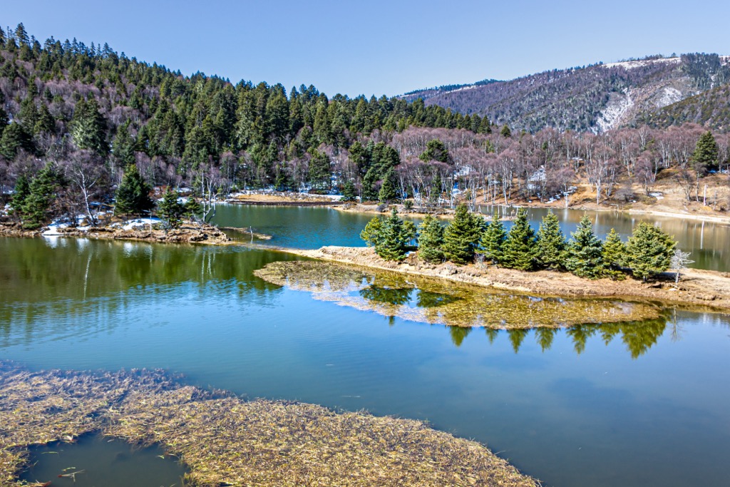
This parkin northern Sichuan province is a wonderland made up of over a hundred multi-colored karst lakes, and some of the most biologically diverse temperate forests in the world.
The stunning colors of the water come from high concentrations of calcium carbonate. Some of the lakes are fed by spectacular waterfalls, including the widest one in China.
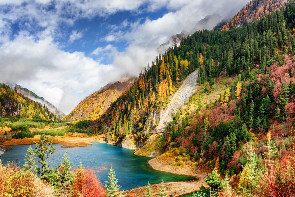
The core area of the park contains three connecting valleys that form a Y shape. Many visitors make a side trip to the nearby Huanglong Scenic and Historic Interest Area (黄龙风景名胜区) that features terraced travertine pools filled with aquamarine water.
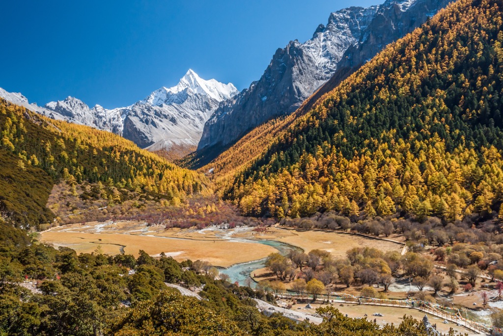
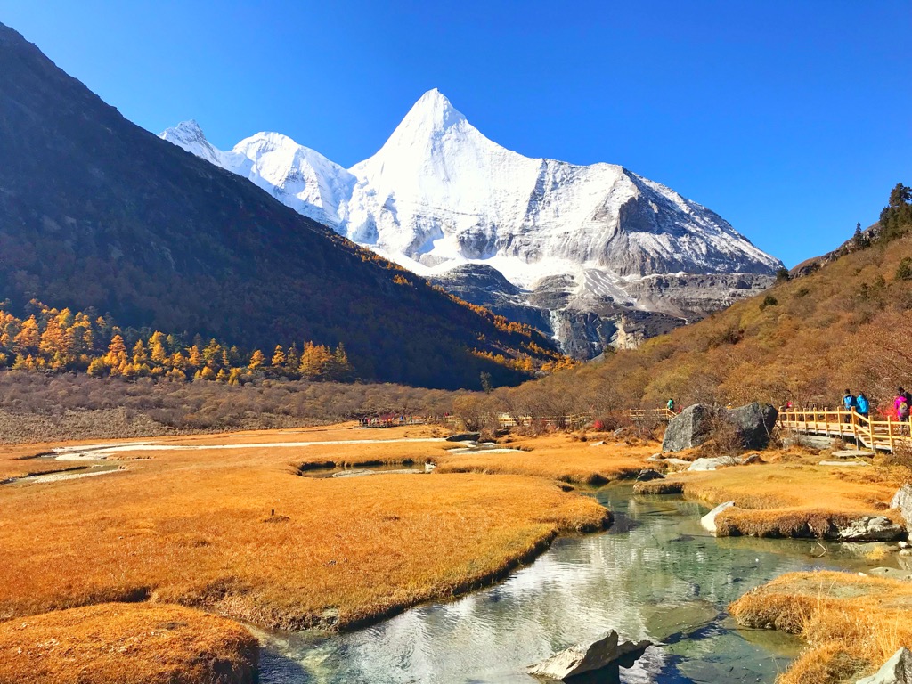
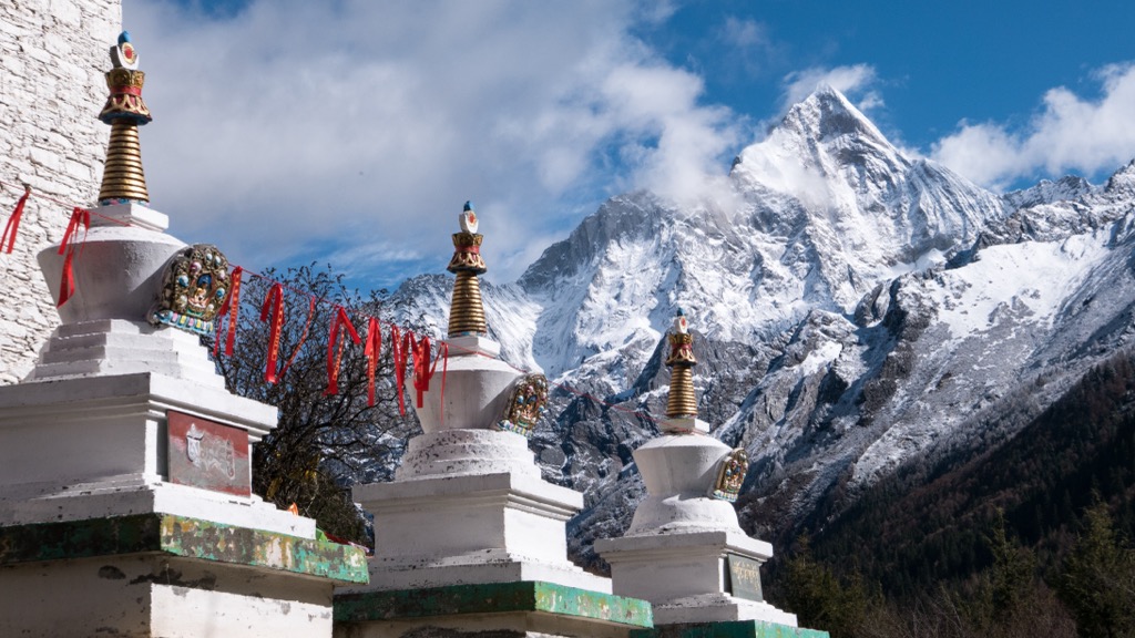
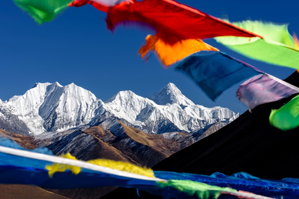
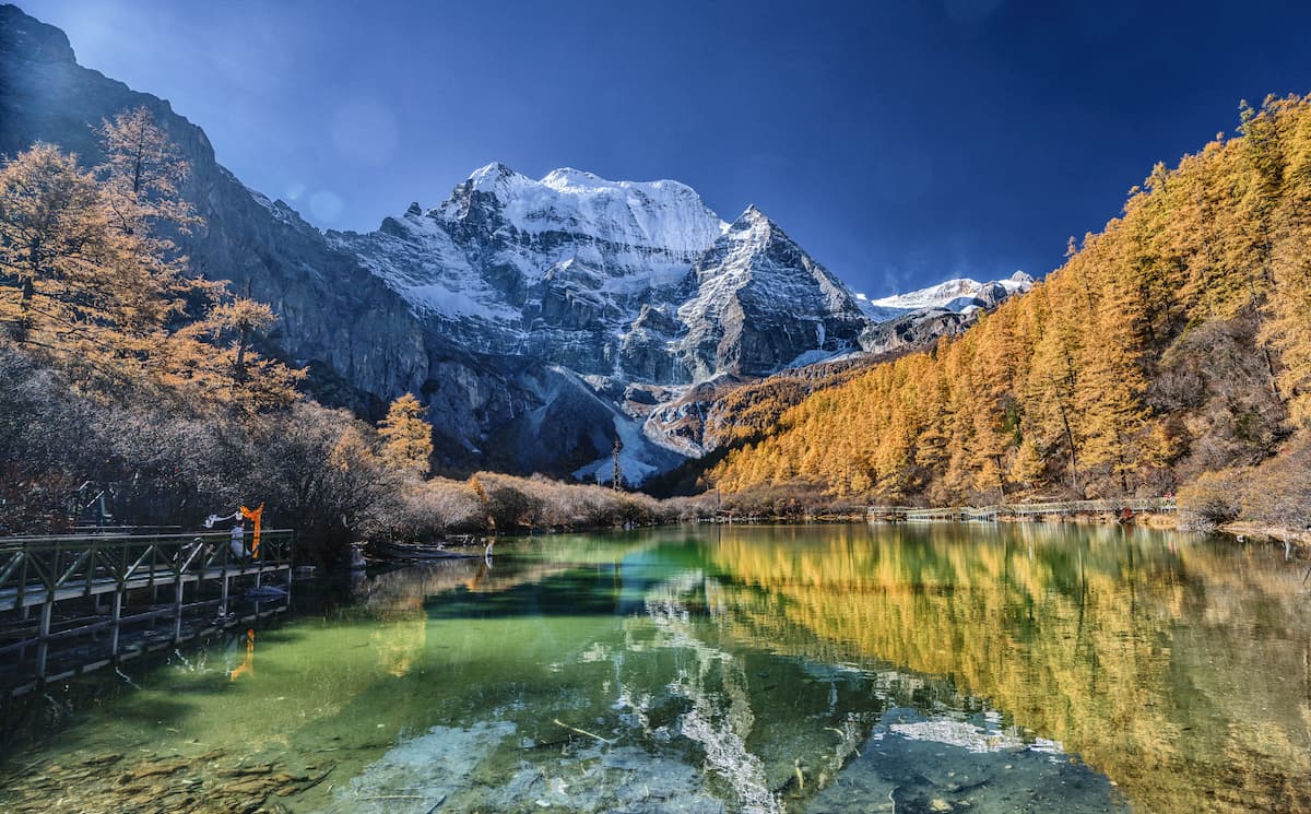
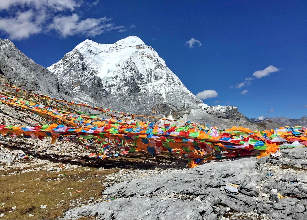
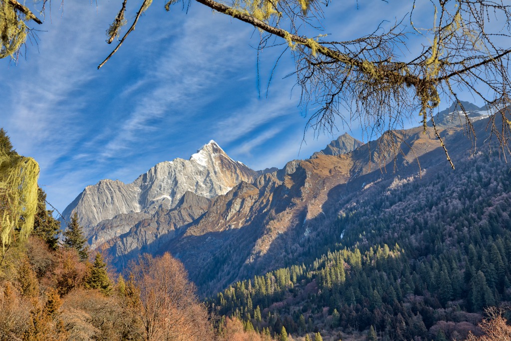
Located in Daocheng County (稻城縣) in southwestern Sichuan, Yading Nature Reserveboasts pristine alpine meadows, stunning glacial lakes and an imposing monastery below three sacred snow-capped peaks. The altitude ranges from under 3,000 m (9,840 ft) to over 6,000 m (19,680 ft).
Hidden deep within the Hengduan region, Yading used to be the best kept secret of outdoor enthusiasts until the local county opened the world’s highest civilian airport at 4,411 m (14,470 ft) above sea level in 2013.
Lijiang (丽江) and Jade Dragon Snow Mountain Scenic Area (玉龙雪山景区)
Set against the backdrop of snow-capped peaks, the city of Lijiang offers the best of nature and culture at 2,400 m (7,870 ft) above sea level in Yunnan province. Its old town is characterized by tile-roofed timber-framed buildings along streets paved with stone slabs.
The Jade Dragon Snow Mountains, located just 15 km (9.3 mi) north of the city, are among the most accessible and popular snowy mountains in China. However, no one has ever reached the summit of the main peak, Shanzidou(扇子陡5,596 m/ 18,360 ft).
The city of Shangri-La, formerly Zhongdian county, is situated 3,200 m (10,500 ft) above sea level in northern Yunnan. It is graced with a thousand-year-old historic quarter and the ornate Ganden Sumtsenling Monastery (松赞林寺), also known as Little Potala Palace.
Potatso (or Pudacuo) National Park is 22 km (13.5 mi) away from the city. Its virgin forests, primeval wetlands and grasslands sustain about a third of China’s mammal and bird species, and over a fifth of the plant species.
Nicknamed the Alps of the East, the Siguniang Mountains have 52 peaks above 5,000 m (16,404 ft) in altitude. The highest of them, Yaomei Feng(6,250 m/ 20,505 ft), is considered “the Queen of Sichuan Mountains”.
The reserve has a well-developed hiking and mountaineering scene, and is a hub for other outdoor sports like cross-country running, ice climbing, rock climbing, mountain biking and rafting. It is 160 km (99.4 mi) by road from Chengdu, the provincial capital of Sichuan.
The reserve was established in 1963 to protect the giant panda on the eastern edge of the Hengduan Mountains in Sichuan. Not only is it the hometown of wild pandas, it also runs the largest captive breeding and wild training program.
Apart from the giant panda, the reserve provides undisturbed habitat to thousands of species. It has the highest density of the rare and elusive snow leopard in the country with at least 26 individuals.
In 2021, the reserve became part of the brand-new Giant Panda National Park that spans three provinces with an area three times the size of Yellowstone National Park. It links up 67 existing protected areas in order to reverse habitat loss and fragmentation.
Roads in the Hengduan Mountains have improved significantly in recent years. Some cities and attractions in the region are also accessible by air or high-speed rail. Whatever the means of transport, most travelers go through either Chengdu or Kunming.
Chengdu (成都), the provincial capital of Sichuan, is the most developed and international city in western China. It is the most convenient gateway to the vast Qinghai-Tibetan Plateau.
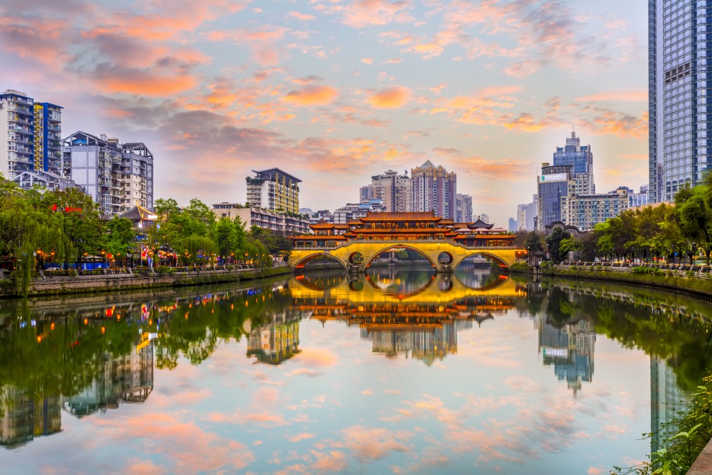
Chengdu has been a major center of culture, commerce, and political administration for more than a thousand years. It offers world-class attractions such as the Chengdu Research Base of Giant Panda Breeding, as well as the historic Kuan Zhai Alley and Jinli Pedestrian Street.
For a local experience, don’t miss the bold and spicy Sichuanese cuisine. Additionally, be sure to check out the Sichuanese opera, which features the stunt-like art of face-changing (变脸).
The Hengduan region within Yunnan province is usually reached from its provincial capital, Kunming (昆明). At 1,900 m (6,200 ft) above sea level, this “City of Eternal Spring” enjoys a pleasant climate all year round.
The top attraction is the Stone Forest (石林), located about 90 km (56 mi) from the city. It features 500 square kilometers (193 sq. mi) of unique karst landscape with pillar-like stone peaks, limestone caves and underground rivers.


The highest peak in the Hengduan Mountains is Mount Gongga, at 7,556 m.
The Hengduan Mountains have 659 named peaks.


