
Scan the QR code and open PeakVisor on your phone
A small state with a rich history, Sikkim is a fascinating piece of India notched inside the Eastern Himalaya, stemming off the Siliguri Corridor. Sikkim is a state of great diversity in every aspect, whether it be the variety of landscapes, ecosystems, and wildlife, or the variety of cultures, languages, and traditions that make up its population of around 610,000 people.
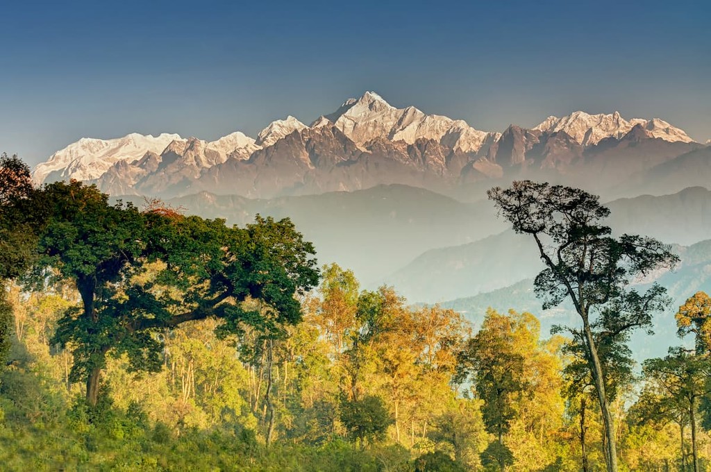
Sikkim’s most globally significant feature, however, is likely the mountain of Kangchenjunga, the third tallest peak on Earth and, of course, the tallest and most prominent of Sikkim’s 58 named peaks, towering at 8,586m/28,169ft tall with a prominence of 3,919m/12,857ft.
Sikkim is the 27th smallest state of India by area, and nestled just north of the Siliguri Corridor that connects West Bengal to the Indian mainland. To the west of Sikkim is Nepal, with Bhutan to the east, and Tibet in the north.
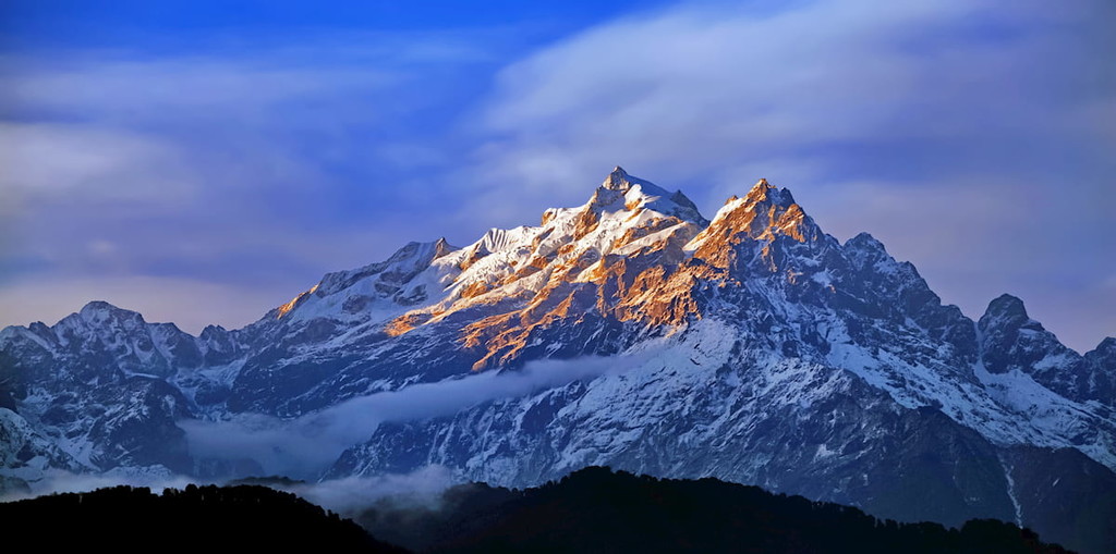
As its location between Nepal and Bhutan would suggest, Sikkim’s landscape is dominated by the Eastern Himalaya. Most significantly, the mountain of Kangchenjunga, third tallest in the world, sits right on the border between Sikkim and Nepal. In fact, much of Sikkim and Nepal’s border is delineated by mountains, with the Singalila Ridge, south of Kanchenjunga, separating Sikkim from the Nepalese district of Ilam.
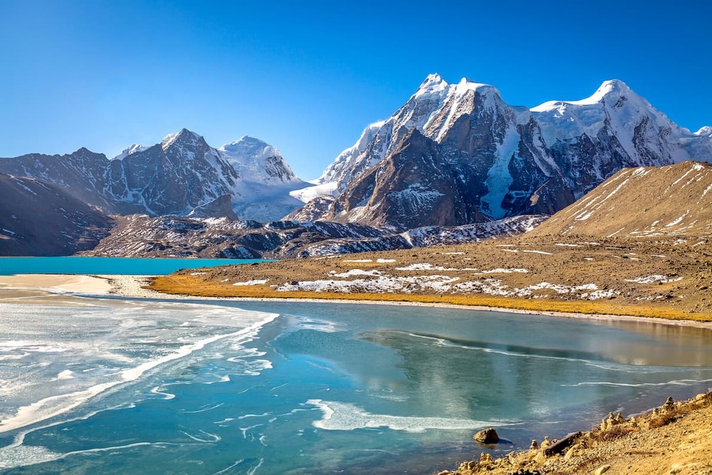
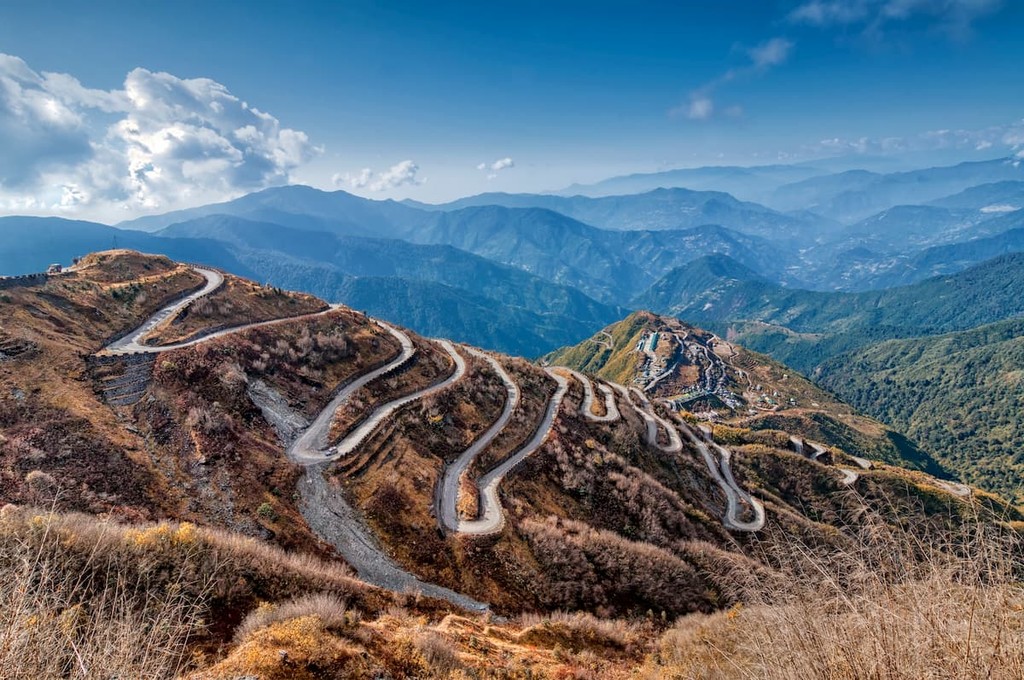
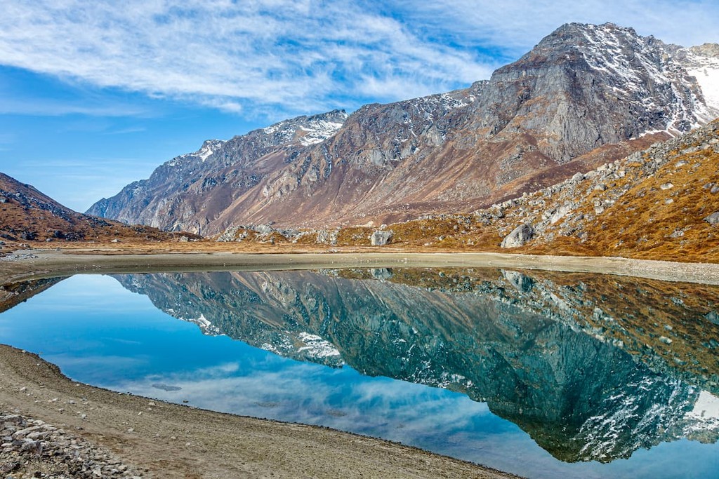
Not only is Sikkim home to massive peaks, but massive glaciers as well, such as the Zemu Glacier, the biggest in the Eastern Himalaya, sitting at the foot of Kangchenjunga. The Lhonak, Talung, and Rathong glaciers are also of particular note for the state. Waterfalls, passes, and hot springs comprise other notable geographic features of Sikkim.
The state is divided into four cardinal subdivisions: North Sikkim, East Sikkim, South Sikkim, and West Sikkim. North Sikkim comprises the entire northern half, where elevations are higher and temperatures colder; East Sikkim hilly and extremely biodiverse; South Sikkim temperate and relatively flatter; and West Sikkim temperate and rocky.
Despite its small size, Sikkim is known for its biodiversity, owing to the great range of elevations that constitute the state and allow for a variety of ecosystems. In the lower, southern regions, the climate is subtropical, while further north is home to alpine climates and the tundra. Generally speaking, however, most of the population lives in the more temperate parts of Sikkim.
Owing to the high elevations, Sikkim sees regular snowfall among its frigid tundras and high peaks, with the tundra specifically snowbound for about four months a year. There, temperatures frequently drop below 0ºC/32ºF; in the northwest, where altitudes are some of the most extreme, temperatures occasionally drop below −40°C/−40°F during the winter season.
Alongside the winter, Sikkim experiences a summer, spring, autumn, and monsoon season, the last of which brings a threat of landslides to the region from the torrential rain, which can sometimes last for days on end.
The largest river of Sikkim is the Teesta, which is responsible for the creation of ravines and gorges within the state. The most important tributary of the Teesta is the Rangeet, fed seasonally by melting Himalayan snow and monsoon rains.
Sikkim’s base rock mainly stems from the Precambrian, mostly consisting of schists, gneisses, and phyllites. These rocks are very vulnerable to erosion, heightening the risk of landslides in rural locations.
Much of Sikkim is rather ill-suited to agriculture, due to poor clay soils formed from the gneiss and schist-made hills that comprise much of Sikkim. Typically, this soil is most appropriate for the growth of the evergreen and deciduous forests that can be found in more temperate climates of Sikkim.
Parts of Sikkim, such as Gangtok, are prone to frequent earthquake activity, due to being located by the convergent boundary of the Indian and Eurasian tectonic plates. There are also some unique geologic features in certain parts of Sikkim, such as the stromatolite Buxa Formation near Namchi.
Some parts of Sikkim even contain past or present mining operations, where coal, talc, graphite, dolomite, limestone, marble, and others can be present alongside many metallic minerals.
As the climate and geography of Sikkim is greatly varied and dynamic, so too are the species of animals and plants that inhabit Sikkim, and the habitats they reside in.
Where the elevations are at their lowest, subtropical broadleaf forests host populations of figs, sal trees, laurel, bananas, bamboo, and orchids. As elevations rise about 1,500m/4,921ft and temperate broadleaf forests take over, oaks, maples, alders, chestnuts, and other similar trees become more prominent, though Himalayan subtropical pine forests can be found around these elevations as well, typically characterized by the presence of Chir pines.
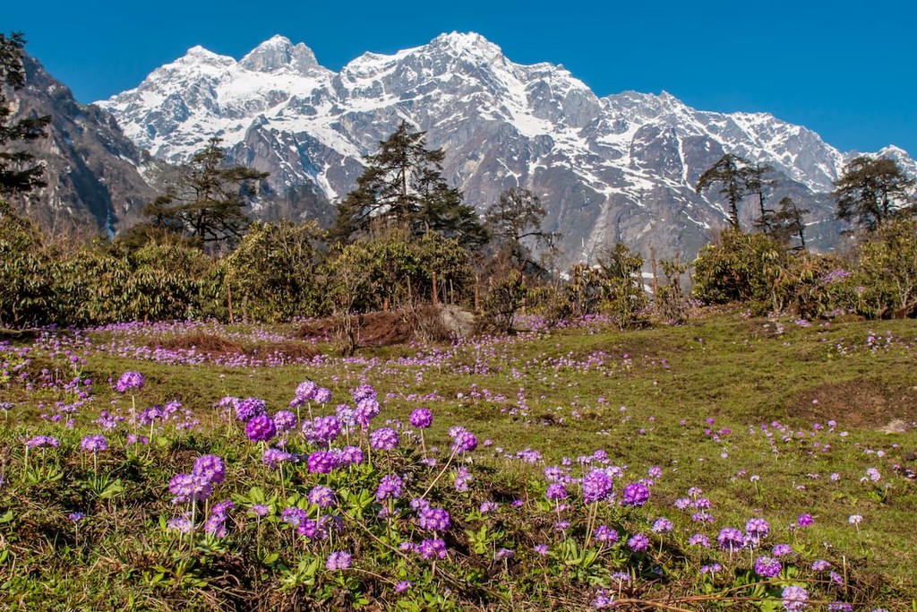
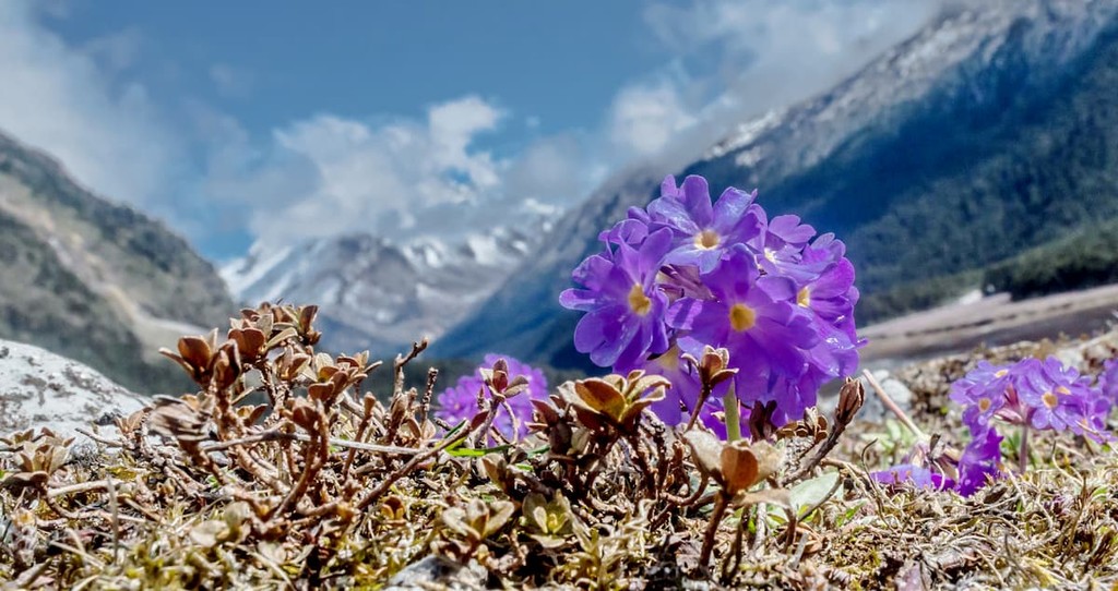
Around 3,500 to 5,000m (11,482 to 16,404ft), alpine flora begin to unravel. The lower half is home mainly to juniper, firs, cypresses, and other typical Eastern Himalayan subalpine conifer plants; the higher half is less forested, mainly becoming alpine scrub and meadows with occasional wetlands, where wealths of wildflowers tend to reside.
Overall, Sikkim hosts about 5,000 species of flowering plants, one of many impressive numbers for a region of its size. For example, Sikkim also contains over 550 bird species, and 695 recorded species of butterfly--almost 50% of the total amount of butterfly species seen on the entire Indian subcontinent.
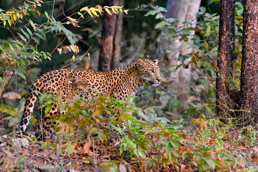
Sikkim is also home to many of the quintessential fauna associated with the forests and slopes of the Himalaya. Carnivores and omnivores like the snow leopard, leopard cat, clouded leopard, marbled cat, Himalayan wolf, and Asian black bear, as well as ungulates like the Himalayan tahr, goral, serow, and muntjac, are just a microcosm of the many animals that roam throughout Sikkim’s landscape.
Other notable animals of Sikkim include the gray langur, Himalayan marmot, and red panda, which is also Sikkim’s state animal. Birds like the impeyan and crimson horned pheasant, Tibetan snowcock, bearded and griffon vulture, snow partridge, golden eagle, and various species of quail, plover, woodcock, sandpiper, and more, make up a fraction of the diverse avifauna of the state.
Though Sikkim itself first became a unified kingdom in 1642, the history and historical significance of the area stretches back to far older dates. The oldest significance seems to be that the land west of the Teesta was part of the kingdom of Yalambar, of the Kirat people, around 1500 BC.
Later on came the settlement of the Lepcha people in Sikkim around the 6th and 7th centuries AD, who today are still a sizable population. While the Lepcha are regarded as the earliest inhabitants of Sikkim, it is possible that the Limbus and Magars lived in more isolated parts of Sikkim around a similar time.
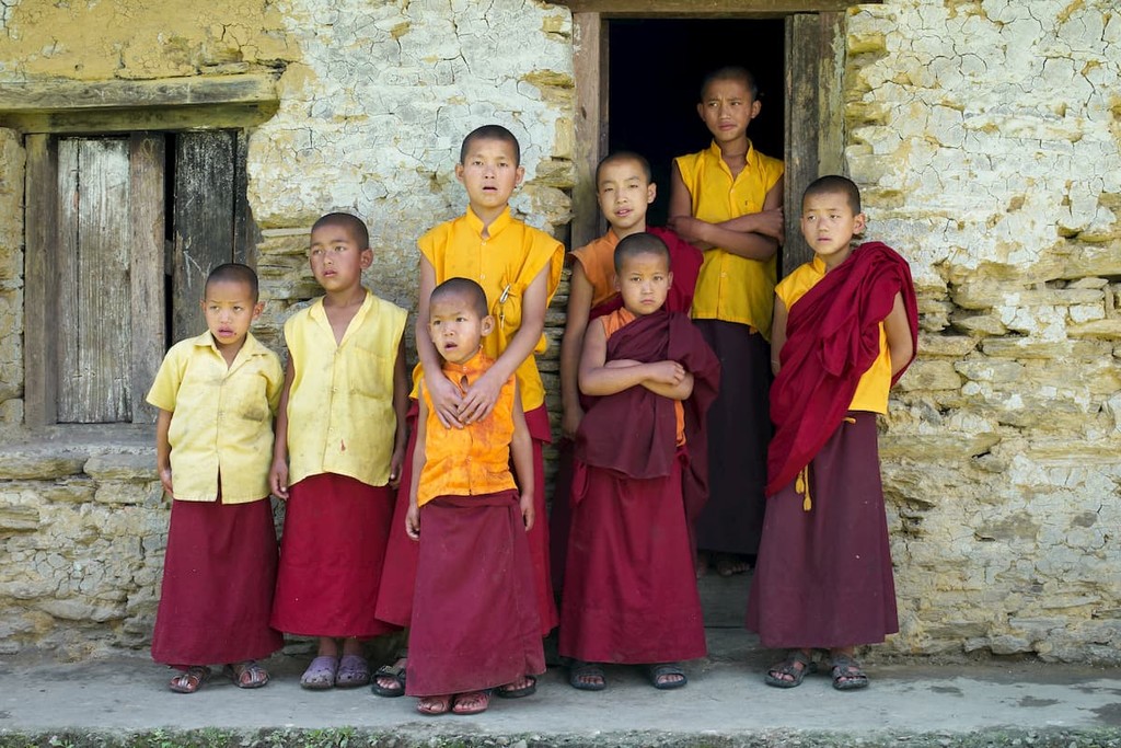
During the 1600s, the Lepcha, Limbu, and Magar people lived rather independently of one another in distinct parts of Sikkim. Around this time, the Bhutia people of Tibet took refuge in Sikkim as a result of conflict in their homeland, and were fairly successful at spreading Buddhist influence throughout Sikkim. The Tibetan Lamas wanted to create a Buddhist Kingdom in Sikkim, and in 1642, they made the Buddhist Phuntsog Namgyal the king of Sikkim.
The transition to the next king in 1670, Phuntsog Namgyal’s son Tensung Namygal, marked a more peaceful era. But during the reign of the subsequent kings of Sikkim in the 1700s, Sikkim faced various royal conflicts and controversies that weakened the throne and faced threats by the nearby Gorkha kingdom, who invaded Sikkim in 1788 and annexed the area of Limbuana.
The Gorkhas became a uniting force for Sikkim and the British presence in India. Territorial disputes caused the Anglo-Nepalese War from 1814 to 1816, with Sikkim and the British East India Company on one side against the Gorkhas. The Treaty of Sugauli resulted in Nepal remaining independent but renouncing its claim parts of its territory, including all of Sikkim.
The bond between Sikkim and Britain weakened over time, however, as Sikkim disapproved of some of the policies the British were putting in place in the Morang region and of the unauthorized expedition of British physicians into Sikkimese mountains. Conflicts resulted in a British invasion and the Treaty of Tumlong, which made Sikkim a British protectorate, existing alongside Independent Sikkim.
Eventually, northern Sikkim came under British control. But the ascendance of Sidkeong Tulku into power around the 1910s and his good relationship with King George V led to further domestic independence for Sikkim, and the decades after his reign were characterized by increasing sovereignty and independence until full independence from the British in 1947/8.
This gave way to a growing accessionist movement, with some desiring to be part of the newly independent nation of India. It became a protectorate of India in 1950, but it wouldn’t be until 1975 that Sikkim officially became the 22nd state of India.
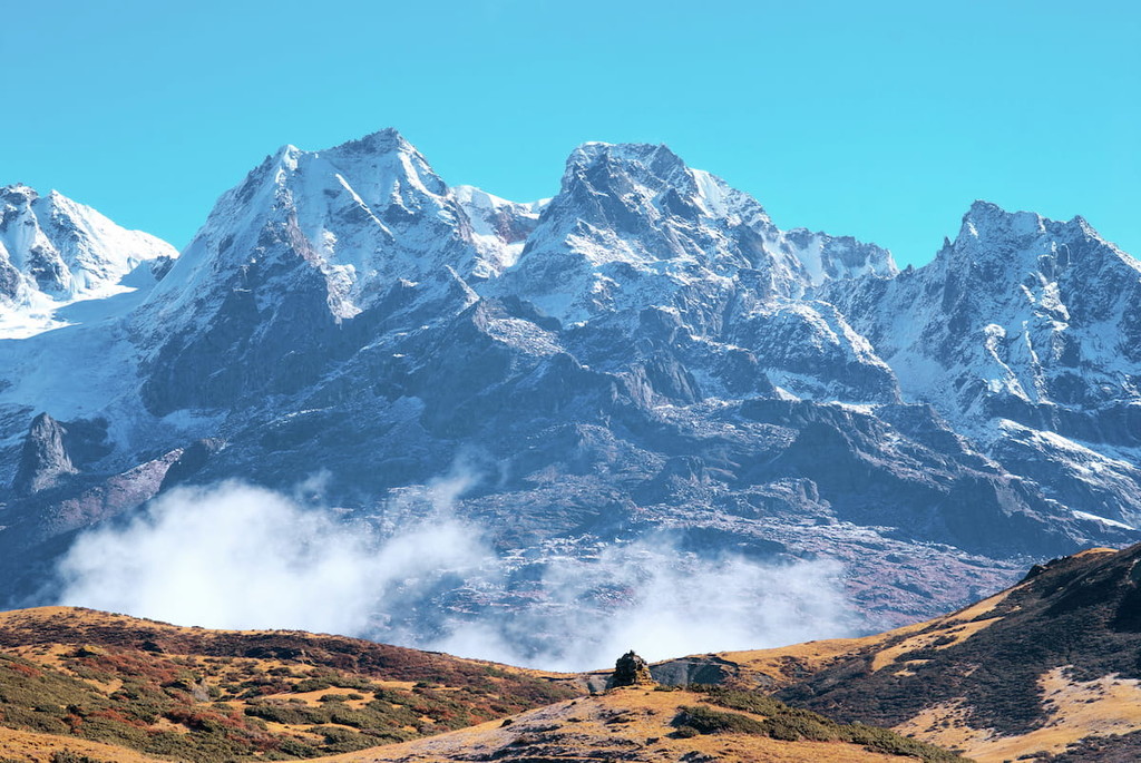
When it comes to thinking and trekking in Sikkim, Khangchendzonga National Park is perhaps the premiere location to do so. The park covers almost 35% of Sikkim’s area, mainly in North and West Sikkim, and its famous Kangchenjunga peak and variations in elevation from 1,829m/6001ft to over 8,550m/28,050ft deem it a dynamic, diverse, and attractive adventure for many visitors.
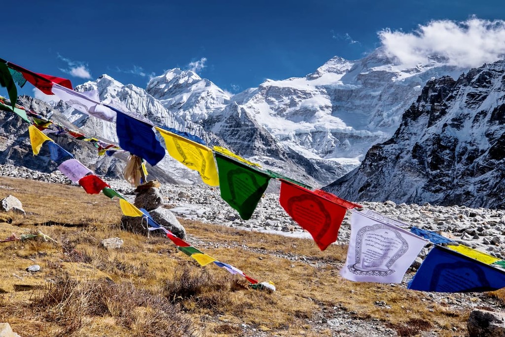
Deemed a UNESCO World Heritage site, Khangchendzonga houses many of the archetypal flora and fauna of Himalayan temperate and alpine forests. Musk deers, snow leopards, sloth bears, blue sheeps, griffons, tragopans and far more reside in and around the area, which can be explored through one of its numerous trekking routes, such as the Green Lake, Tholung-Kishong, Goechala trek, or any of the many stemming from the town of Yuksom.
These trekking routes may also lead through local communities of the area as well as their important religious and cultural sites, which visitors should be mindful of. Permission to trek the park must be granted by the Chief Wildlife Warden, with special permits needed to access particular restricted or protected areas.
Special permits, government approval, or booking through specific organizations may also apply to any of the other treks mentioned, and thus it is always incredibly important to check in advance.
Other notable treks include the particularly popular Bakhim Trek, studded by rhododendrons and ending with stunning valley views. Rhododendrons are also on full display on the aptly-named Rhododendron Trek, while the Yuksom-Dzongri Trek provides some of the best views of the snow capped mountains. Kangchenjunga can also be explored through the arduous but rewarding Khangchendzonga Trek.
There are several mountains available for trekking that typically must be done through approved tour providers and organizations, such as Frey Peak, Lama Angden, Mt. Tinchengkhang, Mt. Joponu, and Brumkhangse Yumthang, which range around 5,000 to 6,000m (16,404 to 19,685ft) in height.
More notable treks include:
Many of these treks lie within or go through Sikkim’s various wildlife sanctuaries, including:
Due to the lack of population density and the rural nature of life in much of Sikkim, there are few true urban centers to be found, but many lively and culturally vibrant towns and communities throughout.
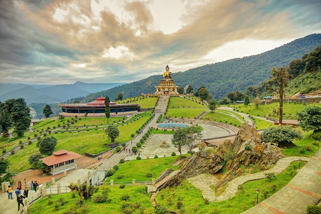
Gangtok is the capital city of Sikkim and its most populous, with a population around 100,000 people. Long known as a place of great Buddhist knowledge and culture, there are many monasteries, stupas, and museums devoted to Buddhist beliefs and practice, as well as Hindu temples and shrines. Religious and cultural festivals are celebrated often, as there is a diversity of cultures in the city.
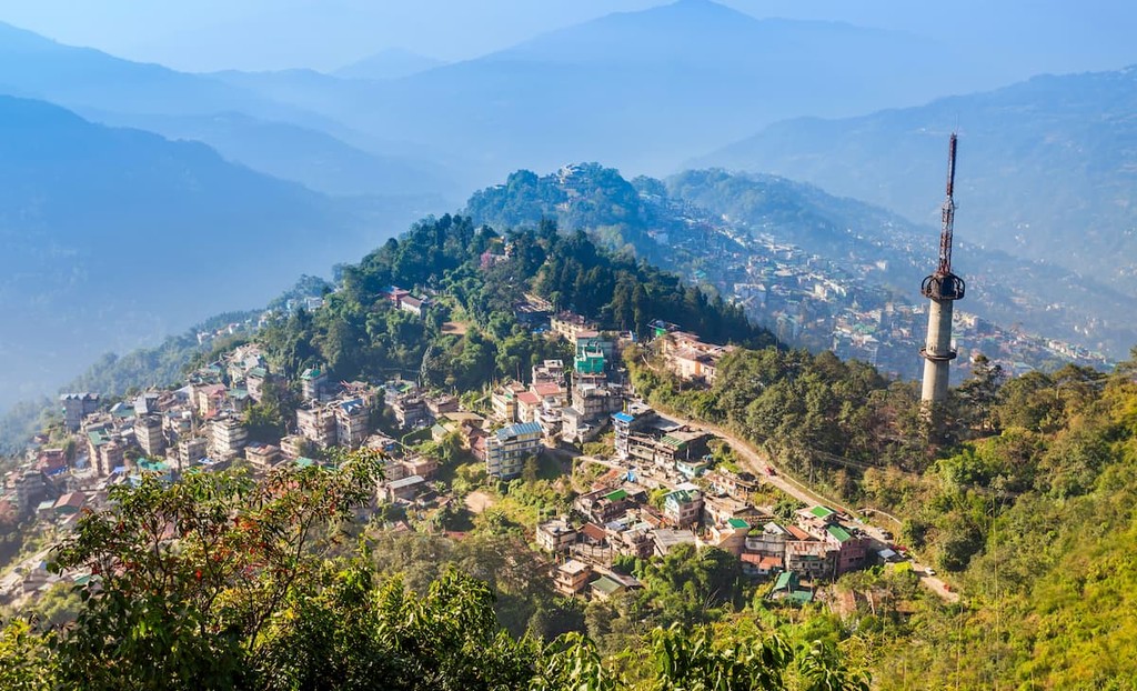
Owing to its size and importance, Gangtok has become the hub for tourism in Sikkim, especially in the spring and summer. Hotels and restaurants are plentiful, and sites like the Lal Market and the Mahatma Gandhi Marg, a bustling and beautiful street with many commercial and cultural activities, are some of the popular locations within the urban center.
Gangtok also has industries in various handicrafts, alcohol, and watch-making, and many nearby rural residents will sell their produce in Gangtok’s markets. Ecotourism, however, is the major attraction to the city, with the region around it perfect for activities such as river rafting, mountaineering, or hiking and trekking. The Himalayan Zoological Park and Jawaharlal Nehru Botanical Gardens are other nearby locations for seeing local flora and fauna.

For transportation, National Highway 10 connects Gangtok to Siliguri and thus the rest of the country. The remoteness and rocky terrain has made air and rail connections difficult, but there is one recently-made airport, Pakyong Airport, nearby. Within the city, taxis are the most accessible form of public transportation.
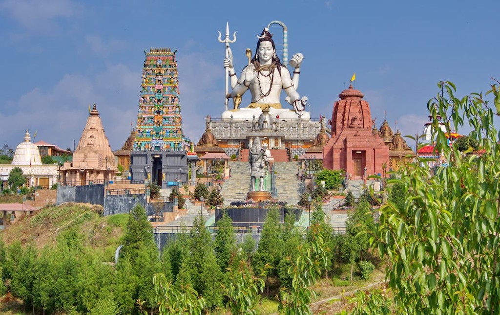
Though it only has a population of around 12,000 people, the city of Namchi in South Sikkim has become a greater and greater visitor location over time, both for reasons of tourism and religious pilgrimage.
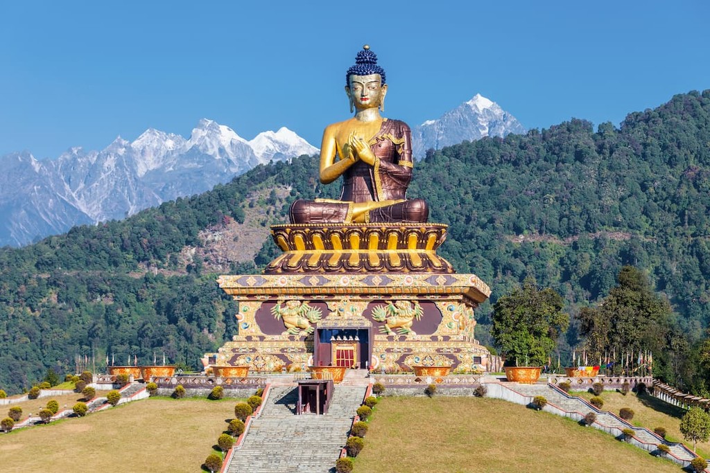
Several sites like the Namchi and Ralang Monasteries and Tendong Hill are popular pilgrimage sites in the area. Buddhist culture and art is also shown through the massive statue of Guru Rinpoche; likewise, a massive statue of Lord Shiva at the Siddhesvara Dhaam cultural center and the gorgeous Sai Temple epitomize the local Hindu culture.
Namchi is also known for its natural beauty, as seen in the endlessly green Temi Tea Garden and its dramatic views of the mountains, and the annual February flower show where local and rare flowers are put on display.
Namchi itself is mainly accessed by road, typically through Gangtok, with nearby Siliguri housing the nearest railway and major airport. Taxis and state-run buses are typically available.


ultra
8000ers
india-ultras
nepal-ultras
ultra
8000ers
india-ultras
nepal-ultras


