
Scan the QR code and open PeakVisor on your phone
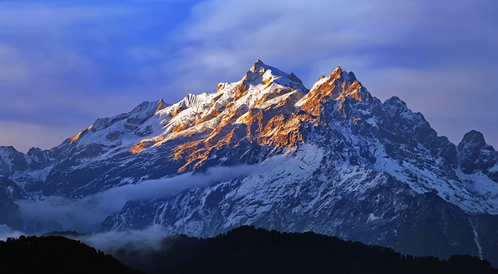
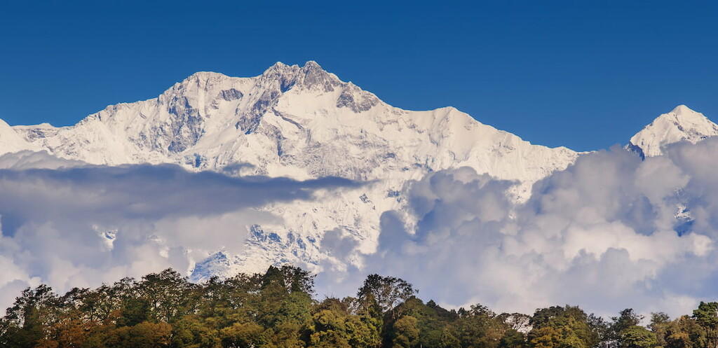
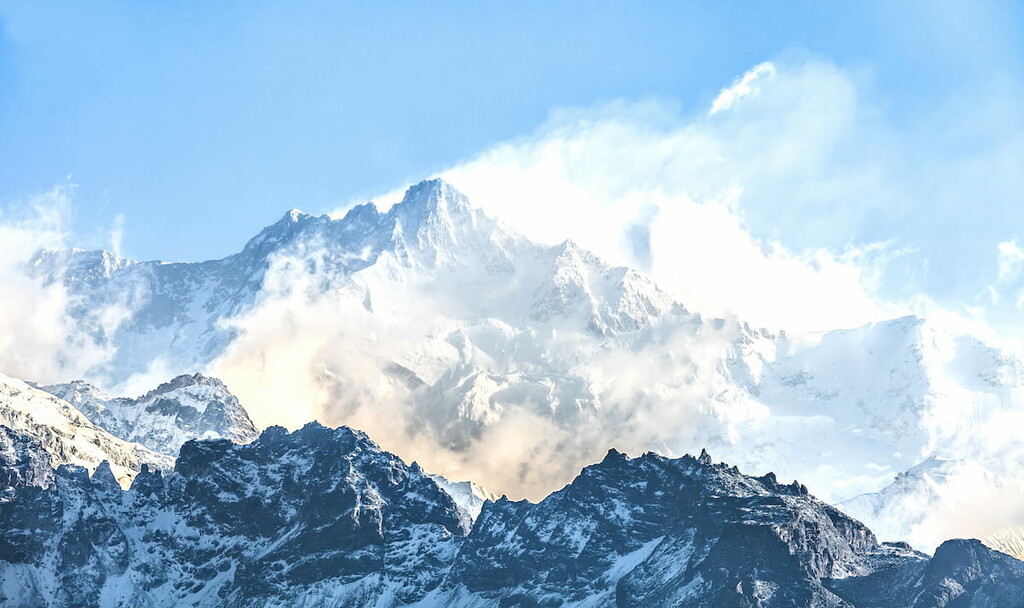
Centered around the mighty Kangchenjunga, the third highest peak in the world, Kangchendzonga National Park is a gorgeous and rugged federally-protected area located in the northwestern part of the state of Sikkim in India. The park contains 23 named mountains, the highest and most prominent of which is Kangchenjunga (8,586m/28,169ft).
Kangchendzonga National Park (कंचनजंगा राष्ट्रीय उद्यान) is located in the northeastern part of India in the state of Sikkim. It is located along the border with the Eastern Development Region of Nepal and near the border of Gamba County in Tibet (China).
The park contains a total area of some 1,784 square kilometers (689 square miles), which makes it the fifth-largest park in India after Hemis National Park in Ladakh, Desert National Park in Rajasthan, Simlipal National Park in Odisha, Gangotri National Park in Uttarakhand, and Namdapha National Park in Arunachal Pradesh.
Kangchendzonga is also technically called the Kanchenjunga Biosphere Reserve and it is a UNESCO World Heritage Site. In fact, the park was India’s first “mixed heritage” site, which means that it is home to elements that hold both cultural and natural significance, similar to Machu Picchu in Peru.
The park is named after Kangchenjunga, which is the highest peak in India and the third-highest peak in the world after Mount Everest (Chomolongma) in Nepal and K2 in Pakistan. However, there are a number of English transliterations of the name Kangchenjunga, which is why the park is named Kangchendzonga as this is an alternative spelling of the mountain’s name.
As Kangchendzonga is located in a highly mountainous region of India, it is also surrounded by a number of other important parks and protected areas.
In particular, this includes the Maenam WLS, Fambong Lho WLS, Kyongnosla Alpine WLS, Barsey Rhododendron WLS, and Mahananda WLS to the south and the Shingba Rhododendron WLS to the east of the park. Furthermore, the park is located to the east of Kanchenjunga Conservation Area in Nepal and to the south of Qomolangma National Nature Preserve in Tibet.
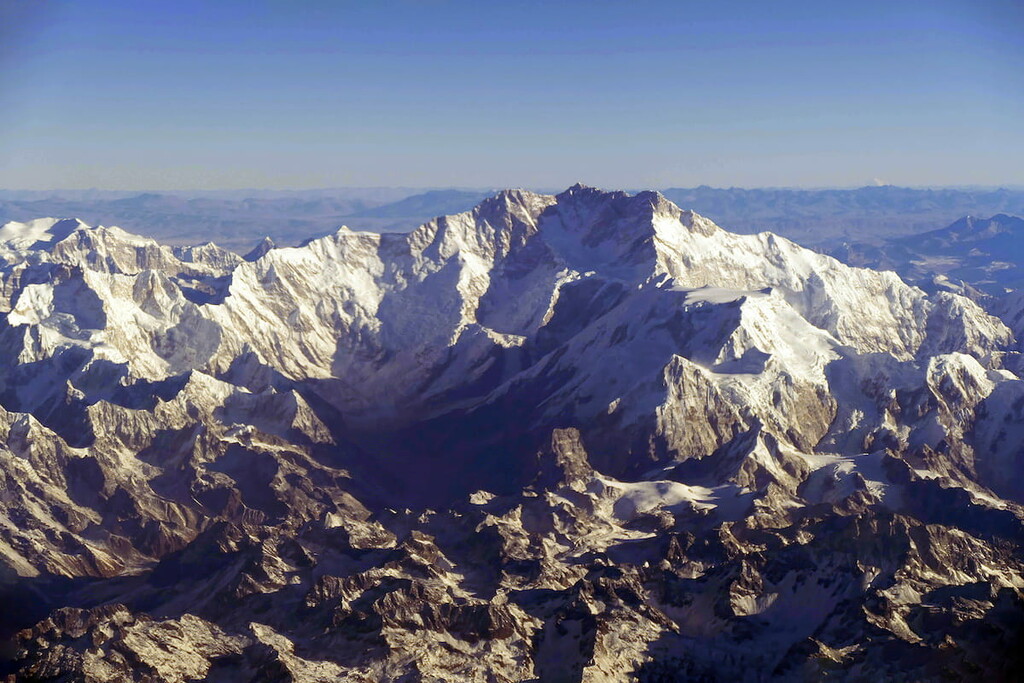
The peaks in Kangchendzonga National Park are part of the mighty Himalaya—the highest mountain range in the world.
The Himalaya started to form as the Indian plate drifted northward into the Eurasian plate, a process that started approximately 130 million years ago. This northward drift continues today and is the impetus behind the convergent plate boundary that created the Himalaya.
As the Indian plate is still moving northward, the Himalaya are actually growing in height each year. It's believed that the range is growing at a rate of about 5mm per year, so the world’s highest mountains are continuing to get taller.
Furthermore, the mountains of Kangchendzonga National Park are heavily glaciated. Over the millennia, these glaciers have carved out many of the topographical features that we see today, including the region’s massive valleys.
Major peaks in the park include Kanchenjunga, Pandim, Jongsong Peak, Kirat Chuli, Gimmigela I, Talung, and Siniolchu.
Although Kangchendzonga National Park is perhaps best known for its beautiful mountainscapes, it is also a haven for local flora and fauna. Indeed, the park is also a protected biosphere reserve thanks to its high levels of biodiversity.
The park is located within a biodiversity hotspot in the Himalaya and it contains a large number of endemic, endangered, and rare species. In fact, UNESCO states that the park contains approximately 50% of India’s total diversity of birds, wild trees, rhododendrons, and orchids, as well as about 30% of the country’s total flowering plant species.
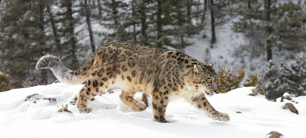
As far as wildlife goes, there are confirmed reports of at least six cat species in the park, including the jungle cat, golden cat, leopard cat, clouded leopard, leopard, and snow leopard. There are also Tibetan wolves, Indian civents, goral, jackals, red pandas, mainland serow, Himalayan tahr, and blue sheep, as well as a number of musk deer, primate, and rodent species in the park.
Humans have lived in the area in and around what is now Kangchenjunga for thousands of years. While the highest slopes of Kanchenjunga itself were not climbed until 1955, the region has long been home to humans, including the Lepcha people, who have lived in the foothills of the mountain since time immemorial.
During the early Middle Ages, the region that is now part of Kangchendzonga was controlled by a number of different ruling groups until the seventeenth century when Phuntsog Namgyal became the first chogyal (king) of Sikkim. The next few decades were characterized by repeated invasions by neighboring kingdoms, including those of Nepal and Bhutan.
In the nineteenth century, as Britain started to gain control over much of what is now India, Pakistan, and Bangladesh, the Kingdom of Sikkim ceded what is now Darjeeling to the British. During this time, much of Sikkim was actually considered to be an autonomous region with self-rule, though it was effectively a British protectorate until Indian Independence in the mid-twentieth century.
When India gained its independence, the people of Sikkim held a popular vote and decided to become a special protectorate of India rather than as a state. However, Sikkim became a state in 1975 after the deposition of the Sikkimese king.
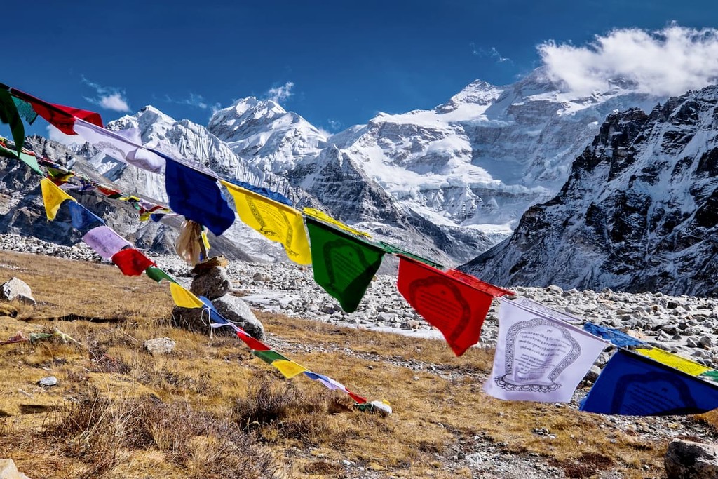
Due to the lofty grandeur of the region, the area that is now part of Kangchendzonga National Park has long been of interest to mountaineers.
Interestingly, Kangchenjunga was actually believed to be the world’s highest peak until 1852 when officers in the Great Trigonometrical Survey determined that the peak that is now called Mount Everest was the world’s highest. Further calculations a few years later also confirmed that Kanchenjunga is the third highest peak in the world.
The earliest ventures into the region by people of European descent were likely those of Joseph Dalton Hooker who was a British botanist based in Darjeeling that frequented the Himalaya in the 1840s. Nevertheless, the closed borders of Nepal at the time, as well as the onset of the Nepalese-Tibetan War made travel beyond Sikkim quite difficult.
In the 1889s, a group of mountaineers, including Douglas Freshfield of Britain and the famed mountain photographer Vittorio Sella of Italy traveled throughout the region and visited some of the more remote western faces of Kangchenjunga.
The first concerted effort to attempt to climb the mountain in the last few centuries was made by Aleister Crowley in 1905, though this ended in tragedy as a group of porters were swept away and killed in an avalanche.
Finally, in 1955, after years of failed attempts by other climbing parties, a team led by Joe Brown and George Band made the first ascent of Kanchenjunga. This makes it the sixth 8,000 meter peak to have been climbed, after Annapurna, Mount Everest, Nanga Parbat, K2, Cho Oyu, and Makalu.
The area that is now Kangchendzonga has been protected under Indian law for many years. It was first established as a park under the Wildlife Act of 1972 and it was given the designation of national park in 1977. There is also a buffer zone around the park that is protected as a forest reserve. The entire park was expanded in size in 1977, too, to include the region’s highest peaks.
Furthermore, Kangchendzonga was officially designated as a UNESCO World Heritage Site for its remarkable cultural and natural significance in 2016. It is one of the largest such sites in India and it is renowned for its biological diversity.
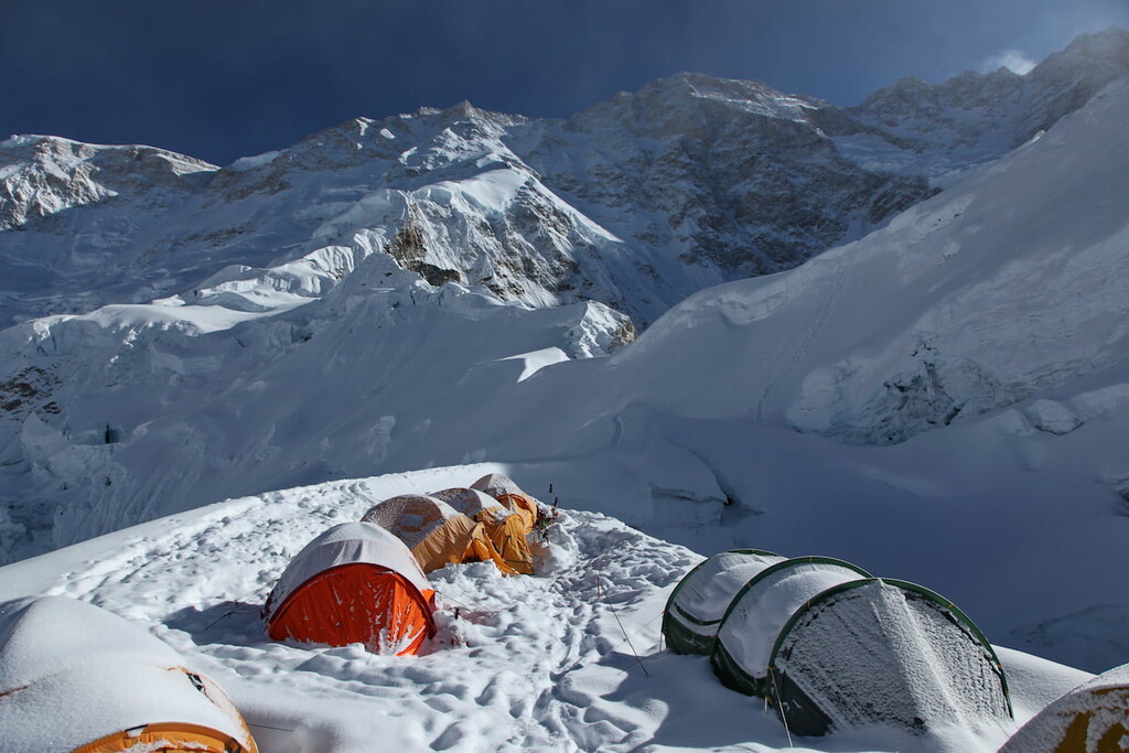
Kangchendzonga National Park is one of the region’s premier trekking destinations. That being said, there are relatively few major trekking areas in the park when compared to places like the Annapurna Conservation Area in Nepal.
Most of the park’s trekking routes start in Yuksom and the majority of trips into the region require a permit for both international and domestic travelers. Here are some of the best trekking routes to consider in the park:
A week-long trek, the Dzongri Trail is a moderately strenuous adventure that takes you to some high altitude locales in northwestern Sikkim. It starts and ends in Yuskam and it offers a chance to see Kanchenjunga itself in a relatively short period of time.
The best time to trek the Dzongri Trail is from March to June. During the summer months, the region is in full monsoon season so trekking is very difficult, if not impossible, due to the heavy snowfall in the mountains. So, be sure to plan your travels accordingly.
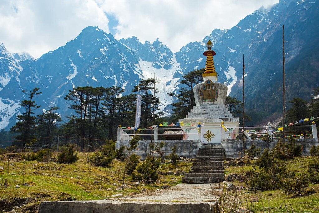
Sikkim’s premier Himalayan trek, the Green Lake Trek is a 12 day trekking route that brings you into the heart of the national park. This trek starts in the town of Lachen and then steadily climbs upward into the mountains.
As the trek reaches nearly 5,000 m (16,404 ft), however, proper acclimatization before hiking is of the utmost importance. During the trek, hikers get to see Kanchenjunga in the distance as well as the famed Green Lake, which makes for an excellent campsite. There are also a number of important monasteries along the trek that are worth a visit.
Looking for a place to stay near Kangchendzonga National Park? Here are some of the best cities, towns, and villages to check out:
Located in the southern foothills of the park, Yuksom is a community of about 4,000 people that has long played an important role in the region. Yuksom was actually the first capital of Sikkim, having been designated as such in the seventeenth century.
Furthermore, Yukson is a particularly popular tourist destination in Sikkim. The town is the main starting point for many of the treks in the region, including the majority of treks that lead into
Kangchendzonga National Park. Therefore, there are many guest houses, restaurants, and other amenities in the town of Yukson for visitors to enjoy.
The town of Chungthang is a community of about 4,000 people that’s located in the northeastern part of the state along the Lachen and Lachung rivers. Chungthang is known for its beautiful scenery and rich cultural heritage. The town is also home to the Gurdwara Nanaklama, which is a well-known Sikh temple in the region.
Gangtok is the capital and largest city in the state of Sikkim. It is home to over 100,000 residents and it is a center for culture and commerce in the state.
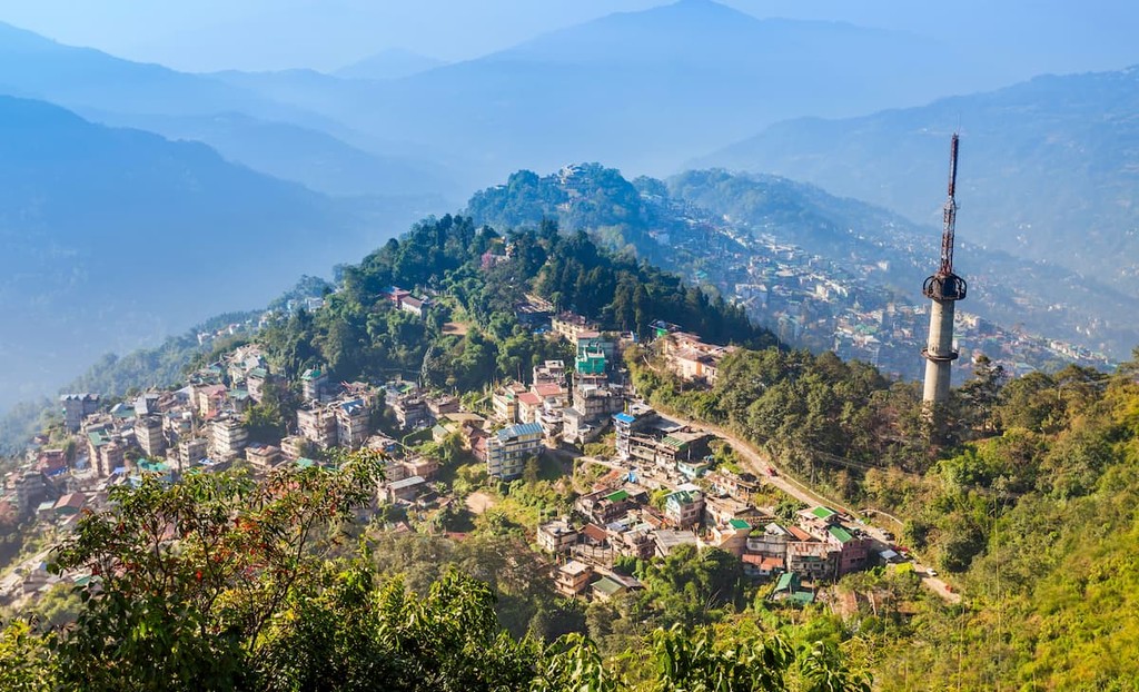
The city is also a major tourist destination as it is home to Sikkim’s largest airport as well as an extensive road network. There are also plans to connect the city to the important New Jalpaiguri Junction Railway Station, which offers rail connections to the rest of India.
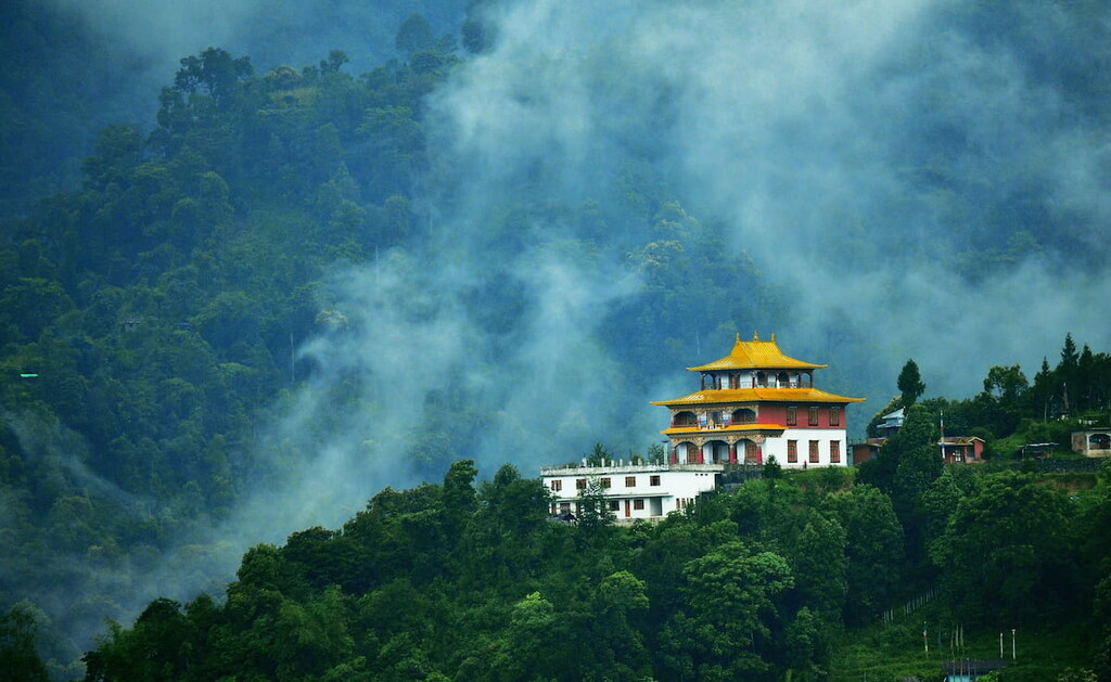
However, there’s more to see and do in Gangtok than fly into the airport. There are a number of important museums and cultural sites that are well worth a visit, including the Rumtek monastery. The city is also known for its fantastic cuisine, which includes the momo (a type of steamed dumpling) and a number of other traditional Sikkimese dishes.
Lanchung is a town located in the northeastern part of Sikkim near the border with Tibet (China). The town is often considered to be one of the most stunning places in the state due to its superb alpine scenery.
Lachung also happens to be the home of one of the most important bases for the Indian Army in the region. Nevertheless, it is also a crucial tourist destination as it is the gateway to the famed Lachung Monastery.


ultra
8000ers
india-ultras
nepal-ultras
ultra
8000ers
india-ultras
nepal-ultras


