
Scan the QR code and open PeakVisor on your phone
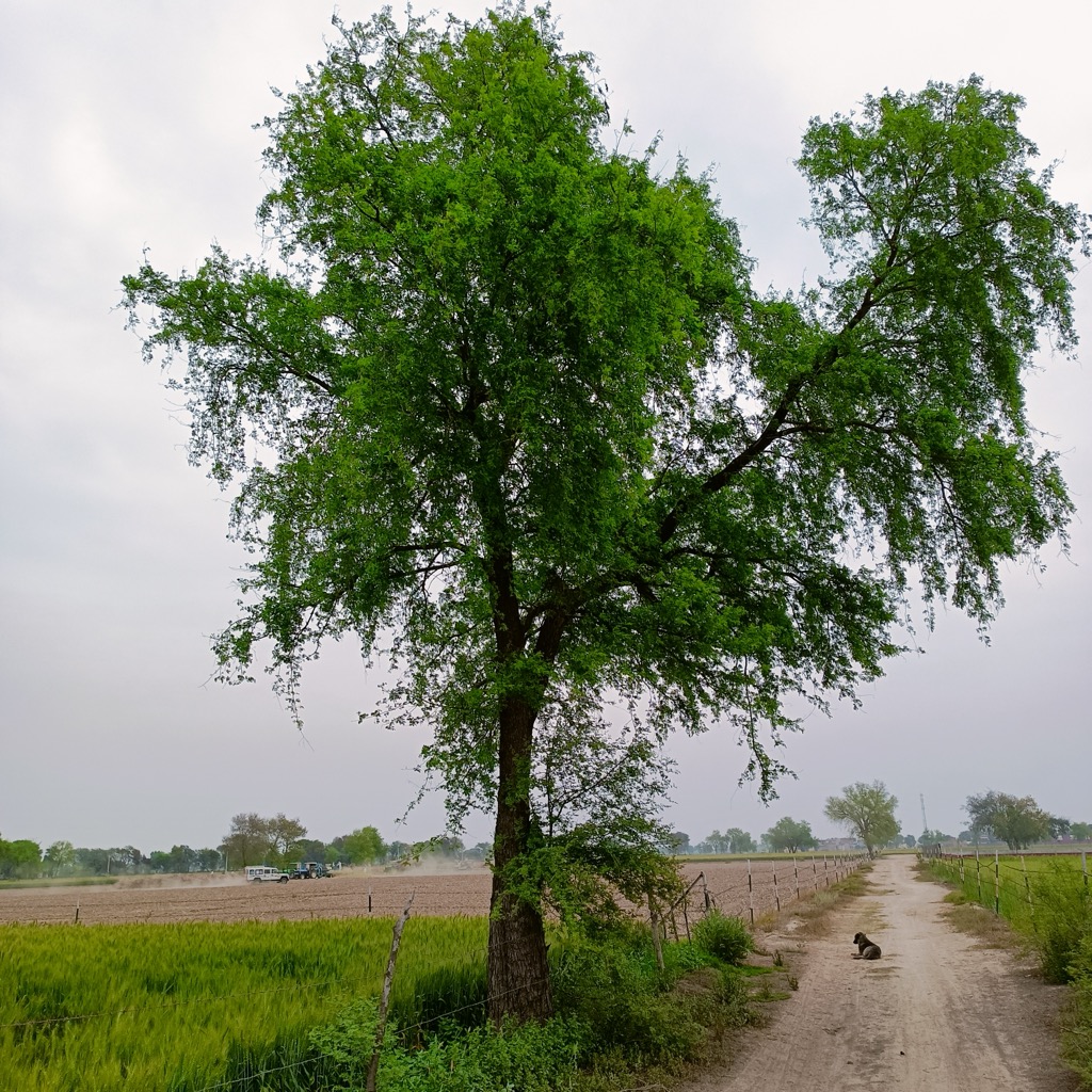
Rajasthan, “The Land of Kings,” is a state in northwestern India renowned for its royal palaces, ancient forts, and traditional culture. Despite its particularly generous land mass, the state has just 102 named mountains to its credit, all of which are in the picturesque Aravalli Hills range. The tallest and most prominent peak, the holy Guru Shikhar, sits at an elevation of 1,681 m (5,515 ft), with a vertical relief of 1,335 m (4,379 ft) and has a Hindu temple at the summit, making it a major attraction for pilgrims and adventurers alike.
With a total geographical area of 342,239 sq km (1,122,831 sq ft), this rhomboid-shaped state is the largest in India. Its physical size is slightly smaller than that of Germany, though somewhat larger than that of Norway. Rajasthan is located between 23°30' and 30° 11' North latitude and 69° 29' and 78° 17' East longitude.
According to the 2011 census reports, the most recent available, 8,548,437 people reside in Rajasthan. That ranks this behemoth of a state as the 7th most populated in India, giving it one of the lowest population densities in an otherwise overcrowded part of the world.
To the northwest and west, Rajasthan shares a remote international border in the Thar Desert with Pakistan, which is heavily fortified and patrolled by the Border Security Force, India’s central armed police force. It shares far-friendlier, national borders with the 5 Indian states of Punjab, Haryana, Uttar Pradesh, Madhya Pradesh, and Gujarat.
The defining characteristics of Rajasthan’s polarizing landscape are its mountains and desert, yet a wide array of different terrain features exist here, at least to some extent.
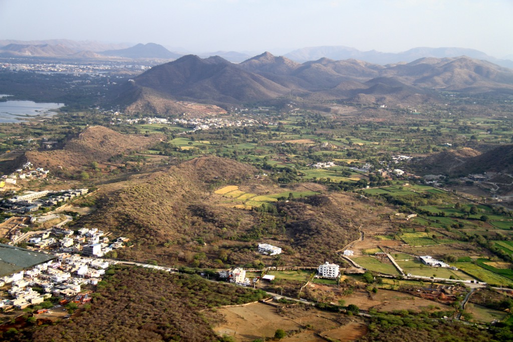
Mountainous terrain in Rajasthan is exclusive to the sacred Aravalli Hills, a series of sandstone parallel ranges which run diagonally, from northeast to southwest, across the entire state. The range creates a natural separation between the Thar Desert and the fertile plains and plateaus in the eastern part of Rajasthan. About 15-20% of the population resides in this mountain belt.
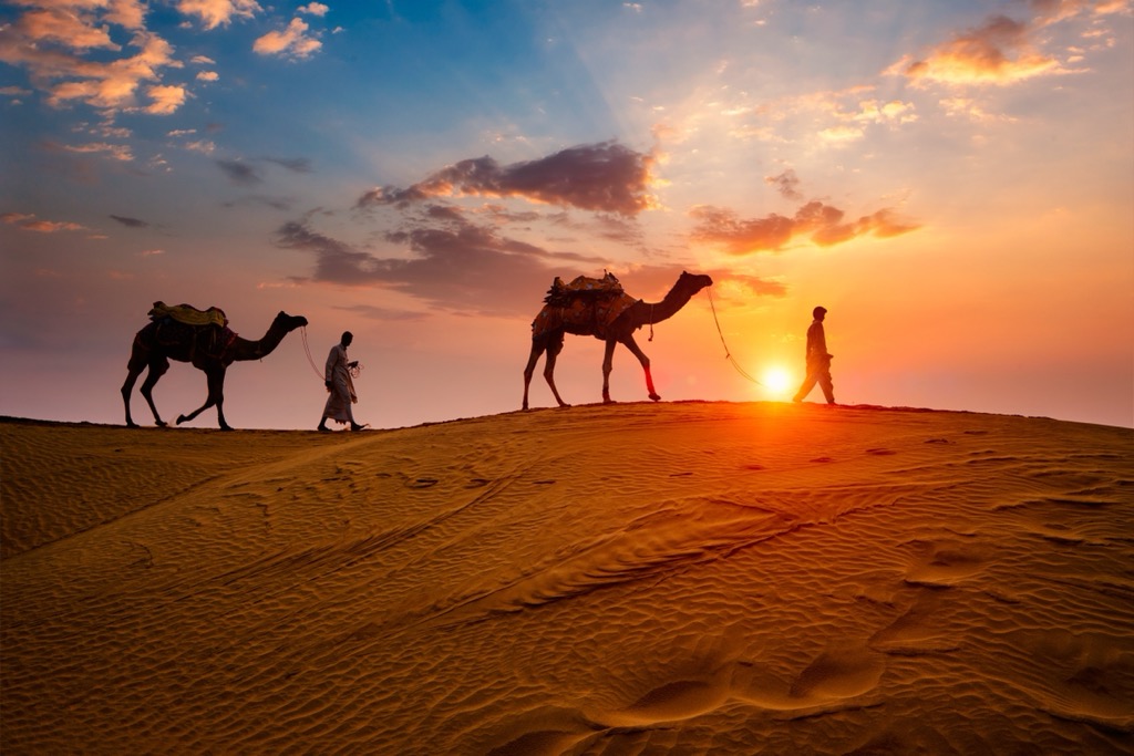
Desert, specifically, the Thar Desert, is Rajasthan’s primary terrain feature, making up more than 60% of its total land area. Also known as the Great Indian Desert, at 238,254 sq km (77,220 sq mi) it’s the largest desert in India and the 18th largest in the world. The desert landscape of Thar is constantly in flux, as undulating sand dunes, arid plains, and low barren hills ebb and flow with the winds of time. Some of the older, more stabilized dunes have been known to reach gravity-defying heights of 150 m (492 ft).
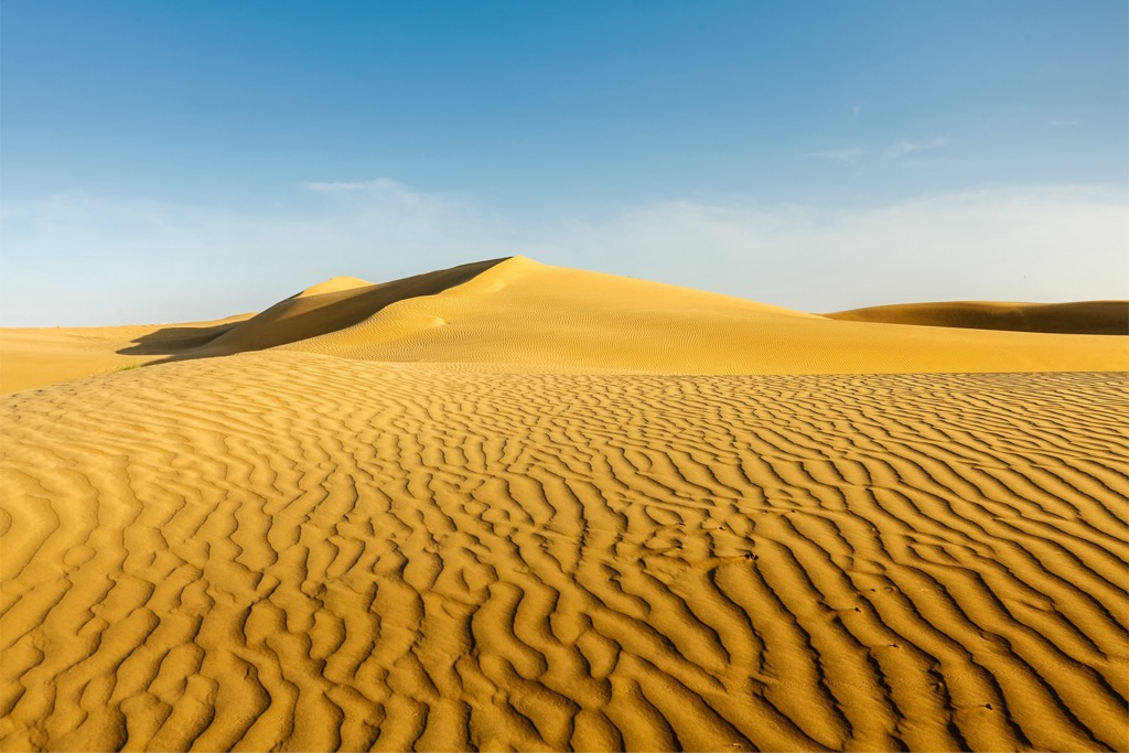
The Thar Desert is home to the Indira Gandhi Canal, the longest canal in India, which provides essential irrigation and drinking water to this inhospitable land. Upwards of 16 million people call this place home, making it one of the most densely populated deserts.
Plains are found in the eastern and southeastern parts of the state, where most agriculture takes place. Due in part to the rich soils bolstered by alluvial river deposits flowing out of the Aravalli Hills, major crops include wheat, barley, maize, pulses, and sugarcane. Approximately 40-45% of Rajasthan’s population makes their home in this region.
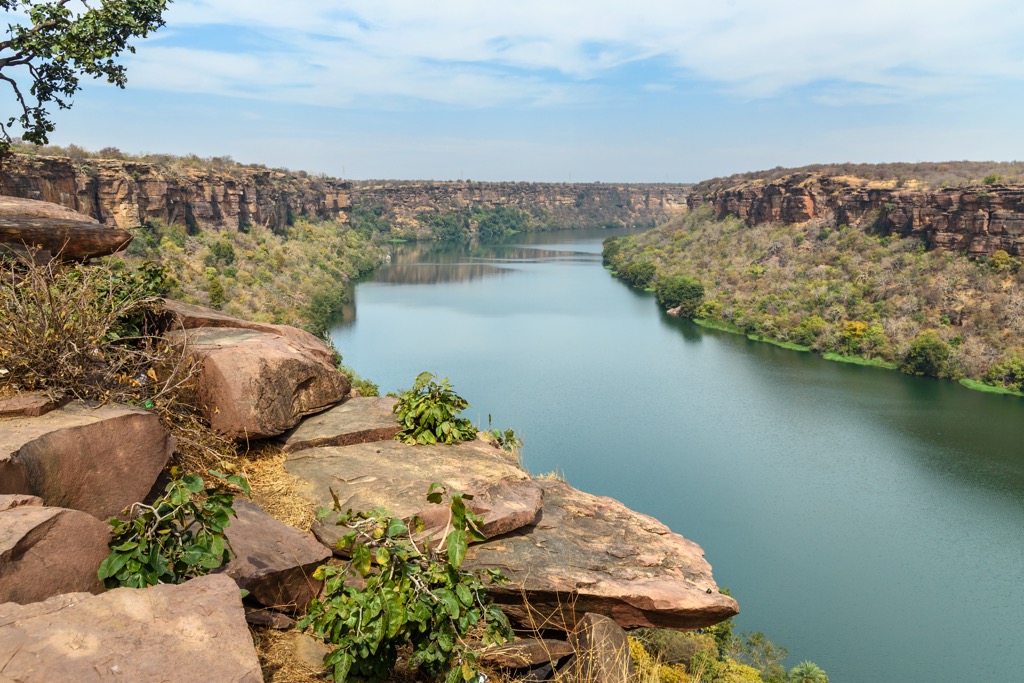
Rivers are simply not the most notable feature of the state’s landscape. Rajasthan is India’s driest state, with total surface water accounting for only 1% of India’s total water surface resources. Despite these shortcomings, there are 41 total rivers and 7 reservoirs. The 3 main rivers, the Banas, Sahibi, and Luni, all flow from the Aravalli Hills. These hills form the main watershed of Rajasthan, splitting the drainage between the Arabian Sea and the Bay of Bengal.
The only river that runs perennially is the Chambal River, of which about 360 km (223 mi) of its total 960 km (596 mi) length flows through Rajasthan. The local rivers are all dependent on the monsoonal rains and run seasonally.
Plateaus comprise 6.89% of Rajasthan’s total land area and can be found in the eastern and southeastern parts of the state, known as the Hadoti region. Part of the Deccan Traps, the rich soil is primarily black regur, making it particularly loamy and fertile.
Forests make up 9.6% of Rajasthan’s total land area. As you would expect from a place with such distinct terrain, forest types range widely throughout the state, and include: dry tropical deciduous forests, riverine forests, riparian forests, tropical thorn forests, and semi-arid forests.
Wetlands cover roughly 2% of the state's total land area, and typically have a salinity level of around .5%. Of the 8,013 sq km (4,979 sq ft) of wetlands in Rajasthan, 5,231 sq km (2,019 sq mi) are seasonal wetlands and 2,375 sq km (916 sq mi) are semi-permanent ponds.

Lakes are present in Rajasthan, it is true; however, most are either saline, such as Sambhar Lake and Panchpadra Lake, or artificial, like Ana Sagar Lake or Lake Foy Sagar.
With its slogan "Padharo Mhare Desh,” which means “Welcome to My Land,” Rajasthan is one of India's most popular tourist destinations. If you are travelling here, it’s always advisable to stop at a local Tourist Office when you arrive, for in-person recommendations on guided tours and activities, and to get answers to specific questions.
Rajasthan Tourism Development Corporation (RTDC)
Paryatan Bhawan, 3rd Floor,
M.I. Road, Jaipur- 302001 Rajasthan (India)
0141-2209860, 2209866
croho.rtdc@rajasthan.gov
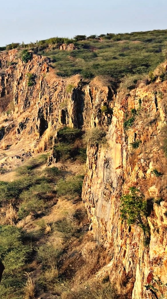
The prominent mountain range of the region, the Aravalli Hills, was formed by a series of tectonic processes during the Precambrian period, known as the Aravalli-Delhi Orogen. The range mainly comprises volcanic and sedimentary formations, along with metamorphic rock, granite, gneiss, and schist.
Like some of the most revered mountain ranges in the world, including the Alps and the Andes, the Aravalli Hills are a fold mountain range, meaning they were formed as the uppermost layers of the earth’s crust were thrust upward, and “folded” into each other.
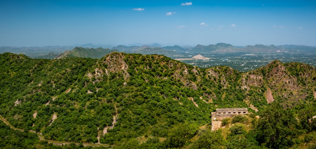
In the case of the Aravalli Range, its orogeny began more than 2.5 billion years ago, making it one of the planet's oldest ranges of this kind. That said, it is undeniably the oldest fold mountain range in India. At the height of the range’s development, its highest peaks averaged approximately 2,800 m (9,186 ft). As a result of the transformational effects of millions of years of erosion and ongoing submergence by the oceans, today the range elevation averages a much less grandiose 400-600 m (1,300-1,900 ft).

The Aravalli Hills are often compared to another old fold mountain range, the Appalachian Mountains in the United States, because both of these once-soaring mountain ranges have been worn down to mere stubs. On the other end of the spectrum, the rugged Himalayas are a young fold mountain range, with the world’s tallest mountain, Mount Everest, still growing, albeit at a snail’s pace of only 2-4 mm per year.
A direct translation from Sanskrit, meaning “line of peaks”, the Aravalli Hills run 670 km (416 mi) across northwestern India. About 80% of the range is contained within the borders of Rajasthan. The remaining 20% of their territory is the domain of the neighboring Indian states of Gujarat, Haryana, and Delhi.
The range consists of a series of detached ridges and peaks varying in width between 10 and 100 km (6 - 62 mi) and ranging in height from 400 to 1,700 m (1,312 - 5,577 ft).
The Aravallis are divided into two distinct parts: the Sambhar-Sirohi, which is known for having the range’s tallest mountains, and Sambhar-Khetri, comprising 3 discontinuous ridges. The range is more heavily forested in the south, while the north is more desolate, with masses of rose-colored quartzite, stone, and sand dotting the landscape.
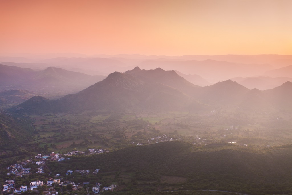
Still formidable, even at their diminished stature, the Aravalli Hills create a weather barrier during the monsoon that shifts the clouds toward the east and the lower Himalayas, contributing to the overall climate of the northern part of India. The range also serves to curb desertification, the eastward spread of sand from the vast Thar Desert.
The British first protected the range under the Indian Forest Act of 1878. In theory, it’s been largely safeguarded by various conservation efforts in the following years. Unfortunately, unregulated mining and, to a lesser extent, urbanization and deforestation, have run rampant. One 2018 study revealed that 25% of the Aravalli Range has been lost in Rajasthan since 1967. On its current trajectory, the range is poised to experience even greater devastation in the years to come.
The “Peak of the Guru,” or Guru Shikhar, is the tallest in all of Rajasthan at 1,681 m (5,515 ft). Located a short 15 km (9 mi) from the hill station of Mount Abu, the mountain is surrounded by forests and natural beauty. The main attraction, for the faithful among us, is a Hindu temple dedicated to Dattatreya, an incarnation of Brahma, Vishnu, and Shiva, who lived here in a cave at the summit as a young monk.
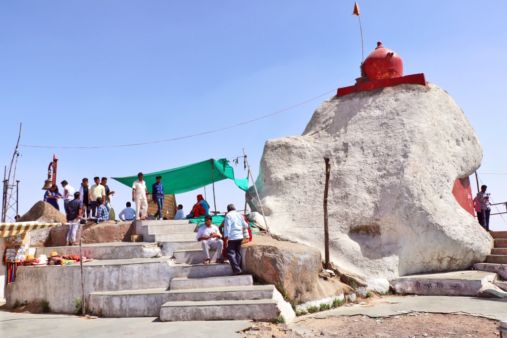
Another highlight of Guru Shikhar is a massive bell inscribed from 1411 AD that all visitors are invited to ring upon arrival.
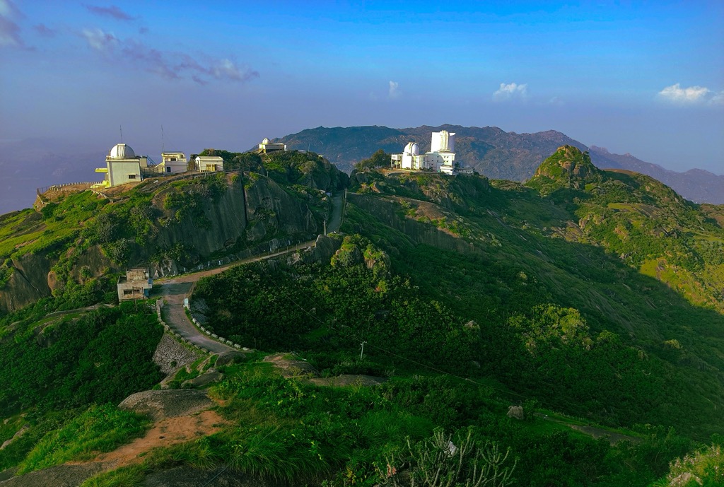
The only hill station in the state, Mount Abu, is situated at an elevation of 1,183 m (3,881 ft) in the Sirohi district, near the Gujarat border. Hill stations are mountain towns built during the British Raj. These towns were purpose-built to offer relaxation, recreation, and, most of all, to escape from the insufferable heat.
Known as an “Oasis in the Desert,” Mount Abu is one of the most popular destinations in the summer due to its cool climate high above the scorching desert below.
The Mount Abu Wildlife Sanctuary, a biodiversity hotspot, is one of the area's highlights, with leopards, sloths, wild boars, orchids, and various medicinal plants making their home here. Another popular attraction of Mount Abu is the many extravagant temples, including the world-famous Dilwara Temples, renowned for their intricate, white marble carvings, as well as lesser-known temples like the Adhar Devi and Raghunathji.
Kān 1,091 m (3,579 ft)
Mandori 1,087 m (3,566 ft)
Belka 1,085 m (3,559 ft)
Zāli 1,075 m (3,526 ft)
Jambūri Bāl 1,061 m (3,480 ft)
Māndia 1,045 m (3,428 ft)
Dūba ka Magra 1,007 m (3,303 ft)
When you consider that well over half of Rajasthan is made up of the Thar Desert—one of the most stark and barren parts of the Indo-Pacific region—it’s only then that you appreciate the state’s ecological diversity.
The climate of Rajasthan is primarily arid to semi-arid, with uncomfortably hot summers, cooler winters, and limited rainfall, except during the monsoon. It is one of the hottest states in India and is prone to droughts. On average, Rajasthan receives 25-50 cm (9-19 in) of rain annually. Naturally, the desert region is considerably drier, with extreme temperature gradients not uncommon. Like much of India, there are 3 main seasons: summer, monsoon, and winter.
Summer: April to June is the warmest period in Rajasthan, with temperatures ranging from a bearable 32°C (89°F) to a downright insufferable 45°C (113°F). The summer is plagued by hot winds, called “loo,” not to mention the regular dust storms, which make conditions less than ideal for all but the heartiest of travelers. The best way to escape the heat is to go out in the evenings when the temperatures drop or seek higher ground around Mount Abu.
Monsoon: From the end of June until September, the region experiences the southeastern monsoon. This results in dropping temperatures, rising humidity, and 90% of the annual precipitation. Though rainfall is heaviest during the monsoon, in Rajasthan it’s moderate and typically only rains around every 3 days, on average. The eastern and southeastern regions normally receive more rain than the western and northwestern parts of the state.
Winter: From October through March is winter in Rajasthan and the most popular time to visit. January is the coldest month. Temperatures during this period are comfortable, ranging from 10°C (50°F) to 27°C (81°F); not nearly as extreme as the summer months. Rainfall is generally sparse during this time.
Rajasthan, known as the “Desert State of India,” is home to an impressive 2,000 species of plants and over 1,000 species of animals, including 500 bird species, 87 mammal species, and 81 reptile species.
Flora: Rajasthan’s vegetation largely consists of thorny shrubs and other plants adapted to the dry landscape, known as xerophilous plants. The iconic Jand tree is an example of this type of flora. This drought-resistant tree has small leaves and thorny branches and is equipped with a deep root system to survive in punishing heat and with limited water.
Another common plant that grows in the arid regions is Khejri. The beanlike pods it produces are a delicacy in local cuisine, particularly the famous Rajasthani dish Panchkuta/Ker-Sangri.
In greener parts of the state, such as the Aravalli Hills and southeast, dry deciduous forest and tropical dry broadleaf forests are home to Teak, Mango, Bamboo, Banyan, Neem, Babul, Salar, and Dhonk Trees.
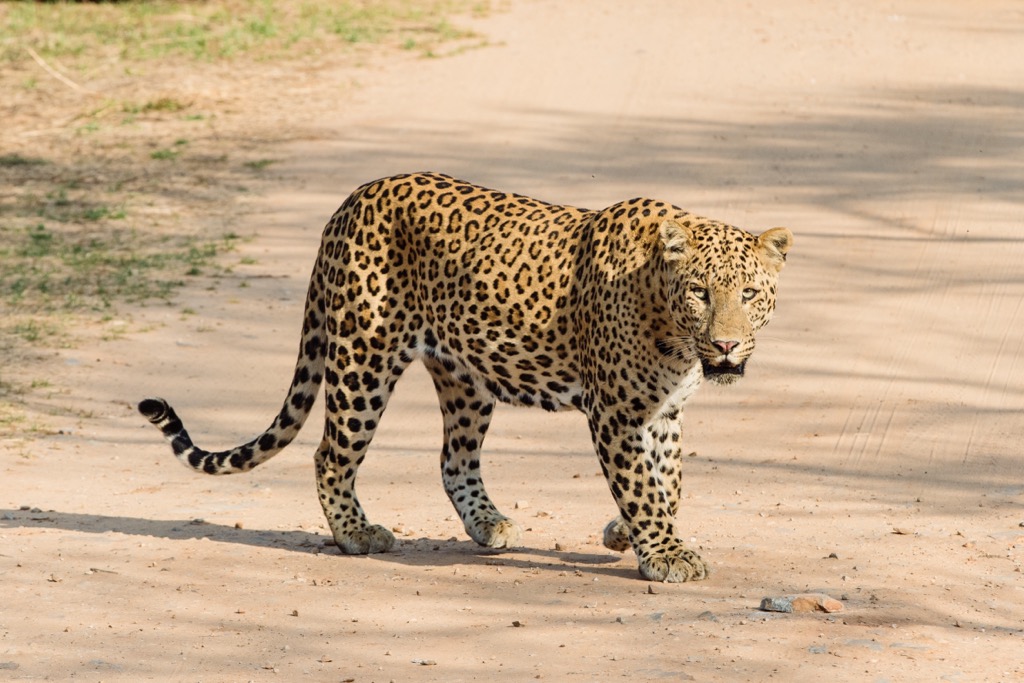
Fauna: The state’s unique mix of mountain forest, desert, and wetlands creates a viable habitat for a wide range of fauna. Rajasthan is most well-known for its big cats like the endangered apex predator, the Bengal Tiger, and the elusive Indian Leopard. The Thar Desert is also home to a lesser-known, wild, medium-sized cat called the caracal, with distinct, tapered ears. This species can survive without water for long periods and does most of its hunting by jumping in the air and swatting at birds.
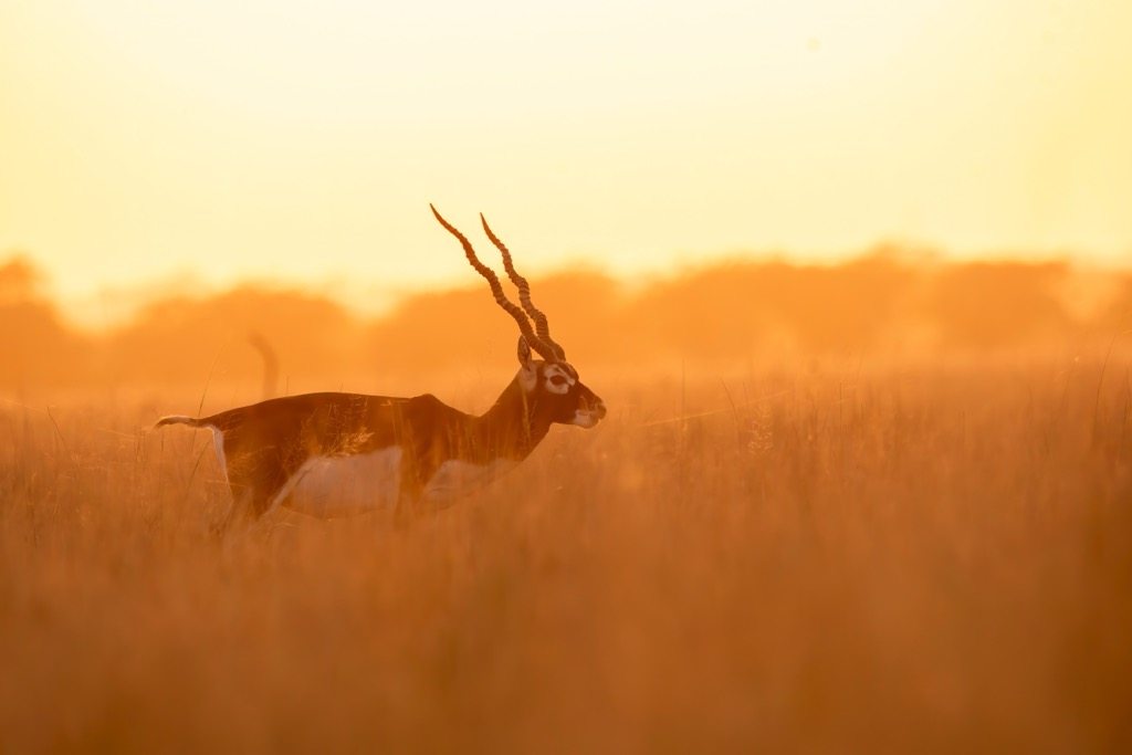
The elegant Blackbuck, another local resident, is regarded highly for its long, spiral horn with 3-4 tight twists and tremendous top speeds up to 80 kph (49 mph). These graceful beasts are revered in many parts of the country; poaching is not only prohibited but considered a religious offense.
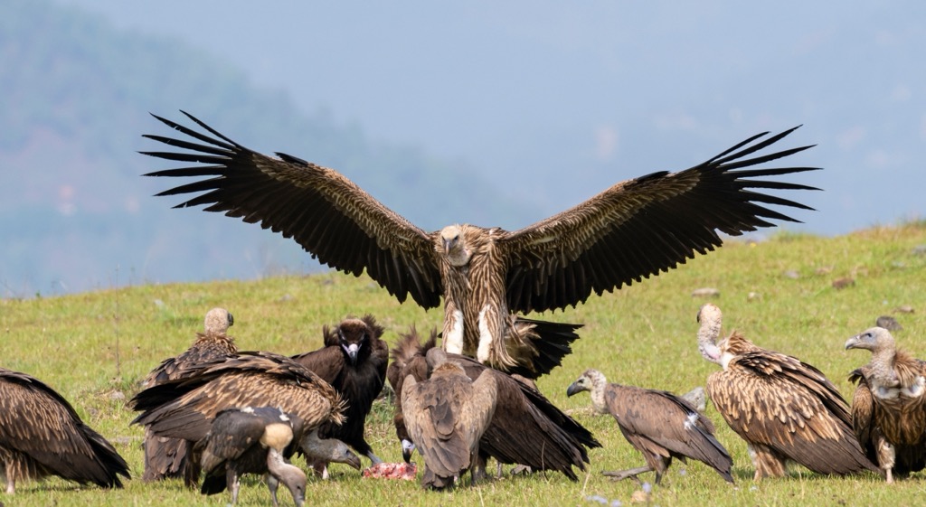
A long list of avians spend time in Rajasthan for at least part of the year, but probably the most imposing is the Himalayan Griffon, which migrates in the winter in search of more hospitable conditions. With its gargantuan 10-foot wingspan, this true old-world species of vulture is the second largest in the world, and is considered “near-threatened”.
Other avians who make their permanent home within the state include the Indian Spotted Eagle, the peacock (both the state and national bird), and the endangered Great Indian Bustard, which holds the long-standing record for the heaviest flying bird on the planet.
Throughout Rajasthan, conservation efforts are largely made possible by joint efforts between government initiatives, community efforts, and ecotourism. Together, they support the protection of the state’s most iconic species and ecosystems through national parks and wildlife sanctuaries.
National Parks:
Ranthambore National Park
Sariska National Park
Desert National Park
Keoladeo National Park
Mukundra Hills National Park
Wildlife Sanctuaries:
Mount Abu Wildlife Sanctuary
Jaisamand Wildlife Sanctuary
Kumbhalgarh Wildlife Sanctuary
Sita Mata Wildlife Sanctuary
Ramgarh Vishdhari Wildlife Sanctuary
Tal Chhapar Wildlife Sanctuary
Darrah Wildlife Sanctuary
Bassi Wildlife Sanctuary
Phulwari ki Nal Wildlife Sanctuary
Shergarh Wildlife Sanctuary
Jorbeed Wildlife Sanctuary
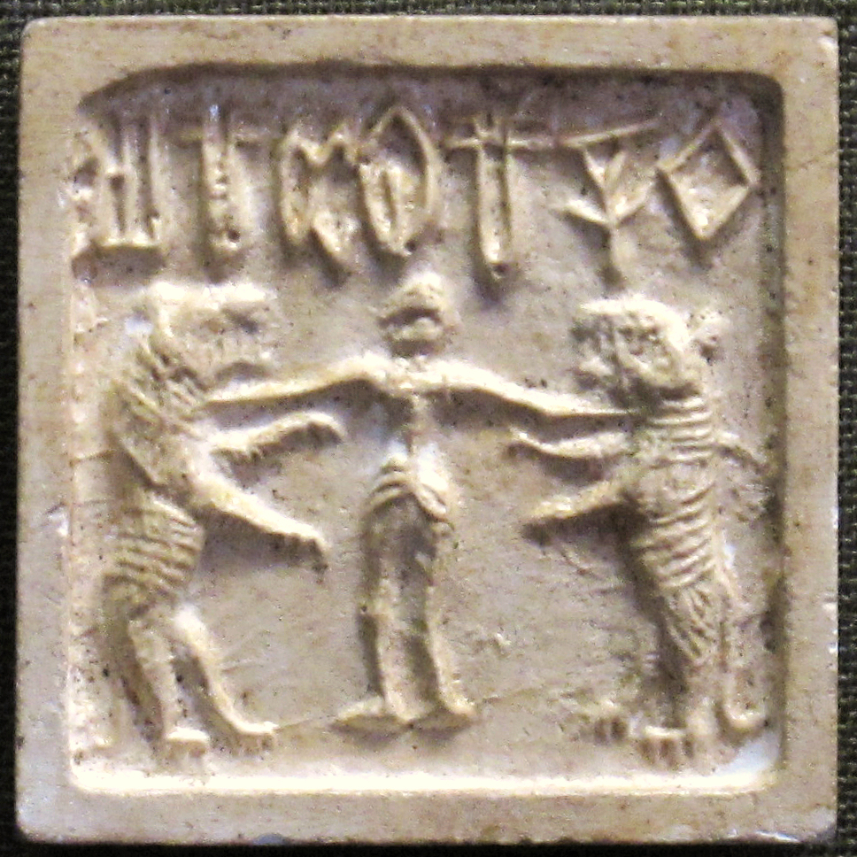
Archaeological evidence of prehistoric human settlement around the Aravalli Hills, Bhimbetka, Tilwara, Bairat, and Bagor, in what is now Rajasthan, dates as far back as the Stone Age. This includes tools and cave paintings that suggest these early inhabitants were part of hunter-gatherer communities. It is generally accepted that the people of ancient Rajasthan during the Bronze Age, between c. 2600-1900 BCE, were part of the Indus Valley Civilization, one of the world’s earliest urban cultures, which thrived in northwestern South Asia during this time.
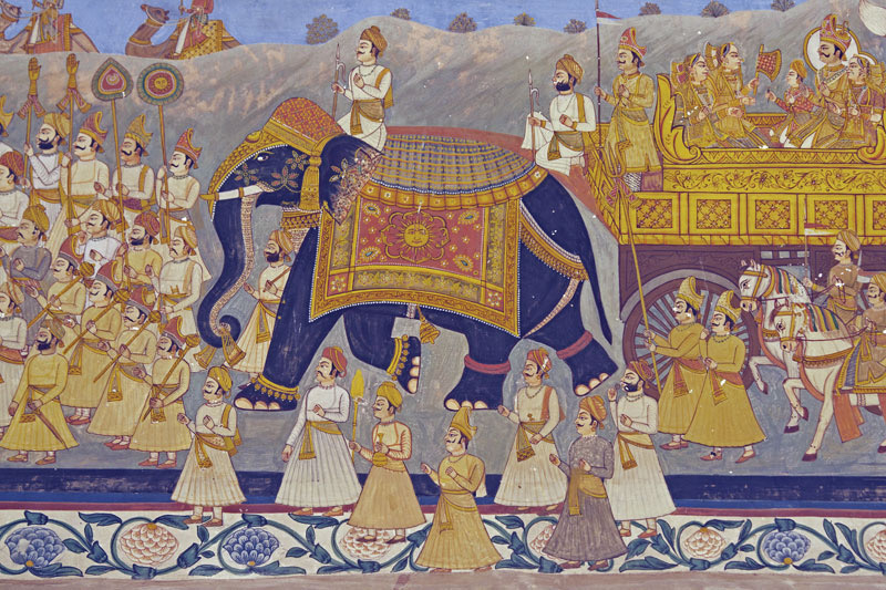
Between c.1500-500 BCE, Rajasthan was inhabited by Indo-Aryan tribes, including the Matsya, Surasena, Sivi, Malava, and Brahmanical. During this time, Buddhist traditions began to influence the region. The Rajput Kingdom came to power around 500 CE during the early medieval period with 4 ruling clans: The Chauhans (Ajmer and Delhi), Solankis (Patan and Mount Abu), Pratiharas (Kannauj, Jodhpur), and Guhilots (Sisodias) of Mewar (Udaipur).
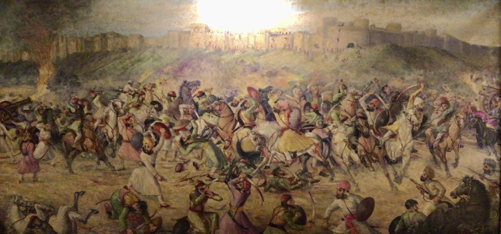
These Rajput dynasties built massive forts that could withstand invaders at the Battle of Rajasthan (738 CE), putting an early stop to Muslim expansion in the region. These clashes would continue between Rajput and Muslim raiders in the centuries that followed.
During the 12th to 16th centuries, Rajasthan would defend its territory against Turkish and Afghan rulers. The earliest influence from the British East India Company began in the 18th century as princely states were created under British rule, while retaining internal autonomy, at least temporarily. Starting in 1947, the various princely states merged to form the modern state of Rajasthan, which was officially completed in 1956.
No hiking trip to Rajasthan would be complete without a trek to the highest point in the state. That said, this is anything but a traditional hike or trek. “Guru’s Peak” is located near Mount Abu in the Sirohi district of Rajasthan. Most people wishing to visit the summit either drive or take a cab to the parking lot at the highest point on the road.
From here, it’s about 1.5 km (.9 mi) of easy to moderate uphill travel on well-paved steps to the summit. It takes most people about 30-45 minutes at a casual pace. Keep in mind, there are shops and eateries selling snacks, tea, and souvenirs along the way to the holy site at the highest point. Note that part of the Guru Shikhar is controlled by the Indian Air Force and restricted to the public.
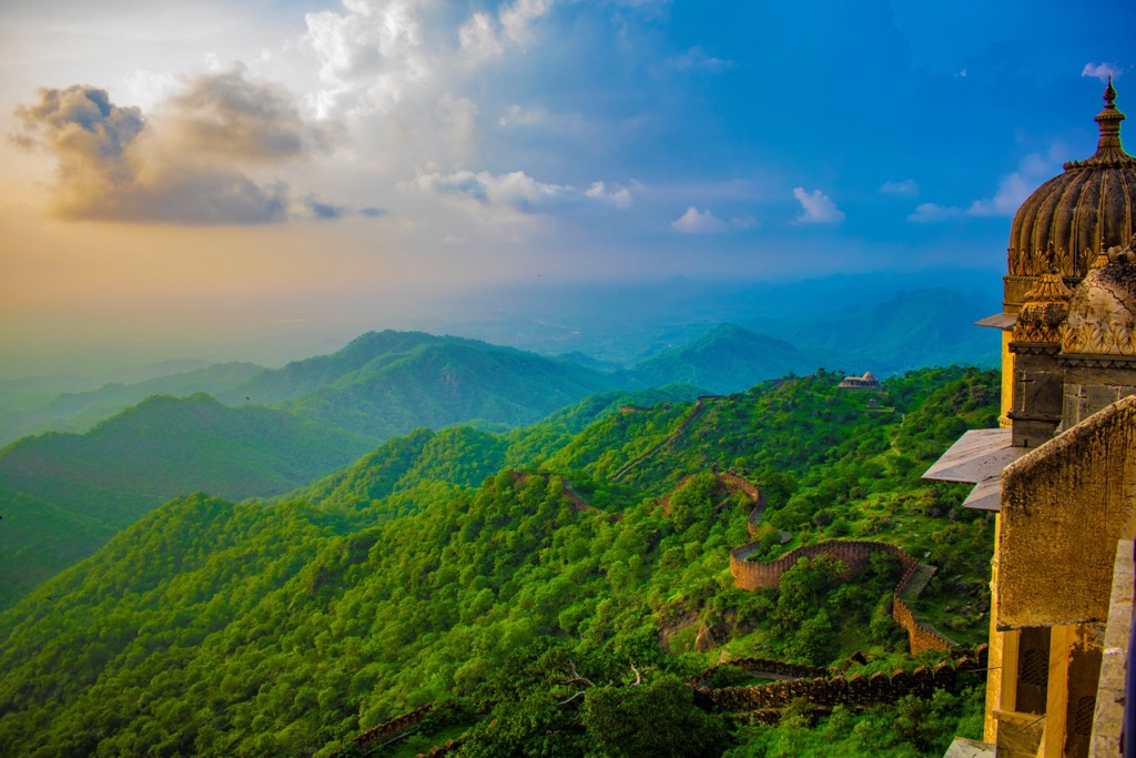
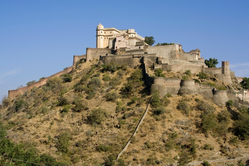
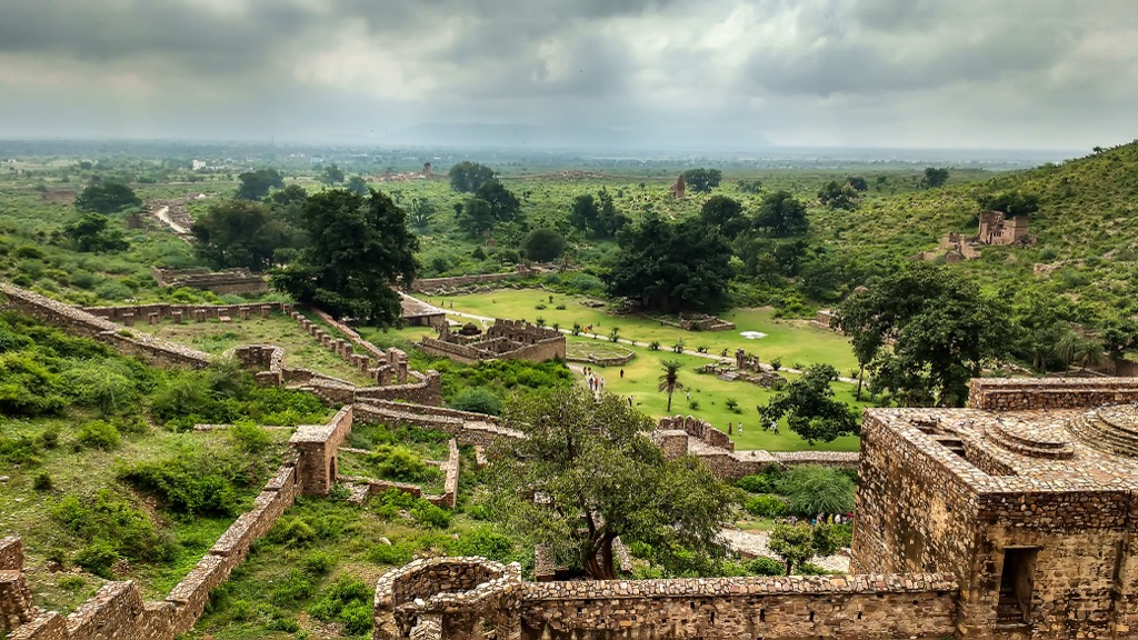
Encompassing more than 600 sq km (373 sq mi) across the Aravalli Hills, the Kumbhalgarh Fort, built in the 15th century, is known as the Great Wall of India. It is among India's most historically significant sites, serving as a refuge for the rulers of Mewar during times of war.
The second longest wall in the world (behind the Great Wall of China) at 36 km (22 mi), this UNESCO World Heritage Site is home to 360 ancient temples. It is one of the world's largest and most fortified structures, with frontal walls that are 4.5 m (15 ft) thick, complemented by seven gateways wide enough for 8 horses to pass through.
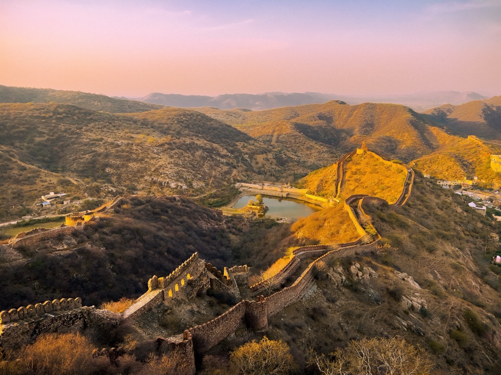
Surrounding the fort, among the rugged terrain and dense forests, is the Kumbhalgarh Wildlife Sanctuary, which provides a safe habitat for various animals like wild hogs, sloth bears, antelopes, blue bulls, reptiles, and exotic bird species.
On a clear day, from the palace top, known as Badal Mahal, the “Palace of Clouds”, one can see deep into the Aravalli Range as well as the dunes of the Thar Desert. As one would expect from such a rambling location, there is a wide range of nature trails, hikes, treks, and safaris that range from casual, self-guided strolls within the fort to challenging climbs deep into the Aravalli Hills and surrounding villages, where potentially dangerous wildlife roams free, and a guide is mandatory.
It is recommended that you touch base with the resort where you are staying or with the Tourist Office to help select a reputable local guiding service to advise you on the best options.
Embarking from the Bundi district, this short, lesser-known 3 km (1.8 mi) trek takes hikers through rocky terrain and forests before revealing a hidden 60-meter-high waterfall. It’s best to go during the monsoon for the most striking views. A natural pool at the base is perfect for lunch or dipping your feet, although swimming is not recommended.
For a true wilderness experience through the raw natural beauty of Rajasthan, this 10-12 km (6 - 7 miles) hike is hard to beat. A full-day hike along dense jungle paths, this adventure trek takes travelers through ancient temple ruins, including the Neelkanth Mahadev Temple, and ultimately into the Sariska Tiger Reserve, where you may catch a glimpse of Bengal tigers, leopards, wild boar, and langurs. It should go without saying that this trek is guided only for your own safety.
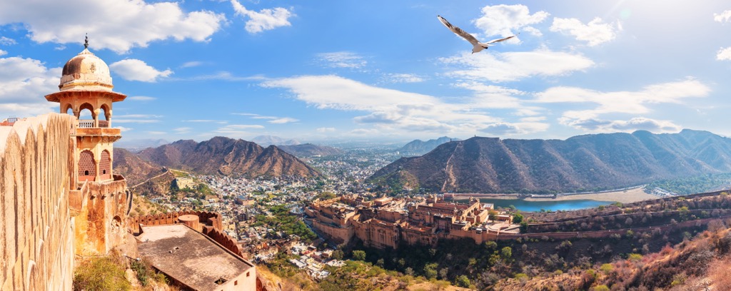
Located in the eastern part of the state, not far from the Aravalli Hills, is Jaipur, the largest city and capital of Rajasthan. Known as the “Pink City” for the historic, pink-colored buildings of the old town, it is not only a population center, home to more than 3 million people, but also an economic center with jewelry, marble, sandstone, and tourism as its primary drivers.
The bustling city was founded in 1727 and is one of the first planned cities in India. Its architecture is heavily influenced by the 17th-century Renaissance, with its wide streets and markets. It is a popular destination and part of the Golden Triangle, a tourist circuit that includes Delhi and Agra. Jaipur is also known for vibrant festivals like the Jaipur Literature Festival, and interesting markets like the Johari Bazaar and Bapu Bazaar. The official language is Hindi, but English is also considered an official language.
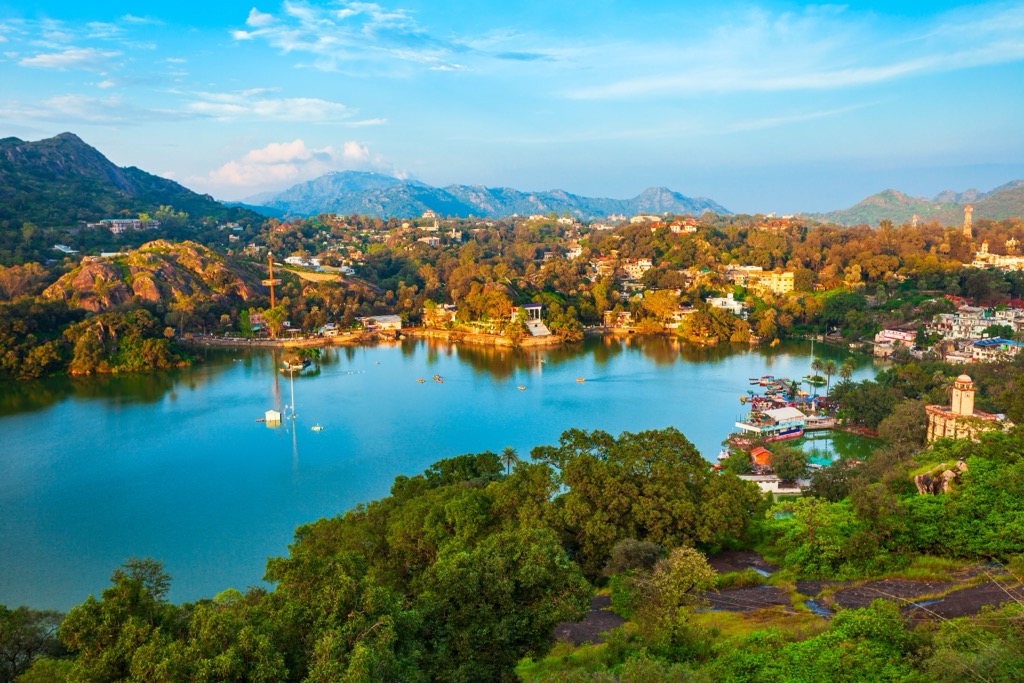
Located in the southernmost reaches of Rajasthan, close to the Gujarat border, Udaipur is known for its seven lakes that surround the city. “The City of Lakes,” as it is known, is located on the south slope of the Aravalli Hills and consists of mostly elevated plateaus and fertile plains. The economy is mainly based on tourism, with 1.4 million visitors a year, as well as agriculture and mining. One of the biggest attractions is the City Palace, which dates back to 1559.
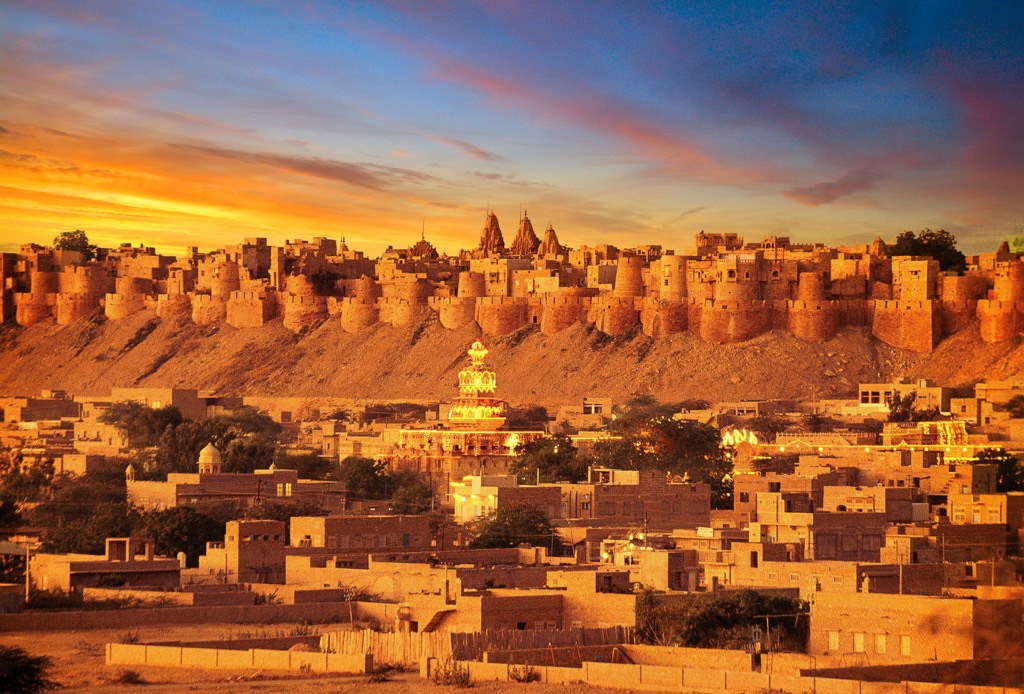
Smack dab in the heart of the Thar Desert, near the Pakistani border, is the desert fortress of Jaisalmer. Known as India’s “Golden City” for its yellow sandstone architecture, it was first made famous as a strategic trading center along the camel routes. The city is punctuated by the legendary Fort Jaisalmer, the site of many important battles over the centuries.
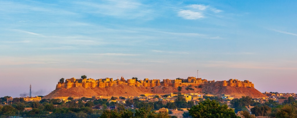
Jaisalmer is what is known as a living fort, with hotels, stores, and homes inside the walls. In fact, about 25% of the population still lives within the confines of the fort to this day.
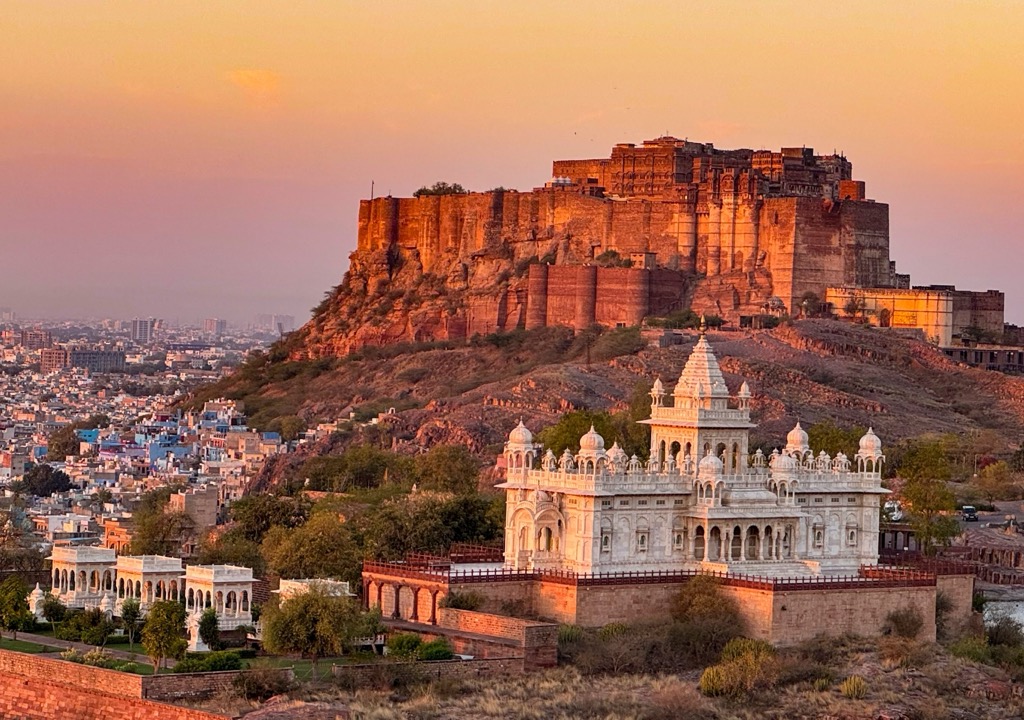
The second biggest city in Rajasthan, Jodhpur, is located on the edge of the Thar Desert and has many nicknames, including the Blue City, Sun City, and the Gateway to Thar. It is home to Mehrangarh Fort, the largest historic fort in the state (of which there are many), which sits strikingly on a hilltop above the city with commanding views in all directions.


.jpg)