
Scan the QR code and open PeakVisor on your phone
Just past the Himalaya, into the plains of the Ganges River and the ridges of the Vindhya Range, is the Indian state of Uttar Pradesh. The most populous state in India and one of the most urbanized, the state nonetheless holds endless gems of natural beauty, best preserved in its many sanctuaries designed to protect its diverse and unique local ecosystems.
Though more known for its grasslands and forests and iconic Indian structures, such as the Taj Mahal, Uttar Pradesh nonetheless contains 282 named mountains. The highest of these peaks is Amsot, at around 943m/3,093ft above sea level with 341m/1,119ft of prominence, and the most prominent is Kotadei Hill, with a prominence of 361m/1,184ft and a height of 605m/1,985ft.
The state of Uttar Pradesh rests in the northern portion of India, bordered to the north by Nepal and Uttarakhand, to the east by Bihar, to the south by Madhya Pradesh, to the west by Rajasthan, and to the northwest by Himachal Pradesh and the union territory of Delhi. The peculiarly carved borders of Uttar Pradesh also reach the states of Jharkhand and Chhattisgarh.
It is the fourth-largest Indian state by area, containing around 240,928 km2/93,023mi2 of land, but the most populous, with almost 200,000,000 people within its borders. That population lives between 18 divisions and 75 districts, with its capital located in the division, district, and city of Lucknow.
Uttar Pradesh boasts the most metropolitan cities, with almost 12% of India’s urban population, of any state in India, with 15 of these metropolitan areas having over half a million people. Nonetheless, the state still teems with an abundance of natural beauty, biodiversity, and stunning landscapes.
Though the political northern boundaries are marked by Nepal, the natural northern boundary are the Himalaya mountains, where the Bhabar region gives way to the vast and fertile Gangetic Plain region that constitutes much of northern Uttar Pradesh. The Gangetic Plain, in turn, contains part of the Terai-Duar savanna and grasslands.
The Vindhya Range, meanwhile, with its mountain ridges, highlands, plateaus, and hills, rests in the south. A small part of the Shivalik range just creeps into Uttar Pradesh, which contains the highest point of Amsot.
The most notable feature of Uttar Pradesh, however, might be its rivers, with more than 30 spread throughout the land, resulting in rich and fertile valleys and thus intensive cultivation, as well as forests webbed by river streams.
Climate-wise, Uttar Pradesh, typically humid and subtropical, experiences four seasons, including a monsoon season between June and September. The Gangetic plain ranges between a semiarid to sub-humid climate, while the Vindhya Range and plateaus are more subtropical.
Temperatures can vary rather extremely during the summer, and precipitation levels vary greatly depending on the part of the state, although both floods and droughts occur on occasion.
The Vindhya Range of southern Uttar Pradesh comprises a complex of mountain ridges, plateaus, highlands, and hill ranges, with ambiguously defined limits. It is not quite one single range of landforms, not lying upon an anticlinal or synclinal ridge, but is rather a disjointed conglomerate of all the aforementioned landforms.
The range consists largely of sedimentary successions, successions being chronologically-aligned strata of rock, and is known as one of the biggest and thickest examples of such a succession in the world. The Vindhya basin is home to some of the earliest known multicellular eukaryotic fossils, potentially as old as 1.7 billion years, alongside evidence of shelled creatures from the Cambrian explosion.
There is also the Bhabar, a sloped alluvial zone made of coarser material that stands between the Himalaya and the plains, especially the Terai plains. The Terai lowland region is structured mainly by alluvium and alluvial deposits of sand, clay, silt, and gravels of varying ages. New alluvium is replenished by the Himalaya streams that rush down toward the Terai; larger Himalayan rivers stretch across the Terai bordered by massive alluvial fans.
As for the soil in the Terai, it is, of course, alluvial, and of fine to medium texture, but decreases in forest cover and increasing cultivation have resulted in more permeable soil and a sinking water table. In certain parts, however, made of layers of clay and fine sediments, the groundwater rises instead and removes heavy sedimentation, thus resulting in more flooding during monsoon season.
Forests make up almost 7% of Uttar Pradesh’s area, having been affected by deforestation and urbanization. However, a great diversity of flora and fauna still exist and thrive, from the aforementioned forests to the savanna and grasslands to the riverbanks of the Gangetic plain.
All throughout the country, tropical and dry deciduous forests can be found, where shrubs and grasses thrive due to great amounts of sunlight. There are also tropical thorny forests diffuse throughout the state, heavily populated by thorny trees such as babool. Temperate forests rest in the more mountainous regions of Uttar Pradesh, home to many tree species and mammals of all sizes.
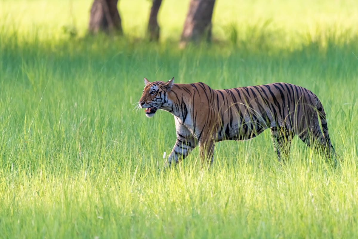
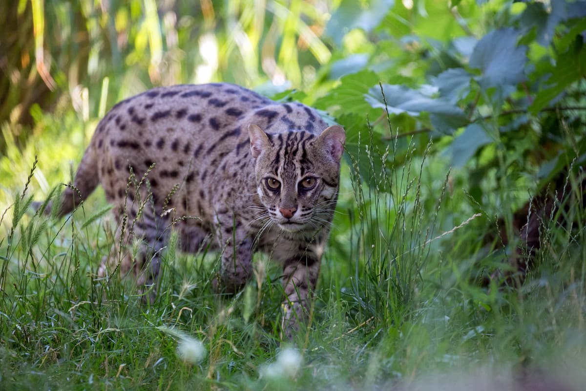
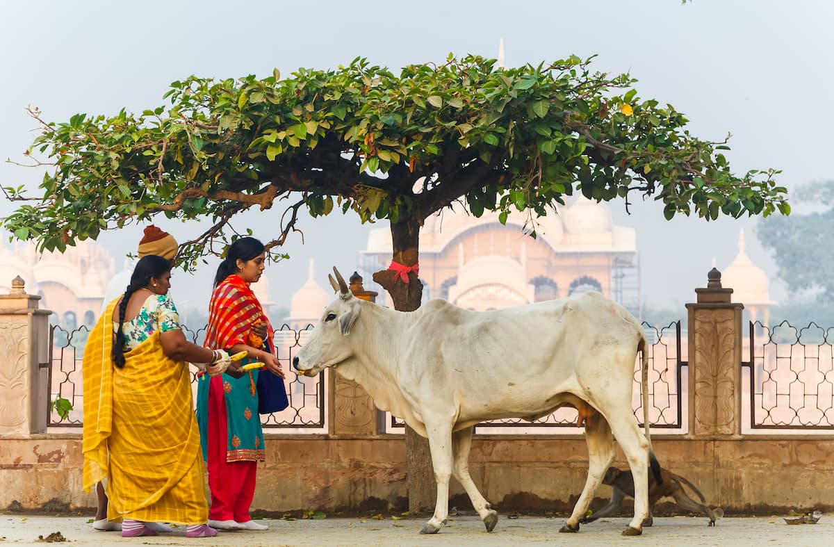
Cattle are largely found in the Terai-Duar savanna and grasslands, marked by grasses such as baruwa and kans grass and trees such as the sal, as well as riverside tropical deciduous forests. Animals such as the endangered Indian rhinoceros, Bengal tiger, and Indian leopard are present among the Terai-Duar, albeit with varying degrees of rarity, as well as grazing animals, gharials and crocodiles, and abundant birds.
The Gangetic plain and namesake Ganges River house a diversity of reptiles, amphibians, fish, and crustaceans. Notable for their presence among the Ganges are the gharial and the endangered Ganges river dolphin. In the Vindhyas, trees like the aforementioned babool and animals like the Chinkara populate the region.
Some important trees indigenous to the area include the neem and the sacred fig, both of great significance to the people of Uttar Pradesh; the former for its historical use in traditional herbal medicine, and the latter for its religious importance to certain Hindus and Jains, for it is thought that Guatama Buddha achieved enlightenment under the sacred fig.
Lastly, there is a true wealth of bird species found throughout Uttar Pradesh, including doves, peafowls, kingfishers, parrots, quails, blue jays, and endless more. Numerous bird sanctuaries have been established to support the preservation of these birds, including the Bakhira Sanctuary, Okhla Sanctuary, National Chambal Sanctuary, and others.
Evidence of human life from around 85,000 years ago has been found in Uttar Pradesh, implying the presence of Stone Age hunter-gatherers in the area. These patterns continued through the Paleolithic, into the Mesolithic where a hunter-gatherer settlement was established in the city of Pratapgarh around 10000 BC.
Long-term settlements with domesticated livestock and even early signs of agriculture can be found beginning around 6000 BC, developing throughout the next several thousand years as the Indus Valley Civilization and corresponding Harappa culture took hold, stretching into the western portion of the modern-day state. Then came the Vedic Period from around 1500 to 500 BC, followed by the Iron Age of the Indian subcontinent.
One of the first significant kingdoms to plant itself in Uttar Pradesh was the kingdom of Kosala, which had first emerged during the Vedic period, which had reigned until around the 5th century BC, when the Magadha kingdom began to absorb the land.
Beginning around 200 BC, the Indo-Gangetic Plain increased in prominence, as they were very convenient for invaders looking to cross the subcontinent. They came under rule of the Maurya, whose expansive reach across southern Asian was immense and unprecedented.
In the 3rd century AD was the reign of the likewise notable Gupta Empire over the lands of Uttar Pradesh, which has been referred to as the “Golden Age of India” by certain historians due to large advances in the sciences and arts. There is a theory that the Guptas, in fact, originated in Uttar Pradesh, but it is uncertain.
Then came the Gurjara-Pratihara dynasty, who conquered the city of Kannauj and Uttar Pradesh and turned the city into the center of their massive state, albeit with much conflict with the neighboring Pala and Rashtrakuta dynasties.
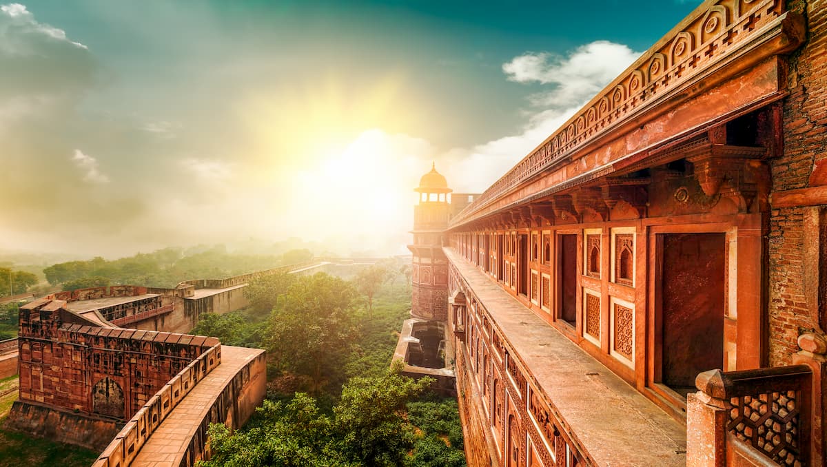
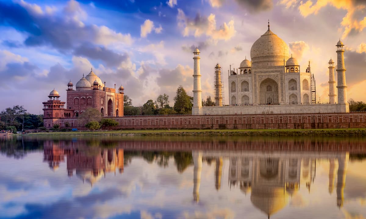
From around 1206 to 1526 AD, Uttar Pradesh, like much of northern India, was under the rule of the Delhi Sultanate, an Islamic Empire in contrast to the largely Hindu Empires the area had previously been ruled by. Eventually, Uttar Pradesh was taken into the Mughal Empire in the 16th century, under whose emperors grand Indo-Islamic structures such as the Taj Mahal were constructed.
As Mughal rule crumbled in the 1700s, the Maratha Empire took control. This ended with the arrival of the British East India Company in the 1800s, under whom the area fell to British suzerainty. This would become direct British rule, during which the capital of the United Provinces was Lucknow, a legacy that lasts today. The United Provinces became the state of Uttar Pradesh with the independence of India as a republic in 1950.
Uttar Pradesh is home to a number of wildlife sanctuaries and a national park that is critical in preserving the Terai ecosystem, in which visitors can explore the beauty of the Gangetic Plain. It is important to note, however, that some locations, such as the Dudhwa National Park, have stringent safety regulations and prohibit walking entirely, as visitors may only traverse in a vehicle. Permits may be required in advance.
The Bakhira Bird Sanctuary is another tourist destination in Uttar Pradesh, home of a lake where a wealth of birds come for migration during the winter. The Okhla Bird Sanctuary is also home to many unique migratory and year-round birds, making a prime location for birdwatchers.
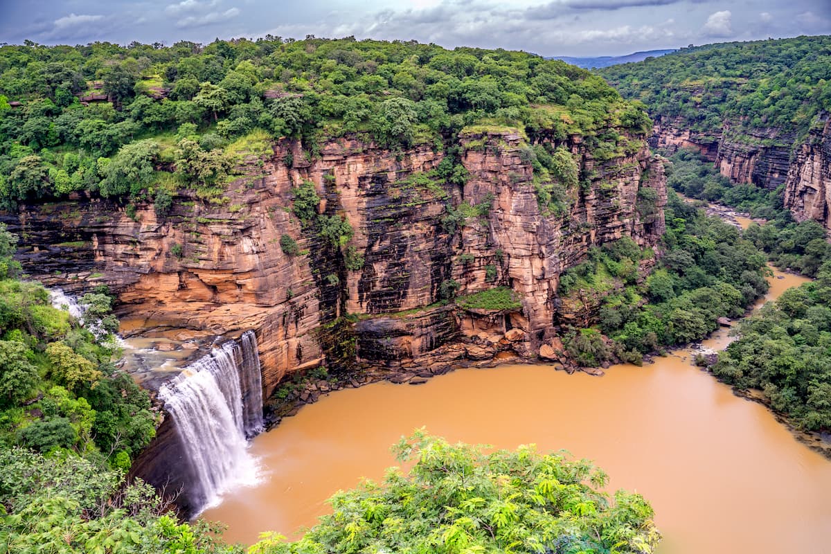
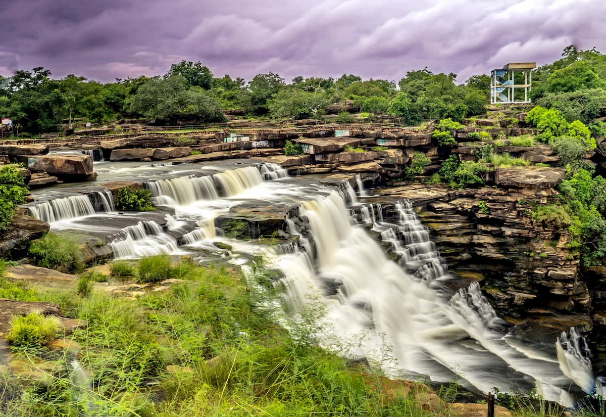
For stunning views of waterfalls and lush forests, there is the Chandra Prabha Wildlife Sanctuary. Hiking through the hilly terrain leads through said forests and waterfalls, as well as leading to caves where prehistoric cave paintings can be found.
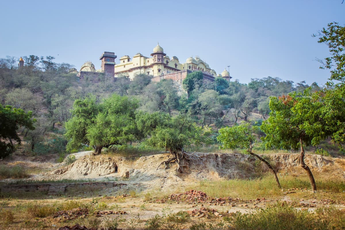
There are almost thirty other wildlife sanctuaries scattered throughout the state, with varying levels of size and maintenance. Likewise, there are a smattering of trekking options, both within the state and connected externally to other states and territories.
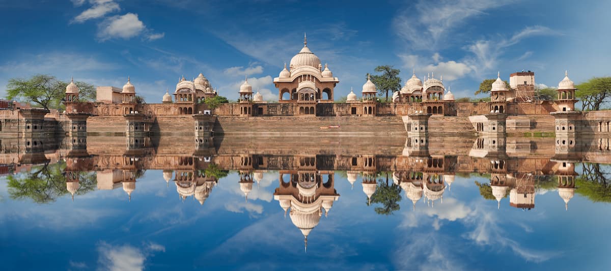
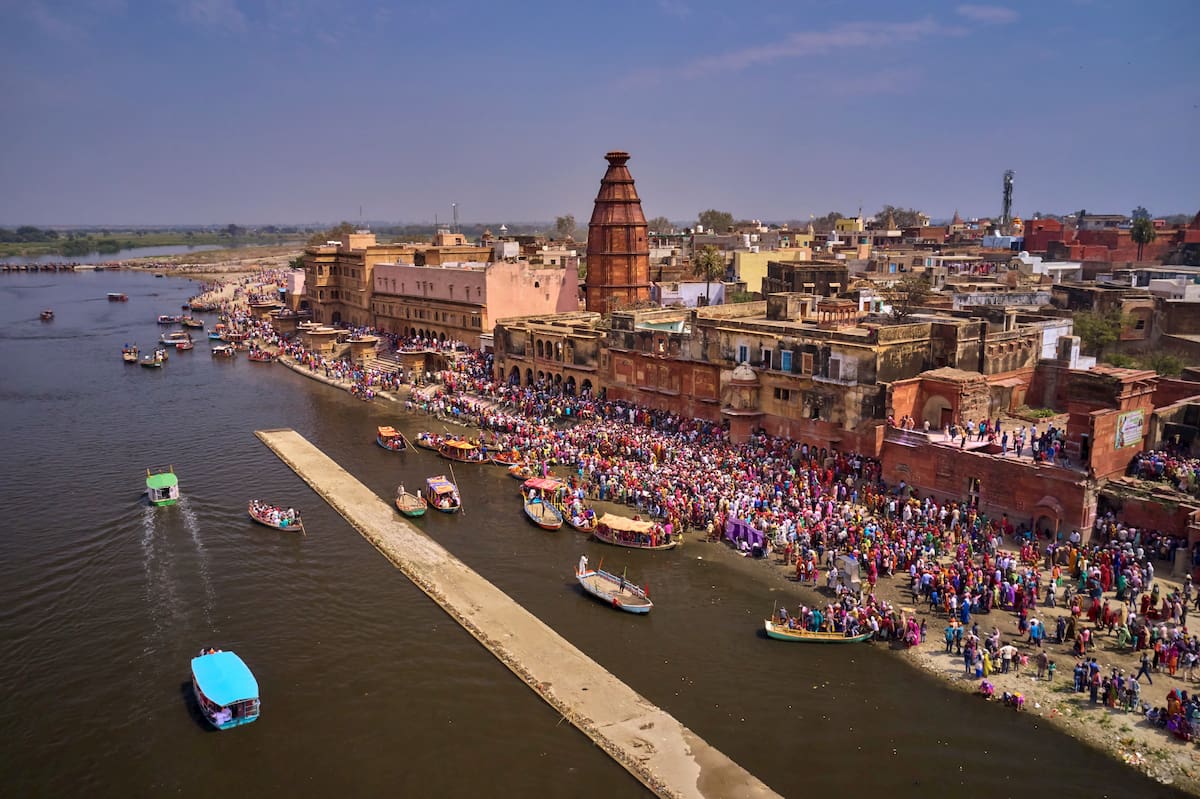
Uttar Pradesh is also home to many religious pilgrimage treks, especially within the Braj Region. which includes parts of neighboring states as well. Braj holds many pilgrimage circuits, some that are long and extensive, some shorter and designed for visitors to reach major sites like the Govardhan Hill in Mathura, with about 21km/13mi of trails leading to it.
Vrindavan, Gokul, Radha Kund, and the town of Mathura are other major locations around the area. Vrindavan is of particular significance to the followers of Vaishnavism, with an abundance of temples in its boundaries that have become important pilgrimage sites.
The longer, traditional trails lead to places such as Nandgaon, atop the Nandisvara Hill, or Barsana, both of which are towns of great historical and religious significance to Hinduism due to their connections to Hindu gods.
Buddhist pilgrimages are notable as well, such as the pilgrimage to the town of Kushinagar, or the historical city of Sarnath, which has seen around a million visitors per year in much of the 2010s. Muslim pilgrims have been drawn to towns such as Dewa Sharif or Fatehpur Sikri, which have particular significance to Sufis, alongside Jama Masjid Agra and others.
These religious centers, alongside many more of their kind, and the natural centers and sanctuaries mentioned earlier, provide many opportunities for exploring the land and culture of Uttar Pradesh on foot.
As a heavily urbanized state with a great population of large cities, there are many options to consider, but the cities of Lucknow and Agra stand out as some of the most politically and culturally significant.
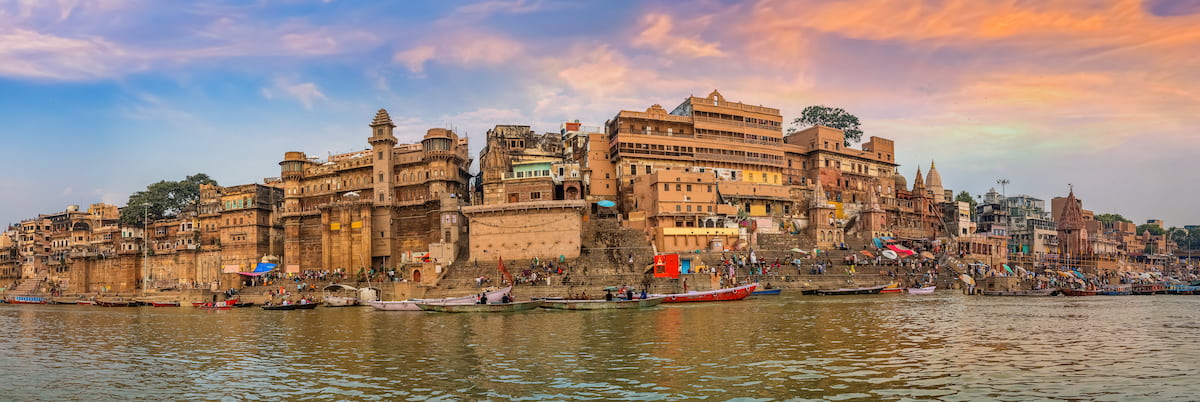
As the capital city and the largest by population, with around 3,500,000 people, Lucknow is a significant Northern Indian hub that has long been a center of culture, art, and commerce. It is renowned for its diverse and historic architecture, with major Islamic structures as well as secular gardens, pavilions, and palaces, mixing styles from the English Baroque to the Gothic to the Indo-Saracenic Revival and more.
Lucknow is greatly multicultural with all sorts of religious and cultural festivals celebrated among its streets. The Lucknow Mahotsav and Lucknow Literature Festival are two of many annual celebrations that showcase the art and culture of Lucknow on a grand stage. Unique Nawabi cuisine, stunning traditional handicrafts such as chikankari, a thriving sports culture, and a variety of lush green parks also contribute to the city’s appeal and popularity.
For travelers, Lucknow provides inter-state buses, railways, air travel, and a recently-built metro system, allowing for movement in and around the city and connecting it to other major destinations in the area.
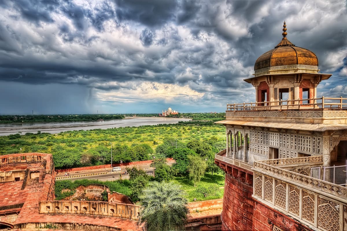
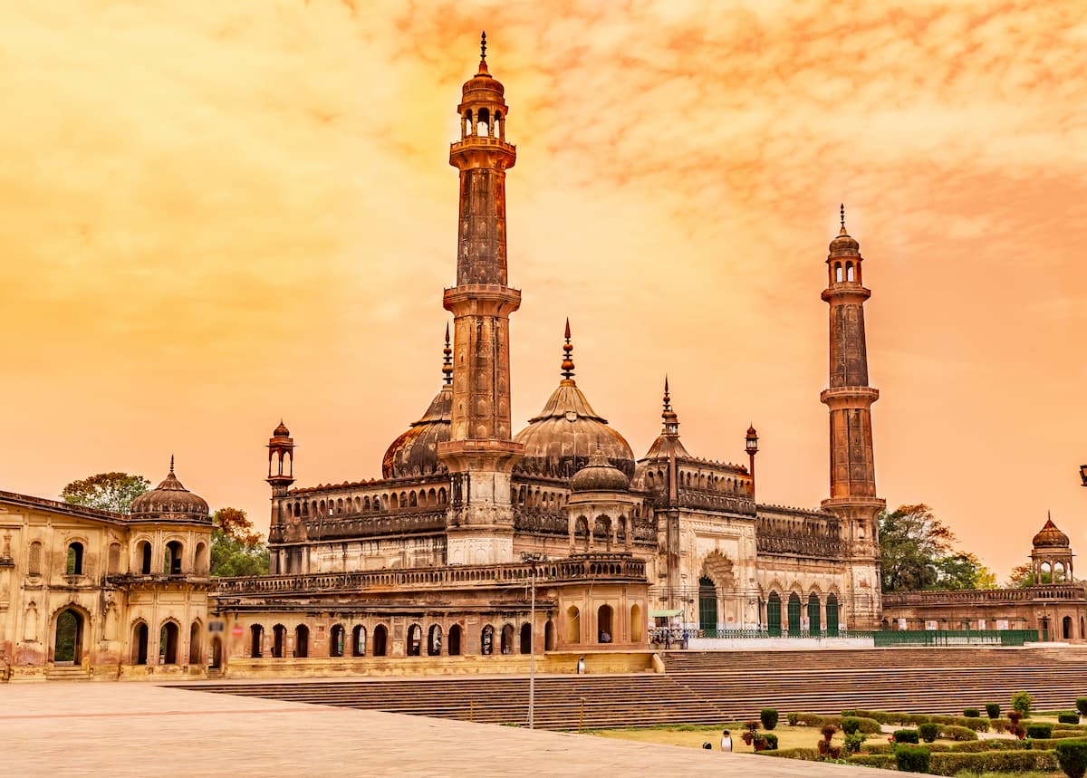
It is impossible to discuss Uttar Pradesh without a mention of the Taj Mahal and, in turn, the city of Agra in which it stands. A city of around 1,500,000 people in western Uttar Pradesh, Agra boasts several Mughal-era UNESCO World Heritage Sites, such as the Taj Mahal, Agra Fort, and Fatehpur Sikri, that have made it a massive tourist destination.
The architectural history of Agra is truly immense, from centuries-old mosques to Persian-influenced tombs to Mughal gardens and more, although it also contains stunning natural sites such as the Sur Sarovar Bird Sanctuary at nearby Keetham Lake.
Like Lucknow, festivals are an important component of the city, like the Taj Mahotsav cultural festival and craft fair, the Taj Literature Festival, or the Ram Barat. Agra also hosts bazaars where local handicrafts, snacks, clothing, etc. are sold.
Considering the fame of the Taj Mahal, the city is suited for tourism infrastructure, with abundant hotels and railways, including a recently constructed semi-high speed train that travels between Agra and New Delhi.


