
Scan the QR code and open PeakVisor on your phone
Bihar (pronounced Bee-har) is a landlocked state in northeast India. On the border to Nepal, in the depths of the Someshwar Hills, Someshwar Fort (880 m / 2887 ft) marks the state’s highest point. At an average elevation of 53 m (174 ft), Bihar isn’t a mountaineering destination. However, despite its low profile, the state encompasses a wide range of hills, lush tiger reserves, rich Sal forests, and a wealth of archeological treasures. Locals call Bihar the land of “vihara,” or monasteries, for its unparalleled density of religious sites. It is here that the Buddha reached enlightenment under the Bodhi tree, and where Hindus follow the footsteps of the great epic Ramayana.
Bihar borders Nepal to the north, recently-ceded Jharkhand to the south, Uttar Pradesh to the west, and West Bengal to the east. With a population of 120,000 million living on 94,163 km², Bihar surpasses all other states in population density—1,106 people/ km²—more than twice the Indian average.
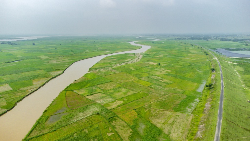
For the most part, Bihar’s territory comprises a vast plain at the confluence of various Gangetic tributaries. Glacier-fed Himalayan rivers, such as the Kosi and Gandak, cross unspoiled Terai land from the northern Shivalik Range. Interestingly, though it is the most densely populated state, Bihar is relatively undeveloped, with more designated rural populations than the nation’s average.
In south Bihar, the easternmost edge of the Vindhya Range (Kaimur and Rohtas) and the plateaus bordering Jharkhand feed various agricultural arteries like the Karamnasa, Son, and Punpun rivers.
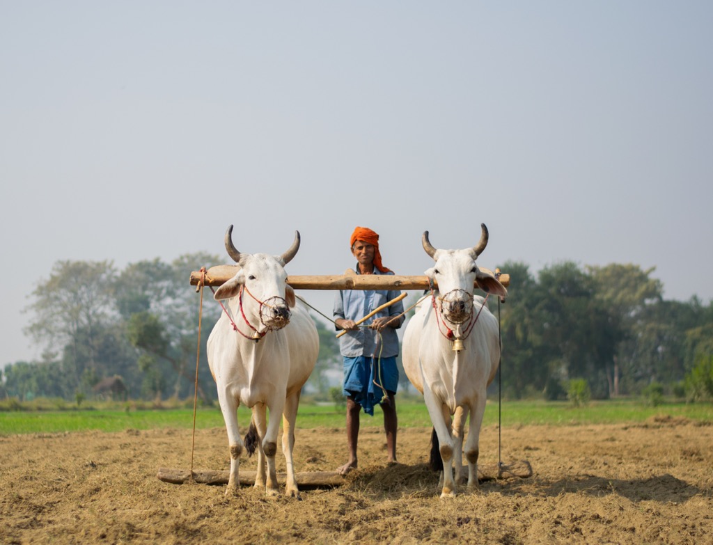
Bihar’s extensive rivershed benefits from flattened loam, which is regularly re-fertilized with rich silt from seasonal floods. Despite the agricultural benefits, this also exposes roughly 76% of the population in northern Bihar to major flooding risk. Bihar is also very deforested, with only 7% contiguous tree cover. For the most part, agricultural plains prevail. Mangos and north Indian rosewoods line extensive rice, wheat, and corn fields, taking advantage of the nutrient-rich Gangetic floodplain.
Bihar’s geology consists primarily of younger (Tertiary) rock formations in the north close to the Himalayas, contrasted by older Precambrian layers such as quartzite in the Vindhyan Plateau to the south. Thousands of years ago, the current Gangetic plains consisted of a deep trough, which erosion from the Himalayas gradually filled with fertile runoff.
Bihar is slightly influenced by the collision between the Indian and Eurasian Plates, which has produced the young Himalayan range. The state’s land slowly begins to rise as one moves north towards the Himalayas; however, the state’s highest peak, Someshwar Fort (880 m / 2887 ft), is but a foothill of the Himalayan foothills.
With over 200 million tons of gold reserves, abundant quartzite, and 95% of India’s pyrite (iron sulfide) deposits, Bihar is a promising mining center. The southeastern Jamui district is the center of gold mining, but also holds potential for aluminum extraction from existing bauxite deposits. Bhagalpur is known for its abundant hematite (iron oxide) reserves.
In its original state, Bihar's ecology was shaped by its fertile Gangetic plains, southern dry deciduous forests, and rich wetlands. Charismatic species include the endangered Gangetic river dolphin, migratory birds at Kanwar Lake, and Bengal tigers in Valmiki Tiger Reserve. However, recent millennia have witnessed an explosion of human settlement. Now, the state faces deforestation, habitat fragmentation, river pollution, and more frequent flooding, to name just a few.
Bihar experiences a mixture of seasonal, dry savanna climates and subtropical monsoon. Its temperature and humidity vary by district, but in general, Bihar forms a transitional region between drier Uttar Pradesh and more humid West Bengal. While the moist hills in West Champaran District bordering Nepal offer some relief from the summer heat, Bihar is no stranger to the flaring 40℃ heat waves that pass through the Indian plains in the early summer months, just before the monsoon kicks in.
From June to September, the heat transitions to a monsoon, where many fields flood, and the parched dry Sal forests regain their green vigor.
To avoid the monsoon season, aim to visit between September and April. The blue skies and manageable winter temperatures (4-10℃) make for easier travel plans, but ones that shouldn’t exclude chapstick and sunscreen. Unpaved roads quickly turn into dust pans, and the 25-degree latitude sun poses a challenge for the fair-skinned, even in deep winter.
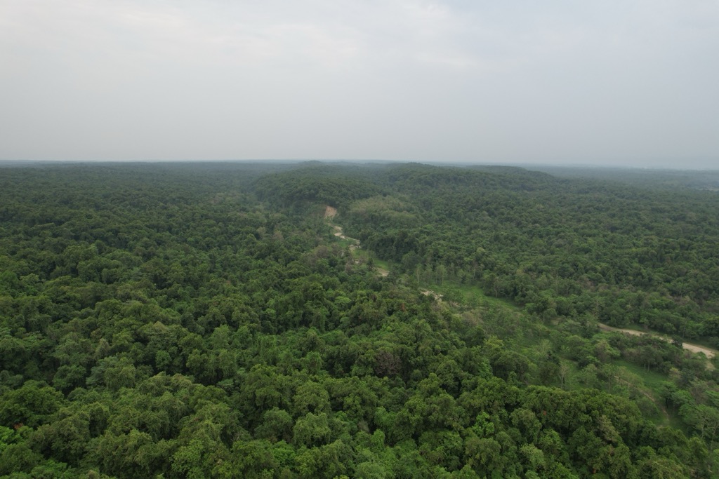
With its dense population and intensive agriculture, Bihar is not a paradise of virgin jungle. The 7% forest that does remain, however, contains high tree diversity and abundant opportunities to spot wildlife.
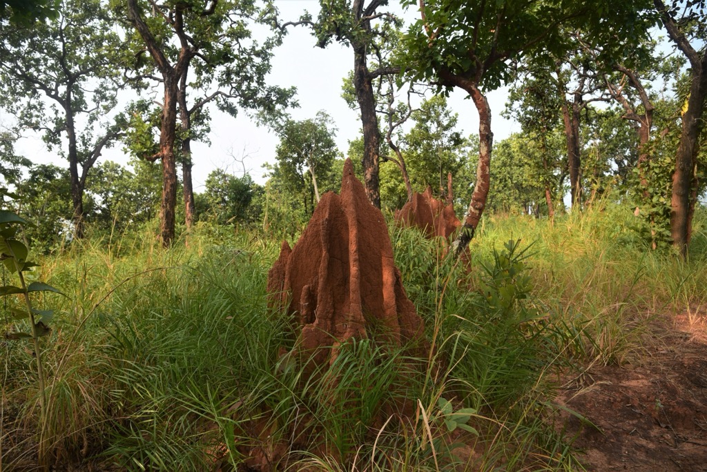
Forests in Bihar can be split into two main subtypes: dry and moist subtropical. Dry forests are the most common ecosystem in Bihar. These contain thorny, drought-hardy, and nut-producing species like acacia, rosewood, and the mahua butter tree. Species like the “flame of the forest,” with its brilliant red flowers, give color to the springtime.
In the north, the warm air of the Gangetic plains rises to condense on the Himalayan foothills, shrouding districts like West Champaran in ample cloud cover. The resulting moist forests boast a thicker, darker canopy composed primarily of Sal (Shorea robusta). Sal has Ayurvedic medicinal uses and a longstanding history in Indian ethno-botany. Also prevalent are mangos, evergreen Java plum, Indian beech, and cotton trees. Dashes of color announce the growth of ashokas (the trees of the love god Kama) and champa flowers.
Other ecosystems of note in the Himalayan Terai region include swampy canebrake forests, floodplains reminiscent of Italy’s Piedmont, and Terai grasslands covered in bamboo, high grass, and flood-resistant shrubs.
Outside forests, Biharis regularly cultivate sweet lychee, guava, or the insecticidal neem tree.
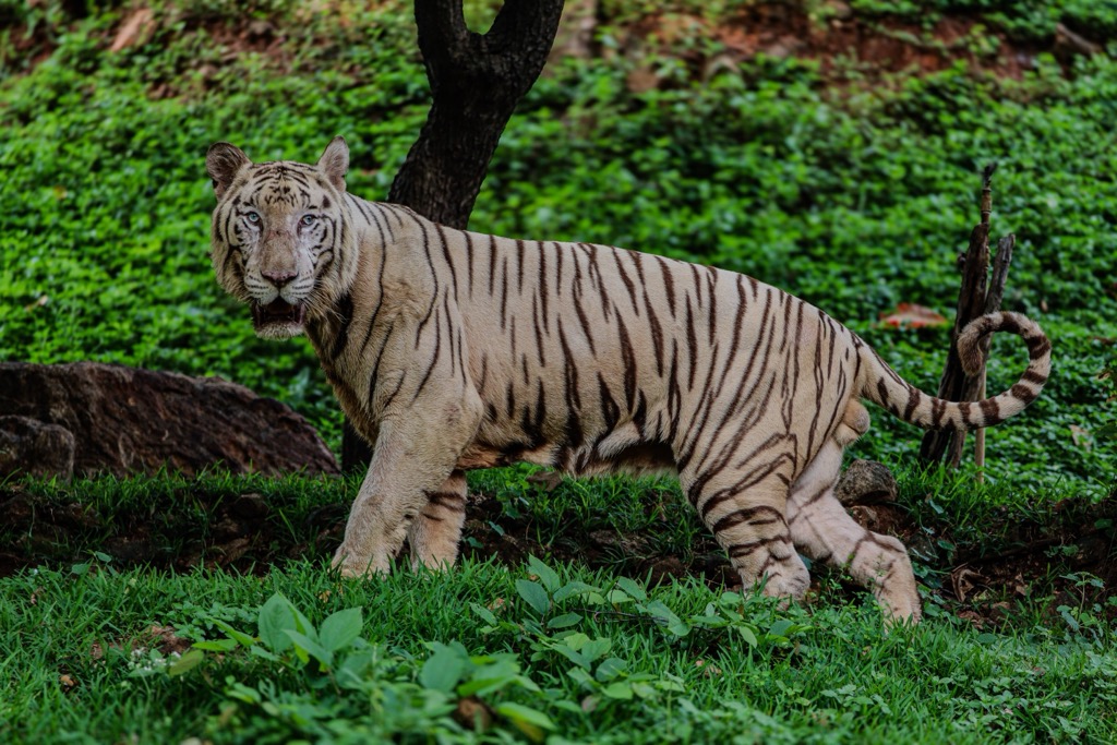
Despite the high population density, Bihar is home to Royal Bengal tigers, not to mention mammals like chitals, Indian leopards, Sambar deer, and antelopes. Bird watchers will enjoy the abundant drongos, white-tailed eagles, and hundreds of other bird species.
Bhagalpur, better known for its riverine cityscape, is home to one of the last habitats for the highly endangered greater adjutant bird (Leptoptilos dubius). Neighboring Indian Assam and Cambodia are the only other two remaining habitats. In addition to birds, the Gangetic floodplain is a critical riparian habitat for dolphins, crocodiles, and freshwater snakes.
Bihar's human history probably began 5,000 to 10,000 years ago. Archaeologists have discovered cave paintings displaying sophisticated hunting scenes in Munger, Kaimur, and other areas dating to the Mesolithic Age. Roughly in sync with the Indus River Valley civilization, the subsequent Bronze Age saw the beginning of settled agriculture in Bihar. However, the exact location of kingdoms like the mythical Kikata is still disputed.
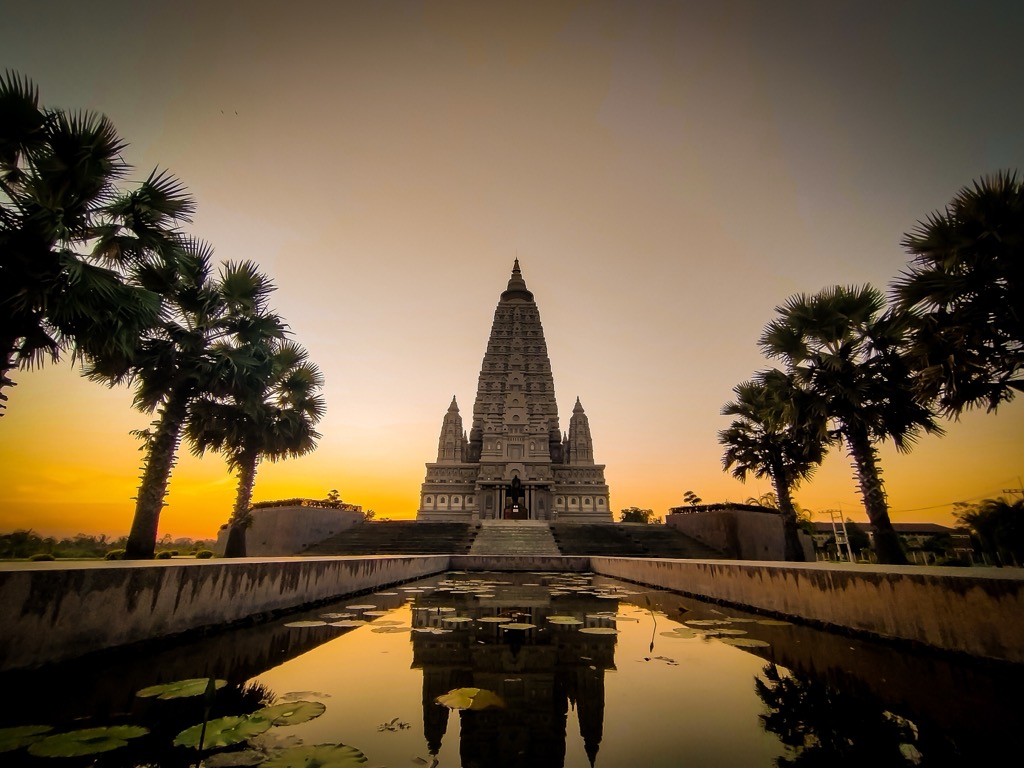
During the first millennium BCE, Bihar contributed to India's cultural heritage through the founding of Jainism and the publication of the Ramayana, the literary brainchild of epic poet Valmiki. During the Axial Age, Siddhartha Gautama introduced Buddhism to the region, which later emperor Ashoka famously supported through his erection of the UNESCO world heritage Mahabodhi Temple at Bodh Gaya.
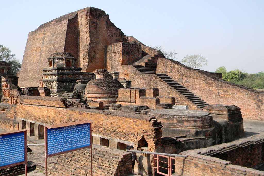
In 320 BCE, Chandragupta Maurya founded India’s great Mauryan Empire, with Patnapurli (modern-day Patna) as the center of what was then called Magadha. However, Bihar did not reach its cultural heights until the rise of the Guptas, where a decentralized tax system and the famous Nalanda academic center fostered the exploration of mathematics, astronomy, and ayurvedic medicine.
After around 1200 CE, Bihar alternated between various Afghan invaders and Mughal rulers. In the 17th and 18th centuries, the arrival of the East India Company brought plantation economies, later supplying the infamous opium trade.
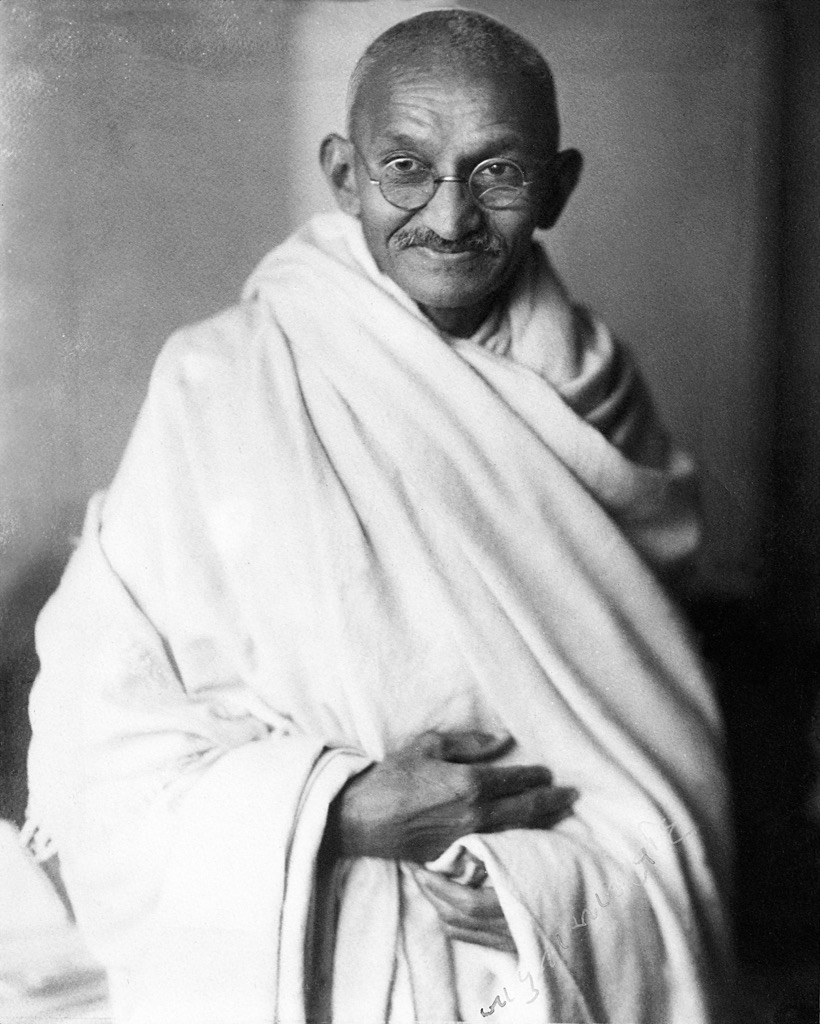
More recently, Bihar served as the breeding ground for the nationwide upheaval that freed colonial India from the hands of the British. In 1917, Gandhi began his resistance to the British in Bihar’s West Champaran district, in reaction to injustices on local indigo farms. India finally pried itself from the British embrace in 1947.
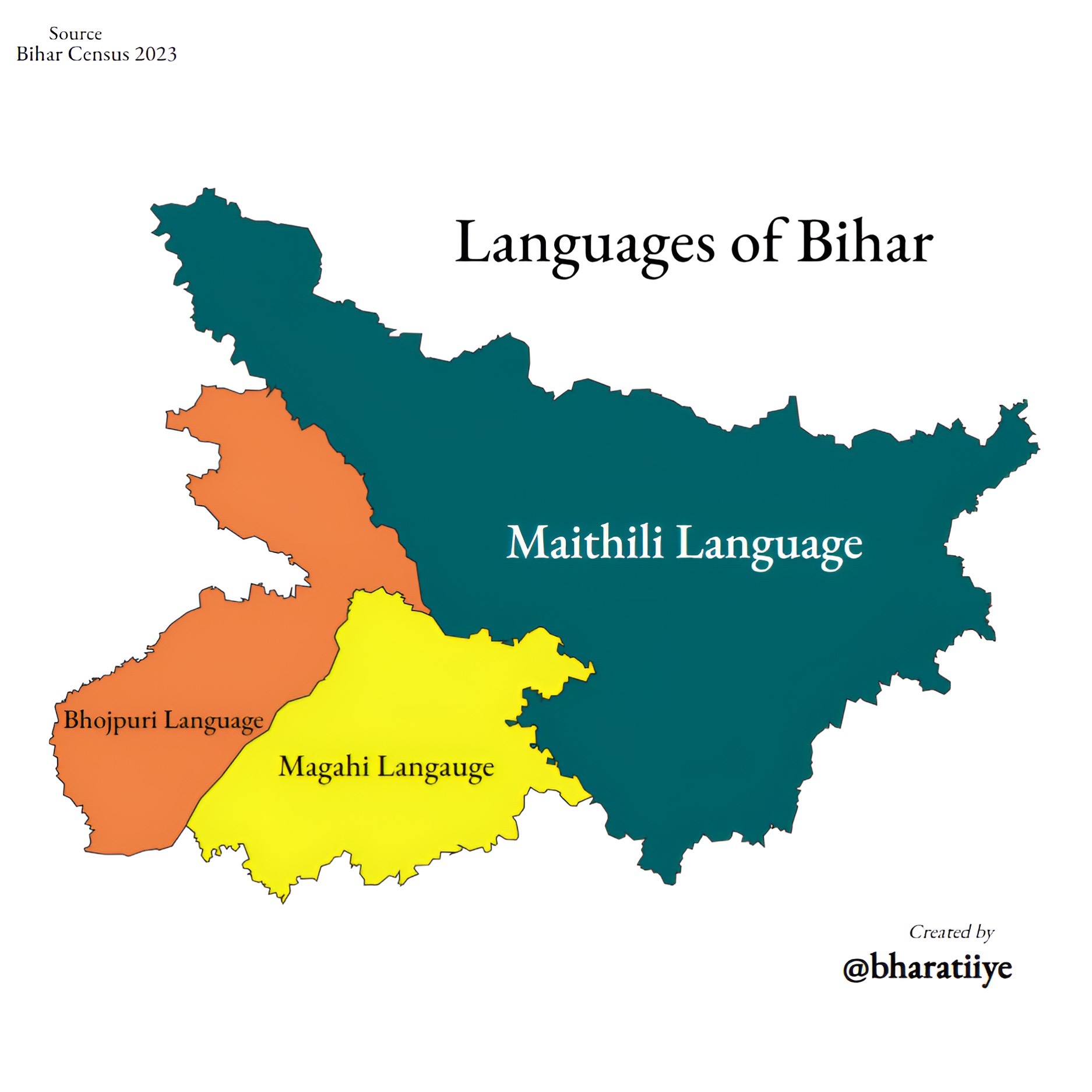
Bihar’s primary ethnolinguistic groups include the Bhojpuris, Maithils, and Magadhis, most of whom (83%) practice Hinduism. Modern-day Bihar is relatively stable, but tribal interests in the south aimed to separate Jharkhand, “land of forests”, from the rest of Bihar starting in the late 80’s. In 2000, through the Bihar Reorganisation Act, Jharkhand officially split.
Socioeconomically, Bihar remains a poster child of India’s rigid caste system, gender disparities, and multidimensional poverty. Roughly a third of its population belongs to the “other backward class.” Despite its agricultural productivity, some experts still regard Bihar as one of the least developed states in India.
Bihar contains only one of India’s 106 national parks: West Champaran’s Valmiki National Park. Nevertheless, Bihar is home to many sanctuaries and secondary conservation sites, such as Vikramshila Gangetic Dolphin Sanctuary and Kanwar Lake Bird Sanctuary. For those interested in hiking, the Kaimur and Bhimbandh Wildlife Sanctuaries are just two options outside the most popular Valmiki National Park.
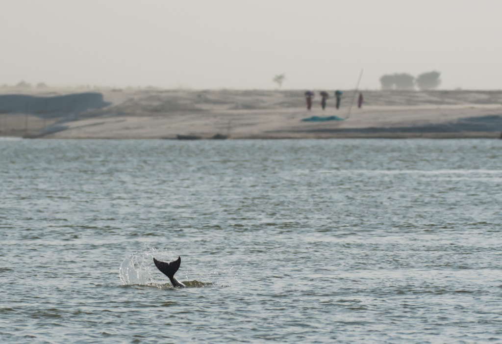
To experience India’s “national aquatic animal”—the endangered Gangetic dolphin—the southern banks of the Ganges by Bhagalpur are well worth a stop. The famous mammal roams a short 60 km² stretch in the Bhagalpur district, protected by a sanctuary founded in 1991. The area is best explored via the Bhagalpur Railway Station, in June and October. You might also encounter crocodiles, otters, and turtles if you're lucky.
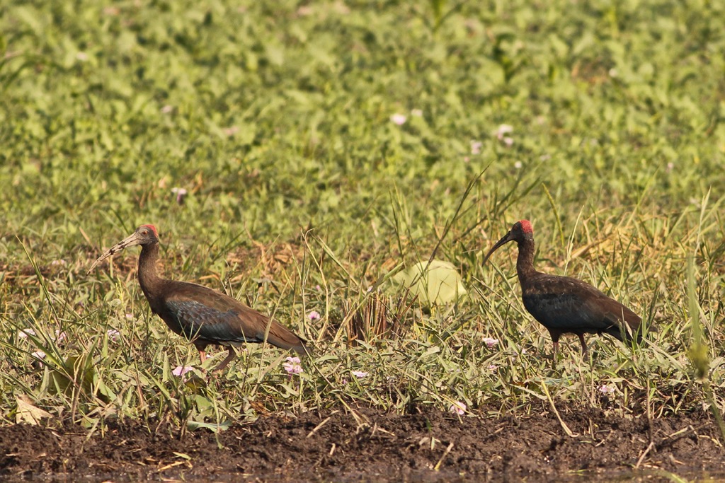
As Southeast Asia’s largest oxbow lake, Kanwar Lake is a migratory stop for 58 bird species seeking shelter from the Eurasian winter. In the scientific community, Kanwar is an official Ramsar site: a wetland crucial to maintaining the homeostasis of surrounding ecosystems.
Kanwar’s wealth of mammal, bird, and plant species remains relatively unknown internationally. Most international birdwatchers will have heard of Rajasthan’s Bharatpur Sanctuary, yet Kanwar Lake is more than twice as large. Despite Kanwar’s protected status, its proximity to surrounding population centers and intensive farming exposes its species to poaching and endocrine disruption from pesticide runoff.
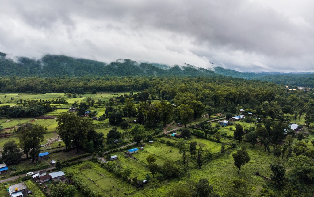
For hikers, Bihar can be divided into four regions of interest: the West Champaran district in the Shiwalik Range, the Kamuir Hills/Rohtas Plateau in the southwest, the dense forests near Munger, and various hills and waterfalls in the South towards the Gaya and Nawada districts.
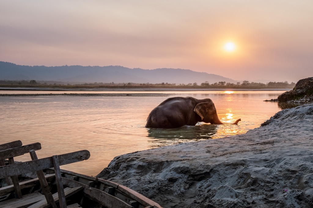
The Shivalik Range spans the pre-Himalayan belt from West to East in North India. Nestled in its eastern stretches is Valmiki Wildlife Sanctuary, the crown jewel of Bihar, protecting over 880 km² of tiger forest. Since 1990, officials have gone further and designated 336 km² as a National Park. Aptly named after the poet Valmiki, it is now the country's 4th most densely populated tiger reserve.
Along with its exciting striped wildcats, tree huggers will rejoice with the region’s exotic forest types like “Bhabar Dun Sal,” “Khair Sissoo,” or “Barringtonia Swamp” growing among the Gandak, Masan, and Pandai riversheds.
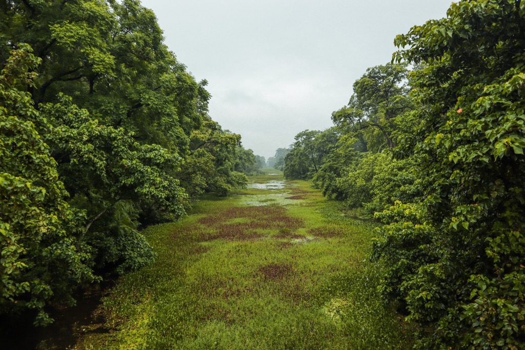
A large portion of the reserve straddles the border with Nepal’s National Forest, an endless stretch of winding streams and lush pre-Himalayan hill country. While Bihar's tiger reserve is just short of 900 km², it forms only a fraction of the much greater Valmiki-Chitwan-Parsa Terai Arch Tiger Conservation Landscape (3549 km²). Combined with Chitwan National Park (932 km²) and Parsa Wildlife Sanctuary (499 km²) in Nepal, Valmiki is one of the subcontinent’s eleven Level 1 Tiger Conservation Units.
Tigers, however, aren’t the only fauna you will encounter here. The park is incredibly diverse, including 58 species of mammals, around 250 bird species, and a staggering 100 different butterflies. Indian rhinoceros roam the land, flying squirrels reign the treetops, and dolphins glide through the mighty Gandak river.
With so much variety, how do you see it all? The best bet is to reach Bettiah first from Patna, then arrange transport and a guide to one of the various access points of the reserve. If traveling by rail, head to Bagaha if you are targeting the western part of the sanctuary or Narkatiaganj for the east.
The most popular starting area is Valmikinagar because of its convenient location by the National Park boundary and proximity to premier rafting on the “Trivali” river trinity flowing into the Gandak at the Nepalese border. For a more wild, jungle feel, Gobardhana in the center offers prime access to the depths of the Someshwar hills. For a “safari” experience, the eastern outpost at Manguraha, close to the homelands of the Tharu tribe, offers a full immersion into local savanna life.
In summary, Valmiki has something for everyone. For example, the central Raghia forest offers a drift along the Kapan river with green pigeons, kingfishers, and owls sharing its wooded banks. Rohua Nala, a wetland with excellent bird and potential rhinoceros watching, is the perfect backdrop for a lazy weekend boat tour. Bheriyari Watch Tower near the Manguraha access point offers a stunning panorama.
Between Gobardhana and Manguraha, hikers can stop at Lalbhitiya, an elevated red clay patch overlooking Sal forest. Early mornings and evenings reward hikers with enchanting views of illuminated Himalayan peaks and gathering birds. Or, follow in the tracks of thousands of monks who have stopped at the picnic area Bhikhna Thori before walking to Nepal. From here, the glistening Pandai river can be seen at sunset and sunrise, with the odd gold panner striking their luck on its colorfully pebbled banks.
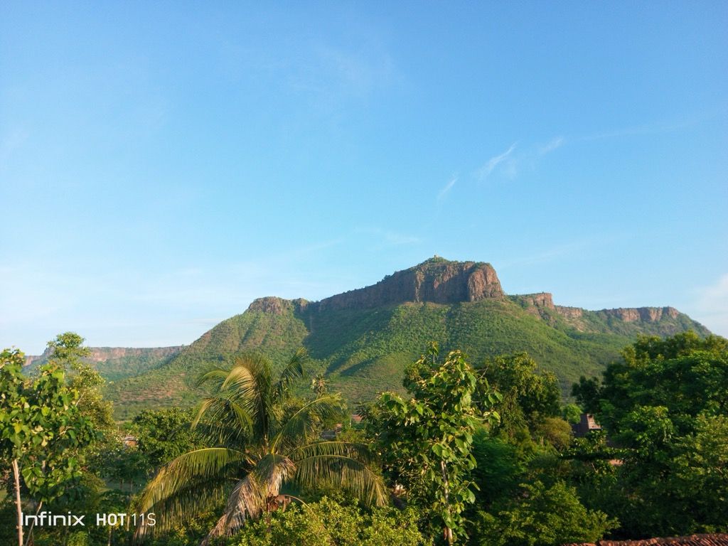
For those seeking a “lost world” feel, look no further than the Someshwar Range. The main range covers only 75 km², extending from the western Triveni Canal to Bhikhna Thori in the east.
Luckily, the range contains numerous river-fed passes such as Someshwar, Bhikhnathori, and Marawat Pass, enabling a cross-border hike to 600+ meter hills. This includes the famous 14 km (8.7 miles) trek from base camp that leads to the highest point in Bihar at the Nepalese border: Someshwar Peak/fort (880m / 2884 ft). Stop for the views at “Titanic point” and don’t miss the ancient temple ruins at the top.
You can also ask your guide to stop in Parewa Dah. “Parewa” means pigeon, and “dah” means water body. Its azure blue waters, rushing waterfall, and dove swarms make this one of Valmiki’s most coveted stopping points.
Just south of the Someshwar mountains is the 643 km² Harha Valley, a slightly elevated plains region awaiting exploration. Even further south lies Ramnagar Doon. This reaches the southernmost extent of the Terai Region, at 240m (787 ft) elevation or lower.
Meanwhile, the Udaypur Wildlife Sanctuary is a tiny 9 km² protected ecosystem situated on one of the Gandak’s oxbow lakes. Before leaving West Champaran, follow Gandhi's footsteps at Bhitiharwa Gandhi Ashram, the birthplace of the peaceful resistance movement and an early Bihari education center.
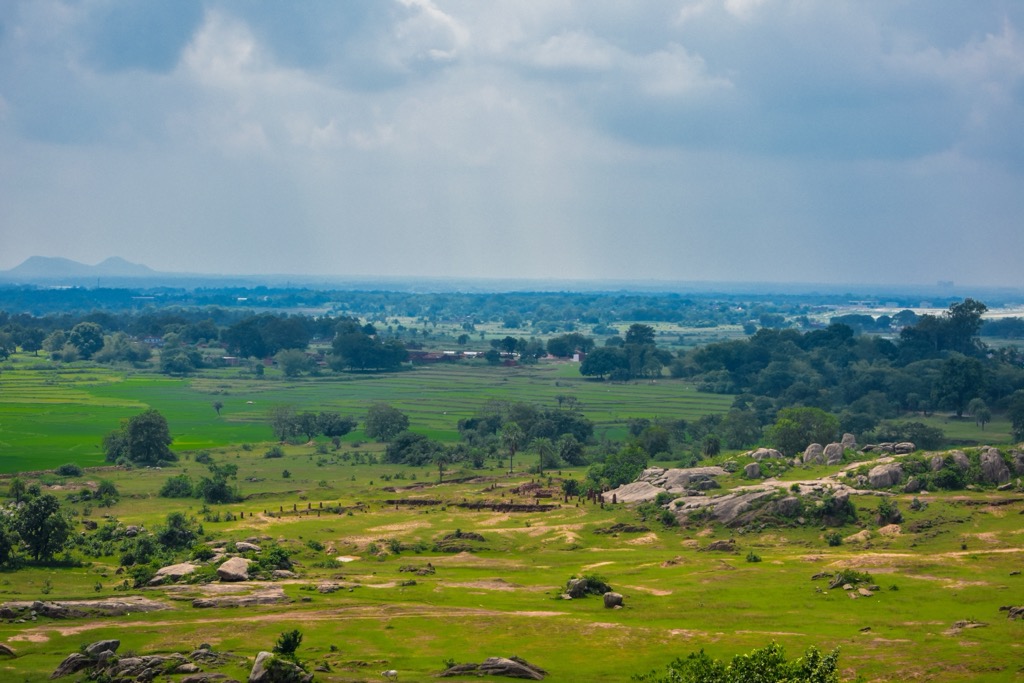
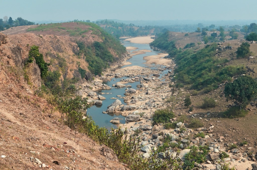
The Kamuir/Rohtas region in southwestern Bihar consists of undulating plateau tables that comprise the eastern portion of the Kamuir Range, a subregion of the greater Vindhya mountains. The area is directly accessible from nearby cities Bhabhua, Jehanabad, and Sasaram.
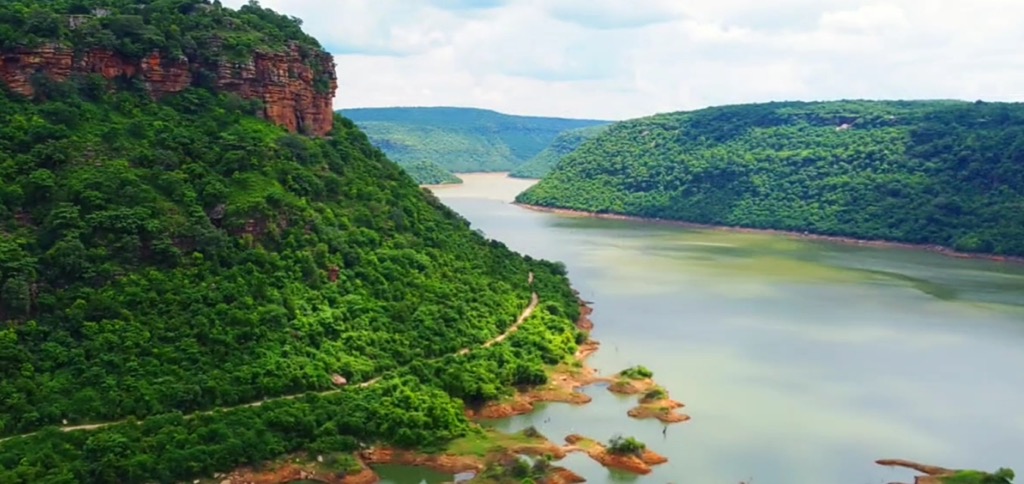
The Rohtas Plateau forms a sharp incline towering above the northern plains, with steplike waterfalls feeding rushing rivers on their course to meet the Ganges rivershed. On the border with Jharkhand, some rock formations reach 600 meters of elevation. Amidst all this beauty lies the 1342 km² Kaimur Wildlife Sanctuary, known locally for its wild tiger populations.
While not as wild as Valmiki up north, Bihar’s southwest charms with its mysterious air. It is filled with crocodile-infested waters, ancient temples, and prehistoric cave paintings, once serving as the hideout of famous public enemies. Unlike other regions, the best time to visit is during the monsoon, when the many seasonal waterfalls are in full swing and the relatively dry vegetation turns a bright green.
Most waterfalls in the area plunge from staggered steps leading down ravines, bordered by arid forest. The abrupt inclines of the southern plateau country and various major river systems make for beautiful cascades.
Many waterfalls are in the 80m (263 ft) height range, including Durgavati Falls on the Durgavati River, nearby Telar Kund, or the popular Karkat Cascade fed by the Karmanasa River. For a truly immersive nature experience, Tutla Bhawani near Maa Tutla Bhawani Temple is ranked as one of the most beautiful waterfalls in Bihar.
Given their long history, the southern plateaus boast a mosaic of archeological treasures. The cave paintings in the Lehda forest are a no-brainer on the travel itinerary. What makes these particularly special is their similarity to the Lascaux cave in southern France, depicting hunting scenes and other firsthand accounts of Mesolithic Bihar.
For those who like combining hikes with historical ruins, the mysterious Rohtas Fort, also known as Rohtasgarh (450m / 1,476 ft), offers a glimpse of this region's human history. Those with short legs, however, will be disappointed: the strangely broad steps leading to the Rohtas Plateau’s highest inhabited point were probably built for elephants.
If in the area, make sure to visit Bhagwanpur, Chainpur, Ramgarh, or Baidyanath. Each of these villages teems with archeological and religious sites. Or, stop for a picnic in the verdant plateau area of Adhaura, with spectacular views of the surrounding Rohtas.
In the center of Bihar, the city of Raghir is close to the UNESCO World Heritage Nalanda University, a renowned center for learning during India’s Golden Age.
Surrounding the city, the Rajgir Hills invite the mystical traveler to discover ancient inscriptions, caves, and meditative paths leading up gentle peaks overlooking the town. There are five known hills, most notably the vulture-shaped Griddhakuta Peak, said to have been where the Buddha taught his “fire sermon.”
A quick 48 km (30 miles) drive southwest leads to India’s oldest rock-cut caves, some with inscriptions from the great emperor Ashoka. Nagarjuni Hill contains three separate caverns, while two linked hills called Barabar house four other caves. All are more than worth a short hike.
Further south, past Gaya, lie the forests and hills bordering the Koderma Wildlife Refuge of Jharkhand, some between 600 and 700 meters high. Once in the area, people may visit the famous Dungeshwari Hills, with numerous caves where the Buddha is said to have meditated.
Likewise, the Hindu Lord Rama is said to have venerated his ancestors with food (pinda-daan) on Ramshila Hill, one of the most popular hikes in the area to reach the thousand-year-old Ramesvara Temple. On the border of Jharkhand, check out Gautam Buddha Wildlife Sanctuary.
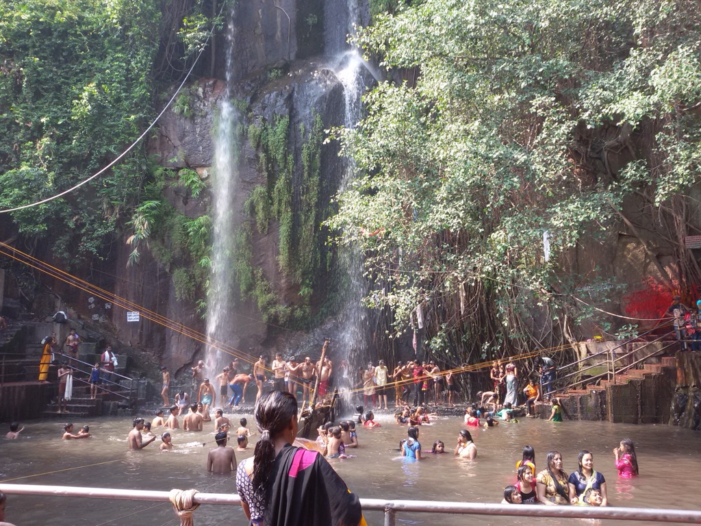
If traveling to Bihar from southern Jharkhand or if you happen to be in Nawada district, stop at Kakolat waterfall, located in the Ektara hills just north of the Hazaribagh Range. It's 49 m (160 ft) rushing water columns and lively, popular crowd make for a lovely cool down. Although logistically inconvenient, the monsoon season provides the best water flow.
Centrally located, the Munger region contains the beautiful 682 km² Bhimbandh Sanctuary, just 200 km (124 miles) from Patna and 20 km (12 miles) from Jamui railway station. Local Hindus will tell you that Bhimbandh was once known as the hideaway of legendary Sanskrit warrior Bhima. That comes as no surprise, as Bhimbandh is an unexpected enclave of thriving wildlife amid heavily populated plains, just at the northern limit of the Rotna Chagur Plateau stretching up from Jharkhand.
The surrounding hills offer the only stretch of land outside West Champaran with officially “dense” forests. Tigers, chitals, boars, and panthers make their home on this isolated green patch.
More famously, the sanctuary is known for the 100+ bird species that roam its grasslands and forests. The Kharagpur Hills that surround nearby Kharagpur Lake offer easy family-friendly hikes, and for those who favor relaxation, Bhimbandh hosts several active hot springs, which can reach up to a scalding 65℃. These include Bhimbandh, Sita Kund, Rishi Kund, and Rameshwar Kund.
It is best to visit outside the monsoon, when water quality and discharge are manageable. Also note that Bhimbandh can easily get crowded during local festivals like Makar Sankranti, so if you are wary of sharing the hot springs with half of Munger’s vacationers, it is best to visit outside these times.
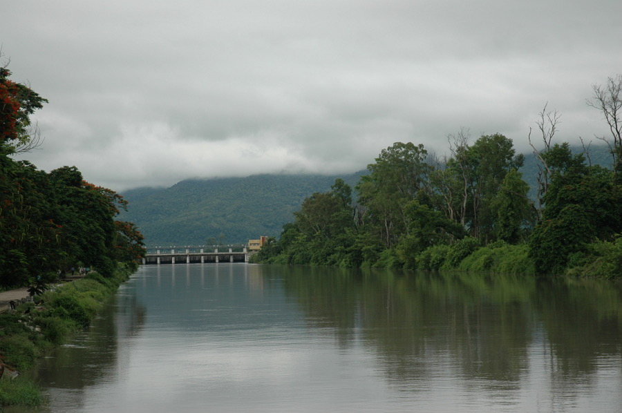
Most foreign visitors fly into Patna airport if they are not traveling locally by train or bus. While relatively unknown, Patna ranks as one of India’s top 20 urban centers by population, spanning 250 km² with roughly 2.5 million people. It’s located on the Gangetic plain, at the confluence of the Ganges, Son, Gandak, and Punpun rivers. Patna was founded in 490 BCE, when the Magadha king moved the capital from hilly Rajgir to its flatter neighbor to the north.
Bihar is known as the “land of monasteries,” and it goes without saying that Patna is one of its spiritual centers. Whether Hindu, Buddhist, Jain, Sikh, or Sufi Muslim, it would be hard not to pass by a holy site in Patna.
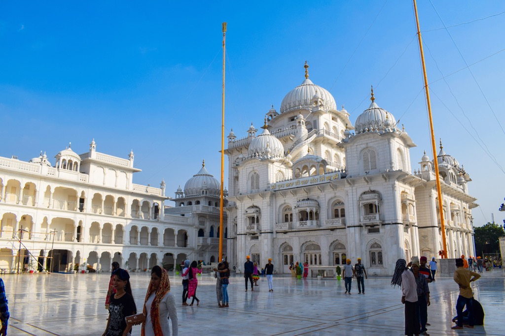
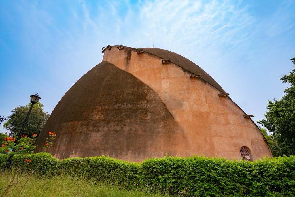
Hindus may venture to Mahavir Mandir, while the birthplace of one of the Sikhs’ most important gurus can be found at Takht Sri Patna Sahib. Or maybe check out the Jain Temple of Pawapuri, a beautiful white edifice. Patna’s secular attractions, from the ancient Golghar granary dome providing a beautiful view of the city, to the Ruins of Pataliputra’s old assembly halls, can turn any day into a historical treasure hunt. In case of rain, the Patna museum—built by the British in 1917—features rich archeological exhibits.
But where there is sightseeing, there is also Patna’s street food. Try Khaja, sugar-dipped fried dough at Baba Silav Khaja Bhandar, Chana Ghugni (spiced chickpeas with green chili and lime) near Patna University, or juicy mutton kebab skewers at Patna junction. For those in town around mid-January, the Hindu festival of Makar Sankranti will fill the streets with sweet tilkut, an addictively delicious blend of roasted sesame seeds and jaggery.
While Patna is only 1/7th the size of Mumbai by population, its urban flair still brings with it the noisy traffic and crowded streets known to any Indian metropolis. On the other hand, Gaya offers a calm backwater close to the Gaya Hills with just under half a million people.
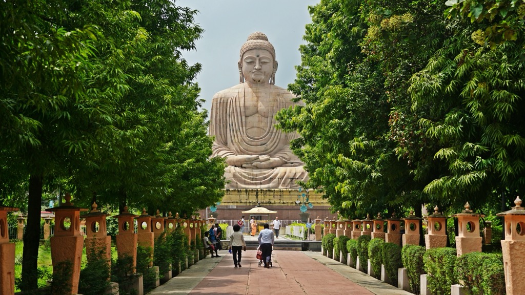
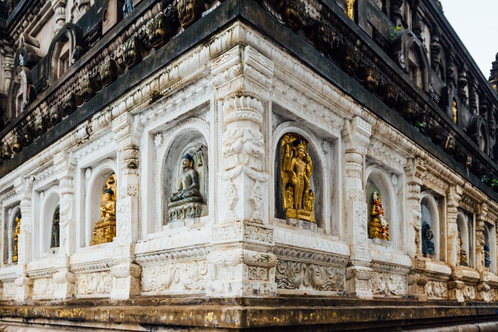
Gaya is filled with religious sites. Hindus regard Gaya as an ideal place to perform ancestor veneration. On the outskirts of town, Buddhists delight at one of the world’s four holy Buddhist sites: the Bodh Gaya. The site includes a complex consisting of the 50m (160 ft) Mahabodhi Temple and meditation grounds.
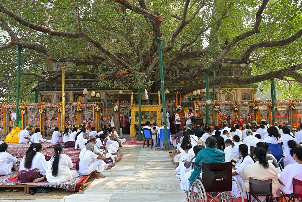
Siddhartha Gautama (later the Buddha) is believed to have reached enlightenment while meditating under a Bodhi (ficus religiosa) tree during the 6th-5th century BCE. The ancient tree with its many arching arms is probably not the direct specimen the Buddha sat under, but rather an imported Sri Lankan sapling.
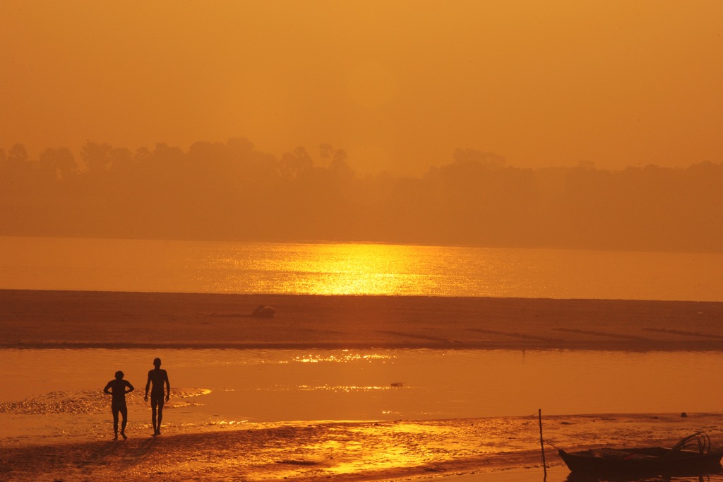
As a trading and silk-producing hub, Bhagalpur offers true Gangetic vibes, with its hazy river sunsets and echoing temple music. From April to June, its surrounding fields produce some of the juiciest mangoes, with the local jardalu rivaling the world-renowned alphonso.
If you prefer the sugar-sweet lychee, the relatively unassuming city of Muzaffarpur, north of Patna, is for you. Both the lychee and mango from these regions have received “protection of geographic origin” across India, meaning you can’t grow these fruits elsewhere and market them under the same name.


