
Scan the QR code and open PeakVisor on your phone
Jharkhand (pronounced jaa knd) is an Indian state located in eastern India. Jharkhand is a region of significant contrast, with deeply traditional tribal communities, as well as heavy industrialization. The state’s abundant mineral resources have fueled industrial growth, yet it remains one of the least urbanized states in the country. With 29% of the state covered in forest and several notable “hill stations,” there is still plenty of room to spread out in this fine state. In total, there are 931 named mountains in Jharkhand. The highest and the most prominent is Parasnath Hill (1,367 m / 4,485 ft).
Jharkhand covers an area of approximately 79,710 square kilometers (30,779 sq mi), making it India’s 15th-largest state. It’s also one of India’s newest states, having been carved out of Bihar on November 15, 2000.
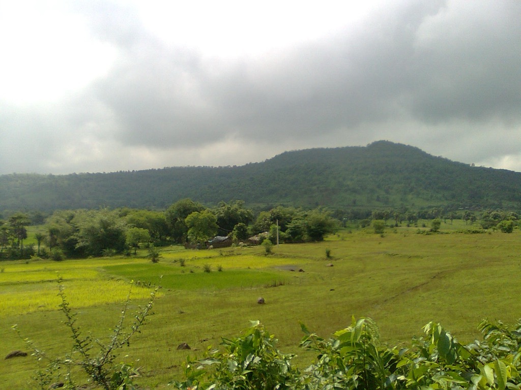
Jharkhand is predominantly a plateau region. The Chotanagpur Plateau forms the bulk of the state, featuring a landscape of rolling hills and valleys. The state’s elevation ranges from 200 to 1,100 meters above sea level, with Parasnath Hill being its highest peak at 1,367 meters (4,485 ft).
Jharkhand is home to several important river systems; the Subarnarekha, Damodar, Koel, and Barakar rivers are the primary water bodies, providing water for irrigation and hydroelectricity.
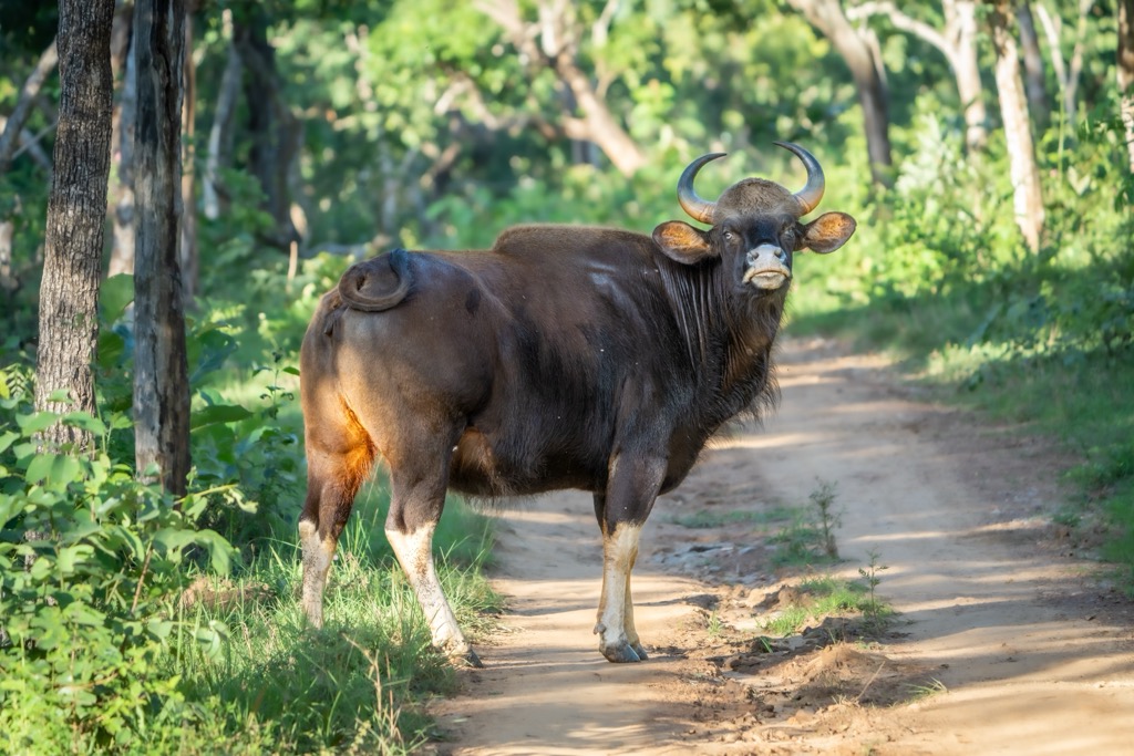
Deciduous and tropical forests cover nearly 29% of Jharkhand’s land area. These forests are home to tropical and subtropical flora and charismatic megafauna—think elephants—and several national parks and wildlife sanctuaries are scattered across the state. Deforestation and mining have posed significant threats to the state’s environment, and Jharkhand’s parks are not as well known (or as well cared for) as others in India.
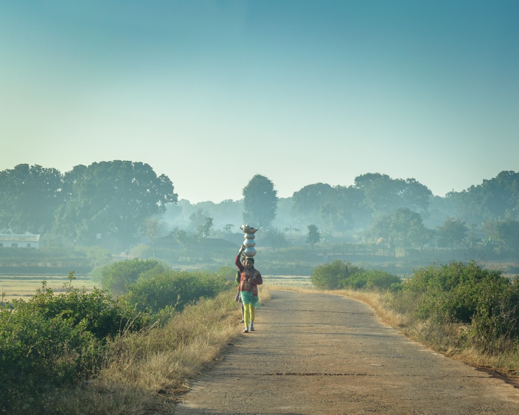
Demographically, Jharkhand is home to over 32,000,000 people—larger than the population of Australia—and is India's 9th least urbanized state. Only 24% of residents live in cities, with 76% living in rural regions.
The capital and second-largest city of Jharkhand is Ranchi, located approximately in the middle of the state. If you’re coming by air, Ranchi is the best way to travel to Jharkhand. Compared to industrial cities like Jamshedpur and Dhanbad, Ranchi has natural beauty and is close to key attractions like Betla National Park and the Netarhat “hill station.” For those of you who don’t know, hill stations are purpose-built mountain towns built by the British Raj to facilitate outdoor recreation and escape the oppressive heat of India.

Notably, the Chotanagpur Plateau is formed from ancient Precambrian rocks, making Jharkhand one of India’s most resource-rich states. The region boasts reserves of coal, iron ore, copper, uranium, and bauxite.
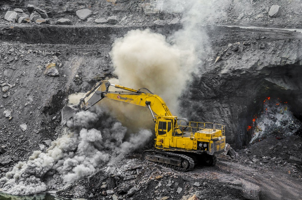
The Damodar River Basin, in particular, is significant due to its rich coal reserves, as well as the underground coal fire that has been burning since circa 1916. The fire has consumed 37 million tons of coal; that’s small change compared to the mine’s 19.4 billion tons of reserve, but it has significantly impacted regional air and water pollution in Jharia.
The center of Jharkhand is located at the Tropic of Cancer, about 23°N. This is the most northerly latitude at which the sun can appear directly overhead, and it’s often used to delineate the Earth’s tropical regions.
Indeed, Jharkhand experiences a tropical climate, though one characterized by three distinct seasons: summer, monsoon, and winter. Summers, from March to June, are typically hot and dry, with high temperatures ranging between 35°C and 40°C, occasionally rising higher in May. The monsoon season, from June to September, brings heavy rainfall due to the southwest monsoon, with an annual average rainfall of around 1,100 to 1,500 mm.
Winters, from November to February, are mild and pleasant. Temperatures can drop to as low as 5°C in some areas, especially in the hilly regions. Daytime temperatures remain comfortable around 15°C to 25°C. Winter is the perfect time to visit. Meanwhile, outdoor recreation is nearly impossible during the summer.
Jharkhand’s forests are largely deciduous, dominated by sal, teak, and bamboo. The forest canopy supports diverse flora and serves as a habitat for numerous bird and insect species.
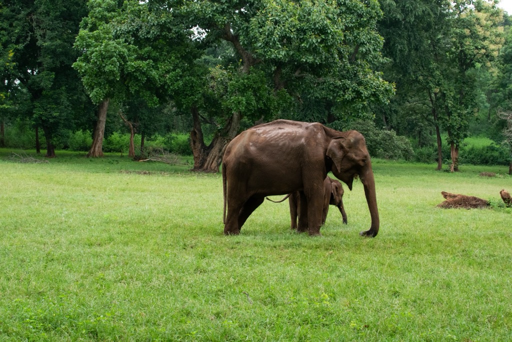
The wildlife is remarkable where its habitat still exists; Indian elephants, sloth bears, and bison inhabit the protected areas. Betla National Park is the most prominent reserve in Jharkhand.
Jharkhand’s ecology faces significant challenges. Pollution from industrial operations, particularly in mining regions, has degraded the environment. The state is home to several large, polluted industrial cities. Deforestation caused by logging, agriculture, and mining has led to habitat loss and fragmentation.
However, like many parts of India, the biggest issue in Jharkhand is its rural population, mostly subsistence farmers. Outside the parks, farms and villages have eradicated any remaining wilderness. Ecosystems like those in Betla National Park are limited only to the most protected areas.
The human history of the Jharkhand region dates back to the middle Stone Age (approximately 9,000 BCE), as evidenced by the discovery of cave paintings and stone tools in areas like Hazaribagh and Singhbhum.
During the ancient period, Jharkhand was a part of the larger Mahajanapadas and later the Magadha Empire. The region's dense forests and rugged terrain maintained a degree of isolation, allowing indigenous tribal communities to thrive with distinct cultural identities.
Various dynasties influenced Jharkhand in the medieval period, though the Nagvanshis ruled much of the region from the 10th to the 18th century. Periodic uprisings by tribal communities against oppressive taxation and land encroachment set the stage for later events.
The arrival of the British in the 18th century marked a tumultuous period for Jharkhand. The region was incorporated into the Bengal Presidency, and the British sought to exploit its coal resources.
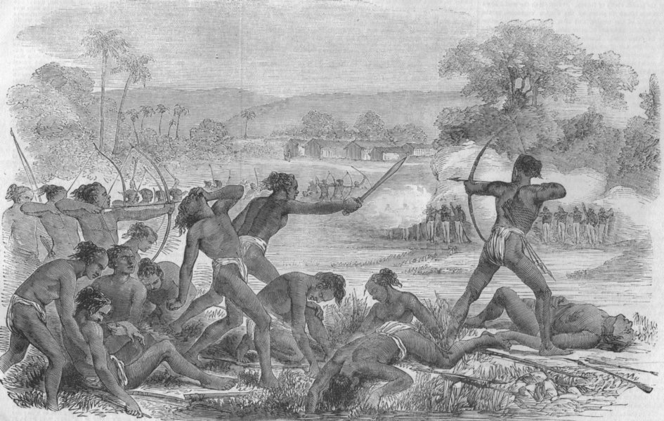
British industrialization led to widespread displacement of tribal populations and disruption of traditional livelihoods. The resentment culminated in the famous Santhal Rebellion (1855–56) and the Munda Rebellion led by Birsa Munda in the late 19th century.
In 1916, British mine operators started an underground fire in the Jharia coalfields, which continues to burn to this day. The fire has been a constant source of regional air and water pollution.
Following India’s independence in 1947, Jharkhand remained part of the state of Bihar, but demands for a separate state grew. Tribal leaders and activists argued that the region's unique cultural, social, and economic challenges required a separate government.
After decades of advocacy, Jharkhand was finally carved out as an independent state on November 15, 2000, coinciding with the birthday of revered 19th-century leader Birsa Munda.
Today, Jharkhand is a fascinating place because it’s largely removed from the tourist circuit of a modernizing India. Jharkhand’s cities are mostly purpose-built industrial centers—take, for example, Bokaro Steel City…yes, that’s actually its name—but the rural regions are a fabric of tribal customs.
It’s often said that visiting India will help you understand the absurdity of the idea that it is one country. There are just so many cultures and identities. Jharkhand’s hill country has largely retained its tribal roots, and it is a great place to experience some of these cultures.
Betla National Park was one of the first parks in India to become a designated tiger reserve under Project Tiger in 1974. Initially, it was part of the Palamu Wildlife Sanctuary. The national park status, granted in 1986, aimed to strengthen conservation efforts for endangered species, particularly tigers and elephants. Nowadays, few, if any, tigers remain, although there are still many elephants, especially during the wet season.
Established in 1954, Hazaribagh Wildlife Sanctuary is one of Jharkhand’s oldest protected areas. However, it symbolizes the government’s limited reach in this rural region. The area, rich in tropical forests and grasslands, was once home to large populations of tigers, leopards, and elephants. Over the decades, the park has battled poaching and habitat encroachment and is now home to relatively few animals.
Jharkhand is an off-the-beaten-path hiking destination.
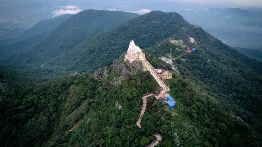
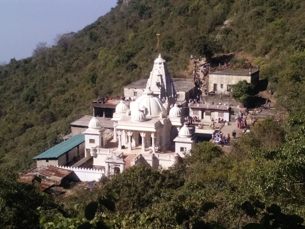
The Parasnath Hill Trek journeys through the highest peak in Jharkhand, which is also one of the most sacred Jain pilgrimage sites. The trek starts at Bhomiyaji Asthan in Madhuban village at the foothills of Parasnath. As the crow flies, it’s less than 100 kilometers from Ranchi, but slow and circuitous roads mean driving will take about four hours.
The trail winds through dense tropical forests and up rocky paths featuring ancient Jain temples. The summit, known as Shikharji, is believed to be the place where 20 of the 24 Tirthankaras attained moksha, earning its status as a pilgrimage site. Beyond the spiritual aura, the panoramic views from the top are exceptional, gazing across the hilly farm country of rural Jharkhand.
However, the hike is no cakewalk. Depending on how many temples you visit, it could be as long as 27 km (16.5 miles) and take an entire day to complete. Rest houses at the foot of the hill offer vegetarian food and accommodation for pilgrims and other visitors.
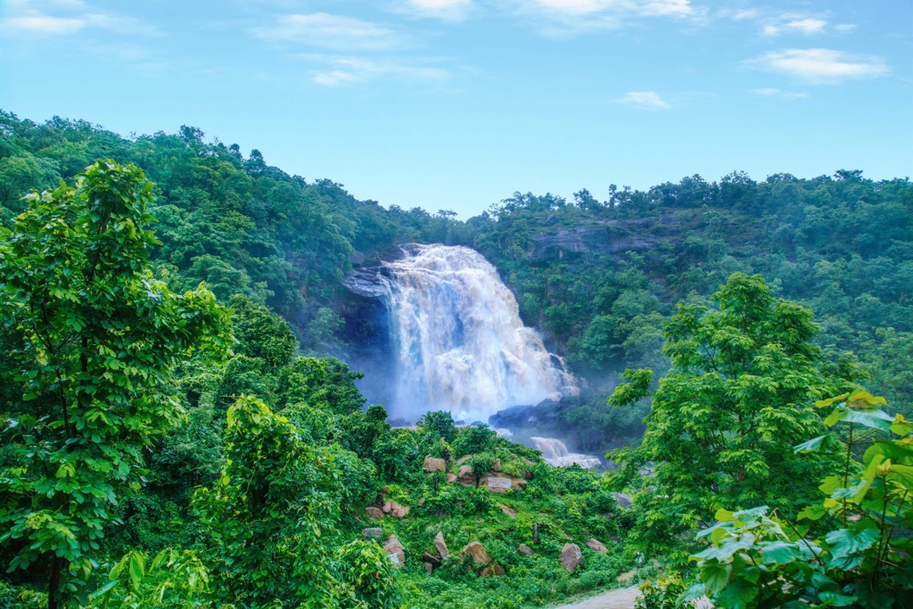
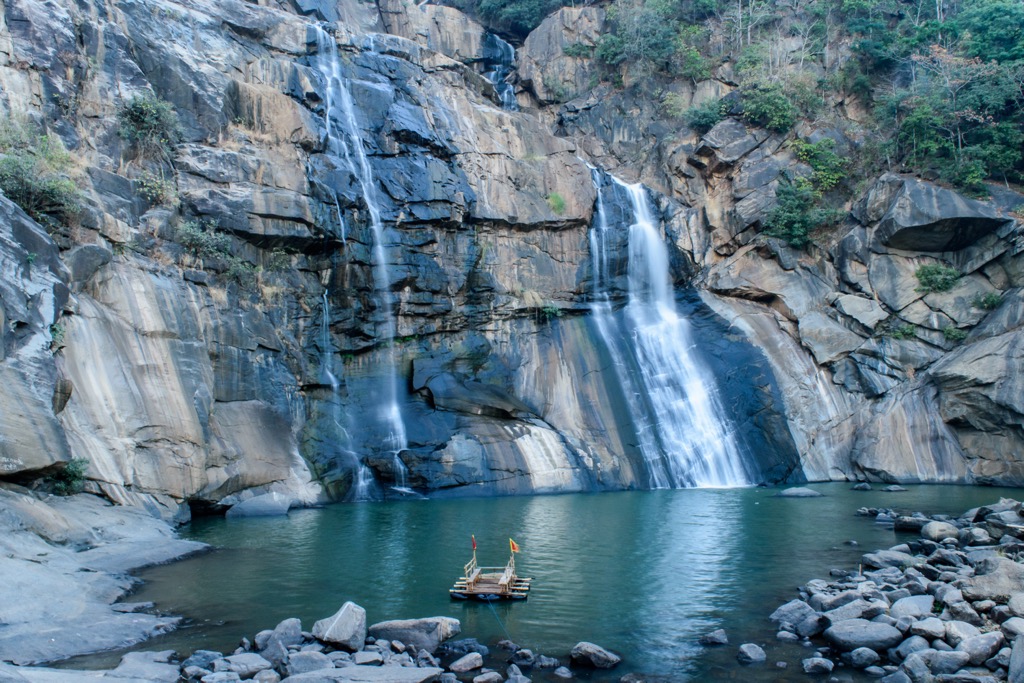
The Hundru Falls Trek is a must-do adventure to one of Jharkhand’s most spectacular wonders. The falls are the culmination of the Subarnarekha River plunging 98 meters (320 ft) into a rocky gorge. They’re a breathtaking sight, especially during the monsoon season (contrary to the other hikes in Jharkhand).
The falls are about 45 km from Ranchi, though the drive is still about an hour and a half long. There are two routes: the Maldi Kargha is 4 km (2.5 mi) (~ four hours), while the Minjur Nacha Hill is 2 km (1.3 mi).
The trails are rugged and surrounded by dense greenery and the sounds of cascading water echoing through the gorge. At the base, a serene pool is safe for swimming (though visitors should follow any local guidelines).
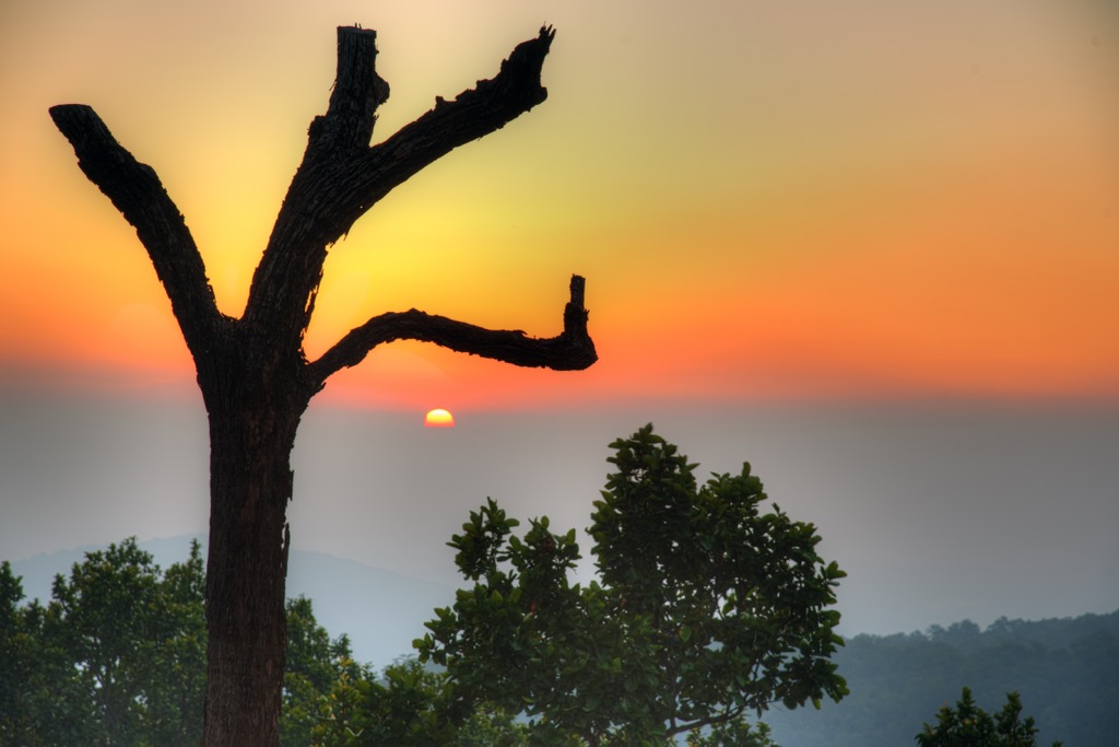
You can drive to Magnolia Point along a dirt road, only 10km from Netarhat. However, those seeking a hike should not be shy about venturing here on foot. You can also explore the pastoral farmland around the point, connected by a network of peaceful dirt roads.
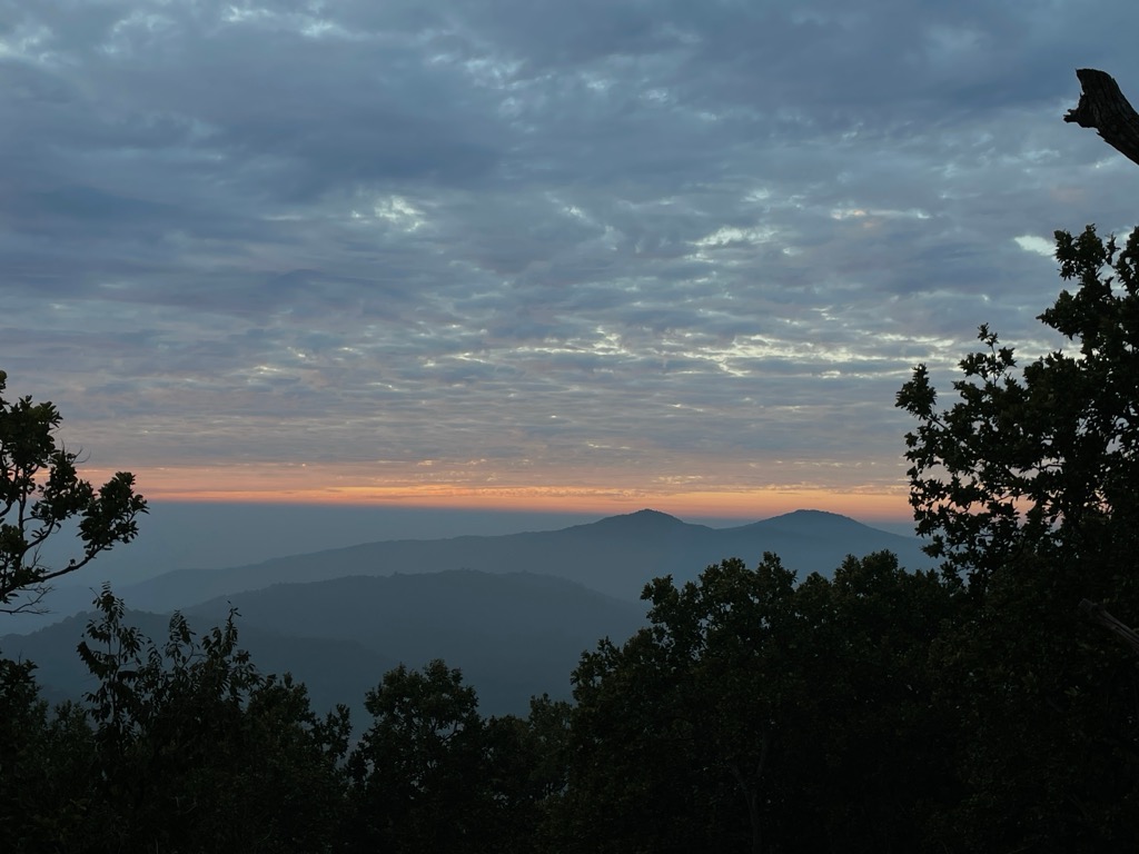
Magnolia Point offers a beautiful view of the sunset; it’s one of the best places to watch it in Jharkhand. The point is named after the story of a British officer’s daughter, Magnolia, who is said to have fallen into a forbidden love with a local shepherd, ultimately ending her life here. However, it may also be the Magnolia trees that dot the landscape, an uncommon sight in this tropical jungle.
Unfortunately, many other people are vying for sunset views, and Magnolia Point is no secret. Don’t expect solitude, as this is a popular locale accessible by car or bus from Netarhat.
Ranchi is the vibrant capital of Jharkhand and is one of the few cities you’ll want to visit in this state. It’s where you’ll fly into as a domestic or international traveler, though the airport is only domestic, so internationals will have to connect elsewhere in India.
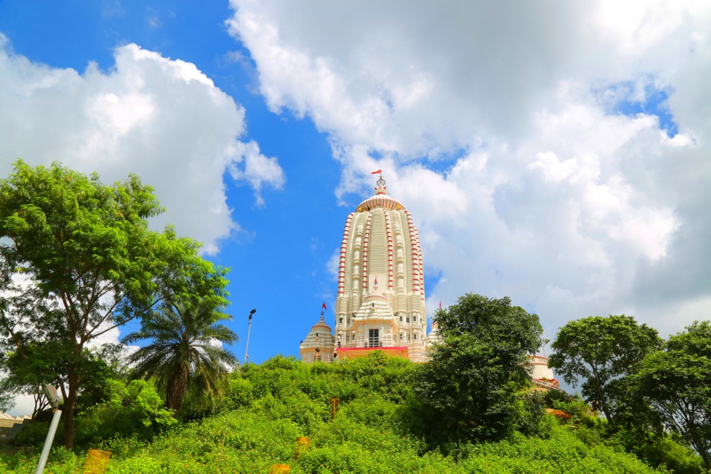
Known as the “City of Waterfalls,” every corner of Ranchi hides a secret cascade, with Hundru Falls and Jonha Falls stealing the spotlight. Be sure to climb to the top of Tagore Hill to take in the city during sunrise or sunset. Like the best of India, Ranchi is a kaleidoscope, shifting from the calm of the Jagannath Temple to the bustle of local bazaars brimming with tribal art and colorful textiles.
Netarhat is a charming hill station Known as the "Queen of Chotanagpur." The town’s cool climate and lush surroundings make for a relaxing getaway; it was purpose-built by the British Raj as an escape from the heat of the valleys. Magnolia Point and Koel View Point are both easy hikes and offer breathtaking sunrises and sunsets. Meanwhile, the town is only a couple hours from Ranchi, where domestic and international travelers will start their adventure.


