Scan the QR code and open PeakVisor on your phone
The Trans-Himalaya (also spelled Transhimalaya) is a significant mountain range across China, India, and the Tibet Autonomous Region. These peaks lie predominantly on the Tibetan Plateau and parallel to the main Himalayan range. There are 185 named peaks in the Trans-Himalayas, with Namcha Barwa being the tallest and most prominent at 7,782 m (25,532 ft), with 4,103 m (13,461 ft) of prominence.
The Trans-Himalayas run parallel to the main Himalayan range. The major subranges include the Gangdise Range, also known as the Kailash or Kailas Range, and the Nyenchen Tanglha Range.
Situated north of the Yarlun Tsangpo River, these peaks lie along the southern edge of the Tibetan Plateau. The Gangdise Range lies in the western section of the Trans-Himalaya, while the Nyenchen Tanglha Range is in the east.
The Gangdise Range is an extension of the more extensive Ladakh Range in western Tibet. The headwaters of the Indus River lie in the western stretches of the Trans-Himalaya.
Namcha Barwa is the tallest and most prominent peak in the range, located in the Pemako region of Tibet. The mountain lies in the Mamcha Barwa Himal Range and is one of the easternmost peaks of the greater Himalayan mountainous region.

Most of the Trans-Himalayas are in the Tibet Autonomous Region, with elevations averaging 3,000 m (9,843 ft). This east-west range is 1,600 km (990 miles) long and 225 km (140 miles) wide near its center.
Unlike the Himalayan Mountains to the south, the Trans-Himalayas lack defined ridgelines and feature few deep river gorges. Passes average 5,330 m (17,500 ft), with the highest pass being Chargoding Pass at 5,885 m (19,308 ft).
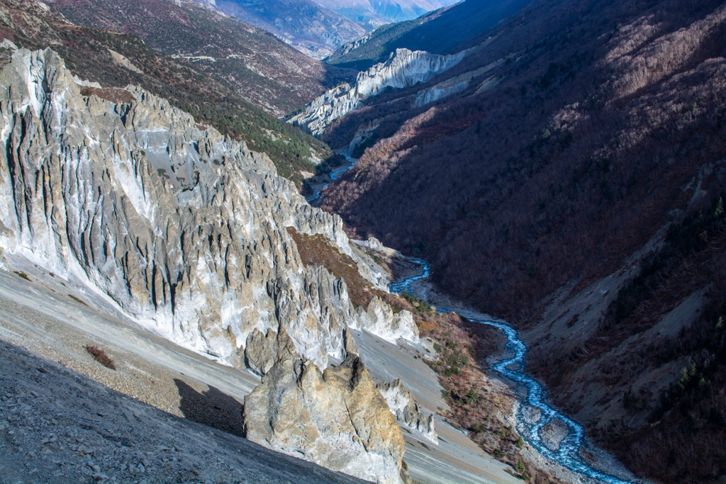
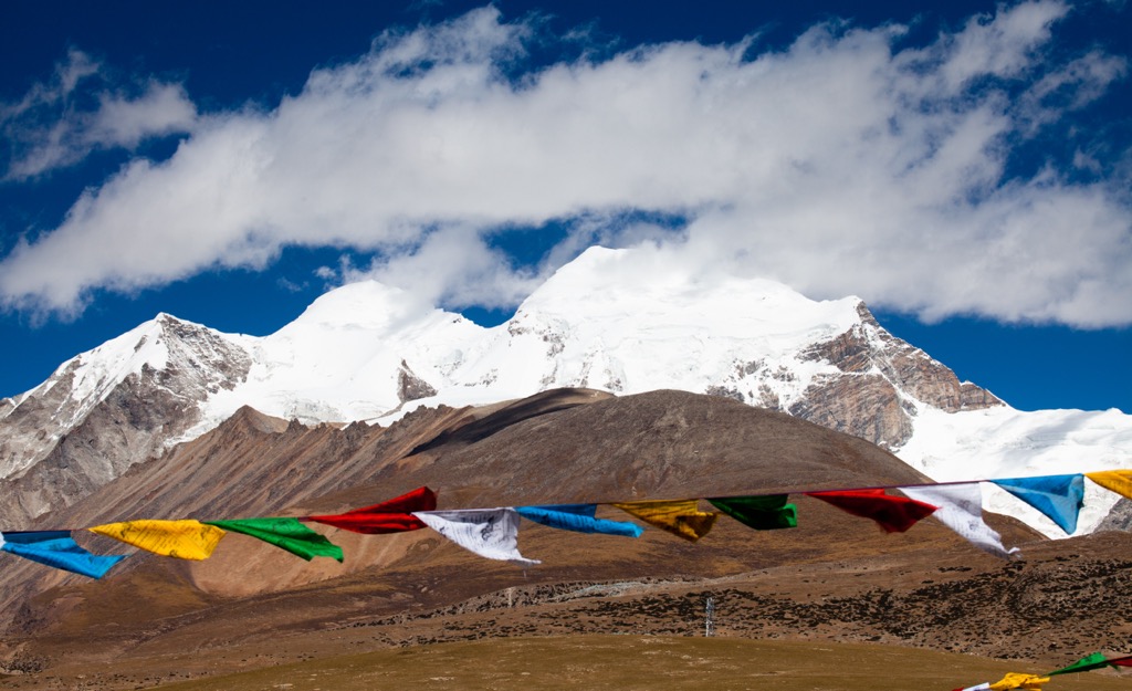
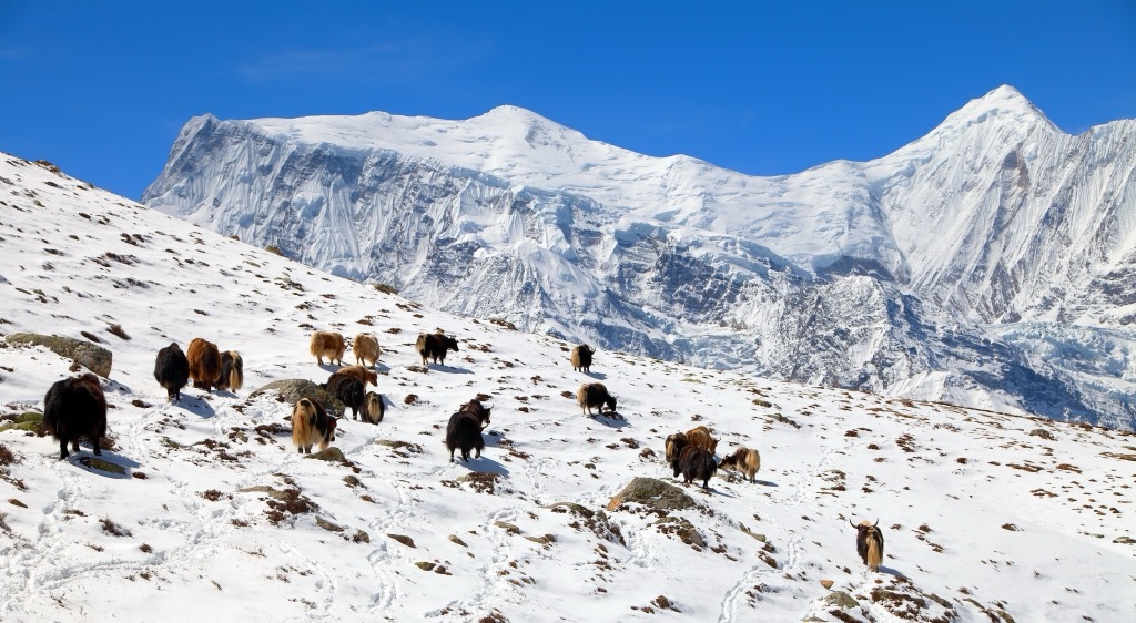
Snowcapped peaks tower above the high desert landscape marked by dry alpine steppes. Northern slopes tend to feature more dramatic changes in elevation compared to southern slopes.
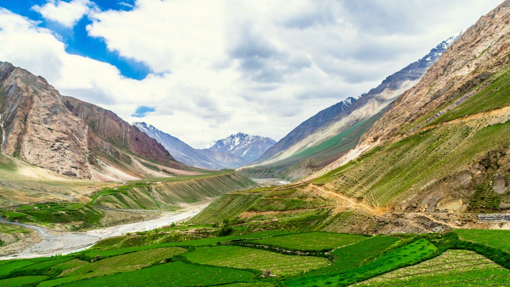
Large sections of the range are protected to help protect biodiversity. Prominent protected areas include the Pin Valley National Park and Kibber Wildlife Sanctuary in India, Kangrinboqê National Forest Park in China, and a portion of the Annapurna Conservation Area in Nepal.
The Trans-Himalaya Mountains have a unique geological history distinctive from the nearby Himalayas.
The foundation of the range dates back 65 million years ago to the Cenozoic Era. These peaks are part of the major mountain system known as the Alpide Belt. The Belt includes ranges such as the Himalayas, Karakorams, Alps, Alborz, Hindukush, and nearly every other range stretching from Western Europe to China.
The Alpine Orogeny formed the Alpide Belt during the Cenozoic Era. The collision of the Indian and Eurasian landmasses forced the land upward, creating the distinctive ridgelines and peaks of the nearby Himalayas. The subduction of sediment in the region further defined the Trans-Himalayas. Younger sections formed 40-60 million years ago during the Eocene Epoch.
Granites and volcanic rocks from the Neogene and Paleogene are typical throughout. Intrusions of igneous rocks lie in the sedimentary and metamorphic rocks of the southern Tibetan block.
The extreme cold temperatures and arid landscape make it difficult for plant life to survive. Dry alpine steppes and minimal vegetation coverage define this stark landscape.
The range is primarily above the treeline and features some low-growing shrubs and grasses. The Spiti region is home to nearly two dozen medicinal plants that have become incorporated into traditional Tibetan medicine over thousands of years.
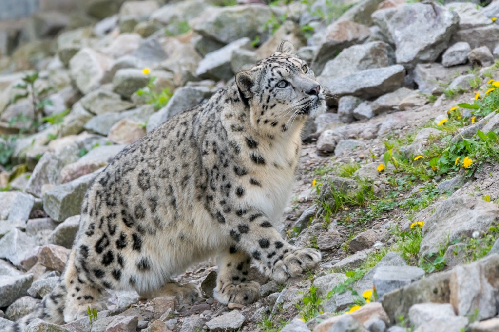
This mountainous region is home to elusive species such as the snow leopard, Tibetan wolf, red fox, Tibetan fox, and Eurasian lynx. Establishing and enforcing protected areas withinin the Trans-Himalayas has helped the snow leopard move from an endangered to a vulnerable species as its population continues to rise and become more stable.
Common herbivores native to the region include kiang, yak, Asiatic ibex, bharal, urial, argali, and Tibetan gazelle. The range is home to sparrows, finches, choughs, chukar partridges, snow partridges, and Himalayan snowcocks.
The Trans-Himalaya Mountains encompass the southern rim of the historic Tibetan Plateau. Numerous cultures, religions, and territorial disputes have shaped the region’s human diaspora.
Archaeological evidence suggests that humans began inhabiting the Tibetan Plateau between 30,000 and 40,000 years ago. In 618 CE, Yarlung kings officially founded the Tibetan Empire. The empire reached its most significant power during the 8th century, but a civil war led to its downfall in 842 CE.
In 1244 the Mongol Empire conquered most of modern China including the region of Tibet. The empire’s territory was the most expansive in history, stretching from the eastern coast of China, across Pakistan and the coast of the middle East, through Turkey and as far north and west as Poland. During the 13th and 14th century, the Mongols controlled most of the Eurasian continent.
Kublai Khan of the Yuan Empire reportedly adored the Tibetan region and had great respect for the Tibetan Monks, who he considered to be powerful healers. Kublai reigned until his death in 1294 and the Yuan Dynasty lasted until 1368, when it was succeeded by the Ming Dynasty.
Tibet remained relatively autonomous from the time of Kublai Khan and the Nêdong, Shigatse, and Lhasa dynasties ruled Central Tibet from 1354 to 1642. Tibet was not a part of Ming China.
Güshi Khan of the Khoshut Khanate established the Ganden Phodrang court in 1642, establishing himself as King of Tibet. Dzungar Khanate overthrew the Khoshuts in 1717 though their rule was short-lived. In 1720, the Chinese conquest of Tibet expelled the Dzungar forces, beginning the Qing rule over Tibet. Qing rule ultimately led to Tibet coming under the direct control of the Chinese government.
Following the fall of the Qing dynasty, from 1912 to 1950, the State of Tibet acted as an independent region. The Republic of China did not express any authority over Tibet due to civil war and the Japanese invasion throughout the rest of China.
The Chinese established the People’s Republic of China in 1949. A year later, the People’s Liberation Army defeated the local army of Tibet, with the battle taking place near Chamdo. China and Tibet signed a 17-point agreement in 1951, ultimately establishing China’s sovereignty over Tibet.
Following a failed uprising in 1959, the 14th Dalai Lama renounced the agreement and fled to India. The Dalai Lama is the head of Tibet and is known for being the highest spiritual leader of the Gelug school of Tibetan Buddhism. Today, the Dalai Lama lives in exile as a refugee in McLeod Ganj, Dharamshala.
In 1965, Tibet became the Tibet Autonomous Region, a provincial-level design of the People’s Republic of China. Tibet’s population is estimated to be 3.6 million, with Lhasa, located in the southeast, being the capital and most populous city with nearly one million residents.
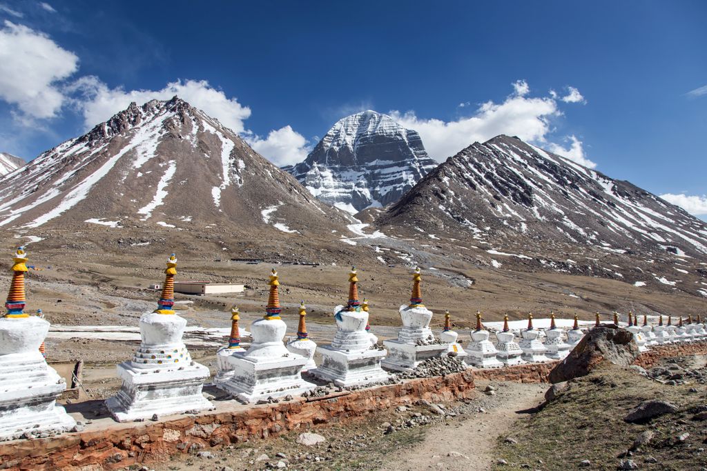
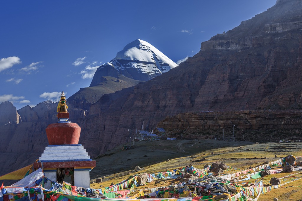
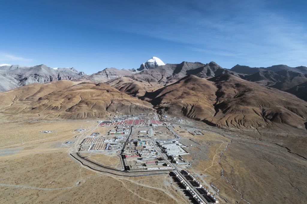
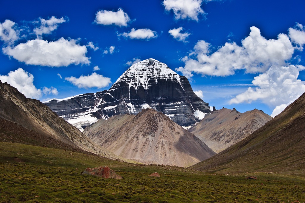
Mount Kailash, part of the Gangdise subrange, lies in the western Trans-Himalaya Mountains. The peak is near the sources of the Indus, the Sutlej, the Karnali, and the Brahmaputra rivers. In Hinduism, Mount Kailash is the abode of Shiva. In Jain scriptures, Mount Kailash is where Rishabhadeva, the first Tirthankara, gained liberation. In Buddhism, the peak is known as Mount Meru and is an important pilgrimage site for some branches of the religion.
Namcha Barwa, the tallest and most prominent peak in the range, has only been summited once. In 1992, after many failed attempts, a group of Chinese and Japanese mountaineers reached the summit.
Hundreds of routes climb through the Trans-Himalaya. Climbers hoping to summit the range’s peaks should be highly experienced and work with expert guiding companies. Many people opt to experience the range through guided treks. Below are some significant hiking areas to check out on your next visit.
Mount Kailash holds sacred meaning for Buddhists, Hindus, and Jains. Numerous treks, hiking routes, and pilgrimages surround this stunning peak. The Pilgrimage Ciruct is one of the most popular routes in the region. The clockwise loop circles around the base of Mount Kailash, often taking visitors three days to complete. Altitudes range from 4670 m (15,322 ft) to 5650 m (18,537 ft) at the Drölma-La pass. Those visiting the region fly into Lhasa or Kathmandu before driving to western Tibet.
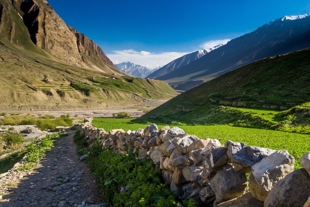
Pin Valley National Park lies in the Spiti Valley of northern India. The park encompasses the desert landscape within the Cold Desert Biosphere Reserve. Elevations range between 3,500 m (11,500 ft) to 6,000 m (20,000 ft). Rolling sloped hills give way to the craggy peaks of the Transhimalya Mountains. Vegetation is sparse, offering visitors sweeping views of the high desert landscape.
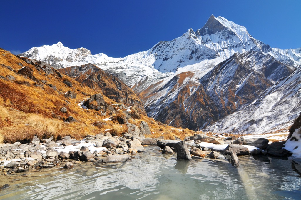
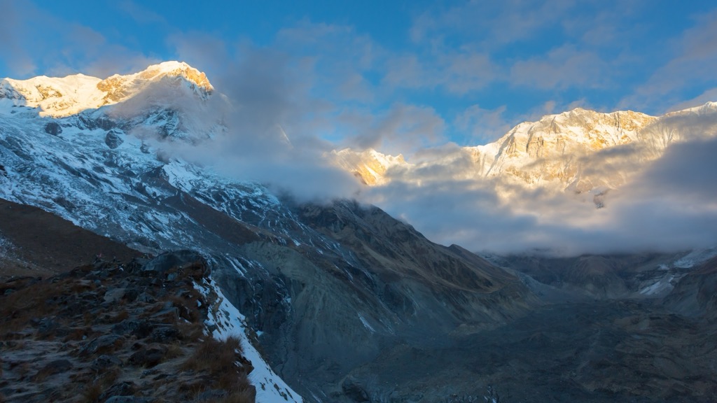
The Annapurna Conservation Area covers 7,629 sq km (2,946 sq miles), marking the largest protected area in Nepal. Elevations range from 790 m (2,590 ft) up to 8,091 m (26,545 ft) at the summit of Annapurna I. The Annapurna Circuit is one of the most popular treks in the area. Length varies between 160-230 km (100-145 miles) depending on where visitors start and end the trek. The trek circles the Annapurna Massif and is known for being one of the most beautiful long-distance treks in the world. On average, this route takes between 15-20 days.
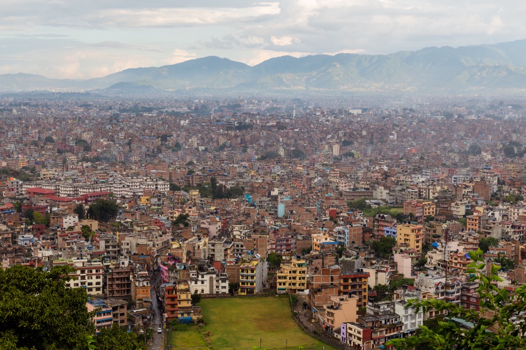
Those visiting the Trans-Himalayas should note that much of the range is uninhabited, with small towns and cities scattered throughout the Tibetan Plateau. Two major cities exist: Kathmandu south of the Himalaya, and Lhasa to the north.
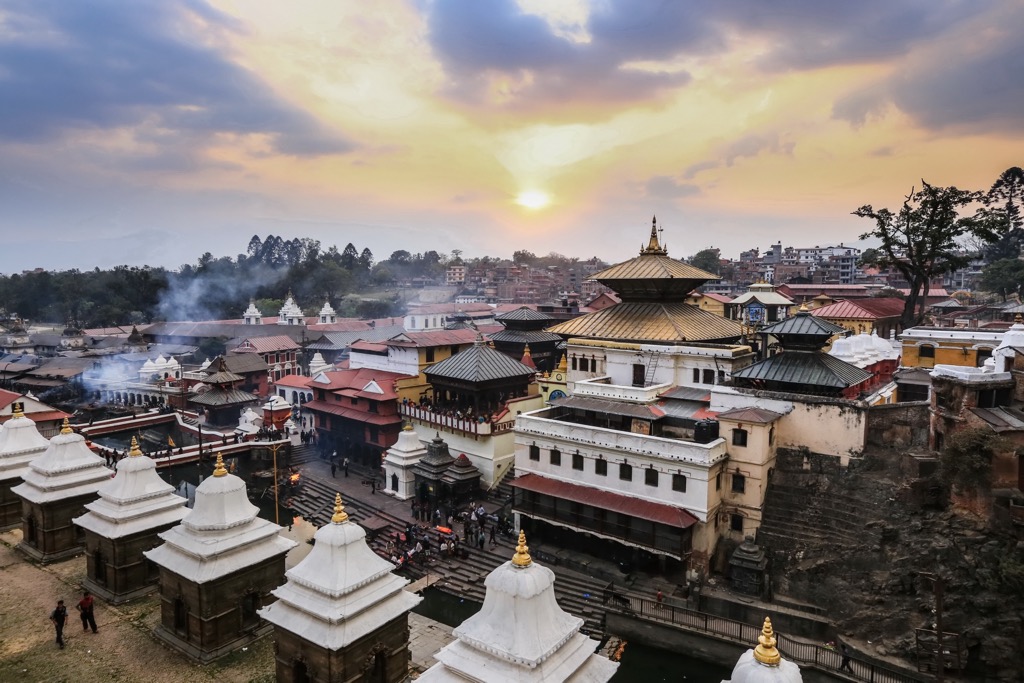
Nepal’s capital and most populous city, Kathmandu, has a population of over 1.4 million. Located in the Kathmandu Valley of Central Nepal, Kathmandu is at an altitude of 1,400 m (4,600 ft). The city is known for being one of the oldest continuously inhabited places in the world and is home to seven UNESCO World Heritage Sites. A major earthquake in 2015 destroyed many of the historical buildings and sites and precipitated a large loss of human life.
Popular attractions include Durbar Square, Garden of Dreams, Buddha Stupa, Pashupatinath Temple, and Swoyambhu Mahachaitya.
Since 1950, tourism has become an essential industry within Nepal. Hiking, trekking, mountaineering, and pilgrimages dominate much of the tourism industry.
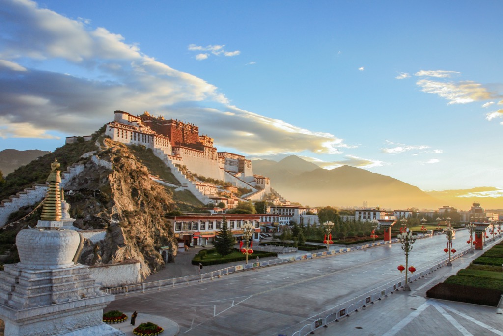
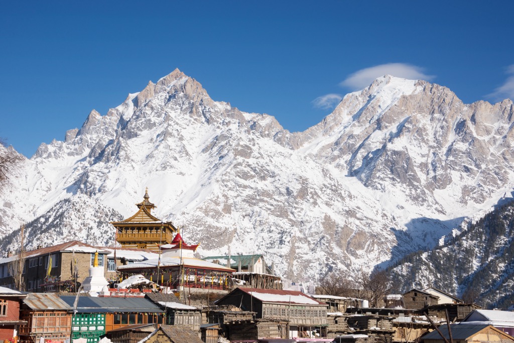
Lhasa is the capital city of the Tibet Autonomous Region. Located in eastern Tibet, Lhasa is home to nearly one million residents. Situated on the north bank of the Lhasa River, the city sits at an altitude of 3,656 m (11,990 ft), making it one of the highest capital cities in the world.
The Dalai Lama lived in Lhasa before his exile. Prominent cultural features include the Potala Palace, Jokhang Temple, Sera Monastery, Norbulingka, and Ramoche Temple. A licensed tour guide must accompany those wishing to visit Lhasa.