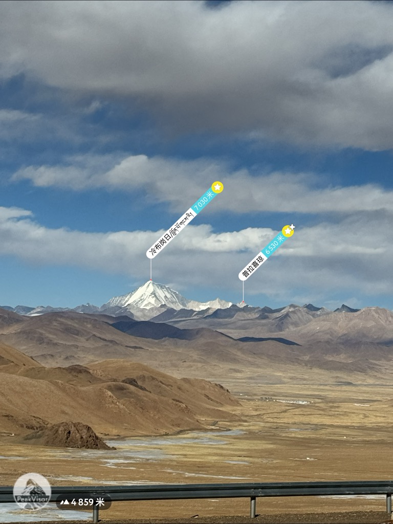
Lunpo Gangri, also known as Loinbo Kangri, is a Himalayan mountain in Tibet Autonomous Region, China. It has an elevation of 7,095 metres (23,278 ft) and is the highest peak in the Gangdise range (Kailash Range). The second highest and the most famous peak in Kailash Range is the Mount Kailash which is considered sacred in four religions: Hinduism, Buddhism, Jainism and Bon.
By elevation Loinbo Kangri is
# 2 out of 437 in the Tibet Plateau # 65 out of 936 in Tibet # 94 out of 12241 in China # 1 out of 8 in Saga County # 1 out of 15 in Zhongba County
By prominence Loinbo Kangri is
# 2 out of 437 in the Tibet Plateau # 24 out of 936 in Tibet # 67 out of 12241 in China # 1 out of 8 in Saga County # 1 out of 15 in Zhongba County
We use GPS information embedded into the photo when it is available.
3D mountains overlay
Adjust mountain panorama to perfectly match your photos because recorded by camera photo position might be imprecise.
Move tool
Rotate tool
Zoom
More customization
Choose which peak labels should make into the final photo and what photo title should be.
Next
Photo Location
Satellitte
Flat map
Relief map
Latitude
Longitude
Altitude
OR
Latitude
°'''
Longitude
°'''
Apply
Register Peak
Peak Name
Latitude
Longitude
Altitude
Register
Teleport
PeakVisor
This 3D model of Sagarmatha National Park in Nepal was made using the PeakVisor app topographic data. The mobile app features higher precision models worldwide, more topographic details, and works offline. Download PeakVisor maps today.
Download OBJ model
PeakVisor
The download should start shortly. If you find it useful please consider supporting the PeakVisor app.
PeakVisor for iOS and Android
Be a superhero of outdoor navigation with state-of-the-art 3D maps and mountain identification in the palm of your hand!