
Scan the QR code and open PeakVisor on your phone
Meghalaya (pronounced Megh-a-lay-a) is both a hiker’s and an anthropologist’s paradise, a virgin mountainscape of dense subtropical jungle. It boasts some of the world's largest and intact matrilineal indigenous societies, awe-inspiring waterfalls, sacred ancient tree groves, living tree-root bridges, and enormous limestone caves awaiting exploration. While hiking through this prolific land, Meghalaya will awaken even the traveled adventure seekers. There are 11 named mountains in Meghalaya; the highest and most prominent is Shillong (1965 m / 6,449 ft).

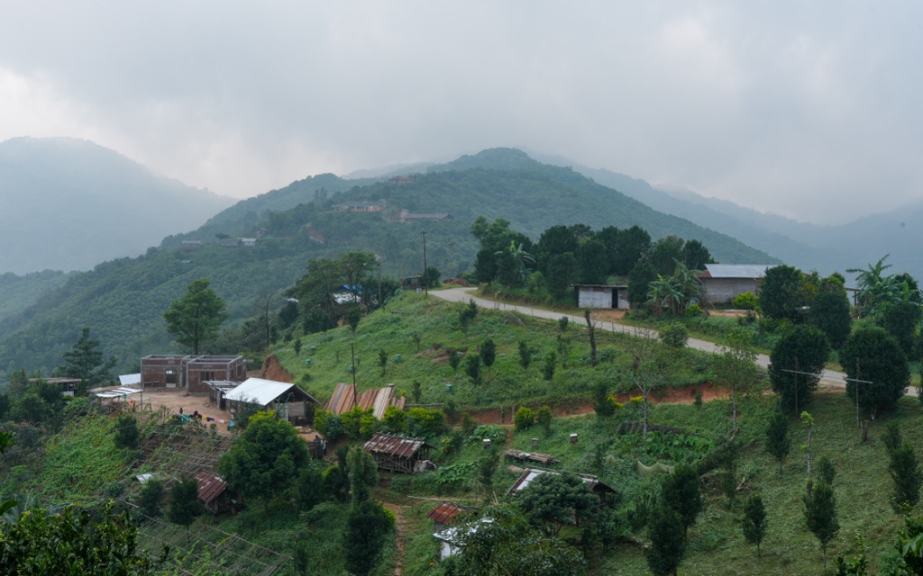
Meghalaya is an autonomous province in the northeast territory of India. It shares a border with only two other entities: the Indian state of Assam to the north and east, and the nation of Bangladesh to the south. Meghalaya is one of India’s most rural states, with nearly 80% of the population being rural, compared to an average of 68.9% nationwide.
Meghalaya’s oppressive monsoon season and rugged terrain are just two factors that have contributed to its lack of urban development. The region remains remote even in the 21st century; Shillong Airport is the only international entry point. However, budding railway infrastructure and Guwahati Airport across the border in Assam provide alternative transportation options.
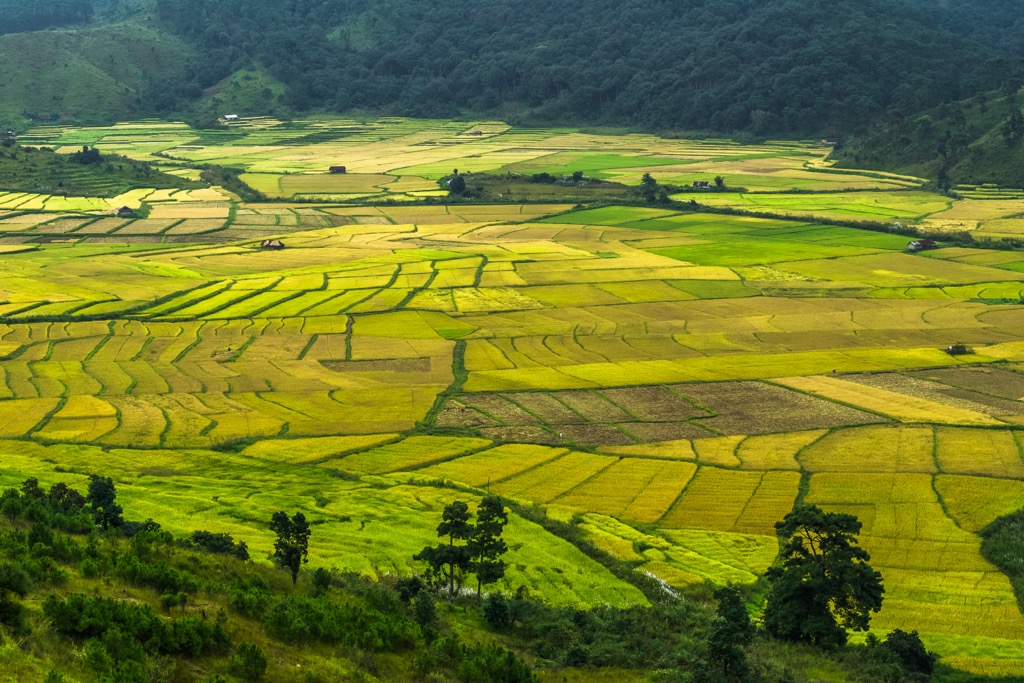
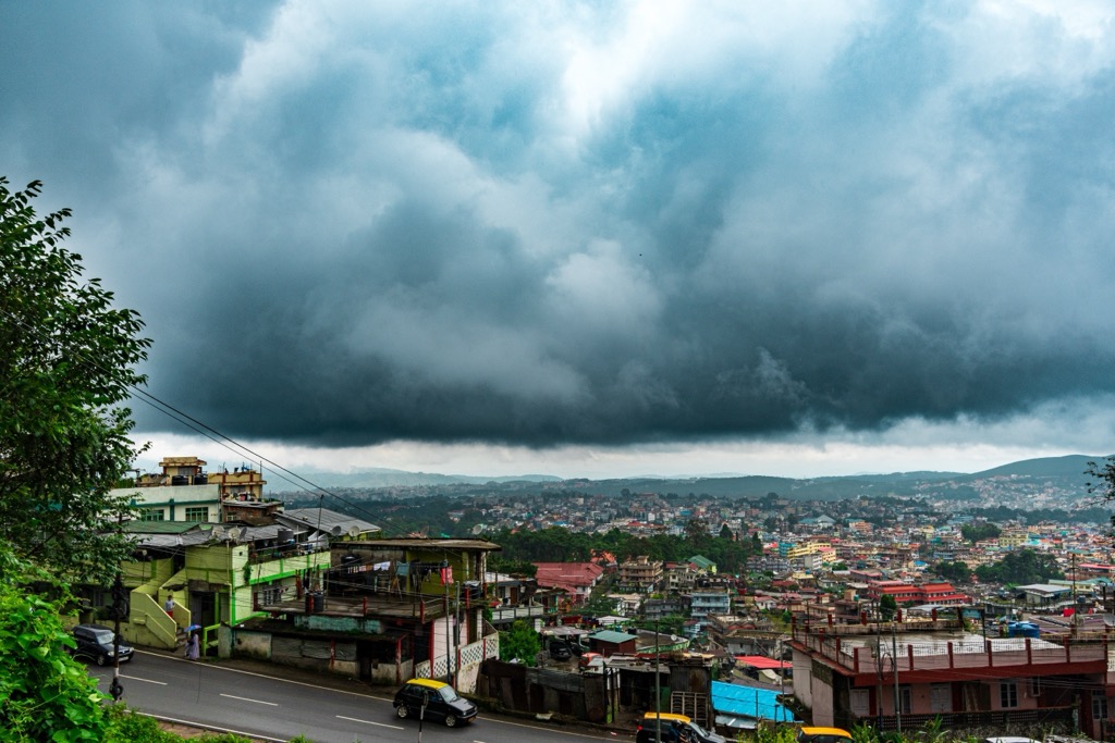
The central highlands, also known as the Khasi Hills or the Shillong Plateau, form the state’s highest mountain range and are home to the state capital and most populous city, Shillong. The range includes Shillong Peak, as well as some of the world’s rainiest towns in Cherrapunji to the south.
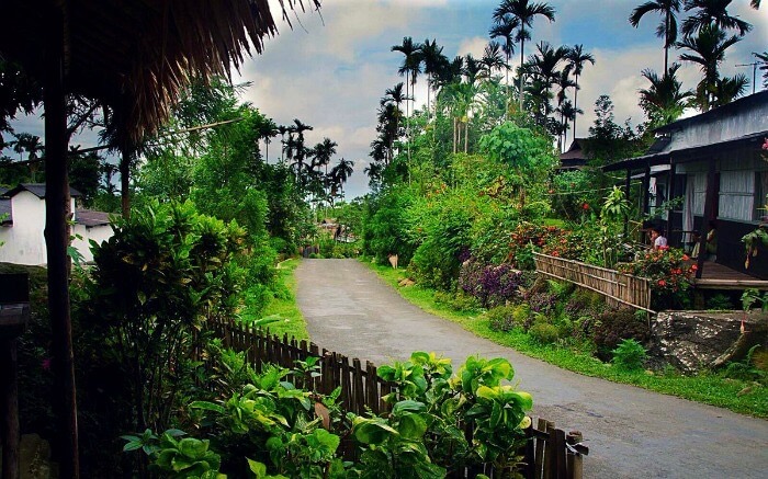
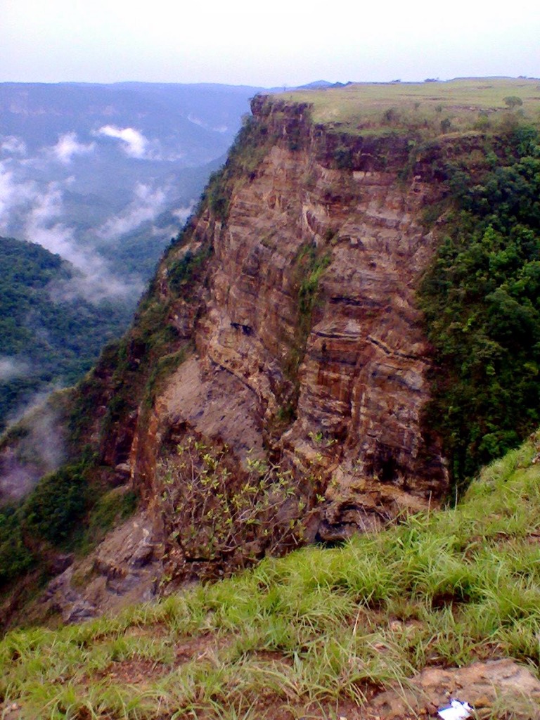
The Jaintia Hills, another separate range, cover the eastern parts of the territory, while the Garo Plateau to the west rises to 1500 meters. Tura, the second largest city and center of the Garos, lies over 300 km (7 hours' drive) from Shillong Airport. Outside the cities, the geography is defined by eroded gorges, towering cliffs, and stalactite-clad caves, almost all covered in luscious vegetation.
The Shillong Plateau, the ancient rock protrusion spanning Meghalaya, is geologically complex. The central-northeast section contains mainly quartzite formations of the Precambrian Era, while the West displays remnants of the Permo-Carboniferous Age, such as shale. A slim strip of Jurassic basalt interrupts these two, as do Cretaceous-Tertiary sediments on the southern end of the plateau. Recent alluvial deposits exist along river beds.
The primary mining interest lies in the abundant limestone reserves, estimated at over 15 billion metric tons. Coal is the second most mined material, followed by some iron ore and trace metals.
Meghalaya is one of the eastern Himalayas' most ecologically diverse and biologically rich regions. The state’s ecology is shaped by its monsoonal climate, altitudinal variation, and relative geographic isolation in rural northwest India. The state supports a mosaic of forest types and a high degree of endemism. Let’s explore the various factors contributing to Meghalaya’s ecology.
The region experiences a humid temperate climate, usually hovering between 20 and 30℃. The common denominator in the “Abode of Clouds” is plentiful precipitation. In fact, Sohra and Mawsynram are considered some of the rainiest places on Earth, receiving upwards of 11,000mm per year. In the Northern Hemisphere summer, the Bay of Bengal churns out a forceful monsoon system, swelling the roaring rivers of eastern regions like Meghalaya.
As the vast Indian plains become unbearably hot in the summer, many venture to Meghalaya. In fact, being located almost 2 degrees north of the Tropic of Cancer, and, in many cases, above 1000 meters of altitude, locales like Mylliem, Laitlyngkot, and the West Khasi Hills are no strangers to frost and morning dew in the winter.
For those who do enjoy a good sweat, it is best to check out the western Garo Hills, the northern Bhoi district, as well as some of the southernmost stretches of the province for a true steamy jungle experience, particularly between May and September.
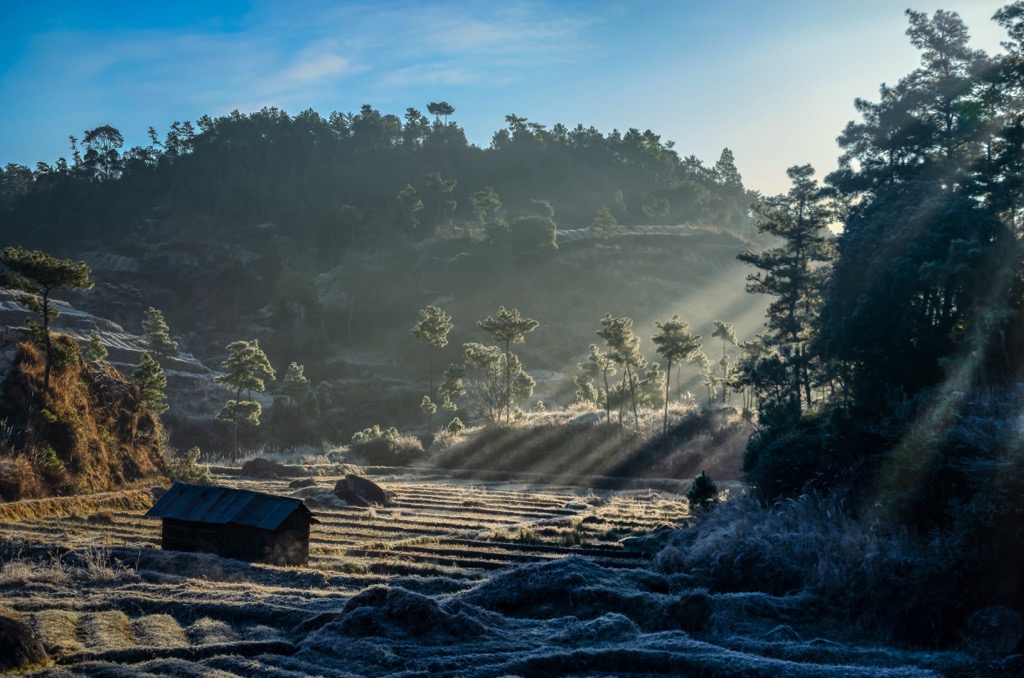
With less precipitation, winter allows access to the otherwise impermeable, mud-clogged hinterlands. Meanwhile, the fall harvest season after monsoon is characterized by local produce and festivals such as the Garo Wangala celebration. The landscape turns into a living hammam between May and September, when the monsoon is in full swing.
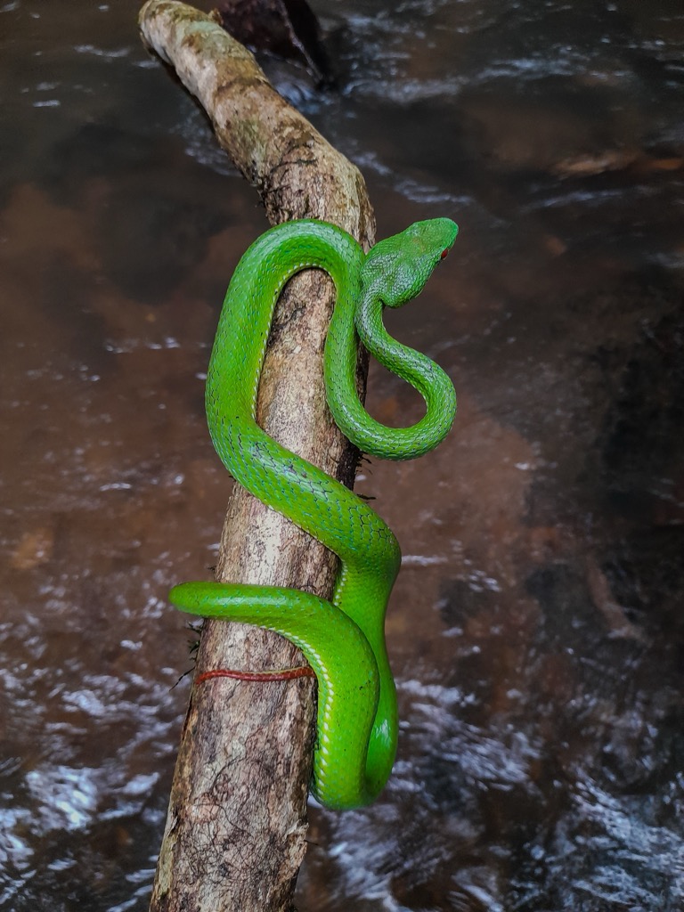
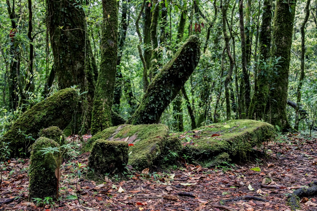
Meghalaya, like its neighboring Indian territories, lies at the far western corner of the Indo-Burma biological hotspot, an ecozone that spans Southeast Asia. The high rates of endemism stem from the region's well-preserved subtropical broadleaf forests filled with both deciduous and evergreen species. Up to 1000 meters altitude, moist montane cloud forests dominate, giving way to grasslands, bamboo groves, and diverse shrubs on the highest plateaus. Clouded leopards, sloth bears, and pangolins are just a few of the charismatic creatures that make this their home.
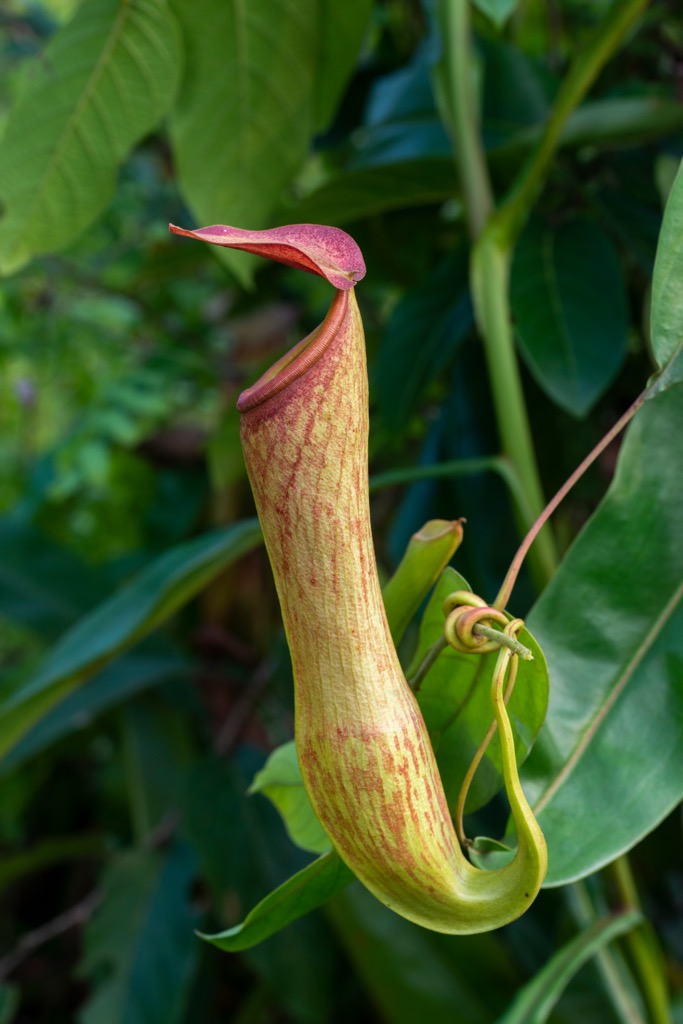
The region is sometimes known as the “Cradle of Flowering Plants,” with over 300 different orchid species. Other species of note include the insect-gulping pitcher plants, rubber trees, and perhaps the mother of all citrus fruits: Citrus indica.
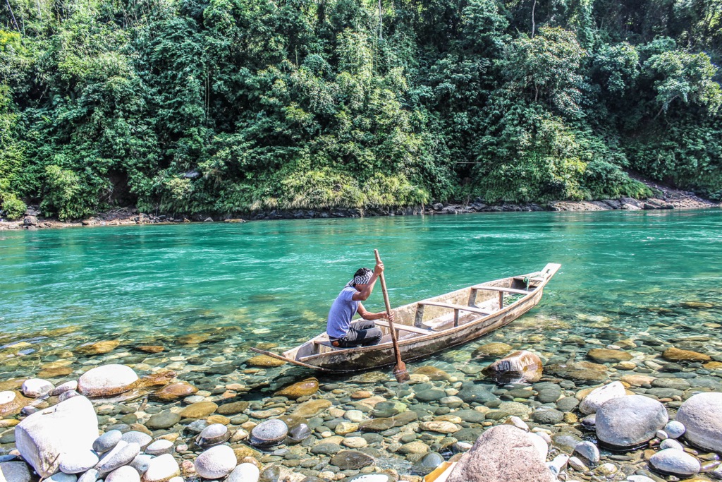
In other taxonomies, Meghalaya does not disappoint. It houses some of the largest subterranean freshwater fish, glowing Roridomyces mushrooms stretching shady forest beds, and red pandas. Sit by the Simsang River, and you might encounter peacock pheasants and grey hornbills. Being inside the Asiatic “Elephant Corridor,” a surprise encounter with the big-eared giants is equally likely.
The region includes two official national parks (Nokrek and Balpakram) and a possible UNESCO World Heritage site. In addition to formal recognition, local peoples protect Sacred Groves, as is standard practice in other parts of India, to preserve stretches of forest rich in medical plants, local myths, and endemic plant species.
The earliest evidence of human habitation in Meghalaya dates back to the Neolithic period, with discoveries of polished stone tools and megalithic structures in the Khasi and Jaintia Hills.
By the medieval period, small kingdoms and chieftainships had formed in parts of Meghalaya. The Jaintia Kingdom, for example, emerged as a significant power in the 17th century, with a sophisticated administrative structure and trade links to the Brahmaputra Valley and Sylhet plains. The Khasi Hills were divided among multiple hima, or chieftainships, each ruled by a syiem, or chief, chosen through hereditary and communal processes.

The British arrived in the early 19th century, and Meghalaya was incorporated into the colonial province of Assam. British administrators introduced formal land revenue systems, mission schools, and Christianity—the Bible was even translated into Khasi and Garo. Ultimately, the Christian Doctrine found a home in Meghalaya; 80% of the population identifies as Christian.
When India freed itself of British colonial shackles in 1947, Meghalaya was part of Assam. It was only in 1972 that the Khasi, Garo, and Jaintia Hills regions were declared autonomous from Assam, forming their own territory. The British saw it as an excluded hinterland dubbed the “Scotland of the East.” Despite its colonial history, the region saw comparatively little violent conflict.
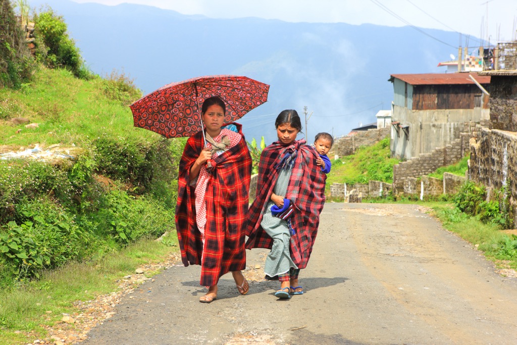
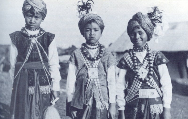
The Khasi, Garo, and Jaintia form the three main tribal groups, making up the majority of the over 3 million inhabitants of the territory. They serve as living examples of one of the planet’s few matrilineal societies, where the youngest daughter, not the eldest son, inherits the land and property of her parents.
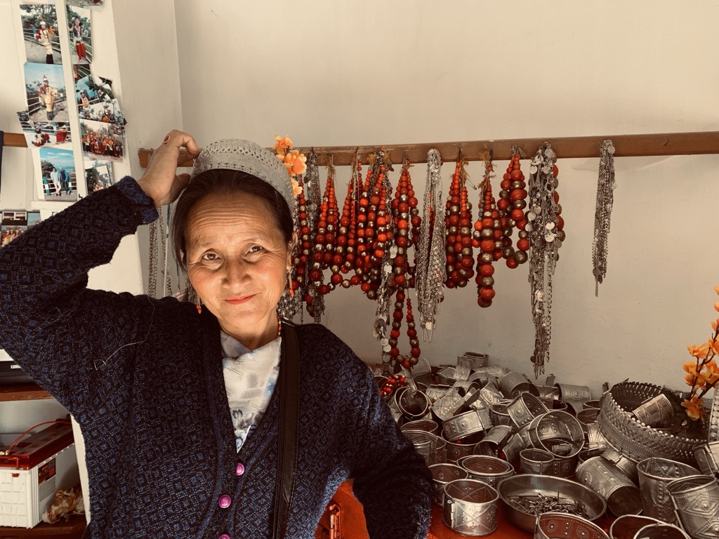
Each tribe has its own forms of government, with various elected headmen. CSOs (civil society organizations) form another important social fabric in the form of NGOs and local councils, representing the needs of different ethnic groups, students, or religious institutions. Besides CSOs, Christianity unites Meghalaya. For the most part, the minority Hindus, Muslims, and indigenous animist belief systems coexist with the over 80% Christian majority. Nonetheless, recent mass migration from Bangladesh and rumored insurgency CSOs test the fragility of this peace.
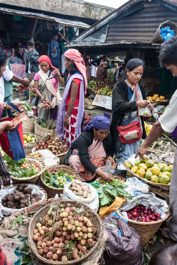
After a long forest trek, stopping at a local restaurant is the only way to experience Meghalaya. From nutty black-sesame fish stir-fries (Ktung Bain Nei-Iong) to spiced ground pork salad (jadoh), not to mention jungle vegetables and rice cooked over a fire inside bamboo tubes (Ja Tyndong), Meghalayan food is stimulating for both the eye and palate. The Jaintias, Khasis, and Garos incorporate smoked and dried fish into their cuisine, given the plethora of trout roaming their rivers.
When dining, the locals’ red-stained teeth may come as a surprise. Betel nut chewing is a highly prevalent social practice, especially after meals. While discouraged by health officials, the practice is a social custom that binds members of the tribal community, and yes, it makes their teeth bright red!

Nestled in the South Garo Hills, the “land of perpetual winds” lies far from the entanglements of civilization. Almost 400 kilometers from Guwahati Airport and more than 150 km from Tura, it’s unsurprising that the Indian government positioned it as a candidate for UNESCO World Heritage.
Vegetation-clad mesas border whistling canyons, home to the Simsang River that originates in the Nokrek Range to the north. Between insectivorous pitcher plants, the rare wild water buffalo, Asiatic elephants, and supposed sightings of the mythical “mandeburung” jungle men, Balpakram excites, frightens, and heals the soul.

A 47 ㎢ stretch of protected land at the intersection of the East, West, and North Garo Hills, Nokrek attracts for its breathtaking peaks like Nokrek Peak (1,412 m / 4,633 ft) and Tura Peak (900 m / 2,952 ft).
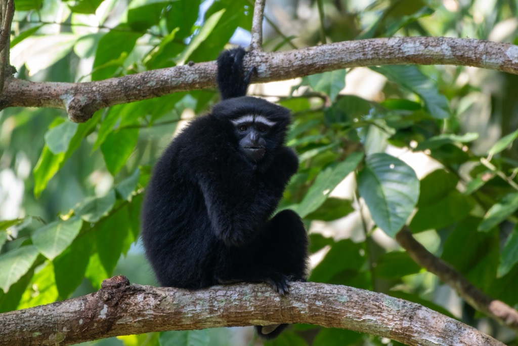
Hoolock gibbons, numerous wild cats (possibly including the Royal Bengal Tiger), and red pandas make Nokrek their home, sharing the land with indigenous farming villages producing honey and citrus fruits. Daribokgre is the entry point to see Nokrek Peak, Rongbang Dare waterfalls, and the famous Siju caves, resplendent with underground cascades and impressive limestone scenery.
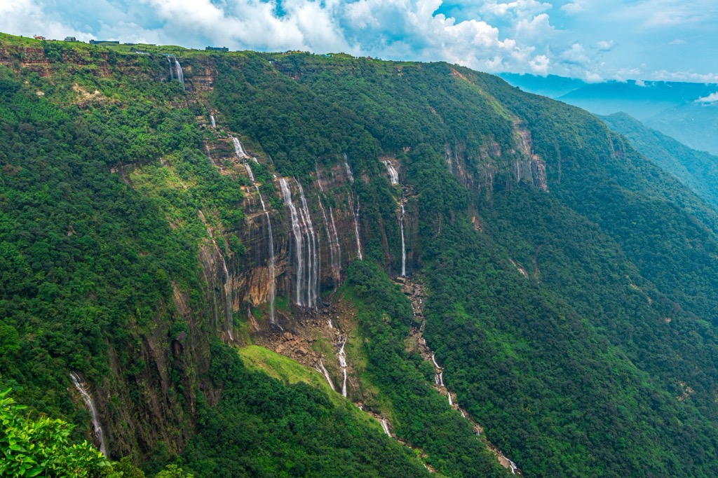
The Seven Sisters Falls, a hallmark of Meghalaya’s natural wonders, tumble over 315 meters (1,000 ft) over dramatic limestone formations amid a backdrop of saturated green rainforest. Accessible directly from Mawsmai Village in Cherrapunji, the surroundings include an intricate network of wild hiking trails, best tackled in the dry season to avoid the mud.
Equally iconic is the Nohkalikai Waterfall, a mythical cascade overshadowed by the dark legend of a local widowed woman named Likai who plunged to her death in desperation over losing her child. The waterfall literally means “Where Likai Jumped.” Despite its somber aura, India’s tallest waterfall is also one of the world’s most beautiful. Several trails lead to a plateau opening at the top, where the falls are visible from above. The pool below is likewise accessible on foot.
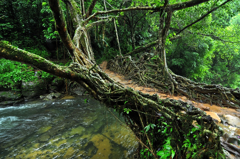
A long-standing tradition of coexistence between the ficus elastica (rubber) tree and the local tribes explains the presence of natural root bridges connecting villages divided by rivers. These bridges comprise living roots; some methods involve directly stacking or twisting ficus aerial roots, while others include bamboo, areca, or betel palm.
Shillong Peak, roughly 10 km from Shillong and accessible via taxi or car, offers relatively easy access to arguably one of the most beautiful views in the province. It directly overlooks Shillong city and the vast agricultural fields and forested hills in the distance. During good visibility, binoculars will reveal the Bangladeshi plains on the horizon. Entry is 50 rupiah, and while the peak is open to the public from 9 a.m. to 3 p.m., it is best to arrive early to beat the crowds.
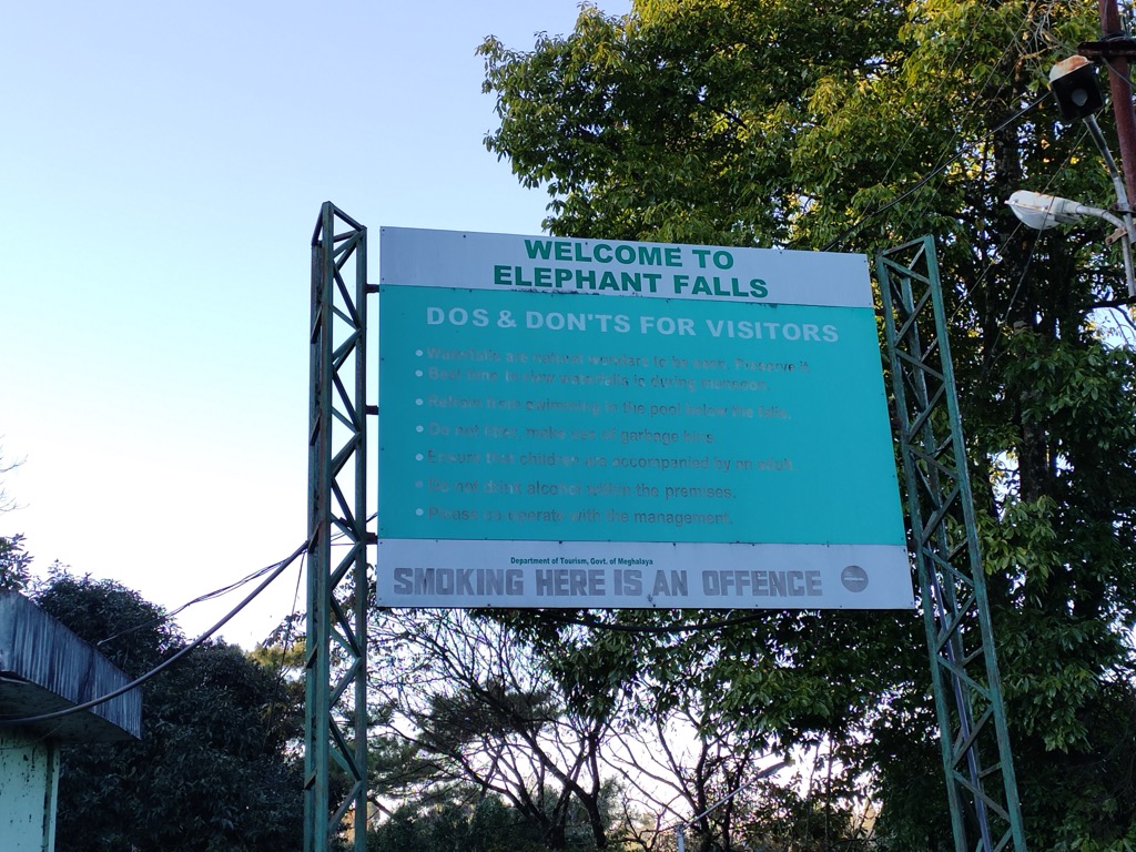
For the avid adventurer, visiting waterfalls, canyons, lakes, and cultural heritage on the same day is possible. Elephant Falls (Ka Kshaid Lai Pateng Khohsiew), just 12 km from Shillong, is a 3-tier cascade of crystal clear water cutting through fern-embroidered forest lands. For the less faint of heart, a pounding 96-meter waterfall called Sweet Falls (Kshaid Weitden) offers a more challenging hike, as one descends a tricky path down bramble bushes, ferns, and a mix of wild pines. Be sure to come early (the evening hours can bring unsavory characters), and do not go near the notorious impact zone.
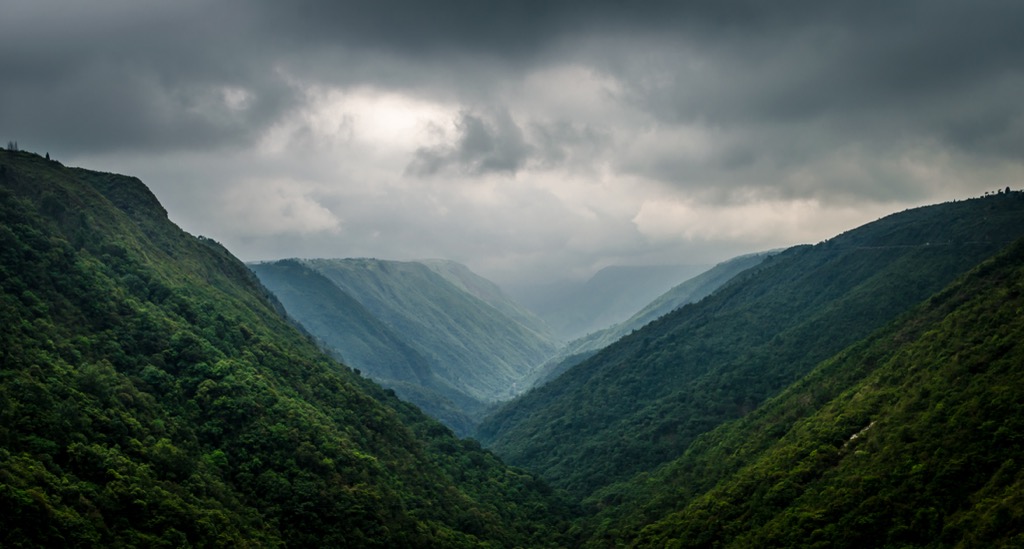
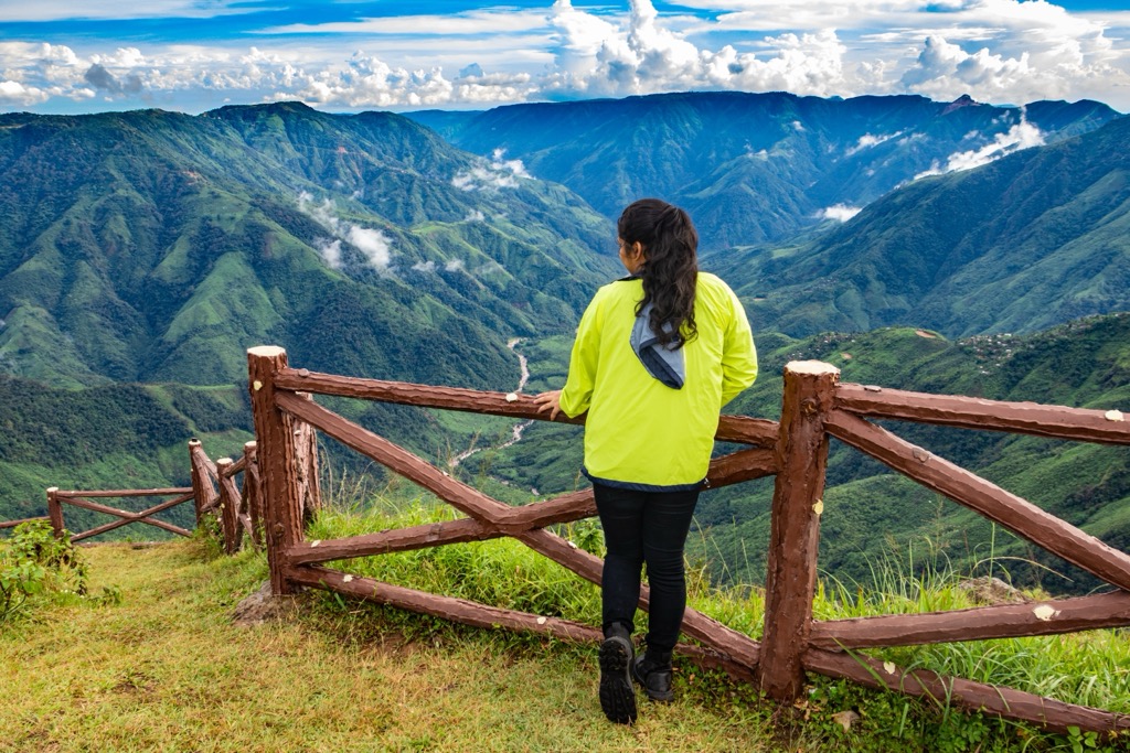
If you are more inclined to go on a hike and skip the thrills, Laitlum Canyon offers a hazy escape into what some call the East’s “Grand Canyon.” Cloudy mist and greyish-blue evergreen terpenes shroud the gently edged hills that border agricultural land and idyllic streams.
Before leaving Shillong, the spiritually inclined must visit Mawphlang Sacred Grove, an ancient primary forest with over 450 plants, among them important keystone species and medicinal herbs. Foraging, while tempting, is strictly prohibited. A guide is mandatory, and, according to local lore, taking anything will result in bad fortune.
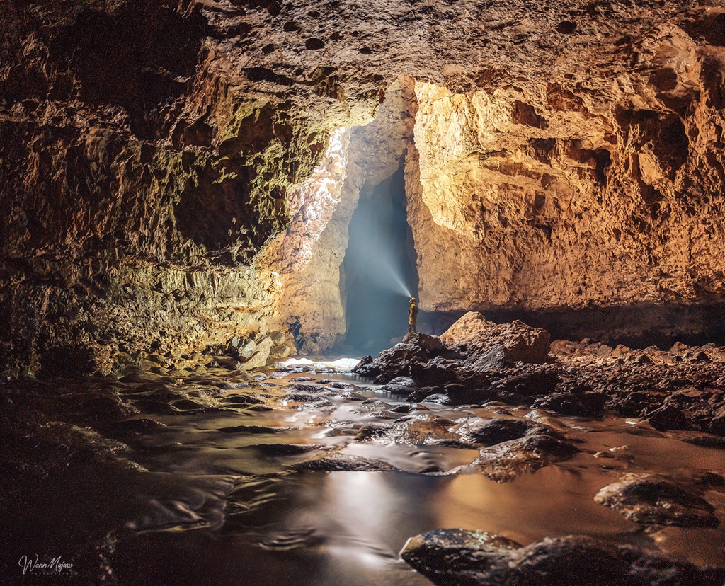
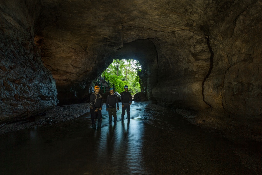
Krem Liat Prah, South Asia’s longest limestone cave at 34 km (21.1 miles), is one of over 1500 caves that make up an intricate underground paradise for cavers and geologists. “Krem” means cave in the Khasi language. Siju Cave, on the edge of Balpakram National Park, is home to many rare bat species.
Other famous caves include Krem Puri (the world’s longest sandstone cave), Krem Lymput (a breeding ground for bees), and Krem Lubon (a scenic cave with a hidden waterfall inside). Meanwhile, Mawsmai Cave, located near Nohkalikai Waterfall, is a relatively tame, beginner-friendly cavern. Many caves remain undiscovered; therefore, complex route-finding skills and caving experience are a must to ensure safety. Unfortunately, limestone mining directly threatens some of the most coveted, ecologically irreplaceable locations.
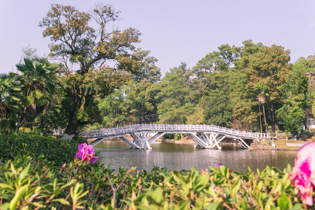
Meghalaya is rural, so Shillong is the best bet for those who seek nature with proximity to infrastructure. If directly in town, paddle on Ward’s Lake, a beautiful passage through the city with waterlilies and surrounding cherry blossoms. Equally enticing is Umiam Lake, an artificial expanse of turquoise water bordered by lush evergreens. The lake was created by cutting off the Umiam River in the 1960s.
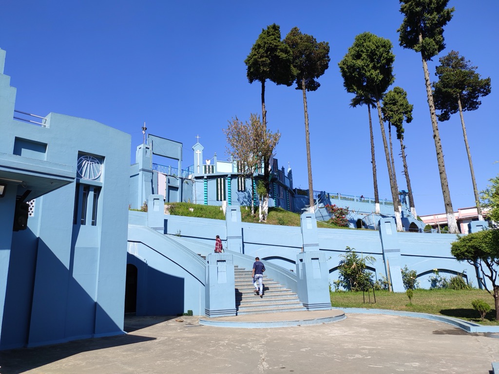
In addition, Shillong’s history is rich and enticing. History buffs will gravitate toward the Don Bosco museum, a deep dive into Northern India’s past. For those interested in the local religious customs, a beautiful blue-painted Catholic church called Cathedral Church of Mary Help of Christians beckons. Built by German settlers in the early 20th century, it is the place of worship for over 300,000 devout locals. For the secular traveler, the Ever-Living Museum welcomes one into multi-faceted and complex tribal customs.
If opting for a more low-key, less urban experience, a guided tour to the villages of the Khasi Hills is a definite itinerary. Mawlynnong Village, dubbed “Asia’s Cleanest Village,” is a proud example of waste management in heavily polluted India. The village is 100% plastic-free, with broom-swept streets and ornate traditional houses. Very close by, the supposedly 300-year-old Riwai Root bridge is also a must-see, being one of the most beautiful natural bridges in the state. It is only a 300-meter walk from Riwai Village, another charming hamlet directly accessible from Shillong by tour bus or 4X4.


.jpg)