
Scan the QR code and open PeakVisor on your phone
Kathmandu is home to 7 named mountains. The highest is Shivapuri Peak at 2,732 m.
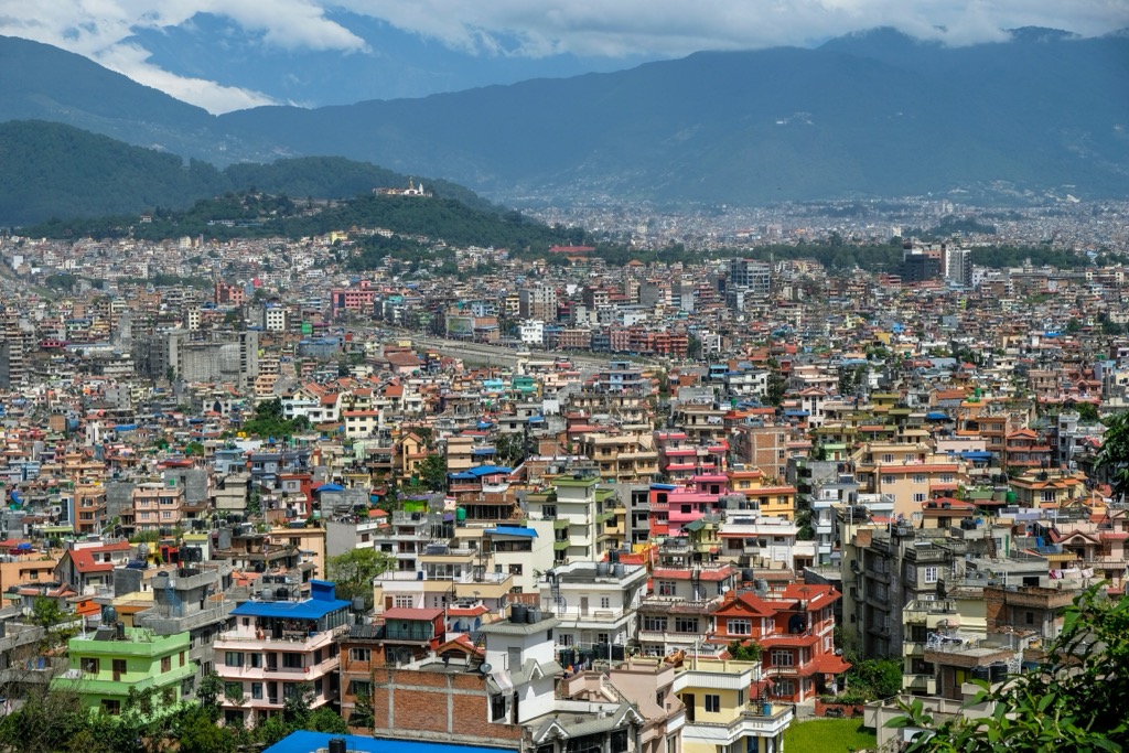
Nepal's capital and largest city, Kathmandu (काठमाडौँ), is one of the oldest continuously inhabited places on the planet, steeped in thousands of years of Hindu and Buddhist history and culture. Kathmandu offers no shortage of hiking opportunities, with rolling hills and the Shivapuri Nagarjun National Park within proximity of the city center. There are 7 named mountains in Kathmandu. Shivapuri Peak (2,732 m / 8,963 ft) is the highest point. The most prominent mountain is Chandragiri Hill (2,551 m / 8,369 ft).
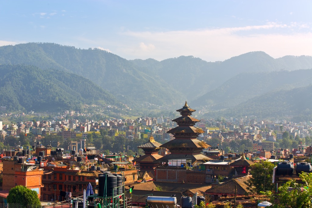
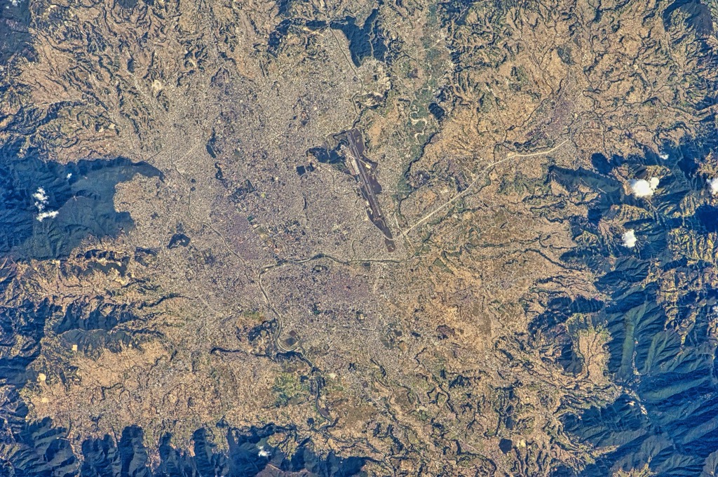
Kathmandu is the largest of the three ancient cities in the Kathmandu Valley, home to over 845,000 people and covering an area of 50.7 square kilometers (19.6 square miles). The Kathmandu Valley is Nepal's largest metropolitan area, with a population of over 5 million. Lalitpur, Nepal's fourth-largest city, borders Kathmandu to the south.
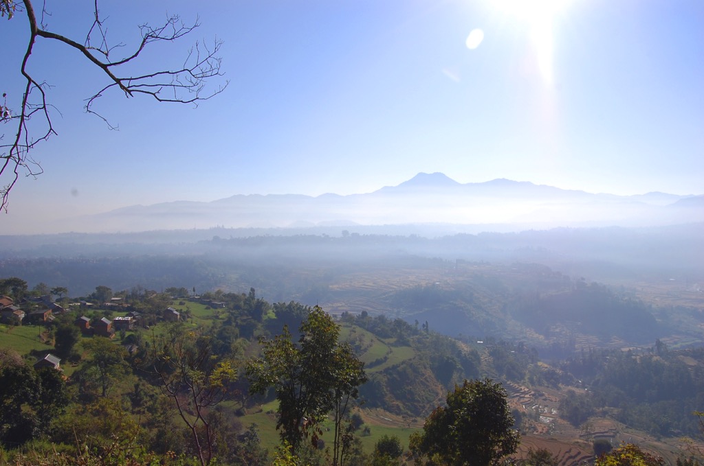
The Kathmandu Valley is roughly oval-shaped and drained by the sacred Bagmati River and its seven tributaries. It's surrounded by five Himalayan mountain ranges, including the Shivapuri Hills to the north, Phulchoki to the east, and the Chandragiri Hills to the south.
Deciduous monsoon forests cover the mountains surrounding the Kathmandu Valley, which rise approximately 1,300 m (4,265 ft) above the valley below. Kathmandu sits on the valley floor at an elevation of around 1,324 m (4,344 ft).
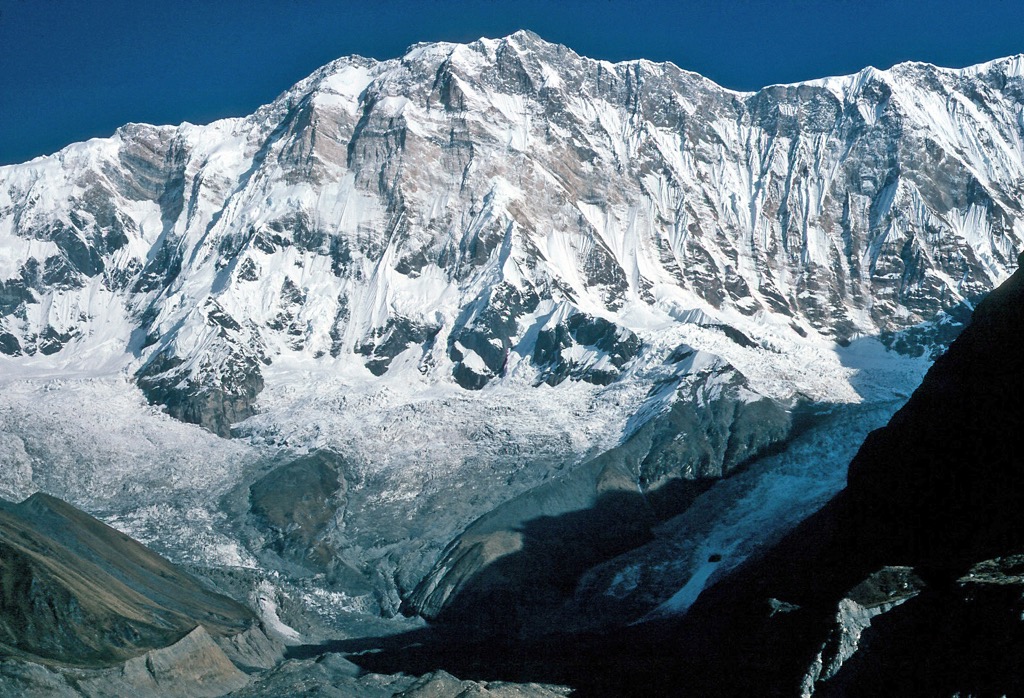
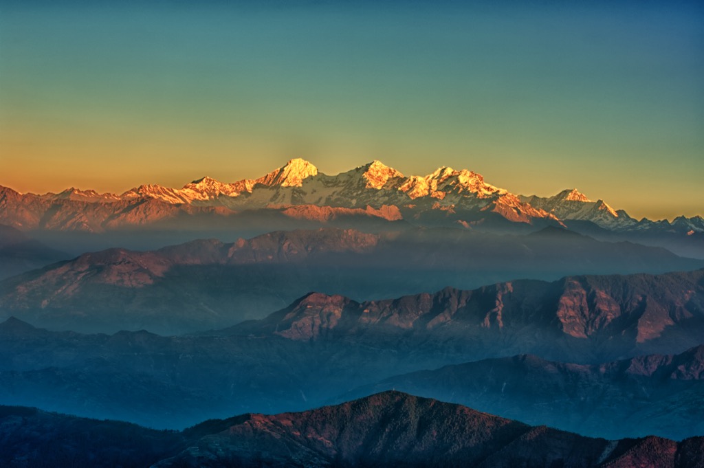
Several of the world's highest mountains are visible from summits around the Kathmandu Valley, including Manaslu (8,163 m / 26,781 ft), Gaurishankar (7,134 m / 23,406 ft), and Langtang Lirung (23,711 ft) — even Mount Everest (8,848 m / 29,029 ft) is visible on a clear day.
While Nepal boasts eight of the ten highest mountains in the world, none of them are particularly close to Kathmandu. Phulchoki (2,782 m / 9,127 ft), to the southeast of Lalitpur, is the highest summit in the Kathmandu Valley. The nearest of the world's top ten highest mountains to Kathmandu are Manaslu and Cho Oyu (8,201 m / 26,906 ft), positioned over 110 km (68 mi) away.
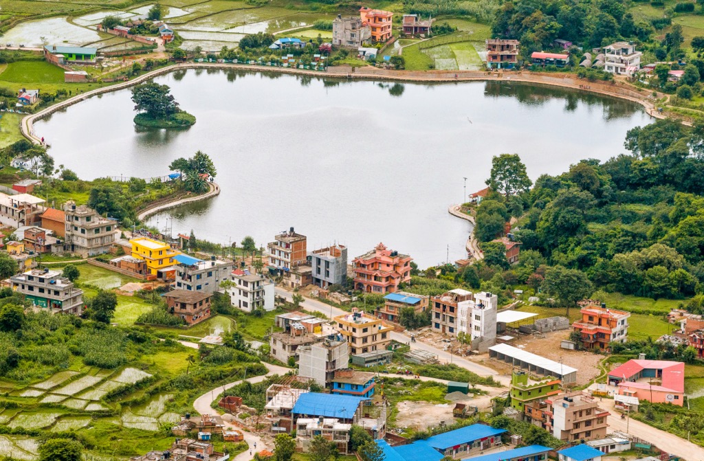
Taudaha Lake is the only lake in the Kathmandu Valley. It's a small lake with a surface area of 463 ha (1,140 acres) on Kathmandu's southwestern outskirts. Myths of nagas - half-human, half-serpent deities - living in Taudaha Lake have prevented locals from fishing or swimming in the lake for centuries.
Kathmandu is one of the world's most polluted cities, surprising given its natural surroundings. This unwanted title is partly due to its unique geography, with the Kathmandu Valley and the nearby mountains trapping polluted air. Vehicle emissions, forest fires, and Nepal's position between heavily polluted China and India contribute to its poor air quality.
The basement rocks of the Kathmandu Valley date back to the Precambrian to Devonian periods, with Precambrian rocks among the oldest on Earth, originating 4.5 billion years ago.
These rocks are from the Phulchowki Group and Bhimphedi Group, two series of metamorphosed rocks. The Phulchowki Group is mostly poorly metamorphosed limestone, while the Bhimphedi Group is an 8 km (5 mi) thick succession of mainly schists, quartzites, and marbles.
Kathmandu experiences a significant amount of seismic activity due to its location near the boundary between the Indian and Eurasian tectonic plates. On average, a major earthquake of magnitude 7.0 or greater occurs in Nepal approximately every 38 years.
The Lesser Himalaya is the main tectonic unit in the Kathmandu Valley. Common rocks near the surface in the Kathmandu Valley from the Lesser Himalaya unit include dolomite, limestone, phyllite, schist, and slate.
Geologists believe that the Kathmandu Valley was once a primordial lake formed in a tectonic basin between mountains. It's thought that this lake drained in two stages, thousands of years apart, likely due to earthquakes.
This lake, known as the Paleo-Kathmandu Lake, is believed to be between one million and two million years old. Large areas of the Kathmandu Valley are coated in a thick layer of sediment up to 500 m (1,640 ft) thick in places due to the former lake and the region's rivers. These layers range in composition from slit and clay in the north to sand and gravel in the south.
Nepal ranks among the top 50 countries for biodiversity, with Kathmandu's rolling hills and monsoon forests supporting an array of animal and plant species rarely found anywhere else in the world.
One of the rarest large mammals in Kathmandu is the clouded leopard — there are estimated to be between 100 and 500 individuals in Nepal.
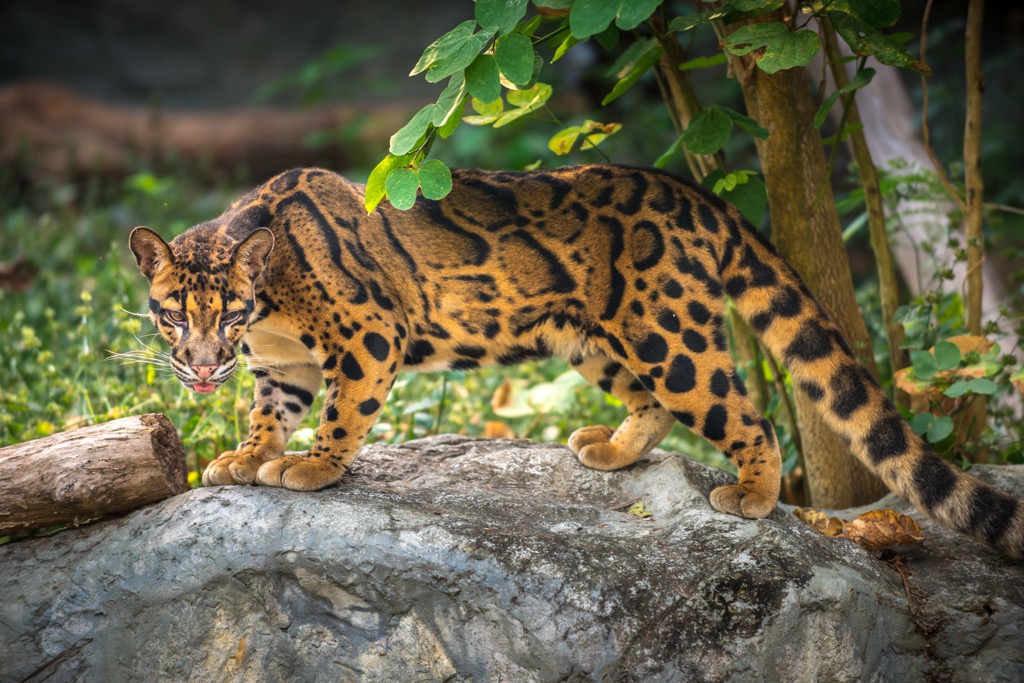
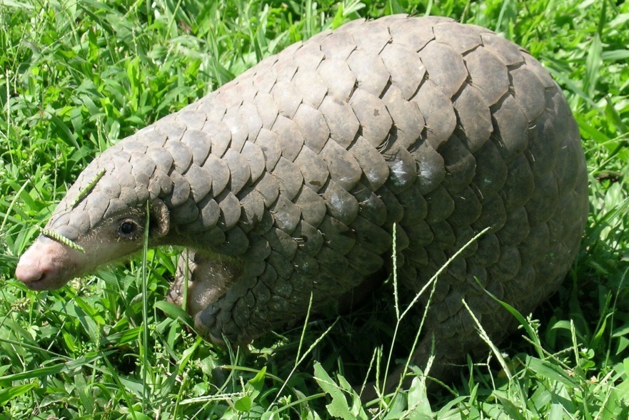
Over 175 mammal species have been recorded in Nepal, many of which inhabit the Kathmandu Valley, including barking deer, masked palm civets, crab-eating mongooses, rhesus macaques, Himalayan porcupines, Chinese pangolins, and Royle's pikas.
The Kathmandu Valley is home to over 530 bird species. Common birds that have adapted to living in downtown Kathmandu include rock pigeons, common mynas, common crows, rose-ringed parakeets, and barn swallows.
Cattle egrets, white-throated kingfishers, mallard ducks, ruddy shelducks, and common coots are often spotted around Kathmandu’s rivers and lakes. Black kites, steppe eagles, mountain hawk eagles, eagle owls, and peregrine falcons are a few of the valley's birds of prey.

Several venomous snake species have been recently discovered in urban areas of Kathmandu, including the monocled cobra and the world's longest venomous snake, the king cobra. All told, there are over 145 reptile and amphibian species in the Kathmandu Valley, including checkered keelbacks, oriental garden lizards, fork-tongued frogs, and black-striped frogs.
Most spider species in Kathmandu are harmless, but there are a few species to watch out for, such as Latrodectus elegans, a species of black widow that's relatively common in urban areas of Kathmandu. Their bites are painful and can cause worrying symptoms like muscle spasms, but they're seldom lethal when properly treated.
Nepal is a verdant country with over 45% forest cover, and the Kathmandu Valley is no different. The valley's montane monsoon forests are primarily composed of oaks, schima, beeches, and maples, with coniferous trees, such as blue pines and chir pines, found at higher elevations.
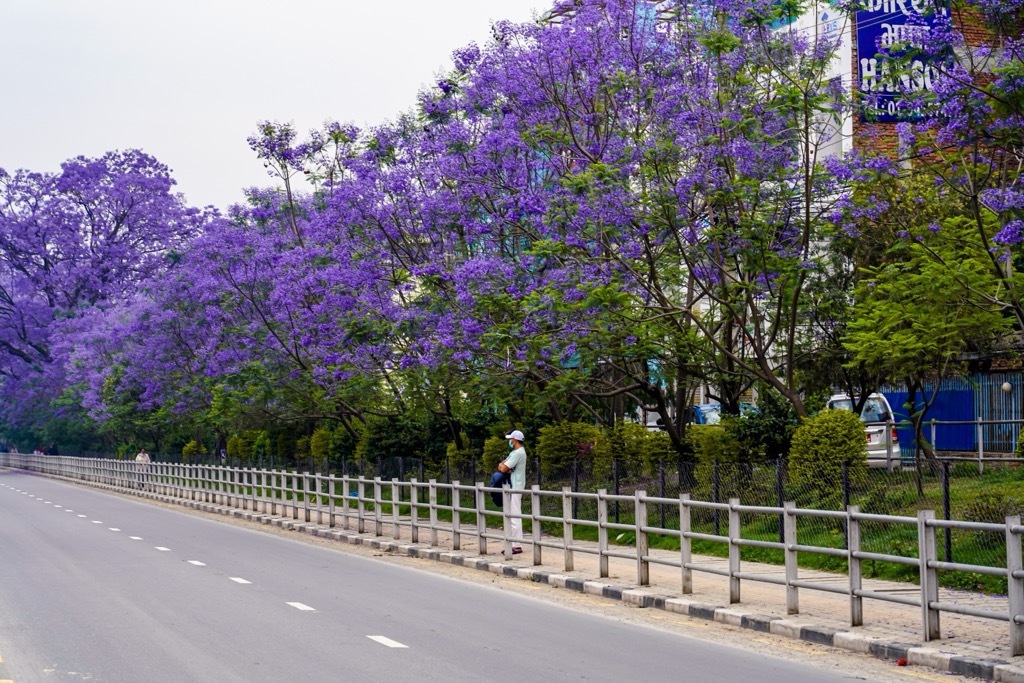
Jacarandas line the streets of Kathmandu with their purple flowers, brightening up the city in spring and summer. Rhododendron arboreum, or tree rhododendrons, are the national flower of Nepal, with their red, white, and pink flowers in bloom across the Kathmandu Valley between March and late April. Tree rhododendrons are endemic to Nepal.
Several other wildflower species found in Kathmandu are endemic to the Himalayas, like Himalayan blue poppies and coiled cobra lilies. Other plants native to Kathmandu include marigolds, satin poppies, painted leaf begonias, and lemon clematis.
There are no records documenting the first ascents of the hills surrounding Kathmandu — locals have been scaling these hillsides for hundreds of years.
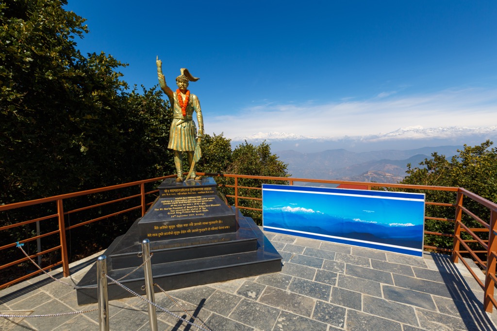
Chandragiri Hill has historical significance, as it's said to be where King Prithvi Narayan Shah first decided to annex Kathmandu after viewing the valley from its summit. King Prithvi Narayan Shah's conquest resulted in the unification of Nepal in the mid-18th century. There's a statue of King Shah atop Chandragiri Hill.
Trekking in Kathmandu and Nepal opened to international travelers in the 1950s following the fall of the Rana Dynasty. British explorers Colonel James Roberts and Bill Tillman were the first outsiders to be granted permission by the King of Nepal for an expedition in the Nepalese Himalayas.
In 1950, Roberts joined an expedition led by Tilman to the Annapurna massif; however, the trek was poorly organized, and the team failed to reach the lower summit of Annapurna IV (7,525 m / 24,688 ft). Later that year, a French expedition — led by Maurice Herzog — became the first team to reach the summit of Annapurna I (8,091 m / 26,545 ft).
Colonel James Roberts is considered "the father of Nepalese trekking," as he was the first to recognize the appeal of hiking in Nepal to tourists. In the mid-1960s, Roberts established Mountain Travel, the first company to organize tourist treks in Nepal. Tilman and Roberts' 1950 Annapurna expedition is widely considered the first tourist trek in Nepal.
Today, Kathmandu serves as the gateway to Nepal's most popular hikes, with Tribhuvan International Airport the nearest international airport to Mount Everest. Over 100,000 come to Nepal annually just to hike in Sagarmatha National Park, the home of Mount Everest. Shivapuri Nagarjun National Park, located just north of Kathmandu, is one of Nepal's most visited national parks, attracting over 300,000 visitors in 2024.
While the hills around the Kathmandu Valley aren't as perilous as most of the nearby Himalayas, you still take precautions when hiking near Kathmandu. Spring and fall are the best times of year for trekking around Kathmandu — summer brings monsoons, and winter can be stormy.
Many trails, such as Chandragiri Hill, are well-marked and easy to follow, but consider hiring a local guide or joining a hiking group if you're unfamiliar with the area. It's better to hike in a group in Kathmandu due to the presence of Himalayan black bears and leopards.
Spring and summer temperatures in Kathmandu can exceed 26°C (80°F), so be sure to bring plenty of water while trekking. Carefully map your route and inform others of your itinerary.
At PeakVisor, we love information. That’s why we write articles like this one.
Once upon a time, it was challenging to obtain accurate maps in remote locations, such as Nepal. No longer. Welcome to PeakVisor’s 3D Maps with real satellite imagery. PeakVisor has all the public trails at your fingertips—we still encourage supporting the locals by hiring a guide, though!
Check out the PeakVisor app for even more information on thousands of additional hikes, ski tours, and ski resorts across the world. In fact, we’ve compiled information on all publicly maintained walking tracks worldwide, formatted onto our 3D maps.

PeakVisor started as a peak identification tool, but we’ve evolved into purveyors of the finest 3D maps available. We continue to expand our offerings. You can track your hikes directly on the app, upload pictures for other users, and keep a diary of all your outdoor adventures.
Most recently, the PeakVisor App has included up-to-date weather reports, including snow depths, at any destination. We've also been hard at work adding the details of hundreds of mountain huts, including information on overnight accommodation, dining options, and opening hours. You can also use our Hiking Map on your desktop to create .GPX files for routes to follow later on the app.
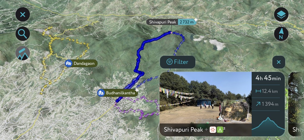
Shivapuri Peak (2,732 m / 8,963 ft) is the namesake and highest summit of Shivapuri Nagarjun National Park. It's located on the northern rim of the Kathmandu Valley, around 15 km (9.3 mi) from downtown Kathmandu. Shivapuri Nagarjun National Park spans an area of 159 square kilometers (61 square miles).
Shivapuri Peak is a superb climb if you fancy a spot of nature watching — the park is home to over 300 bird species, including colorful species like slender-billed scimitar-babblers and golden-throated barbets.
You'll need to pay for a trekking permit before visiting Shivapuri Nagarjun National Park. Parks in Nepal charge different fees depending on your country of residence. A comprehensive list of national park fees is available on the Nepal Tourism Board website. You can pay the entry fees at the Tourist Service Center, located in Bhrikutimandap, Kathmandu, or at any park entry point.
A guide isn't mandatory in Shivapuri Nagarjun National Park, but we highly recommend hiring one. You can pay for a guide at the park gates.
There are several looped trails to Shivapura Peak. One popular, moderately challenging option leads from Panimuhan past the Nagi Gumba Monastery and Bagdwar, the source of the holy Bagmati River. Shivapuri Peak provides views of the Jugal Himal, the Ganesh Himal, and the Langtang Himal, stretching as far as Annapurna on a clear day. This trail takes around 6 hours to complete and is roughly 18 km (11 mi) long.
Chandragiri Hill (2,551 m / 8,369 ft) is the most prominent hill in the Kathmandu Valley, located 16 km (10 mi) southwest of downtown Kathmandu. It's among the best-developed hills in the Kathmandu Valley, featuring cable cars and topped with the Bhaleshwor Mahadev Temple, a resort, restaurants, a children's play park, and several viewing platforms. It's advertised as Nepal's premier hill station summit.
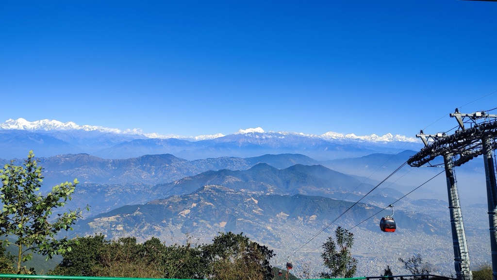
Views from the hill are far-reaching, with Mount Everest, Annapurna, and Gaurishankar (7,134 m / 23,406 ft) visible on a clear day. Chandragiri Hill is regarded as the quickest way to see Mount Everest from central Kathmandu, thanks to its cable car.
While you can take the cable car straight to the summit, it's much more rewarding to hike up Chandragiri Hill. One recommended route up Chandragiri Hill is from Machhegaun, following a clear trail that zigzags up to the summit. The trail is easy-going and not particularly steep. Return the way you came or ride the cable car down to Thankot.
You don't need a permit to hike Chandragiri Hill. You'll find prices for the Chandragiri Hill cable car here. This trail takes 2 to 3 hours to complete and is approximately 5 km (3.1 mi) long.
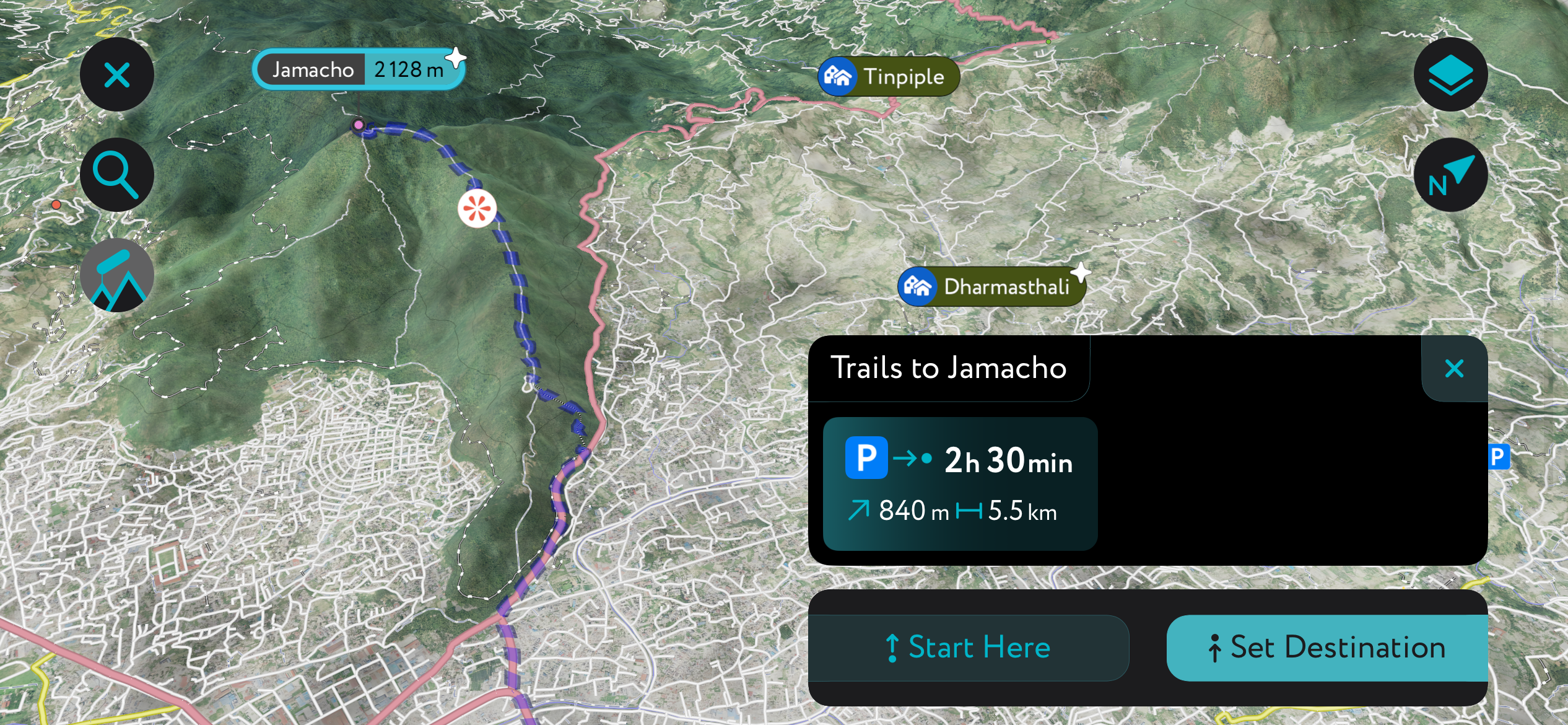
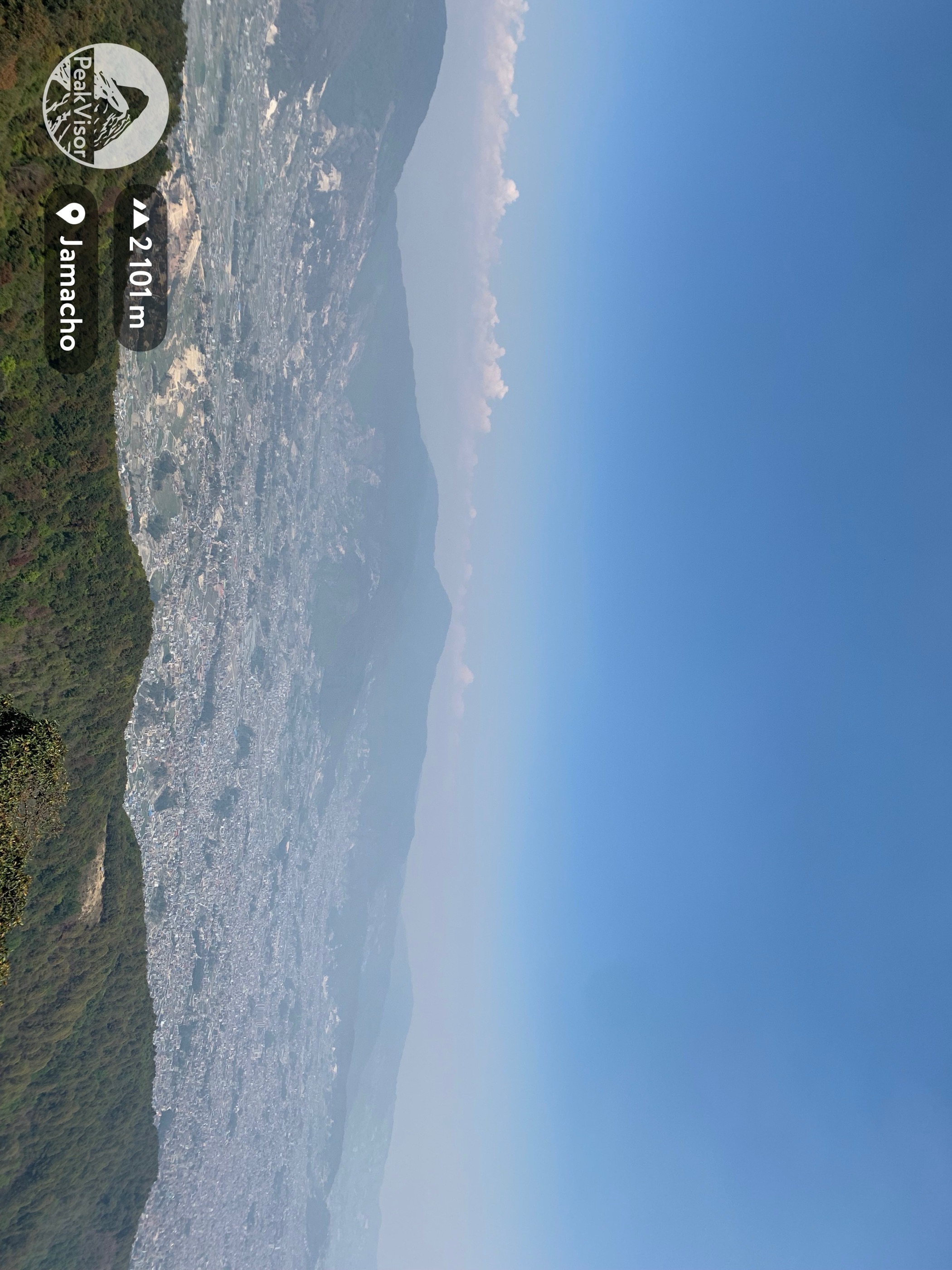
Jamacho (2,128 m / 6,982 ft) is an easily accessible day hike near Kathmandu, offering panoramic views of the Kathmandu Valley. Positioned on the northwestern edge of the valley, Jamacho is less than 5 km (3.1 mi) from central Kathmandu within the Nagarjun Forest Reserve. Near Jamacho's summit is the Jamacho Gumba, a Buddhist monastery.
The best place to start climbing Jamacho is from the Fulbari Gate trailhead. The Nepalese army uses Jamacho for training, so you'll need to sign in with them before continuing. The Nagarjun Nature Reserve is part of the Shivapuri Nagarjun National Park, so there's an entry fee, which you can pay at Fulbari Gate.
Jamacho is a short but fairly strenuous climb, with some steep sections and uneven trails. The views from Jamacho are sweeping, with the likes of Langtang Lirung (7,227 m / 23,711 ft) and the Ganesh Himal visible beyond the valley. The hike to Jamacho from Fulbari Gate is approximately a 7.5 km (4.6 mi) round-trip.
Consider climbing Champa Devi (2,255 m / 7,398 ft) if you're searching for another day hike on the south side of Kathmandu near Chandragiri Hill. Champa Devi is famous for the sacred Hindu temple located on its summit, dedicated to the Goddess Champa Devi.
Summit views on Champa Devi are similar to other hills in the Kathmandu Valley, with Everest, the Annapurnas, Langtang Lirung, and more visible on clear days.
There are several routes up Champa Devi, including from the summit of Chandragiri Hill. One of the most popular and quickest routes is from the Hattiban Resort Parking Ground in Dakshinkali. The route initially follows a stony road past the Hattiban Resort to the Champa Devi trailhead.
The Champa Devi Trail leads directly up the hill and is partially paved. Descend the way you came. This Champa Devi hike from Dakshinkali is approximately 10 km (6.2 mi) long.
Phulchoki (2,782 m / 9,127 ft), or Phulchowki, is the highest summit in the Kathmandu Valley, located within Godavari Forest near Lalitpur, around 15 km (9.3 mi) southeast of central Kathmandu.
Godavari Forest is popular with nature watchers and hikers due to its botanical gardens and trails. Godavari Forest is famed for its biodiversity and is home to leopards, barking deer, pangolins, and giant flying squirrels.
The route to Phulchoki's summit isn't necessarily challenging, but it's a long day hike. The hike to Phulchoki starts and ends at the Godawari Bus Stop. The entire route follows the Phulchoki - Godawari Road as it weaves up the hillside. This Phulchoki hike is approximately 25 km (15.5 mi) long.
Despite its countless snow-capped summits, Nepal isn't a popular skiing destination. There is only one ski resort within driving distance of Kathmandu that's accessible in late spring and early winter. The Kalinchok – Kuri Ski Resort is Nepal's only ski resort, situated roughly 140 km (87 mi) northeast of Kathmandu.
Nestled within the Kathmandu Valley are three ancient cities once ruled by the Malla kings, each with unique historical sights worth discovering.
Tribhuvan International Airport is Nepal's main international airport, located less than 5 km (3.1 mi) from the city center. It offers flights to over 15 countries, predominantly in Asia.
Kathmandu is the capital and largest city in Nepal, with a population of over 856,000. An ancient city founded in 723 CE, Kathmandu boasts numerous UNESCO World Heritage Sites, including Durbar Square and the 5th-century Swayambhu Great Stupa.
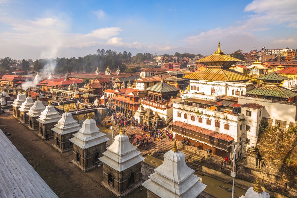
The most famous of Kathmandu's many temples is the Pashupatinath Temple, dedicated to Shiva and renowned for its pagoda-style, tiered architecture, intricate engravings, and its position on the sacred Bagmati River.
Kathmandu is the primary gateway to trekking in Nepal, serving as the country's main transportation hub. Central areas of the city, like Bagbazar and Thamel, are within 10 km (6.2 mi) of the Chandragiri Hills and Shivapuri Nagarjun National Park.
Lalitpur, also known as Patan, is Nepal's fourth-largest city, with a population of around 300,000. Lalitpur is believed to be the oldest city in the Kathmandu Valley, dating back to the 2nd century CE.
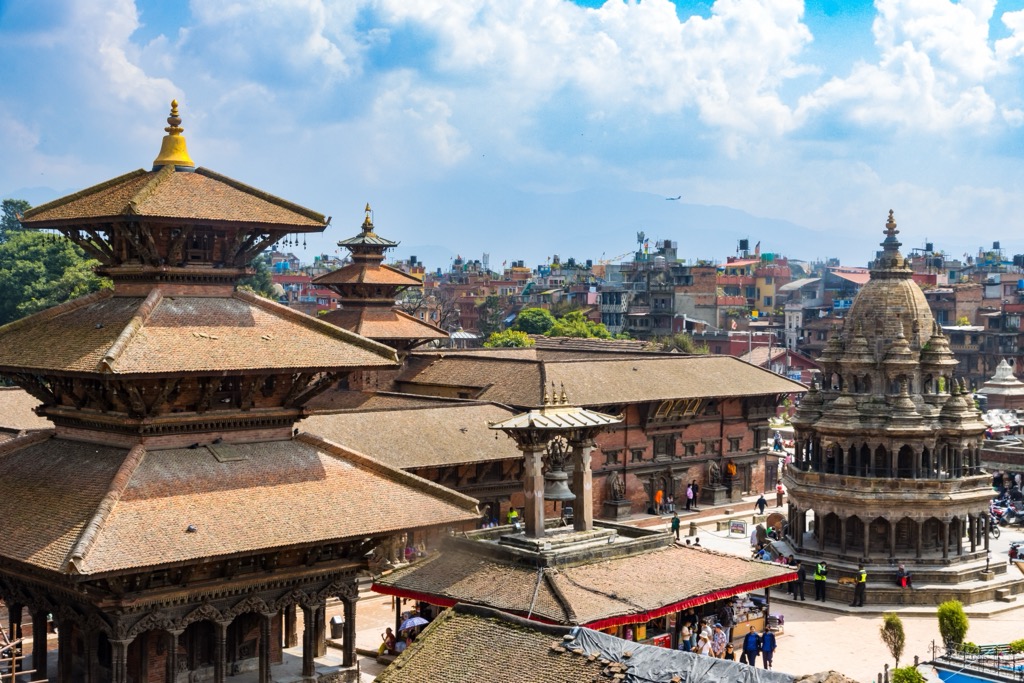
Like Kathmandu, Lalitpur features a UNESCO-protected Durbar Square, which includes a palace complex used by the Malla kings, part of which now hosts the Patan Museum. Consider paying your respects at the impressive 12th-century Hiranya Varna Mahavihar, also known as the Golden Temple, during your visit to Lalitpur.
Located on the south side of the Kathmandu Valley, directly south of Kathmandu, Lalitpur is perfectly positioned for visiting the Chandragiri Hills and Godavari Forest.
Bhaktapur is Nepal's smallest but most densely populated city, with a population of around 80,000. It's the final of the three ancient cities of the Kathmandu Valley, east of Kathmandu and northeast of Lalitpur.
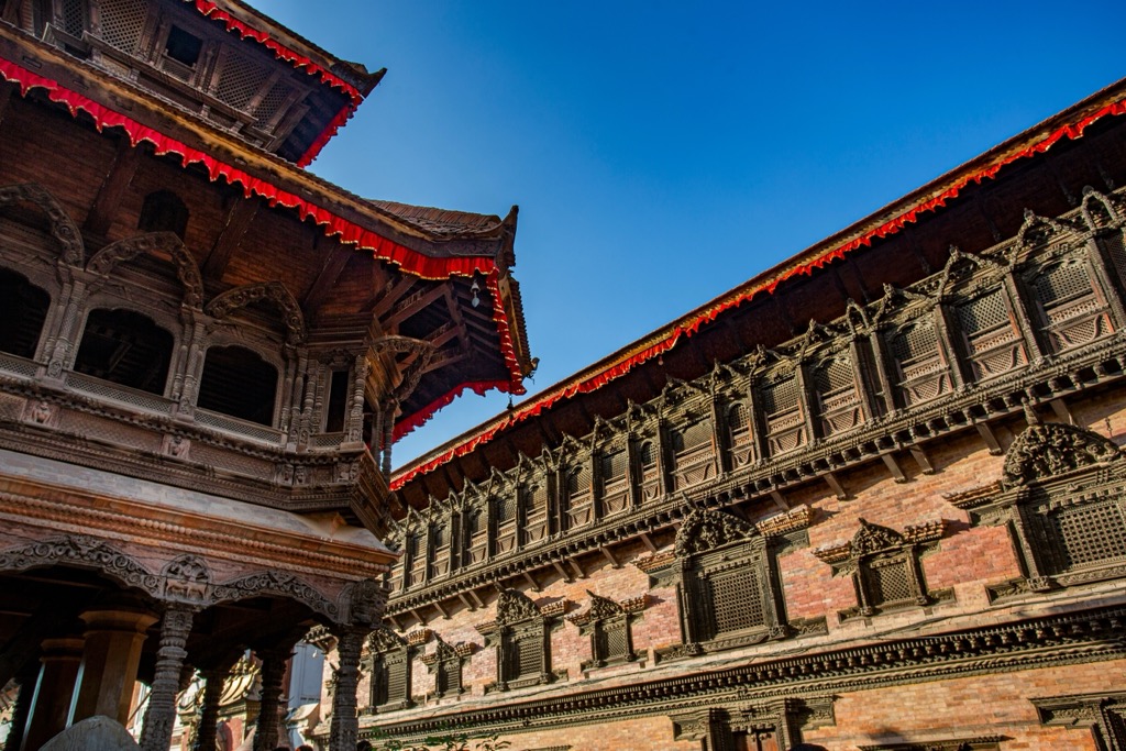
Like its neighbors, Bhaktapur also has a Durbar Square, which accommodated the Malla kings in the 14th to 15th centuries. Sadly, the palace complex suffered significant damage from earthquakes in 1934 and 2015. Other top attractions include Nyatapola Temple, Nepal's tallest temple, and Changu Narayan Temple, a UNESCO World Heritage Site.
Bhaktapur is within 10 km (6.2 mi) of hiking destinations like Godavari Forest and Shivapuri Nagarjun National Park.


Yes. Kathmandu has 7 named mountains. The highest is Shivapuri Peak at 2,732 m.
The highest mountain in Kathmandu is Shivapuri Peak, at 2,732 m.
Kathmandu has 7 named mountains.


.jpg)