
Scan the QR code and open PeakVisor on your phone
Welcome to Manipur, a state in the northeastern arm of India on the border with Myanmar. It’s a land almost entirely dominated by mountains, with the capital, Imphal, situated in a central valley. The lush green peaks of the Eastern Himalaya and Indo-Burma ranges comprise nearly 90% of the state’s land area and are collectively known as the “Manipur Hills.” According to publicly available resources, there are 32 named mountains in the state, though the actual number is far higher. As Manipur is exceptionally rural and had limited interaction with the British Raj, these mountains likely have only local names in indigenous languages. The highest mountain is Tenipu (Mount Tempü), at 2,994 meters (9,823 ft). Laikot (2,832 m / 9,291 ft) is the most prominent peak.
Manipur is a landlocked state covering 22,327 square kilometers (8,620 sq. miles). It’s bordered by Nagaland to the north, Mizoram to the south, Assam to the west, and Myanmar to the east. Mountains account for nearly 90% of Manipur's land area, while the remaining 10% consists of the fertile Imphal Valley.
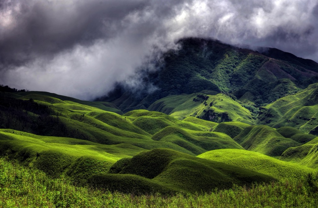
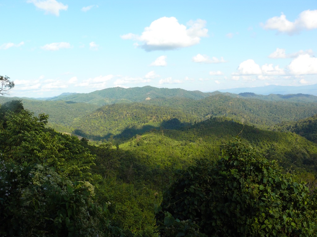
The Manipur Hills, part of the Eastern Himalayas and the Patkai Range, surround the central valley on all sides. To the north, the Naga Hills extend into Nagaland, featuring Mount Tenipu (Tempü), the highest peak in Manipur at 2,994 meters (9,823 feet). To the west, the Barail Range separates Manipur from Assam, while the eastern hills merge with the Chin Hills of Myanmar. The Lushai Hills in the south extend into Mizoram. These mountains are covered with dense subtropical forests in the lowlands, and temperate forests and grasslands at high elevations.
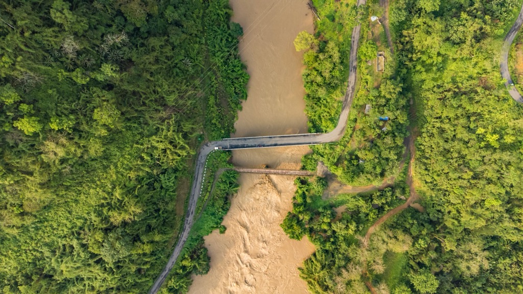
The rural lowlands of Manipur are a biodiversity hotspot featuring rare orchids, tigers, and clouded leopards. At the heart of Manipur lies the Imphal Valley, a vast alluvial plain surrounded by mountains. The valley covers about 2,000 square kilometers and is home to Imphal, the capital city, and most of the state’s population. Several rivers flow through the valley, including the Imphal, Nambul, and Iril Rivers. The Barak River, originating in the Barail Range, is the largest in Manipur, flowing westward into Assam.
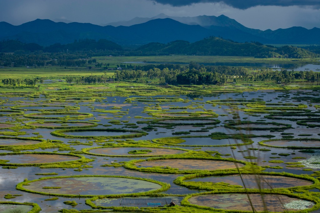
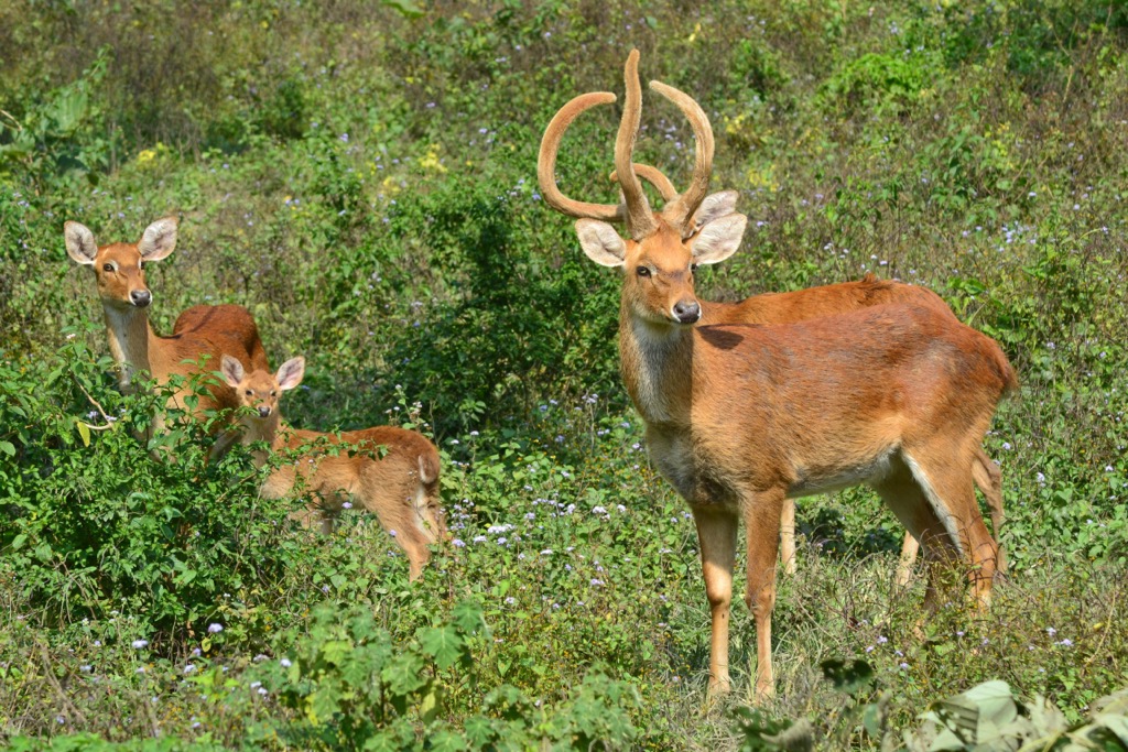
Manipur is home to Loktak Lake, the largest freshwater lake in Northeast India. Loktak is renowned for its phumdis, floating islands of vegetation that support entire ecosystems atop little islands upon the water. The Keibul Lamjao National Park is the world’s only floating national park and the endangered Sangai deer’s last natural habitat. The Sangai deer, also known as the brow-antlered deer, Eld’s deer, and “dancing deer,” is the state animal of Manipur. It was declared extinct in 1951 and re-discovered in 1953.
Manipur is located in the Indo-Burma Range, a highly active tectonic zone where the Indian Plate collides with the Burmese Plate. This geological setting has made Manipur prone to seismic activity. Earthquakes are common; most recently, the 2016 Imphal earthquake (6.7 magnitude) caused significant damage in the capital.
The Patkai Hills, Barail Range, and Naga Hills are composed of metamorphic and sedimentary rocks, primarily shale, sandstone, and limestone, which date back to the Cretaceous and Tertiary periods. The presence of ophiolite belts, remnants of ancient oceanic crust, suggests that parts of Manipur were once submerged under an ancient sea before being uplifted by plate tectonics.
Manipur is home to an array of mineral deposits. The state is rich in limestone, chromite, and clay, used in cement production. Oil and natural gas reserves have been identified in the Jiribam and Tamenglong districts, though large-scale extraction has not yet begun.
Lastly, water has come to shape Manipur’s geology. Loktak Lake and the Barak River system formed due to tectonic subsidence and sedimentation over millions of years. Manipur's limestone has led to the development of caves and underground river systems, such as the Tharon and Khangkhui caves. Limestone is soluble in water, particularly acidic water. The resulting cave formations are known as karst.
Most of Manipur has a subtropical monsoon climate. The state experiences three primary seasons: summer, monsoon, and winter. Summers, from March to May, are generally mild, with temperatures ranging from 16°C to 35°C, while winters, from December to February, bring cooler conditions, with temperatures occasionally dropping below 0°C in the mountainous regions. The state's highest altitudes occasionally receive snow in the winter.
From June to September, the South Asian Monsoon is marked by heavy rainfall, often exceeding 2,000 mm annually. This monsoon is the world’s most important, with over a billion people directly relying on it. Most of the state’s rainfall arrives during the monsoon.
Manipur is one of India's most ecologically diverse states and part of the Indo-Burma biodiversity hotspot. With nearly 77% of its land covered in forests, Manipur’s ecosystems range from tropical and subtropical forests in the lowlands to temperate forests in the higher elevations of the Naga Hills and Patkai Range. Of the total forest area, around 31% is protected, while the remainder is unclassified.
Forests populate elevations between 900 - 2700 meters (3,000 - 9,000 ft) and sustain rare and endemic plant and animal life. The state’s forests feature bamboo (55 species), teak, oak, and pine along the forest floor. Over 500 species of orchids have been recorded, as well as 4,000 angiosperms, 1200 medicinal plants, and 34 species of edible fungi.
Manipur’s fauna is equally impressive. In addition to the aforementioned Sangai deer (Rucervus eldii eldii), notable species include migratory Asian elephants, clouded leopards, tigers, and hoolock gibbons, the only ape species found in India. The forests and wetlands of Manipur support a diverse avian population, with over 400 bird species, including the Blyth’s tragopan, green peafowl, and Manipur bush quail. Rivers and lakes feature species like freshwater turtles and river dolphins. The wetland regions of Loktak Lake, Pumlen Lake, and Lamphelpat are critical ecological zones that support large populations of migratory birds, fish, and amphibians.
Manipur faces serious environmental threats from industrialization, such as deforestation and climate change. Urbanization and linear infrastructure development, e.g., railways and highways, are contributing to habitat fragmentation and biodiversity loss. Meanwhile, persistent long-term threats are jhum (slash-and-burn) cultivation and poaching.
The issue with Manipur is that the environment has largely been preserved due to the low population and lack of industry. As mentioned, 69% of forests are unclassified and devoid of environmental protection.
In the future, the state may choose to prioritize growth and economic opportunity over conservation. Many resources remain untapped, such as hydroelectric power. Less than half of the state’s potential hydropower would be enough to provide electricity to the entire state. However, damming Manipur’s river systems would undoubtedly harm these fragile ecosystems, even in the most well-managed scenario. Another example is the state’s untapped petroleum reserves.
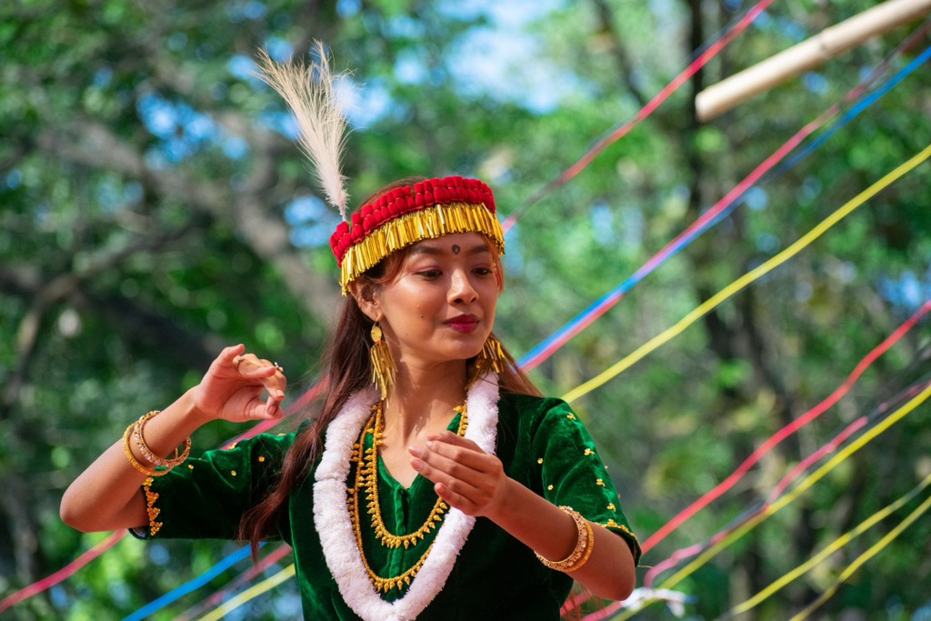
Manipur was—and is still—home to indigenous cultures such as the Meitei, who primarily inhabited the Imphal Valley. The Kingdom of Manipur was established in the first millennium CE and evolved with both indigenous customs and Hindu influence, particularly after the arrival of Vaishnavism in the 18th century.
Manipur was a cultural bridge between South Asia and Southeast Asia. Before the 18th century, the region followed its indigenous religious traditions, known as Sanamahism, which centered around ancestor worship and nature spirits.
However, Vaishnavism eventually became the dominant religion. The Meitei script, which had been used for centuries, gradually declined in favor of the Bengali script, and many indigenous customs were modified to align with Hindu traditions.
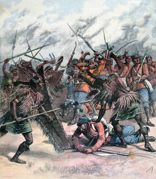
In the 19th century, Manipur became entangled in the geopolitical struggles of British India and Burma (Myanmar). In the Anglo-Manipur War of 1891, British forces defeated the Manipuri army and established indirect colonial rule over the kingdom. The war resulted in the execution of Tikendrajit Singh, who became a symbol of resistance against British imperialism.
However, the British impacted Manipur less than other Indian states. Manipur is considered one of the “Princely States” of India, in which the Maharaja continued to govern under looser British supervision.
After India gained independence in 1947, Manipur initially functioned as a princely state before formally merging in 1949. The transition was met with resistance from the Meitei, who felt they had little in common with India.
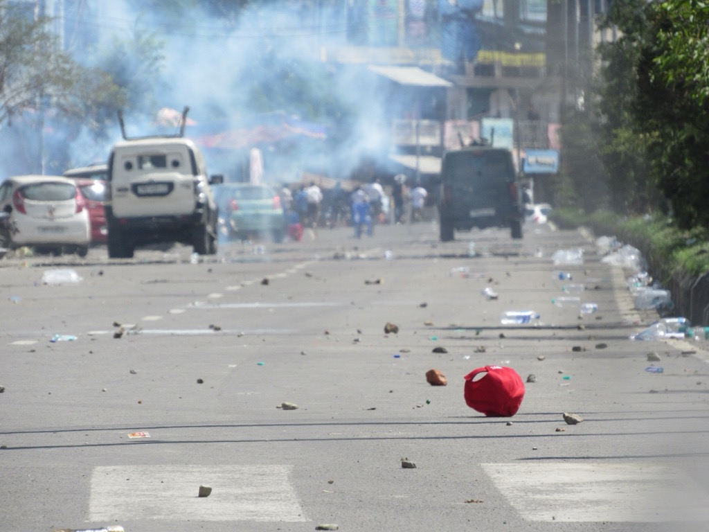
In 1972, Manipur was granted full statehood, leading to further political and economic integration with India. Since then, Manipur has been subject to ethnic conflicts, insurgency movements, and demands for greater autonomy. In 2023, riots required the intervention of the Indian military, with hundreds of people killed and dozens more missing.
One of Manipur's most significant conservation milestones was the creation of Keibul Lamjao National Park in 1977. The park was designated to protect the Sangai deer, once thought to be extinct.
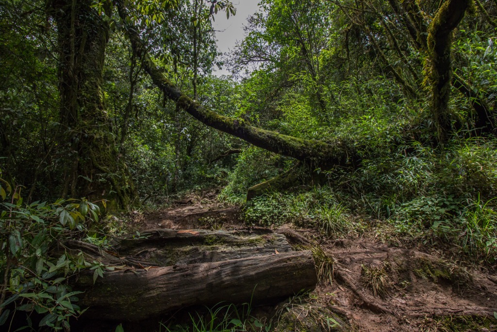
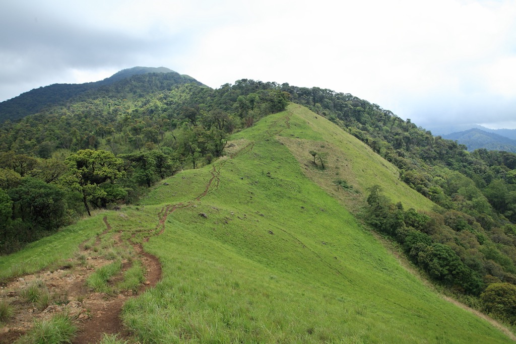
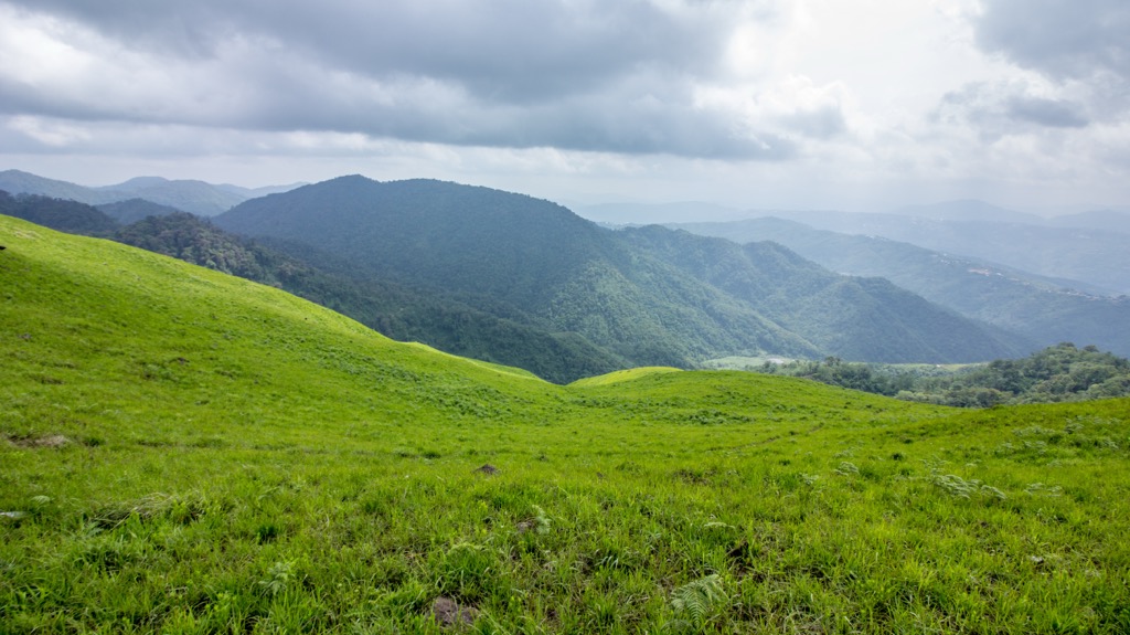
The Dzukou Valley Trek is among Manipur's most scenic mountain treks and is probably the most famous. Often referred to as the Valley of Flowers of the Northeast, the grasslands become incredibly lush with the monsoonal rains (June to September). Dzukou transforms into a riot of colors, with lilies, euphorbias, and aconitums carpeting the largely unforested hills. It’s an impressive sight.
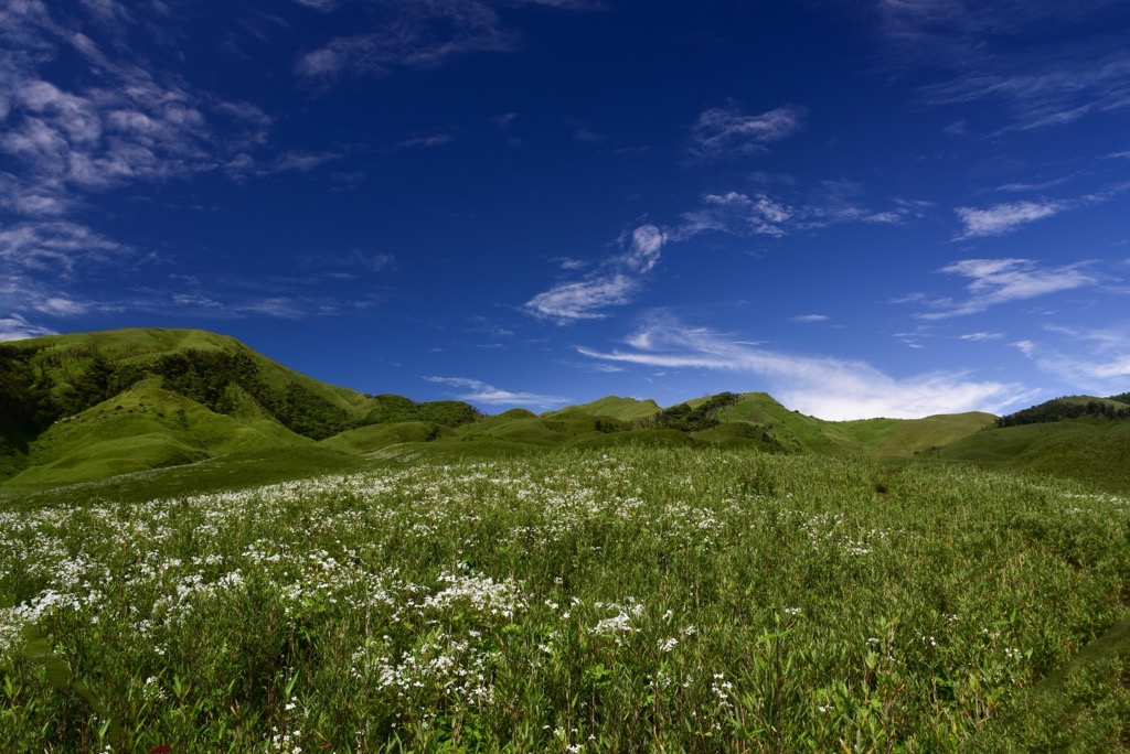
The trek begins from either Viswema or Zakhama village in Nagaland. The former offers a more gradual ascent, while the latter presents a steeper but shorter route. The trail winds through dense lowland forest before opening up to the vast, breathtaking valley at about 2,500 meters (8,200 ft). The valley is subject to unpredictable weather, ranging from clear sunny skies to thick fog and sudden showers, especially during monsoon season.
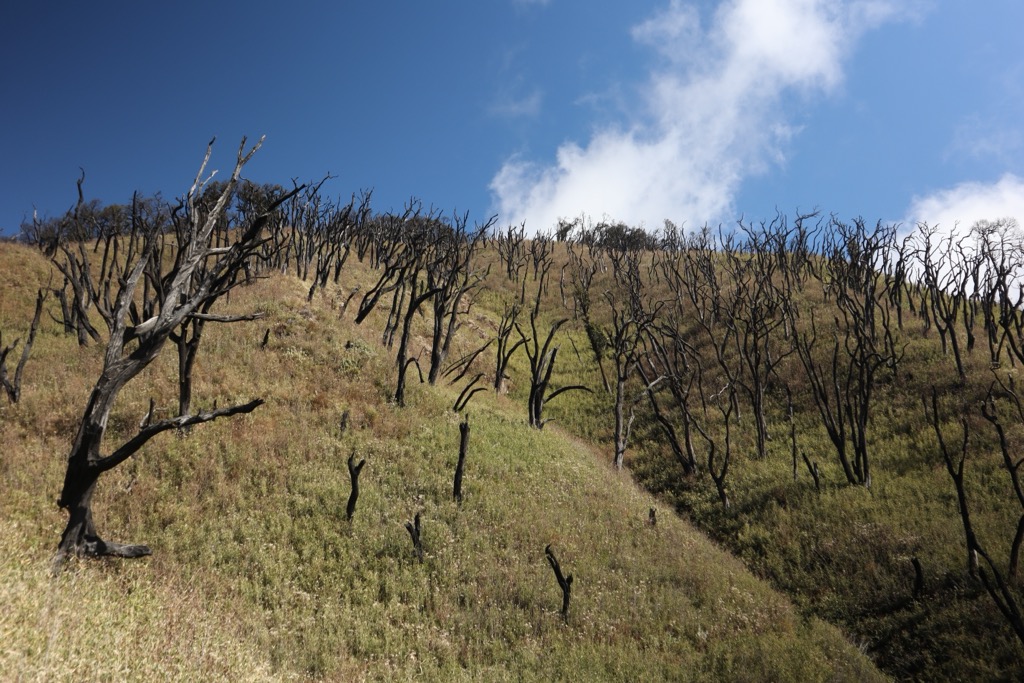
The valley is sacred to the Angami Nagas, who have long regarded it as a place of peace and spiritual significance. The region is also home to unique wildlife, such as Asiatic black bears. Trekkers often camp overnight at the Dzukou Valley Rest House. Unfortunately, forest fires have threatened the fragile ecosystem in recent years, and some parts of the trek are now covered in burn scars. Remember, pack-it-in, pack-it-out; hikers should carry back all waste and avoid using plastic.
Tharon Cave is a 656-meter-long cave with several twists and turns and a few different exits. Visitors will find maps engraved and painted on the stone, making it a bit easier to explore…it would be hard to navigate every nook and cranny within these alleyways without it!
The cave is of great archaeological and historical significance—remains related to the Hoabinhian culture of North Vietnam have been found here.
Tharon Cave is accessible by public transportation in Tamenglong. Other natural excursions here include Bunning Meadow and Barak Waterfall.
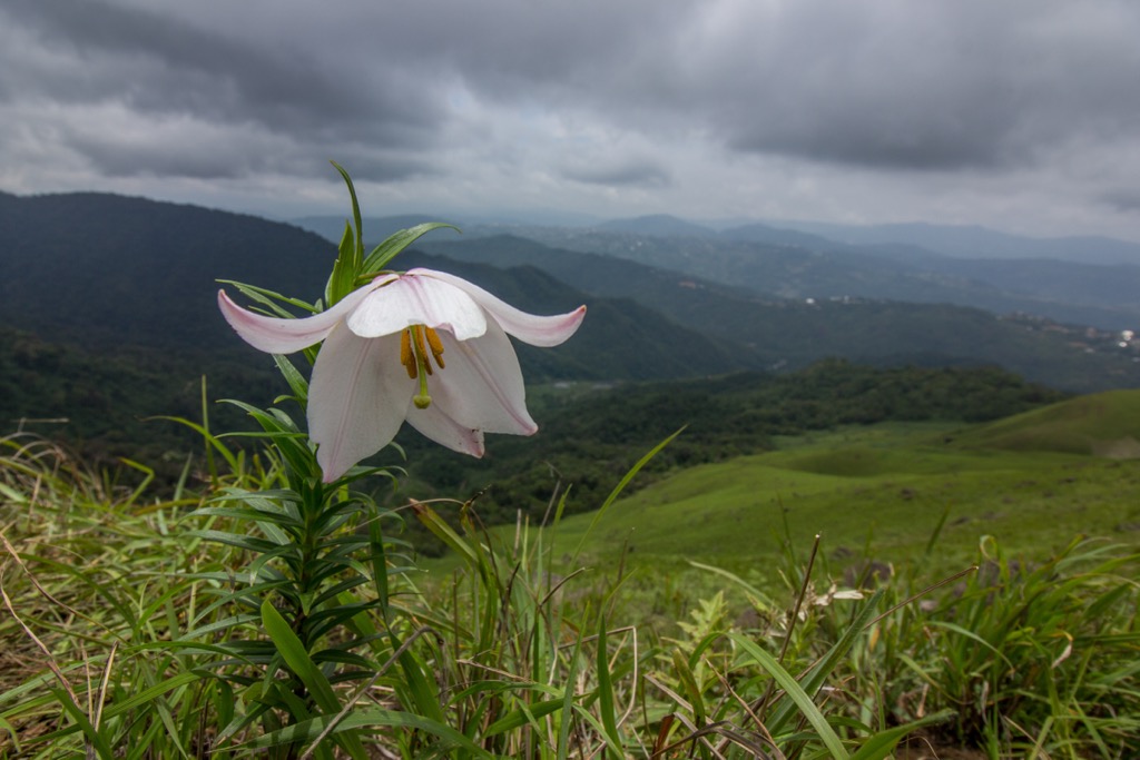
Nestled in the Ukhrul district, the Shirui Hills are a land of mist-laden valleys and rugged, lush peaks. The hills are best known as the only habitat of the endangered Shirui Lily (Lilium mackliniae), which blooms between May and June. The trek to Shirui Peak, the highest point in the range, is moderately challenging, with trails cutting through grassland and occasional forest. Hikers are rewarded with panoramic views of the surrounding Naga Hills and the distant landscapes of Myanmar. Given the region’s frequent drizzle and dense fog, the trail can be slippery.
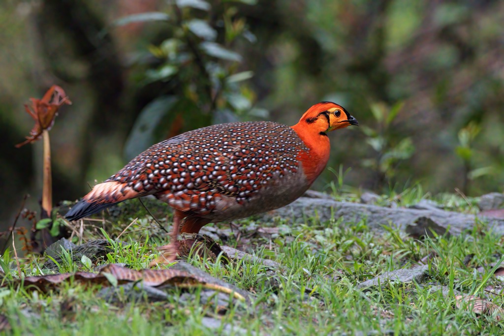
The Shirui Hills have plenty of local Tangkhul Naga culture and folklore. According to legend, the spirit of a benevolent deity resides in these hills, protecting the land and its people. The hills are certainly a holy place; the silence is broken only birdsong and whispering wind. As for wildlife, hikers with a keen eye may spot rare species such as the Blyth’s Tragopan.
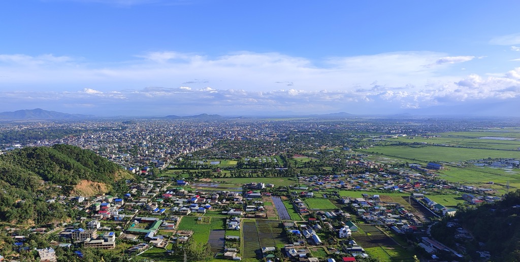
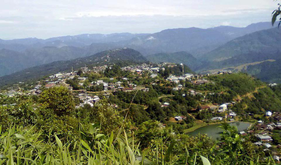
Imphal is the capital of Manipur and a sure stop for any traveler planning to approach by air. It’s a city of about a million people, though it’s not as dense as some other Indian cities.
The Ima Keithel (Mother’s Market), one of the world’s largest all-women-run markets, showcases Manipuri handicrafts and cuisine. The city offers easy access to Loktak Lake and the Keibul Lamjao National Park.
Imphal was a major battleground between British and Japanese forces during the Anglo-Manipur War of 1891 and World War II. It is home to several war memorials and the Kangla Fort, the former seat of Manipuri kings.
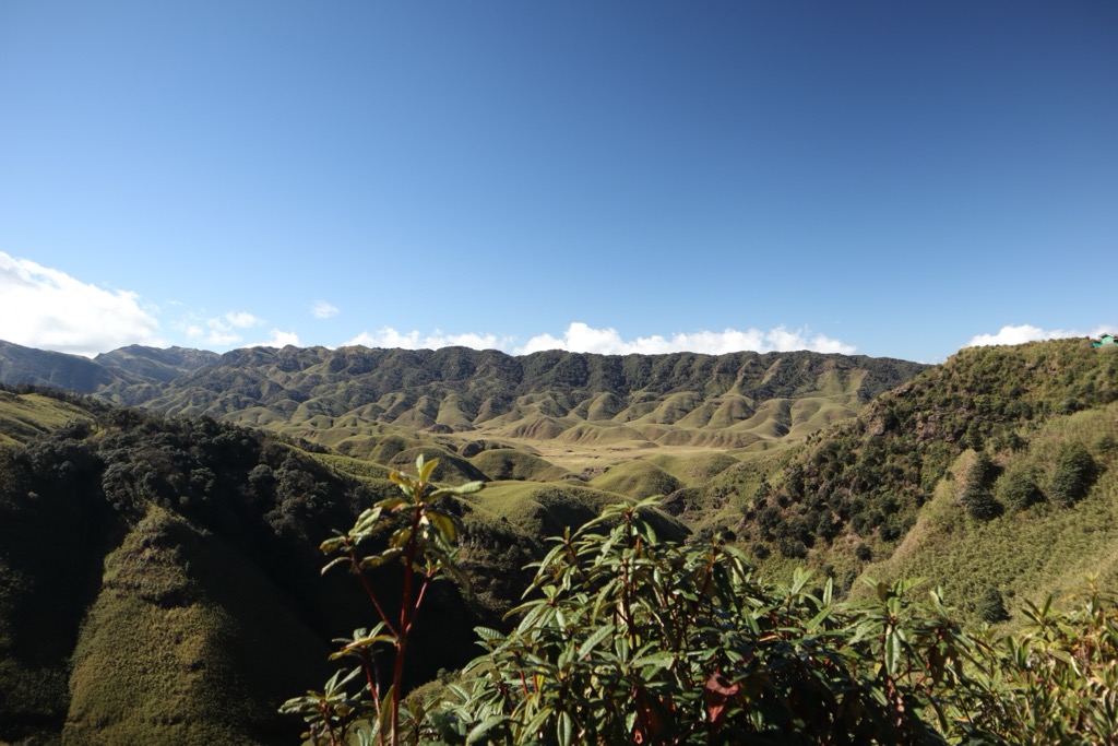
Senapati is the gateway to the Naga Hills of Northern Manipur. The town is primarily inhabited by the Naga tribes and surrounded by lush green hills.
Senapati is the best access to Tenipu (Mount Tempü), the highest peak in Manipur. Other nearby adventures include Yangkhullen Village, a unique cliffside settlement with traditional wooden houses, and the aforementioned Dzukou Valley, famous for its seasonal blooms and rolling meadows. Visitors hoping to do the Dzukou Valley trek will pass through Senapati on their way north.
The British constructed “Hill stations” to escape the heat of the lowlands and expand opportunities for natural recreation in India. Tamenglong is one of these hill stations, located in western Manipur and known for its dense forests and cascading waterfalls. It is home to several indigenous Naga tribes and is a gateway to some of Manipur’s most stunning natural attractions, including the Barak Waterfalls and Zeilad Lake. Tharon Cave is an ancient limestone cave system accessible through public transportation.
Tamenglong is also a habitat for the endangered Rufous-necked Hornbill and other rare species. The town’s tribal culture comes alive during Gaan Ngai, which marks the New Year for the Zeliangrong Naga community.
Ukhrul is a serene hill town in northeastern Manipur, the heartland of the Tangkhul Naga community. Ukhrul’s most famous attraction is the Shirui Hills, home to the rare and endemic Shirui Lily (Lilium mackliniae), which blooms only in this region during the summer months. The town also has trails leading to Khayang Peak, one of the highest points in Manipur. Ango Ching is a virgin subtropical forest teeming with diverse flora and fauna. Ukhrul is also known for its black pottery and handwoven textiles.


_01.jpg)