
Scan the QR code and open PeakVisor on your phone
Altai Republic is home to 784 named mountains. The highest is Belukha at 4,509 m.
Located in the heart of Asia, the Altai Republic of Russia may be pretty hostile to the faint-hearted or those who cannot take hardships of the wild into their stride. Yet, these vast pristine lands are a true treasure grove for outdoor aficionados and those keen on appreciating the ethereal beauty of panoramic landscapes in the loud silence, since it is forbidden to make a noise in most places here. The Altai is also a religious mecca, a place of worship for Buddhist monks and local shamans, if you are a female, you may have difficulty obtaining access to some of the mountains of the region.
The Altai Republic or so-called the Mountainous Altai is a boundless wildland located in the centre of Asia at the junction of the Siberian taiga, Kazakh steppes and semi-deserts of Mongolia. It is a mountainous country with extremely picturesque landscapes, some call it the Russian Tibet, in the centre of Eurasia at the junction of several states, natural zones and cultural worlds. The Republic borders the Altai Territory in the northwest, the Kemerovo Region in the northeast, the Republic of Khakassia and the Republic of Tyva of Russia in the east, Mongolia and the People's Republic of China in the south, and Kazakhstan in the southwest.
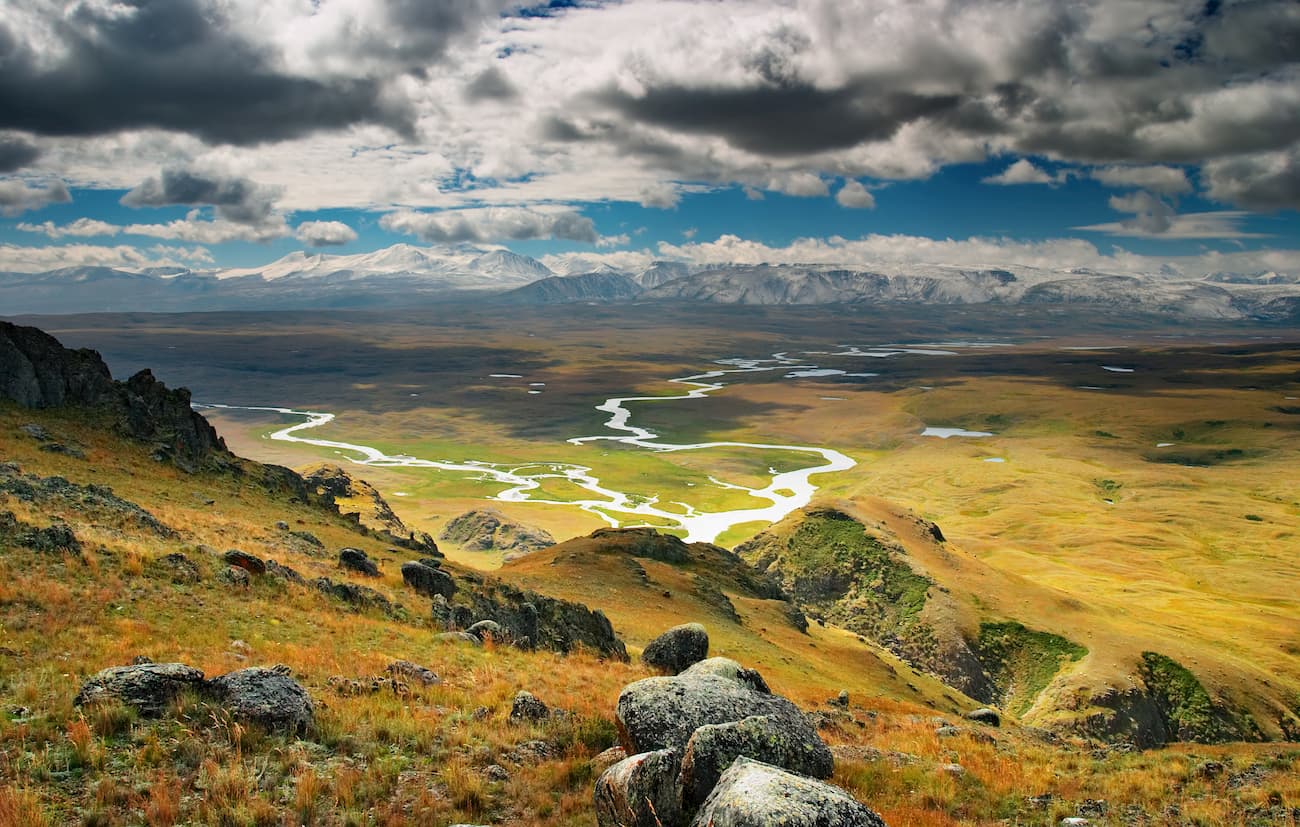
The Republic is fully located within the Russian part of the Altai Mountains. Accordingly, the relief of the Republic is characterized by high ridges separated by narrow and deep river valleys and rare wide intermountain hollows and ravines. In total, there are over 30 ridges in the Mountainous Altai with an average height of 2,000 to 4,000 meters, the mountains are lower in the northwest and higher in the south-east.
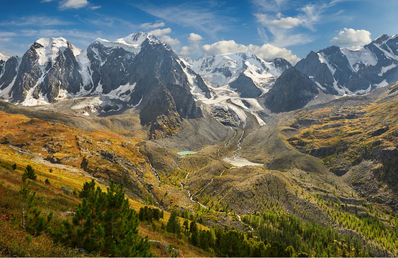
The Katun Ridge is one of the highest ranges of the Altai Mountains in the Republic of Altai. There is no forest above 2000-2200 meters, only rocks that are covered with eternal snows and alpine meadows. On the slopes of the Katun Range, there are more than 386 glaciers, their total area exceeds 150 sq.km. Here starts the river Katun, it originates in the Gebler glacier. Just north of the Katun Range is the famous Uymon Steppe – an intermountain ravine at an altitude of about 900 meters above sea level.
Belukha (4,506m) is the highest peak of the Altai Mountains and the highest peak of Siberia. Geographically, this mountain is about the same distance from the Arctic, Pacific and Indian oceans. The top of Mount Belukha is always covered with snow and ice, thus the name – white mountain.
It has two summits, the Eastern and the Western, the former being a bit higher than the latter. In 2002, two paragliders started synchronously from the Eastern summit (4,509m). Travelling by air is undoubtedly faster, but skier Dmitry Shchitov took up the challenge in 2003 and went downhill from the very top of Belukha in about 2 hours. Belukha is not a mountaineer-friendly mountain due to harsh weather conditions and the typically low atmospheric pressure, which at the top of the mountain is about half the normal. Moreover, the rocks on the slopes of Belukha are covered with a thin layer of leaky ice all year round, which makes them incredibly slippery. To add to the trouble, Belukha is located on a tectonic crease that generates earthquakes on a regular basis.
A famous Russian painter Nicholas Roerich made Belukha the star of several of his paintings.
The mountain is considered sacred both by Buddhists and Altai shamanists. It is considered to be one of the entrances to the mystical land of Shambala and the mysterious Belovodye (White Water Area). Modern esotericists and Roerich's followers consider the mountain a place of power and information pyramid that is receiving messages and energy from space.
The Altai people have many prohibitions associated with the sacred mountain. It is forbidden to make noise and loud sounds on the slopes of Belukha. Also, iron objects cannot be brought here, and hunting is not allowed in these places. As in many other sacred places in the Altai, women are not allowed to enter the lands of Belukha Mountain.
Once upon a time, there used to be a legend among the locals that everyone who dared to climb the top of Belukha, would go blind. It has a scientific justification as well – without special glasses the glow of light reflected from snow and ice can really damage the retina and impair vision.
The length of the Terektinsky Ridge is about 150 km, the height reaches almost 3000 m. It is located along the Katun River and reaches the Kansk steppe. The ridge as a whole has a smooth character, the slopes are abundantly covered with coniferous forest, there is a large number of flat peaks and plateaus, the largest of which is the Tuguryuk. Thanks to the boggy nature of many plateaus, a huge number of small rivers originate here.
The Terektinsky ridge is a not much visited but it is a promising tourist area. On its territory, there is the Karakol Nature Park called Uch-Enmek. The landmarks include the fields of burial mounds Bashadar, the Tuekta barrows, the Lower Sooru tract, the archaeological monument Bichiktu-Boma. Here you can see burial mounds, stone idols, petroglyphs of the Scythian tribes, the Hun-Sarmatian peoples, ancient Turkic and medieval periods, rock drawings and runic inscriptions.
The North Chui Ridge is especially popular among fans of active tourism due to its convenient transport accessibility as the Chui Road is very close, as well as due to the abundance of glaciers and lakes. The most famous of them are the mountainous Shavlin (Shavlinskiye) lakes, they are located at an altitude of 2164 m. The average height of the ridge here is about 3,600 m, and the number of peaks exceeds 4,000 m (Maasha-bash is 4,173 m, Aktru is 4,044.4 m). In the central part of the North Chui Ridge, there are about 200 glaciers.
The Sumultinsky Ridge is located in the north-eastern and central parts of the Altai Republic, between the Chui Road and Lake Teletskoye, which makes it one of the most visited in ridged in the Altai. Glaciers are not found here as the maximum height of its peaks reaches only 2756 m. It is kind of weird, but the highest point of the ridge located in the southern part of the ridge has no official name. Approximately in the middle of the Sumultinsky Ridge, at the top of 2666 m, strictly to the north goes a short (20 km) but high (2700 m) Tongosh ridge.
Regardless of the lack of snow-capped summits, the ridge is blessed with an extensive network of pretty lakes and boisterous rivers running down the slopes. There are hiking, horseback riding and skiing routes on the ridge. In the Soviet times, these places were covered by the All-Union tourist route No.77, which had the 3rd category of complexity and was the most difficult planned route in the USSR and at the same time the cult walking route of the Mountainous Altai. There are no roads through the ridge, you can traverse it only via trails which are not very well marked, so take a guide not to get lost and fall prey to the local fauna.
The Southern Altai Ridge begins to the west of the Karakoba River which separates the ridge from the Kalbin Range. It stretches from west to east and ends near the Tavan-Bogdo-Ula massif, which is the starting point for the Sailugem Ridge (farther to the east) and the Mongol Altai Range (to the south). There are over 180 glaciers on the territory of the Southern Altai Ridge. The rivers of the Irtysh basin originate there: the Akkaba and the Bukhtarma. The Ukok, Ak-Alakha, Betsu-Kanas, Muzdy-Bulak, Kara-Chad and Argamji rivers originate in the Russian part on the northern slopes of the Southern Altai Ridge and belong to the Ob basin.
The highest peaks on the Russian territory are Kanas (3,440.7 m), Cholok-Chad (3,217.5 m) and Bertek (3,172.6 m).
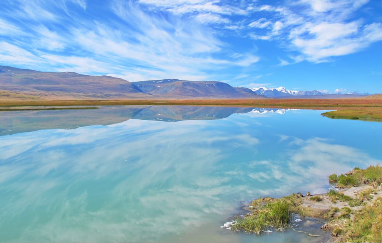
The Ukok Plateau stretches in the extreme south of the Altai Republic at an altitude of about 3 kilometres above sea level. Ukok is an ancient name, it means "massive elevation with a flat top". It is an endless and lifeless surface of sand, stones and permafrost and glaciers, surrounded on all sides by the peaks of the Altai Ridges.
The Ukok is in some sense a "blank spot" on a scientific geographical map of the Altai. It has very short and cold summers, a borderline position, there are very few or better say no roads and settlements, which makes this area difficult to access and thus leaves it practically unexplored. On the Ukok plateau, there are many mysterious natural phenomena, i.e. ball lightning can strike out of nowhere. This might be due to the local tectonic faults but who knows.
The Altai Republic can proudly boast of the five sites called the "Golden Mountains of Altai", which are among the UNESCO Special Protected Areas.
The Altai Nature Reserve is definitely the star of the show with its majestic 22 lakes and numerous rivers, it is heaven for fishermen and just those who enjoy relaxing by the water. It is home to the snow leopard – a gracious, yet deadly, highest mountain cat. The maximum height at which it was found reaches 6000 meters, but they usually live at an altitude of 1500-4000 meters above sea level. The snow leopard is almost impossible to see due to its catastrophic decrease in numbers, it is listed in the red book. World Wildlife Fund (WWF) is implementing programmes aimed at snow leopard conservation in Russia.
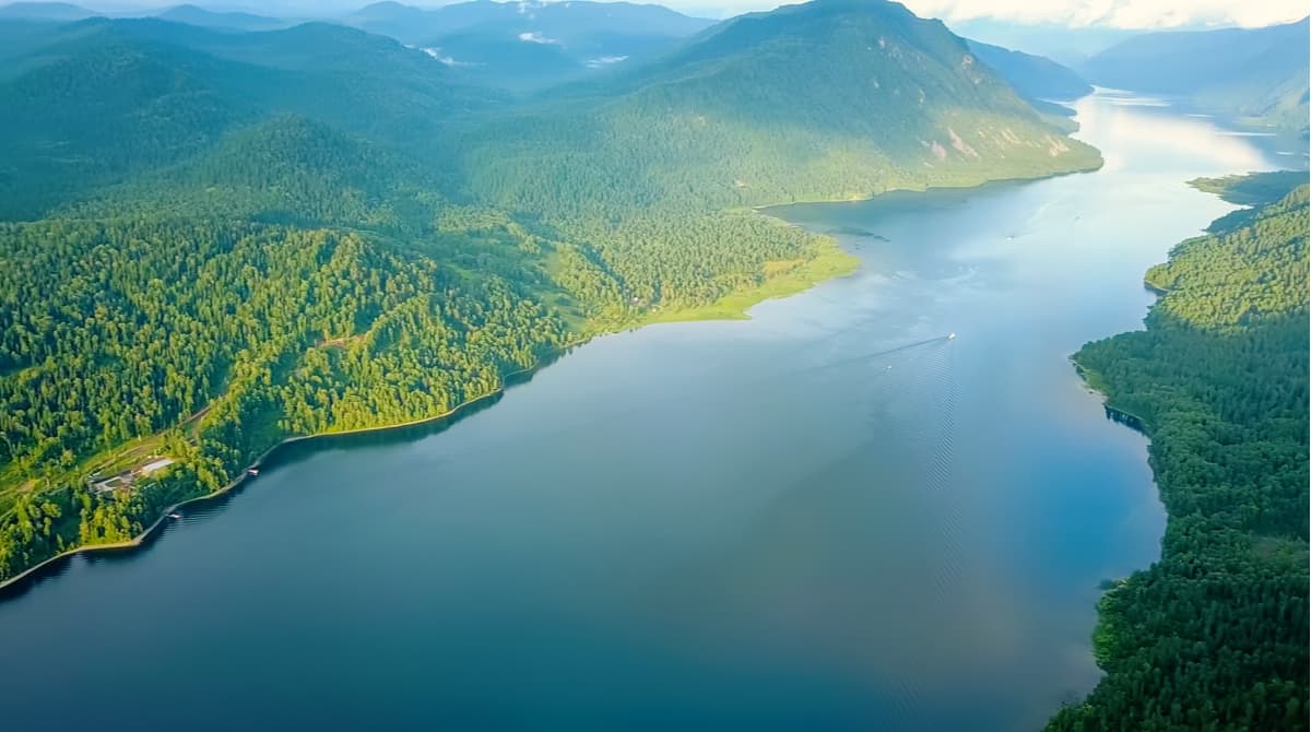
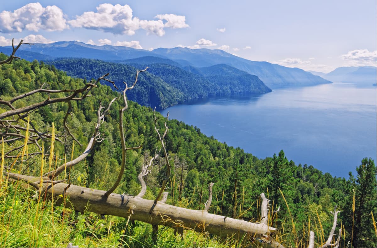
Being the fifth in depth in Russia, Teletskoye Lake is also called the Little Baikal of Western Siberia. Its length is 78 km and the maximum depth is 325 m. Its area is 223 sq.km that holds over 40 cubic km of pure freshwater. The lake is fed by 70 rivers including the main one – the Chulyshman River. Teletskoye Lake flows into the Biya River which in its turn is feeding the Ob River with its waters. The lake fills a narrow hollow of tectonic origin created by an ancient glacier.
Teletskoe lake is one of the most visited places in the Altai Republic. Vacationers are accommodated in 18 tourist bases and camping sites. The Pioneer Altai motor ship operates regular runs on the lake. From villages at the northern tip of the lake (Artybash, Iogach) during the navigation season boats and smaller motor vessels can go to several local attractions:
The Katun State Natural Reserve is an untouched nook of wild nature located near the highest mountain peak of Siberia – the magnificent Belukha. The main purpose of the Reserve was to preserve the typical ecosystems of the Katun mountain range, snow leopard habitats and rare species of flora and fauna.
In 2017, UNESCO approved the establishment of the first transboundary biosphere reserve in the Altai. It was established on the basis of the Katun biosphere reserve (Russia) and the Katon-Karagai National Park (Kazakhstan). This is the first transboundary biosphere reserve of such high international status. The joint territory is called The Big Altai. The Big Altai reserve covers an area of over 1.5 million hectares.
The Belukha Nature Park is named thus due to Belukha Mountain, the highest point of the Russian part of the Altai. The territory of the park begins from the town of Belukha and extends to the north and north-west up to the Katun River, covering the basins of its right tributaries – the Kucherla and Akkema rivers.
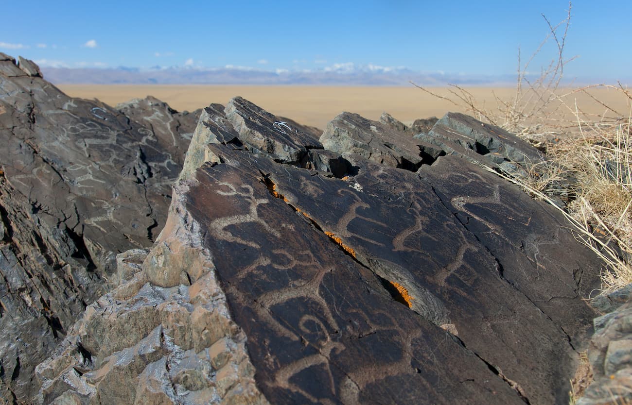
The main sights are the Tekelu waterfall (falling from a 60-meter height), Lake Akkemsk, Lake Kucherlin. The park is also known for its petroglyphs – the stone drawings of the early Bronze Age. The Kuylu Petroglyph has over 100 drawings made in a niche of a small rocky grotto, about a dozen more drawings are applied on separate stones within 1 km from the grotto. The main characters depicted are deer, goats, horses and humans. In general, the petroglyphs date from the Eneolithic Age to the Middle Ages. Petroglyphs of the Black River are silhouette drawings on rocks made by fine dot-cutting. There are about 30 images in total.
The area is of prime interest for fans of rafting along mountain rivers. The Kadrin River with its famous Sugar waterfall is the ultimate destination for the white-water sports lovers. In the upper reaches of the Kadrin River, there are lakes Sittenkel, Kadytakkel, Akkol, Beltir and also the Kadrin Spring. In general, being the central part of the Altai Republic, the territory of the Reserve is poorly visited due to the lack of transport links and settlements there.
The area of 255.352 ha includes the Sumultinsky, Koldeoyuk and Kyzylart ridges. The following ranges adjoin the Reserve: the Ioldo and the Kuminskie Squirrels – from the north and north-west; the Tongosh and the Dzhunduk – from the east, and the Aigulak Ridge – from the south.
The Reserve is covered in mountain taiga, mountain tundra, subalpine meadows and steppes. The forests here are light coniferous, dark coniferous and deciduous, they are home to over 50 fauna species, some of which are in the Red Book.
The Nature Park called the Ukok Calm occupies the southern part of the Ukok Plateau. The Bertek Basin is fully located within the park. In the east, the border of the park coincides with the state border between Russia and Mongolia (the Sailugem Ridge), whereas in the south, it runs along the border with China (the South Altai Ridge), in the south-west, it borders with Kazakhstan.
The Ukok Plateau is located in the south of the Altai at an altitude of about 3 km above sea level. Ukok is an ancient name, it means "massive elevation with a flat top". The native Altai people believe that it is here, at the foot of the Tabyn Bogdo-Ola Mountains, that the mountain world called the second layer of heaven is located. It is very difficult to get here, but once you take a helicopter ride, you will see a stunningly beautiful and mysterious view of giant boulders and steep naked rocks, the majestic panorama of mountain peaks covered with eternal snow.
In the summer of 1993, an unusual discovery made the Ukok famous all over the world. A Russian archaeologist from Novosibirsk Natalia Polosmak, a PhD in Historical Sciences, discovered the burial place in the Ukok that contained a young woman's mummy. This find made an overnight sensation, the mummy was called the Altai Princess, her age is 2500 years old and she is in a very good state. The finding is extremely precious because the land where it was found was considered to be ‘a haven of Gods’ and no human could walk there.
Another curious landmark was discovered at the end of the last century on Kyzyl-Tas Rock located in the Bertek valley of the Ukok Plateau. The archaeologists found a complex of rock images consisting of 120 figures recorded so far. This place was called Bertek carvings. Chronologically, these petroglyphs belong to several eras, the oldest of which is the Stone Age. Most images are dotted figures of animals and anthropomorphic figures dated by the Bronze Age and early Iron Age.
At the beginning of the 2000s, there were found some mysterious drawings – geoglyphs as if made by the hands of unknown giants. Their origin and meaning are not clear. Geoglyphs are the mind-boggling hieroglyphs laid out on huge territories. Scientists have been trying to decipher these messages for centuries. So far, to no avail.
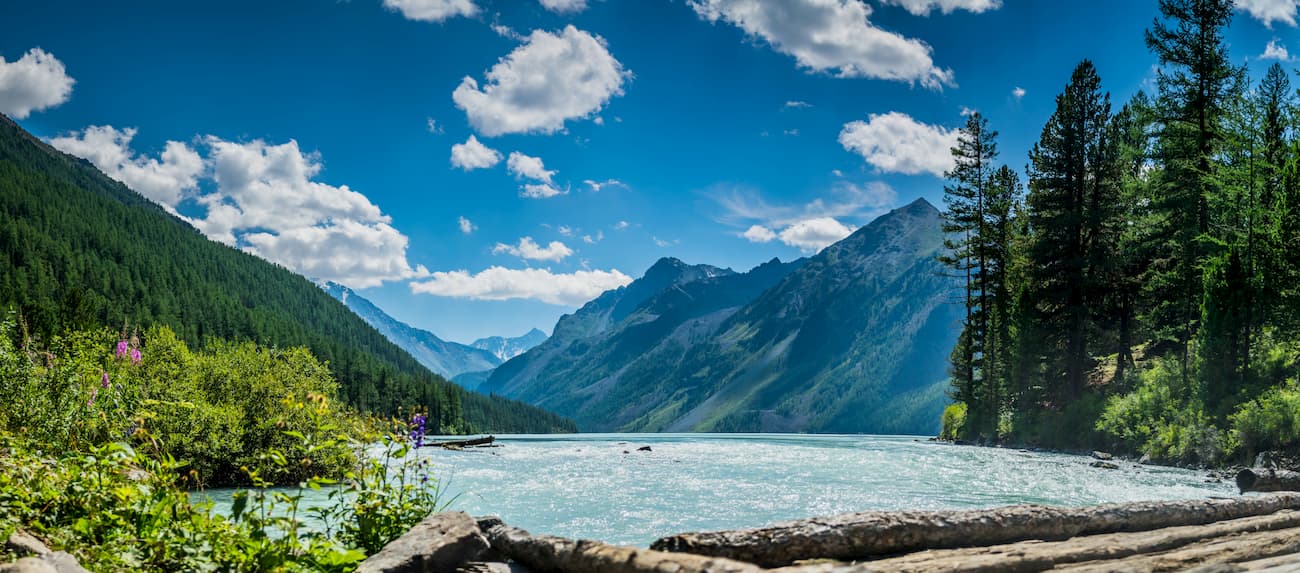
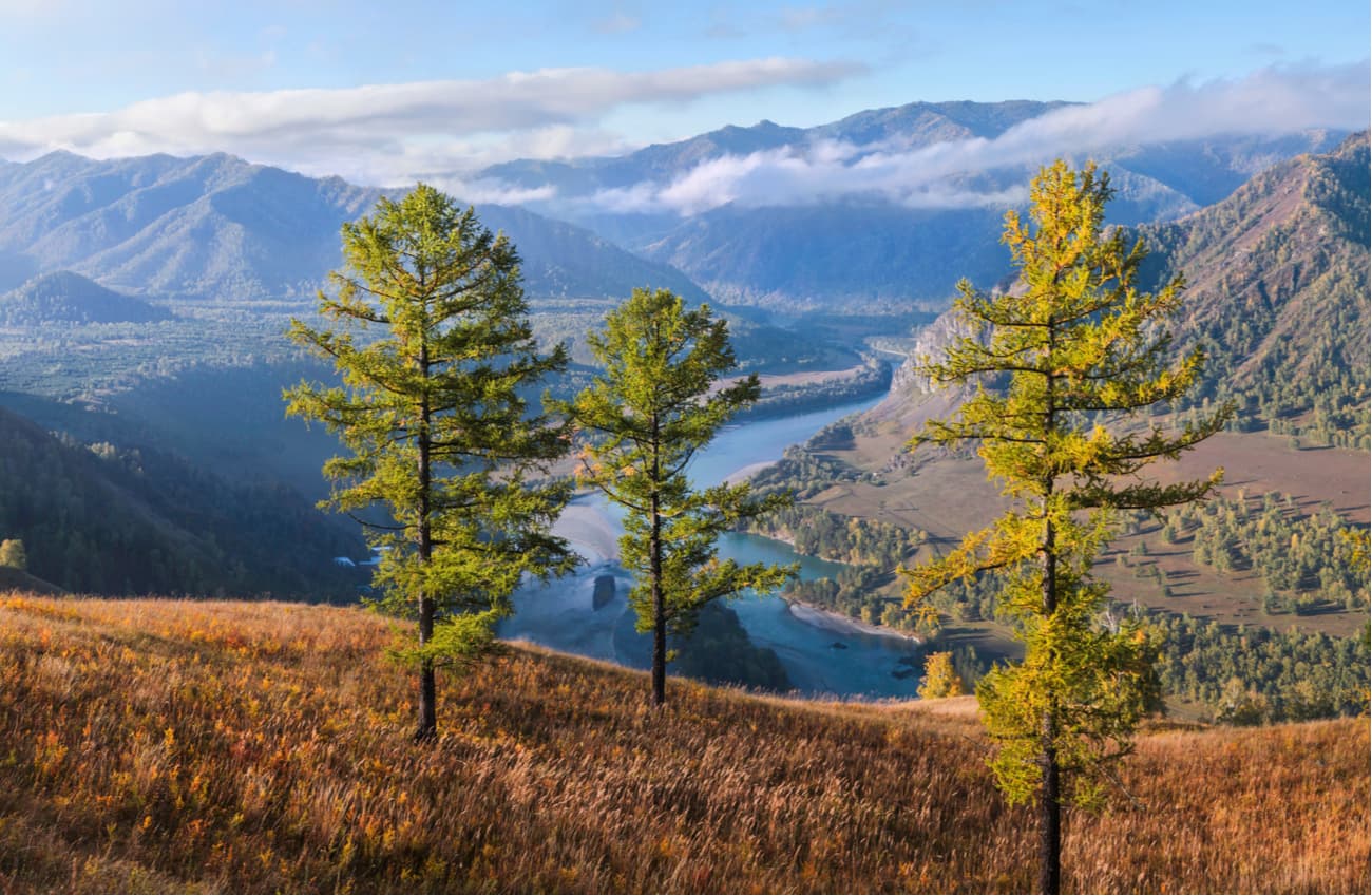
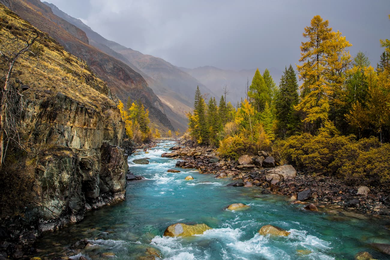
The Mountainous Altai is dissected by a dense network of mountain rivers which are fed by melting snow water and summer rains and characterized by long spring floods. There are over 20 000 rivers and streams with a total length of over 60 thousand km and about 7 thousand lakes with a total area of more than 700 sq.km.
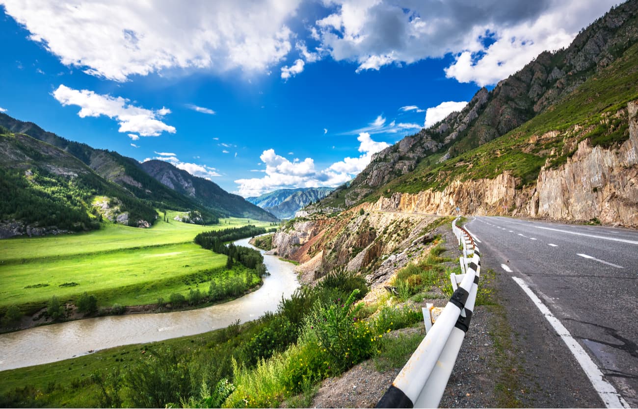
Most of the rivers belong to the Ob basin, both its sources – the Katun and the Biya - are in the Altai and are its main waterways. The Altai is dominated by rivers less than 10 km long, the largest being the Biya (301 km), the Katun (688 km), the Argut (232 km), the Chuya (320 km), the Chumysh (644 km) and the Alei (858 km).
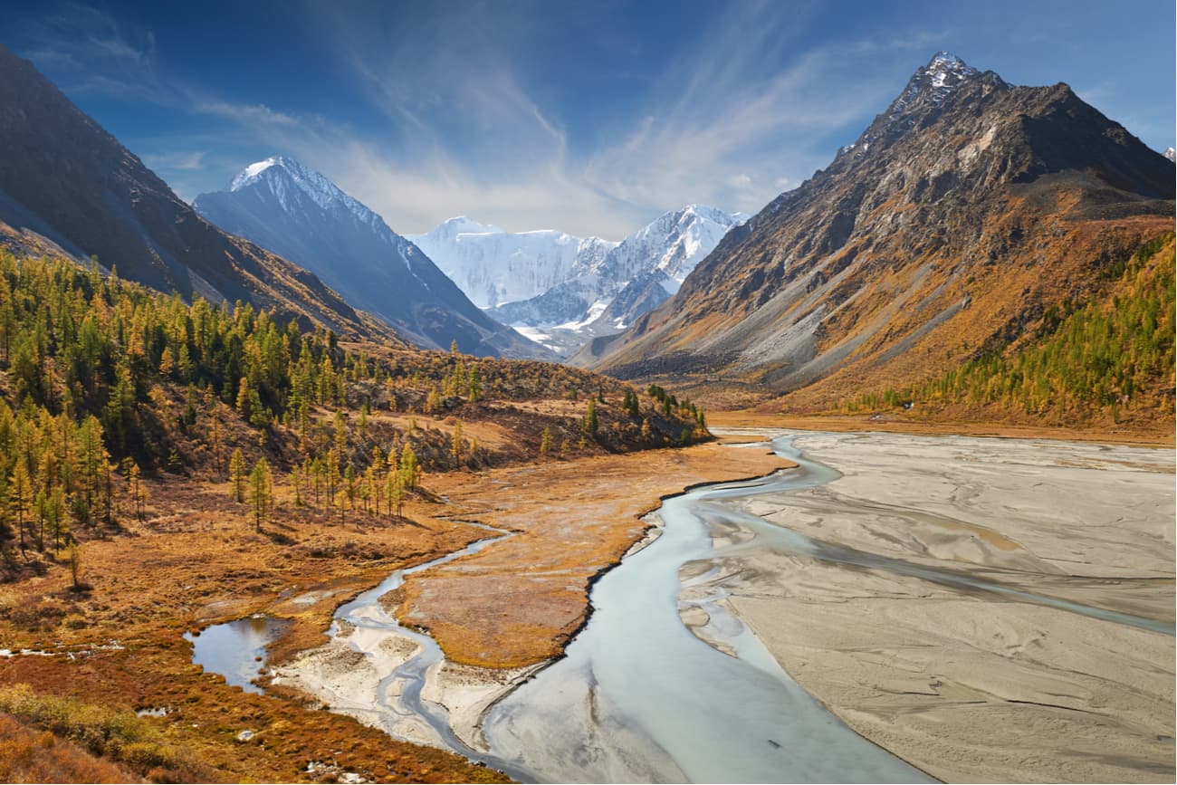
The Katun flows out of the Gebler glacier at an altitude of about 2,000 m and flows down the valley also shaped by a glacier retraction. After 2 km, the river Rassypnaya flows into it and the Katun becomes a rapid, full-flowing river, especially in summer when snow and glacier ice melt intensively. Depending on the slope and the nature of the riverbed, the river rumbles between rocks and boulders or flows quietly.

The Biya is the second most water-intensive river in the Altai. The length of the river is 301 km, and the basin area is 37 000 sq.km. It is the only river to flow out of Teletskoye Lake and when it confluences with the Katun River, they form the river Ob. The water in the section from Lake Teletskoye to the inflow of Sarykoksha river is clear and cold (10-15 °C), but in the lower reaches it warms up significantly.
The Biya is much loved for rafting (mainly by kayaks and catamarans). There are several rapids with up to 1 m and above on the section from the source to Upper Biysk. The basic thresholds are the Yurtok, Pyzhinsky, Kebezensky, Sarykokshinsky, Kipjatok (Boiling Water) in Turochak village. The last threshold is in village Udalovka. The river flows fast, usually at the speed of 1-1.5 m/s, the deposits of coarse gravel are found almost to Biysk.
The Argut is one of the major tributaries of the Katun. The name comes from the Altai word archyt – a bag for making koumiss, it is a special drink from horse’s milk. The Argut has a very rich basin composed of calm rivers and streams of the Ukok Plateau, as well as powerful, milky-white, boiling whirlpools of the tributaries that start from glaciers, and transparent, clean, rapid streams flowing from the lakes. The upper reaches of the Argut have been developed for a long time and are mostly passable, but the lower parts of the river valley are still an inaccessible gorge.
Most mountain rivers are not navigable due to fast currents and rapids. Many have waterfalls usually located at the sharp bends of the river channel and tectonic ledges. Waterfalls are particularly numerous and varied in the Central Altai. These are the Tekelyu (60 m), the Kurkura (20 m), the Kok-kol (40 m), the Rasypnoy (35 m), the Tegheek (40 m), the Iedigem (30 m), the Shaltan (20 m), the Korbu (12 m).
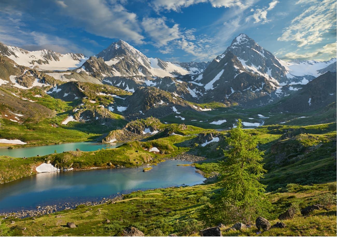
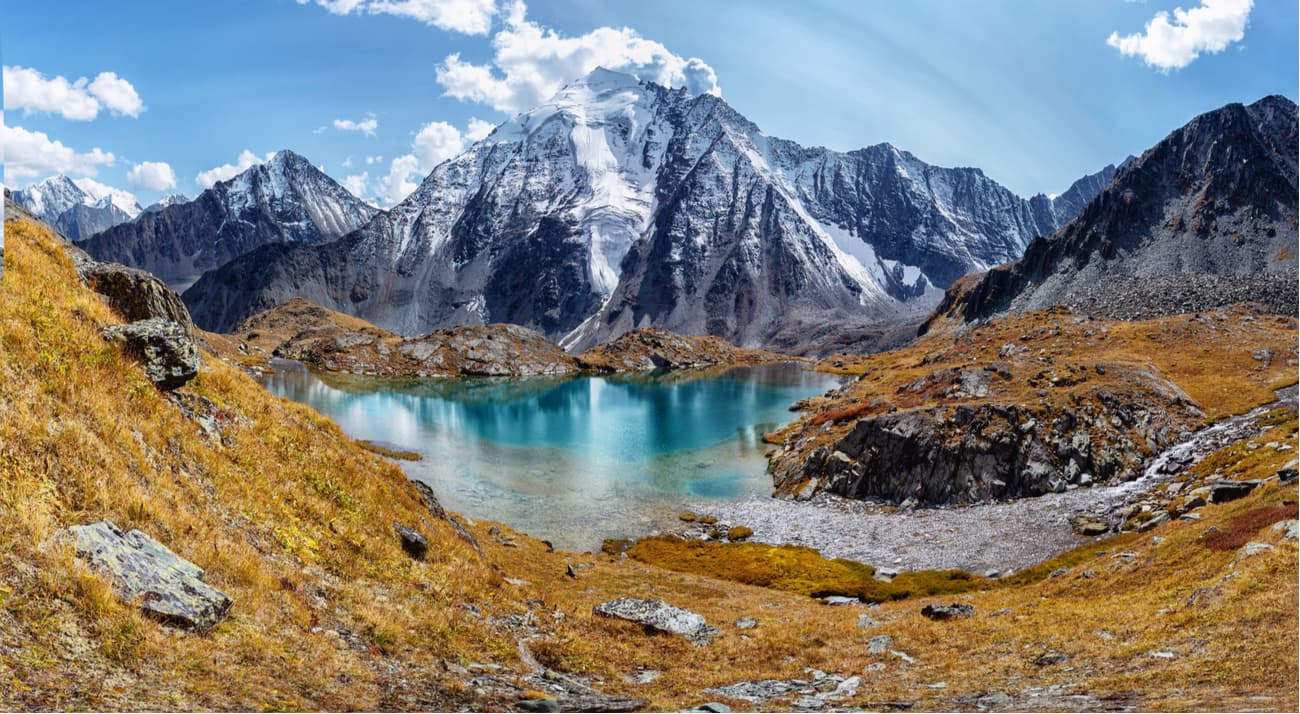
The total number of lakes in the Altai is 7000+, the largest being Markakol and Teletskoye Lake. Many small, usually 1-3 sq.km or less, ancient glacial lakes often fill the picturesque deep valleys. In the north of the Altai Mountains, there are karst lakes. There are also healing mineral water springs in the region.
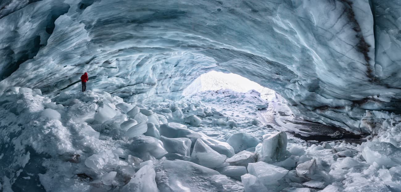
Glaciers in the Altai contain huge reserves of freshwater. The total volume of ice in the Altai glaciers reaches 57 cubic km, which corresponds to 52 cubic km of water. In general, the water reserve in the glaciers exceeds the annual average long-term flow of the Altai rivers equal to 43 cubic km per year. The largest glaciers are the Big Taldurinsky - 35 sq.km, Mensu - 21 sq.km, Sofia - 17 sq.km, Big Maashey - 16 sq.km.
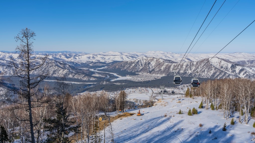
For skiing and snowboarding enthusiasts, there is Manzherok Ski Resort near Gorno-Altaysk in the Altai Republic with more than 15 km (9 mi) of slopes and more than 3 ski lifts.
Check the Altai Republic ski resorts map on the larger Russia ski resorts map in the World Mountain Lifts section of the site. It includes information about open ski lifts / slopes in the Altai Republic in real-time with opening dates and hours. There are also year-round cable cars, funiculars, cog railways, aerial tramways, and all other types of mountain lifts.
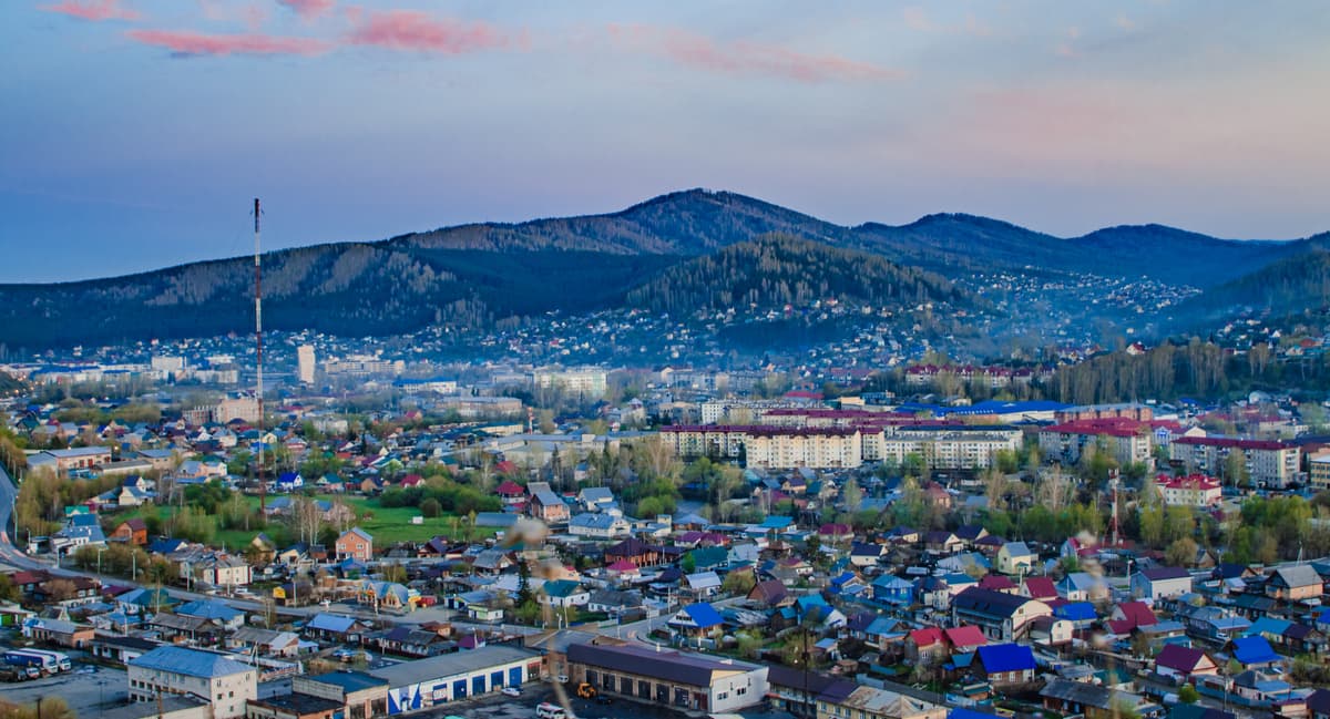
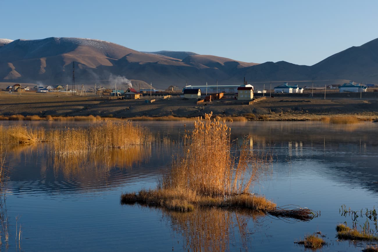
The Republic has only once city, all other urban settlements are mainly villages with
The capital and the only city in the Republic of Altai. Gorno-Altaisk Airport is 6 km west of the centre. Should you wish to take a railway road, the closest station is Biysk, 100 km away. The city is located in the northwestern part of the Altai Mountains, in an intermountain basin surrounded by low peaks at an altitude of 270-305 m above sea level, at the confluence of the rivers Ulalushka and Maima which flow into the river Katun about 250 km north of Mount Belukha, the highest point of the Altai and Siberia.
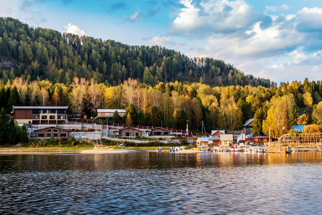
The easiest way to get to Teletskoye Lake and the Altai Reserve is through Artybash village Artybash. The Information Center of the Altai Reserve is situated here. There are cafes, shops, hotels, recreation centres and a tourist centre. There are several piers in Artybash where you can arrange a tour of Lake Teletskoye. Also, many estates and camping sites in the vicinity of Artybash offer boats for rent.
Ust-Koksa is a quite developed district centre, there is a central estate of the Katun Reserve and Roerich’s National Library. The village is a centre of local tourism – here begin many routes due to its close proximity to the Katun Range, Multinskoye, Akkemskoye, Kucherly and Shavlinskoye lakes. Ust-Koksa is the last settlement which can be reached by a shuttle bus from Gorno-Altaisk.
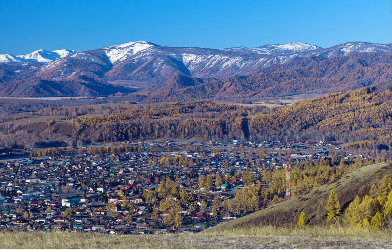
Kosh-Agach is one more district centre located at an altitude of over 1,500 meters above sea level, 465 km from Gorno-Altaisk. Kosh-Agach is high in the mountains near the Russian-Mongolian border, which is merely 50 km away. The road from Gorno-Altaisk to Kosh-Agach is asphalted and is of very good quality. The village is in the middle of the desert Chui steppe where you can drive in any direction, just like on the road. Kosh-Agach is the largest village in the southeastern part of the Altai Republic. There are hotels and shops in the village. From here it's not far to the Chagan-Uzun (aka the Mars Valley) and the natural park the Ukok Calm is just a 3-hour drive.


Yes. Altai Republic has 784 named mountains. The highest is Belukha at 4,509 m.
The highest mountain in Altai Republic is Belukha, at 4,509 m.
Altai Republic has 784 named mountains.


