Scan the QR code and open PeakVisor on your phone
How can you say a place is sacred? Should there be a signpost, a temple, an altar or a tour guide telling you agitatedly about the bygone days of worship? In some places, you just feel the power and the vibe. Belukha Mount in the middle of Siberia is one of those mysterious wonders that have been considered sacred since time immemorial, no matter what peoples lived nearby. It is geographically located at equal distances from the Arctic, Pacific and Indian Oceans. Even though it is just a four-thousander, climbing it is a challenge of a lifetime.
Belukha Mount is situated in the Belukha Nature Park that is on the territory of the Ust-Koksinsky district of the Altai Republic, Russia. It is the first nature park in the Republic of Altai, and it is also included in the UNESCO World Heritage List of the Altai Golden Mountains.
Russia's international obligations under the World Heritage Convention ensure the preservation of the exceptional universal value and integrity of the site. With regard to Belukha Mountain, it is primarily the conservation of populations and habitats of endangered plant and animal species, the star of the show is definitely the snow leopard, but there are plenty of other rare beasts, birds, and plants.
The Belukha Nature Park is one of the most visited tourist areas of the Altai Republic. You can go rafting, horseback riding, mountain climbing and hiking here.
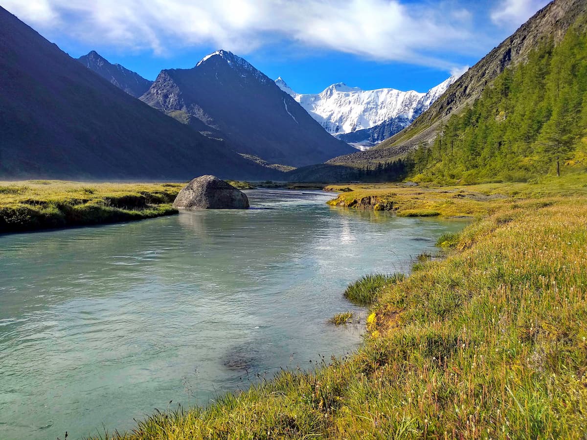
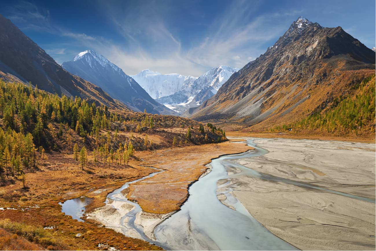
The terrain close to Mount Belukha is typically mountainous and glacial. Rows of sharp rocky ridges and jagged peaks covered with snow and glaciers surround the main peak – Belukha. To the north go flat watersheds and sloping plateaus cut by the rivers Kuragan, Kucherla, Akkem, in the east, there is a deep gorge of the Argut River.
The climate is continental and its conditions vary with the high-altitude belts. The sun radiance here exceeds many mountain resorts in Russia. Average temperature in July ranges from +3 / + 10°С (37-50F) in high mountains to +14 / + 17°С (57-63F) in river valleys. Maximum temperatures at weather stations Karatyurek and Akkem are +22 / +25°С (72-77F). However, don’t be deceived by the nice numbers, the temperature can drop below zero in any summer month, this usually happens at the rivers and lakes.
All the mountain rivers in the park belong to the basins of the river Katun that starts at the foot of Mount Belukha. The largest of the Katun tributaries are the Kuragan, Kucherla, Ak-Kem (also spelt as Akkem), and the Argut. The rest are small but numerous mountain streams fed by melt and rainwater.
Big and small glacial lakes occupy valleys and deep cirques. Lower Akkem Lake and Kucherlin Lake are the natural wonders listed in the Red Book of Altai.
The vegetation in the area can boast of staggering diversity. The plants vary radically with height gain. Forests are dominated by Siberian cedar and spruce, while larch and silver fir is usually found at the lower heights. The typical shrubs feature Rhododendron, Ledum (Labrador tea) and alpine meadowsweet.
The undergrowth is represented by yellow acacia, honeysuckle, pea shrub, raspberry, rhododendron ledebourii (much preferred by the local elks), meadowsweet and currant. The area is especially beautiful and August when berries ripen and you can eat them aplenty.
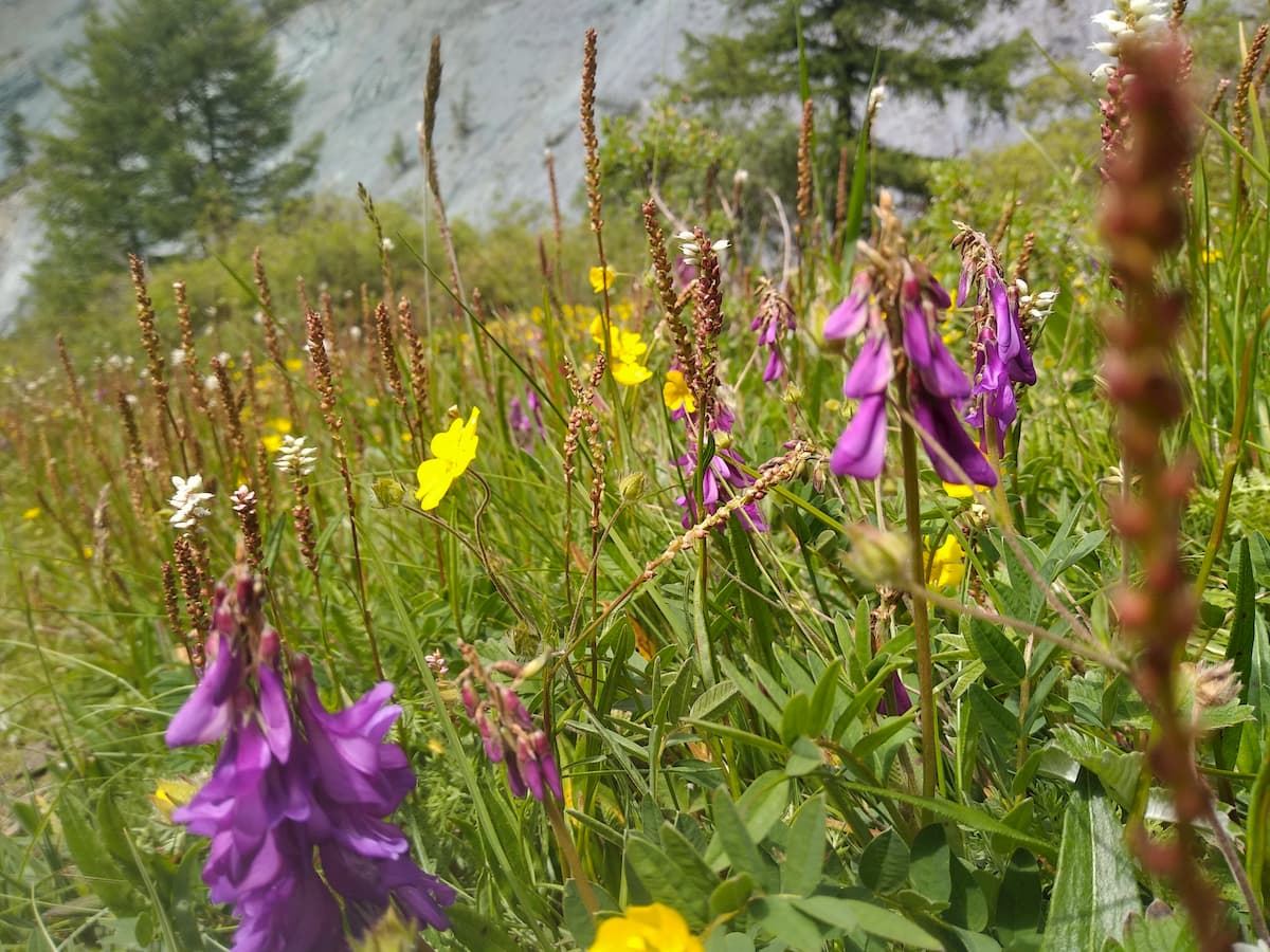
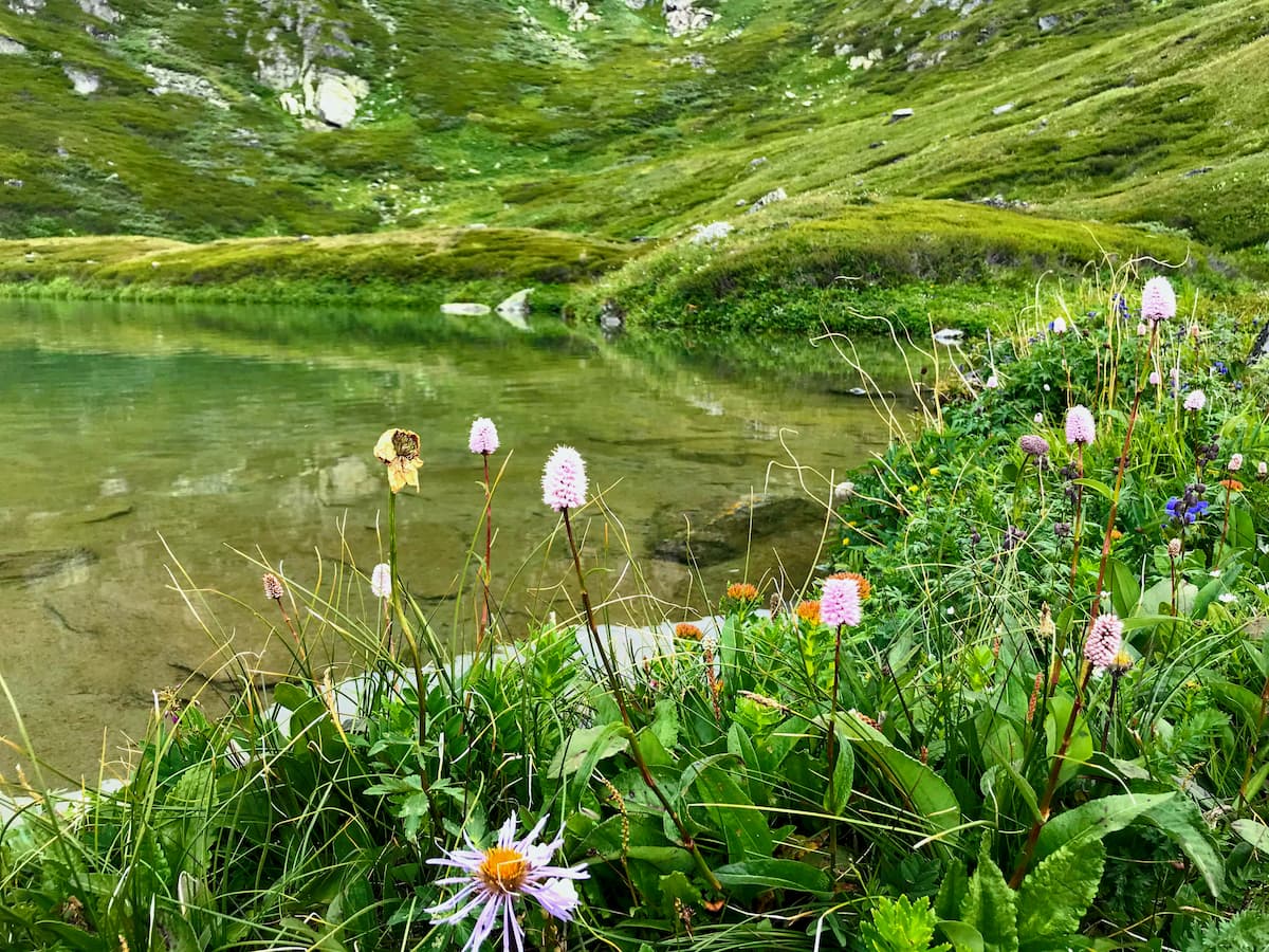
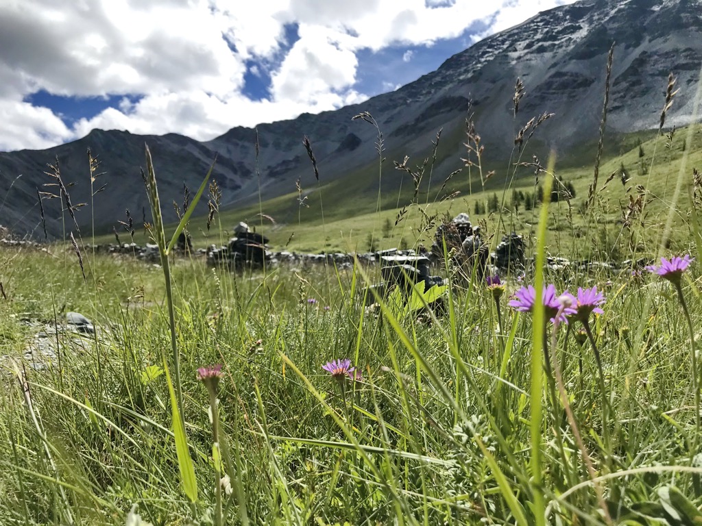
The mountain meadows are rich in subalpine herbs and large flowers. There grow orange lights and blue columbine, silver edelweiss, white anemone, blue dragon’s head, raspberry tick trefoil (Hedysarum), golden-yellow buttercups and violets.
There is an incredible amount of healing plants growing in the Altai. It is a unique ecologically clean place, you can collect them yourself or buy them from the local residents. The Altai is famous for its herbal teas and medicinal collections.
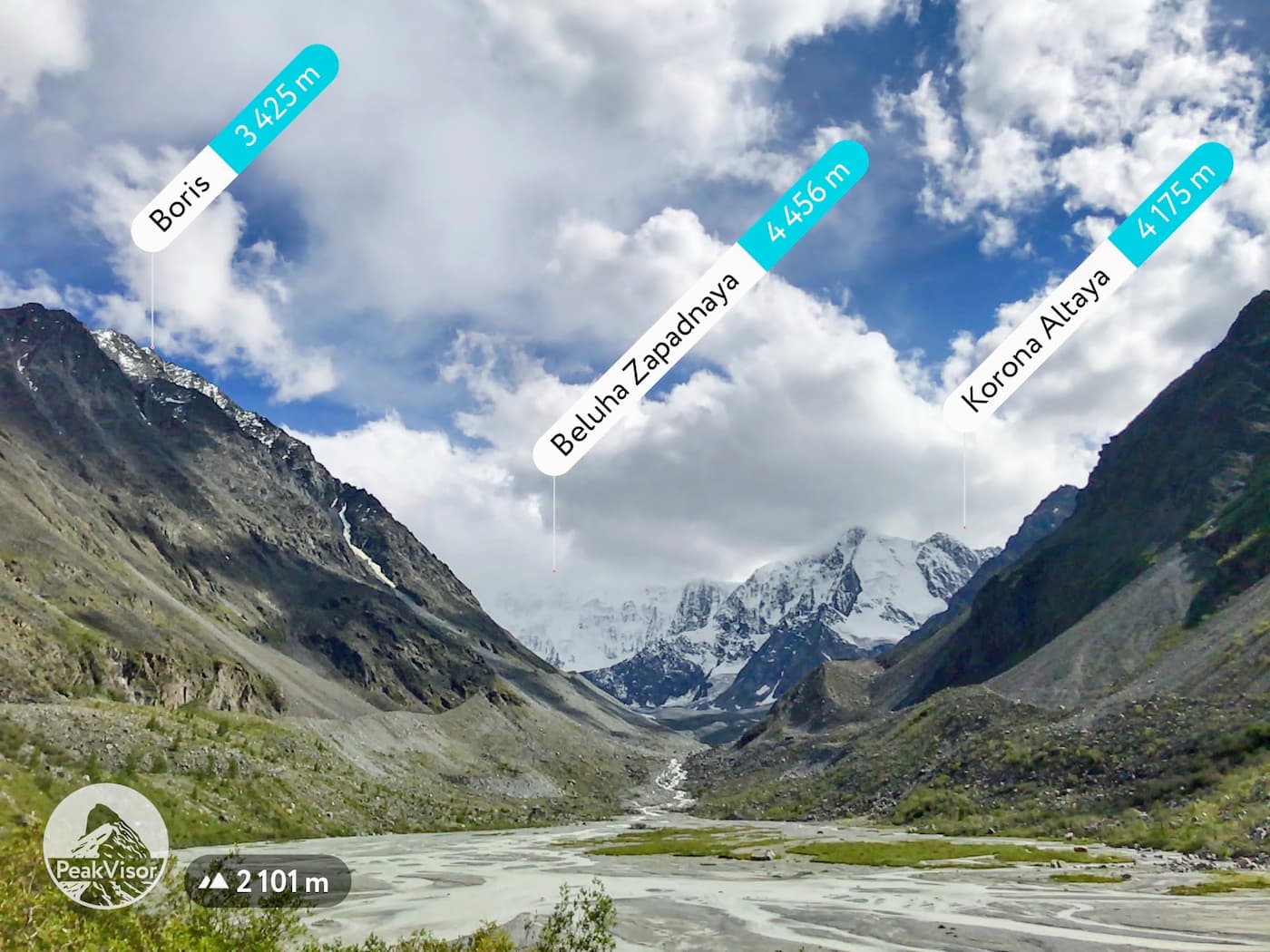
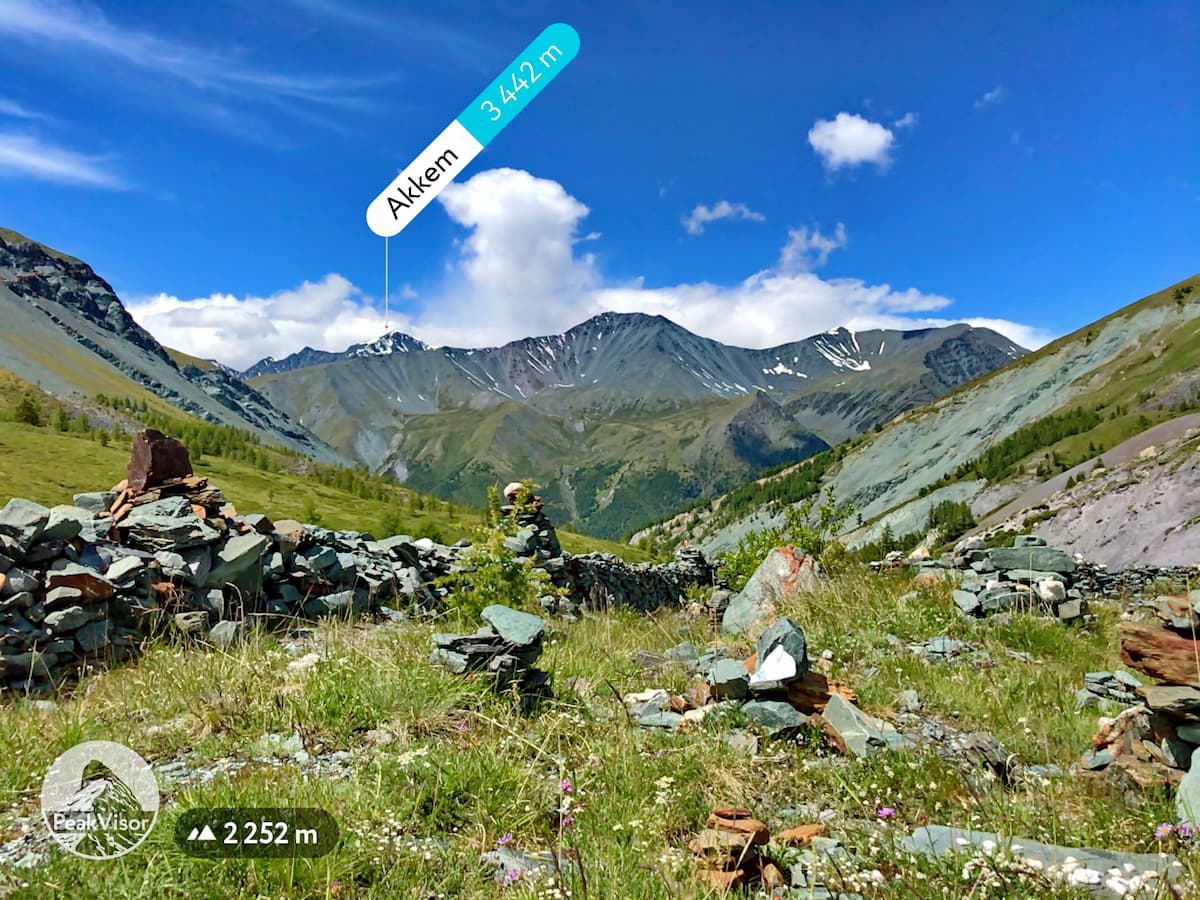
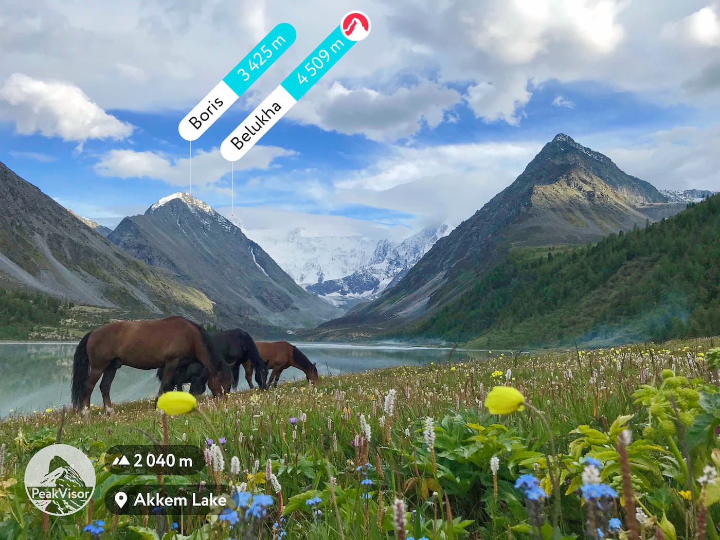
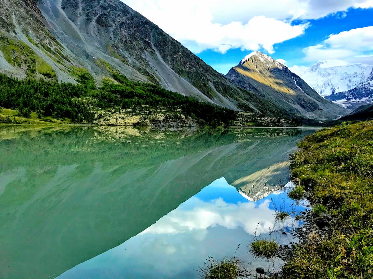
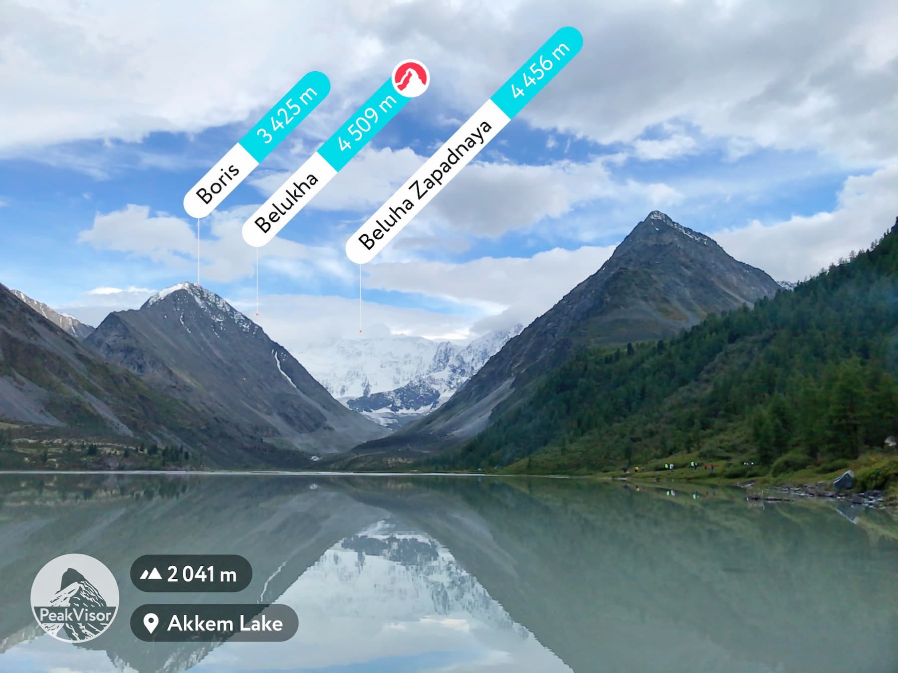
Belukha (4,509m) is the highest peak of the Altai Mountains and the highest peak of Siberia. Geographically, this mountain is about the same distance from the Arctic, Pacific and Indian Oceans. The top of Mount Belukha is always covered with snow and ice, thus the name – white mountain. Belukha actually has two peaks that remind of irregular pyramids – the pointed Eastern Belukha (4,509 m) and the gentler Western Belukha (4,435 m). Northwards, they drop almost vertically to the Akkem Glacier, whereas in the southward direction, the slopes are gradually descending to the Katun glacier (the Gebler glacier).
In 2002, two paragliders started synchronously from the Eastern summit (4,509m). Travelling by air is undoubtedly faster, but skier Dmitry Shchitov took up the challenge in 2003 and went downhill from the very top of Belukha in about 2 hours. Belukha is not a mountaineer-friendly mountain due to harsh weather conditions and the typically low atmospheric pressure, which at the top of the mountain is about half the normal. Moreover, the rocks on the slopes of Belukha are covered with a thin layer of leaky ice all year round, which makes them incredibly slippery. To add to the trouble, Belukha is located on a tectonic crease that generates earthquakes on a regular basis.
A famous Russian painter Nicholas Roerich made Belukha the star of several of his paintings. You can read about this famous artist and traveller in our article that features quite a bunch of mountains.
The mountain is considered sacred both by Buddhists and Altai shamanists. It is considered to be one of the entrances to the mystical land of Shambala and the mysterious Belovodye (White Water Area). Modern esotericists and Roerich's followers consider the mountain a place of power and information pyramid that is receiving messages and energy from space.
The Altai people have many prohibitions associated with the sacred mountain. It is forbidden to make noise and loud sounds on the slopes of Belukha. Also, iron objects cannot be brought here, and hunting is not allowed in these places. As in many other sacred places in the Altai, women are not allowed to enter the lands of Belukha Mountain.
Once upon a time, there used to be a legend among the locals that everyone who dared to climb the top of Belukha, would go blind. It has a scientific justification as well – without special glasses the glow of light reflected from snow and ice can really damage the retina and impair vision.
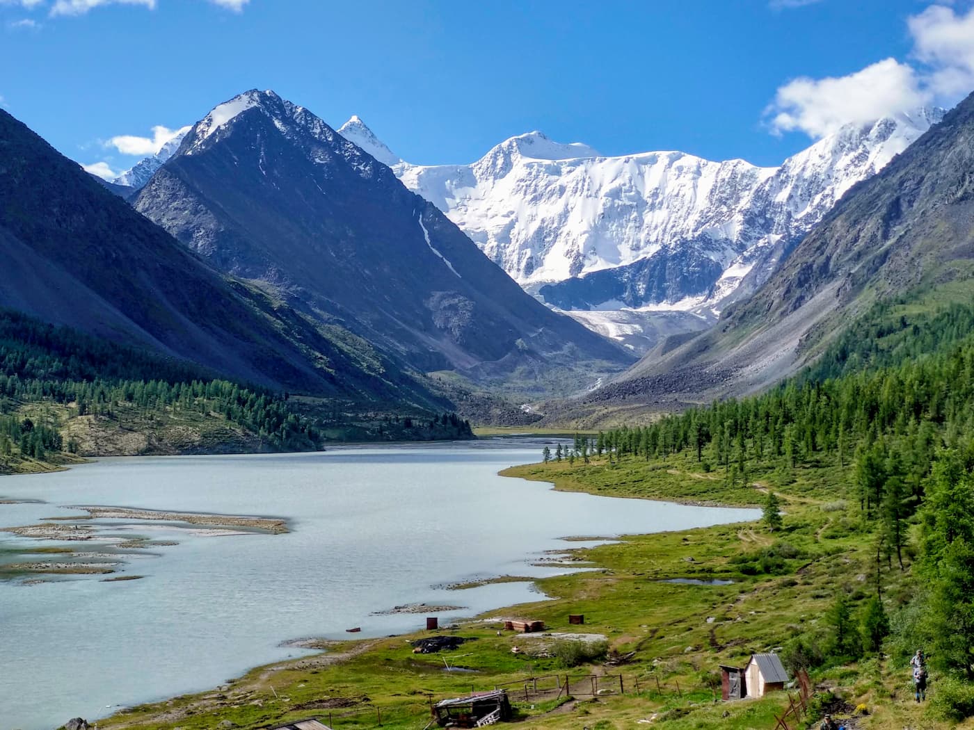
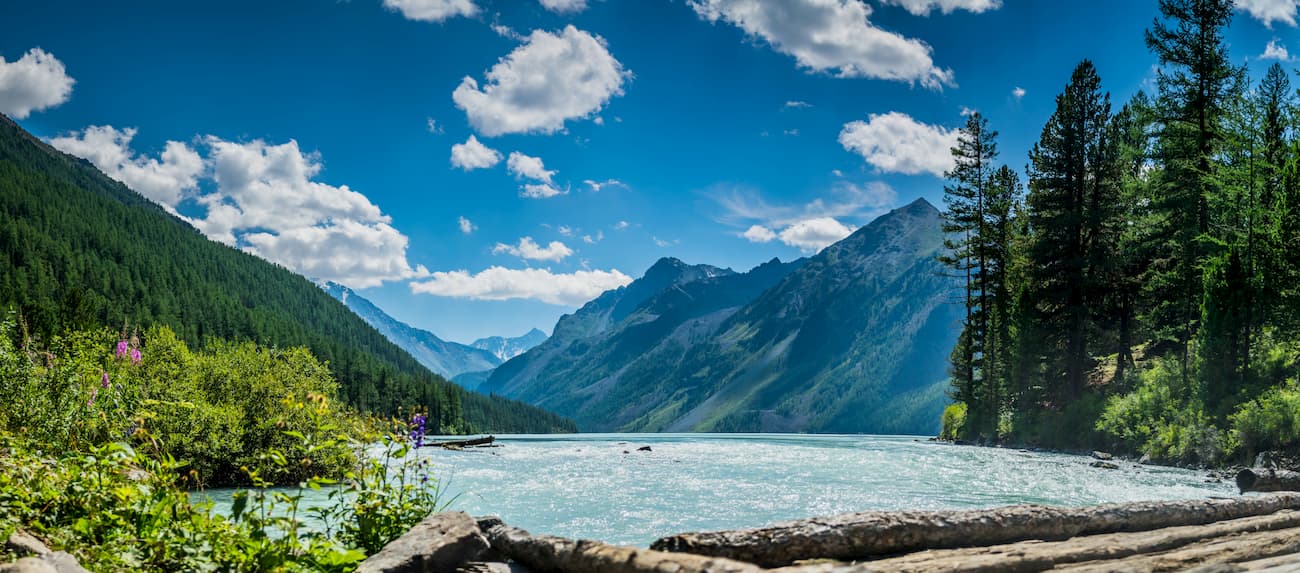
Lake Kucherlinskoye is a high-mountain lake at the foot of the northern slope of the Katun Ridge in the upper reaches of the Kucherla River. It is located at an altitude of 1,790 m a.s.l. It is one of the largest lakes in the Altai Mountains and one of the largest reservoirs of glacial origin. Lake Kucherlinskoye is a popular tourist destination, often included in the same route as visiting Mount Belukha and Lake Akkem. Since the lake has a glacial origin, its colour is unusual deep turquoise. The lake is squeezed from the east and west by high rocks rising up to 3000m, from the south it flows into the valley of the river Kucherla, and from the north, it abuts on moraine deposits which feed the lake.
The lake is quite impregnable, you can't get there by car, you can reach it only on foot with a tourist group, luckily, you can cover part of the way by riding horses. It is also possible to get there by helicopter.
From the village of Kucherla to Kucherlinskoye Lake there is a 34 km long horseback riding trail. On the lake, there is a camping house with comfortable cottages and a bathhouse. You can stay and take good advantage of comfortable conditions.
It is also located at the foot of the northern slope of Mount Belukha. The lake is fed by the melted waters of the Akkem glacier. The Akkem and Akoyuk rivers flow into the lake on the south side, whereas the Akkem River flows out from the north side. The water temperature in the lake does not exceed +4.5 degrees Celsius (40F).
The Tekelu Fall is one of the highest waterfalls in the Altai Mountains, with a drop of 60 m. It is located on the Tekelu River which flows into the Akkem River near Lake Akkem.
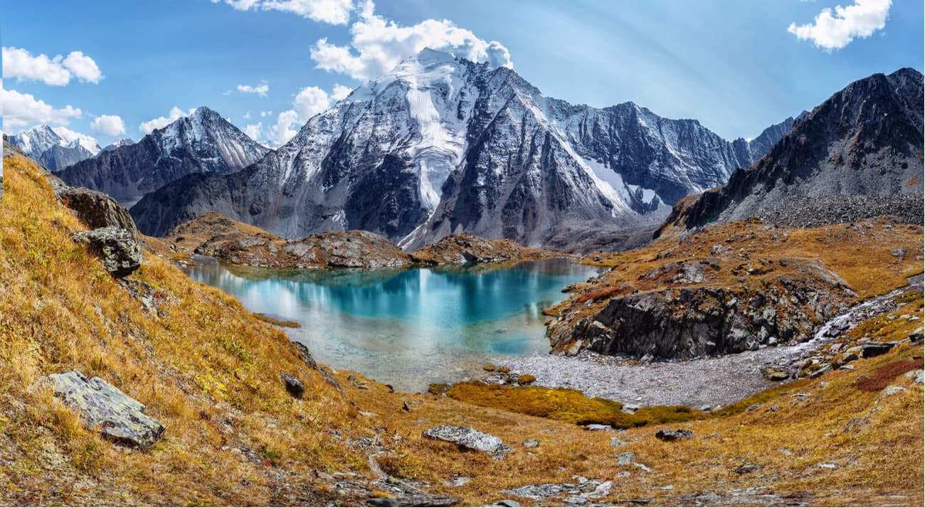
Lake Darashkol lies to the south-east of the Kucherlinskoye lake. It is surrounded by mountain peaks, wastelands and glaciers. The altitude of the lake is 2,133 m above sea level. The lake offers a beautiful view of the Katun Range mountains, the Crown of Altai (4,178 m) is particularly well seen from Lake Darashkol. In the middle of the lake, there is a granite cape with thickets of moss and berries. The Yoldo-Airy River flows out of the lake, it forms a low but very beautiful cascading waterfall. It is one of the most beautiful lakes in the Altai, few people go to it as it is difficult to access and requires really good stamina and fitness level of a tourist.
A small alpine valley lying 10 km away from Belukha Mountain features a large number of small lakes. Their mirror-like surfaces reflect the majestic snow-white peaks of the Katun Range. Around those lakes are lavish green alpine fields with bright flowers.
The lakes are glacial, the water is the purest and tastiest. The valley is considered one of the most beautiful places in the Altai, from here you can enjoy a magnificent view of Belukha. The Valley of Seven Lakes consists of three tiers, the uppermost of which is at an altitude of about 2,600 meters.
The Yarlu Valley is located on the right bank of the Akkem River at the Yarlu Mountain which feeds the Yarlu River, the right tributary of the Akkem River. The confluence of the Yarlu and Akkem rivers is located 2 km below Lake Akkem.
The Yarlu Valley is famous for the colorful slopes of a small 2-km-long spur which divides it in half. The colors of these slopes become especially bright after rain conveying the entire palette of the rainbow.
It is full of different flowers all year round. The Yarlu Valley has another name, the Valley of Edelweiss. It is here that these Red Book flowers are found in huge numbers. It is surprising that in the neighbouring gorges they occur rarely or no longer grow.
Since the early 2000s, in the Yarlu Valley, followers of Roerich’s ideas have been building a town of stones around a monolithic stone block, which they call the Stone of Wisdom located in the centre of the gorge and embedded in the ground. The Banner of Peace, the so-called Roerich's sign, is painted on the stone. They surrounded the territory with a fence made of slate, placing hundreds of stone pyramids inside the “town”. Here you can meet the disciples of Roerich's ideology and Hindu religion.
The walk to the Jarlu Valley is easy and pleasant, following a picturesque path along the river. You will cross the Akkem River over a bridge, along a wide rocky river bed with high steep banks overgrown with larch.
Not far from the Valley of Seven Lakes, there is Ak-Oyuk mountain with a large hanging glacier. The height of Ak-Oyuk is 3,860 meters, the mountain is considered quite easy to climb. It is also the best observation point in the Belukha area. The mountain is often used for training and education of beginner climbers.
Built at the foot of Belukha Mountain, in the valley of the Akkema River, the Chapel of Michael the Archangel is the highest-altitude Orthodox cult place in Russia. It was built in memory of all rescuers, climbers and travellers who died in the mountains. However, a madman set this edifice on fire in June this year (2020), it is still unclear whether it can be restored.
One of the landmarks of the of Lake Akkem Valley is the Lake of Mountain Spirits. If you come here in sunny weather, it will amaze you with turquoise purity of its water. The water is so pure that when there is no wind, it seems as if it is not water but a mirage over the rocks lying on the bottom. Such deceptive state of water, the feeling of magic, and the enchantment of this place generated many legends about the lake being a refuge of mountain spirits. From the southern side of the Lake of Mountain Spirits, a waterfall flows down the stone bedrock.
Belukha is visited by people of all shapes and sizes, there are groups of common tourists and hardcore professionals. Hiking here had different complexity levels and duration. You can hike for 3 to 5 days, with an opportunity to go light. Alternatively, you can take up a 2-week endeavour if you are more prepared and in good physical shape. Mountaineering options are also of different levels of complexity.
It is possible to use services of the local population or tourist companies and facilitate transitions by covering part of the route by GAZ-66 all-terrain vehicles or by helicopter.
Horseback riding with an experienced horse breeder and professional guide is popular. Riding a horse is a great option for overcoming even quite difficult passes such as the Kara-Turek (3,000m classification A1).
The Altai is a region of rapid rivers, it is a wonderful place for rafting – here take place competitions of Russian and world levels. Tourist companies offer separate water tours for extreme sportsmen and for amateurs as well as routes of different complexity with a combination of equestrian crossings, hiking and river rafting.
If you are in any doubt about your capacities, or if you want to make the trip a bit easier, you can use the services of transportation of food, tents and public equipment on pack horses, or a by a helicopter drop.
Mind you that the Belukha Nature Park lies very close to the border, sometimes the routes come as close as the 5-km zone from the border (Belukha Mount, Tomsk parking lots), thus you must have a permit to cross the borders. For Russian citizens, the application for the permit should be filed to the park administration 10 days prior to the trip. For foreign citizens, including citizens of CIS countries, it is necessary to obtain a border pass, the documents and application must be submitted a month before the tour.
The route to the foot of Belukha is a popular 2-week route on which you will pass the most interesting and legendary places of the Altai Mountains. You will go along the river Akkem to Lake Akkem, the Valley of Seven Lakes, the Yarlu Valley, the foot of Belukha, the Karatyurek pass, Kucherlinskoye Lake, Lake Darashkol, which few people go to as it is difficult to access and requires good physical fitness. The route is classified as 3B, the maximal elevation drop is 1000m per day. The load that you will have to carry on your back is 6-15 kg for the first two days till you reach the first pit stop, but after that be ready to have a backpack weighing up to 25kg. Kids can join the trip only once they turn 16. And one more tip - have a vaccination against tick-borne encephalitis before travelling in the Altai.
As to climbing Belukha, get real and take an unbiased look at your powers. Sparkling Belukha ice against the background of bright blue sky attracts travellers like a rare jewel. To conquer a height of 4509 meters is a great achievement even for an experienced climber. Surmounting difficulties are exacerbated by snow that covers the mountain from base to peak. Climbing is usually organized for groups of tourists.
The ultimate destination is as follows: the Republic of Altai, Ust-Koksinsky district, the Katun Ridge, Belukhinsky hub. The Park administration is located in Ust-Koksinsky district, Tyungur village, 5 Zarechnaya street, tel.+7 388 482 9421. The Belukha Nature Park website is in the Russian language but they have two emails: park_belukha@mail.ru and Altay-info@yandex.ru
Routes start from the village of Tyungur.
There are camping sites on the territory of the park, the hospitality of which can be used during the hike:
Ust-Koksa is a quite developed district centre, there is a central estate of the Katun Reserve and Roerich’s National Library. The village is a centre of local tourism – here begin many routes due to its close proximity to the Katun Range, Multinskoye, Akkemskoye, Kucherly and Shavlinskoye lakes. Ust-Koksa is the last settlement which can be reached by a shuttle bus from Gorno-Altaisk.
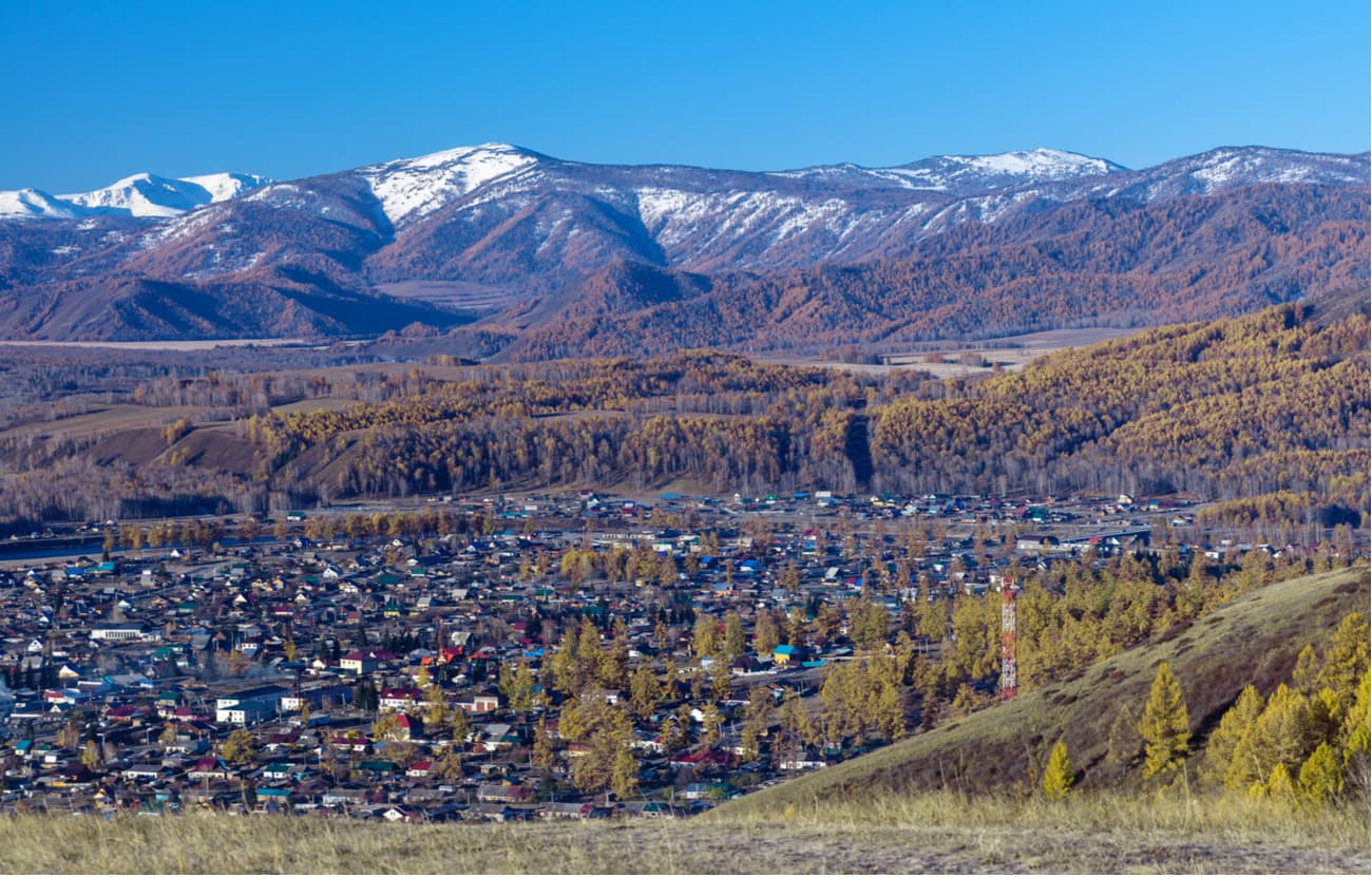
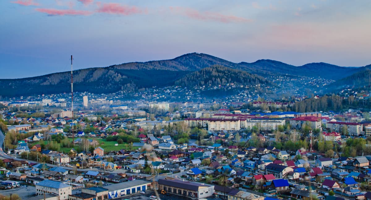
The capital and the only city in the Republic of Altai. Gorno-Altaisk Airport is 6 km west of the centre. Should you wish to take a railway road, the closest station is Biysk, 100 km away. The city is located in the northwestern part of the Altai Mountains, in an intermountain basin surrounded by low peaks at an altitude of 270-305 m above sea level, at the confluence of the rivers Ulalushka and Maima which flow into the river Katun about 250 km north of Mount Belukha, the highest point of the Altai and Siberia.