
Scan the QR code and open PeakVisor on your phone
Sakhalin Oblast is home to 1,899 named mountains. The highest is Alaid at 2,339 m.
Given the abundance of vast expanses of the Russian mainland, the Sakhalin Region seems to be a really bizarre formation since it is the only federal region that consists only of islands. Yet, even that fact does not undermine its impressive square footage of over 87,000 sq. km, of which about 78,000 sq. km fall on Sakhalin Island. In terms of its size, Sakhalin can be compared to the territory of such relatively small European states as the Czech Republic or Austria.
This land has many wonders that leave long-lasting impressions on any traveller. The Sakhalin Region encompasses 87 islands, including Sakhalin Island, the adjacent Tyuleniy and Moneron Islands, plus two ridges of the Kuril Islands. Located in the Far East of the Russian Federation, the region is bordered by Khabarovsk, Kamchatka and Primorsky Krai, and by Japan to the south. The ownership of the southern part of the Kuril Islands is still disputed by Japan. Today, the border between Russia and the Land of the Rising Sun runs along the sea (Sovetsky, Kunashirsky, La Perouse, and Izmeny Straits).
The Sakhalin region was formed in 1918 and is now part of the Far Eastern Federal District. The region has a population of 488,257 (according to Rosstat, 2020). It includes 1 city of regional significance (Yuzhno-Sakhalinsk is the administrative center) and 17 districts (among them 1 city of regional significance, 1 urban-type settlement and 1 rural district).
Sakhalin Island stretches over 948 km, it is one of the largest islands in Russia. Its width varies from 26 km to 160 km. The island is washed by the waters of the warm Sea of Japan to the west and southwest and the cold Sea of Okhotsk to the north and east.
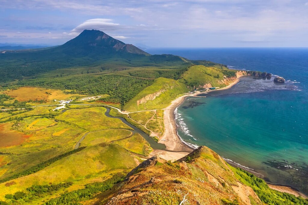
The 1,250-km long strip of the Kuril Islands, which are usually divided into the Greater Kuril Ridge and the Lesser Kuril Ridge, stretches from Japan to Kamchatka. The western shores of the Kuril Islands are washed by the Sea of Okhotsk, and the eastern shores by the Pacific Ocean. Kunashir Island, the southernmost among the 30 islands of the Kurils, is the third largest in the Kuril Islands you can see Japan from it, whereas the largest is the island of Iturup (3,200 sq. km.).
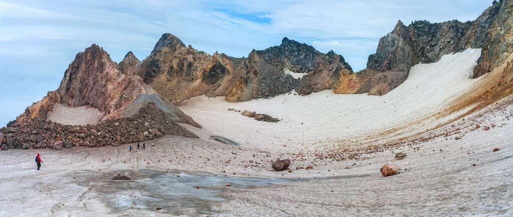
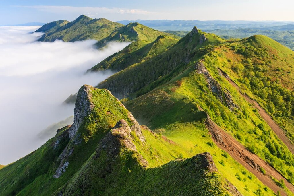
With 160 volcanoes, 40 of which are active, the Sakhalin Region enjoys really high seismic and volcanic activity which defines both the nature and the human lifestyle here. The Kuril Islands are often considered a place to go for the most fantastic natural sights. Mountains occupy the most part of the territory, the highest point is Alaid Volcano (2,339 m).
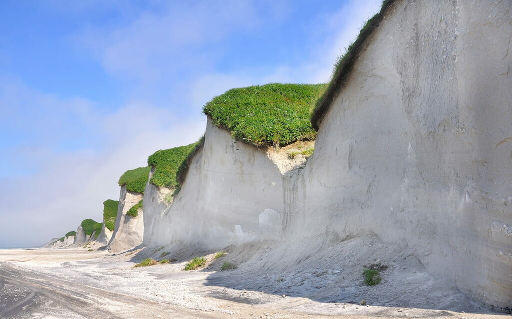
As for the relief on Sakhalin Island, it is usually divided into two parts: the southern mountainous part and the northern flat area with low gentle hills. The former includes the West Sakhalin Mountains – Mount Onor (1,330 m), Mount Vozvrascheniya (1,325 m) – and the East Sakhalin Mountains with the main peak of Mount Lopatin (1,609 m). The latter stretch along the shores of the island. The mountain ranges are intersected by the extensive river network into separate ridges and freestanding cliffs.
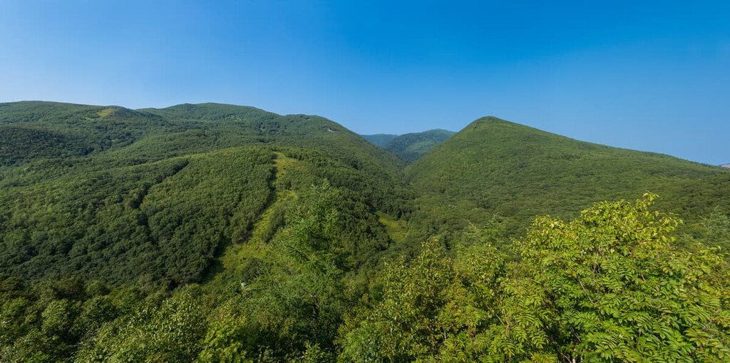
The rugged nature of the region gives an incredible mix of beautiful exotic flora and fauna. You can see lavish green bamboo thickets, dark coniferous forests, mixed grass meadows and much more. The gigantism of the local plants is mind-blowing, making you feel like you're in a sci-fi movie.
The flora of Sakhalin resembles that of the mainland, and the flora of the Kuril Islands resembles that of Japan as well as North America. There are about 1,400 plant species on the islands. On Sakhalin, the mountainous areas are covered with coniferous forests which mainly feature Sakhalin fir and Ayana spruce, whereas river valleys are occupied by deciduous forests with willows, poplars and alders. Birch, maple, ash, elm, and yew are more common in the central and southern parts of the island. Sakhalin is rich in berries and valuable medicinal plants (Eleutherococcus, Aralia, etc.). Some plants (e.g. Sakhalin buckwheat, Angelica ursina, butterbur) are surprisingly influenced by the island conditions - many of the grasses grow up to 3-4 meters in height.
The flora of the Kuril Islands can be characterized as a cluster of plant paradoxes. While wandering in the midst of the dense coniferous forests you can find patches of bamboo (Sasa), which grows in a hard-to-get-through thicket. Another seemingly inconceivable sight is coniferous trees wrapped with lianas.
The land fauna of the islands is somewhat impoverished by the separate location of the territory in relation to the mainland, which is compensated by the richness and uniqueness of marine life, some of which are found only here.
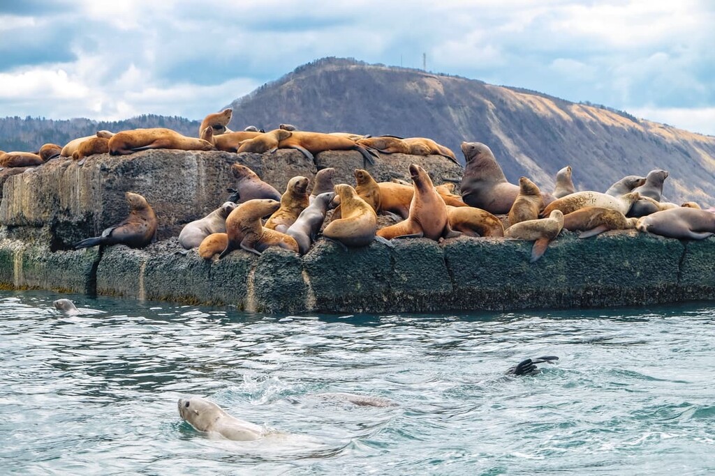
Brown bear, fox, sable, hare, reindeer, wolverine, squirrel, chipmunk, ermine, otter, musk deer, and ibex inhabit the Sakhalin Region. There are also many bird species including wood grouse, white grouse, hazel grouse, woodcock, woodpecker, mallard, teal, guillemot, cormorant. On the Kuril Islands, there are many bird and seal rookeries. You can see the insular seals (Phoca vitulina kurilensis), sea lions (Eumetopias jubatus) leisurely basking in the cold northern sun. On Tuleniy Island, there is a famous rookery of sea bears (Callorhimus). Over the past 20 years, some species of animals – Barguzin sable, muskrat, spotted deer, Ussuri raccoon – have acclimatized on the islands. Some of the fauna species are included in the Red Book.
Steller sea lion (Eumetopias jubatus) is the largest representative of the family of long-eared seals.It is a symbol of Nevelsk town in the Sakhalin Region and features on the emblem and flag of the Nevelsk District. It is included in the Red Book of Sakhalin Region and the Red Book of Russia.
The rivers, lakes and sea around the islands of the region are rich in fish. There is a great variety of salmon, sturgeon, pike, goldfish, mirror carp, Amur sturgeon (Huso dauricus), pink salmon, chum, silver salmon, lenok (Brachymystax), cherry salmon, grayling, char, bull-trout, East-Siberian char. Incidentally, the Amur sturgeon is the largest freshwater fish, it reaches a length of 5 meters, and its weight can be up to 1 ton! It is an endangered species and is listed in the Red Book of Russia.
The Sakhalin Region has 65,175 rivers. The largest of them are on Sakhalin Island – the Poronai and the Tym. There are also quite a few lakes, the amount totals at 1,719. Most of them are situated in the northern and south-eastern parts of Sakhalin. The largest of these is Lake Nevskoye (178 sq. km.). And the largest on the Kuril Islands is Lake Koltsevoye (Ring Lake) (26 sq. km.). Swampy terrain also occurs, mostly in the lowlands.
The microclimate varies in different areas of the region, and as a result, the temperature regime is very heterogeneous. In general, Sakhalin and the Kurils belong to the zone of moderate monsoon climate though the climatic conditions here are more severe than in other areas of the temperate zone.
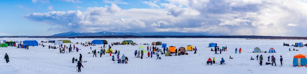
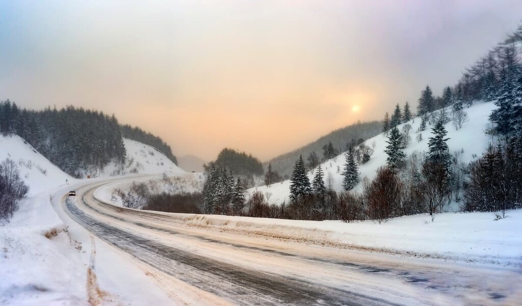
Winters on Sakhalin are long and very snowy. Winter cyclones bring heavy and frequent snowstorms. The snowfall is sometimes so heavy that it seems as if it will whelm everything in its path – fences, cars, and even houses.
Average temperatures in January in the northern part of Sakhalin Island range from -16°C to 24°С (+3 to -11F), and in the southern part the temperatures vary from -8°С to -18°С (+18 to 0F). Frosts may reach -40°C to -50°C (-40 to -58F). Spring in Sakhalin is prolonged, cold, foggy and with late snowfalls. Summers are rather short, cool, with an abundance of rain. Ice migration also takes its toll on the climate, cooling the average temperatures as big ice chunks flow southwards carried by the current from the Sea of Okhotsk along the eastern coast. August is the warmest month. In the north, the temperature rises to +12°С - +17°С (+54 to +63F), and in the south the temperatures reach +16°С - +18°С (+61 to +64F). Yet, there may be temperature hikes in the summer of up to +35°C (+95F). Autumn in Sakhalin, as well as in the Primorsky Region, is the golden time and the best period for holidays on Sakhalin. The weather at this time is sunny and warm. You may though get brief frosts in August, but after such short cold spells, there come warm and clear days usually until November.
The Kuril Islands are often affected by typhoons, tsunamis, and earthquakes. But the climate itself is milder here than on Sakhalin Island. The Kuril Islands are also characterized by frequently overcast skies, cool summers, and abrupt changes in weather. Winters are long, but with little snow. The average temperature in August in the northern part of the islands is +10°C (+50F), in the south it is +16°C (+61F). However, such low temperatures do not mean you cannot get a decent suntan, it actually is believed that the Kuril tan does not wash off for a long time and lasts until the next season.
Stormy winds and snowstorms are rampant in winter in the Kuril Islands. In February, the lowest temperatures drop to -6°C / -8°C (10-18F), but with a strong wind even such low temperatures seem quite severe. Speaking of the nastiest winds, go to Paramushir to experience the strongest recorded gusts of wind that reach the speed of 230km/hour. In winter, there are thaws up to +8°C/+12°C (+46/54F). Snow cover in the north of the Kuril Islands already appears in November, in the south – only in early December. Snow covers the territory of the Kuril Islands irregularly: in weathered areas, there may be no snow at all, while in valleys, the snow cover may be as thick as several meters. Spring is cold, with considerable precipitation. Only autumn, with the biggest number of sunny days a year, gives a respite from the incessant rains. It is as beautiful in the Kuril Islands as it is on Sakhalin.
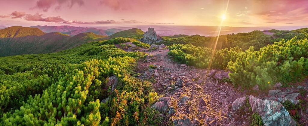
Sakhalin and the Kuril Islands are one of the most exotic regions of Russia. Unique nature with smoking or erupting volcanoes, the Pacific Ocean, national parks and reserves with beautiful geological natural monuments and various touristic opportunities make the region an irresistible temptation for any traveller. If you wish to boost your health and recharge the batteries, take the health-improving routes with thermal springs on the way, or drink unique mineral waters, or take some therapeutic mud baths. You can enjoy wild drives on four-wheelers here, or go hiking and fishing, canoeing, rafting or catamaran rafting, take up some sea travel as well as helicopter tours to completely inaccessible corners of the Sakhalin Region.
The specially protected natural territories occupy an area of 844,472 thousand hectares, which is about 9.7% of the territory. Among them, there are 2 nature reserves, 1 federal wildlife reserve, 1 nature park, 51 natural monuments and 12 game reserves.
Should you wish to visit nature reserves and sanctuaries, you need to buy a permit to visit, to do photo and video shooting. And if the visit is free, it is still necessary to obtain a pass to the protected area. In protected areas, fishing and hunting is prohibited.
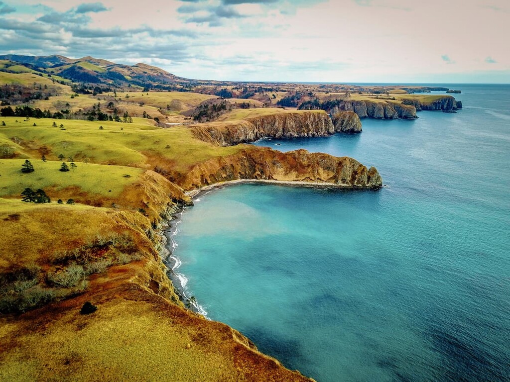
Sakhalin Island can surprise even the most fastidious traveller if not with the towering peaks, but with strangely formed mountains, cozy bays and fast rivers, mud baths, thermal springs and wonderful waterfalls, let alone the wildlife that you can spot on any route.
Frog Mount aka the remnant of Gorbunov Mountain is an amazing power place on the island. This 70-million-year-old mount is associated with many legends. In ancient times, the native Ainu people used to hold their mysterious rites here. The place was revered as the Temple of Wisdom. This natural site is located about 20 km from Yuzhno-Sakhalinsk, near the village Vestochka. The area of Frog Mount is 12 hectares and it is shaped as a circle 200 m in diameter. You can clearly distinguish three taller rocks 8m, 7m and 6m high and from the side the mount really resembles the silhouette of a frog. In 1983, the mount was awarded the status of state natural monument of regional significance. It is also included in the list of ‘The Seven Wonders of Sakhalin’. An eco-trail called the Sakhalin Frog starts from the village Vestochka. The river Ayichka flows nearby. The locals believe in the healing properties of its waters.
Chekhov Peak (1,045m) is one of the highest points on Sakhalin Island. It is located in the southern part near the city of Yuzhno-Sakhalinsk and is a protected object. This peak is named after the famous Russian writer Anton Chekhov who visited Sakhalin in 1890. During Japanese reign, a small temple house was built on the very top of the mountain, and it is still there today. There is a signposted hiking trail to the summit, in some places it is equipped with ropes. The slopes are home to rare animals, including those listed in the Red Book, and in some places there are small bushes of bamboo and dwarf birch.
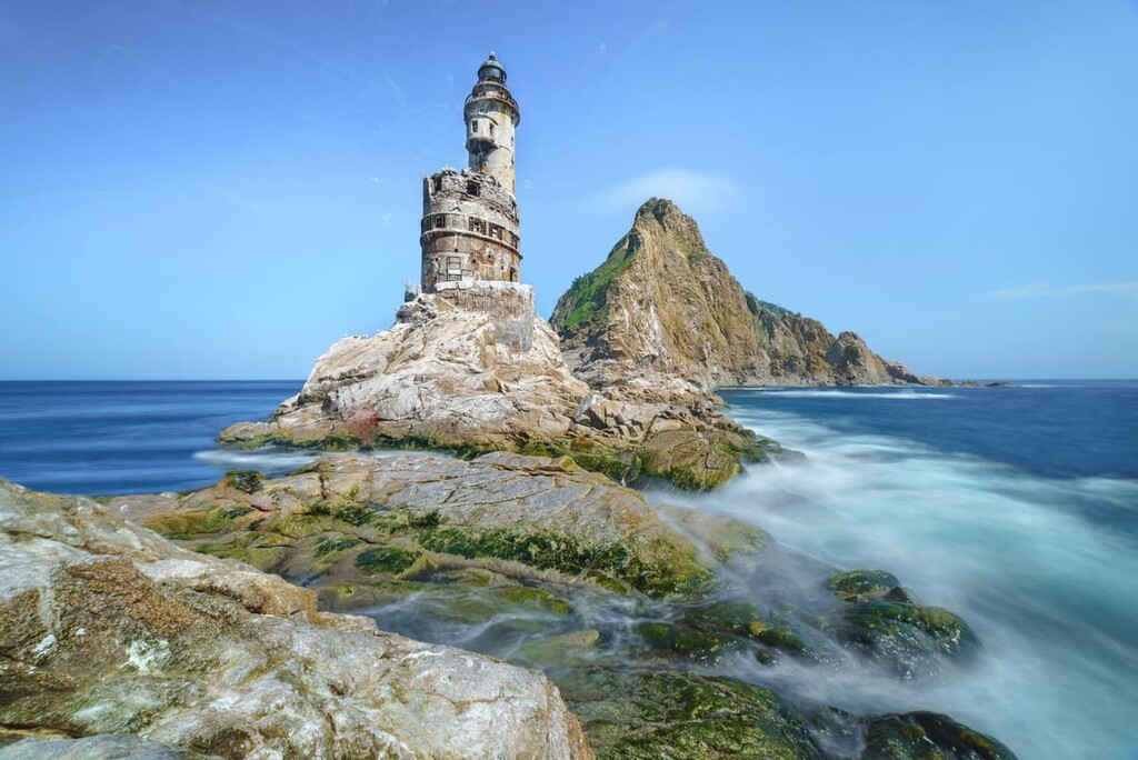
A beautiful place in southern Sakhalin that attracts travelers from all over the world is Cape Aniva and the lighthouse. The cape itself is narrow and rocky, it looks like a huge stone ship prowling the grey waters of the Pacific Ocean. The lighthouse was built on the rocks in the 1930s under the direction of a Japanese architect in order to reduce the number of sinking ships. Later, a settlement was formed near it. Now both the lighthouse and the settlement are abandoned.
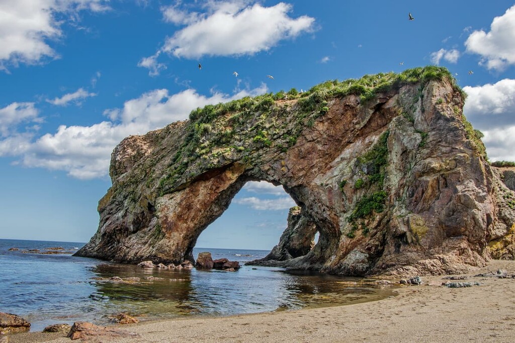
Cape Velikan is located in the southeast of Sakhalin, on the east coast of Tonino-Anivskiy Peninsula, the most beautiful place on the island. The Cape is also a natural monument. You will see rare natural sites from here to the neighboring Ptichy (Birds) Cape.
Near Yuzhno-Sakhalinsk, there is a group of volcanoes. They are basically hills with a depression in the center, but the visitors can enjoy some amazing volcano activities. There may come warm mud outpours, oozing calmly from the ground, or dripping quietly and then suddenly splashing out with a whistle. So, watch out if you don’t want to get an unplanned mud-bath.
There several local thermal springs here that help to cure many diseases and bring you back to life after an excruciating hike:
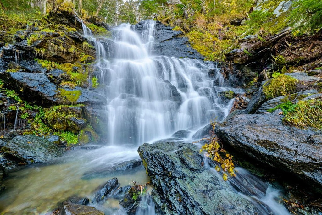
Waterfalls are quite abundant in the area, they come of various shapes and sizes. Probably, the Shuisky Fall is one of the most beautiful waterfalls on the island. It consists of two streams that is why it is sometimes called the Two-headed Fall. The waters of the river Chekhovka and the waters of its left tributary fall from a height of 25 m (and according to some sources it is 36 m) in two massive streams. The distance between the two powerful jets is about 20m.
We have written a long-read on the Kuril Islands. Anyway, this remote 1,2000-km-long chain 56 islands never fails to impress with fantastic landscapes. Even in foggy weather, gale-strong winds or monsoons the Kurils look amazing and mysterious. Tours are held only on a few islands, but the itineraries of the tours include visits to quite a number of natural sites including those located on uninhabited islands, like Ring Lake on Onekotan.
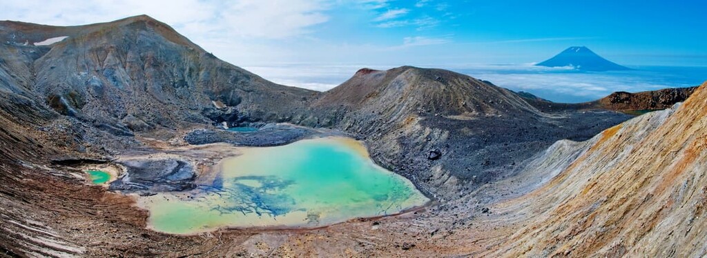
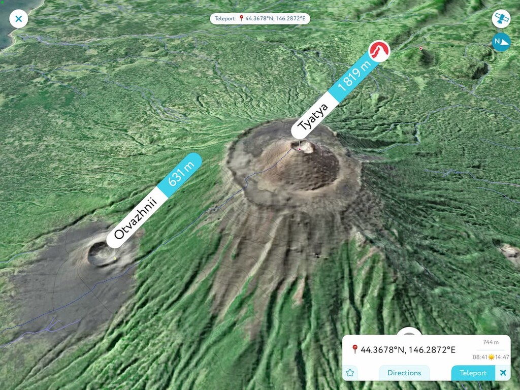
The ancient name of Kunashir is Black Island. Its color is associated with the shade of soil, dark green forest and gloomy volcanoes. In total, there are four volcanoes on the island. Tyatya Volcano is Kunashir's calling card. It is a perfectly shaped volcano with a large round crater. Mendeleev Volcano attracts with thermal springs at its foot, and Golovnin Volcano lures tourists by picturesque lakes in its caldera.
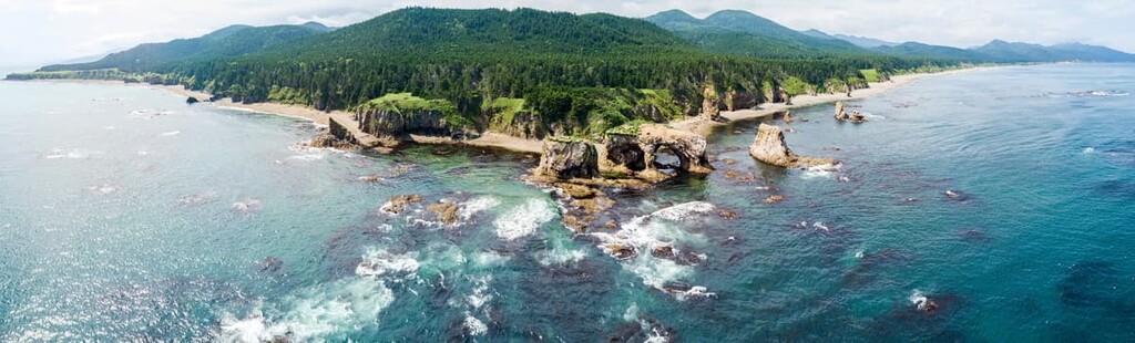
Kunashir Island is a nature reserve. Here there is a lot of unique flora and fauna and the local nature is practically untouched by human presence. It is worth going here because you can enjoy excellent views of Japan. In addition to the volcanos, the island's gem is a unique Pillar (Stolbchaty) Cape which looks like the pipes of a giant organ. There are similar landscapes in several other places on the planet, but they are also hard to reach.
Iturup houses the capital of the Kuril Islands, the city of Kurilsk. There are 20 volcanoes here 9 of which are active. The most important and majestic of them, Bogdan Khmelnitsky Volcano (1,585.3 m), is visible from anywhere on the island. There are a lot of thermal springs and lava rocks frozen in bizarre forms, amazing bays and wonderful lavish forests. One of the main attractions are the fabulous White Cliffs.
The local bays, the most popular of which are the Lion's Mouth and the Good Start (Dobroe Nachalo), are very colourful. The northern part of the island has predominantly mid-mountain relief with volcanic formations. In the north of the Medvezhiy Peninsula, there is a vast volcanic caldera with two cones that host the Ilya Muromets waterfall (141 m high), one of the highest in Russia. Slightly to the south lies the Medvezhy volcano caldera. This volcano is considered the most ancient and has a height of 1,124 m.
Apart from natural wonders, those interested in military history can find many fields with abandoned armored vehicles - tanks and fighter jets with variable geometry of the wing, those were left here in the 1990s. Also, there are Japanese tunnels left from WW2 near the Orca Bay (Kasatka bay). And the airfield of modern airport on Iturup used to be the starting point for the Japanese bomber planes to fly to Pearl Harbour.
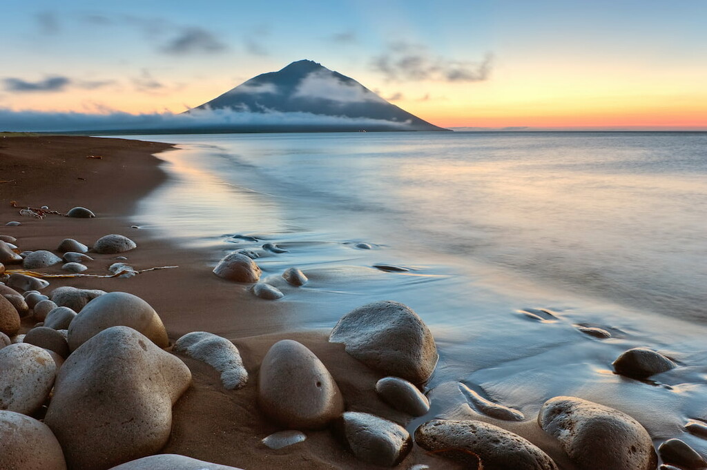
Shikotan Island is home to the volcanic vents that have long been extinguished, which is why it is sometimes called the ‘Land of Dormant Volcanoes’. Here you can enjoy pristine nature, admire the combination of rocky massifs and low gentle hills and picturesque bays. Visiting the Cape of the Land’s End with the lighthouse located on it, you can experience an incredible feeling, as if you are really at the most extreme point of the globe, watching the vast expanses of the Pacific Ocean in front of you with California looming somewhere far ahead.
Paramushir is an ultimate fitness test, most common pleasures are accessible only to people in a good physical shape, unless we are talking about unlimited travel budgets that can cover expensive trips by boats and helicopters. Hiking programmes in this part of the Sakhalin Region are characterized by high complexity of routes. Not every person can cover the trails to see the crater of Bogdanovich Volcano, Malovodny Lake, the caldera of Karpinsky Volcano, the hot springs in the upper reaches of the Yuriev River, Lake Emerald and Glukhoe (Outlandish) Lake or visit the peaks of Ebeko (1,156m) and Chikurachki (1,817m).
Waterfalls in the Kuril Islands are very beautiful. You can find the so-called ‘flying water’ on almost every island. Just look at the coastal waterfalls. Here is one of the highest waterfalls in Russia – the waterfall Ilya Muromets on Iturup. You can feel its power by watching the streams of water plummeting from a height of 141 meters.
To visit the Kuril Islands, you need a border zone pass which is issued by the Sakhalin branch of the FSB Coast Guard in Yuzhno-Sakhalinsk. The application may be submitted on workdays from 9:30 to 10:30 a.m. (you need only your passport and its photocopy, which can be made on site), the next morning the pass will be ready, there are usually no problems with obtaining it.
If you try to go to the Kurils without a pass, the least punishment is a fine of about 500 RUR, and the maximum is you will be sent back to Sakhalin by the same flight. The pass is issued only for the islands specified in the application, so you need to specify all the places you are going to visit.
When planning a trip to Iturup, you should consider getting a border zone permit a few days (or better a week) before the departure date, and getting a photo and video shooting permit. You can apply for these documents in Yuzhno-Sakhalinsk at the address: 63a Pobedy Ave. Tel.: +7 424 249 21 04.
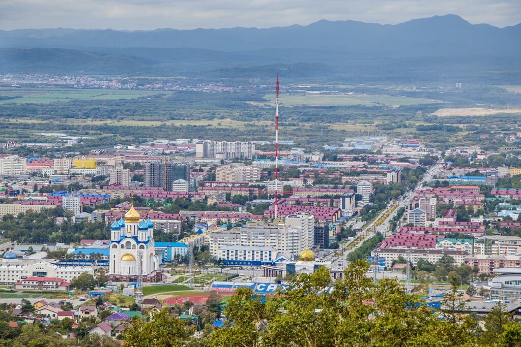
A visit to the Sakhalin Region usually starts with its capital, Yuzhno-Sakhalinsk. Because of its isolation from the mainland, there are not many options to get there since there is no land connection. The most popular way is by plane. There are 7 airports on Sakhalin Island, you can take a bus or a cab to Yuzhno-Sakhalinsk.
You have some time to spare and want some adventure, you can take the train to Vanino Station in Khabarovsk region and then the ferry. Vanino is the only town that operates sea transfer to Sakhalin. You can reach Vanino by train from Khabarovsk (14 hours) or Vladivostok (40 hours).
As for the Kuril Islands, you can get there by boat from the port in Korsakov, Sakhalin Island, or from Kamchatka if you travel to Paramushir, or by plane from Yuzhno-Sakhalinsk airport. In 2019, it became possible to fly between the neighboring islands by helicopter.
Yuzhno-Sakhalinsk is currently one of the largest cities in the Sakhalin Region and its administrative center. As many remote cities, it began its existence as an exile place for the convicts. Back in 1882, the Russians founded the village Vladimirovka which later grew into a bigger settlement. From 1905 to 1945, it was part of Japan under a different name – Toyohara, which means ‘Beautiful Plain (or field, or steppe)’. And only after the return of the southern part of Sakhalin Island to the Soviet Union in 1946, it got its present name, Yuzhno-Sakhalinsk.
The city is located in the south of Sakhalin Island, on the Susuya River, 20 km from the Sea of Okhotsk. It is located in an earthquake-prone area with a high likelihood of mighty earthquakes. Therefore, any housing construction takes into account seismic resistance, that is why buildings must withstand earthquakes of intensity up to 8 points on Richter scale.
Yuzhno-Sakhalinsk is well known in the Far East for the Mountain Air Sports and Recreation Centre. Located on the southern and western slopes of Bolshevik Mountain, this place is probably the best in the entire Sakhalin Region for fans of skiing. Nation-wide competitions are also held here.
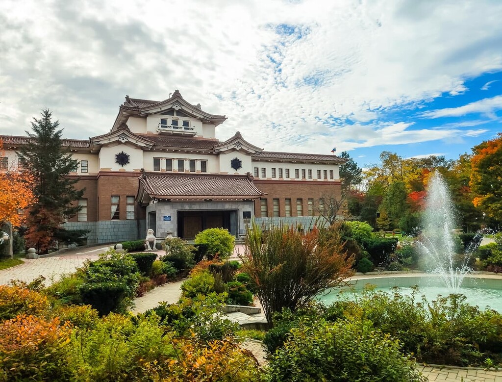
There are some options for culture-vultures as well. The city has many monuments, theaters and museums. Among the museums, the Sakhalin Museum of Local Lore draws particular attention. Looking at the building, you may get the impression of a Japanese noble palace, which is no wonder, since it was built in 1937 in the traditional style of the Land of the Rising Sun. In those distant times, Sakhalin Island was under Japanese jurisdiction. During the tour, you can learn about the nature, history, culture and traditions of the indigenous peoples.
Gagarin Park is also designed in the Japanese style. In 1981, it was destroyed by typhoon Willis, but was later rebuilt.
Sakhalin Zoo and Botanical Garden is one of the largest zoos in the Far East. Many of the species of animals and birds represented here are included in the Red Books of Russia and the world.
Another attraction is the Victory Museum and Memorial Centre opened in 2016 in honor of the 70th anniversary of the Victory in WW2. It includes a square, a cultural and educational center which houses a museum with exhibits of the Russian-Japanese War and the Great Patriotic War (more known in the world as WW2).
Nearby stands the Cathedral of the Nativity, its walls are decorated with mosaics created in Jerusalem.
Kurilsk is considered to be the capital of the Kuril Islands, administratively it is a town in the Sakhalin Region, located on the island of Iturup in the Great Kuril Ridge. The town is situated at the mouth of the Kurilka River on the shore of the Kuril Bay in the Sea of Okhotsk.

The town is one of the smallest in Russia in terms of population, but it stands in an extremely rich area and impresses with the beauty of the surrounding landscape. It is home to a seaport, a pink salmon spawning factory, a seismic station, a weather station, and a tsunami warning station which can be visited with a guided tour. Fans of gastronomic tours can visit the fish factory where they can see the breeding of humpback salmon. Kurilsk even has its own museum of local history, with a collection of archaeological and ethnographic materials.
Give us a shout about your fantastic adventures in the Sakhalin Region, we appreciate your feedback at peakvisor@routes.tips


Yes. Sakhalin Oblast has 1,899 named mountains. The highest is Alaid at 2,339 m.
The highest mountain in Sakhalin Oblast is Alaid, at 2,339 m.
Sakhalin Oblast has 1,899 named mountains.


