
Scan the QR code and open PeakVisor on your phone
Kurils Nature Reserve has 15 named peaks. The highest is Tyatya at 1,819 m. Other notable peaks include Gora Ruruy, Gora Sibirtseva and Gora Glinki.
Few are the places on Earth equally hostile to human presence. Nature goes rampant here. There are massive earthquakes on land and under the water, storms, typhoons, the strongest winds that can knock you off your feet before you say Quidditch. What is this magic place? It is the Kuril Islands, the rocky cliffs in the Far East, the 75-year-old bone of contention between Russia and Japan due to the outcomes of WW2.
Yet, despite the toughness of the elements and the iffy issues of the humans, the Kuril Islands are a feast for the eye and a must-visit for the body and soul. The nature here is rich and mesmerizing in its uniqueness, it leaves no one indifferent to its charms. The wildlife is rare and features species listed in the Red Book of Russia.
The Kuril Islands are mainly a protected area. They host the Kuril aka Kurilsky Nature Reserve established in 1984 to protect and study the extraordinary landscapes of the Southern Kurils, their flora, fauna, marine and coastal ecosystems.
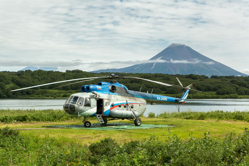
On the territory of Russia, it is one of only two reserves with active volcanoes, the second is the Kronotsky State Nature Reserve in Kamchatka. Kamchatka is the land of the fiery dragons’ dens, fuming volcanic cauldrons and tranquil serenity of permanent frost vastness. Kamchatka is a unique mountainous region on the easternmost edge of Russia. There is nothing like it on the planet, you can see a staggering variety of volcanoes, mountains, valleys, hot springs and what not. Some places have never seen a man’s footprint; you can fly over them only by a helicopter.
PeakVisor 3D Map Kunashir Island
The Kuril (Kurilsky) Nature Reserve is usually subdivided into the Kuril Reserve per se and the Maly (Lesser) Kuril Wildlife Sanctuary, which administratively belongs to the Kuril Nature Reserve. The Maly Kuril Wildlife Sanctuary spreads over several small islands of the Kuril Ridge and partially on Shikotan Island.
The Kuril Reserve ‘Major’ consists of three main clusters. Two parts, the North Kunashir section (49,899 ha) and the South Kunashir section (15,366 ha), are located on Kunashir Island, in the very south of the Kuril Ridge. The third part is called the Maly (Lesser) section of the Kuril Ridge (100 ha in total) stretches over Demina and Oskolki islands. Marine protected area of the reserve is 33 thousand hectares.
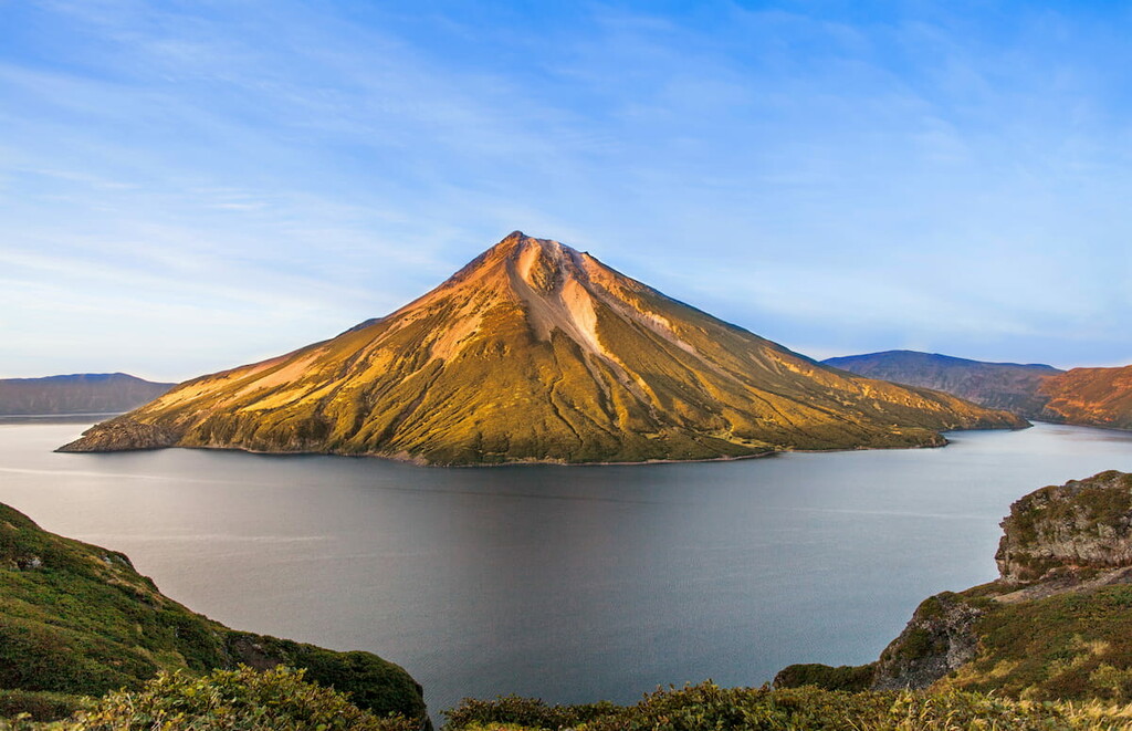
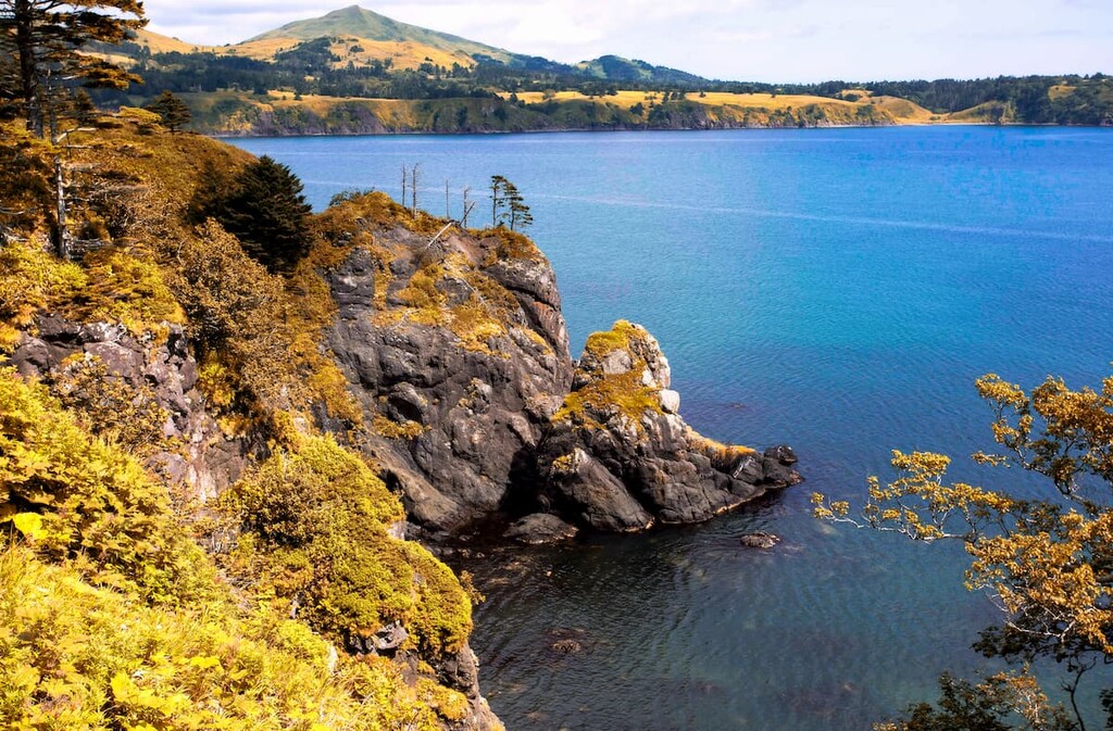
The island of Kunashir is the heart of the Kuril reserve. It captivates with its beauty at any time of the year. It is the southernmost island on the Great Kuril Ridge stretching 123 km from northeast to southwest, its width varies from 9 km on the land bridges to 30 km in the northern part of the island. In the Ainu language, the name Kunashiri means Black Island.
The island got such a name for the abundance of dusky hushed colours of the dark coniferous forests, soil and the blackish cinder cone of Tyatya Volcano. Kunashir is dominated by mountainous terrain. There are two volcanos – Rurui (1,485 m) and Tyatya (1,822 m) – in the northern (Tyatinsky) area. Tyatya is the highest point of the island. The southern and south-eastern parts (South or Alekhinsky area) have more gentle terrain with flat areas. There is Golovnin Volcano caldera (541 m) in the south as well. The island is divided into four parts by three low isthmuses. The relief of Shikotan Island is hilly. On the other islands of the Lesser (Maly) Kuril Ridge, the relief is more lowland.
The wetlands of the Kuril Reserve are vast and occupy 132 hectares. Rivers here are predominantly up to 20 km-long mountain streams with fast currents and picturesque waterfalls. In spring, the water level in the rivers rises insignificantly and no floods have been recorded so far. However, be aware of the typhoons which make the rivers swell with waters in a matter of hours. Many of the rivers are spawning areas. The longest river in the reserve is the Tyatina.
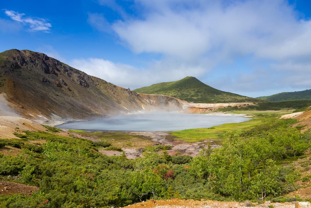
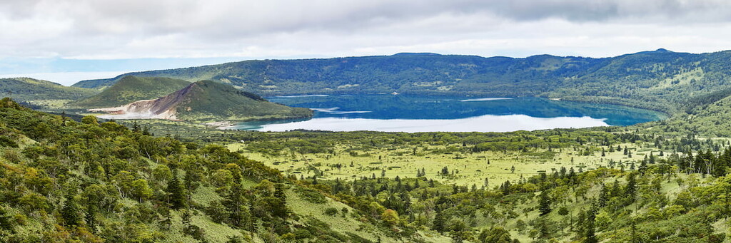
There are six lakes in the reserve: Sand Lake, Hot Lake, Boiling Lake, Remote (Glukhoye) Lake, Urvitovskoe Lake, and Williams Lake. The largest lake on the island and in the reserve is Sand Lake (7.14 sq. km) of lagoon origin. The deepest lakes of the island are of caldera origin – Hot Lake and Boiling Lake.
About 80% of the area is covered by forests which are dominated by dark conifers (spruce and Sakhalin fir) with a large number of deciduous species. In the southern part, deciduous species such as oak, maple and alder prevail. Tall grass occupies about 9% of the area of the whole reserve, it grows on mountain terraces and in the coastal zones. Forest glades and sparse forest stands feature bamboos (Sasa) which form dense thickets sometimes reaching 2-2.5 m in height.
The influence of warm and cold currents that wash the Kuril Islands from all sides bring asymmetry into the vegetation. You can actually see it with a naked eye when you observe the panoramas of the island. Here you can find a surprising neighborhood of plants, for example, bamboo (Sasa) can grow next to cedar shrubs or dark coniferous trees can be easily twined with sneaking lianas.
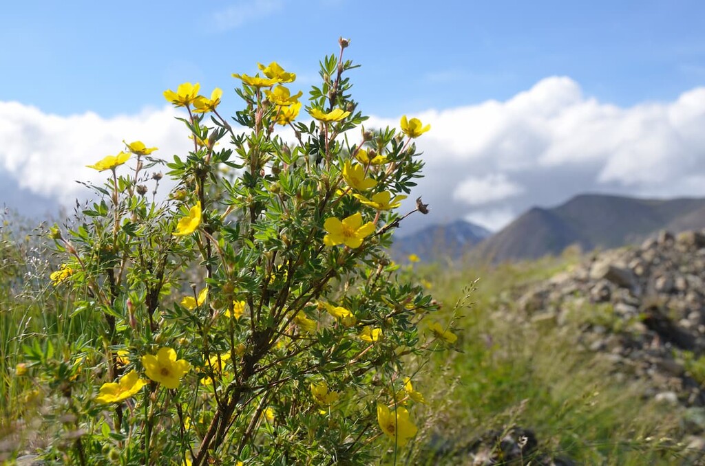
The flora of Kunashir Island features 1,072 species of vascular plants 33 of which are listed in the Red Book of the Russian Federation, 519 species of mosses with 3 Red-Book species, 259 species of algae, 310 species of lichens among which 4 are Red-Book species as well. Kunashir Island is the northern boundary of the areas for 10 plant species which grow only in East Asia, namely Japanese maple, Maksimovich's linden, magnolia “white from underneath”, Bothrocaryum controversum, Daphniphyllum humile, Rhododendron tschonoskii, Schizophragma hydrangeoides (a dense deciduous liana which can firmly cling by its aerial roots to the support around which it hangs. It has beautiful heart-shaped leaves with serrated edges. The liana blooms in midsummer with white or light-red flowers that resemble hydrangea flowers), Eleorchis japonica, Chloranthus serratus etc. Compared to other Russian nature reserves, the Kuril Reserve enjoys the highest number of rare plants.
Seismic activity affects the formation of the Kuril Islands fauna. There are frequent changes in the redistribution of terrestrial and marine mammals after volcanic eruptions and tsunamis.
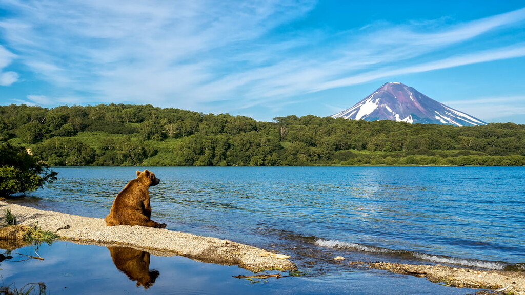
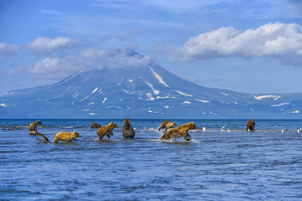
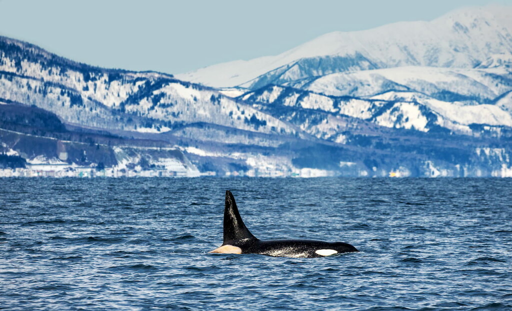
The forests are inhabited by brown bears, foxes, hares, sables, weasels, and European minks. The latter were brought here in the 1980s and luckily they do not behave like European rabbits in Australia. As to the Red-Book species, here live 5 invertebrate and 37 vertebrate species: 2 reptiles, 3 mammals, 33 birds, and 1 fish species. Several species are included in the International Union for Conservation of Nature Resources Book of Rare Species: the Kuril seal aka insular seal (Phoca vitulina kurilensis), sea otter (Enhydra lutris), sea lion (Eumetopias jubatus), fish owl (Ketupa blakistoni), Japanese crane (Grus japonensis). The Kuril seal and sea lion have large summer rookeries on the lands of the reserve.
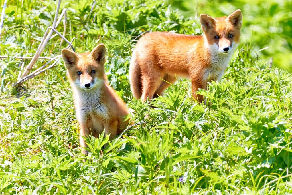
High grasses provide protection and forage for many animals. Bamboo thickets also give shelter and grant protection for some species during the winter. However, life is not rosy here. The main factor restricting winter procreation of species is not the cold, but the lack of food. Due to food shortages and territorial constraints, many islands are heavily dominated by predatory mammals. In such a situation, predators have to use additional, non-typical food sources, the so-called trophic resources. Thus, birds with their nests and even poo, passing salmonids, sea dogs and common seals, seafood including mollusks, crustaceans and echinoderms which are washed on the shore during low tides, etc. can become food for a hungry predator. This factor explains the attachment of predators to seashores. Also, watch out for your belongings, foxes can steal easily your plates, cans, boots, just stuff if you are too carefree to let it lie in the tent or a boat.
The climate in this region is maritime monsoon, humid, with very strong long-lasting winds and an abundance of fog. There are no harsh winters here. The coldest month of winter is February with an average monthly temperature of -4.5 or 5C (40 to 41 F). Summers are cool, with average temperatures of around 15.5-16C (60-61 F) in August, but at least you can have some sunny days unlike the springtime when sun appears very rarely due to the high rainfall. Strong cyclones (typhoons) are common in summer and autumn.
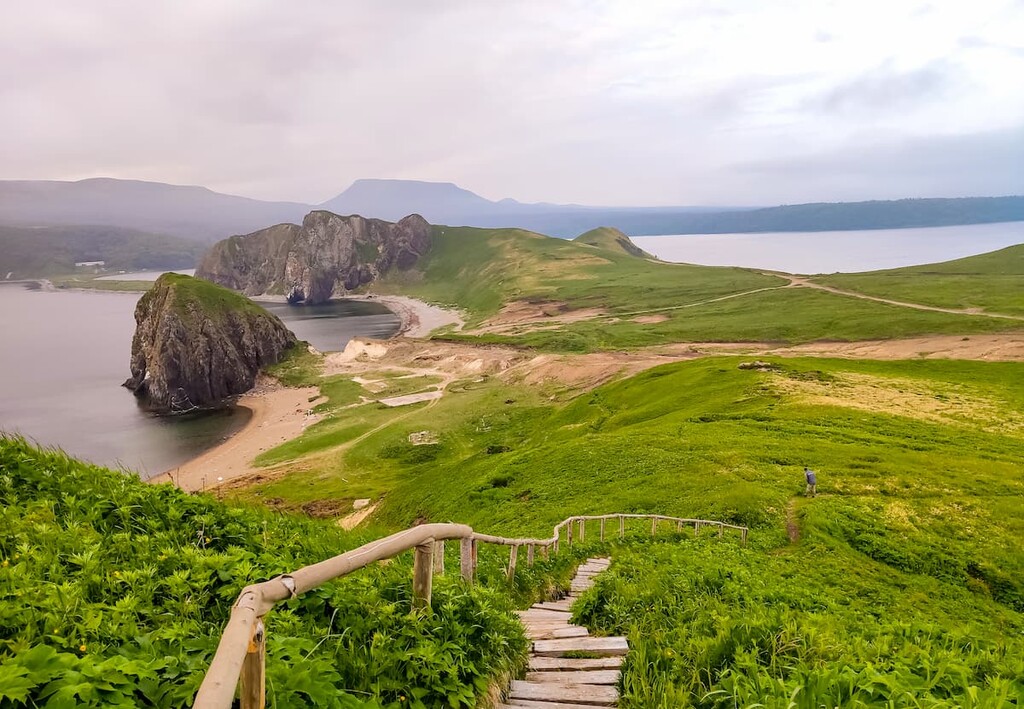
The Kuril Reserve is definitely a treasure trove for a photographer or actually anybody who enjoys powerful visuals. It provides excellent opportunities for photographing and video shooting flora and fauna, volcanoes and hot springs, waterfalls, seashores, forests with lianas and bamboo thickets.
Most popular sites to visit are:
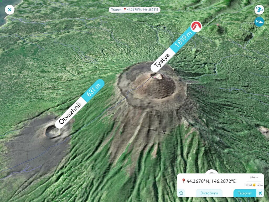
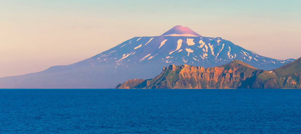
Tyatya Volcano (1,819 m) is one of the most active volcanoes and the second largest volcano of the Kuril Ridge (the first volcano is Alaid (2,339 m) located on Atlasov Island). The Ainu people called Tyatya Chacha-Nupuri, which means Father Mountain, and the Japanese called it Tyatya Dake. The volcano is a symbol of Kunashir Island. Because of its regular shape of a truncated cone, it is considered one of the most beautiful volcanoes on the planet.
The documented historical eruptions occurred in 1812 and 1973. The latter did not cause significant damage to nearby settlements, but led to a large fire of the protected area, destroying large areas of forest.
Ascent to Tyatya volcano begins from Cape Rubezhny. At the height of 650 m above the sea level you will see the crater Otvazhny (Brave), which was formed by an eruption, and a little farther, 100 m above it, there is a small crater called the Frontier Guard. You will have to climb partially on the sharp volcanic cinder, so it is desirable to have appropriate hiking boots. After climbing up and standing on the edge of the main crater 160 m deep and over 1000 km long, you can experience an incredible feeling. Just touching the surface of the volcano beneath your feet, you can feel the power of the planet and the heat coming from the depths of the earth.
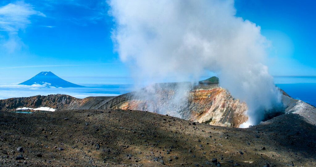
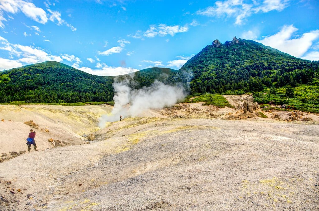
At the present time, poisonous gases periodically eject from the side crater, and the main crater of the volcano often smokes in cold weather. This is one of the main reasons why there are so few inhabitants in this part of the island.
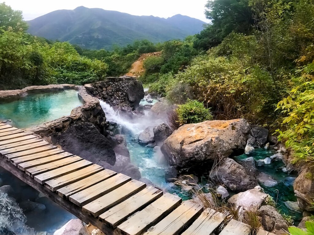
Naturally, there are many thermal springs, mud pots, steam and gas jets here. This is how Golovnin, Mendeleev and Rurui volcanoes manifest their naughty temper. Visit the Neskuchenskie, Stolbovskie, Tretyakovskie, Alekhinski springs, and certainly see the hydro-solfatara springs of Golovnin volcano, those are the springs of volcanic origin with an intense emission of high-sulfur and water vapor.
Golovnin Volcano, which is 547 m high according to the official website of the reserve, was named after Vasily Mikhailovich Golovnin, a navigator, vice-admiral, explorer and leader of two round-the-world expeditions. He was captured near this volcano in 1811.
It is believed that Golovnin volcano originated at the bottom of the sea and in the beginning was throwing out a lot of pumice. As a consequence, a large cone grew. Gradually, the volcanic mountain collapsed and formed a volcanic basin – the caldera of Golovnin Volcano which was filled with water. The water eventually found its way out of the caldera by the Ozernaya River, which flows into the Sea of Okhotsk. Extrusive domes gradually began to grow in the caldera as a result of viscous lava eruptions. Their growth was accompanied by explosions due to which Boiling Lake was formed in one of the explosion craters. All of these events took place many hundreds of years ago, perhaps even thousands of years ago. The last eruption was observed in 1998.

Scientists are occasionally asked how likely the Golovnin volcano is to erupt. In their opinion, the most likely explosions might happen in the area of Boiling Lake and other fumarole fields or at the bottom of Hot Lake. There is also a good possibility of extrusion-type eruptions which will produce new domes of viscous lava inside the caldera. These processes may be accompanied by new explosions and the formation of new explosive craters. However, the potential volcanic hazard will most likely be limited to the area of the volcanic basin itself. But such events are likely once every hundred years or more.
Currently, there are two mineralized lakes at the bottom of Golovnin Volcano caldera – the Hot and the Boiling. There are many hot springs, fumaroles and mud pots concentrated around Boiling Lake. The lake is located in the very 200-m-wide crater and has milky waters. Also in a huge basin are Hot Lake and Mud Cauldron Lake. The lakes are separated by magma-squeeze domes. All lakes have different chemical composition and temperature.
Mendeleev Volcano is an active volcano in the south of Kunashir Island. The Locals call it the Sleeping Woman because when you look at it from a certain angle, you can see a silhouette of a lying woman. Yet, the official name is after the outstanding Russian chemist Dmitry Mendeleev. The height of the volcano is 888 m (according to some sources it is 886 m). The volcano itself has an interesting location. Its Pacific slope as well as the summit are outside the territory of the reserve and outside its protection zone. But the Okhotsk Sea slope is located in the protected zone. On this slope, there is an outlet of thermal waters called the Stolbovsky springs – they begin to break through from under the ground 1 km from the mouth of the Snake Stream (on its left bank) and continue their activity on the surface for 20 m.
The main formation of the volcano happened in three stages as is evidenced by the three cones. Judging by the analysis of the underlying lava sediments, the first eruption was 200-230 thousand years ago, the second happened 36,200-36,400 years ago, and the third occurred 2,550±40 years ago. After the formation of the third caldera, the dome began to grow which lasted several hundred years. Then explosive craters were formed along circular faults at the periphery of the dome itself. Currently, these craters represent both extinct and active solfatara and fumarole fields.
As for predictions about significant volcanic activity, scientists do not expect any changes in Mendeleev volcano activity in the near future. There are still possible repeated outpourings of sulfur flows, as well as explosions with subsequent release of gases to the surface. These manifestations will be localized within the solfatara fields, valleys of the Cedar, Sour, Healing, and Chetverikov brooks, and should not pose a serious threat to the nearby settlements.
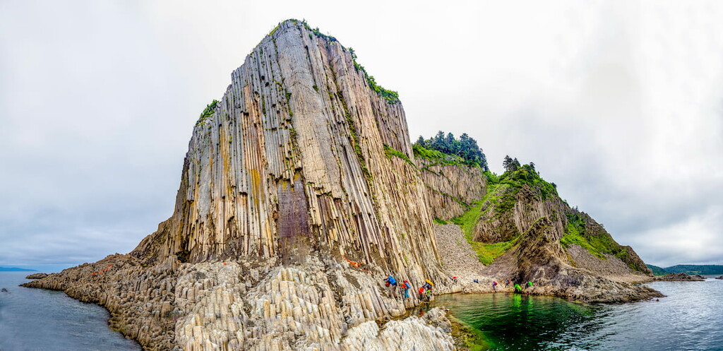
When you come down to the seashore after visiting the volcano, look around. You will see a huge stone wall in front of you. This is the Pillar (Stolbchaty) Cape, unique in its geological structure. It is a result of an extrusive eruption of rhyodacite – a volcanic rock formed as a result of rapid cooling of the lava. The age of this cape is 4-6 million years. Pillars of different shapes are clearly seen. They are four-, five- and six-sided prisms. Each part of the cape has its own name: Organ, Bastion, Bridge, and Turtle. Near the southern end of the Pillar Cape rise several rocks – the Feathers Cliffs or Guardians (or Monks) Cliffs.
In the Tyatinsky section of the Kuril Reserve, there is Rurui Volcano (1,485 m). This is a wrecked stratovolcano which kind of merged at its base with the Dokuchaev volcanic ridge. It is commonly referred to as an active volcano because at its foot on the north-western slope there are about 50 solfatara gas outlets and thermal springs on a 1.5 km-long strip of land. These springs are called the Neskuchnye or Neskuchenskiye (Not Boring), after the village of the same name. The waters of the springs differ in their chemical composition.
Fast and turbulent are the rivers of the Kuril Islands. Hardly can you find one without a nice waterfall.
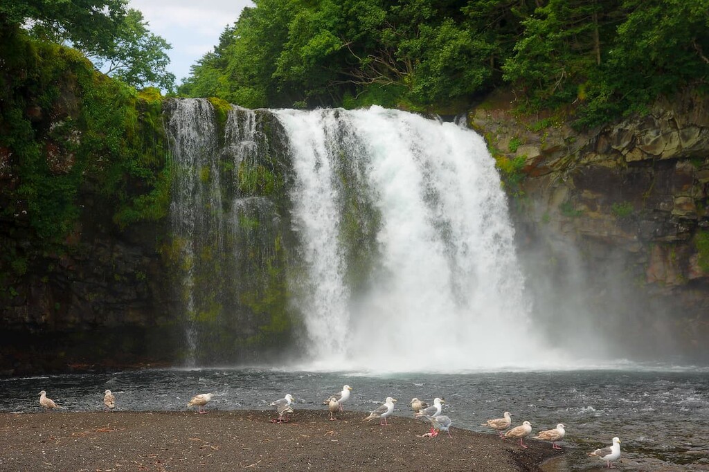
When you approach Kunashir Island from the north, you can see a big white spot of a trapezoid shape against the background of green cliffs that stretch as far as an eye can see. That is the Ptichy Waterfall on the Ptichya River. It looks like a sail from afar. The water tumbles down from a height of 12 meters. It is the most powerful waterfall on the island. Its name and the name of the river (Ptyichya means bird’s) are associated with a very large number of birds that fly to the large water hole here to eat fish.
Another rather large and picturesque waterfall of Kunashir is located on the river Andreevka. The bottom of the river is rocky, the surrounding valley is overgrown with bamboo, which makes photos of the waterfall exceptionally beautiful.
Bear in mind that the Reserve is meant to preserve the unique nature of the Kuril Islands, thus the numerous rules and restrictions must be adhered to when visiting it.
It is prohibited to:
There are two routes within the Kuril Reserve itself for visiting groups of no more than 7 people:
There are also three routes through the protected area:
In addition, the employees of the reserve offer excursions outside the territory of the reserve:
You can stay in the Kuril Nature Reserve at the cordon with or without overnight accommodation, in tents or modular houses. Tents, barbecues, transport (cars, boats, quad bikes, snowmobiles) are available for rent.
To visit the Kuril Reserve, you must go to Yuzhno-Kurilsk located in the Sakhalin region.
The administration of the Reserve is located at:
5 Zarechnaya St., Yuzhno-Kurilsk, Sakhalin Region, 694500.
kurilskiy@mail.ru or kurilskiy@gmail.com (Ecological Education and Ecotourism Department)
Tel. +7 424 55 21 502
You can get to Yuzhno-Kurilsk either by air or by sea:
To visit the reserve you will need to obtain permission and buy entrance tickets in advance.
Information for Russian tourists
Russian tourists can get permits to enter the border zone from the Border Division of the Federal Security Service in Yuzhno-Sakhalinsk. Address: 63A, Pobedy Ave., telephone: +7 4242 49 21 04. The application documents should be submitted in person or by e-mail 15 days or earlier before the date of entry.
Information for foreign tourists
For all foreign citizens from countries of near and far abroad, it is necessary to arrange permits for entry to the territory of the border zone in advance. Foreign tourists must have a visa with the purpose of travel, or a migration card (if entry to Russia is visa-free for the tourist).
The issuance of visas to foreign citizens in Yuzhno-Sakhalinsk is the responsibility of the Sakhalin Frontier Directorate of the FSB, Address: 63 A, Pobedy Ave., Yuzhno-Sakhalinsk. Phone number +7 4242 49 21 04. All phone calls and consultations are in Russian language. The permits are processed within 1 month (which actually means you can get your documents any day after the submission, but no longer than 31 days). It is advisable to apply well in advance. Email for sending documents: pubo.sahalin@fsb.ru
Once you enter the Yuzhno-Kurilsk District, you must register at the local Resident Registration Office as a foreign citizen at the place of stay, e.g. a hotel, within 3 days. It is usually done for the tourist by the hotel administrator, but this should be agreed about in advance when you are booking the hotel. So, just notify the hotel that you need the registration. By the way, since Yuzhno-Kurilsk is very small, there are just six mini-hotels and guest houses here, some of them offer just 2 rooms and the maximum rooms per a hotel we found was 4!
Current information about the routes and services of the Reserve, how to get there and the rules of its visit can be found on the official website of the reserve http://kurilskiy.ru
Mind you though, it is now operational only in Russian. There is no English and Japanese version despite the available language icons.


The highest peak in Kurils Nature Reserve is Tyatya, at 1,819 m.
Notable peaks in Kurils Nature Reserve include Tyatya, Gora Ruruy, Gora Sibirtseva, Gora Glinki and Gora Morozova.


