
Scan the QR code and open PeakVisor on your phone
Orenburg Oblast is home to 238 named mountains. The highest is Nakas Ridge at 668 m.
Welcome to the southernmost and widest part of the Urals – the Orenburg Region. Being geographically located in the South Urals and the extreme south of the Trans-Urals, it grandly spreads in the south-eastern part of the East-European Plain. This is the place where two parts of the world meet – Europe and Asia. Since times immemorial, the border between the two continents was accepted to run along the Ural River, with the physical and geographical boundary going along the eastern foot of the Urals Range, as well as the Mugodzhara Ridge and the Emba River.
In earlier times, the territory of the present Orenburg Region (est. 1934) was part of the huge Orenburg Province. It was called Chkalovskaya from 1938 to 1957 according to the Soviet tradition to rename everything with prominent revolutionaries’ or bolsheviks’ names. At present, it is part of the Volga Federal District. The administrative center is the city of Orenburg. The region includes 489 municipalities, 13 of which are urban districts. The population of Orenburg Region is 1,956,865 (as of 2020). Representatives of more than 100 nationalities live here, the region being considered their native land. The area of the region is 124 000 sq.km., which is about 0.7% of the total area of Russia. The length from north to south is 445 km, from west to east is 760 km.
The Orenburg Region can be considered a border region. The length of the border with Kazakhstan adjoining it in the east and south is the impressive 1876 km. In the west, the Orenburg Region borders the Samara Region, in the northeast the Chelyabinsk Region, in the northwest it borders the Republic of Tatarstan, and in the north it borders the Republic of Bashkortostan.
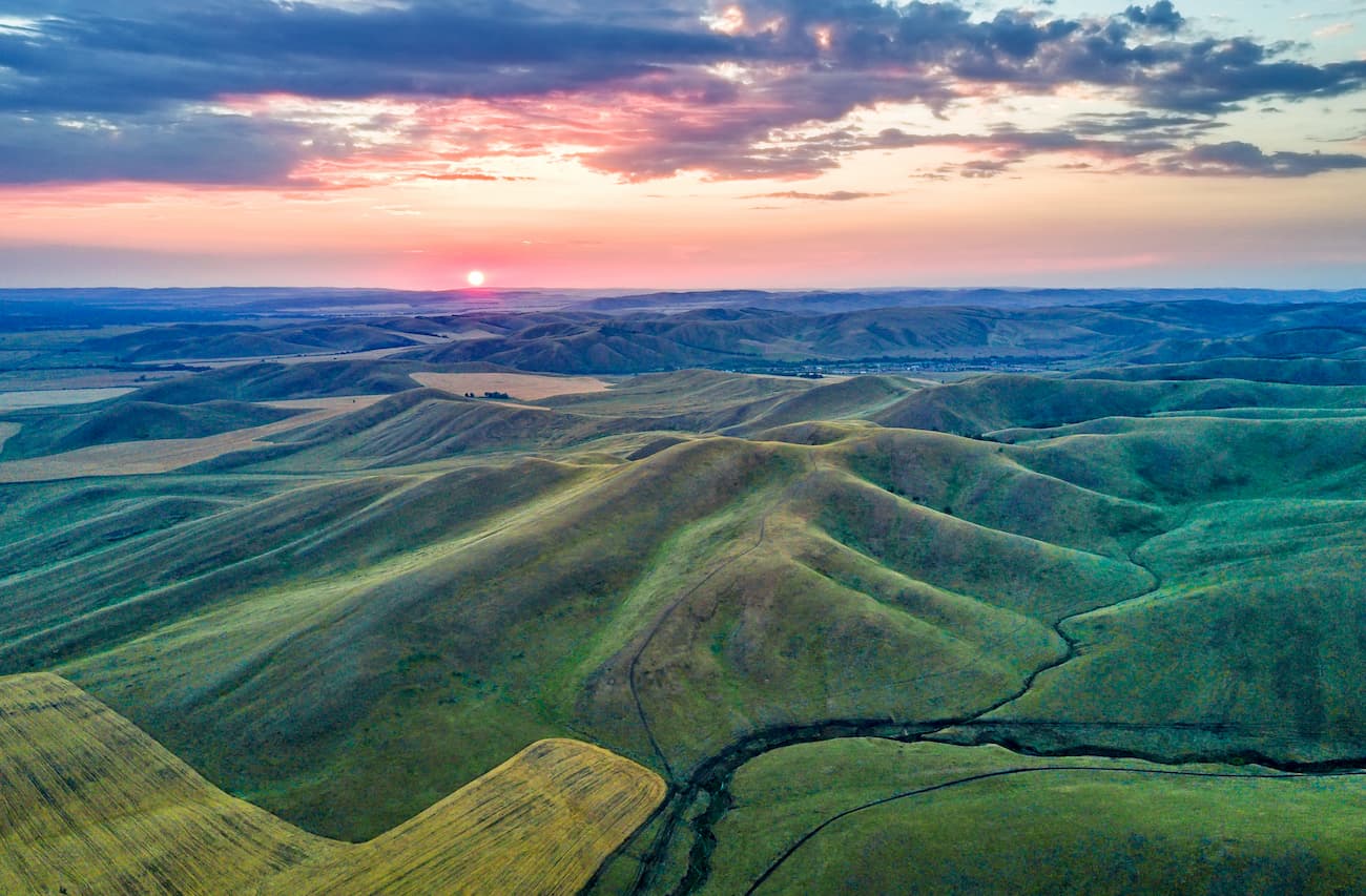
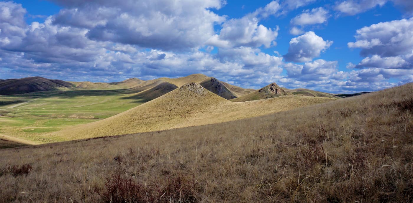
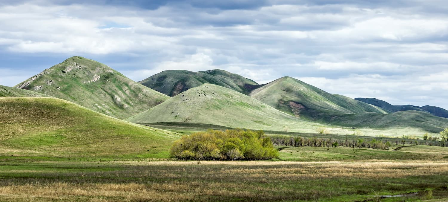
In the west and east of the region, the relief is represented by interfluve areas and gentle slopes with low residual ridges, whereas in the central part there is a low mountain range. The region is home to the plains of the Cisurals, the peaks of the Ural Mountains, as well as the so-called peneplain, a hilly area of the Trans-Urals, and the Turgai plateau. The uplands and mountains of the Orenburg Region remind of a Wagner’s symphony with sharp rises and great falls: they grow to heights of about 668 m, and then drop again to almost 40 m a.s.l. The highest point is Mount Nakas located on the ridge of the same name.
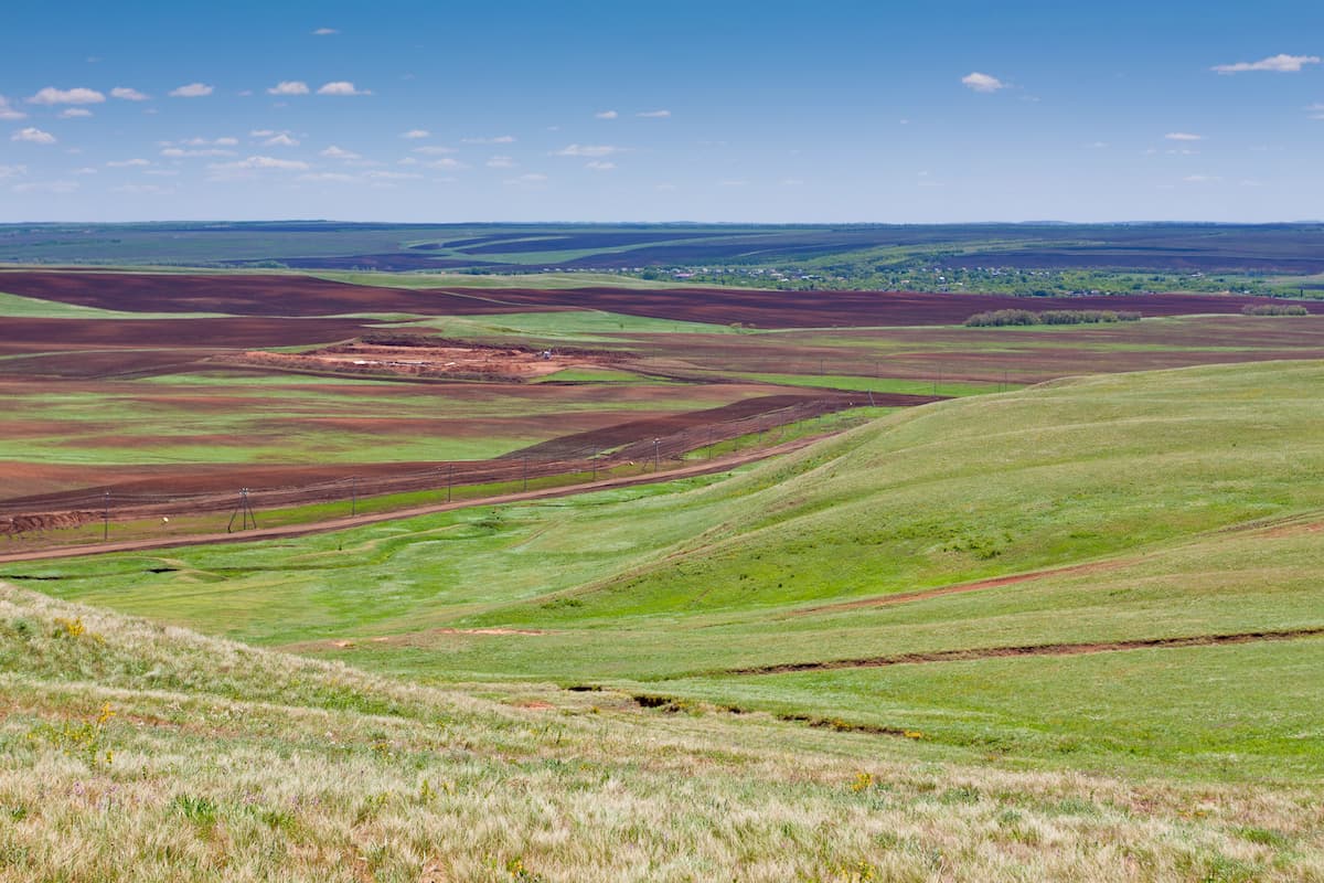
This is the place to take in the vastness of the boundless steppes which extend in the central and eastern parts of the region. If you happen to travel here in summertime, the rich and potent ordours of steppe herbs can virtually knock you out. By the way, the Orenburg Nature Reserve was created to preserve the steppe natural habitats.
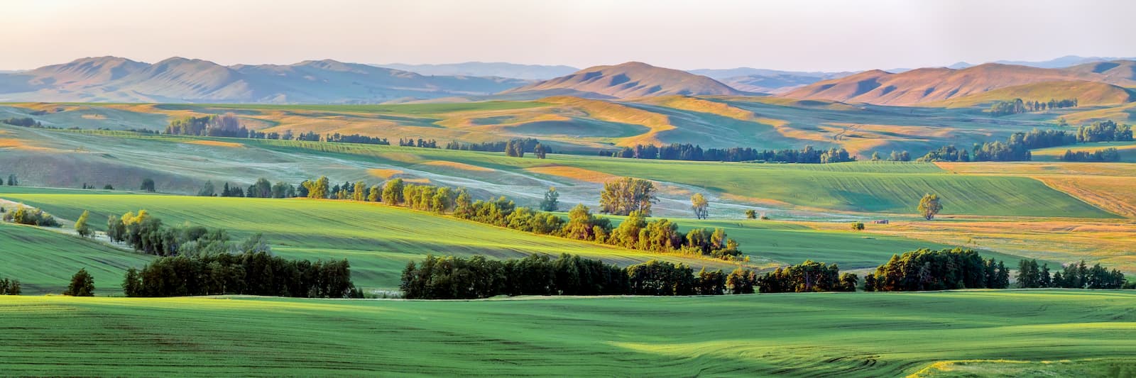
The southern part of the region is dominated by desert landscapes, whereas the northern one mainly features forests and mountains. Yet, the region’s forest area is not that impressive as in the neighbouring regions, in fact, forests occupy only 697,400 ha, which is about 5.6% of the region’s territory. The forests are united into nature conservation complexes called Bor. The most famous among them is the Buzuluk Bor with the status of a national park.
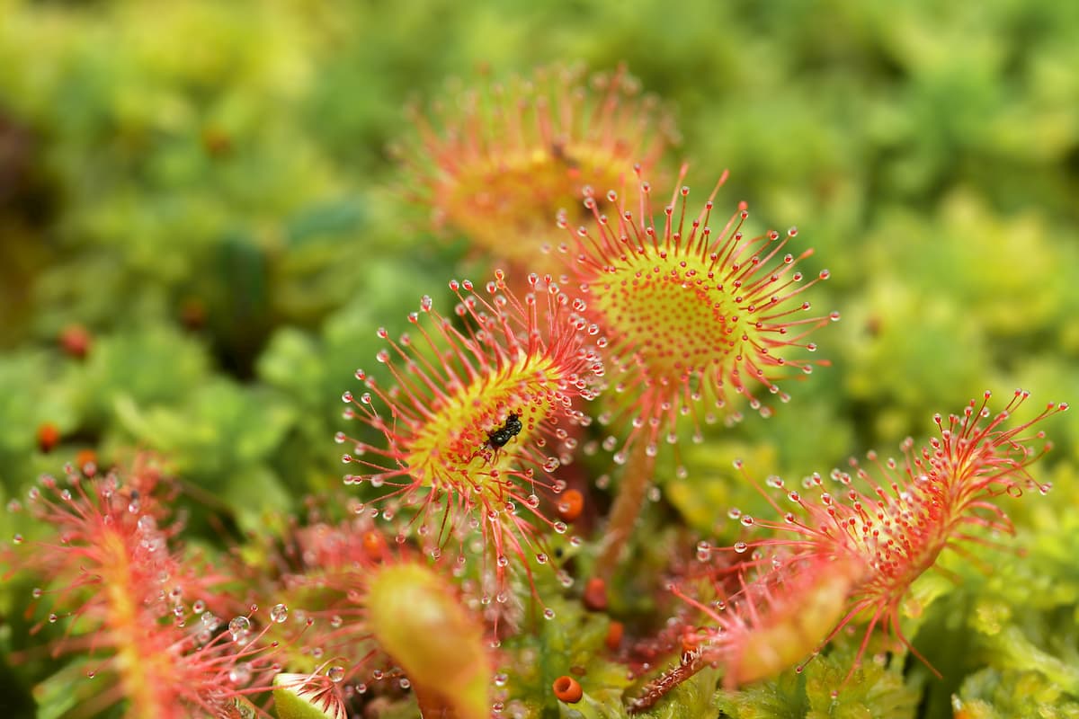
Steppe vegetation is rich in a variety of herbs, some of which are listed in the Red Book. The region is famous for its mosses and lichens thriving in the natural habitat. And in the middle of grassy bogs you can find a very rare plant – the sundew, an insectivorous plant.
The animal world is typical for the steppes of Russia. There are over 80 species of mammals. The ordinary and long-eared hedgehogs are a frequent sight and if you are lucky, you can spot a bat. In the floodplain of the Ural River, there lives the Russian musk-rat (desman), and the west of the region is home to the forest dormouse. There are hares, wolves, foxes and steppe corsacs (dog foxes). In the southern areas, you will often see the lynx. But the brown bear which lives in the forests of Shaitantau and the Maly (Little) Nakas mountains shows itself very rarely. In case you do happen to encounter a bear, read the guide on how to behave with this mighty predator here.
If you are a hunter, there is a license hunting for moose, wild boars, roes and deer living in these forests. Among the birds, the main inhabitants of the local steppes are daytime raptors that have plenty of food in the steppe where many rodents live. In rivers and water basins of the region have 60 species and varieties of fish belonging to 15 families, the most numerous of which is the family of carp (28 species).
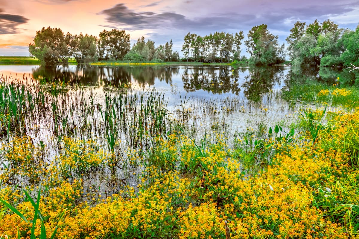
The river network of the Orenburg Region is dense and varied, it features 3,492 rivers. At the same time, most of them are small rivers and or just streams. The Ural River can be rightly called the main river of the Orenburg Region, it crosses almost the entire territory of the region from east to west. The other rivers worth mentioning are the Samara, Ilek, Sakmara. The drought-prone climate of the area takes its toll on the local rivers – they are not that water-abundant. The feeding is mixed, with a predominance of snow. It is very common to have high spring floods with a sharp rise of water as well as fairly stable summer and autumn low-water periods, which are only occasionally interrupted by short rainfall floods.
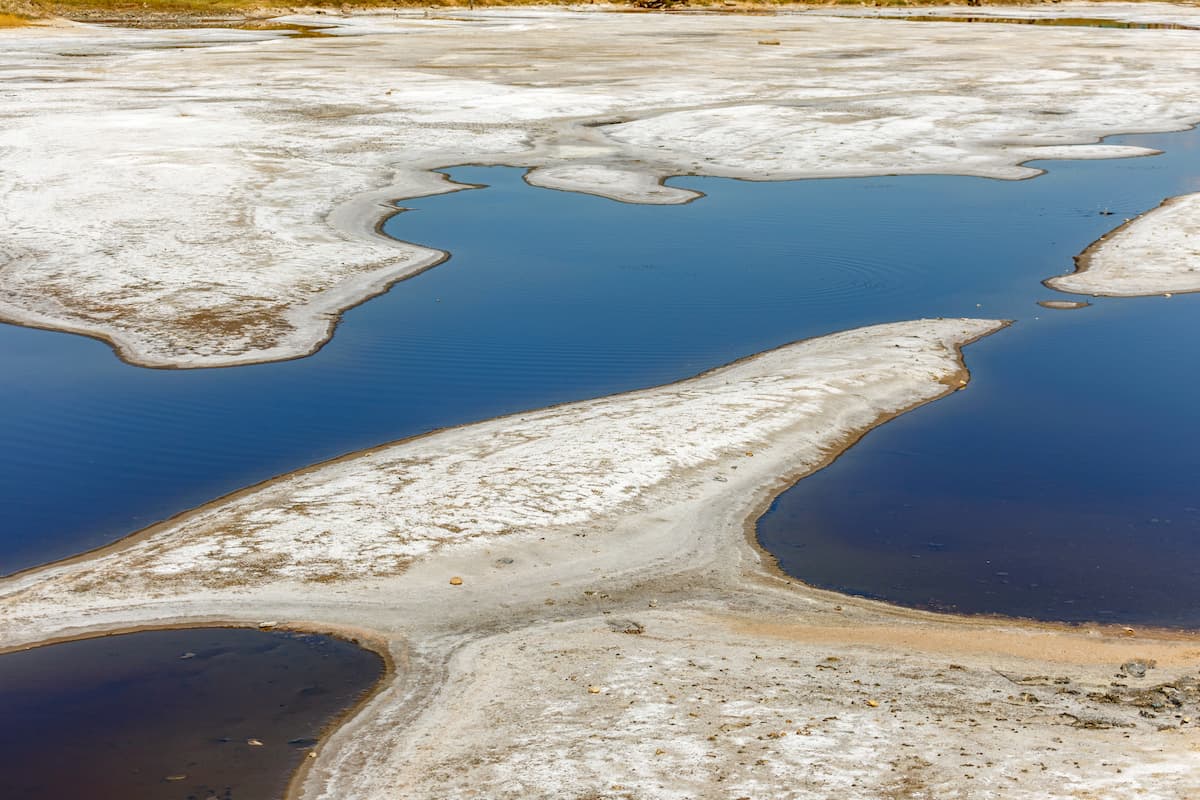
There are over 5,700 lakes, most of which are located in the valleys of the Ural, Sakmara, Ilek, Samara rivers and their tributaries. Some of them are of karst nature, and some are even of tectonic origin. The latter are represented by the salty lakes near Sol-Iletsk, they are closed potholes of rounded shape. These lakes provide healing muds which are very popular and have great healing properties.
The area of artificial reservoirs in the Orenburg Region exceeds the area of natural water basins due to the fact that they have mainly been created to service hydroelectric power plants. Among these biggies are the Iriklinskoe Reservoir on the Ural River and the Sorochinskoe Reservoir that is fed by the Samara river and its tributary Big Uranus. Wetlands Orenburg region is the smallest among all regions of the federal district.
The marshlands are quite insignificant and occupy the last place among the regions of the Volga Federal District.
The local climate is quite capricious to say the least as it is sharply continental. Summers are hot and dry, winters are freezing cold, which is due to the region being quite far from the ocean. So, just as in other areas of Eurasia located in the depths of the continent, there is no softening effect of sea air masses which contributes to aridity of the air. Moisture from precipitation does not have time to sufficiently saturate the land and evaporates on the way to it. Late spring often sees no rain, there are hot weather spells with hot dry winds. In the hottest month of summer, the average daily air temperature is +25ºC to +27ºC (77 F to 81 F). And on some days it may rise to +35ºC to +40ºC (95 F to 104 F).
The absence of high mountain peaks also has a significant impact on the local climate. When there are no barriers to the invasion of both cold air masses from the north and hot, dry air cyclones from the south there forms a yawning gap between the maximum and minimum temperatures. Winter in the Orenburg Region is notable for its steady low temperatures and severe frosts which can reach -40ºC to -45ºC (-40 F to -49 F). The average temperature in the coldest month of the year – January – is -15ºC to -18ºC (5 F to 0 F). In winter, the region is influenced by a high pressure area called the Voyekova Axis. This axis is a very important wind divide during the winter months: dry and cold northeastern winds blow south of it, whilst wet and relatively warm western and southwestern winds reign north of it. Frequent changes of cyclones and anticyclones ensure good precipitation in winter which comes in blizzards and heavy snowstorms with rather wet snow. The snow cover is not high, so the ground freezes deep enough.
The Orenburg Region is amazing and beautiful with many natural monuments to keep you enthralled during your travels. Apart from vast steppes, there are forest areas with many hidden precipices, mountains (although, at the edge of the Ural Mountains, we can call them hills). You can even find ancient volcanoes here.
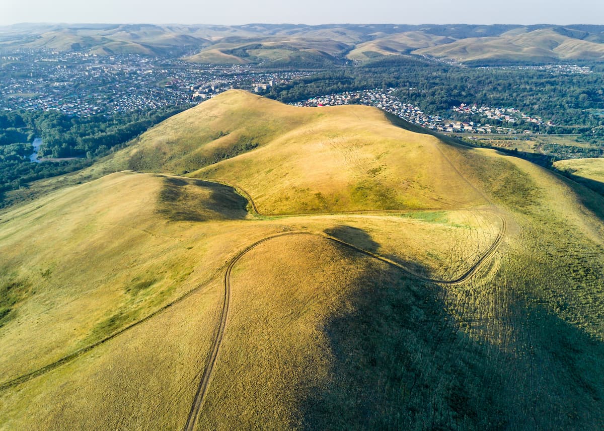
Just 110-120 km away from Orenburg, when the steppes cease, you get into the realm of hills and mountains. Those highlands go by the names Nakas Ridge or the Little Nakas Ridge, the highest point is Mount Nakas (667.6 m).
Shrouded in the broad-leaved forests, the Little Nakas Ridge is located in the north-western part of the Tyulgansky district of Orenburg Region and is a kind of watershed. Most of the rivers and streams originating here are fast, whimsical and have a stony bottom you wouldn’t like to hit. They are fed by the many springs, hidden on the slopes of the Little Nakas.
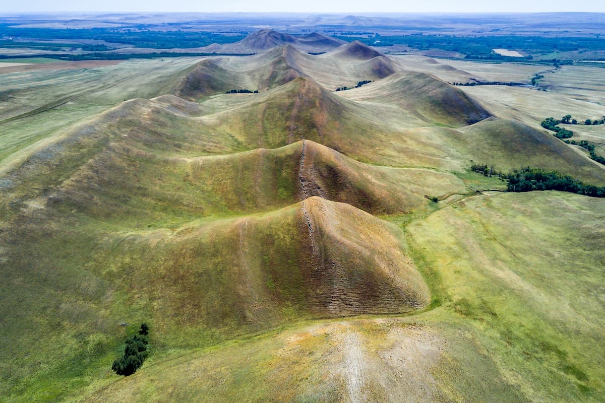
The Nagai and the Long (Dolghie) Mountains are surely a sight to behold. They stretch from north to south being conveniently located between two large rivers of the region – the Sakmara River in the north and the Ural River in the south. Located only 135 km from Orenburg and having good transport accessibility, the mountains attract many tourists. Among those, paragliders are scoring top numbers.
The mountains are not very high; they form a rather narrow ridge with a length of 14 km. They are composed of limestone and resemble a mantle wrinkled into large folds. Somewhere in the middle is the border between the Long (Dolghie) Mountains and the Nagai Mountains. The highest point (414m) does not have any name for some reason. If you look from the Nagai Mountains towards the north, you can see the Karamurun-Tau Ridge. And if you glance in the southwest direction from the Long (Dolghie) Mountains, you can see the Orenburg steppes.
The southernmost point of the Long (Dolghie) Mountains is Mount Verblyuzhka aka Dyuyatash (loosely translated as a small female camel). It has a height of 329.4 m and looks like a two-humped camel, thus the name. Verblyuzhka is located on the right bank of the Ural River, 7 kilometers east from the village of Verkhneozernoye. The mountain is a rather noticeable landmark, it marks the beginning of those giant folds of the Ural Mountains. There is a triangulator on its top, it is used to mount geodetic surveying equipment.
The easiest way to get to the Long (Dolghie) Mountains is by car or bus going from Orenburg to Orsk, it is about 135 km up the highway. From there, it is a five-minute walk to the south of Mount Verblyuzhka and five minutes north to the valley of the Long (Dolghie) Mountains. If the return journey is planned by bus, leave from a stop at the village Donskoe, located 5.5 km to the west on Orenburg – Orsk highway. The Nagai Mountains are located 7 km north Orenburg - Orsk highway. It is more convenient to reach them from the north side, take the train Orenburg – Kuvandyk to Kondurovka station.
The Karamurun-Tau means the Black Nose mountain, where “kara" is black, "murun" is a nose, "tau" is a mountain. One of the peaks is called Nos, which means Nose (385 m). The mountain got its name thanks to one of the layers of limestone located at its southern end and resembling a human nose. On the slopes of the mountain, you can find fossils of small clams and shells. A karst lake is located at its southern foot and a geodesic triangulator is installed on the top of Mount Nose.
The Karamurun-Tau Ridge is comb-shaped; it stretches to the north for 4-5 km. Its highest point, which reaches 421 m is also unnamed, another customary sight is a triangulator. The views off the top are picturesque. In the south, there is the Sakmara River and the northern part of the Nagai Mountains, and in the west is the strip of steppes with wildflowers blooming all spring and summer and the continuing valley of the Sakmara River. Bashkirian rugged mountains lie in the north and east. There are springs and brooks in some gorges. The most beautiful gorge is the Kilkan with a small stream at its bottom.
The ridge is located on the right bank of the Sakmara River, in the western part of the Saraktash district of the Orenburg Region, about 138 km east of Orenburg. It is heaven for paragliders. You can get there by car or by train Orenburg – Kuvandyk to the station Kondurovka, and then 40 minutes on foot to the Karamurun–Tau Ridge. It should be noted that in spring the bridge over the river Sakmara gets flooded, in this case tourists have to get to the ridge in a slightly different way: from the station Zheltaya (Yellow) or from the station Dubinovka. In this case, the distance will be about 7 km.
It is here that the stone belt of the Ural Mountains stretching from the Kara Sea ends. The Guberlinsky Mountains are an elevated section of the Orsk steppes. They are made of pointed hills and you can learn all about them in the Orsk Local History Museum. Spreading for 70 km, the Guberlinsky Mountains are picturesquely dissected by ravines and a valley formed by the Guberlya River and its tributaries. The name, it is easy to guess, came from the name of the river Guberlya. Surprisingly, the foot of the mountains themselves is below the level of the steppe. The mountains are very modest, just 400-430 m a.s.l. and have a major peak – Mount Poperechnaya.
The terrain here is diverse; the mountains remind lumpy hills but looking at them is no less enthralling than gazing at a chain of high mountains. Deep and abyss-like rocky gorges, lonely rocks, mountain streams and brooks, stone rivers and mounds make up plenty of adventure. The rocky sediments often exhibit the so-called desert tan, when the stone turns black under the influence of the scorching sun and wind. The landscape is throbbing with colours, there is much steppe vegetation on the slopes and a bit higher the rocks are covered with multicolored lichens of various shades: green, yellow, orange, and red.
The Guberlinsky Mountains are like a giant bowl placed in a small island oasis in the midst of the steppes. To the north, the mountains reduce to a steppe with gently rolling hills, in the west there is a ridged low-mountain relief, the eastern slope and is completely transformed into a gentle plain.
The Guberlinsky Mountains are quite long, so you can get to them in several ways. It is more convenient to get from the city of Orsk to the town of Gai by car, then 10 kilometers east to the village of Ishkinino. It is on this section of the road that you get the closest to the Guberlinsky Mountains.
Mount Colonel received its unusual name in the late 1800s. In those days, on its slope there was a stud farm managed by Colonel N. Balk. There is no trace of the farm now but the name has rooted deeply.
It is not so much of a mountain but more of a hill towering 40-60 m above the river Or. The absolute height of Colonel Mount is 240 m. The mount stretches for 3 km from north to south. It is not difficult to pass it along and across, but it is worth staying longer. This is where a rich deposit of mottled-coloured jasper is located. You can find almost all kinds of shades of jasper (and there are about 360 of them!) – from red-brown and black to greenish ones. Orsk jasper is considered to be the standard for determining the quality of other types of jasper. Art pieces made from it are kept in the collections of the Louvre, the British Museum, the Hermitage, the Russian Armory Chamber and the State Russian Museum, and in the large throne room of the Winter Palace, there are even Orsk jasper pieces in Lenin’s Mausoleum in Moscow. The jasper has been mined here since the 1750s. At present, the work has been stopped due to the complexity and cost of its processing. However, to this day, you can find different types of jasper on a leisurely stroll on Mount Colonel.
A peculiar symbol of the Orenburg Trans-Urals is a stone statue located in the very east of the region, 8.5 km southeast of Vostochny village. 6 km from the Rock is the mouth of the spruit Atshesu, a tributary of the Tobol River. By the end of May this small brook breaks up into small dubs but by the middle of summer it becomes overgrown with water lilies.
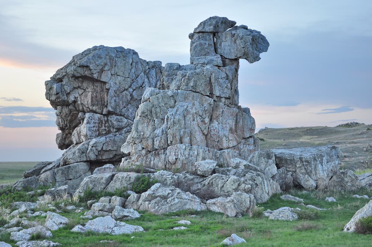
Camel Rock resembles a one-humped camel standing 20 m tall. From here you can enjoy a beautiful view of the Volga River valley, and the Sokolnichy Mountains. The rock looks very impressive among the steppes and has generated many legends. According to one of them, there is a real camel in the rock, that camel came to try its strength with the Ural Range itself. But the battle never happened with the camel becoming petrified. The place is much visited, you can drive up right to the foot of Camel Rock.
Camel Rock is a protruding part of the Zhiguli Ridge between the Shiryaevsky and Kozy ravines. The length of the Zhiguli Ridge is 4 km and the highest point is 326 m. Some smaller ravines divide the mountain into lesser spurs. The western part of the mountain is called Monastery Mountain, it faces the village Shiryaevo.
One of the most interesting places in the Orenburg Region is Red Mountain, 5 km from Saraktash village. Red Mount is towering on the right bank of the river Sakmara. It may be actually called a hill, that is why you sometimes come across the name Red Hill for this spot. This is the place where people built Belogorskaya Fortress in life-size, this settlement was described in the story The Captain’s Daughter written by the great Russian writer Alexander Pushkin. All the buildings were made of wood, it was also used as a filming set for the movie Russian Riot, which made this mountain famous and popular among tourists. Now all of this is an open-air museum called the Landscape and Ethnographic Museum of the Orenburg Cossacks.
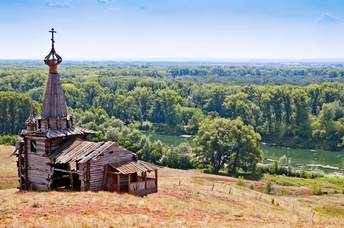
Thanks to the red clay and red sandstone making up the mountain, it really has a reddish hue seen from much afar, which is why may be the origin of the name. However, there is another name for the mountain - Saryktash, which means "stone sheep". This name can be explained by the fact that there are unusual stone blocks which from afar can be taken for sheep grazing on the mountain. The size of the stones varies from 0.5 to 2.5 meters. The top of the Red Mountain offers a beautiful view of the surrounding area, Saraktash village, and the Sakmara River.
There is a Regional Museum of Local Lore in Saraktash village, which is located opposite Red Mount on the left bank of the river. It hosts a collection of Russian rural life relics, you can get introduced to the history of Orenburg woven shawls, a very famous thing in Russia. The Holy Trinity Monastery of Mercy, a church or great beauty, is also located there. The largest bell in the Orenburg region is located on its temple.
There are not so many skiing pistas near the cities of Orenburg and Orsk if you compare them to the other parts of the Urals but still you can go skiing, snowboarding or tubing here.
Grebny ski resort (14 km from Orenburg, located on Grebenskaya Mount).
Tashla ski resort (about 110 km from Orenburg, located in the village of Tashla in the north of Tyulgansky district in the Orenburg Region). It is a year-round sports and recreation centre which is often called Orenburg Switzerland for the beauty of its surroundings. The village is located on the southern side of the Little Nakas Ridge, in the valley between the ridge and Yamantau Mountain.
Kuvandyk Valley ski resort (2 km from Kuvandyk town, 200 km from Orenburg, 100 km from Orsk). You can reach Kuvandyk directly by train from Moscow, Yekaterinburg, Chelyabinsk and Samara.
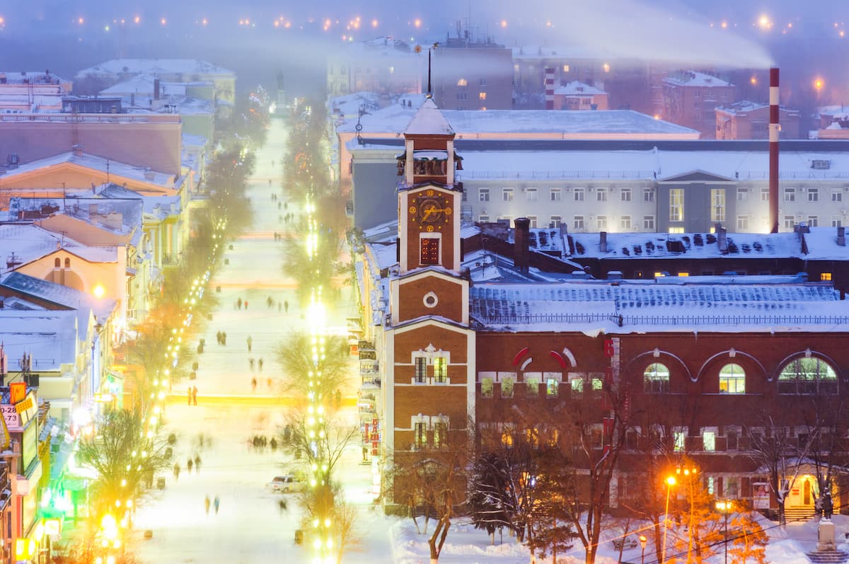
Acquaintance with the Orenburg region begins with a visit to its capital – the city of Orenburg. You can get to this wonderful city by airplane, train, bus or car.
Some people say Orenburg was conceived three times and once born. To understand the origin of this mysterious phrase, let's dive into the history of the city itself.
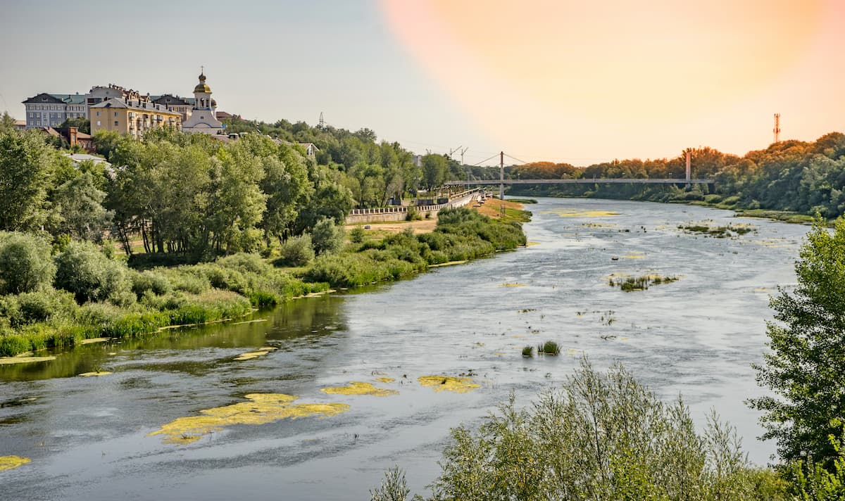
The first phase of Orenburg construction began in 1735, it was a fortress city to protect the southeastern borders of Russia from enemy invasions. The place was chosen by the head of the Orenburg expedition I.K. Kirillov and was located in the valley of the river Yaik (now Ural), at the mouth of the river Or. However, the city was not completed in the assigned time. As time passed, the chiefs were replaced and a new location was chosen for the future city. And only in 1742, the new chief Ivan Ivanovich Neplyuev chose the third place, which is now the historical centre of the city. And Neplyuev is considered the founder of Orenburg and the founding father of the Orenburg Region. Modern Orenburg is officially considered to have been founded in 1743, it is located on the Ural River near the mouth of its right tributary – the Samara River. Orsk is located in place of the very first foundation of the Orenburg project.
Other interesting facts are also connected with Orenburg. For example, in Soviet times, Orenburg was the very first capital of Kazakhstan. From 1920 to 1925, it was the administrative center of the Kyrgyz Autonomous Socialist Soviet Republic (at that time the Kazakhs were officially called the Kirghiz for some obscure reason). From 1938 to 1957, following the notorious Soviet tradition to rename everything, Orenburg was called Chkalov, after the name of a famous Soviet pilot Valery Chkalov. The pilot himself never visited the place, the renaming was mainly due to the fact that the authorities had plans in the 1930s to make the city the so-called aircraft capital of the USSR. Being the centre of the Orenburg province and having a railroad, the city actively developed trade between Russia and Central Asia, being an important link. During WW2 (on the Russian territory the battles were fought from 1941 to 1945), a large number of industrial enterprises were evacuated here, which gave the city a powerful impetus to development. The growth of Orenburg was also associated with the development of gas fields.
Here we will probably finish our acquaintance with the key milestones of the city development and move on to its sights.
Before the start of a fascinating journey through the city, it will be very handy to fetch a guest (tourist) passport of Orenburg in the Information and Tourist Centre located at Sovetskaya Street 27. There you will find a list of eight best objects for a walking tour and background information about them and the museums of the city (addresses and opening times). There is a symbolic fee for the Orenburg Guest Passport. Well, if you manage to visit all these places and put in a so-called visa in your passport from each of them, you can get a prize – an album of Orenburg. The passport itself will be a real tourist trophy.
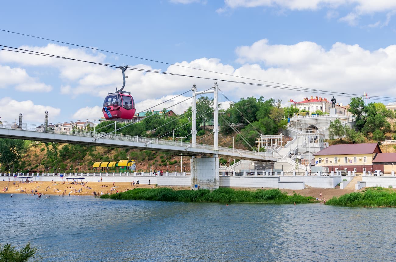
You can get to the park Trans-Ural Grove from the historical center of Orenburg if you go along the Snow White Bridge that is crossing the border of Europe and Asia. In the summer heat, tall trees here give you comfortable shade, and you can see plenty of cute gophers who will welcome you with their whistles, while standing up on their hind legs.
Those who want to take a break from hiking can use a cable car which starts running opposite from Naberezhnaya Street 16. It is easily accessible from the railway station of Orenburg, take a shuttle bus number 156 and go for 5 stops or drive 10 minutes by car. The same shuttle bus can also take you from Europe to Asia. The cableway was opened in 2006, and received the status of the most comfortable cable car of Russia. Passengers are carried in cozy semi-transparent cabins, over the distance of 233 m at the height of 70 m. The speed of movement is 3 m/s, so passengers have a great opportunity to take a photo or video of the view of the river, the bridge and the embankment.
Not far from the cable car is Orenburg History Museum. It is easily recognized by the building reminiscent of a castle. The old tower and its clock look especially spectacular. Who would have thought that originally it housed the city treasury and archive, and later the guardroom? Its exhibits tell about different periods and key events in Orenburg's life. There is a special hall telling about the life of the great Russian poet Alexander Sergeyevich Pushkin (1799-1837, killed in a duel). He was one of the first writers to explore the theme of Pugachev’s Rebellion and the Peasant War of 1773-1775, he visited the nearby villages, talked to witnesses of those events. It was here that he was inspired by the idea to write The Captain's Daughter novel.
Despite the fact that the train is small and fairytale-like stations are designed for children, the Orenburg Children's Railroad is considered quite an adult attraction! In addition to its entertainment purpose, the railroad delivers parents to kids’ country health camps. A trip along the railway track laid along the Ural River will be remembered for its picturesque landscapes and brightly decorated stations.
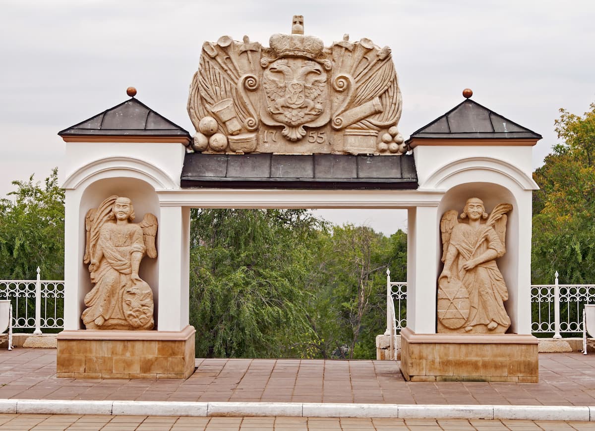
Walking along the embankment, you come across one of the symbols of the city – Elizabeth's Gate. In the distant 1755, the founder of Orenburg Ivan Ivanovich Neplyuev heroically suppressed the rebellion of the Bashkirs thus defending the borders of Orenburg lands. To honour this, Empress Elizabeth decreed to set the gate at the exit of the city so that it would look out towards the steppes to remind the nomads of the power of the Russian army. The fragments of the gate, which eventually collapsed, can be seen in the Local History Museum. What you see now is a copy installed in 2008.
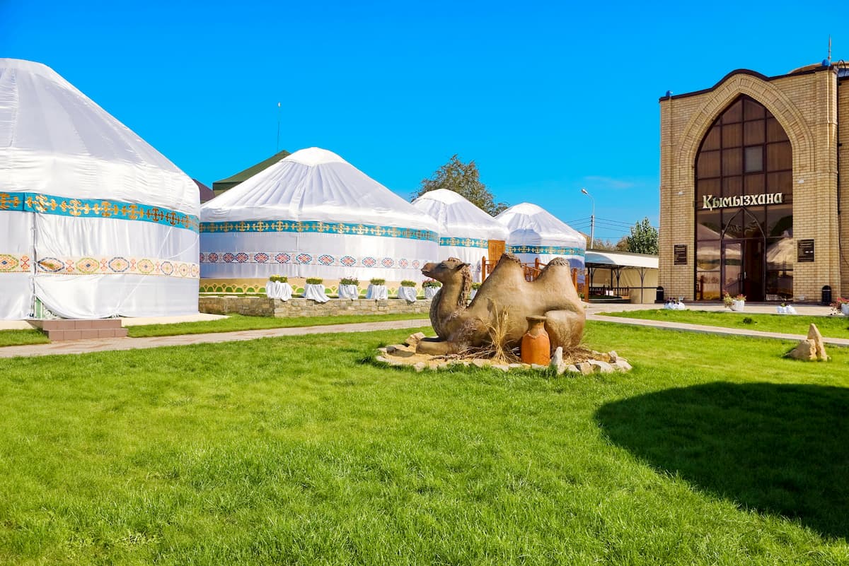
Fans of ethnography will love the cultural complex called the Ethnic Village where you can get acquainted with the history, culture, traditions and national features of different peoples. It is an open-air museum with the Russian, Kazakh, Bashkir, Tatar, German, Mordovian, Armenian, Chuvash, Belarusian and Ukrainian houses and courtyards. The Ethnic Village has become a symbol of love, friendship and unity among the peoples of the region living here together for many centuries.
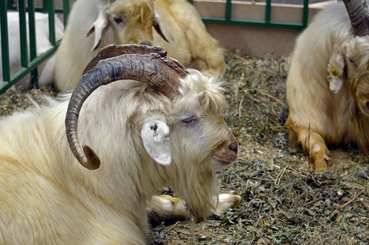
The museum exhibits some finest shawls and tells about the craft of knitting those warm fluffy beauties that has been known since the 18th century. Surprisingly, a seemingly flimsy lacey thing can keep you warm in a -40C (-40F) frost and it is a real miracle you see it the first time to pass through an engagement ring seamlessly. The shawls are of no mean size (at least 1 by 1 meter) and are created by a rather ancient technology using the wool off local goats.
There are other museums in Orenburg, i.e. the Museum of Fine Arts, the museum-apartment of Yuri and Valentina Gagarins, the museum-apartment of the Rostropovich family, the museum of Taras Shevchenko and others.
Walking around Orenburg and reaching Victory Park, you can visit the open-air military equipment exhibition located in the park. There you will find planes, tanks, self-propelled units, and even trains.
A large number of ancient buildings, which are monuments of architecture, have survived in modern Orenburg. Caravanserai is among the interesting architectural solutions. In Asian countries, public inns were usually called caravanserais which housed trade caravans and merchants with goods. The Orenburg Caravanserai was not a public inn but it received the name to emphasize the Asian style.
The territory of the former Caravanserai Garden is currently a Perovsky Park. Walking around it, you can see the bust of V. A. Perovsky who once served as the military governor. There are some art objects to spice up your IG snaps, you will see the Snail Family, Alarm clock, and the Bird restaurant.
The monuments of Orenburg do not end there. You may encounter them everywhere. Here are just some of them: the Orenburg Cossacks, the monument to Emperor Alexander I, Yuri Gagarin’s Monument, Peter the Great, A.S. Pushkin’s, P.I. Rychkov, V.I. Dal, Leo Tolstoy, Musa Dzhalil, Viktor Chernomyrdin’s Monuments, even a monument to a scientist cat, to the water pipeline, there is a sculpture Good Angel of Peace, etc.
If you feel like having a night out, visit one of the city theaters: Orenburg Region Drama Theatre named after M. Gorky, Orenburg State Regional Theatre of Musical Comedy, Orenburg State Tatar Drama Theatre named after Mirkhaidar Faizi, Orenburg State Regional Puppet Theatre, Orenburg Municipal Puppet Theatre "Pierrot", Student Theatre Goritzvet of Orenburg State Medical Academy.
The resort town of Sol-Iletsk is a major tourist centre in the Orenburg Region. It is located near the border with Kazakhstan, on the banks of the Ilek River, a tributary of the Ural River. Orenburg and Sol-Iletsk are 70 km away from each other. You can get there by bus, car or train the railway station is Iletsk-1).
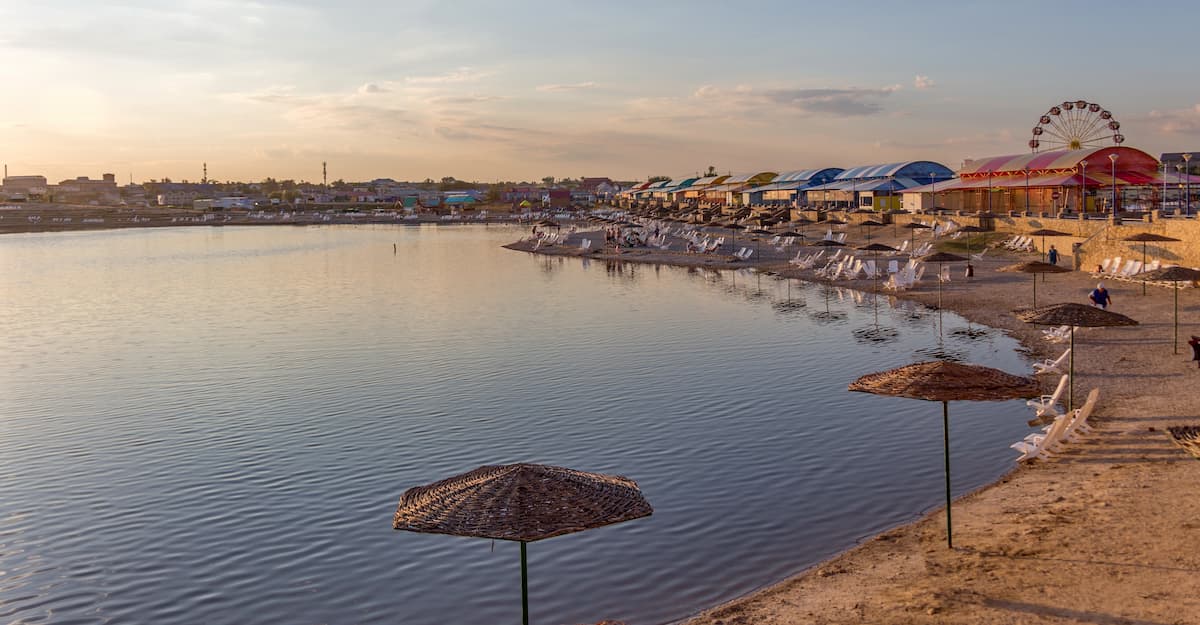
With its salt and mud lakes, Sol-Iletsk is a major attraction for numerous tourists. The town started back in 1744 with first salt mining. However, at that time it was a wooden Iletsk fortress and historically it changed its name more than once. The modern town did not start until 1945.
Sol-Iletsk lakes were formed on the sites of salt mining, on the site of Mount Tuz-Tube. The most famous among these lakes is called Razval, the locals call it Solyonka (i.e. Salt Shaker). The water in it is so salty that it is similar to the Dead Sea in Israel. Being highly saline and thus very dense, the water is pushing the swimmers to the surface, so you can never get drowned in it. In the summer season, the depths of the water are poorly heated and if the surface is warm, deeper layers feel icy cold. Due to the high concentration of salt, the water does not freeze in winter. However, for the same reason there are no living inhabitants or even algae in it.
Dry hot climate and the salty lake with its soluble mineral elements of healing properties have a beneficial effect on health. Here the visitors treat joint, skin and respiratory diseases. If you don’t have any those issues, there is a significant strengthening of the body as a whole.
In addition to Razval Lake, there are several other lakes in town: Dunino, Tuzluchnoye, Maloye Gorodskoye, Novoye, and others. Some of them are salty, others contain curative muds. In summer time, there are health tours here every weekend. You can stay in a tent or rent accommodation from local residents. There is also a balneal resort called the Regional Sol-Iletskaya Hospital of Rehabilitation. The local horse factory produces koumiss (fermented mare’s milk), known for its curative properties. Sol-Iletsk is the largest center in the Orenburg Region for cultivation of melons and gourds. Every summer the Sol-Iletsk Watermelon Festival is held here.


Yes. Orenburg Oblast has 238 named mountains. The highest is Nakas Ridge at 668 m.
The highest mountain in Orenburg Oblast is Nakas Ridge, at 668 m.
Orenburg Oblast has 238 named mountains.


