
Scan the QR code and open PeakVisor on your phone
Let the trip to the South Urals begin! Bashkiria is a land of gently sloped mountains, fast rivers and delicious honey. It ranks first among Russian regions by cattle, horses, honey and milk production. Yet, do not be deceived by this pastoral picture of horses and cows grazing on the green meadows and busy bees buzzing around. Bashkiria is a well-developed industrial land in the south of the Ural Mountains, it territorially covers the South Urals and adjacent plains of the Pre-Ural and Trans-Ural Mountains. Bashkiria lives virtually on the border of Europe and Asia.
The history of the region is long and turbulent. It is a multi-ethnic community where the Bashkirs, the Russians, the Tatars, the Mishars, the Mari, the Chuvashes, the Udmurts, the Mordovians, the Ukrainians and other smaller ethnic entities live peacefully together. Bashkiria has suffered the Golden Horde invasion in the 13-14th centuries. After the Golden Horde disintegration, most of Bashkiria was a special viceroyalty of the so-called Nagai Horde, and the territory of the Eastern Bashkirs was part of the Siberian Khanate, whereas the lands of the Western Bashkirs were part of the Kazan Khanate. Bashkiria became part of Russia after the Siberian and Kazan khanates had ceased to exist in the 16-17th centuries.
As to the name, historically it ran as Bashkir, Bashkiria, Bashkirdia, Bashkurdistan, Bashkir Province. In 1917, the autonomy of Bashkurdistan was proclaimed and in 1919, there was established the Bashkir Autonomous Soviet Republic. It was the first national autonomy in the USSR. In February 1992, the name of the Republic of Bashkortostan was adopted. The name comes from the name of the indigenous people – the Bashkirs (Bashkort) and the suffix –stan meaning ‘a country’ in the Persian language. The common names you will currently hear is Bashkiria and Bashkortostan.
The territory of Bashkortostan is 142 947 sq.km., which is equivalent to that of Greece or Nepal, the population amounts to 4 037 811 people (as of 2020), which is approximately the same amount of people living in Costa Rica or Croatia. The length of the Republic from north to south is 550 km, from west to east is 430 km. It borders on the Perm Area and the Sverdlovsk Region in the north, the Chelyabinsk Region in the east, the Orenburg Region in the south and south-west, the Republic of Tatarstan in the west, and the Republic of Udmurtia in the north-west.
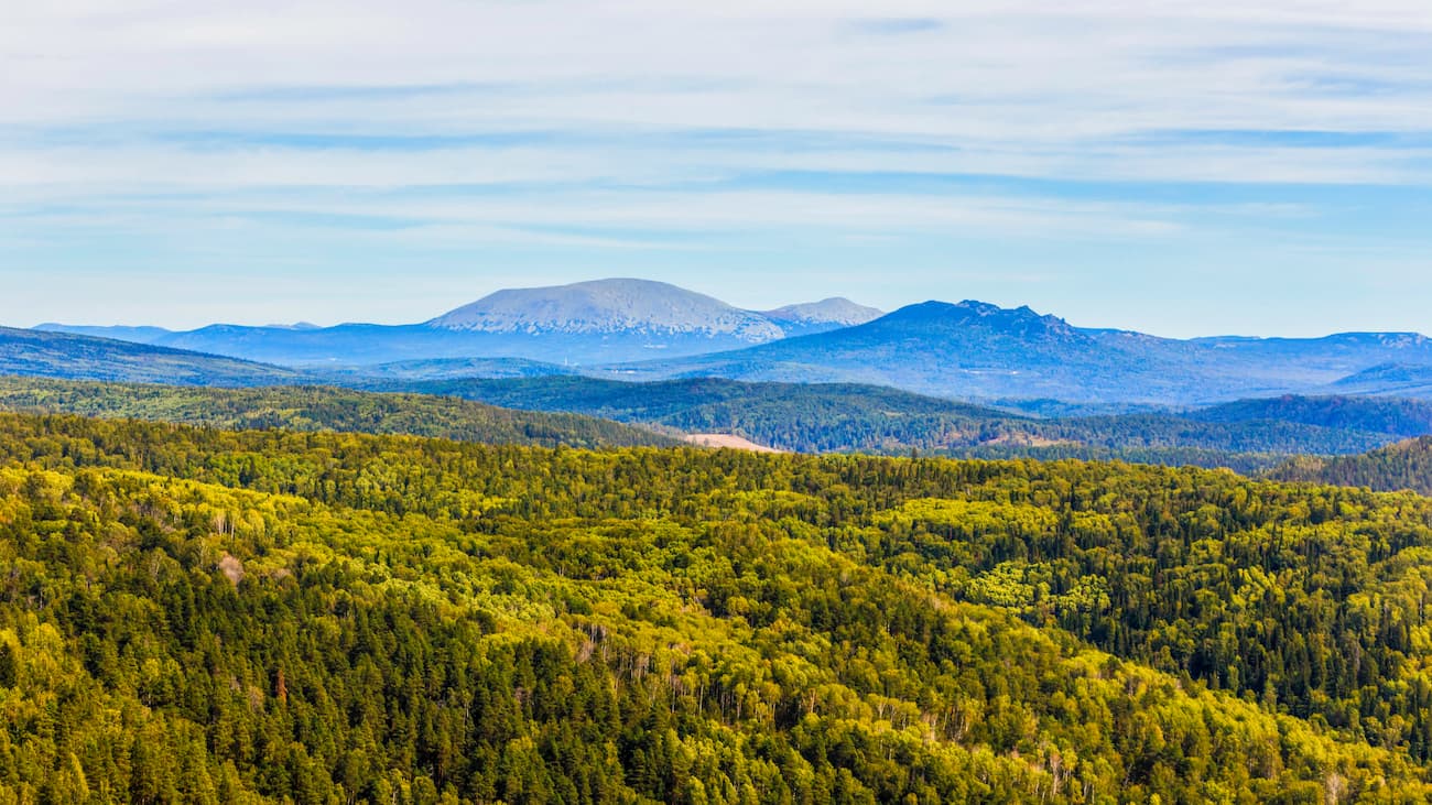
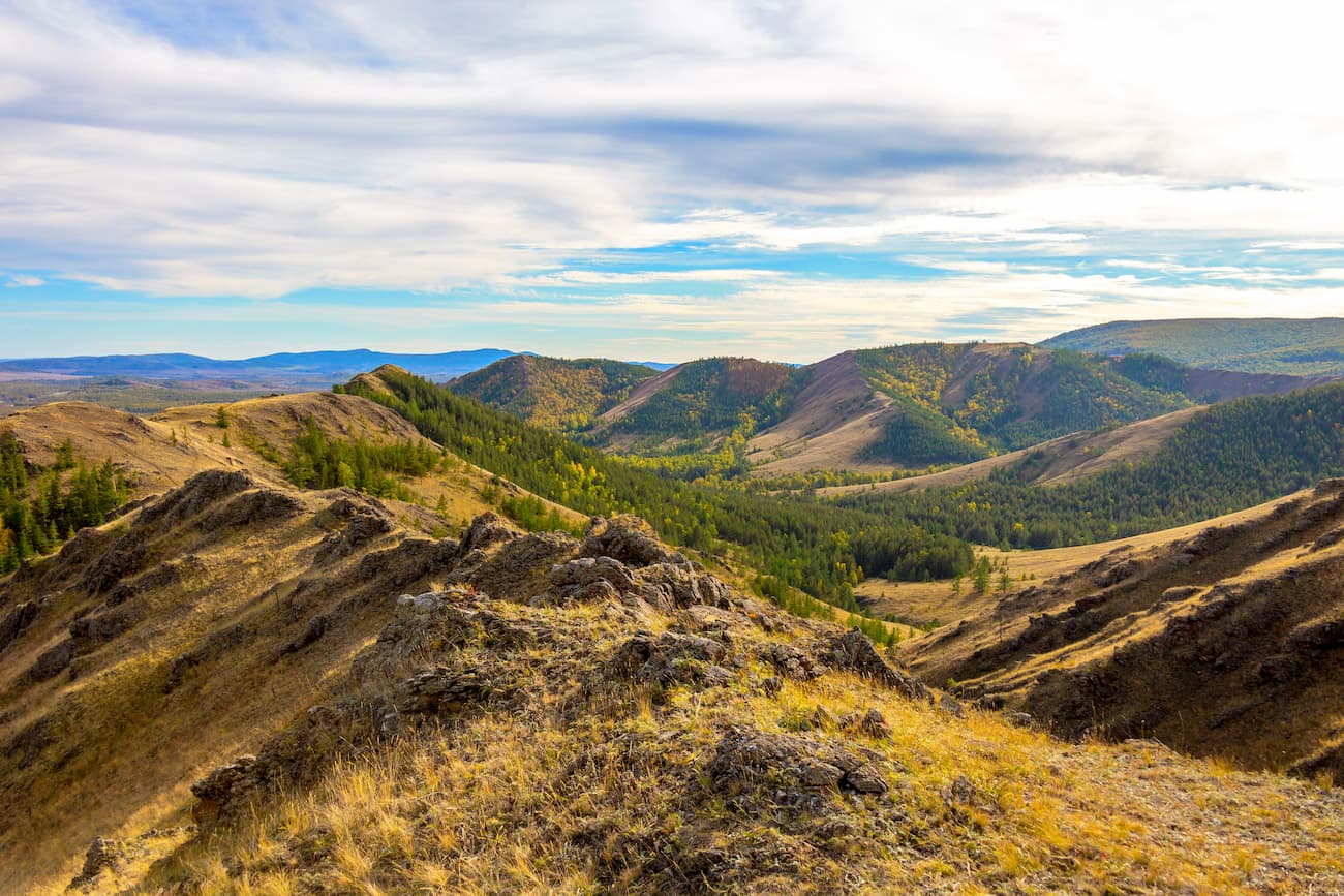
Geologically, Bashkiria is divided into three main areas: the western or Bashkir Cis-Urals, the mountainous Bashkiria and the Bashkir Trans-Urals. Western Bashkiria is located within the East-European Plain and occupies two-thirds of the Republic's area. Mountain Bashkiria embraces the Southern Urals and consists entirely of ridges that occupy a quarter of the territory. The Bashkir Trans-Urals represent a narrow ridge strip along the eastern border of the Republic, in the east, this part of the Republic merges with the West-Siberian lowland. The Trans-Urals strap occupies more than a tenth of the republic's area. The highest point on the territory is Yamantau mountain (1640,4 m).
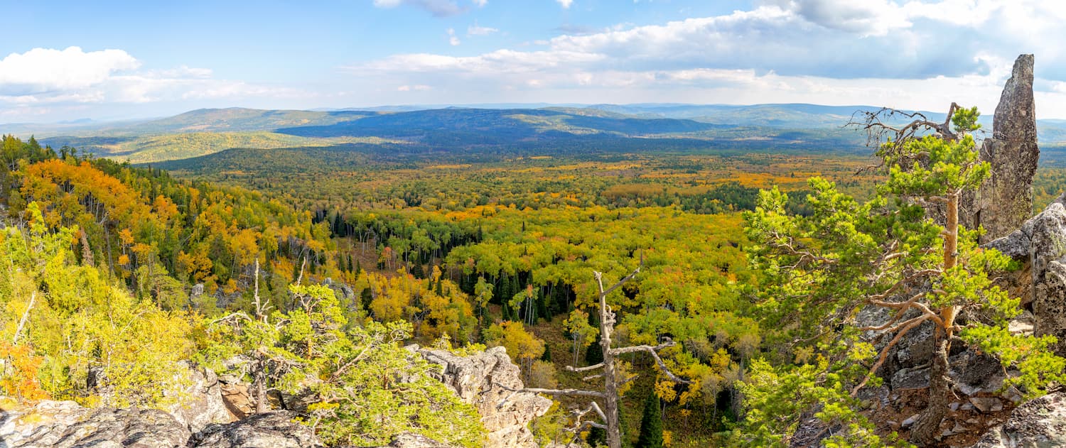
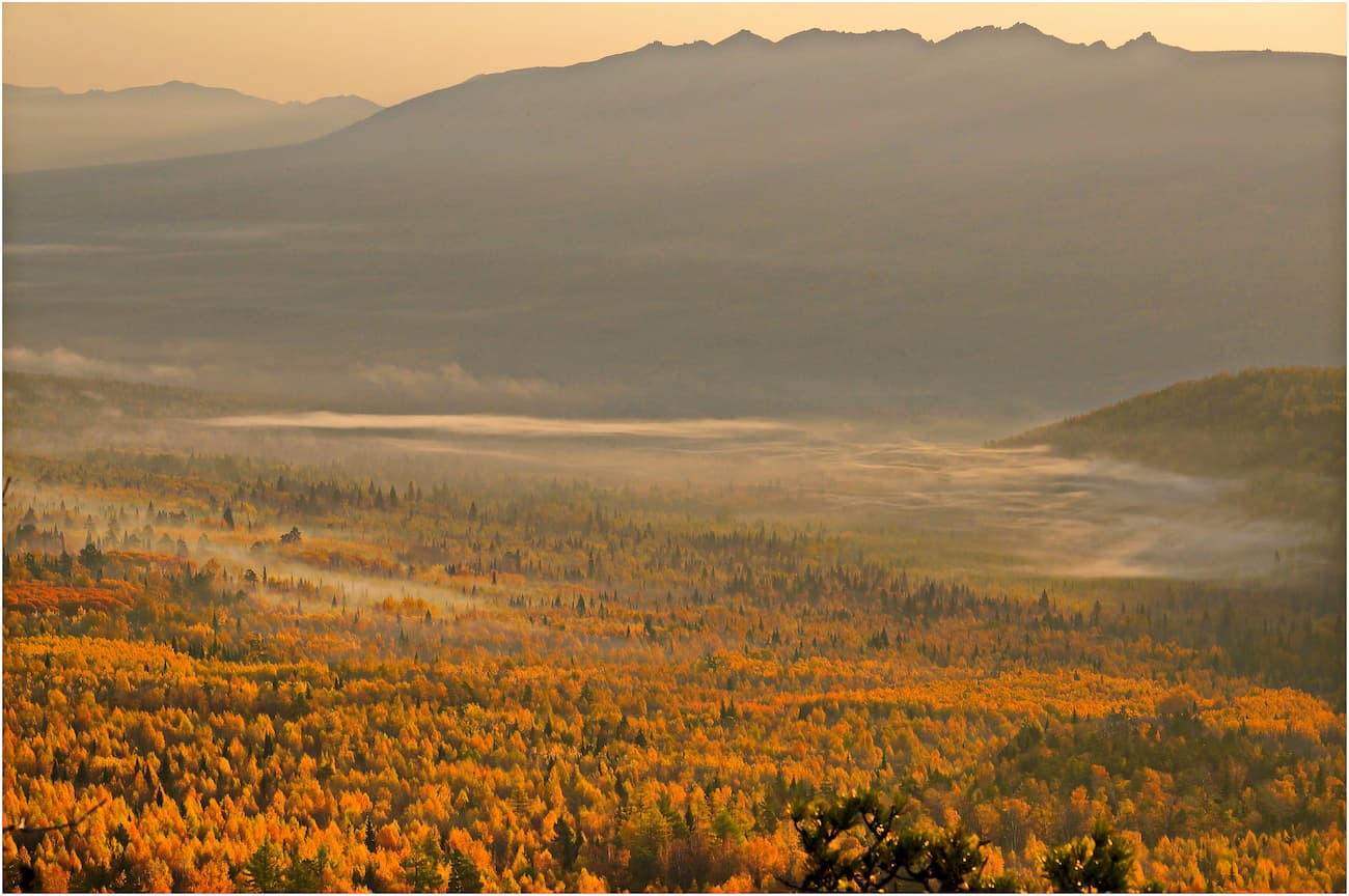
The territory of the Republic falls within four temperate geographical zones: mixed forest zone, broad-leaved forest zone, forest-steppe zone and steppe zone. Forests cover more than 40% of the Republic's area. In the Bashkir (Southern) Urals vegetation has a pronounced high-altitude belt: landscapes change from steppes and forest-steppe featuring birch and oak forests at the foothills and low foothills to spruce and fir taiga observed at heights from 600 to 1100 m of the bald-mountain belt and the highest peaks of the mountains (up to 1600 m and above). In the Bashkir Trans-Urals, you will see the forest-steppe zone and mixed forests. In the Bashkir Trans-Urals, the landscape has the appearance typical for the southern strip of the Western Siberia, as well as the northern part of Kazakhstan, there are pine deciduous forests, birch forests and dark coniferous taiga.
On the territory of Bashkortostan, there are 77 species of mammals, about 300 species of birds, 42 species of fish, 11 species of reptiles, 10 species of amphibians, 15 000 species of insects, 276 species of spiders, 70 species of mites, 120 species of molluscs, 140 species of crustaceans and about 1000 species of worms. Among them, 18 species of mammals, 49 species of birds, 7 species of fish, 3 species of amphibians, 6 species of reptiles and 29 species of invertebrates, including 28 species of insects, are included in the Red Book of Bashkortostan.
The climate is moderately continental, with humid, warm summers and moderately cold winters. Bashkiria is located in the depths of the continent, far from large water bodies but close to arid regions of Kazakhstan and the Caspian lowland, which determines the sharp continentality of the local climate with prevailing anticyclones. The relatively low Ural Mountain Range does not prevent cold air masses from penetrating from Siberia to the Pre-Urals in winter. At the same time, the Urals Range is a climatological border. On the one hand, Bashkortostan falls under the influence of Siberia's harsh continental climate. On the other, it experiences the influence of the warm and humid Atlantic Ocean air masses. Due to this wild mixture, winter frosts can reach -41 to -50 degrees Celsius (-42 /-58 F), and in summer comes the heat with a sharp rise in temperature to +35 to +42 degrees Celsius (95/108 F).
The weather in Bashkortostan is notable for its variability. You can observe thaws in January thaws and frosts of up to -15/20C (5 to -4F) in April. It can snow in May and in August frosts can already begin. The seasons are clearly defined here, you can enjoy the distinctive features of all four of them: winter, spring, summer, and autumn. Winter starts in the second half of November with steady snow cover. January is the coldest month with an average daily temperature of -18 degrees Celsius (0 F). The area is characterised by strong winds and snowstorms. Spring starts in late March or early April. Summer comes in late May or early June. The warmest month is July with an average daily temperature of +18 degrees Celsius (64 F). There can be droughts if days of intense heat continue for more than a couple of weeks. The amount of precipitation on the western slopes of the Ural Mountains is much higher than on the eastern slopes. The least rainfall is on the plains.
Natural tourism is widely developed in Bashkortostan, attracting the true aficionados of beautiful mountains, rivers and waterfalls.
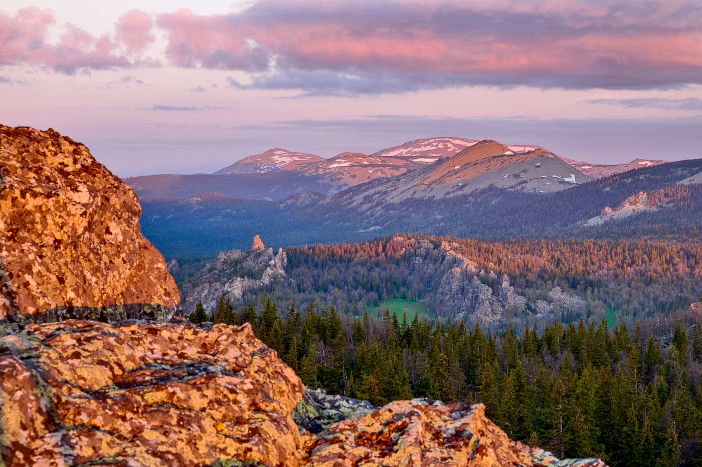
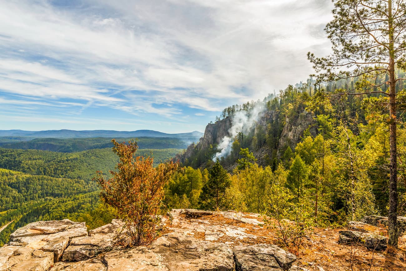
The mountainous part of the Republic of Bashkortostan has many picturesque peaks. The most impressive and popular are Mount Yamantau, the Inzer Range, the Iremel Range, the Mashak Range, the Aush-Tau Range, the Nurali Range, the Nara Range, the Karatash Range and the Aigir Rocks, the Sterlitamak Buttes and others. Some of these mountains and ranges are located in national parks and reserves in Bashkortostan.
This relatively small mountain Yangan-Tau (504 m), dabbed a ‘burning mountain’ in the Bashkir language, can boast of a unique natural phenomenon. There is hot gas coming out of the ground to the surface. Its temperature ranges from +37 degrees Celsius (+99F) to +150 degrees Celsius (+302F). In the specially drilled well which is 90 m deep the temperature reaches 380 degrees Celsius (+716 F). There is no volcanic activity here but this natural anomaly of the hot fumes gave birth to many myths and legends. The Bashkirs still have their own explanation for this phenomenon. Their legend says that in ancient times a bolt of lightning struck a big old tree on the top of the mountain. The tree caught fire which went down via its roots to the heart of the mountain. Since then, a steady fire, which is considered sacred by the Bashkirs, has been burning in the underground bowels. This hearth is located at the depth of 60-90 meters, and heat is preserved due to weak heat transfer of surrounding rocks. Scientists have established that bituminous shales are oxidizing inside Yangan-Tau mountain. Due to the ongoing chemical reaction, abundant heat is generated, which heats the water. The water, turning into steam, rises to the surface via various cracks. And from a distance, it seems that Yangan-Tau mountain is smoking and burning.
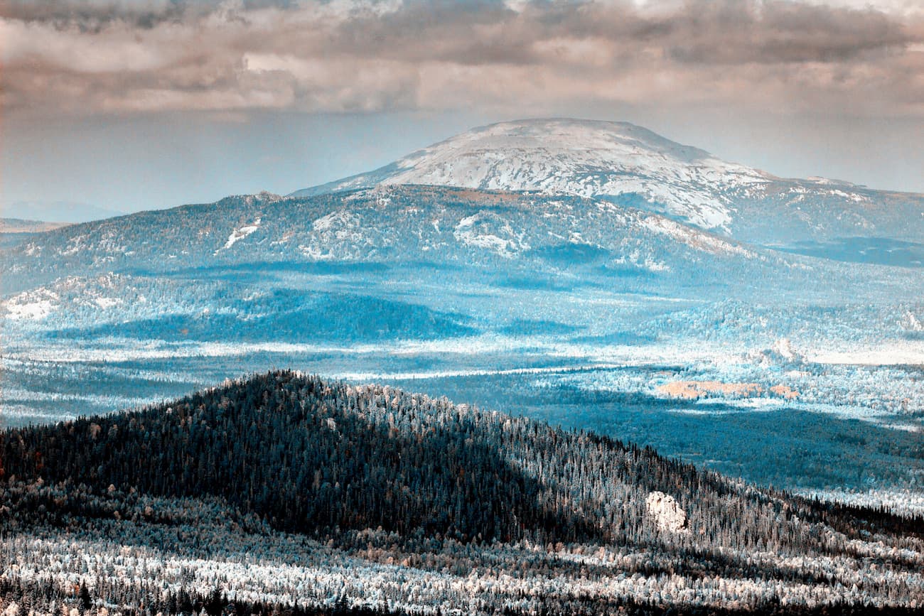
The mysterious peak of the South Urals, Mount Yamantau, is located on the protected territory of the South Urals Reserve.
Mount Yamantau has two peaks – Big Yamantau (1640.4 m) and Little Yamantau (1512.7 m). Both peaks of the mountain are plateaus with flat topography.
Yamantau is the highest point not only in the South Urals Nature Reserve but also in the entire Southern Urals and the Republic of Bashkortostan. In translation from Bashkir language, Yamantau means "a bad mountain" ("yaman" – bad, evil and "tau" – mountain). There are many legends about the origin of the name. Most likely, the name was triggered by a number of unhappy factors. Firstly, there were many swamps and loose rock fields (kurumniks) on the slopes of the mountain, as a result of which in the olden times it was impossible to graze cattle there. Secondly, there are quite a lot of bears at the bottom of the mountains judging by their tracks and trampled glades. Thirdly, the local Bashkirs still believe in the bygone tales that horses were dying when they climbed this mountain. Besides, the weather is very changeable when you are approaching the top of the mountain. All this together made the indigenous peoples stay away from this mountain.
At an altitude of 1100m and above, the slopes of the mountains are composed of loose rocks with intermitted patches of grass, flowers, and moss. Below this mark the slopes are covered with mixed forest, in some places, there are alpine meadows, wind-broken trees that make some places unpassable, and sometimes you see rocky beats or weird rocky formations.
Yamantau mountain has a peculiar location, it is fenced with ridges from all sides. To the north of the mountain, there is the Mashak Range, to the west – the Nary Range, to the east – the Kumardak Range, the Inzer Range and the Belyatur and the Yusha Ranges. In addition, Yamantau fenced itself with the rivers Big Inzer and Little Inzer which originate on the eastern and western sides of the mountain respectively.
Two kilometres southeast of Mount Yamantau, there is the second peak called Little Yamantau. Unlike its big brother, closed for visitors, Little Yamantau has a tourist route which can be taken only if you are accompanied by an employee of the reserve. The route begins at the Central Estate (Visitor’s Centre) of the South Urals Nature Reserve. The length of the route is 6 km, the elevation gain of the route is 600 m. At the top of the mountain, there is an observation platform with beautiful views of mountain ranges of the Southern Urals. On a trail, there are 4 stops for rest with benches. Not far from the top of Little Yamantau, near a spring, there is a forest hut intended for temporary rest.
In the late 1990s, there appeared the first rumours about mysterious buildings in the Southern Ural Mountains, the information was assumedly fed by the American press. At that time, the New York Times published that Russia had begun underground construction of a giant military complex. The purpose of the complex remained a mystery. Different versions were given, from a bunker or a repository of national treasures (Fort Knox a la Rus) to a humble warehouse for the mined ore. The complex was believed to be territorially located under Yamantau mountain. 10 km to the west from the mountain is the closed town of Mezhgorie (the town with restricted public access, a common phenomenon in the USSR for settlements around military objects).
Some rumours say that people living in Mezhgorie serviced the mysterious buildings and when there via a special railroad built inside the mountain from the town. The construction of this facility was allegedly completed in 2002. However, there was no official statement from the country's government regarding the purpose of the underground complex of Mount Yamantau. There is a version that this data is classified, and a large number of military personnel really protect the object of state importance. Who knows, there might be another Area 51 or those rumours might be the sweet reminiscences of childhood tales about mountains.
At the top of the mountain, you can find the ruins of a heliport, abandoned and destroyed barracks, as well as other traces of the military base that had been operating on the mountain until the 1990s. In the centre of the plateau, there is a concrete obelisk in memory of the soldiers who died during the World War 2, which is usually called by the Russians the Great Patriotic War (1941-1945).
Visiting Mount Yamantau nowadays is officially forbidden. The area is constantly patrolled by park rangers and the military to ensure the mountain remains sacrosanct and untouched by the ‘lowly humans’. Yet despite the ban, there are desperate tourists who are ready to conquer the mysterious mountain regardless of the ensuing big fines and violation of the law.
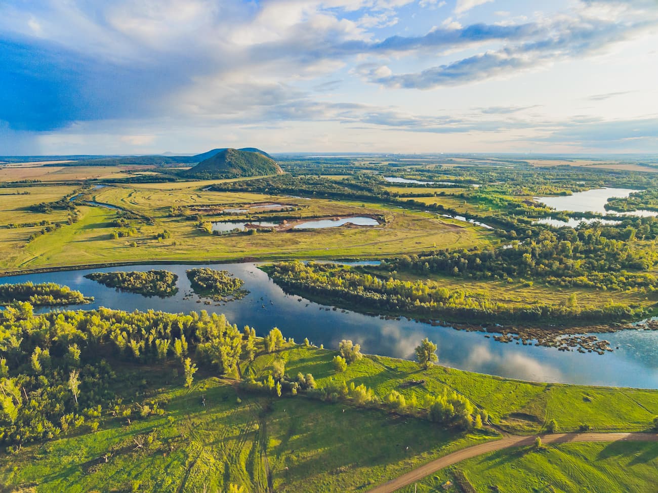
Mount Aush-Tau (646 m) towers over Lake Aushkul. One can climb it by a well-trodden path running directly from the lake. Yet, the ascend might be quite strenuous at times, you will have to pause to catch your breath, both because of physical tiredness and because of the breath-taking beauty surround you. Its slope is unforested. Even though Aush-Tau is not that high or big, it is still famous for its huge deposits of Aushkul jasper which can be seen at the top of the mountain. There are also outcrops of jasper on the slopes, the lower you go, the darker the stone will be. This jasper is known far beyond the Urals.
In the middle of the mountain, there is a spring called Aulia, its water is considered healing and appears for exactly one month a year but always at slightly different times, by rough estimates, it always happens from mid-May to mid-June. This is a place attracting many pilgrimages. Basically, Aulia is shrouded in mystery and legends. The most widespread is a legend about a traveller named Aulia who came from Arabia and brought new faith to the Bashkirs. Those gifts were not appreciated and they cut off the preacher's head. The next morning, they saw a frightening picture: Aulia was climbing a mountain, and in his hands, he was holding his severed head. The impressed witnesses buried him with all the honours on the top of Aush-Tau mountain. After that, a spring appeared nearby, which was named after the vagabond preacher. According to another legend, the wanderer died his own death after living for a while in the village and trying to familiarize the villagers with his faith.
At the top of the mountain, there can now be found a mysterious slab with Arabic script. According to rough translations, the inscription of the slab says there is an Arabian sheikh buried here. Also, the top of Aush-Tau is much favoured by paragliders and students of flight schools from Ufa, Yekaterinburg, Chelyabinsk. There is a wonderful panorama of Nurali and Kumach Ranges. You can enjoy the vastness of Lake Aushkul, one of the most beautiful lakes in the South Urals. Lake Aushkul is located at an altitude of 413 meters above sea level. The lake is oval in shape, 2 km long and about 1.5 lm wide. The lake is shallow as the average depth is only 1.85 meters. The bottom is gentle, covered with jasper pebbles and silt. It is a perfect place for fishing and swimming or landing of unfortunate newbie paragliders.
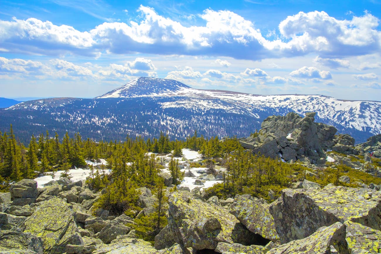
The Iremel mountain range is slightly lower than Mount Yamantau. The highest point of the Iremel is Mount Big Iremel (1,582.3 m) located in the Iremel Nature Park.
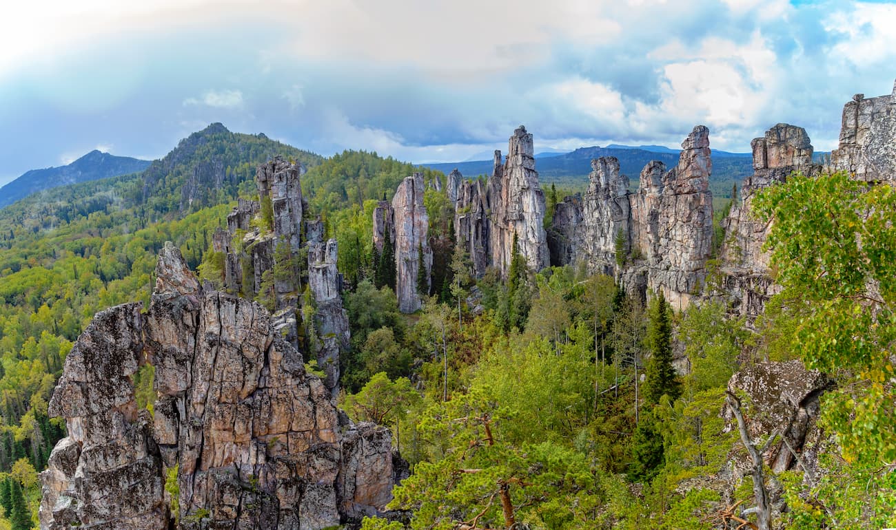
Even though the Inzer Ridge is not particularly high, the highest point is merely 1,161 m, it is a staggering beauty also known as the Far or Tirlian Yalangas. It looks like a fairytale rock castle or the teeth of a huge predator, hence its name. It is located in the interfluve of the Big Inzer and the Tirlian rivers. The ridge is only 8 km long but all along its length, there are rocks in the form of teeth rising up to 35 m high. The highest rocks are in the north of the ridge and are located in a circle which most climbers call a cirque. In the centre, there is the tallest rock. In the southern part of the range, the rocks form a shapeless heap. Some rocks can be climbed without mountaineering equipment and proper preparation. At the top, there is a beautiful panorama of the whole rocky ridge as well as neighbouring ranges: the Kumardak and Yalangas Ranges, Rossypnaya Mountain, Corner Mashak, Big Yamantau and Big Iremel. You can climb the Inzer Ridge on foot or on horseback. In the Tirliansky village, you can stay overnight, take a horse, order a walking or a jeep tour of the ridge and the surrounding area.
Of all ridges in the central part of the South Urals, the Mashak Ridge is the most remote from human settlements. This wild ridge stretches from the south to the north for 40 km, dividing in the central part into two parallel ridges. It has wonderful landscapes featuring stone (kurum) rivers and high bogs. Speaking of the bogs, the largest and most unusual is the Sychin swamp located on the western slope of the ridge, next to Mount Sychin. This slanting or better say hanging bog has an area of 750 ha and is located at an angle of 12 degrees. Water in it is in constant motion, its flow is trapped by mosses and small shrubs. From this swamp begins the river Little Katav. On the southern side of the ridge, there is its highest point – Mount Corner (Uglovoy) Mashak (1,383.3 m). The is the cradle of the Yuryuzan River. The Mashak Ridge is quite close to the South Ural peak – Mount Big Yamantau. In the north of the Mashak Ridge in the olden times, there used to be a railway crossing the ridge. The station was located at an altitude of 900 m, its remains can still be seen today.
The Nurali Ridge with its highest point of 752 m is 10 km long and 2 km side. Despite its small height, the tops of the ridge are covered with meadows, while the forest grows only in numerous deep gorges which generously cut the Nurali. The Miass River and its tributary Sherabai originate on the ridge. Each slope of the range offers beautiful views: the forest-steppe and lake parts of the Trans-Urals, as well as the mountainous part of the Republic of Bashkortostan – the Uraltau, Urenga, Nurgush, Taganai, Iremel ridges.
The Nary Ridge is a typical Urals middle altitude mountain range but at the same time, it has a zest to it. All along its length, you can observe bizarre heaps of rocks and over a vast plateau of thickets of low forest rises the Rock City – a mass of stone objects that resemble houses, destroyed buildings, towers and fortress bastions. Walking among these groups of rocks, one gets an impression that this is where the spirits of the forest and mountains live. To the south-east of the Rock City, there is the highest point of the Nary Range – the Kashkatura massif with three quite sharply pointed peaks. It is also remarkable for its lone-standing rocks. Cellular communication is available here all along the route, which is a rarity for the Urals. The Nary Ridge is completely located on the territory of the South Urals Reserve, so you should get a pass before visiting it.
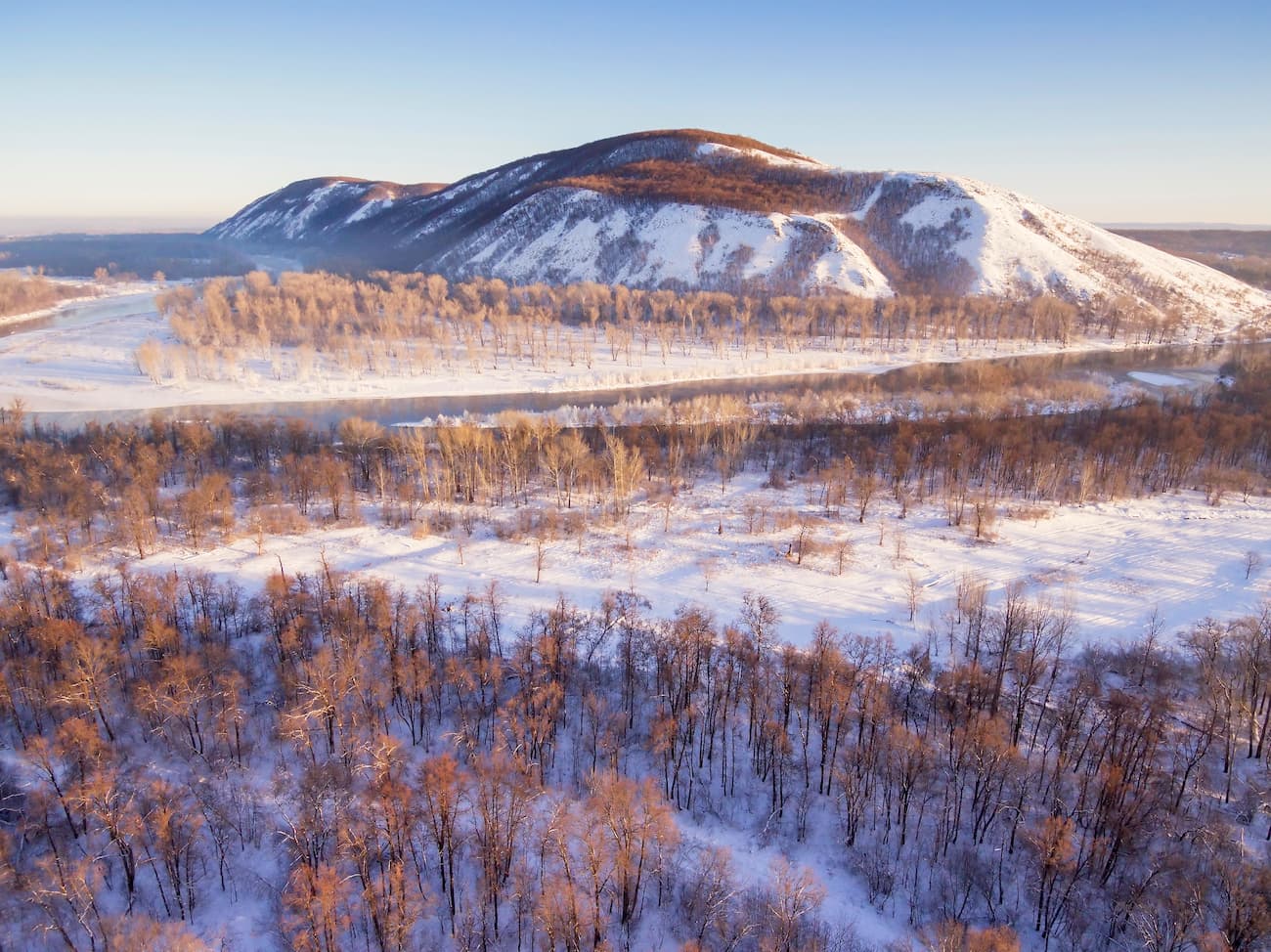
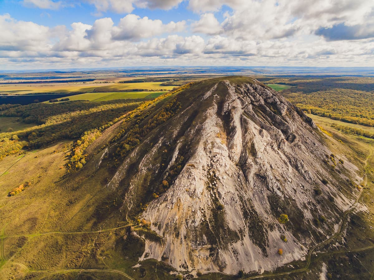
In the outskirts of the city of Sterlitamak, there is a narrow chain of single mountains – the Sterlitamak Buttes (Shikhans or monadnocks – this is the name for a single mountain or a rocky mass that has resisted erosion and stands isolated in an essentially level area). The city of Sterlitamak, the name is translated as ‘the mouth of Sterlya’ is located on the bank of the White (Belaya) River, at the confluence of the Sterlya and Ashkadar Rivers. The Buttes are not just mountains, they are fossilized coral reefs of the ancient ocean which used to fill the territory of the Urals in Paleozoic and Mesozoic eras (320 - 66 million years ago). There you can find many fossilized sea creatures such as sponges, corals, blue-green algae. The composition of these mountains is mainly calcium, so they are ideal for soda production.
There are three Buttes, each of them has its own individual character.
The Aigir Rocks rise on the northern slope of the Karatash ridge. Despite the official name that comes from the nearby railway station – Aigir, the Bashkirs call them the Teeth Shuralee. And the name Karatash means the ‘black stone’. Next to the station, in the valley of the Inzer River, there is the village of Aigir. The name of the village and the station came from the Aigirka or the Aigir River. There is a legend that in ancient times a foal of one man threw itself off the rock and drowned. Because ‘Aigir’ means ‘stallion’ in Bashkir, the rocks were given this name. Another name for the rocks is Shuralee – the spirit of the forest – a Bashkir folklore hero. Not far from the rocks, there is a spring.
At first glance, the rocks seem impregnable but this is not so. You can climb them enjoy the stunning views of Big Yamantau and Little Yamantau mountains. You can get to the rocks by train from Ufa or Beloretsk (to Aigir station) and then walk for 1.5km to the trailhead or you can drive a 4-wheeler to the foot of the rocks. The ascend is quite hard and steep, first in the forest and then on the kurum (stone scree slope). At the beginning of the path, there is a sad monument to the young man who died trying to climb the Aigir Rocks.
Apart from hiking, you can go rafting on the Little Inzer River which is cutting its way through the Little Yamantau and Karatash ridges. In the vicinity of the Aigir Rocks, the Little Inzer River forms the rapids called the Aigir Breakthrough and the Blue Rocks. The first is located upstream of the river, while the second is slightly downstream. Depending on the season and water level in the river, the thresholds have the 2nd or 3rd categories of difficulty, attracting water tourists from all over the country. And this is no surprise due to the presence of railroads nearby.
There are many caves in Bashkiria. Among them are the Sumgan-Kutuk (located in the National Park of Bashkiria), the Kapova cave, the Laklinsaya cave, Askinskaya ice cave, the Okhlebininskaya and the Kinderlinskaya caves. Sumgan-Kutuk cave is located in the National Park of Bashkiria.
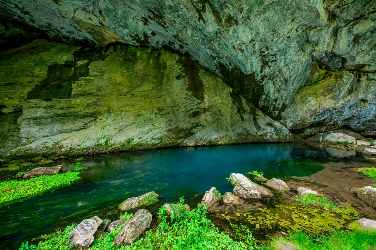
The Kapova Cave aka the Shulgan-Tash Cave was formed in soft rocks by the river Shulgan. It is located in the Shulgan-Tash Reserve. The explored part of the cave is about 3 km, and the age of the cave is about one million years. In summer, the cave is adorned with many dropstones and sinters, and in winter, you can see ice stalagmites and stalactites. There is Blue Lake in the cave. The main value of the cave is the ancient rock paintings from the Paleolithic period. This discovery of the speleologists has put Kapova cave on a par with the world-famous caves of the Altamira and Lascaux. During a tour along the well-equipped trail (about 4 km) to the cave, you can visit the bee farm and beekeeping history museum, viewing platforms. The area open to the public in the Kapova cave is only 300 m. The halls with murals are closed to the public, during the tour you can see only copies of ancient paintings. The Reserve's staff also organizes rafting along the White (Belaya) River. There are campsites on the territory of the reserve.
The Laklinskaya Cave is located in the slope of Lakly Tau mountain near Lakly village in Salavat district of Bashkoria. The entrance to the cave is quite unusual. In the rock above the entrance itself (2.5 m wide and about 3 m high) there is a second hole of almost the same size as the entrance. The length of the cave is 252 meters and its depth is 31 meters. A steep descent at an angle of 30 degrees begins immediately near the entrance and goes to a depth of 14 meters. You should descend carefully, it is quite slippery here in winter and spring. In spring, ice will form at the entrance, so you may need a rope to get out of the cave. Cold air gets into the cave and stagnates there due to the peculiarities of the entrance, so it is cold in the cave all year round.
The Askin Ice Cave is located in Arkhangelsk district of Bashkiria. The entrance to the cave is on the eastern slope of the Uraltau Ridge, 2 km from the village of Solontsy (Askino), at an altitude of about 70 m above the level of the small river Little Askyn. The cave was dabbed after the river Askyn.
It is a sack-like karst cavity, which was formed in limestone. According to Italian experts, it is the only cave in Europe with a bag-shaped cavity which has preserved relict ice from the Ice Age. The cave consists of a huge hall – 104 m long, 61 m wide, up to 26 m high – the floor of which is covered with a glacier. There is also a relict glacier here. Due to the physical features of the cave, the temperature here is always below zero so the ice does not melt even in summer. Inside the cave, there are huge ice stalagmites with the height of up to 8-11 m, their diameter around the base is up to 5 m. The acoustics inside the cave grotto is amazing – every sound is amplified manifold. The best time to visit the cave is in winter. The Askin Ice Cave was leased out to the Bashkir branch of the Russian Geographical Society in 2016. Due to this fact, visits to the cave are limited, and in summer the cave is completely closed to the public. These measures are related to the fact that due to massive tourism the cave began to suffer some irreversible processes.
The Okhlebininskaya Cave is located on the right bank of the White (Belaya) River, near the mouth of the Sim River, 3 km southeast of the Okhlebinino settlement, hence the name. It is the nearest cave to the city of Ufa. The length of the cave is 146 m, depth is 18 m. It has a large inner cavity. At 20 m from the entrance, there is an underground lake with clear water. The lake is 100 m long, 2 to 12 m wide and up to 1 m deep. Then there is a hall of 50 m in diameter and up to 9 m in height with a vaulted ceiling. From the hall, there is a 30-meter-long gallery. The floor is dotted with boulders dropping from the ceiling. The whole cave is cavernous and prone to rockfall because gypsum is quite a fragile rock.
Therefore, when visiting the cave, it is necessary to be vigilant and careful, do not shout or touch the walls. In spring, when the snow is melting, it is better to refrain from visiting the cave. Yet, when winter comes, the cave becomes most beautiful with bizarre snow crystals formed at the entrance, and peculiar high ice stalagmites farther from the entrance. The ice stays there until July. Even in winter, water drips in the cave, that is why in frosty cold weather, you can see steam coming out of the cave, which is basically water vapour. The average temperature in the cave is about +6 degrees Celsius (+43F) but the humidity inside is high. Bats spend the winter in the cave. Under no circumstances should you disturb them. If you wake up the bat during its winter hibernation, it will die.
On the territory of the Bashkortostan Republic there are the following protected natural areas:
The total area of specially protected natural territories is 1,064.7 thousand hectares, which is about 6.9 % of the Republic's area (according to the Bashkir Encyclopedia edited by M.A. Ilgamov in 2015-2020).
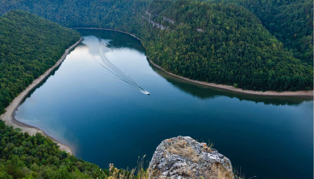
The river network of the Republic is represented by approximately 12,725 rivers with a total length of 57,366 km. Most of them are of low water content. Local rivers are characterised by significant long-term and intra-annual variability in the runoff, which is regulated by the creation of ponds and reservoirs in the region. The rivers are fed in a mixed way, with a predominance of snowmelt (50-70%). Most of the rivers in the region have spring floods with sharp rises in water levels, summer and autumn low water, which yet can rise in a matter of hours because of heavy rainfalls, and winter low water. For mountain rivers of Bashkortostan, high floods in the summer-autumn period are typical. The rivers freeze at the end of November and open up in the middle of April.
Bashkiria takes the third place by the length of the river network among the Russian federal district (after the Perm Area and Kirov Region). It is also rich in underground water sources.
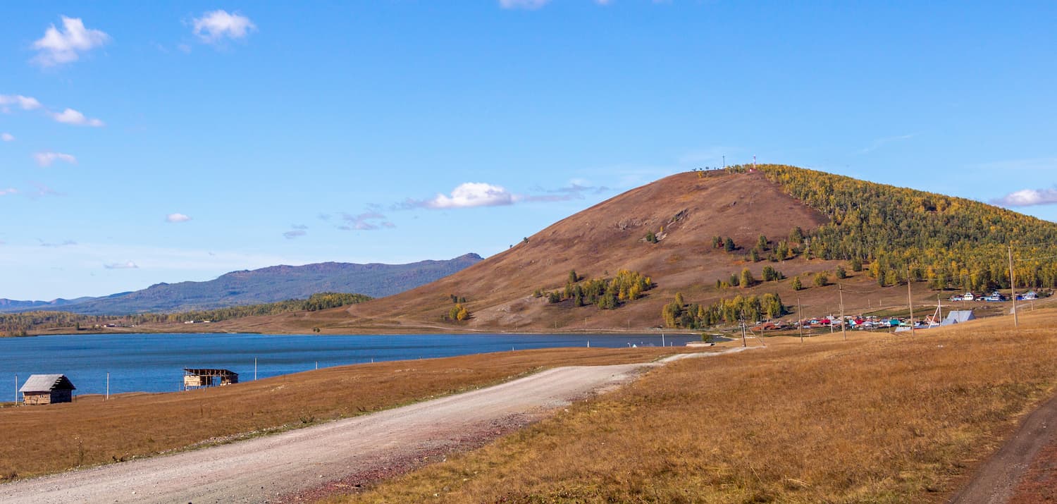
On the territory of the republic, there are more than 7900 lakes and artificial reservoirs with the total area of about 550 sq.km., including about 1650 lakes with the area of more than 0.01 sq.km and a number of smaller lakes, according to the Institute of Lake Science of the Russian Academy of Sciences. Most of the lakes are located in the western part of the region, the smaller part is mainly in the Trans-Urals.
Most lakes in Bashkiria are of floodplain type, located in the floodplains of the rivers White (Belaya), Dema, Ufa, Ika and others. And in the Trans-Urals, you can often see the lakes of tectonic origin. In some areas, there are also karst lakes. The largest lakes of Bashkortostan are the Aslikul, Kandrykul and Chebarkul. The largest artificial lakes here are Pavlovskoye Reservoir (on the river Ufa), Nugushskoe (on the river Nugush, the right tributary of the river Belaya), Karmanovskoe (on the river Bui, the left tributary of the river Kama).
Swamps and marshlands cover 3.55% of the country's territory (5,080 sq.km). The area and the number of lakes and artificial reservoirs, swamps and marshlands are unstable and depend on natural and anthropogenic factors (drainage or, conversely, watering of territories, regulation of flows, etc.).
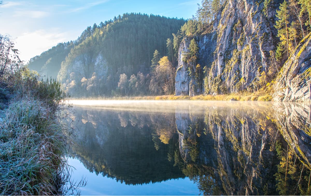
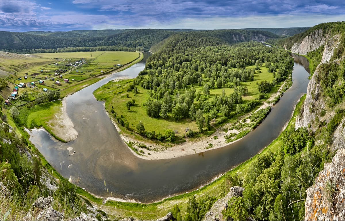
Such abundance of water basins is the ultimate temptation for fishermen, rafters, swimmers and even hikers. Many rivers suit both extreme sports lovers and families seeking for quiet rest. The most popular rivers for rafting are the White (Aghidel), Ai, Inzer, Nugush, Yuriuzan, Zilim, Sakmara, Lameza. The White River flows through the territories of the Shulgan-Tash Reserve and the National Park of Bashkiria, and is a trademark of the Republic of Bashkortostan.
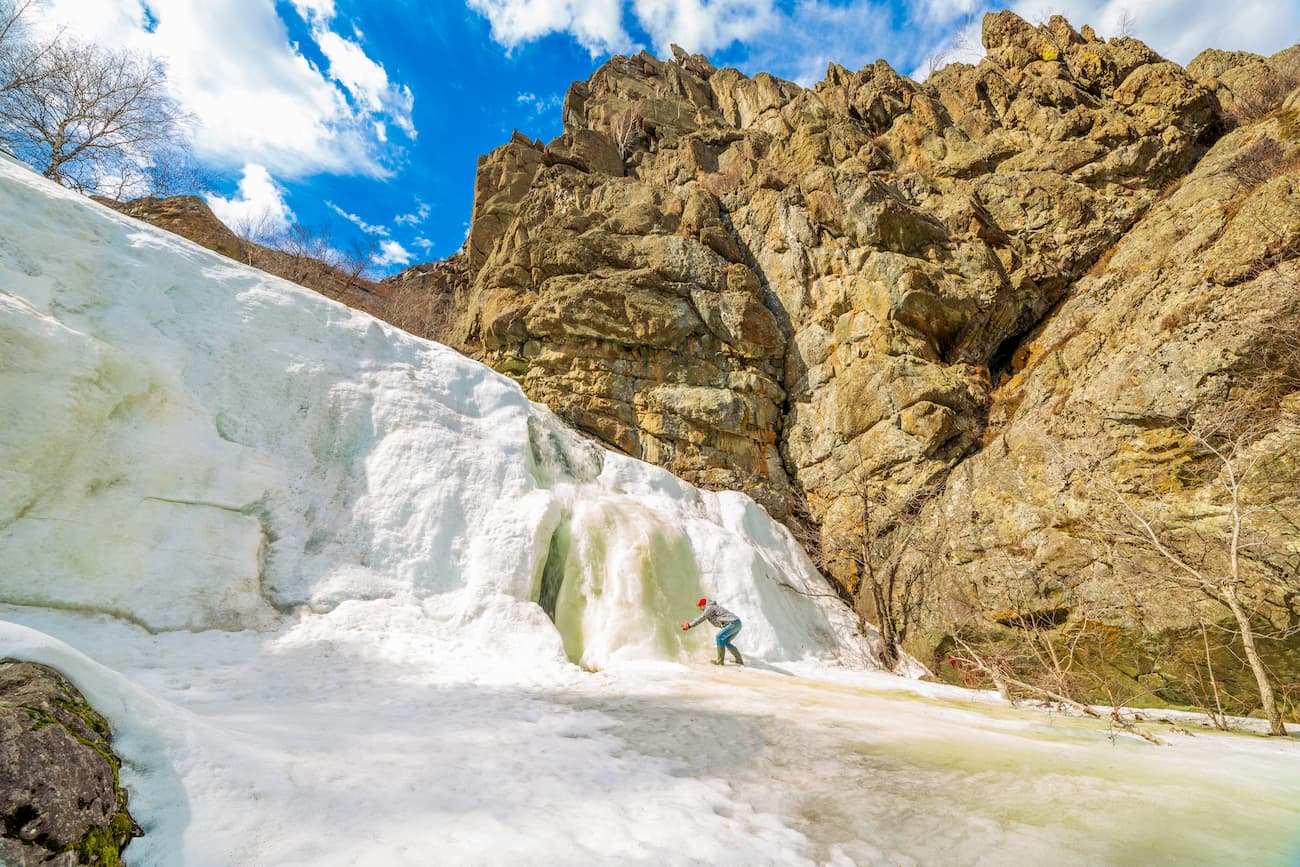
The waterfalls are also numerous. Here is the largest waterfall in the South Urals – the Gadelsh Falls. It looks most majestic in spring when the snow in the gorge has already melted and the river is still full. The waterfall has three cascades, 26 m high. In the gorge around the waterfall, you can find jasper and its varieties.
The Ufa Plateau has beautiful karst springs, including the Krasny Klyuch spring (The Red Spring), the largest spring in Russia. It is located in Nurimanovsky district on the outskirts of the village of the same name, on the left bank of the Ufa River. The Red Spring is basically a surface appearance of the underground River Yamanelga. In the Bashkir language, the name means ‘bad’, probably, because of sinkholes and blind creeks. The river originates on the slope of the Karatau Range, then goes underground and flows there for over 60 kilometres. The spring is located on the southwest tip of the Ufa Plateau, at the base of the left slope of the Ufa River ravine.
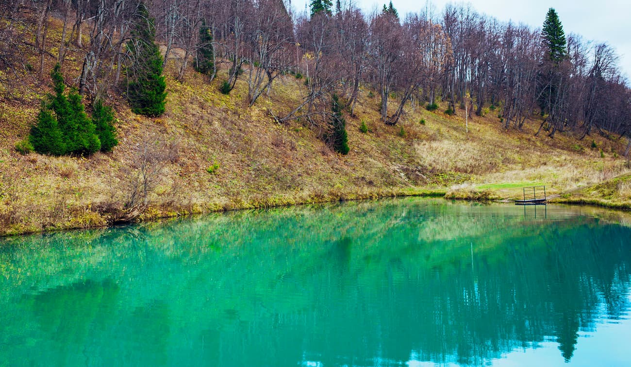
On the same plateau near the village of Sarva is Sarva Lake or Sarvinskoe. The lake is small, about 80 m in length and 38 m in width, but its depth of impressive 38 m, in connection with this it is much loved by divers. The lake is an outlet of an underground river. Transparent bluish-green water allows you to see how the rocky bottom goes steeply down. The visibility is about 10 m deep. The water here is clean, transparent and cold – all year round its temperature is about +5 degrees Celsius (+41F). Swimming in such cold waters is only for the brave-hearted or hardened divers. The lake doesn't freeze in winter.
Another wonder of the region is the Kurgasak Spring. It is located on the left bank of the river Yuryuzan, 3 km south of the resort Yangan-Tau in the village of Komsomol. The Kurgasak mineral spring flows from the spurs of the Karatau mountain range. The water, rich in minerals, rises from an impressive depth of 600-800 m along a tectonic fault and comes from several powerful craters. The healing water of the spring belongs to the hydro carbonate, magnesium-calcium type of water, which has many microelements important for the human body. It also contains radioactive radon. Kurgasak spring water purifies, strengthens the body, helps to detox. The water temperature at any time of year is +16 degrees Celsius (+61 F). There is a hotel built near the spring, and a small artificial lake was created where you can swim.
Zoo in Kulmetovo village (215 km from Ufa city) is a zoo-farm with donkeys, ponies, horses and camels. In summer, there is a parking lot for rafters on the river Ai, in winter, there is a small tubing track. Ski lifts are under construction. The Tashly horse-racing farm (30 km from Ufa) hosts not only horses by camels as well. There is an indoor diving centre to boot.
The gate to the region is Ufa, the capital of the Republic of Bashkortostan. The transport network is well developed, there is the international airport Ufa, a railway station and an intercity bus service. The total number of towns in Bashkiria as of 2019 is 21, the five biggest being Ufa (est. 1574), Sterlitamak (est. 1766), Salavat (est. 1954), Neftekamsk (est. 1963) and Oktyabrksky (est. 1946).
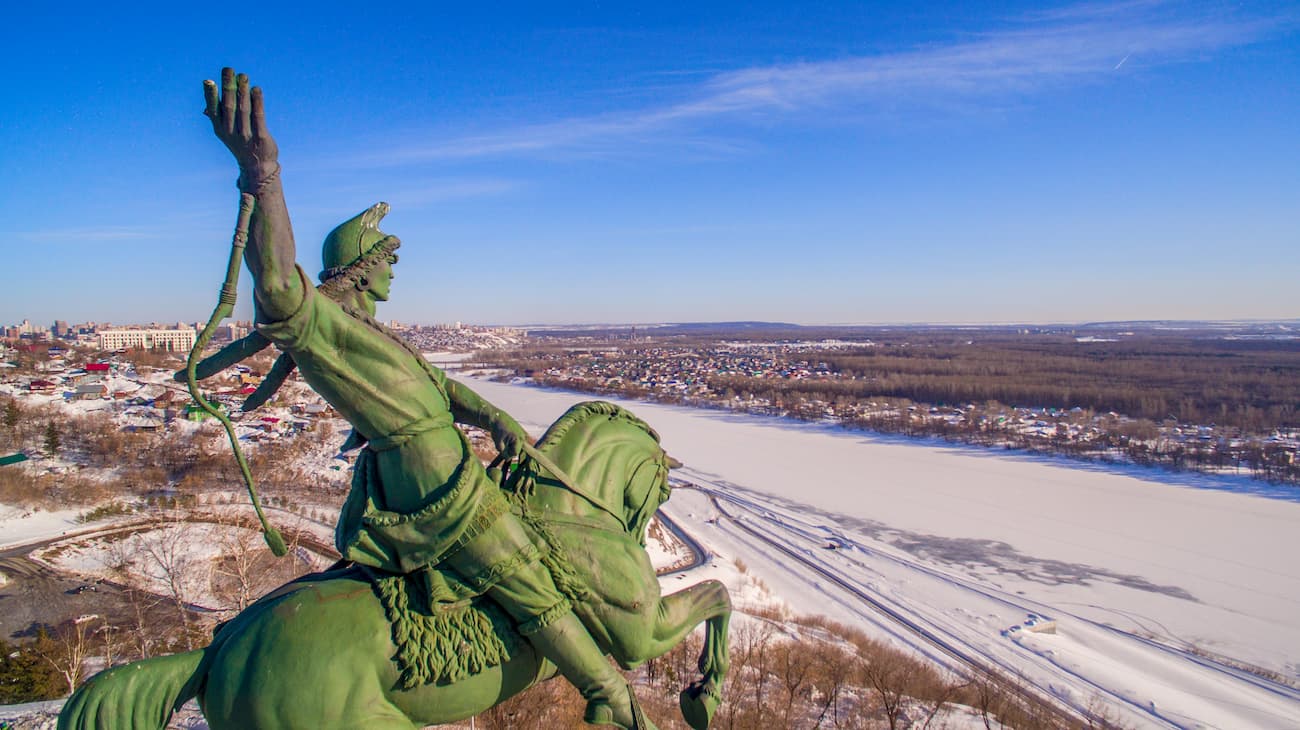
The city dates back to 1574 when a border fortress was built to explore with the frontiers. Less than 500 onwards and it is one of the three longest cities and most spacious cities in Russia. It is also among quite populated areas, the population of Ufa is 1,128,787 people as of 2020. The main symbol not only of the city but also of the entire Republic of Bashkortostan is the monument to Salavat Yulaev, the national Bashkir hero. This equestrian statue reaches a height of 10 m and is located on the bank of the White River. Around the monument, there is a place for nice strolls – the garden named after Salavat Yulaev where you can admire the panorama of the White River and remote areas of Ufa.
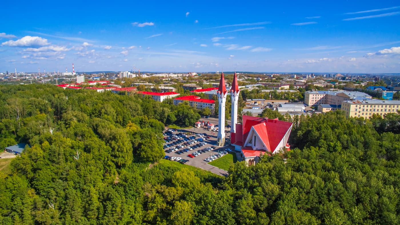
There are 6 mosques in the city, among which is the grand mosque-madrasah Lala Tulip built in the form of a tulip flower and famous for its stained-glass windows. Its high minarets (53 m) make it the third-highest mosque in Russia. The city has well-preserved orthodox churches as well. There is the oldest of the churches, the Protection Church, as well as St. Sergius Cathedral and the Cathedral of the Nativity of the Virgin. Ufa is a green city with many parks and squares. You can take a boat ride from the embankment of the White River in summer when the river is navigable.
Ufa museums are well worth a visit. There is the National Museum of Republic Bashkortostan, the Bashkir Art Museum, the Memorial House-Museum of Aksakov, the House-museum of Hudayberdin, the Museum of Rock (Ufa is called the capital of Russian rock music with so many famous rock musicians being born here), the Museum of Archeology and Ethnography of the Institute of Ethnologic Research of RAS.
There are several theatres in the city: the Bashkir Opera and Ballet Theatre, the Bashkir Academic Drama Theatre, the Russian Drama Theatre of the Republic of Bashkortostan, the Alternative Theatre called the Perspective.
The modern architecture of Ufa features the building of the Congress Hall, next to it there is an amphitheatre and a square where mass public events are held. This square has a set of seven yurts of the ethnic village called Vatan, you can find it if you move closer to the river. These yurts reflect the identity of the Republic of Bashkortostan, its customs, folk crafts, details of traditional Bashkir life, there are an open library and a lecture hall as well as a public catering area where you can taste the national cuisine.


