
Scan the QR code and open PeakVisor on your phone
Sverdlovsk Oblast is home to 1,210 named mountains. The highest is Gora Konzhakovskiy Kamen’ at 1,569 m.
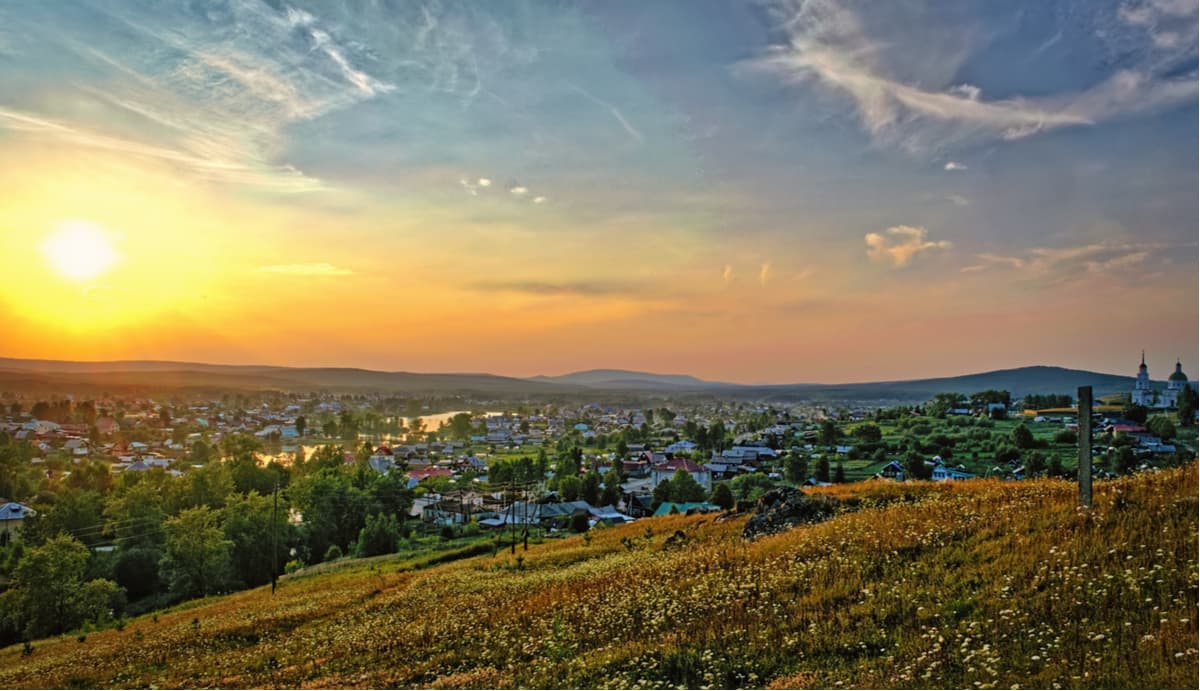
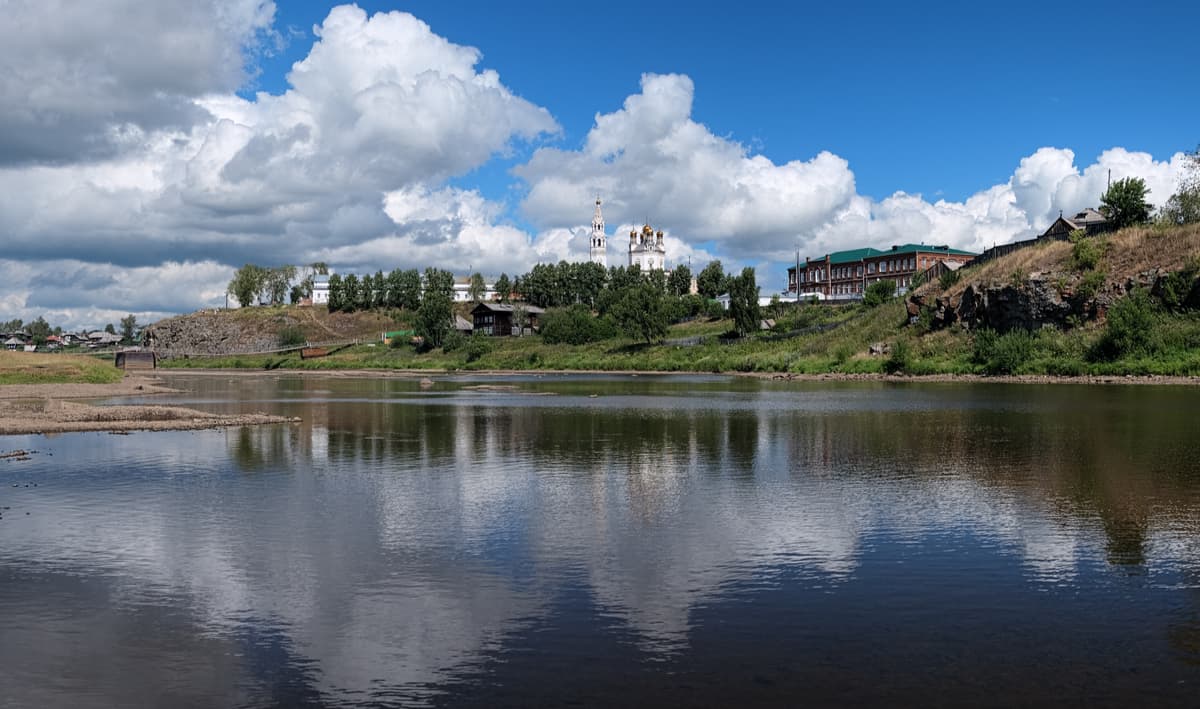
The Sverdlovsk Region territorially covers practically the entire Middle Urals and part of the Northern Urals. The region is usually associated with the Urals in general, and the city of Yekaterinburg, its administrative centre, is called the capital of the Urals. This city is also the centre of the Urals Federal District.
In earlier times, the region was part of the Siberian province, then part of the Trans-Ural region of the Perm province of the Russian Empire. As an administrative unit, the Sverdlovsk Region was separated from the Urals Region in 1934 and finally appeared on the maps as an independent entity. It received its name from the regional centre – the city of Sverdlovsk, which is actually Yekaterinburg, but the city was renamed in the Soviet times to commemorate the revolutionary Yakov Sverdlov. After the collapse of the Soviet Union, the city was given back its historical name – Yekaterinburg, but the region was not renamed, thus the discrepancy. The same story happened with Saint Petersburg and Leningradskaya Region.
The Sverdlovsk Region borders the Komi Republic and the Khanty-Mansi Autonomous Region in the north, the Tyumen Region in the east, the Kurgan and Chelyabinsk Regions in the south, the Republic of Bashkortostan and the Perm Territory in the west.
There is a conditional border between Europe and Asia running from north to south through the whole Sverdlovsk Region. The area of the region is 194 307 sq. km., the length from north to south is 660 km, the distance between the western and eastern extremes is about 560 km. The population of the region is 4.3 million people. There are 47 cities in the Sverdlovsk Region.
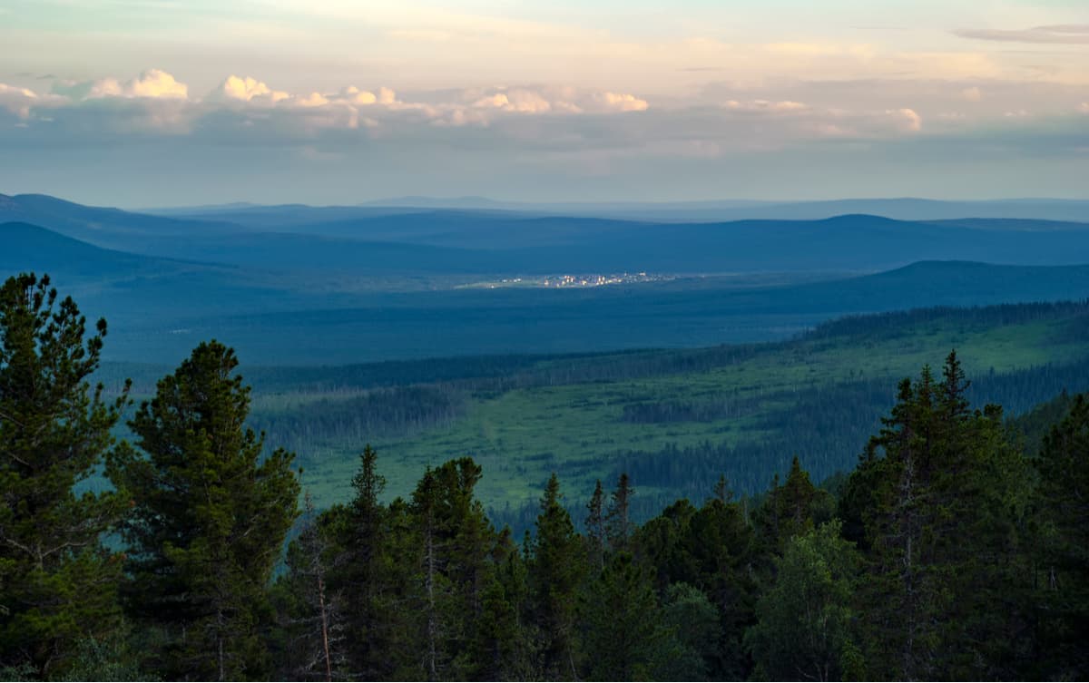
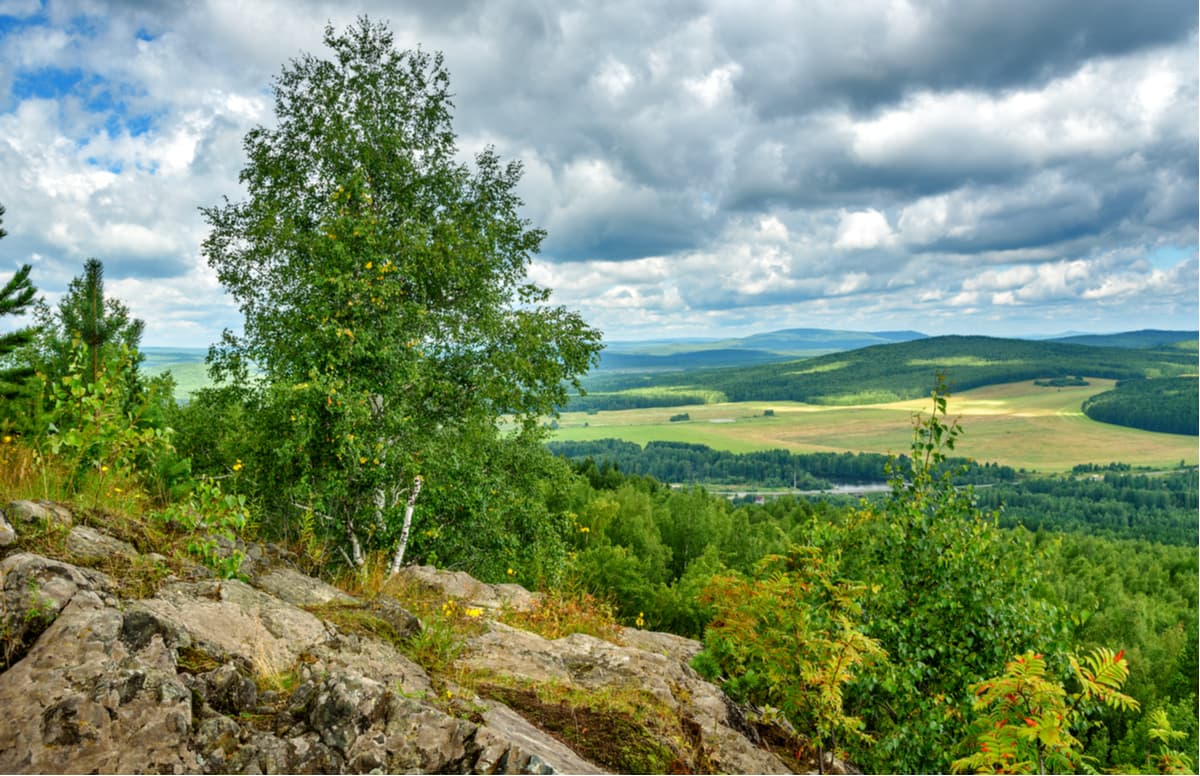
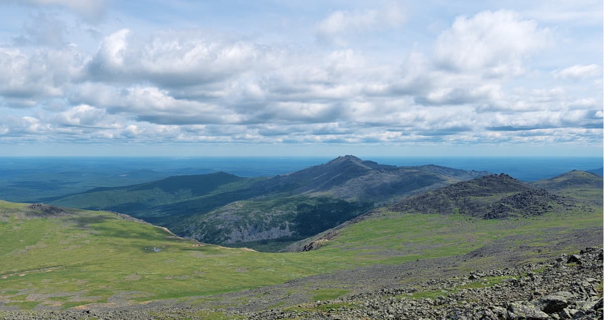
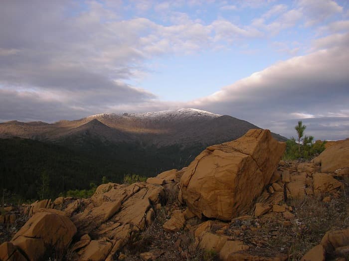
The relief of the region is diverse. The western part is mountainous, whereas the central and eastern parts are plain. The Main Urals Range extends from north to south. The highest point in the Sverdlovsk Region is Konzhakov Stone (1,569 m).
The vegetation is dominated by coniferous and mixed forests, mainly birch, pine, spruce, less often aspen and cedar, while in the extreme south-east there are some forest-steppes. Forests cover about 82.3% of the territory. Mountain slopes up to 600 m high are covered with dark coniferous northern taiga forests (spruce, fir, cedar). The mountains, passes, plateaus starting from the height of 800 m and higher are covered with rocky tundra.
The fauna of the Sverdlovsk Region is filled with typical forest representatives. There are 66 species of mammals, 6 species of reptiles, 9 species of amphibians, 228 species of birds, and 48 species of fish.
The watershed between the basins of the main tributaries of Russia's two largest rivers, the Irtysh and the Kama, runs along the ridges of the Ural Mountains and the eastern foothills in the south of the Sverdlovsk Region. The region's river network includes 18,414 rivers with a total length of more than 68,000 km. They are characterized by mixed feeding (by ground and meltwater, and atmospheric precipitation) with a predominance of snow (snow feeding is about 85-90% in the southern areas of the region and about 60-65% in the Ural Mountains). The rivers freeze in late October-November and open up in April. The main river in the Irtysh basin is the Tobol with its tributaries of the first, second and third-order: the Iset, Tavda, and Tura (tributaries of the Tobol); the Nitsa, Pyshma, Tagil (tributaries of the Tura); the Lozva, Sosva, and Pelym (tributaries of the Tavda). The main rivers in the Kama basin are the Chusovaya River (a tributary of the Kama River) and its tributary – the Sylva River, and the Ufa River (a tributary of the Belaya River).
Swamps and marshlands occupy about 10.53% of the total area of the region (20461 sq. km.). The largest marshes are located in the north-east, in the Tavda river basin.
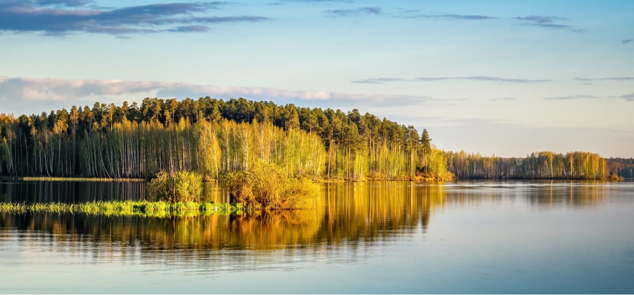
The Sverdlovsk Region has more than 5,850 lakes and artificial water bodies with the total area of about 1.35 thousand sq.km., including about 2000 lakes with the area of more than 0.01 sq.km, as well as a number of even smaller lakes (according to the Institute of Lake Science of the Russian Academy of Sciences).
The largest lakes in the region are the Pelymsky Tuman (its area is 65 sq.km) and the Vagilskiy Tuman (half the size of its bigger brother, it is 31.2 sq.km.). The largest artificial lakes are the Beloyarskoye reservoir on the Pyshma River and the Volchikhinskoye reservoir on the Chusovaya River. The Sverdlovsk Region takes the last place by the total area of lakes and artificial reservoirs, as well as by lakes among the regions of the Ural Federal District. The size and number of lakes, artificial reservoirs, swamps and wetlands is unstable and tends to change depending on natural factors such as water regime, climatic phenomena, swamping, etc. and anthropogenic factors, viz. excessive drainage or, conversely, watering of territories, regulation of river flows, etc.
Underground water reservoirs are also powerful and aplenty in the Sverdlovsk region which ranks the third in terms of the volume of forecasted groundwater resources (after the Khanty-Mansi Autonomous Area and the Yamalo-Nenets Autonomous Area).
The climate of this area is moderately continental. The Ural Mountains partially protect the region from cyclones and anticyclones. Strong winds and snowstorms are quite rare. As we move away from the Main Ural Mountain Range and towards the south of the region, the air temperature increases and the amount of annual precipitation decreases. But on the whole, despite the large territory of the region, climatic conditions in all parts are quite similar. Seasons are well-pronounced, and precipitation is evenly distributed throughout the calendar year. Summer is warm, characterized by moderately hot weather without any extremes. The warmest month is July, with an average daily temperature of +21 to +26°C (+70 to +79 F), and in the mountains, it is only +14 to +16°C (+57 to +61 F). If you get very warm and dry air from Kazakhstan and Central Asia at this time of year, the daytime temperature can reach +35 to +40 ° C (+95 to +104 F), whereas the invasion of the Arctic air can bring some frosts at night frosts. Winter is freezing cold with dense snow cover. January is the coldest month of the year, with average daily temperatures ranging from -14 to -20°C (+7 to -4 F). However, during the Arctic cold air onslaughts, there are severe frosts down to -48 to -50 °C (-54 to -58 F), and in the northern parts of the region down to -55 °C (-67F). Thaws are also possible when the day temperature rises to +8°C (+46 F) in winter, but this is very rare.
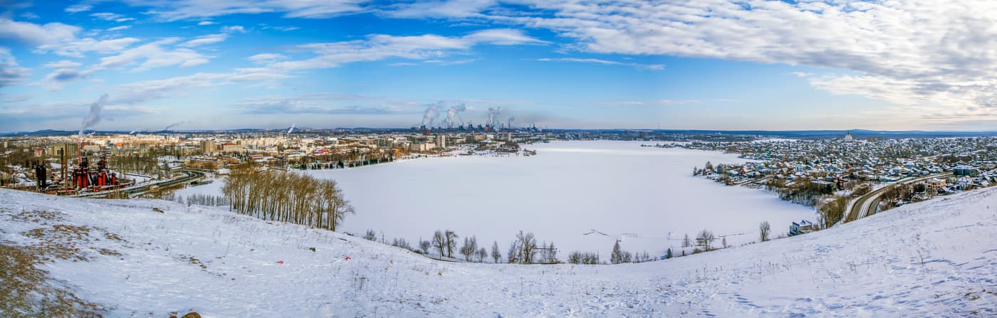
The Sverdlovsk Region is one of the largest industrial centres in the country due to extensive mining. In terms of industrial output, it ranks second in Russia after the Moscow Region. There are rich deposits of bauxite, gold, various minerals, platinum and asbestos. The territory is blessed with many deposits of precious and semiprecious stones, they are mainly located in the so-called ‘gem strip’ running on the eastern slopes of the Ural Mountains.
There are many interesting places in the Sverdlovsk Region that attract travellers. In 2017, it was included in the top 10 most popular tourist regions of Russia. This area is especially suitable for aficionados of active rest.
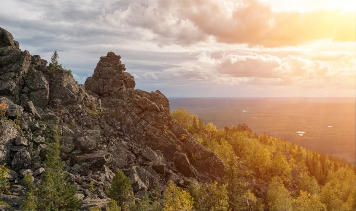
Beautiful and majestic mountains attract herds of tourists in summer and winter alike. You can go hiking, skiing or drive snowmobiles here. The highest of the mountains are in the north of the Sverdlovsk region together with the main peak Konzhakov Stone (1,569 m). Tourists sometimes call the mountain Konzhak. The mountain is 450 km north of the city of Yekaterinburg. There is no cellular communication, but you can spend the night in a tent. Every year on the first Saturday of July, on the slopes of this mountain massif there is held an International Mountain Marathon Konzhak. It is a challenging 42-km distance running along the mountain trails and rock rivers of Konzhakov Stone, over the rivers and snows fields. The run goes from the river Konzhakovka to the top of the mountain and back.
Next to Konzhakov Stone, in its eastern spur, there is Serebryansky Kamen Mountain (also called Serebryanka). The mountain is almost 300 m lower, but it is as frequently visited as Konzhak. The top of the mountain is crowned with huge and steep rock bastions. Its spurs are like the spine of a dragon. In winter, the mountain is often compared to the kingdom of the Snow Queen, so everything here is majestic and impregnable (rocks, ice and snow). On the slope of the mountain in the olden days there used to be a rescue base, the only remnant of that is a sauna. If necessary, you can stay there for a sleepover (it accommodates 3-4 people). The nearest connection with the Ministry of Emergency Situations is at the tourist base Serebryansky Kamen at the intersection of the highway Karpinsk-Kytlym with the river Serebryanka. Here you can spend the night, visit the bathhouse, there is a parking lot as well.
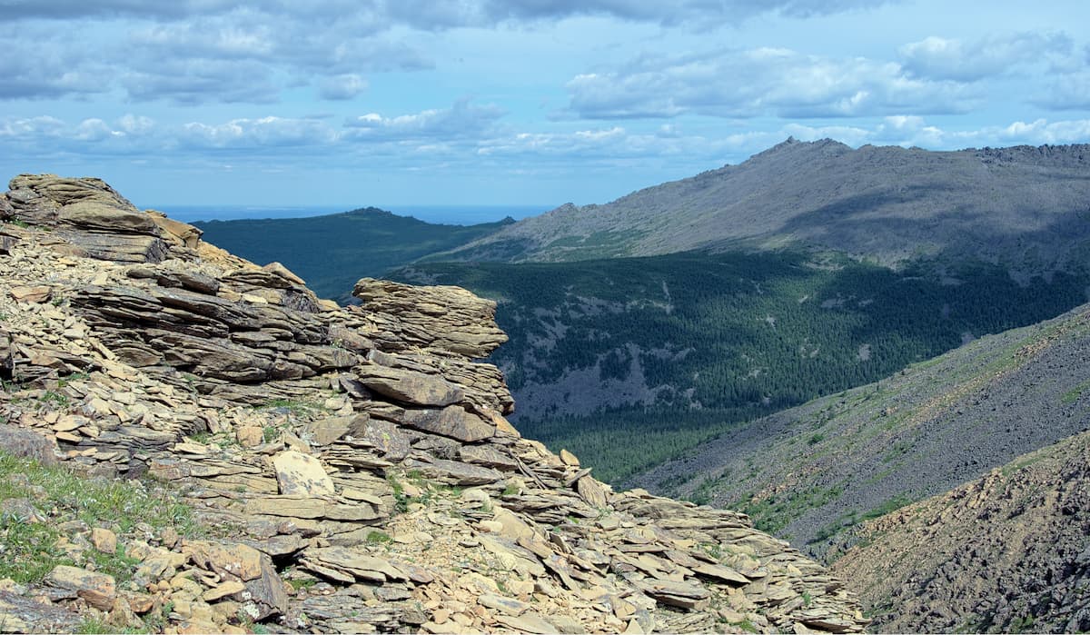
Other high mountain ranges include the Main Urals Range, the nearby Denezhkin Stone Range and the Kvarkush Range. Between the Main Ural Ridge and Denezhkin Stone Mountain there is the Zvezda camping site. There are also no cellular communications or regular transport links in the area. On the Kvarkush Range you can visit the Zhigalan Falls, a five-stage waterfall which is considered one of the most beautiful waterfalls in the Urals. By the end of autumn, the waterfall freezes, which attracts fans of ice climbing.
In the central and southern parts of the region, the mountains are low but easily accessible and no less beautiful. Among them are Mounts Kachkanar, Volchikha, Shunut, Sinyaya (Blue), Azov-Mountain, and the Merry Mountains.
Kachkanar mountain is 270 km away from Yekaterinburg by the Serov road. It is a ridge with two peaks – Great Kachkanar (878 m) and Little Kachkanar (866 m). It is better to start climbing from the top of Mt Malaya. There was founded a monastery called Shad Tchup Ling (Place of practice and realization) on the northeast spur of this mountain in 1995 by Lama Sanje Tenzin Dokshitom (Mikhail Sannikov). When you come up to the beginning of the log path to the monastery, you are invited to take a brick with you up to the monastery so that your path would cease to be some common walking, but will gain the meaning. The bricks are needed for the construction of the site which is still underway today. There are several monks living on the mountain at any time of year. The guests are welcomed by the Awakening stupa. A stupa is a Buddhist commemorative monument usually housing sacred relics associated with the Buddha or other saintly persons. Another stupa is hidden in the rocks from prying eyes. Anyone can come to the monastery as a guest with an overnight stay or as a volunteer worker. From the monastery, the trail continues to Camel Rock, from where you can enjoy views of the town of Kachkanar and the huge steps of the Kachkanar Mining and Processing quarry (EVRAZ KGOK, formerly called KGOK Vanadiy, an iron ore producer). A small lake formed by flooding a quarry is located 500 m from the beginning of the trail to the monastery. From here, bypassing the monastery, there is another road to Camel Rock.
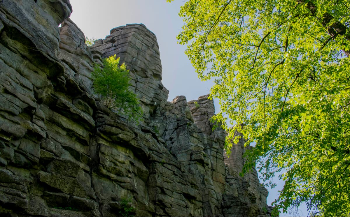
If you are pressed for time, within the city limits of Yekaterinburg there are beautiful rocks with bizarre forms, the most famous of them are the rocks of Peter Gronsky (aka Petrogrom or Grony), the Devil's Fortress, and the Seven Brothers. Tourists admire their beautiful views, and climbers train here to conquer the rocks of varying difficulty.
The rocks of Peter the Gronsky are stone remains on top of the Upper Iset granite massif (370 m high). The height of the rocks themselves is 15 m. They have several names. On the maps, they are called the rocks of Peter the Gronsky. In the Soviet times, it was believed that revolutionary workers headed by Peter Gronsky hid their weapons here and held mausoleums. However, local historians believe that Peter Gronsky, who lived at the Iset railway station in those years, could not participate in the revolutionary events, because he was still very young. Scientists call the rocks Petrogrom, in honour of Peter the Thunderer. They say that lightning strikes here very often. And among the tourists, there's a simpler name – Grony aka Thunderstorms. According to archaeological excavations, in ancient times there was a metallurgical production here, the ore was supplied here from the Sugra mine. Nowadays, it is a popular weekend route oftentimes taken with children at any time of year. From the rocks, there is a picturesque view of Lake Iset. The Petrogrom Rocks are located to the north-west of Yekaterinburg. You can get to them by public transport: by train to Nizhny Tagil, go 479 km to the station. The trail to the rocks starts on the right of the stop. A visit to the Petrogrom Rocks can be combined with a trip to the rocks of the Devil's Fortress and Iset Lake.
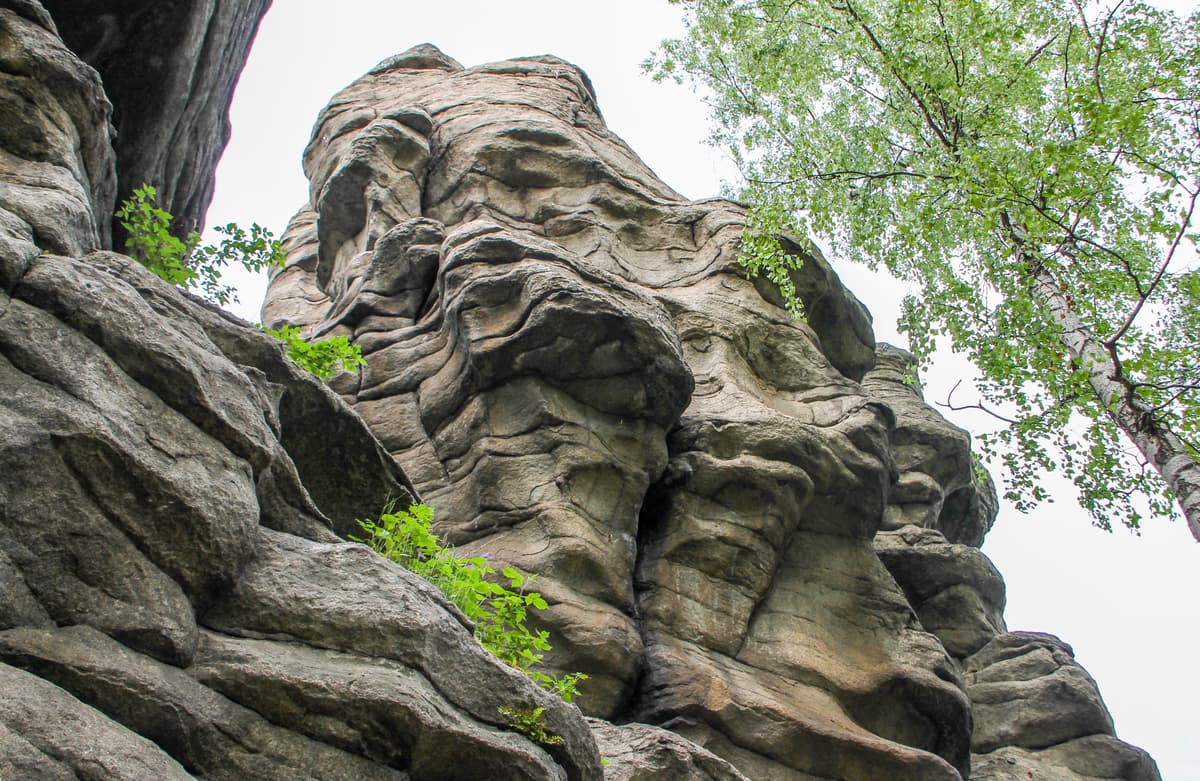
The Devil's Fortress is both a mountain (the absolute height is 347 m) and a rocky massif on its top. The rocks are a mighty granite ridge with a height of 20 m having a folded structure. As for the name, one version of the place was "damned or devilish" because if you look at such an erratic heap of granite slabs them seem so unnatural as if laid out by an evil force. In the process of excavations, there were found traces of ancient people staying here. Probably the first locals made sacrifices here to appease the gods. Mass visitation to the Devil's Fortress began at the end of 19th century after the Ural railway was opened. In 1980-1985, this place was closed to visitors. During this time the territory was cleared, garbage was taken out and the area was equipped with a climbing wall, one of the first in the USSR. For climbers, the northern side of the remains is of the greatest interest. The southern side is more gentle and goes down as if in steps to the valley of the Semipalatka river, a tributary of the Iset River. A wooden staircase leads to the very top of the Devil's Fortress. You can visit the Devil's Fortress by taking a train from Yekaterinburg to Iset station, the rocks are 6 km from this station.
The Seven Brothers Rocks, one of the most popular rock idols in the Middle Urals, are the highest rocks in the vicinity of Yekaterinburg. They are located at the top of Mount Semibratskaya (422 m) and belong to the Upper Iset granite massif. The height of the idols is up to 32 m. In the upper part, the mount is dividing into separate stone columns of folded structure, reminiscent of giants or brothers, from which the name comes. Actually, there are more than seven ‘brothers’, and next to them there is a remnant called ‘a sister’. There are many legends associated with the name of the rocks, and most of them imply that the brothers turned into stone. No traces of ancient people were found here. It could be connected with the prohibition for ordinary people to visit this place because it was believed that gods lived there. Nowadays there are a lot of tourists here, climbers have the training and sometimes competitions. Nearby (1.5 km) are the Rocks of Three Sisters. There are indeed three stone idols of no more than 20 m high. It is easy to climb to the south side. On the north side, there is an interesting big grotto. You can get to the Seven Brothers from the town of Verkh-Neyvinsk (7 km) and to the village itself take a train from Yekaterinburg.
Mount Bunar (612 m), which is the highest in the vicinity of Verkh-Neyvinsk and Novouralsk, has the Bunar idols. There are no idols on the top itself, they are scattered all over the slopes of Mount Bunar. It is not easy to find them among the dense taiga filled with windbreak. There is a belief that there are 999 idols in these forests. You climb one of them, you open your eyes to the next one. By the way, real idols which were worshipped by the peoples who lived here in ancient times must remain hidden from curious eyes. Most of the tourists manage to find two rock sculptures which are called very dramatically: the First and the Second. Not far from Mount Bunar, there are mineral deposits. To the south of Mount Bunar on the Kamenka River, there is one of the few deposits of green garnet in the Urals - a diamond-like demantoid. In the east, in the environs of the former mountain, there is now the Zaplotny Stone quarry where they mine tourmalines, chlorites, sphenes, and radiated zeolite. It is better to start the trip to Mount Bunar from Belorechka settlement or from the railway station Neivo-Rudyanskaya.
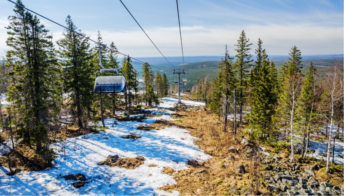
The relief of the Urals Mountains made it possible to build many ski centres in the Sverdlovsk Oblast. The largest of them are located on Belaya, Volchikha, and Yezhovaya mountains. In the city of Nizhny Tagil on Mount Dolganaya there is a ski jump complex where international competitions are held.
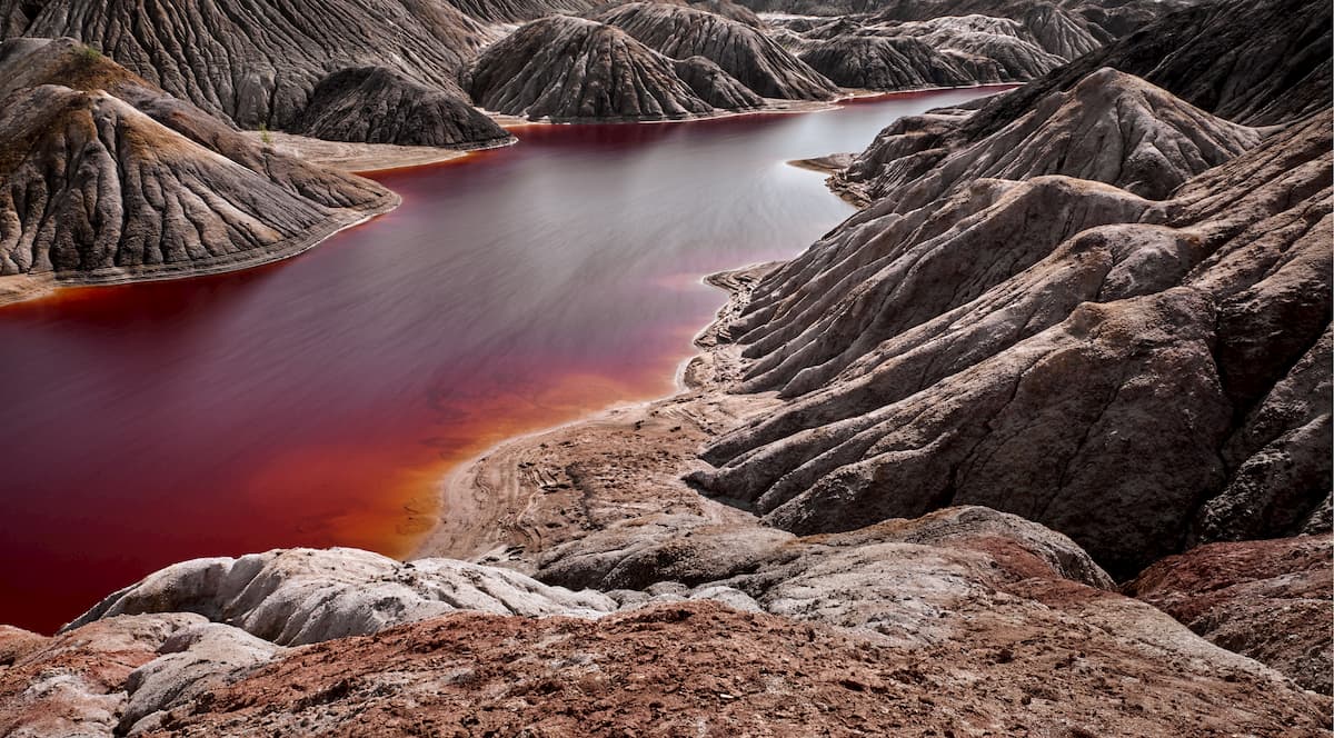
In the Sverdlovsk Region, you can see ethereal landscapes which the locals call the Urals Mars. Unusual beautiful landscapes reminiscent of Martian and sometimes lunar ones appeared on the place of former clay quarries. The official name of this place is Poldnevoy Section of the Troitsko-Baynovsky refractory clay deposit located south of the town of Bogdanovich, near the Poldnevoy village. The deposit is 20 km long and has an area of about 75 sq.km. It is one of the largest reserves in the Middle Urals. The clays have different colouring ranging from white and light grey to black with admixtures of iron oxides and humus matter. Due to this, the local clay quarries differ considerably in colour from each other. Clay hills have the appearance of ridges of different sizes. There are several lakes with water of orange and brown-red colour which is explained by the presence of pyrite in water. Bathing in such water is dangerous. Walking in this area can be likened to walking on another planet.
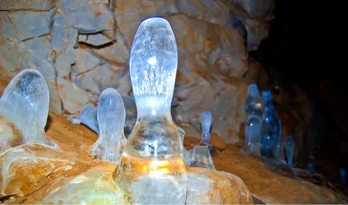
Thanks to karst phenomena, there are many caves, gaps, sinks, arches and other karst formations in the mountains. However, the exploration of grottoes and caves continues to this day and even geographers make very tentative guesses about their numbers. There are about 80 caves in the Sverdlovsk Region that are more than 50 meters long and deeper than two meters.
The longest caves are the Severnaya Cave (2,250 m long), the Bolshaya Yurtishenskaya Cave (930 m long), the Tayozhnaya Cave (850 m long), the Smolinskaya Cave (630 m long), and the Druzhba Cave (500 m long).
The deepest caves are the Sadykovskaya (88 m), the Tayozhnaya (64 m), the Saranskaya (49 m), the Vetrovaya (45 m), and the Volkovskaya Mine (44 m).
The most popular caves in the Sverdlovsk Region are the Smolinskaya, Druzhba, and the Arakayevskie caves. The Smolinskaya Cave is located two kilometres from the village of Beklenishcheva in the Sukholozhskoye District. The Druzhba Cave is located near the Iset River and the Revun rapids. The Arakayevskie caves can be found near the village of Arakayevo in the Deer Streams Nature Park.
The Sverdlovsk region has many interesting places to visit:
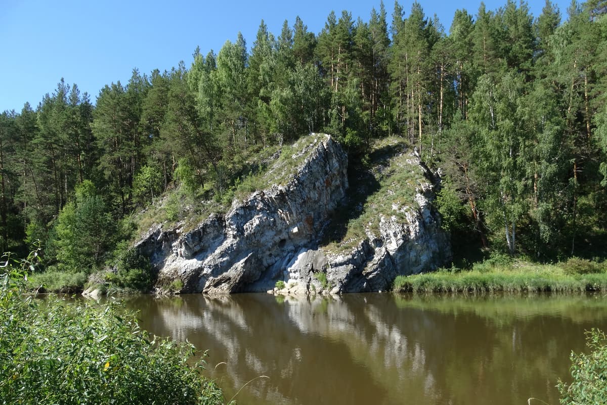
Fans of water trips will be interested in rafting along the picturesque rivers Chusovaya, Sosva, Lozva, Serga, Iset, Rezh, Kakva, Ivdel, Tagil, Ufa, Neiva, Pyshma, Shishim, Serebryanka, Sulem, Ay, and Bardym. The most stunning of them is the Chusovaya River. On the banks of many rivers, there are plenty of beautiful rocks of various shapes and sizes.
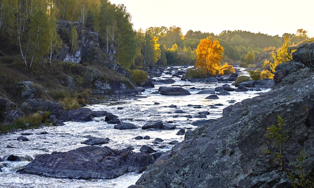
For the lovers of extreme pleasures, the Revun rapids on the Iset River are the biggest temptation. The Iset River is a calm, not a mountain river but for 500 m it turns into a bubbling stream and shows a duel of water and stone. The complexity category of the rapids varies depending on the season and water level in the river from the 2nd to the 5th at the end of March or in April during the flood. It is often possible to watch rafters' competitions or training sessions in canoes, catamarans, kayaks on the Revun rapids. Beklenishchevskie rocks (20-30 m high) surrounding the rapids lure all types of climbers, experienced and beginners alike. In 1989, the last All-Union Tourist Con was held here. In the vicinity of Revun, just 1.5 km away, there is the Smolinskaya cave (500 km downstream, on the opposite bank and 800 m deep into the forest to be exact), which can be visited after rafting.
The following zoo nurseries are located in the Sverdlovsk Region:
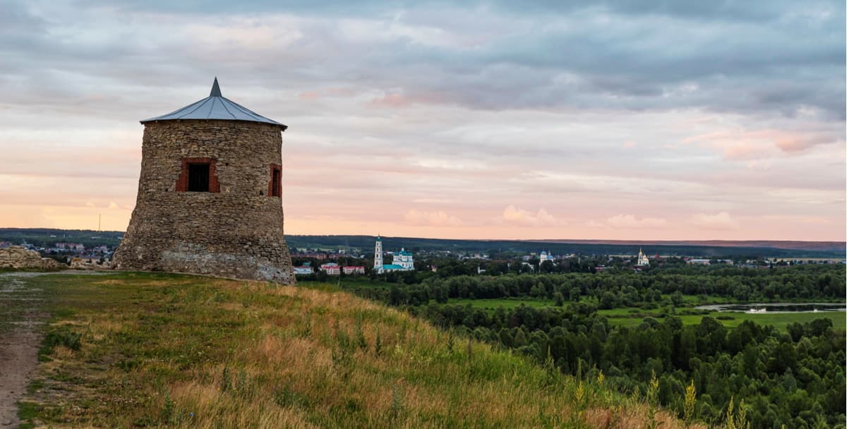
Those who want food for thought and a calmer but no less interesting experience should go to the major cities of the Sverdlovsk region where you can visit their temples and monasteries, museums, and get acquainted with local culture and traditions.
The main pearl among the cities of the Sverdlovsk region is its capital city – Yekaterinburg. You can get to Yekaterinburg in one of the following ways:
You can take a bus, suburban train or a taxi to other towns of the region from Yekaterinburg.
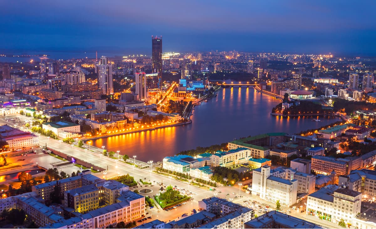
By order of Peter the Great, the city of Yekaterinburg, also spelt as Ekaterinburg, was originally established in the Urals as an industrial and trade centre. In 1723, the Yekaterinburg plant was built on the Iset River. This year is also considered the birthday of the city. Its founders are Vasily Tatishchev and Georg Wilhelm de Gennin. The city received its name in honour of the wife of Peter I, the future Empress Catherine I. The city has a favourable geographical location. Yekaterinburg is located on the eastern slope of the Ural Mountains, in the Middle Urals. The Ural Mountains in this place are low, they are basically hills, which provides favourable conditions for the construction of railways and large roads here. The Koltsovo International Airport is also located here. Now Yekaterinburg is one of the largest transport and logistics hubs. The city has many shopping and office centres. Yekaterinburg is the most compact city with a population of one million people in Russia. Its area is 490 sq. km. In terms of population (about 1.5 million people) it is the fourth city in Russia after Moscow, St. Petersburg, and Novosibirsk. The main river of the city is the Iset. There are also ponds within the city limits: the Urban, the Upper Iset, and the Lower Iset ponds. All the tributaries of the Iset in the city except the Patrushikha River were hidden underground in the past years. Yekaterinburg is the only city in the Urals with metro, and for a long time, it was considered the shortest in the world.
It is convenient to start a brief acquaintance with the history of the capital of the Urals with the Plotinka - the dam of the city pond that gave rise to the plant and the city of Yekaterinburg itself. A stone's throw from it, there is a monument to the founders of the city (Tatishchev and de Gennin), a chapel in honour of Catherine I and a fountain called the Stone Flower. In addition to the dam and the pond, you can visit the exhibition of large-size equipment of Ural factories in the open air. A walk along the embankment of the city pond and along the Iset River in the centre of the city will open views of the old buildings preserved here. In summer, you can take a boat ride on the pond.
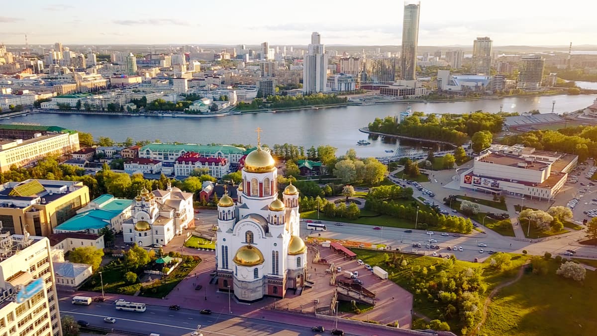
Another attraction is the Temple on Blood built on the site of the Ipatyev’s house. It is believed that during the Civil War in 1918 in the basement of Ipatyev's house the last Russian Emperor Nicholas II and his family were executed. The cathedral was built in the Russian-Byzantine style and divided into the Lower and Upper Temples. There are a firing room and a small museum in the tomb chapel of the Lower Temple.
Across the road from the Temple on Blood, on Voznesenskaya Hill, there is a palace and a park which is sometimes called the Yekaterinburg Acropolis. The estate of the Ural Kharitonov-Rastorguyev dynasty includes a park with an artificial pond and a gazebo-rotunda on it.
To get acquainted with the panorama of the city, it is worth visiting the observation deck of the skyscraper Vysotsky (the 52nd floor, height of the platform 186 m). There is also an observation deck in the business centre of Antey.
There are many theatres in Yekaterinburg, as well as a philharmonic, circus, zoo, and an aqua park. Museums are plenty as well, there is the Museum of History of Yekaterinburg, Museum of Ural History and Archaeology, Museum of Nature, Museum of Radio, Museum of Fine Arts. In addition, the museum complex is located in the Literary Quarter. In the Sverdlovsk Regional Museum of Local Lore, you can see the world's oldest wooden sculpture – the Big Shigir Idol, its age according to the latest estimates is 11.6 thousand years. The most modern museum in Yekaterinburg is Boris Yeltsin’s Museum located in Yeltsin centre. Yeltsin Center itself has become a large public, cultural and educational centre, which hosts many bright, interesting events in the city.
Among the natural sights within the city limits the most interesting are the rocks of Shartash stone tents and lake Shartash, and the Baran peninsula on Upper Iset pond.


Yes. Sverdlovsk Oblast has 1,210 named mountains. The highest is Gora Konzhakovskiy Kamen’ at 1,569 m.
The highest mountain in Sverdlovsk Oblast is Gora Konzhakovskiy Kamen’, at 1,569 m.
Sverdlovsk Oblast has 1,210 named mountains.


