Get PeakVisor App
Sign In
Search by GPS coordinates
- Latitude
- ° ' ''
- Longitude
- ° ' ''
- Units of Length

Yes
Cancel
❤ Wishlist ×
Choose
Delete
The Deer Brooks Nature Park is located in one of the most popular tourist areas of the Middle Urals, in the southwest of the Sverdlovsk Region. It was created in 1999 to preserve the wealth that nature of these places, and to give people the opportunity to get to know it better, to relax, to be in touch with its beauty. The total area of the park is 12,700 hectares and the area of the protected zone is 10,500 hectares.
The territory of the park includes a section of the Serga River valley, as well as part of the western slope of the Bardym ridge from the town of Lower Sergi to the village of Arakaevo.
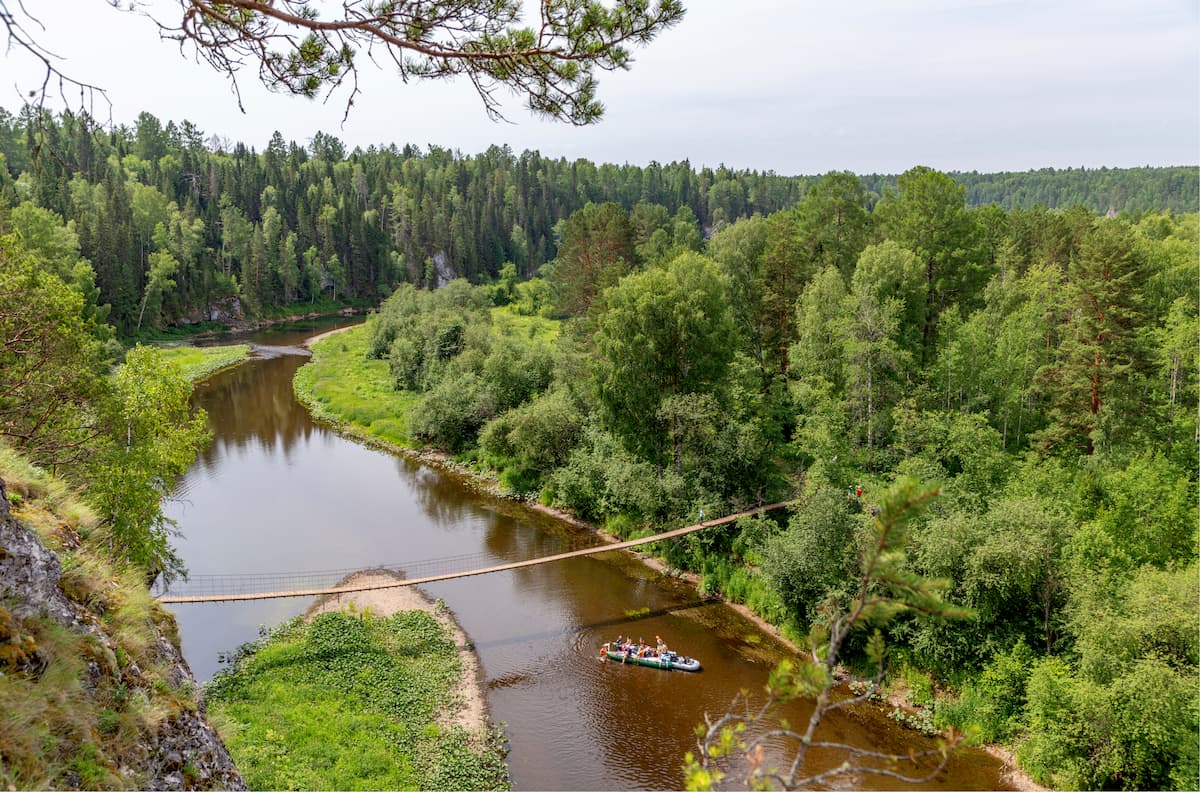
The Deer Brooks Park is attractive with its amazing scenery of the Serga River Valley. There is a great variety of natural and historical objects strewn everywhere: rocks, mysterious caves, peculiar karst formations etc. Most of the local caves are archaeological and historical monuments. Settlements of an ancient man dating back 15,000 years have been found here. One of the famous ancient rock paintings here is deer. Thus, it was the deer that became the emblem of the park and also defined its name.
The Serga River is the border of the West Ural low taiga and the Red Ufa forest-steppe. Due to the location, the richness of vegetation and uniqueness of the fauna is stunning. The main part of the territory is covered with spruce, fir, pine and birch forests with an admixture of larch and aspen. About 8000-10000 years ago, at the time of Melt Age, broad-leaved forests grew in the Serga River valley. Later, these forests were replaced by modern, taiga forests, but a number of species (relicts) that lived under the canopy of former broad-leaved forests can still be found today. In the undergrowth grow mountain ash, linden and rosehip. It is also rich in shrub-grass cover. The vegetation of floodplain meadows is diverse, and near the water itself, there are thick willow and alder thickets overgrown with hops. On hills with steep slopes and along steep river banks, there are areas of steppe vegetation. On the territory of the park, there are about 800 species of higher plants, about 30 of which are endemic and listed in the Red Book of the Middle Urals and Russia.
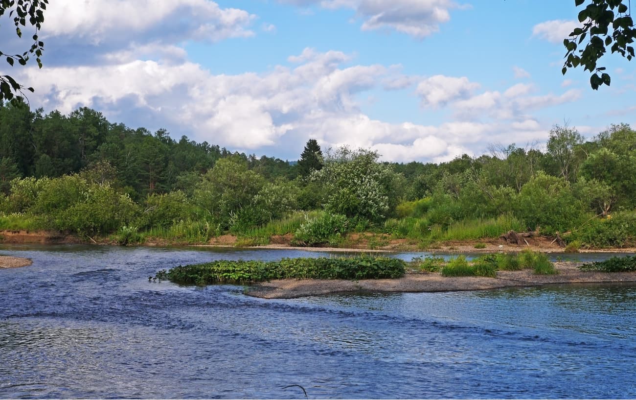
There are interesting big larch groves with trees about 300 years old, those are a botanical natural monument of regional importance. In the olden days, the local forest was cut down for processing into charcoal. However, larch charcoal was very fragile and resembled ash, so larches remained untouched and have survived to this day.
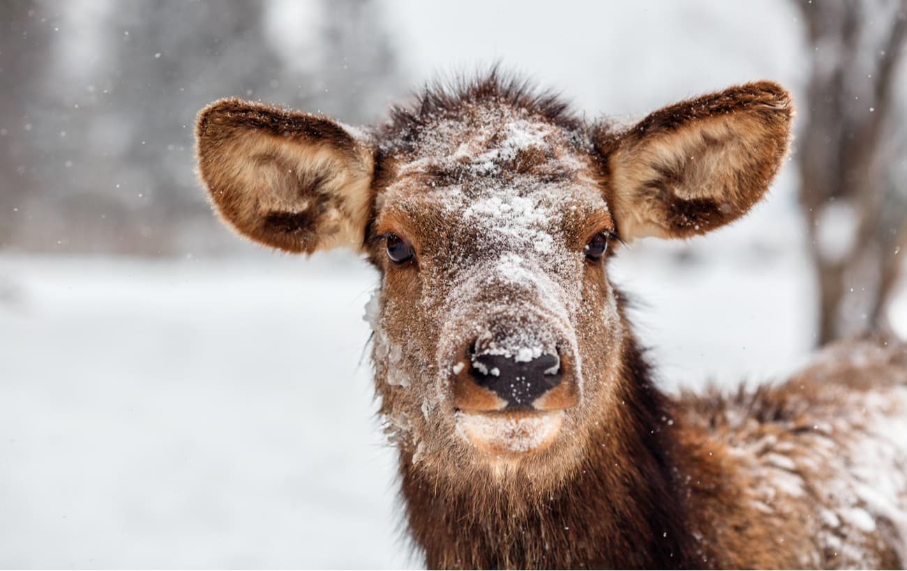
The park's animal world is diverse. Here lives the largest representative of the deer family – moose, and the master of the forest – bear. The smaller animals of these places include red-tooth shrews, foxes, hares, beavers, squirrels and others. In autumn, roe deer and wild boars go from here to other areas where the snow is less deep, and in spring they come back. There are about 150 bird species in the park. In the river, there are representatives of the fish fauna of the taiga zone: perch, rudd (Siberian roach), bream, crucian carp, pike, red finch, chub, asp, burbot (dogfish), loach and bleak. In recent years, the Serga River has become markedly cleaner, there are more sightings of grayling which demands better water purity. Some animals are listed in the Red Book of Russia and the Urals.
The likelihood of seeing an animal close to a tourist is low, as they usually avoid hiking trails. However, it is worth noting separately that vipers are quite likely to be encountered, especially on sunny days in open spaces and along sightseeing trails. The probability of encounters increases during the spring mating season in May. The viper from afar can be mistaken for a snag lying on the ground, so it is necessary to be vigilant and look carefully under your feet in order not to step on it.
Along the Serga River, there are many beautiful and unusual rocks with frequent fossil inclusions. Karst is widely developed here, so there are a lot of caves, grottos and other interesting karst formations.
Among the rocks can be distinguished: Karst Bridge Rock, Pisanitsa, Kissing Rocks, Leaky Stone, Frog, Light and many others.
There are 48 caves in the park. The most popular of them is the Big Arakayevskaya Cave, the Friendship Cave, the Big Failure Cave.
There are ecological trails to the main attractions of the Deer Brooks Nature Park. Away from tourist trails, but in the park's territory, there is the Failure of Eagle Mountain (Eagle Failure) and the Katnikovskaya Cave.
The Serga River is the real gem of the Deer Brooks. It is one of the most beautiful lesser rivers in the Middle Urals. Its length is relatively small – only 110 km. The river originates on the western slope of the Konovalovsky Uval Range in the Mokhovoye Bog near Mount Shunut and flows into the Ufa River thus becoming its right tributary. The river valley is about 80 million years old and there are rare and endangered plant species on its banks.
The river flows among high limestone rocks and in those whitish walls you can spot the gaping dark entrances of many caves. The views opening up from the cliffs towering on both banks of the Serga River show amazing Ural landscapes.
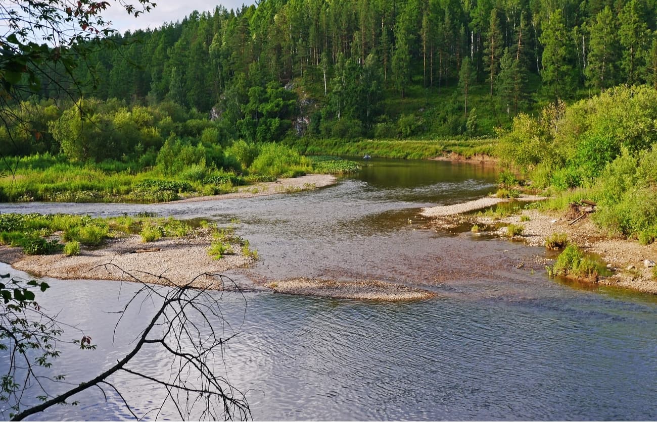
In the Serga River valley, there is the largest underground water deposit in the Urals, pumping of which in case of low precipitation in summer additionally contributes to shallowing of the river.
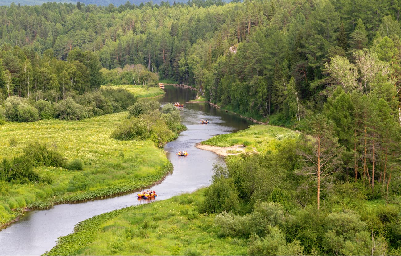
This river is one of the most popular among tourists. They raft it, make hiking trips along its banks, conquer coastal rocks and study the caves and grottoes hidden in them. The water trip traditionally begins in the town of Lower Sergi (near the resort and sanatorium Lower Sergi and the railway station Nizhneserginskaya). This is where the most beautiful section of the Sergi River starts. Having enjoyed the trip, you can finish the water route in Arakayevo settlement or Mikhailovsk town. The length of the rafting from Lower Sergi to the village of Arakaevo is about 42 km, and to the town of Mikhailovsk – 50 km. The rafting is possible from the end of April (during the spring high water) to September. In summer, the river melts heavily which can make rafting a bit difficult.
Mount Eagle (468.9 m) got its name for its appearance. If you look at it from the town of Lower Sergi, it looks like an eagle spreading its wings. As a matter of fact, it is the starting point of the Bardym Ridge that goes south.
In the olden days there was a wooden tower at the top of the mountain and holidaymakers at the resort Lower Sergi climbed it to improve their health. Now only a few locals climb the mountain, as a result of which the trail to the top overgrows with shrubs quite frequently. The summit itself is covered with forest, but despite that, one can still see the valleys of the Serga and Bardym rivers. An interesting sight opens up to the eye: these rivers flow in opposite directions on different sides from Eagle Mountain.
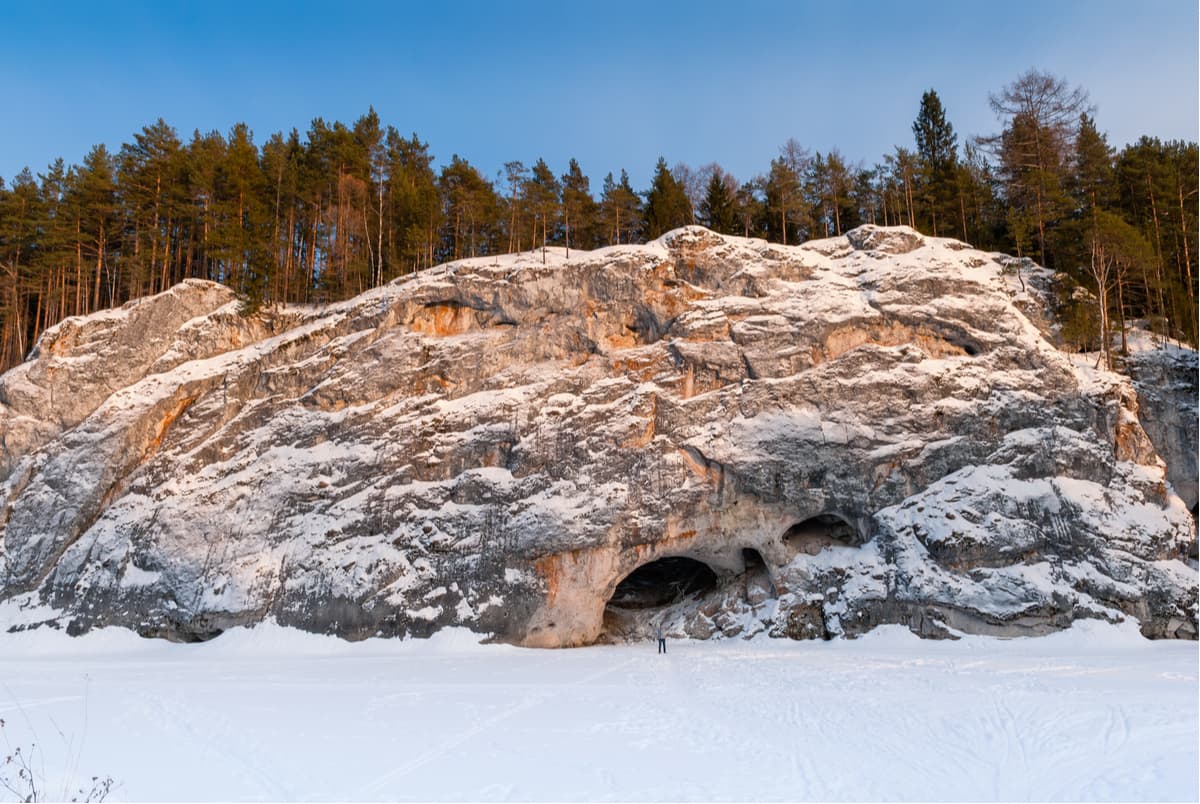
The karst failure is located on the northwest slope of the Eagle's Mountain. Its second name is the Glacier of Mount Orlovaya. And the locals call it the Provalishche (Huge Failure). In the past, it was a big cave, but its vaults collapsed being unable to hold the heavy load. The result was a huge failure surrounded by forest. The view of the failure is really impressive: a giant rectangular depression 21 m deep, 70 m long and 20 m wide. The Eagle Failure is a geomorphological natural monument.
The cave is developed along a vertical tectonic fracture. Fern and moss grow on steep rocky slopes. It is always cool at the bottom of the failure since the ice almost never melts there. It's dangerous to go down in the failure, but possible. Such extreme lovers can be found descending to bottom from time to time. Still, for safety reasons, someone has to stay up to help get back out. At the bottom of the failure is a vertical well descent into the cave. After the descent into the cave, the first grotto opens to the eye, it is a large hall with a shallow lake (approximately 0.5 m deep, 120 sq.m.). It is impossible to go further in summer. In winter the lake freezes and it is easy to get to the second grotto. In this case, ice builds up around the lake and beautiful ice crystals appear. In the last, third grotto, you can climb up the crack.
Karst funnels are also found near the failure. They seem to continue the crack through which the cave was formed.
The karst failure of the Eagle Mount is located approximately 2.5 km south of the town of Lower Sergi. There is no official route in the park to this place, so tourists do not come here often. To get to these places (to Mount Eagle and Mount Eagle Failure) you can take a bus from the town of Lower Sergi or from the Southern Bus Station of Ekaterinburg. The Mount Eagle Failure is located behind the village of Lespromkhoz. Thus, on a way to it, it is necessary to wade through three channels of the river Bardym. The crossing places are usually shallow; the water level is below a knee. Then the trail goes up a mountain. It is less than 1 km from the Bardym to the Failure.
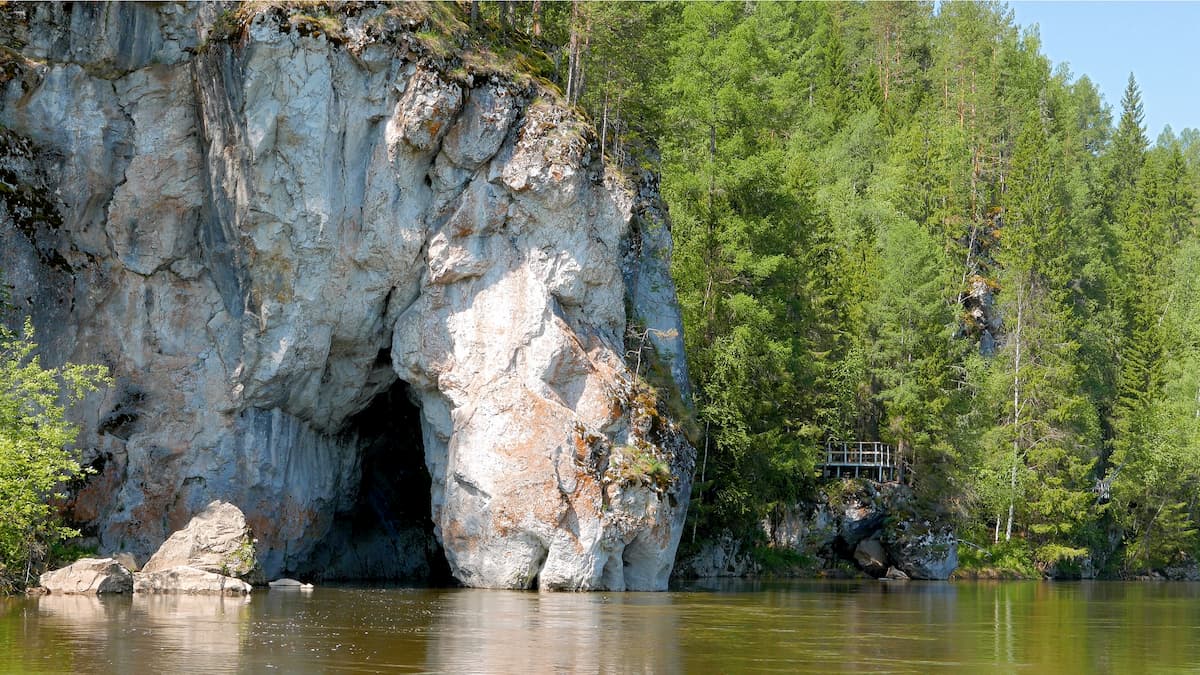
The Karst Bridge is located on the left bank of the Serga River. It is one of the most unusual and original rocks in the area. It reaches a height of 40 meters. At the base of the rock, there is a grand arch of the Karst Bridge. It is a through cavity 12 m long. From the opposite bank of the river, you can reach it by a suspension bridge over the river. And from the side of the river, you can swim into it by boat or catamaran. Inside the through-cave which is also called the Karst Bridge Cave (or Sokolkinaya Cave), there is a metal ladder for climbing up to the observation deck. From the top of the rock, there is a beautiful view of the Serga River valley.
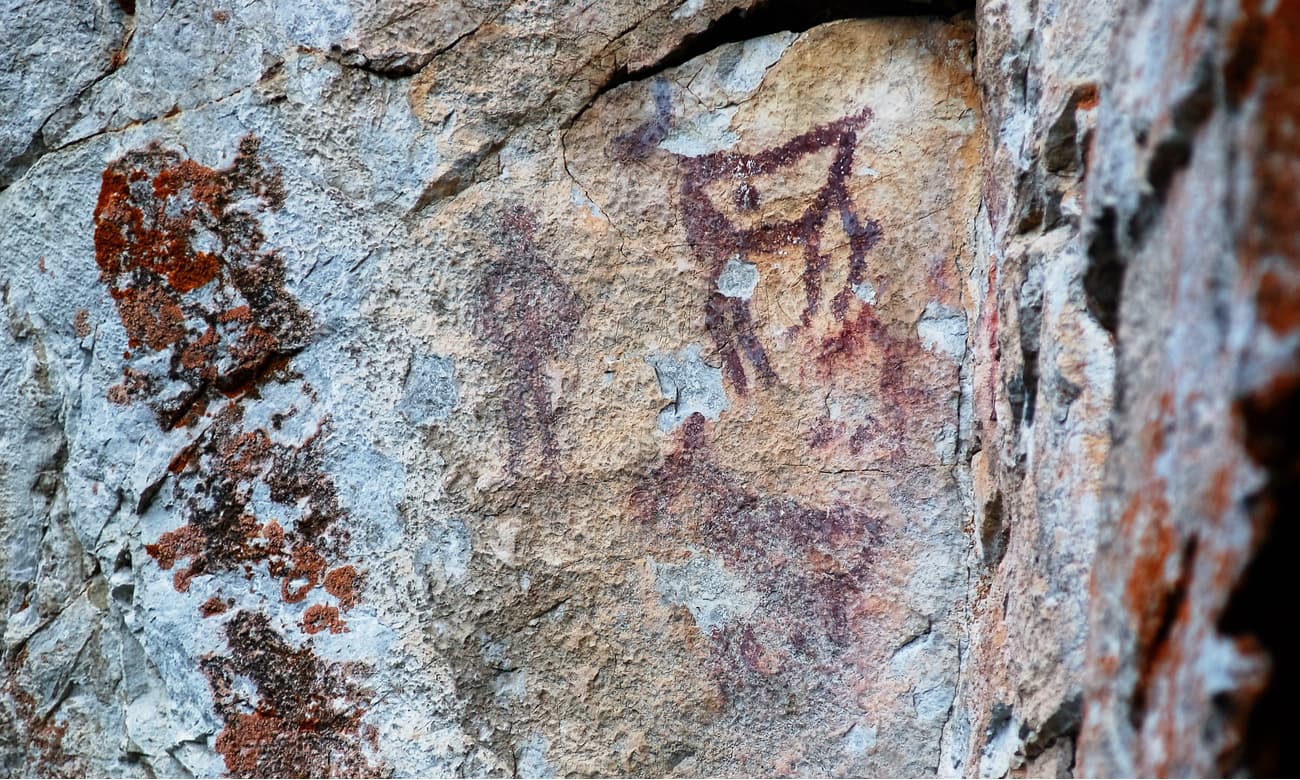
The rock is located in the Reliktovy rocky massif on the left bank in the middle part of the Serga River. The height difference from the top to the river is 35 m. At an altitude of about 4.5 m on the rock you can see pictures made more than 3000 years ago by Finno-Ugric hunters who lived there. Hence the name of the rock. Pretty distinct drawings are made with dark ochre. According to archaeologists, Pisanitsa is one of the ancient places of worship in the Serga River valley where hunting rites were held.
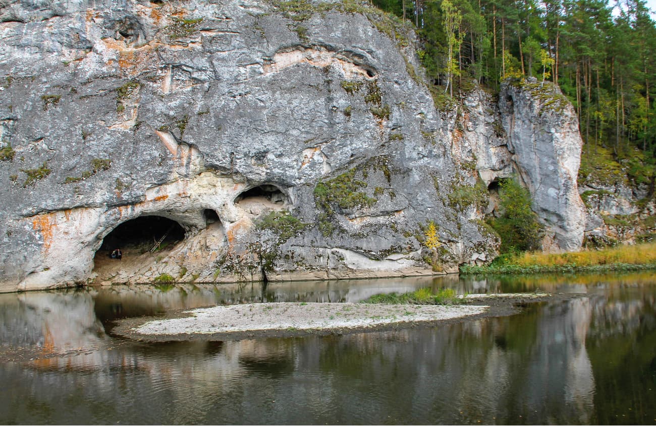
The rock is located on the right bank of the Serga River. It is a majestic limestone arch which goes into the river bed at one end. From afar, it seems as if a stone horse has leaned over the river and is drinking water. That's why the rock is sometimes called the Drinking Horse. The opening height of the arch is about 5 meters. In the Leaky Stone, there is a small cave called the Cave of the Ancient Man. The length of the cave is 17 m. According to archaeological excavations, the cave used to be a temporary shelter for ancient hunters.
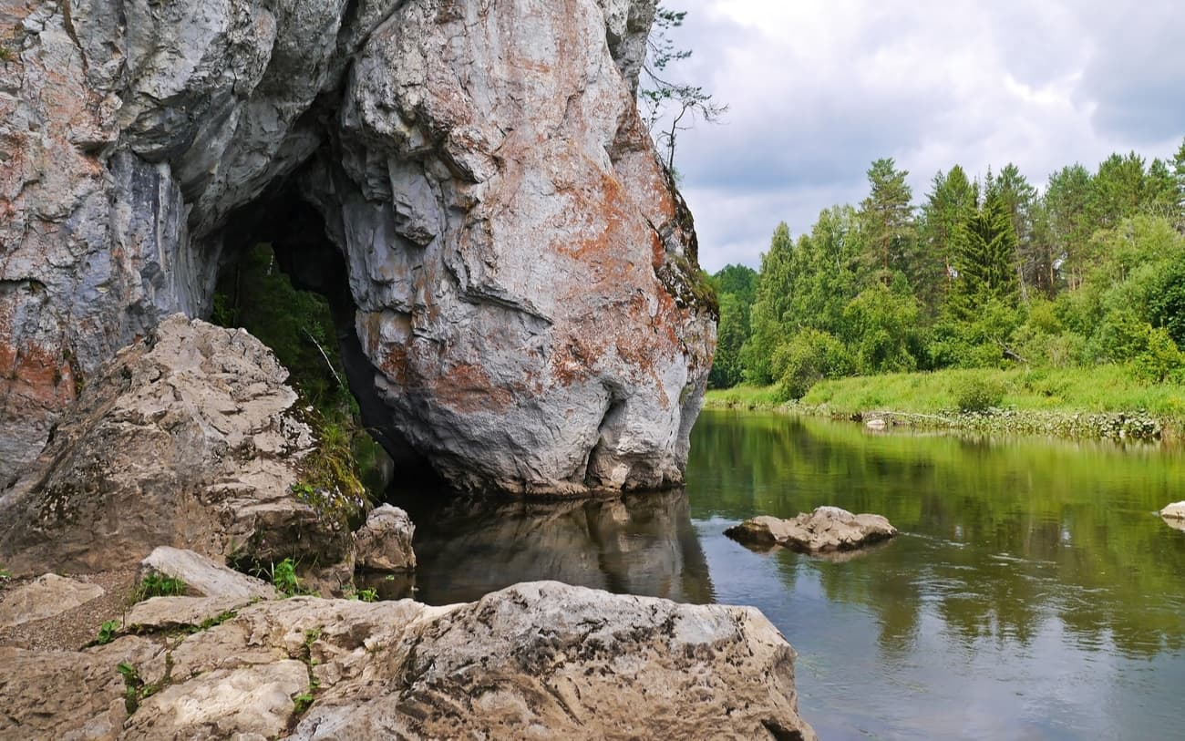
The rock is located on the left bank of the Serga River and is a limestone residue that resembles a frog. The steep angle of the limestone layers can be clearly traced here, which indicates significant tectonic movements of this part of the earth's crust in the past.
The rock was renamed Light not so long ago. There is an observation deck on the rock. It offers a wonderful view of the Serga River valley. There are always a lot of tourists here since this place is the most popular route in the park (the Small Circle). Keep in mind that this place has a clamp to the rock and overhanging trees, so be alert and watch your step!
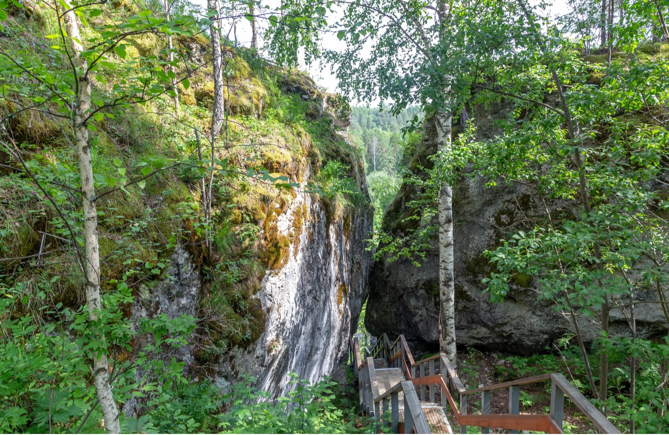
From the observation deck, you can go down the metal stairs through a through-arch in the rocks which are called the Kissing Rocks.
The Kissing rocks are a large sinkhole which was modified by external natural factors. Many years ago the level of the river was 15-20 m higher than it is today. The destruction of rocky limestones occurred on two sides: from above – by surface waters (due to snow and rain), from below – by groundwater (because due to one of the properties of water it can climb up the cracks). As a result of the joint work of these factors, one of the walls of this funnel was gradually destroyed and two stone blocks were formed. They resemble two faces people facing each other and touching by their noses.
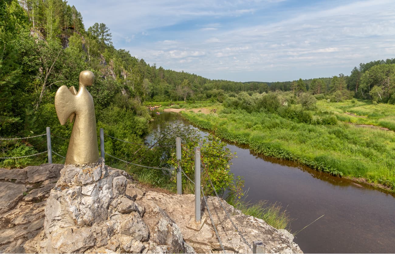
You can go down on a specially equipped stairway to the sculpture Angel of One Hope.
A modern attraction of the Deer Brooks Nature Park is the sculpture of the Angel of One Hope. It stands on a small rocky outcrop above the Serga River, its creator is a Swedish artist and sculptor Lena Edwall. The sculptures of the first seven Guardian Angels were installed on one day (17 September 2005) in Australia, Canada, Peru, Mali, Vanuatu (an island in the South Pacific), Hawaii, and in the Urals, in the Deer Brooks Nature Park. A total of 49 such sculptures were to be installed. The impetus for Lena Edwall to create the project, which is called "One Hope", was the 2004 terrorist attack in Madrid which resulted in numerous victims. According to the author's idea, the Angels placed in different parts of the planet will form a single space carrying Light and Hope and will stand on guard of peace and tranquillity protecting people from evil, including wars and terrorism.
There is a belief among travellers that if they make a wish holding on to the Angel's wing, it will come true.
The Arakayevskaya is one of the largest caves in the Middle Urals and the longest cave on the Serga River, its length is 750 m. Until recently, this cave was considered to be Friendship Cave. The cave is located on the left bank of the Serga River 5-6 km upstream from Arakayevo village. The entrance to it is located on a steep wall at an altitude of about 20 m. Only the first grotto is accessible to visitors. It is about 30 m long and 15 m wide. In winter, the walls and the vault of the first grotto are covered with picturesque ice crystals and numerous stalagmites. The rest of the cave is inhabited by bats listed in the Red Book. And in order not to disturb them during their winter hibernation, it is not recommended to visit the rest of the grottoes in winter.
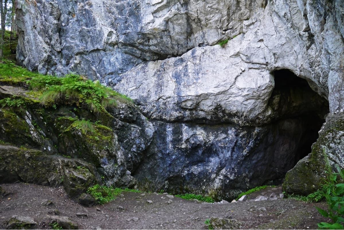
The cave is located on the right slope of the Fedotov Ravine on the left bank of the Serga River, 7 km from Bazhukovo village. It is one of the main landmarks of the route called the Vagaries of the Serga caves. The cave has a complex structure, it has underground lakes and streams. The microclimate of the cave is quite unique: the temperature in different parts of the cave can vary significantly. In winter all the lakes and streams freeze up, and many interesting forms of ice stalagmites are formed. The Friendship Cave is considered one of the most beautiful caves in the Sverdlovsk Region. It is a place of winter hibernation of bats, as well as the camping site of an ancient man of the Neolithic Age. On the vaults of the cave, there are fossils of ancient marine organisms which inhabited the Riphean Sea 300 - 400 million years ago. The first three grottoes of the cave are accessible and safe to visit.
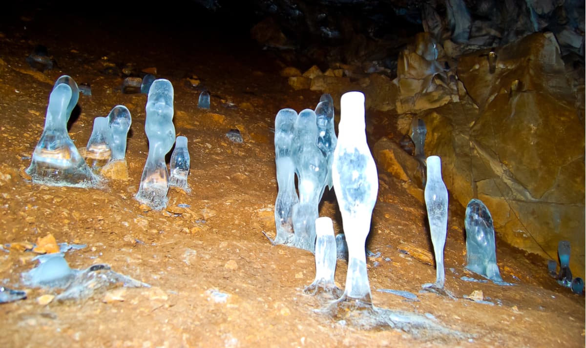
The Katnikovskaya Cave is a natural monument of regional importance. It is away from the main routes of the Deer Brooks Nature Park, so unlike the Friendship Cave, it is less visited by tourists. You cannot see the cave from the water since the entrance to it is 100-200 meters from the Serga River, on the right bank, so even water tourists floating along the river do not always know about this cave. It is located at the base of a small rock in the Serga River valley (2 m above the water level), between the town of Lower Sergi and the village of Polovinka (3 km from the village of Polovinka, 7 km from the village of Bazhukovo, 8 km from the town of Lower Sergi). Some travellers confuse the entrance to the cave with a small grotto located near it, which is the entrance to the badger hole.
This cave has several names: the Stalactite Cave as it was called earlier for a large number of beautiful stalactites, and the Katnikovskaya (or Katnikov) – by the name of its discoverer. Nowadays, there is nothing left of the former beauty of stalactites because the visitors went rampant in their desire to take a piece of stone from this cave. So, now most often it is called Katnikovskaya.
The story of the cave's discovery is interesting. It's said that it was accidentally discovered by a hunter who was tracking a fox. The traces of the fox led him to this cave. As a result, it turned out that a hunter named Katnikov tracked down this cave and became its discoverer.
The entrance to the Katnikovskaya Cave is an almost vertical descending hole, the length of this section is about 2 m. The course is narrow and one has to be careful when going down. However, it is quite easy to overcome. Next, you will need to crawl for a few more meters, after which the cave expands considerably and you can get up to full height. The first grotto is called the Central cave. On the floor of the cave, there are a lot of boulders of different sizes that collapsed from the ceiling. You can get into other grottoes by crawling through a climbing hole. The cave farther is a labyrinth, some passages end in dead ends. If you are an inexperienced speleologist, you can disorient easily. So be alert. The air temperature in the cave never drops below + 5 degrees Celsius, which makes it a nice place for bats and mosquitoes hibernations.
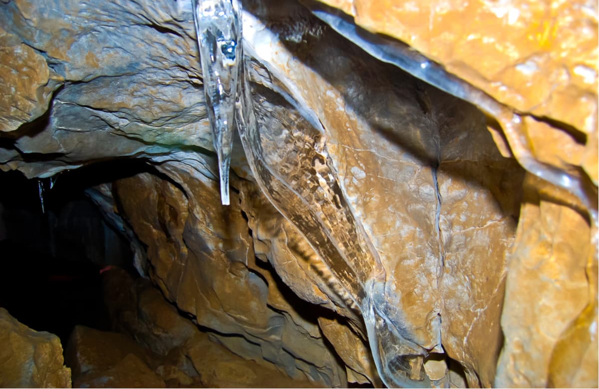
The Big Failure Cave is 500 m from the Friendship Cave, up the Fedotov Ravine. It is an open vertical oval-shaped sinkhole 60x25 m in size, reaching a depth of 35 m. There are small caves in the walls of the Failure. The total length of the passages is about 240 m. This is one of the largest karst failures in the Middle Urals. The Big Failure was formed as a result of the collapse of the vault of a huge cave due to which its bottom is covered with large blocks of irregular shape. The slopes of the Failure are steep, closer to the bottom they are almost vertical. However, it is possible for the authorized researchers to go down the southern slope using a metal staircase installed there. The Big Failure was previously accessible to tourists but is now closed to the public due to the threat of landslides and rockfalls. A few years ago, snow and ice remained at the bottom of the slope during the year, and even in summer cold air accumulated here. Now, in spring the failure began to be flooded with water and in place of the glacier at the bottom there formed an entrance to a new part of the cave – the Obvalny grotto. It stretches towards the Sports Cave. Karst processes in the cave continue to this day, so there is a possibility that in the future the two cave caverns will merge.
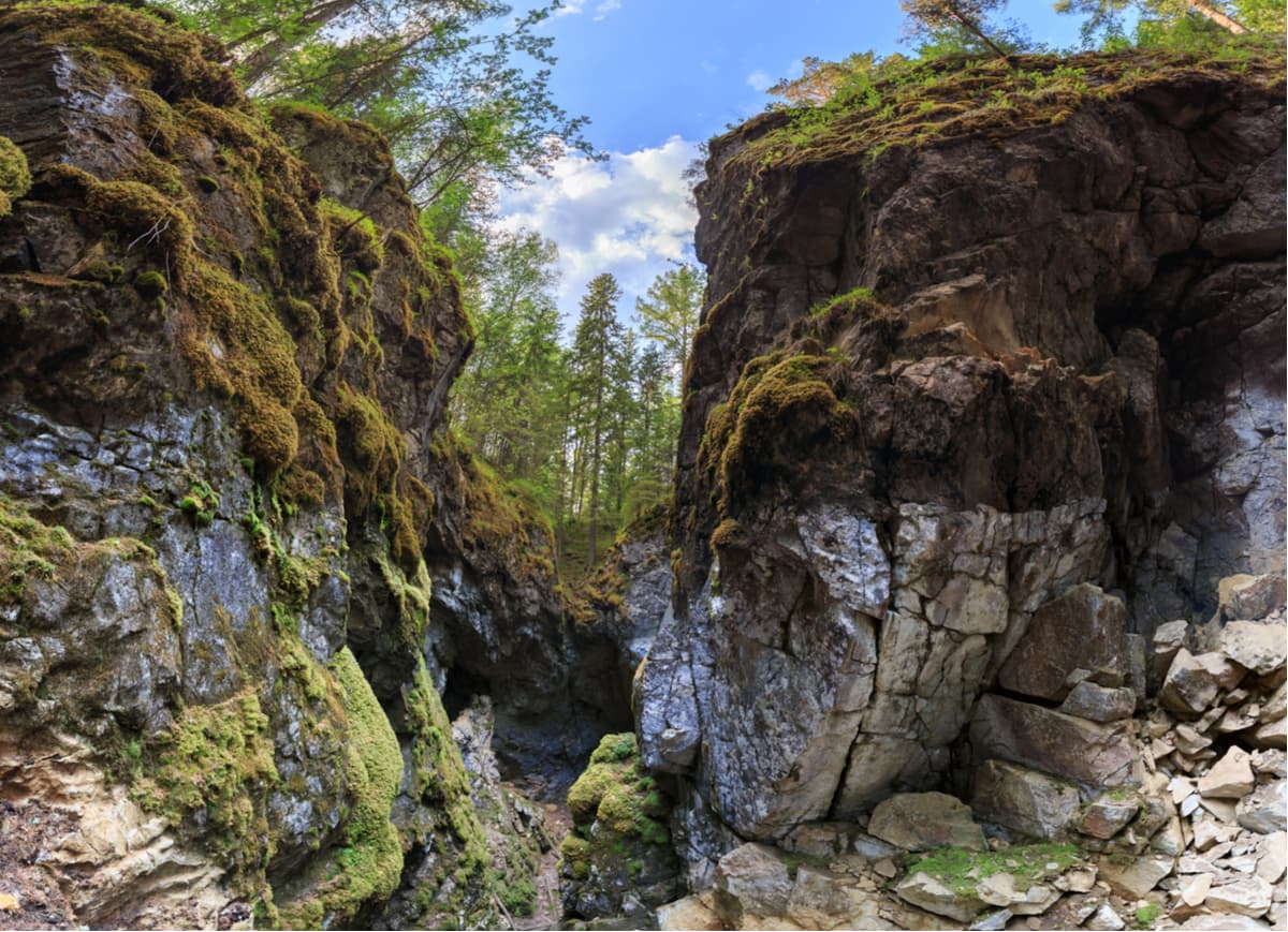
From the Big Failure, you can get to the Mitka Lakes, as well as back to the village of Bazhukovo. You will need to cross the river wade near the Rock of the Priest, or by the bridge near the Karst Bridge Rock.
The Mitkin lakes were formed on the place of an ancient iron mine 4.5 km east of the village Bazhukovo, on the western slope of the Bardym ridge. The mine was named after the name of the manager – German Mitkin. Fragments of the equipment used for mining and processing of iron ore in the 19th century have been preserved.
Three old abandoned iron ore quarries gradually filling with water formed three picturesque lakes on the slope of Mitkin Hill: Upper, Middle (or Central) and Lower Lake. The Mitkin lakes have the status of a historical and hydrological natural monument. The deepest lake is Lower Lake (17 m deep), which is shaped like an oval. The depth of Middle Lake is up to 10 meters. Upper Lake is the shallowest. Upper and Middle Lakes are of irregular geometric shape, they start to bloom early and the water in them is turbid. The water in Lower Lake is purer and more transparent.
A stream flows from Upper Lake to Middle Lake, which in spring forms a beautiful waterfall. Nearby there is a rocky exit called Ram’s Forehead where you can see the fossils. On Upper Lake, there is a beaver dam.
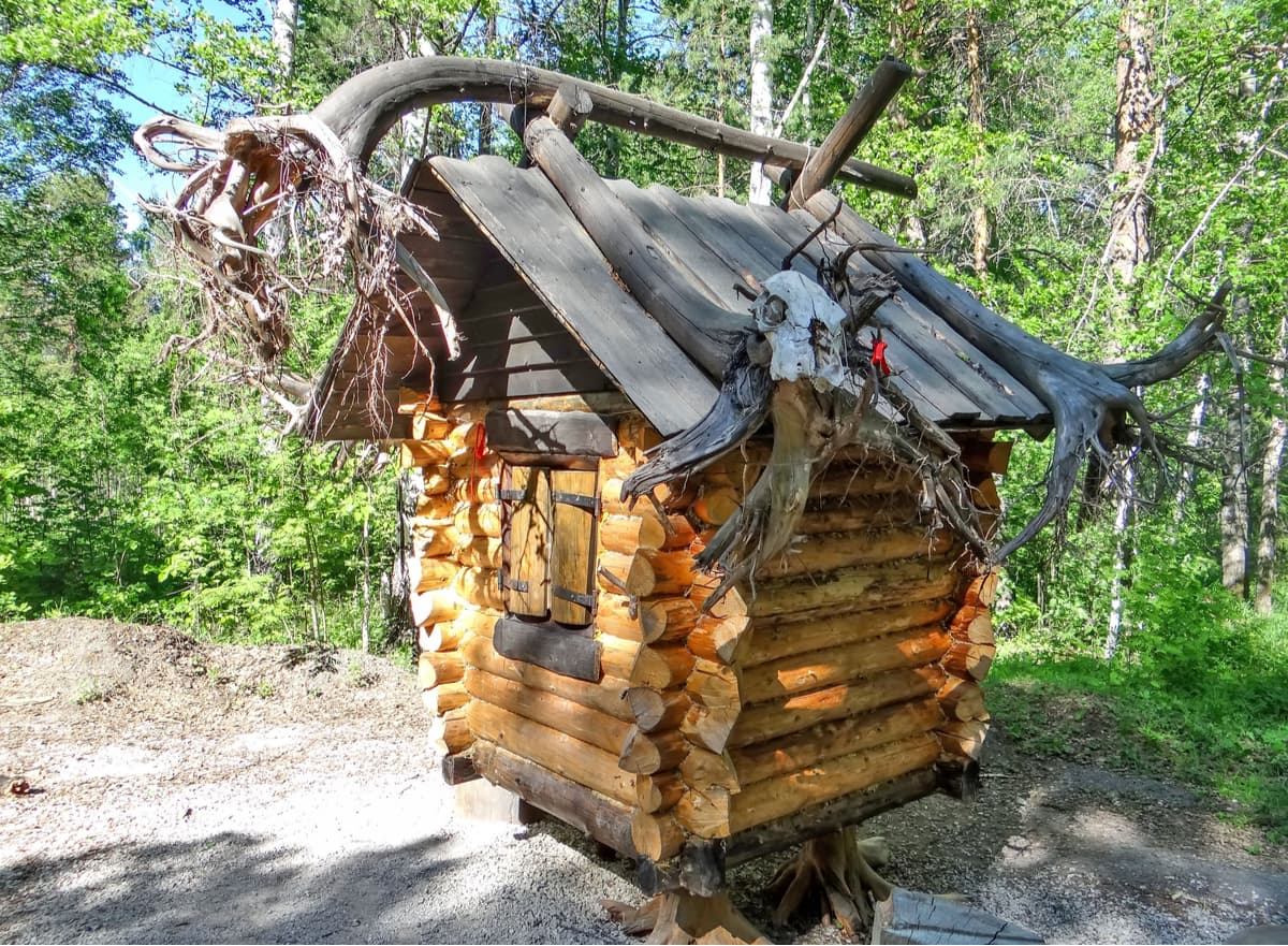
Visits to the Deer Brooks Nature Park are free of charge for children under 7 years of age, children from large families and disabled persons and discounted for children 7-16 years of age and full-time students, pensioners and parents with many children. You can obtain a permit to visit the park and pay for entrance tickets at the tourist registration building in Bazhukovo settlement. There you can also make an order for a tour, choose and pay for other park services. At registration, you will receive a map-scheme of the park.
Pet owners should keep in mind that dogs are not allowed into the park. All kinds of hunting are forbidden in the park. At the same time, recreational fishing is allowed, on a fishing rod with one hook, spinning or fishing tackle.
Driving and parking of motor vehicles is prohibited in the park, as well as motorboats without permission of the administration. It is prohibited to conduct rock climbing training outside specially designated places. Torches and other smoking light sources may not be used in caves and grottoes, no objects or garbage may be left underground, bats may not be disturbed otherwise they may die during hibernation, and frost and ice drifts may not be broken during winter.
It is recommended to set up camps only in places where camping is permitted.
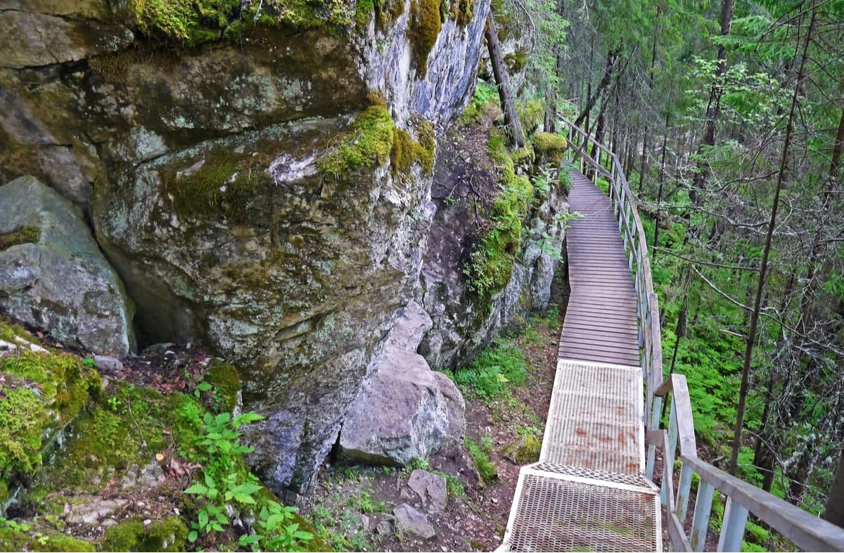
The seasonal peak of visiting the natural park is in September, which is no wonder because nature is especially beautiful here in autumn.
For the convenience of tourists and travellers, there are several routes in the Deer Brooks Nature Park. Routes are of different lengths and passage times. You can walk along them on your own or order a guided tour for a group. Most tourists visiting the park walk the park's hiking routes, and some prefer to raft down the picturesque Serga River. Along the routes, there are arrows and information boards that briefly describe the main sights.
The routes of the park:
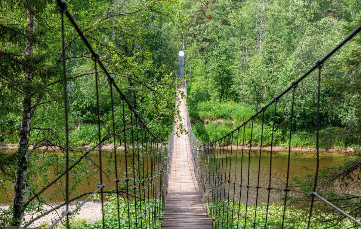
Karst Bridge Route (7 km / 4 hours). This route is more suitable for those who have already been to the park and got acquainted with the main sights but want to walk in the park again and look at it from a different angle. The main sights of the route are Bazhukovo settlement – the forest behind the Wild Honey Glade – Menshikov Ravine – a pine with a wrapped thin trunk – the Inspiration Rock – the Sculpture of Perun – the view to the Filared Stone – the Karst Bridge Rock – a technological road to Bazhukovo settlement.
Along the Arakaevskaya Cave Valley (8 km / 3-4 hours). The route starts near the village of Arakayevo and runs along the southern part of the park, along the left bank of the Serga River. In summer, it is necessary to cross the river ford, in winter, you can go on the ice. A large number of karst objects are concentrated here. The most interesting caves are the Big Arakayevskaya, the Mshistaya, the Sukholozhskaya. The route is poorly equipped, so the services of a guide are highly recommended.
The Mitkinsky mine (18 km / 9 hours) is the most remote place in the park, it is quiet and peaceful. The route is available in the summertime. In 2005, an open-air museum was opened here with information posters, equipped parking lots, preserved fragments of technological equipment for iron ore mining and processing.
For accommodation on the territory of the natural park, there are equipped parking lots, a house called Forest Deer, New Cordon Novy, Ranger Cordon, there are rooms for rent and overnight stay in the administrative and tourist centre. You can stay near the park at the recreation centre Skaz, as well as in the sanatorium Lower Sergi. During your stay in the park, you can visit the bathhouse. In the park, there are several cafes at the entrance, you need to take food and water for the day with you.
In wintertime, you can go skiing in the ski complex located in the nearby town of Lower Sergi.
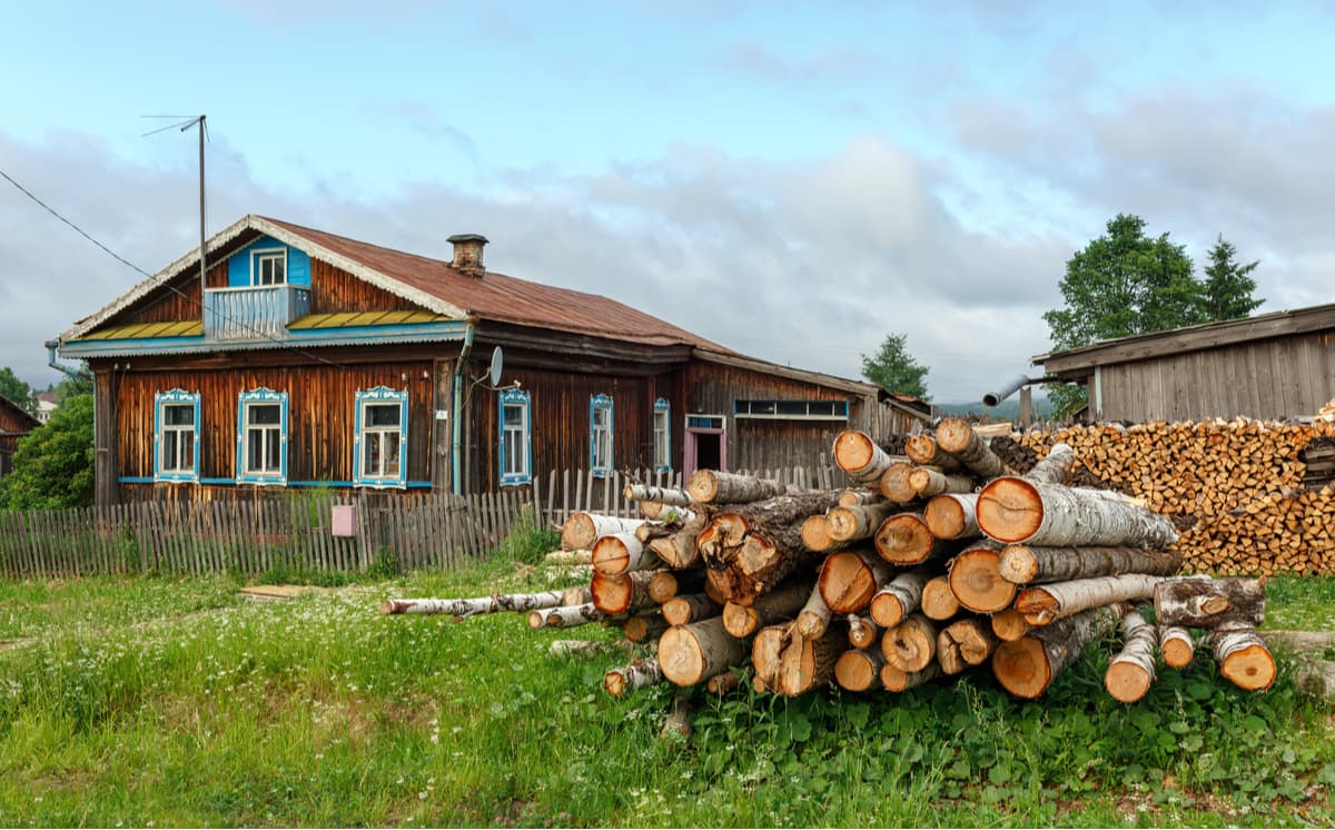
To get to the Deer Brooks Nature Park, you need to get to the village of Bazhukovo located in the Sverdlovsk Region. That's where the park's administration is located.
The address: 623090, Sverdlovsk Region, Nizhneserginskiy district, Bazhukovo village, Stantsionnaya Street, 1.
tel. +7 (904) 17-255-65
olen@olen.ur.ru
adm1olen@mail.ru (mail for tourist applications)
You can get to the village of Bazhukovo from Ekaterinburg by bus (from the southern bus station of Ekaterinburg), as well as by train (the railway line Druzhinino - Mikhailovsky plant) or by taxi (the distance from Ekaterinburg to the park is about 120 km).
The official website of the Deer Brooks Nature Park is http://www.olen.ur.ru provides prices for entrance tickets and services rendered by the park, as well as current information about routes and places of accommodation.
Explore Deer Streams National Park with the PeakVisor 3D Map and identify its summits.


