
Scan the QR code and open PeakVisor on your phone
Denezhkin Kamen Nature Reserve has 15 named peaks. The highest is Gora Denezhkin Kamen’ at 1,492 m. Other notable peaks include Solva, Bolshaya Sharpinskaya Sopka and Kulakovskii Uval.
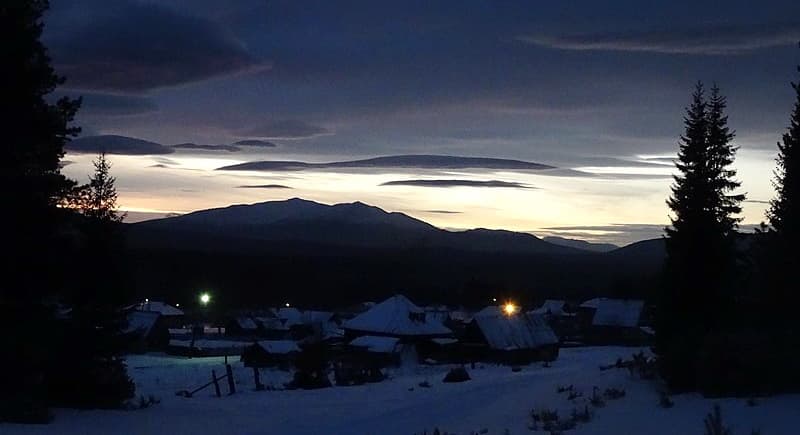
The State Nature Reserve Denezhkin Stone is located on the eastern slope of the Northern Urals on the territory of the Sverdlovsk Region and Perm Territory. To a casual onlooker, the name Denezhkin means ‘money’ in Russian, but it is actually the surname of a famous man living here in the 17th century. This territory was first declared a protected area in 1946, but 15 years later this status was revoked and since 1961 the territory was reclassified to the State Fishery. It had a somewhat detrimental effect on the forests as there started moderate forest exploitation as well as hunting and fishing. The reserve was reestablished in 1991. Its area considerably decreased and now it is 80 thousand hectares.
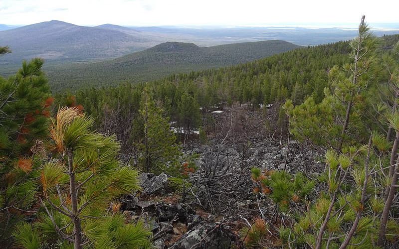
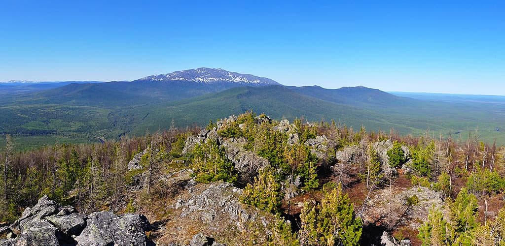
The present-day borders of the reserve include the mountain massif Denezhkin Stone (Kamen), the eastern slopes of the Main Ural Range, the Solva River valley, the southern part of the Khoza-Tump Ridge, the upper reaches of the Sosva, Ivdel, Taltiya and Shegultan rivers. The highest point in the reserve is Denezhkin Stone (1,492m). Through the territory of the reserve parallel to the Main Ural Range stretches a range of island mountains and ridges which are separated from each other by wide river valleys. The relief is medium-high with maximum absolute heights of mountain ridges ranging from 1,200m to 1,492m. The lowest absolute altitude (225 m) is where the Shegultan River crosses the eastern boundary of the Reserve.
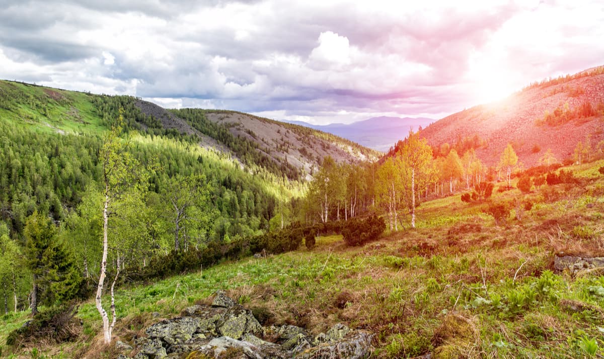
Stretching over the eastern slopes of the Main Ural Range, the Reserve is located at the intersection of different types of ecosystems. This territory is blessed with well-preserved large areas of the primary mountain taiga, many particularly valuable, rare and endemic species of the Ural Mountain Range flora and fauna.
The landscape is a variety of several belts:
Mammals are represented by species from six groups, all species typical for the Northern Urals. Here one can observe various representatives of the Marten family: wolverine, Siberian weasel, ermine, weasel, European and American mink, marten, sable, and kidus which is basically a very cute crossbreed of sable (Martes zibellina) and forest marten (Martes martes). As for the bigger mammals, there is the brown bear, elk, lynx, wild boar and white hare found in the forests. The bear lives everywhere in the protected area. Foxes are rare though. The number of wolves is growing, they commonly bunch outside the territory, but they enter the reserve sometimes as well. There are 140 species of birds of 12 orders. From those, 10 species of birds are included in the Red Book of the Middle Urals. The rivers are inhabited by 4 species of fish, of which the common taimen (salmon trout) is included in the Red Book of Russia.
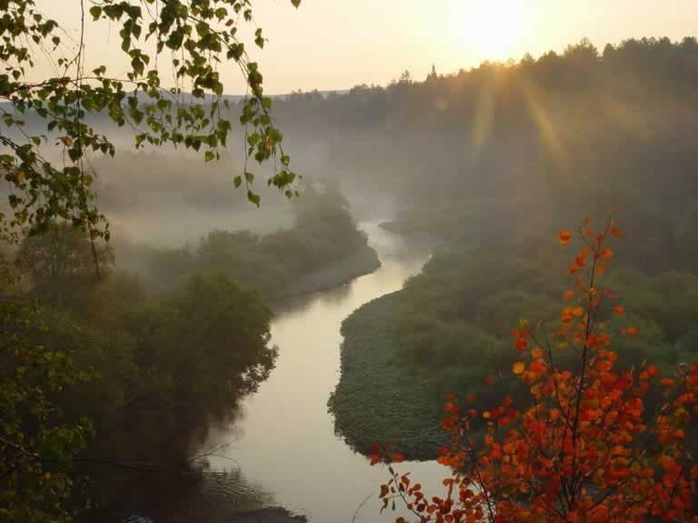
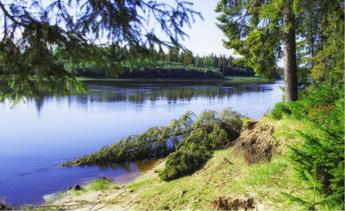
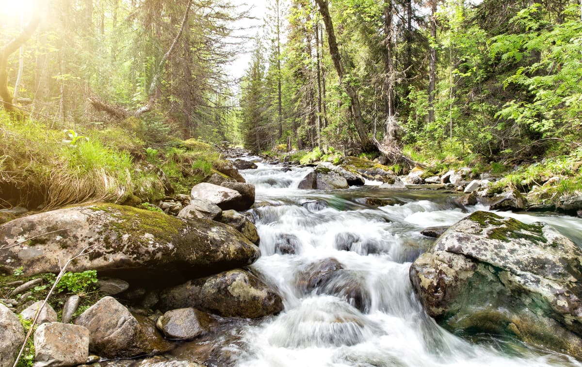
The largest rivers of the Reserve are the Taltiya River which originates on the Khoza-Tump Range, the Shegultan River with numerous tributaries that collect water from both the Denezhkin Stone and the Main Ural Range, the Sosva River with tributaries Solva, Suprey and Talaya. The Sosva River flows into the Ob through the Tavda, Tobol and Irtysh Rivers. The rivers of the Reserve which originate on the slopes of mountains and ridges have high current speed, stony beds, cold and clear water. The rivers here are quite young and most of them have not yet formed their channels. Only such rivers as the Sosva and the Shegultan have a more or less pronounced floodplain.
The climate in the Denezhkin Stone Nature Reserve is continental. Winters are long and cold, with frequent frosts down to -40°C (-40 degrees Fahrenheit). Winter begins at the end of October. The cold season lasts 6-7 months. Snow cover at the foot of the mountains reaches 130 cm. Snow usually lies until mid-April on the plains and until mid-July in the mountains. In some years, snow in the mountains may not melt all summer. It turns out that all other seasons are as if compressed in time. Spring only lasts a month and a half. Because of the rather feeble soil cover, all the water almost immediately rushes into the rivers, and therefore the rise of water in the flood time is very significant, the rivers come out of the banks at the speed of light. Summer is short, moderately warm. It ends by the middle of August, and at the end of August, as a rule, there is already snow in the mountains. The Ural Mountains, despite their low altitude, have a rather strong influence on the local climate. On the eastern slopes of the Reserve's mountains, there is less precipitation than on the western slopes.
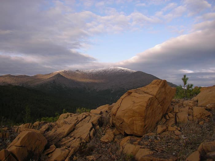
The Denezhkin Stone is a mountain massif on the eastern slopes of the Ural Mountains, in the upper reaches of the Sosva River. It has 4 main peaks, the highest of which is Mount Denezhkin Stone (1,492 m), which makes it one of the highest peaks of the Urals. The second most important peak of the massif is Raisa Rubel Mount (1,360 m). This mountain was named after the famous geologist and local lore historian Raisa Rubel (1912-1991). She was a great educator and influencer in the region. By the way, her surname also means ‘money’ in Russian (rouble).
The well-known name of the mountain massif comes from the Mansi man called Andrey Denezhkin who lived in the 17th century in the village on the Sosva River. The Mansi tribe called this massif Os-Tagt-Talyakh-Yalpyng-Ner-Oyka, which means ‘the Holy Mountain of the Sacred Master of the upper reaches of the narrow winding river’ or ‘the Holy Master of the Urals in the upper reaches of the North Sosva’, reminds of the lengthy descriptive names of the American Indians. Os-Tagt means the North Sosva River, Yalpyng is ‘saint’, Talyakh is ‘top’, Ner is ‘stone’ or ‘Ural’, Oyka is ‘old man’, ‘master’. You can come across various forms abbreviated from this name used for many toponyms in the region.
In the old days, the Denezhkin Stone was a place of mass accumulation of tourists. In the Soviet times, the route to the Denezhkin Stone had the status of All-Union trail. Nowadays this territory is a reserve and officially nobody is allowed to come here, the reserve's territory is patrolled constantly.
From the south side of the Denezhkin Stone, there is an old forest road which starts from the village of Kalya located near the town of Severouralsk. You can get to the settlement of Kalya by train from the city of Ekaterinburg. Immediately before the bridge over the Kriv River on its right side, there is a road to Solva settlement (now uninhabited). This settlement was built in those times when gold mining flourished on the Solva River. Now there is nothing left of gold mining, except dumps which marked some parts of the river banks. And in the village now there is a cordon of the reserve. Another cordon is at the mouth of the Kriv River.
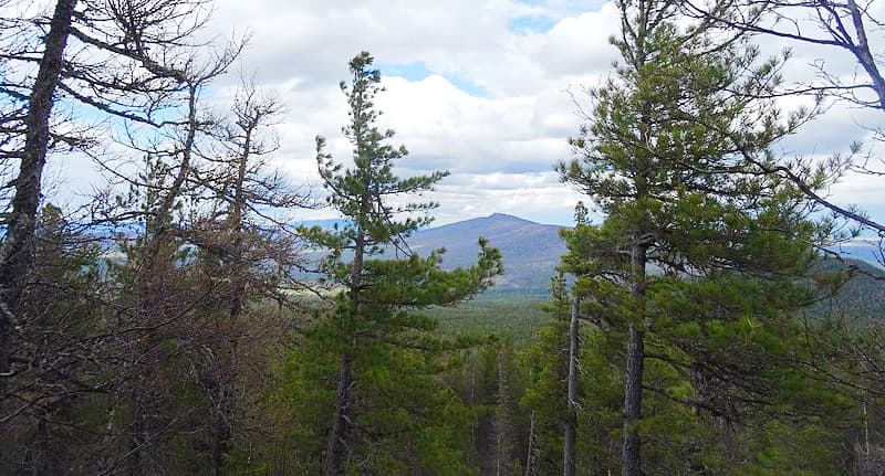
Approximately a quarter of the surface of the Denezhkin Stone is covered with forest and as much is covered in small bushes. The rest is a mass of stones and rocks. The forest consists mainly of coniferous trees (mostly pine trees), birch, alder and mountain ash grow as well. The woods are really dense with a lot of wind-broken trees and brushwood.
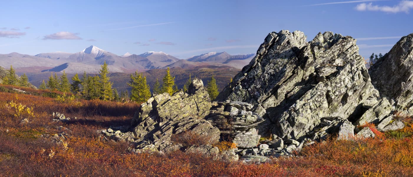
The Main Ural Range is considered to be the main ridge of the Ural Mountains. It is a huge mountain range in the Northern Urals with steep slopes and alpine contours. Its length is 52 km and width ranges from 4 to 12 km. The highest point is Humboldt Mountain (1,410.7 m), on old maps, it is indicated as Lyampa Kutimskaya by the name of the river that originates from the lake on its slope. The mountain was renamed in 2001 on the initiative of the Sverdlovsk branch of the Russian Geographical Society in memory of the German scientist and traveller Alexander von Humboldt (1769-1859), who left a huge trace in the history of exploration of the Urals. He travelled in Russia extensively and came to the Urals region in 1829 at the personal invitation of the Russian Emperor. As a result of the journey, this scholar wrote a fundamental work, one of the chapters of which was called "The Ural Mountain System".
Other notable peaks of the range include Big Khodovskaya Sopka (711 m), Pallasa Mountain (1,337.7 m), Lepyekhina Mount (1,337 m), Trezubets aka Trident (1,204.5 m), Sosvinsky Stone (960 m), and Kazansky Stone (1,035 m). The Main Ural Mountain Range is a kind of a stone belt which is the border between the Perm and Sverdlovsk regions, and also the border between Europe and Asia.
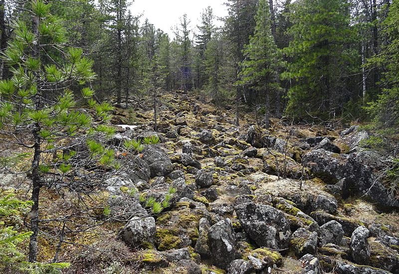
The ridge is poorly dissected, the peaks are flat and cupola-shaped, and the slopes are steep, almost completely covered with fresh rock debris (kurumniks). On the slopes of the Main Ural Range the forest ends at the height of 800-900 m, above go tundra and mountain meadows, and on the tops are stone fields. Once upon a time, a rescue base was built at the southern end of the range on its eastern slope. It was justified by a large number of sports campaigns previously held in the area of the Main Ural Range and the Denezhkin Stone Massif. Nowadays, there are no rescuers at the station, only a radio station is left as a reminder of them. In the remaining houses now there is the Zvezda tourist base. The area is truly remote and hostile to a casual wanderer. There's no cellular communication and no regular transport links. In the winter, the road is under thick snow, which still doesn't stop avid travellers.
The Sosva River (635 km long) is one of the longest rivers in the Sverdlovsk region, it is actually the sixth in length. It flows near the towns of Severouralsk and Serov. The Sosva River originates in the Main Ural Range and the vicinity of the Denezhkin Stone. Then, merging with the Lozva River, it forms the Tavda River, which is navigable. The most beautiful is the upper part of the river which has a mountain character. There are many fast rapids, beautiful rocks and cliffs covered with coniferous forest. The rocks on the Sosva River can be found as far as the village of Denezhkino. And during the summer solstice, you can observe white nights here.
There are several different ways to begin rafting on the river. It is possible to start from the tributary of the Sosva River, the Shegultam River from the car bridge over the river north to Severouralsk near Cheremukhovo village. For those who do not have an opportunity to start that far, it would be more convenient to begin rafting in Severouralsk on the river Vagran, which is also a tributary of the Sosva. Start off at the eastern outskirts of Severouralsk and don’t be surprised to find the Vagran confined to a solid concrete channel, it was done to prevent the flooding of the mines located nearby.
There are many beautiful and picturesque rocks along the Sosva River. Let's consider some of them.
The Grotto Rock is the first rock located after the confluence of the Shegultan and Sosva rivers. The water washed out small niches and grottoes at the foot of the rock. There is even a small through-hole in one place.
The Midday Stone differs from other rocks by its smooth and slightly sloping surface. When you look at it from afar, you may feel as if it is blocking the way to the river.
Mount Pereim is virtually a mountain, not a mere coastal rock. It is located near the confluence of the rivers Sosva and Vagran. An interesting spectacle can be seen from the top of this mountain: you can see two rivers flowing in different directions and separated only by a narrow isthmus (the Vagran is on the left is, the Sosva is on the right).
The Ship Stone is a long rocky wall located on the right bank of the river. Its height is 30 meters, the length is 200 meters. There are several small caves and grottoes in it.
The Strelebsky Stone is the highest rocks on the Sosva (about 50m). It is located opposite the Ship Stone. According to a Mansi legend, there was a competition in archery with the aim to shoot an arrow that can lend on the top of the stone. This is also a point where the River Strelebka flows into the river Sosva.
The Gate aka Vorotny Stone (or Kosyakov Gate Stone, 40m) is an original and interesting rock. It is formed by two open arches, one of them is visible from the river. Hence the name. The second hole can be seen from the top of this rock.
Denezhkin Stone Rock is the last of the coastal rocks, it is located in front of the village Denezhkino. There is a large vertical slit in the rock, as well as a grotto. Opposite the rock, there is a former children's camp Uralets (now inactive). Below there is a railway bridge and the village Denezhkino itself.
Once you pass Denezhkino, the Sosva River becomes a perfect plain still river.
The Reserve has developed the following routes:
It is important to note that there is a ban on unauthorized visits to the protected area including climbing Denezhkin Stone Mountain. Violators are subject to administrative fines, as well as penalties for damage to nature if any. Despite the bans, Denezhkin Stone is an attractive place for mountain lovers and adventurers.
The employees of the Reserve notify the travellers not to trust the maps and guides because most of them have an inaccurate description of the borders of the protected area, which leads to unpleasant situations. But you know what they say – ignorance is no defence! To avoid this, employees have placed the coordinates of the territory borders on the official website of the Reserve.
Fishing in the protected area is strictly prohibited, but there are places where it is possible to fish near the protected area if the area is no longer part of the Reserve. In places, the boundaries of the Reserve are marked with appropriate signs within the territory itself. Therefore, before going to the territory of the Reserve, you should familiarize yourself with its borders and rules of the visit to avoid uneasy moments with the Reserve's staff.
Instead of climbing Denezhkin Stone, the Reserve offers climbing other mountains near the territory of the Reserve. It is possible to use the cordons of the Reserve as base points for days-long hiking with overnight stays in tents on the nearby territories: the Main Ural Mountain Range (Humboldt, Pallasa Mountains) and the Shemur Ridge, White Stone Mountain, Shudya Pendysh, Tary Nyor Range, Quarkush Plateau with the Zhigalan waterfalls. Delivery to cordons is possible by cross-country vehicles. In winter not all cordons are available for passenger transport, only snowmobiles can pass the snow-covered roads.
The main Ural Mountain Range is only 80 metres lower than Denezhkin Stone Mountain and attracts tourists no less than Denezhkin Stone itself. It is very popular in both the summer and winter seasons. Both route options require a long time and are suitable only for well-trained tourists. Moreover, the winter route to the Main Ural Range can be a serious test for professional travellers as well: the air temperature here drops to -40°C (-40 degrees Fahrenheit), and the wind sometimes knocks you down when climbing above the forest border.
As an easier variant of the route, you can consider climbing the southernmost peaks of the Main Ural Range: Mount Sosvinsky Kamen and Kazansky Kamen. Several bases are organized near these peaks. This trip can be combined with a trip to the Quarush and a visit to the Zhigalan waterfalls.
There are 3-4 water route options: along the Vagran, Shegultan and Sosva Rivers. In the upper reaches, these rivers are turbulent and have lots of rapids, and in their flat plain part, there are coastal lime rocks, canyons and caves. The Uls River with access to the Vishera River is also a nice option. There are no floating facilities for rent, so bring your own stuff. However, you can have information support and transport assistance.
Should you wish to chill out in the pristine lands, you can drop to the village Vsevolodo-Blagodatskoe and live in a house heated by a real Russian stove. There are two tourist bases in the vicinity of the Main Ural Range, they are Zvezda and Kriv camps. A guest house was built 3 km away from the Zvezda base in 2017. If you are into studying a bit, drop to Vsevolodo-Blagodatskoye where the Reserve's staff conducts training and gives classes on environmental protection.
There is a tourist club in Severouralsk, they can help in choosing a route, accommodation, and finding transport. Within the town limits, there are three natural monuments – Grunwaldt Rocks, Three Brothers Rocks, and the Petropavlovsk cave. In the vicinity of the town, just 15 km by bus, there are two mountain peaks – Kumba and Golden Stone – each over 900 m high with rocks, park woods, and tundra areas.
To get to the Denezhkin Stone Nature Reserve, you need to go to Severouralsk which is located in the Sverdlovsk region. The Administration of the reserve is located there, this is the place to obtain the visit permit from. There is also a reserve base in the village of Vsevolodo-Blagodatskoye.
Address:
624480, Sverdlovsk Region
Severouralsk
Lenin Street 6, postbox 345
Telephone +7 (343) 802-75-63
E-mail: zapov.dk@gmail.com
You can get to the town of Severouralsk by rail and then take a bus to the village of Vsevolodo-Blagodatskoye. For small groups, it is possible to use transport offered by the Reserve (UAZ minibuses or buses).
On the official site of the Reserve, there is up-to-date information, a set of maps for tourists and travellers for hiking routes in the vicinity of the Reserve. But it is all in Russian.


The highest peak in Denezhkin Kamen Nature Reserve is Gora Denezhkin Kamen’, at 1,492 m.
Notable peaks in Denezhkin Kamen Nature Reserve include Gora Denezhkin Kamen’, Solva, Bolshaya Sharpinskaya Sopka, Kulakovskii Uval and Hozatump Yuzhnii.


