
Scan the QR code and open PeakVisor on your phone
Perm Krai is home to 391 named mountains. The highest is Tulymsky stone (main peak) at 1,453 m.
The Perm Territory lies in the north-eastern part of the East-European Plain and on the western slopes of the Middle and North Urals in Russia. It is situated at the junction of Europe and Asia with 98% of the territory being in Europe and only 2% belonging to Asia.
In the distant past, this territory was called Perm the Great. The name came from the word ‘Permaa’, which meant ‘a distant land’. The capital of Perm the Great was Cherdyn which was considered the oldest city of the Kama Region. The first province was formed in 1792 and in 2005, two big regions merged to form a huge federal land called the Perm Territory. In spite of the fact that it is geographically closely connected with the Urals when the Russian federal districts were created in the 2000s, the Perm Territory was administratively assigned to the Volga Region thus becoming a part of the Volga Federal District. Its administrative centre is the city of Perm.
The borders of the region follow the natural terrain and are very erratic. The Perm Territory borders the Komi Republic in the north, the Sverdlovsk Region in the east, Bashkiria in the south, the Kirov Region and Udmurtia in the west.
Its territory is 160,237 sq.km., from north to south the region stretches for 645 km, from west to east – 420 km, the population is 2 599 301 people (as of 2020), most of them live in the 22 cities.
The main feature is the Ural Mountains. The western and central parts of the Territory are dominated by low and flat terrain, while in the east start large hills and lowland mountainous terrain. In the west of the plain part, there is the Verkhnekamsk Upland (with heights up to 335 m) and the Okhansk Upland continuing in the centre of the region. In the north-west, there are loosely separated hills of the Northern Urals (up to 270 m high). In the south rises the Tulva Upland (up to 446 m high) and in the south-east, there is the Sylva Ridge at the edge of the Ufa Plateau (up to 403 m high).
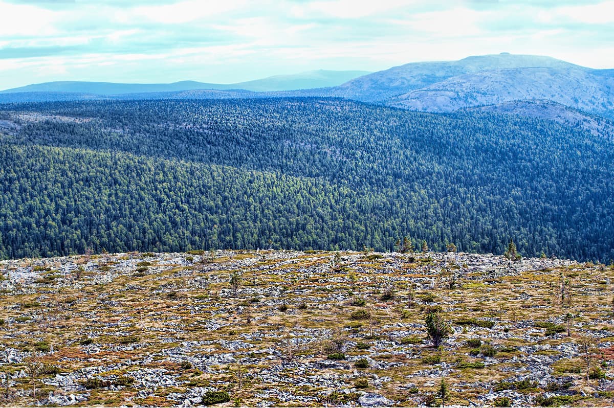
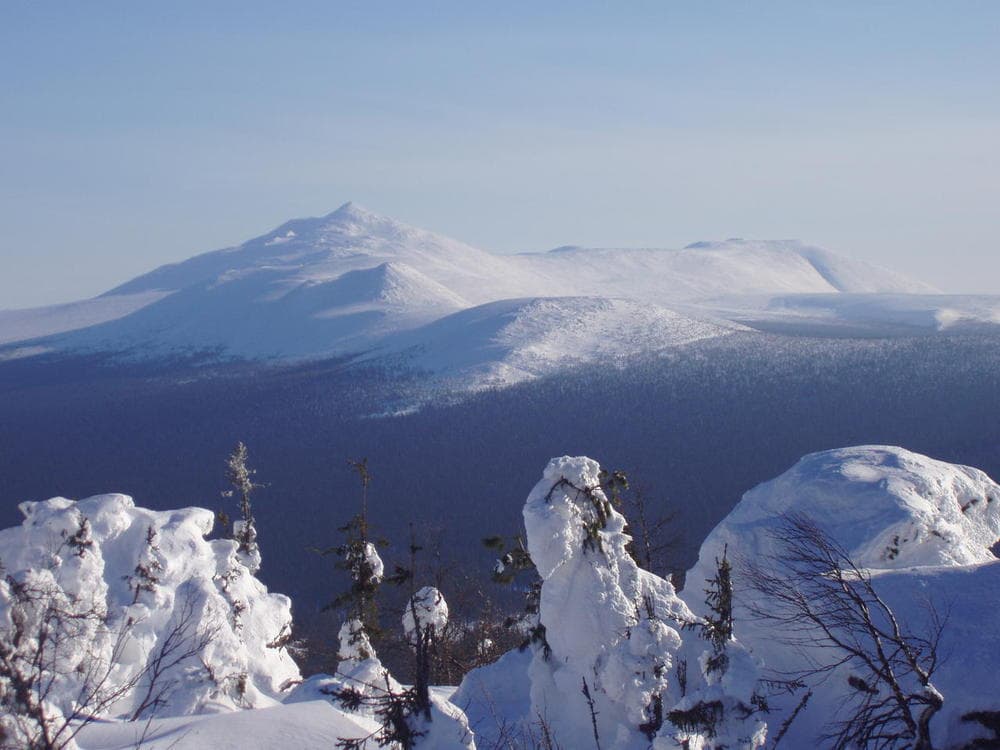
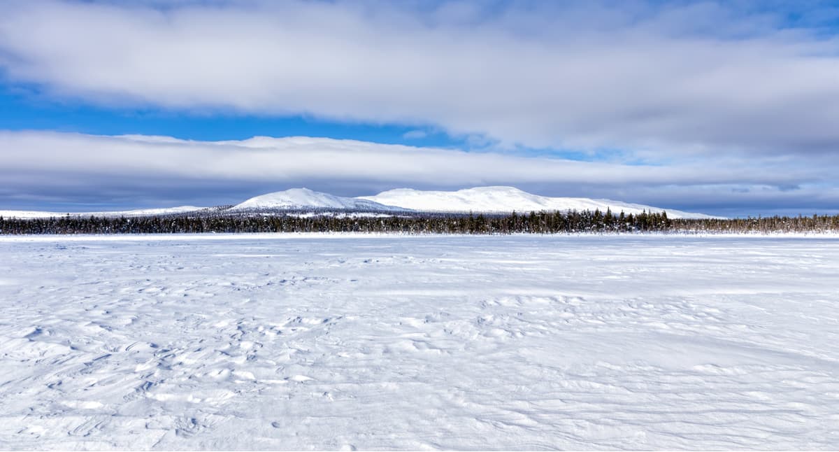
The Perm Territory is rich in karst phenomena, especially in the south-east. The highest mountains are situated in the north (the Northern Urals), there is Tulymsky Stone (1,469.8 m, the highest peak of the Perm Territory), Isherim (1,331 m), HuSoik (1,350 m), Molebny aka Prayer Stone (1,240 m), Martai (1,132 m). The usual name for mountains in the Urals is ‘stones’, they tower over the rest of the area. Among the mountains of the Middle Urals, the highest are located in the Basegi Range (993 m).
Over two-thirds of the territory is occupied by forests mainly represented by dark coniferous taiga. There are two subzones: the middle and the southern taiga. The forests in these zones differ. The middle taiga is dominated by conifers, predominantly by spruce and fir. There are two types of spruce in the territory of the region: the European and the Siberian spruce. The southern taiga features broad-leaved tree species, e.g. linden, maple, elm. Among other tree species, you can find cedar (or rather cedar pine), juniper, three species of birch (silver, downy, and drooping or nodding birch), ground cherry, bird cherry, mountain ash, and aspen. More than 60 plant species are included in the Red Book of the Perm Territory. There are a lot of endemic and relict species, most of them can be found in the many reserves located in the Perm Territory.

The animal world is astounding, there are 62 mammal species, 270 bird species, 42 fish species, 6 reptiles, and 9 amphibians. The most common predator is forest marten. By the number of martens, this region occupies one of the first places in Russia. There are ermine, weasel, badger, otter, wolverine living peacefully in the local forests. Bears and lynx can be found all over the territory, except the very south, but their numbers are small. Wolves and elks can also be spotted occasionally. When winters are not very snowy, roe deer can come to the eastern parts of the region from the neighbouring Sverdlovsk Region. And in the northern regions, there come deer from the Komi Republic. Hunting some animals (sable, otter, marten, moose) is possible only under special permits (licenses). Roe deer and reindeer are under protection and hunting them is prohibited.
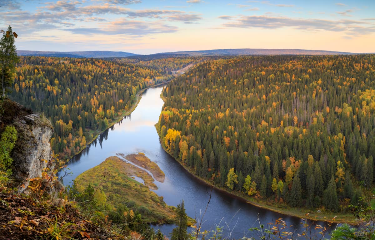
The river network is the densest in the country, there are 29,179 named rivers. The region ranks first in Russia in terms of the rivers’ length and water capacity. The largest rivers of the region are the Kama with its tributaries of the first and second-order: the Vishera, the Chusovaya, the Kosa (Kama tributaries), the Kolva (the Vishera tributary), the Sylva (the Chusovaya tributary) and others.
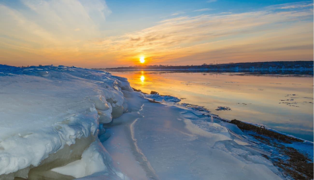
The rivers originate in the Urals. In their upper reaches, the rivers flow down the valleys between mountain ranges and have quite a measured and slow current. Yet once they approach the foothills, rivers acquire more rapid character, typical of mountain rivers, but not for long. When they reach the plains, the currents quieten down and you can enjoy a perfectly calm boat ride. The rivers are characterised by mixed feeding with a predominance of snowmelt (50-60%). Local rivers have plenty of spring floods when water levels rise dramatically and very rapidly, whereas summer and autumn seasons enjoy low water sometimes interrupted by rainfall floods. Winter is defined by low water as well. Rivers get frozen in the second half of November and open in late April – early May.
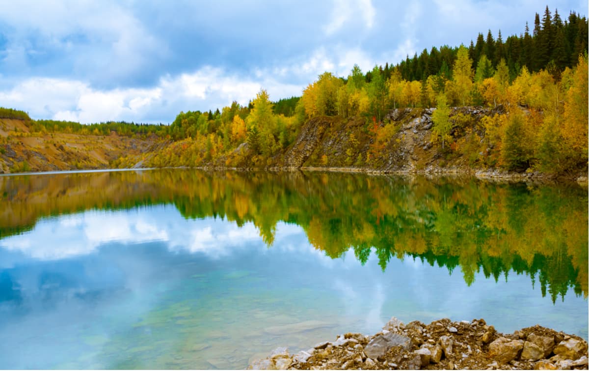
As to the lakes, the figure is mind-blowing over 5.8 thousand. Those lakes and artificial reservoirs include about 690 lakes with the area of more than 0.01 sq.km. and a huge number of smaller lakes. Most of them are located in river floodplains, mainly as meander lakes. Among the boggy massifs of the north of the Territory, there are relict lakes, and in the central areas, there are mainly karst lakes. The largest lake in the Perm Territory is Lake Chusovskoye with 18 sq.km of area. The largest reservoirs are the Kama and the Votkinskoye reservoirs on the Kama River, they were created during the construction of the hydroelectric station and the Shirokovskoye reservoir on the Kosva River.
Among the federal regions of Russia, the Perm Territory is second only to Tatarstan in terms of the area of lakes and artificial reservoirs. Swamps and marshlands occupy about 2.31% of the territory which makes it number one in the country if counted by the area of marshes, marshlands and swamps of the territory as a whole. The area and the number of lakes, artificial reservoirs, swamps and marshlands are unstable and depend on natural and anthropogenic factors viz. drainage, watering of territories, etc.
The climate is moderately continental. The Basegi Ridge as well as the Urals Mountains in general are on the way to the western air mass transfer. Thus, despite the relatively low altitude, they significantly limit the spread of air blown in from the Atlantic to the east. As a result, the climate of the Perm Territory has a pronounced continental character. The seasons are distinct, you can surely tell winter from spring and summer from autumn. Winters are long, snowy, and summers are moderately warm. Winter usually starts in November, with snow cover remaining until April and in the north even until May. By March snow thickness reaches about 80-90 cm in the north and 60-70 cm in the south. In the valleys, the snow depth can reach 1.5-2 m, while at the mountain tops it does not exceed 50-70 cm.
The average temperature in January is -17 C (+1 F). There quite often occur severe cold winters with strong winds when the temperature drops to -53 C (-63 F) in the north of the region. Spring comes in early April and brings about unstable weather with extremely sharp fluctuations in temperature. In May, there is a return of cold weather with harsh frosts. The warmest summer month is July. The average temperature of July in the northeast of the region is +15 C (+59 F), and in the southwest, it is +18.5 C (+65 F). On the hottest summer days, maximum temperatures can reach +38 C (+100 F).
The Perm Territory is blessed with rich deposits of minerals. The world's largest reserves of potassium and magnesium salts, as well as rock salt, are concentrated here. Some time back, this region was called the Salt Capital of Russia. At the end of the 17th century, the city of Solikamsk was the centre of Russian salt production. Currently, salt making in the city has been stopped.
In earlier times, the Kama region massively mined coal. Now all coal mines are closed due to unprofitability. The first Russian diamonds were found in this region as well. The main well-developed industries of the region are oil, chemical and petrochemical, timber, ferrous and non-ferrous metallurgy, machine engineering. As to the chemical industry, mineral fertilizers are dominating the market. The main industrial centres of the Perm Territory are Perm, Berezniki, Solikamsk, Chusovoy, and Lysva. The southern parts of the Territory are agricultural.
The Perm Territory is a major cultural centre. There are many theatres, museums, numerous festivals. At the same time, natural tourism is also developed here due to great natural landmarks. These include beautiful rivers with rocky shores, mountains with wonderful panoramas, and caves with spectacular mazes and grottoes.
The most famous and popular peaks and ranges are the main Ural Mountain Range, the Tulym Range (the Tulymsky Stone), the Chuval Range (the Chuval Stone), the Kvarkush Range, the Basegi Range, the Munin-Tump Mountain, Kruglytsya Mountain, Vetlan Rock and Polyud Rock, Molebny (Prayer) Stone, Kolpaki Mountain, Oslyanka Mountain, Stone City Rocks, Usvinskie Stones and others. Some of these ridges and mountains are located in the reserves of the Perm Territory.
The Main Ural mountain range is the natural border between the Perm Territory and the Sverdlovsk Region, between Europe and Asia.
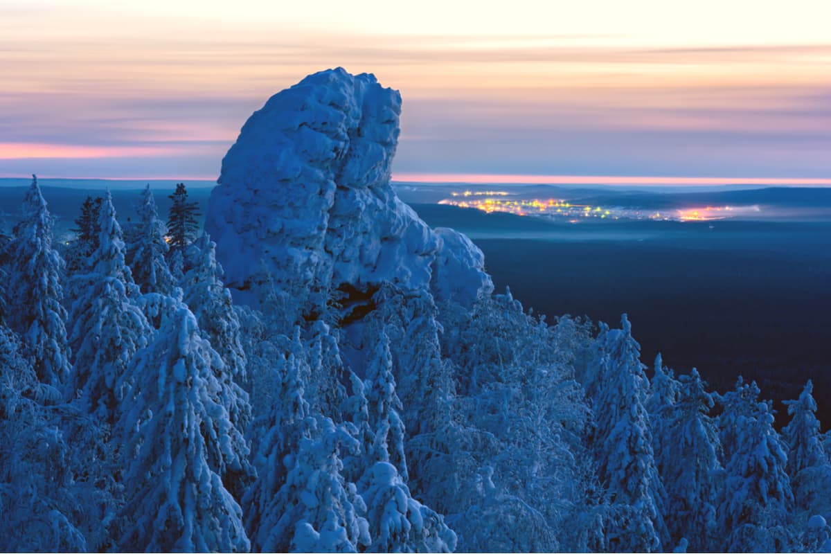
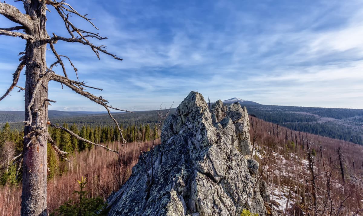
The Basegi Ridge is located in the western spurs of the Ural Mountains. The total length of the ridge is about 30 km. The Basegi name comes from an old Russian word ‘baski’, i.e. beautiful. The ridge features low mountains with gentle green slopes. The peaks are covered with stone placers (or boulder streams), with bizarre rocks, stony idols, arêtes and pillars. In some places, loose rocks form vast stone rivers.
There are relict plants of mountain-forest, subalpine and forest belts as well as subalpine meadows and mountain tundra. The ridge consists of three peaks – Northern, Middle and Southern Basegi. The highest point of the range is Mount Middle Baseg (994 m). In 1982, the territory of the ridge became a protected area of the Basegi Natural Reserve and only Northern Baseg (951 m) is officially open for tourists. There is a trail from the cordon Northern Baseg to the top of the mountain. When you go up, all the high-altitude belts show their secret treasures, animals feel free in the forests and not that afraid of a human. You can even meet a bear.
On a good clear day, you can see Middle Baseg and Southern Baseg, Oslyanka Mountain, the Kharius mountain range, Kachkanar, and provided the visibility is good, even the massif of the Konzhakov Stone.
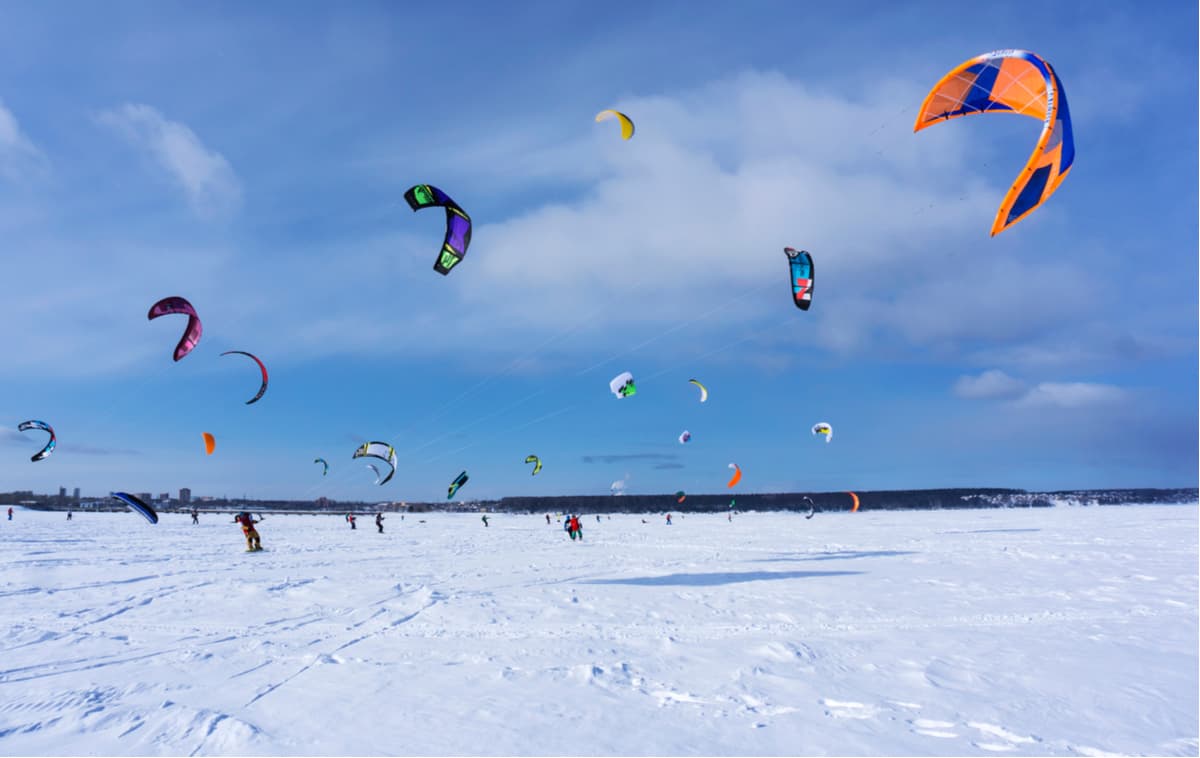
In summer, the most common activities are hiking, cycling and hiking combined with some rafting on the Vilva or Usva rivers. In winter, there are ski and snowmobile expeditions.
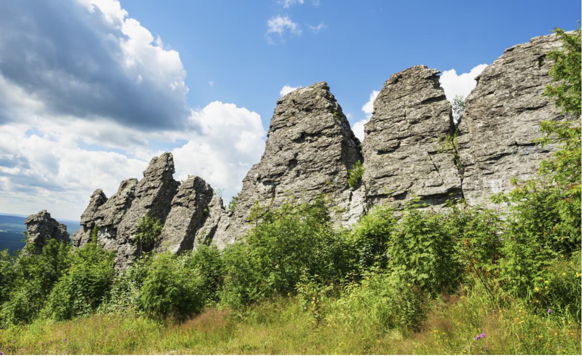
Kolpaki Mountain (614 m) is a hill with an almost perfectly rounded peak. Rumour has it, the name was given because of this round shape as it means ‘a cupola’ in Russian. The main landmark of the hill is the jagged array of stone pillars on the top, the so-called weathering columns of fanciful forms (up to 20 m high). The second name of the mountain is Long Fingers. The most famous of these rocks is the Devil’s Finger. A wooden staircase leads to the observation deck on one of the pillars, you can also have a picnic there. From the top, there is a magnificent panorama over Kachkanar Mountain, the Basegi Ridge, and some gold mines. A pine forest densely covers the slopes. There are a lot of tourists here at any time of the year, mountaineers often have training.
Mount Oslyanka (1,119 m) is somewhat reminiscent of a ridge shape since it stretches from north to south for almost 16 km. The mountain has stone placers, steep slopes and a plateau with stone pillars. It has several peaks, the main is located in the central part of the so-called ‘ridge’ and has a conical shape. In the olden days, the mountain was surrounded by prison camps. Now they are gone giving a way to tourists and outdoor enthusiasts who are lured by the strange shape of this mountain.
Every year in late February or early March a ski marathon is held on Mount Oslyanka. At the end of spring and in summer, you can hike to the top and combine it with good rafting on the Kosva River. From the top, you can see the Basegi Ridge and Konzhakov Stone. Oslyanka is a disputed territory because some researchers attribute it to the Northern Urals whereas others claim it to belong to the Southern Urals, especially since the border between them is quite conventional. But the climate and the nature of the mountain is typical for the Northern Urals. In winter, there is much snow and frequent severe frosts; there are avalanches on the slopes. In summer the weather is very changeable and you can experience massive heat waves alternating with heavy rainfalls.
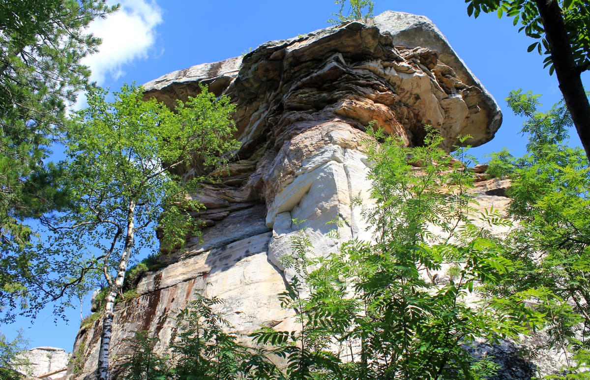
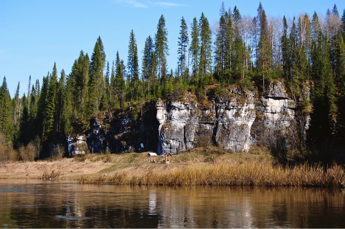
There is a real Stone Town situated near the village of Usva on the top of the Rudyan Spoy Ridge (526 m). This rocky town is also called a Fortress, a Devil's Hillfort or Turtles. When you look at the rocks here, they give an impression of a perfectly organized settlement. You can see narrow streets, corridors, arches and stone gates, houses and squares. This site reminds not of the ruins of a man-made ancient city, but of a kind of a rock labyrinth made of huge boulders. It can also be said that there are townspeople or representatives of the ancient settlement: the stones of the Small and Big Turtle, the Feathered Guardian, the Seal, various stone idols, etc. These rocks have a variety of different colors ranging from white and yellow to red and black, which is due to the sandstones encrusted on the surface of boulders. The Stone Town is divided into a Big Town and a Small Town standing somewhat 200-300 meters apart. There are only four stone idols in the Small Town. Many tourists, including rock climbers, come here at any time of year.
In recent years, the Perm Territory has created quite a few skiing bases, the largest and most famous of which is Gubakha located on Mount Krestovaya (471.3 m). The mountain is the symbol of the town of Gubakha nestled at the northern end of the Rudyan Spoy Ridge.
The List of ski centers in order of their remoteness from Perm City:
Due to abundant karst phenomena in the region, caves are found aplenty here. Nature was generous and gave the region such gems as the Divya Cave, the Kungurskaya Ice Cave, the Orda Cave, the Miracle Cave and many others. Some of them are equipped for excursions while others preserve their natural pristine state. Each of them is unique.
The Divya Cave is one of the longest caves in the Urals, and the top league the Perm Territory. The name Divya comes from the word ‘divo’, or ‘miracle’ and speaks for itself – it is one of the most beautiful caves in the Urals. The cave is located on the bank of the Kolva River, 12 km from Nyrob village. The total length of all its passages reaches 10 km. A small (about 1.5 m) horizontal entrance to the cave is located in a steep, forested coastal slope of Mount Diviy Kamen at an altitude of 90 m. A very narrow and low corridor leads to a series of grottoes and galleries. You will have to creep on your stomach in some places. In the cave, there is an amazing variety of calcite formations, it feels as if you are in a speleological museum. The cave is quite dry and clean despite a small stream and several lakes. On the surface of the lakes, you can observe an unusual phenomenon – the so-called calcite ice particles. The water temperature in the lakes is +4 degrees Celsius (+39 F) at any time of year. The air temperature in the cave varies from +4 to +8 degrees Celsius (+39 to +46 F).
The Kungur Cave is the oldest tour-guided gypsum cave in the world, the first excursions were here back in 1914. It is known and famous far beyond Russia for its ice grottoes. It is a real underground museum which has paths and lighting allowing you to see the cave in full splendor. There are about a dozen of the caves well-equipped so well in the whole world, thanks to which the Kungur cave is widely known outside the Urals. The entrance to the cave is located on Ice Mountain (Ledyanaya) on the right bank of the Sylva River, on the outskirts of Kungur in the village of Filippovka.
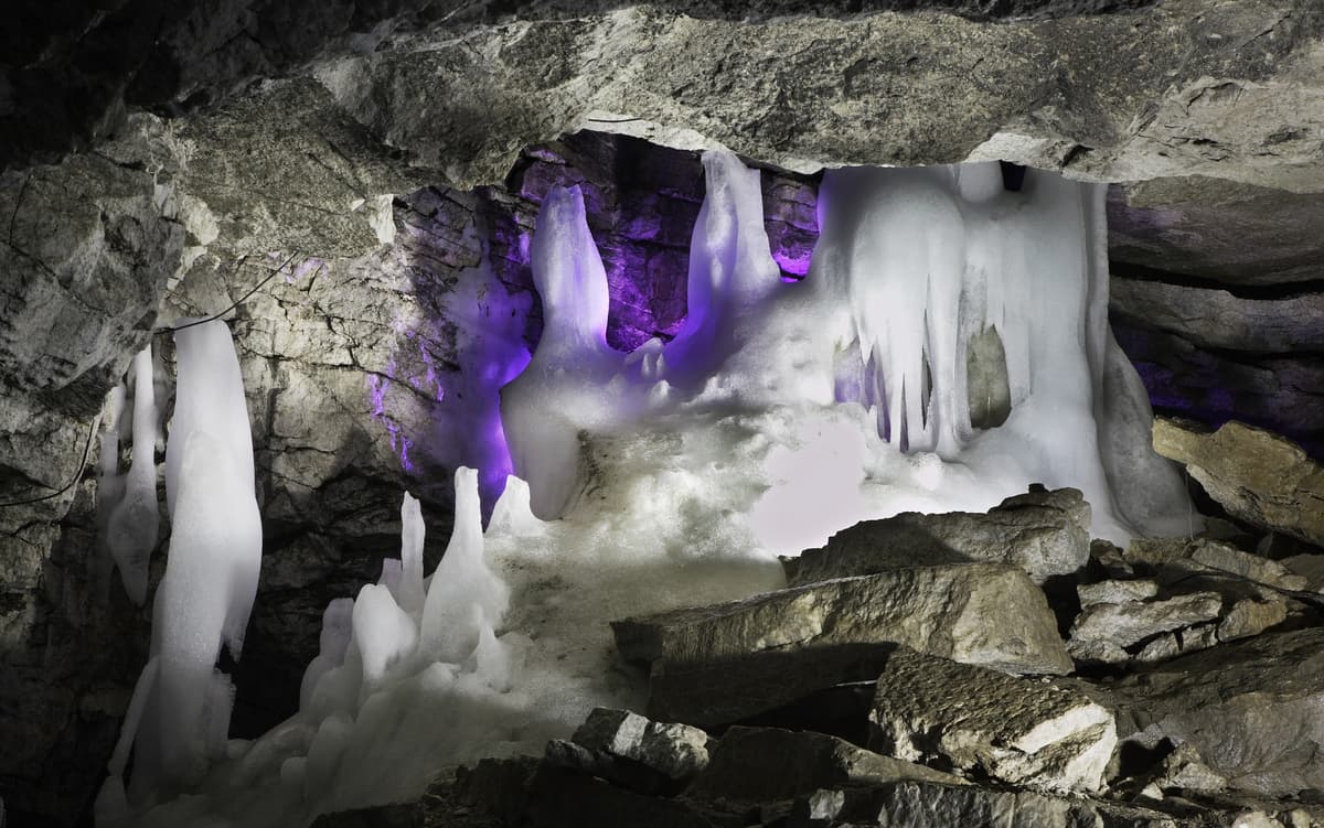
Ice Mountain is strewn with karst sites, there are funnels, sinkholes, karst trenches and many more. One of these is the Kungur ice cave which is about 5700-meter long. About 1300 m is available for tourists. This underground realm has 48 grottoes, 70 lakes, 146 organ pipes. It is called an ice cave for a reason. In most grottoes the temperature is around 0 degrees Celsius (+32F), and in some places it drops to - 15 degrees Celsius (+5F). From February to April, the cave is the most spectacular because then you can observe magnificent snow crystals of the Diamond grotto, as well as ice stalagmites and stalactites of the grottoes Polar, Cross, Vyshka. They create an interesting contrast with the unfrozen lakes in the Friendship of the Peoples Grotto and the Long Grotto. In summer, there is a grand laser show held in the cave. When you are in the cave, try to hear the "music" of the underground organ.
Visiting is possible only with a tour, groups are formed on site and enter the cave according to a schedule. There is a Karst Museum in the cave, where you can spend time waiting for the beginning of your visit. In winter, the Ice Mountain offers skiing and bagel riding (Firefly and Stalagmite Ski Centres).
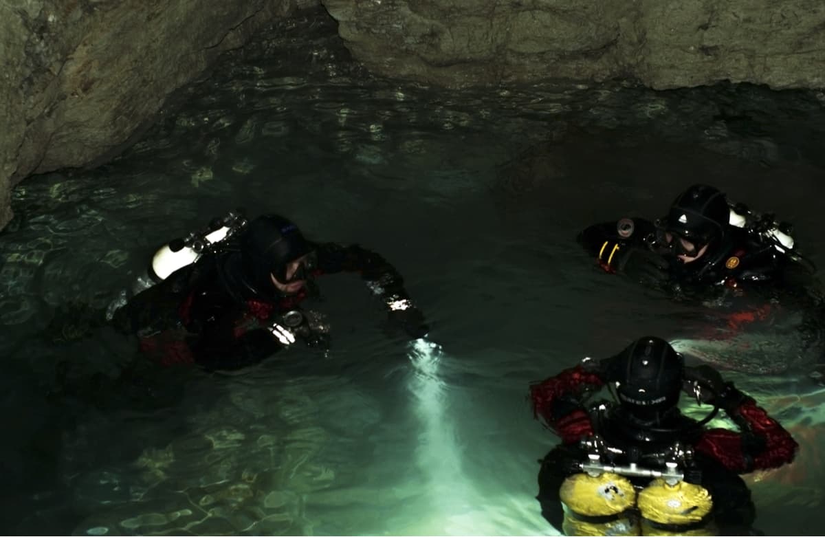
The Orda (Ordinskaya) Cave is located 35 km from the Kungur Cave, near the village of Orda. It is a rather wild rustic cave, not equipped with any facilities, yet it is also quite famous. It is the longest underwater cave in the world in gypsum, which is a real paradise for cave diving (diving with scuba in caves).
It has 4 km of undersea and underwater passages and the longest siphon in Russia (935 m). You can go 15 meters down a good staircase and see only 300 meters of dry passages and halls. And then there are 1250 m of underground lakes which are an irresistible temptation for speleo-divers. At the entrance of the cave, there are beautiful banks of the Kungur River. In the village Orda, there is a local history museum exhibiting a nice collection of coins, watches, samovars, and there is the Prophet-and-Elijah's Church.
The Miracle or Wonderworker Cave got its name thanks to a lot of bizarre natural creations collected here. It is located on the right bank of the Ponysh River, not far from the place where it flows into the Chusovaya River. The entrance to it is located in a crevice on the slope of Mount Kladovoy Stone (at an altitude of about 50 m). The length of the cave is only 512 m, but the amount of wonderful things is mind-blowing. The walls of grottoes and passages are covered with picturesque limestone formations. Here you can find stalagmites, stalactites, dripstones, small lakes, stone waterfalls, cave pearls, etc. The cave is not equipped, thus you must have some speleological experience or an experienced guide to visit it. The easiest way to go is while rafting on the Chusovaya River. The best time for a hike is July or August. In winter, it is possible to go skiing or snowmobile hiking in the vicinity of the cave.
There are two specially protected natural areas of federal significance in the Perm Territory:
The Vishersky Nature Reserve
The Basegi Nature Reserve
Besides, there are about 300 territories of regional importance and about 130 territories of local importance such as natural landmarks, reserves, protected sites, historical sites, etc.
The richest in natural landmarks is the Cherdyn district of the Perm Territory. There are many specially protected areas here. The following regions are the runners-up: the Krasnovishersky, Solikamsky, Bolshesosnovsky, Chusovskoy.
There is also a private park of the Valley of Waterfalls. Its creator and owner is Anatoly Vasilyev or just Egorych (a local witch doctor, healer, herbalist, author of many books). This park includes a man-made area with many springs and streams, sacred pagan places and an anomalous zone. The Valley of Waterfalls has already become famous as a place of UFO concentration, fluorescent glows of unknown origin and other mysterious phenomena. The visit season is from May to October. You can come here as a tourist or a volunteer.
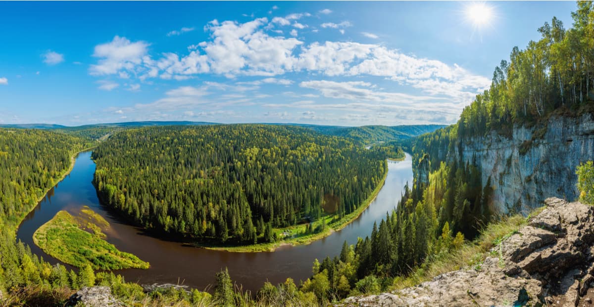
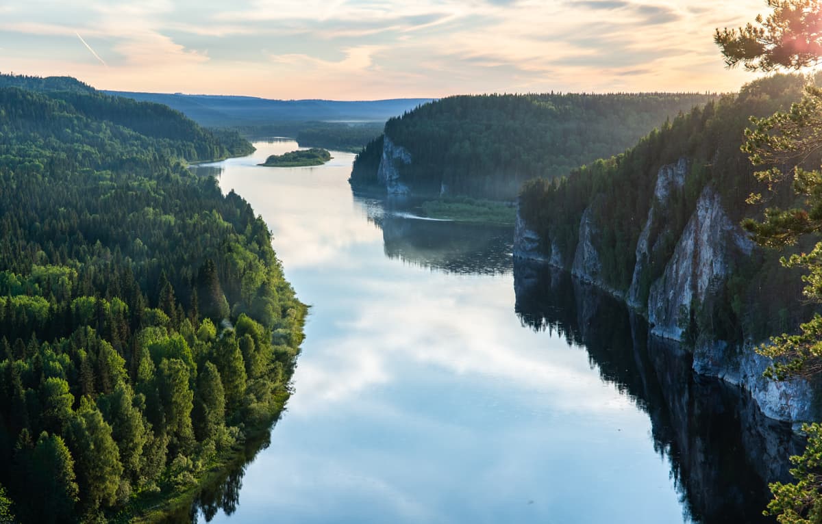
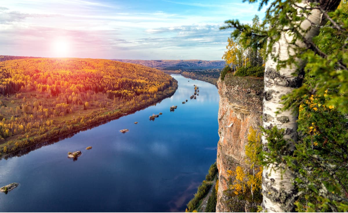
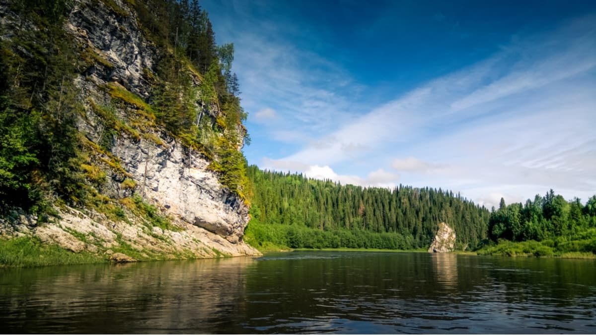
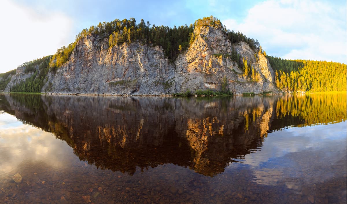
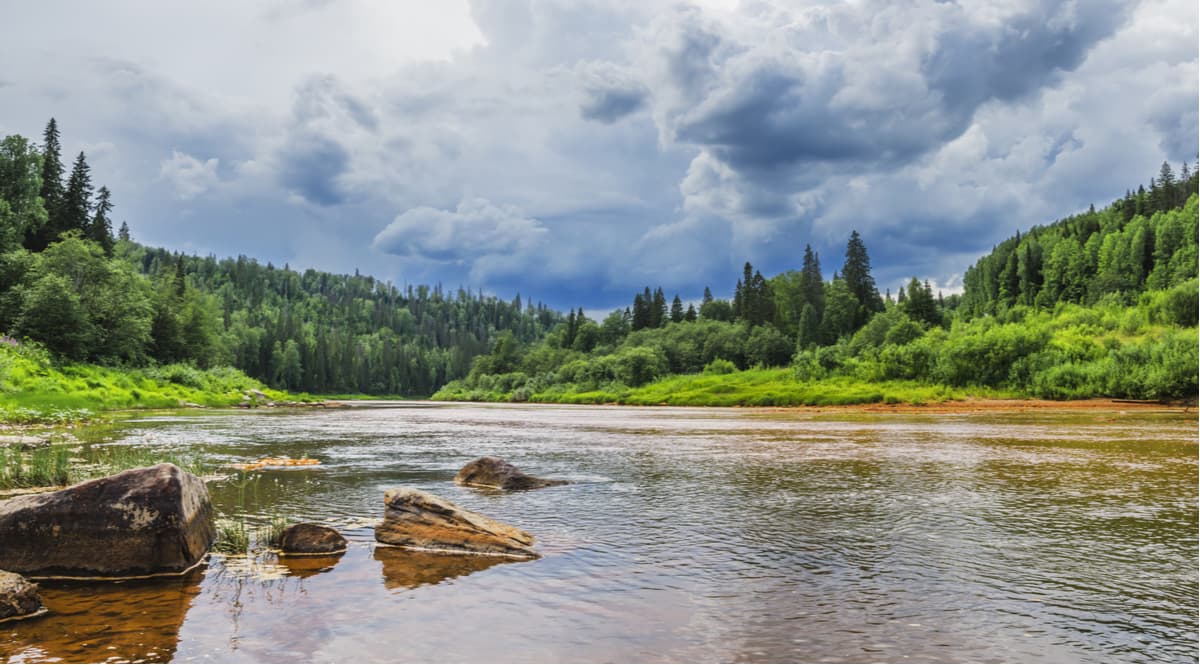
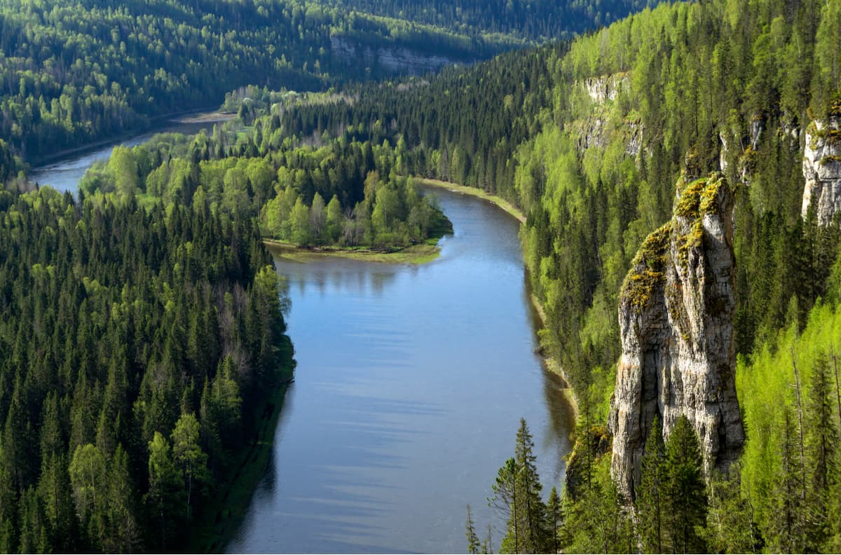
The Perm Territory is rich in picturesque rivers with beautiful rocky banks, which will be interesting for water tourists and fishing enthusiasts. The most popular places are the Chusovaya, the Vishera, the Usva, the Vilva and the Koiva Rivers.
Most attractive for tourists is surely the Vishera which upper reaches are located in the Vishersky State Nature Reserve.
Apart from its pretty banks and splendid tall rocks towering over it, the Chusovaya River has many caves, Blue Lake, and Small Blue Lake.
In spring, the Vizhay River, a left tributary of the Vilva River, is one of the most technically challenging rivers for rafting. In summer, it grows shallow and turns into a quiet brook. It starts on the slopes of the Vizhay Mountains. The best time for rafting is late April to late May. The water route starts from the village of Sarany which is 6 km away from the railway station Lucky. The water will not let you relax – sharp underwater and surface rocks are generously strewn along the way. In the coastal rocks, there are plenty of yet unexplored caves. When approaching the village of Pasha, rafting becomes easier, the river expands and forms some islands. However, it is here that the main obstacle of the Vizhay River, the Pashiya Cliff, is located. At the bridge after it, many tourist groups finish their rafting. However, if the rafting continues until Chusovoe village (another 70 km), you can see two more signature phenomena of the Vizhay River: the Big Funnel Rocks and the Great Pasha Cave located in the mountain nicknamed the Alpinist by tourists. The entrance to the cave is 30 m above the river. The 500-meter-long cave has 15 grottoes and a 12-meter waterfall that turns into a stream flowing into the underground lake.
Rafting the Vilva River is a real test of your rafting skills as it is a truly mountain river. The river is located in the north-east of the Perm Territory and flows down the western slopes of the Ural Range. In springtime, right after the ice drift, the river becomes one of the fastest and most fertile in the region. In summer, the river shoals heavily in the upper reaches. Only well-trained rafters or those with an experienced guide can go down it. The river bed is full of turbulent places, rapids, rolls and swifts.
The main obstacle is a series of rapids called Nyrky. There is a dangerous artificial threshold created on the site of the gas pipeline crossing, there is a reinforced concrete pole and the difference in height reaches 1.5 m, which is better to bypass by land in case you are not sure you can master it safely. You can start rafting from Novovilvensky or a bit farther away from the mouth of the Korostelevka River. After the Nyrky rapids and before the Koldovaty (Sorcerer’s if translated poetically) brook, the Vilva flows past the Kosaya Plate Rocks. Beware of those since the riverbed in their vicinity features many rocks, boulders and rapids. Once you pass the mouth of the Koldovaty brook, you come into the Koldovaty rapids. Farther down the stream, there are more rocks in the river, e.g. the Upper Baran and the three Morozovsky islands after the confluence with the Izbnaya River.
There is a picturesque bridge near the uninhabited village called Palace, and just in front of the village there is a picturesque Falcon (Sokolnaya) Mountain. It is an ancient volcano of about 600 million years old. Such geological formation is a rarity for the Urals. One can climb the mountain and admire the views of the Basegi Ridge and the river. The trails are heavily covered with shrubs and plants, hardly anybody gets here. After the Palace village, the Vilva River features fewer obstacles and islands. In the lower reaches and especially after Gremyachinsk town, the river is heavily polluted and becomes almost lifeless due to rampant industrial activities. The Vilva finally flows into the Usva and further into the Chusovaya River.
The Koiva River is considered the most picturesque tributary of the Chusovaya River. It enjoys crystal clear waters and is mainly mountainous, winding and narrow in its upper reaches. The Koiva has many rapids and a fast current. It is rafted mainly during the spring floods (in the first half of May). In summer, the river is shallow, but despite the fact that the speed of the current is dropping, it still remains passable for both kayaks and catamarans. However, during dry weather there may not be enough water for rafting (above the Biser village). Rafting the Koiva is technically more complex and interesting in spring, whereas in summer, even families with kids can do it. The route can be combined with the Chusovaya River rafting.
The trickiest part of the route is from the village of Old Biser to the village of Kusya -Alexandrovsky. It features the Fedotovsky threshold (heaps of boulders across the river that allow only for a very narrow gentle water drain in the middle; the threshold is not dangerous in summer), the Kalistratovskaya Shivera (it is a 500-meter long rapid, but not dangerous). Once you pass Ust-Tyrym village, there are several beautiful rocks some of which can be easily climbed (Strelny, Arochny, Dyrovaty). The Shaitan rock is fascinating as well. Near Kusya-Alexandrovsky settlement, there is a waterfall formed by the dam of the Kusya river that dumps excess water into the Koiva river. In spring, extreme sports lovers conquer the waterfall on catamarans. There is a road bridge downstream where many rafters finish their joy rides. Further downstream, before the Koiva flows into the Chusovaya River, there is a section with many artificial islands. There are quite a few stops along the banks of the Koiva River, and the river is popular with both rafters and fishing enthusiasts.
The Usva River is the largest tributary of the Chusovaya River. It originates on the eastern slope of Mount Khariusny Stone. The valley of the river is winding, but at the same time the river is quite calm. There are about 200 rapids which probably prompted the Komi people to call it ‘noisy water’. There are rocks along its banks. Rafting is done with catamarans and kayaks. The optimum time for a ride is when the water is still high and that is in the beginning of May, but you can go rafting all summer. It is necessary to keep in mind that in summer the river grows very shallow and only the lower section from the village of Usva to the Chusovaya river is available for boating.
There are several options of routes along the Usva. You can start rafting from the station Usva or from the village Srednaya Usva. You can finish rafting in different spots depending on the desired length and time of the route. At first, the river is narrow, only up to 5 m wide, heavily looped, and the current is fast. However, once the right tributary called the Bolshoi Yaz flows into the Usva, the river straightens and becomes calmer.
Close to the next right tributary called the Persha and after the destroyed bridge, there is a beautiful view of the North Baseg Mountain. Not far from this place is the border of the Basegi Nature Reserve. When you do downstream, there are rocks with equipped observation platforms from which you can admire the beauty of the mountains and panoramic views of the river. Then begins the most difficult part of the rafting – the Dry Rapids. For several kilometers, the riverbed features rocks and boulders occupying most part of the river. In summer during a drought, they turn into piles of stones, hence the word "dry" in the name of the rapids.
The section from the village of Srednaya Usva to Bezgodovo (about 130 km) lacks housing and roads, all you see is solid taiga and pristine nature. Several purest rivers flow into the Usva, i.e. the Big Khariusnaya, the Little Khariusnaya, the Big Baseg, the Little Baseg. This span of the route is a paradise for fishing enthusiasts. While rafting, drop to Gromovaya village and see some stone pillars (all lonely rocks along the river Usva are called pillars). There are 4 easy rapids from Shumikhinsky settlement to the station Usva. Three kilometres away from the village of Usva, the river has majestic rocks that stretch for several kilometers – this is the Usva Columns Massive; these rocks are up to 120 meters tall and you can see traces of corals in them, which proves there used to be a sea here a million years ago.
Once you pass those columns, the wonders don’t stop. There are mountains and rocks on the banks of the Usva, i.e. Overhanging Stone, Small and Big Log Stones (famous for their echos), Panorama Rock, Goat Stone (aka Strelny), Omutnaya Stone (aka Big Whirlpool). At Omutnaya Stone, the river depth reaches 6 meters, the water here is very cold even in summer because of the abundance of underwater springs. Then there are the Bastion cliffs and the Arch. You can finish the route in Chusovaya village where there is a railway station and access to automobile roads.
Another attraction of the Perm Territory is the Ice Falls called the Icicle. In spring and summer, 12 km from Usva railway station, on the right bank of the river Usva, streams and brooks flow down from Omutnaya Stone forming mini waterfalls about 5 m high. However, at this time of the year they are not very remarkable among dozens more similar cascading streams in the Urals. Quite a different thing happens in winter. The water freezes and turns those smallish waterfalls into a giant icicle 15 to 27 meters high. Every winter its size and shape is unique. The Perm people call this icefall very simply – the Icicle. The Icicle is not the only frozen waterfall here, there are a couple of smaller cascading icefalls in the region as well.
Alexandrovsk Blue Lakes are located in the north of the Perm Territory near the town of Alexandrovsk. These amazing man-made lakes have deep turquoise water. They were formed in the old abandoned quarries used for limestone mining (the Shavrinsky and Morozovsky quarries). It is the limestone dredge in the water that gives it such a beautiful color. You can get to the quarries by bus from Perm.
The White Sea in Berezniki is another unusual place in the Perm Territory that exhibits a striking contrast of landscapes. Just imagine walking in the forest, looking at giant trees and catching a glimpse of the Kama River now and then. But suddenly you step into a place when you see a turquoise surface of water resembling some tropical sea with a snow-white shore around it. In the background, you can see the factory buildings. This is Berezniki Soda Plant. The city of Berezniki is home to the soda industry in Russia. When soda is produced, the generated waste is a kind of pulp that is stored in a special storage facility. The White Sea is nothing but a pulp storage reservoir filled with water. The white color of the pulp gives the shores this whitish hues of a true tropical sea shore, and the azure color of the water is produced by various chemical compounds. You can get to the White Sea by bus from Perm to Berezniki. From the center of Berezniki, you should take a bus to the town of Usolie or Usolie district (go to the Boat Base station).
The following zoological nurseries operate in the region:
The Cossack equestrian school, which includes a mini zoo and a horse farm. It is situated 140 km from Perm.
An ostrich farm called The Strauss Park (50 km from Perm).
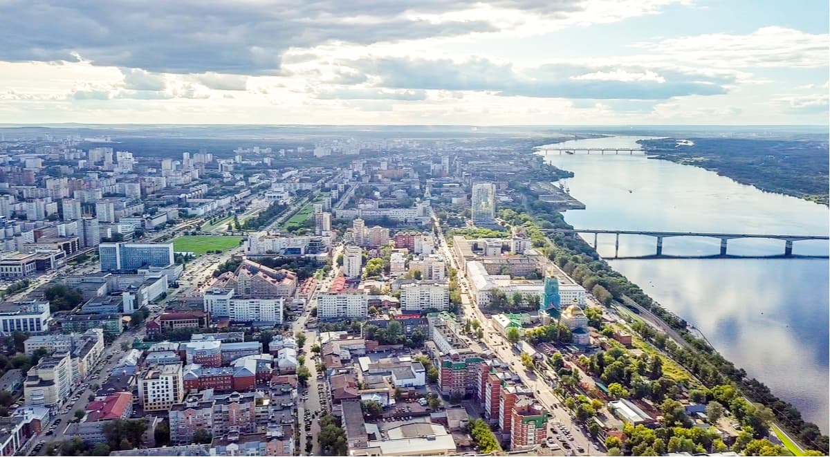
The best place to start your acquaintance with the Perm Territory is its capital – the city of Perm. The transport network here is well-developed. There is the Perm branch of the Sverdlovsk Railway, the Kama River Shipping Company, the Bolshoye Savino International Airport, and major roads connecting Perm to Moscow.
It is most convenient to get to the city of Perm by rail or by air.
Perm was founded in 1723 by Vasily Tatishchev, the man who laid foundations for many cities in the Urals. The city began as a small settlement at Yegoshikhinsky Copper Smelting Plant. Take a 2-hour walking route called The Green Line to acquaint with the city. Along the route, there is a green line on the road, and information boards near interesting sites.
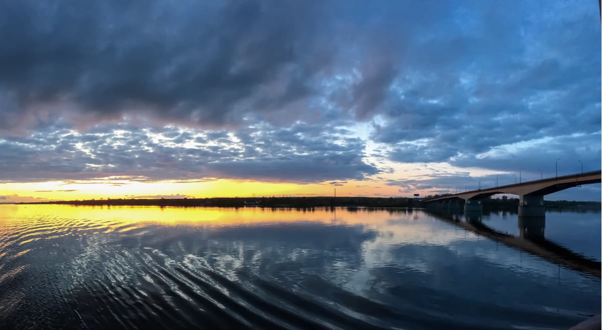
Perm is located at a large waterway. Walk along the embankment of the river Kama, go to the Kommunalny bridge which is especially beautiful in the evening lights, and ride a river tram.
There are several museums in the city, e.g. Perm Art Gallery, Regional Museum, Museum-diorama December 1905 armed uprising in Motovilikha, PERMM Museum of Modern Art.
During the theatre season, you can go to one of the theaters: Perm Academic Theatre of Opera and Ballet named after P.I. Tchaikovsky, Theatre Ballet of Evgeny Panfilov, Perm Academic Theatre called Theatre-Theatre, and Perm Municipal Theatre At the Bridge.
There are many other interesting sights in the vicinity of Perm City. The most famous of them are


Yes. Perm Krai has 391 named mountains. The highest is Tulymsky stone (main peak) at 1,453 m.
The highest mountain in Perm Krai is Tulymsky stone (main peak), at 1,453 m.
Perm Krai has 391 named mountains.


