
Scan the QR code and open PeakVisor on your phone
The Vishersky State Nature Reserve is located in the Northern Urals. It was officially founded in 1991 on the territory of the Perm Area (in its extreme north-east), near the borders of three administrative regions of the Russian Federation (the Perm Territory, the Sverdlovsk Region, and the Komi Republic).
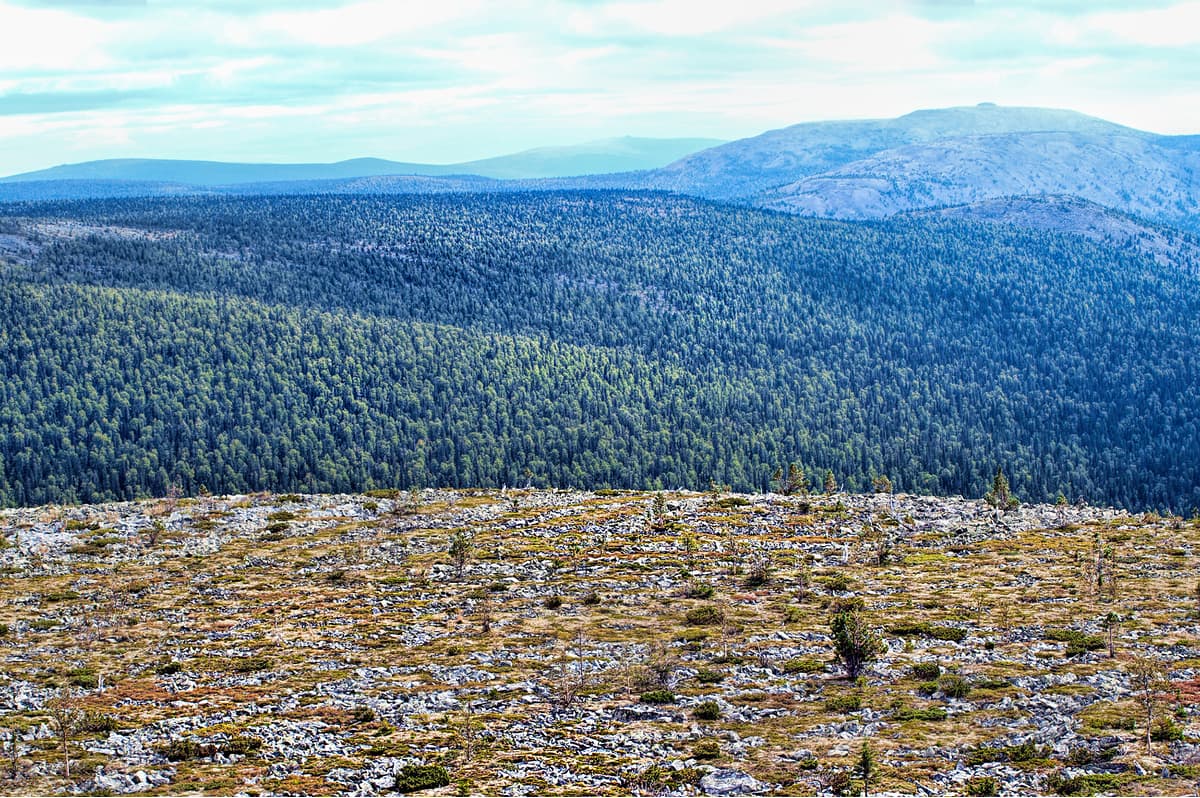
Its area is 2,412 sq.km.(241.2 thousand ha). The Reserve is 90 km long and over 30 km wide and stretches along the Ural Mountains. Due to its impressive size, it is one of the five largest reserves in Europe. The Reserve got its name due to the river flowing through it – the Vishera River. In the upper part of the Vishera you can see the virgin forest, the Reserve is one of the few places in the Urals (and the largest in the Perm Territory) which is so wild that virgin forests had a chance to stay virgin, no matter what a human might be doing nearby. This part is simply a bit too inaccessible. Side by side with the dark coniferous taiga forests, which occupy about 76% of the Reserve's area, there are mountain landscapes that you see at the heights from 750 to 1469 m.
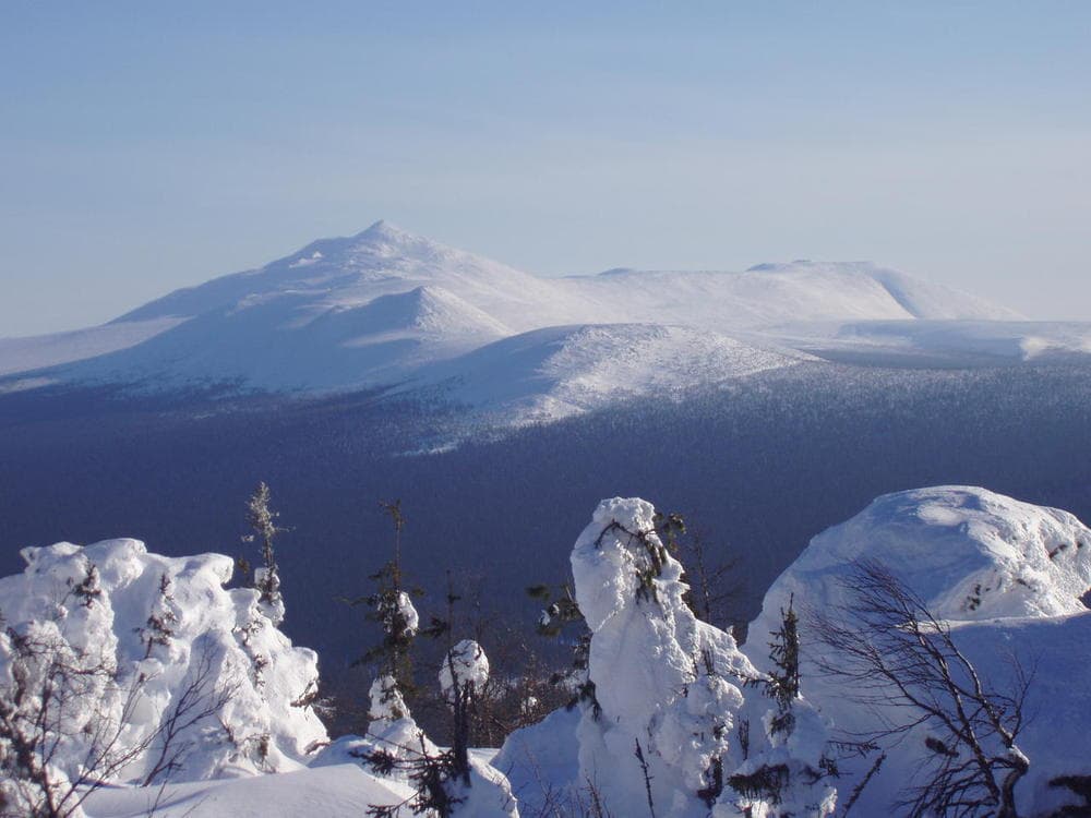
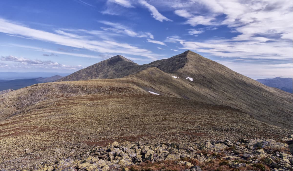
The mountain ridges usually stretch from north to south of the Reserve. They are the highest part of the Perm Territory, the highest point is Tulymsky Stone (1,469.8 m).
The two rivers – the Vishera and the Bolshaya Moyva – form perfect borders for the following mountains: Tulymsky Stone (1,469.8 m), Listvennichniy (Larch) Peak (878 m), Chuval (also called Chuvalsky Stone, 924 m), and Kuryksar (896 m).
To the east of the Bolshaya Moiva River rises the most powerful central mountain junction of the Reserve featuring Prayer (Molebny) Stone Ridge with the main peak Oyka-Chahl (1,322 m), Homgi-Nohl (1,301 m), Olkhovochny (1,056 m), Muraviny and Hus Oyka (1,350 m), Lyapi-Sali-Nohl (823 m), and Isherim (1331.8 m). To the south, on both sides of the boggy valley of the river Vels, there is Mount Martai (1,129.5 m), Mount Put-Tump (945.5 m), Mount Nyatai-Tump (932 m) and others. The most remote and inaccessible northern mountain junction of the Reserve, which has long been a patrimony of Mansi reindeer herders, unites several relatively low gentle ridges surrounding the sources of the Lopya, Vishera and Nyols rivers. Among them, you can see Lopya Stone (932 m), Oshener (1080 m), Pasarvat-Munin-Nohl (893.5 m), Vishera Stone (932.6 m), and Munin-Tump (924 m).
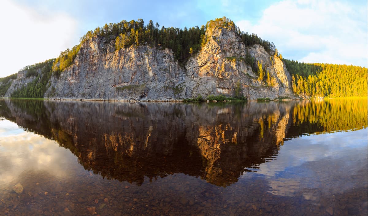
As to the geological structure, most of the protected area includes karst rocks - limestones and dolomites of Silurian and Devonian periods, as well as reef marble. This is why the upper reaches of the Vishera River have well-developed karst. Karst phenomena in the reserve are represented by funnels, logs, drylands, underground water sources and caves. The most famous are the large caves Lypinskaya, Dry Lypinskaya, Visherskaya-2, and Visherskaya. The latter is one of the largest caves in the North Urals (about 1200 m) and is second only to Divya Cave in this respect.
The river valleys are numerous and usually covered with thick forest, they are located at an altitude of 247 to 500 m above sea level. The relief on the territory of the reserve is interesting. It can be clearly divided into two parts: the western one is hilly whereas the eastern is mainly mountainous.
Along the right bank of the Vishera River, there are low (on average 300-400 m) woody ridges covered with dense fir and spruce taiga and small-leaved forests which appeared in the places of windbreakers, old tree felling and caves.
The left bank of the Vishera has a pronounced mountainous relief. The river valleys have a minimum height in the area, which is about 350 - 500 m a.s.l. Above the river valleys rise middle and low ridges with fairly gentle, often no more than 20-25°, slopes and absolute heights of 750 – 1,469 m.
The entire Vishersky Nature Reserve is characterized by a network of permanent water ducts and an abundance of small upland bogs located on poorly drained slopes of river valleys. The Reserve is completely located in the basin of the Vishera River (415 km long). On the lands of the protected area, there is the source of this river and the first 111-112 km of its bed, as well as numerous mountain tributaries. The largest of them are the rivers Khalsoria (aka the Malaya Vishera), the Niols, the Lopia, the Big Moyva, the Malaya Moyva, the Lypya, the Vels. The rivers are fed by snow and rain. The peak of spring floods is in May and early June. The low water season is in winter and in July - August. Rainfall floods are usually low in amplitude but not in frequency, it is a usual event to witness in August - September. The period of land-fast ice on the Vishera River is from early November to late April.
There are no particularly large lakes or glaciers in the Reserve. In the mountains, there are snowfields, snow patches, and snowdrifts the number of which is decreasing due to climate warming. Few small lakes are found only in the stagnant depressions of the upper swamps, as well as on the bottoms of mountain hollows flooded by streams and melting snow. The marshes are only upstream and are located near the largest rivers, still the swamp area is fairly limited.
There are numerous outlets of ground waters. Among them, the Bobrovaya River is the second most water-intensive underground source in the Urals. Here one can also find rivers disappearing underground. Near the houses of Lypya Cordon, the Dry Lypya River flows out of the sinkhole. The river originates on the Berezovsky Stone Ridge and a third of its 15-km journey flows under the ground.
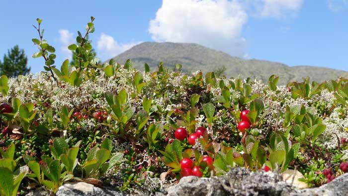
Photo from official site http://www.vishersky.ru/
All of the mountain ridges of the Ural Mountains in the Vishersky Reserve feature a pronounced altitudinal zonation, i.e. the soil and vegetation change dramatically once certain heights are reached. The lowest-lying parts of the slopes, which up to 600 m above sea level, are home to high dark coniferous taiga forests. With altitude gain, they are gradually replaced by sparse woods, meadow grasses and bushes of the bald mountains belt (600-850 m). Higher flat spacious plateaus are occupied by treeless aka bald tundra. Many stony peaks have very scarce vegetation typical of cold mountainous deserts.
The Reserve is home to flora and fauna species of five vast natural and geographical zones, i.e. the Arctic tundra, European coniferous forests, Siberian taiga, Siberian forest-steppe, and the Ural Mountains.
Spruce and fir forests grow next to white birch, Siberian mountain ash and cedar.
There are 36 mammal species, 155 bird species, 2 amphibian species, more than 12 fish species. Some of them are listed in the Red Book. The inventory of animals is still incomplete. Among the animals, there are relatively high numbers of northern and Siberian species (reindeer, wolverine, sable), yet the population of foxes and lynxes is quite small. You can encounter bears, elks, wolves and other animals, including endemic ones, as well.
The mountains of the Vishersky Reserve form a natural habitat border for animals and plants of European, northern and Siberian origin. The Vishersk taiga is the western border of the Ural sable habitat. Yet, animals mind no borders, thus there was registered a cross-breed between the Ural sable and the marten – kydus. This species of fur-bearing animal is found only in the mountains of the Northern Urals and lives in the upper reaches of the Vishera River. It is believed that the largest sable reserve for the whole Perm Territory is located here. There are reports that in the vicinities of the Vishera one can spot moose albinos (there have been registered cases since the 1970s). Some tend to connect their appearance with the consequences of nuclear explosions in the north of the Perm Territory.
The climate of the Reserve's territory is moderately continental mountainous. In general, climatic conditions here are seasonal. The climate is characterized by long, snowy, moderately frosty winters, short and humid summers, long and cold spring and autumn. The minimum temperature in the last 20 years of observation is -48.6°C (-55 degrees Fahrenheit). Western winds absolutely prevail in all seasons of the year. Summer in the Reserve is the shortest season lasting 40 to 70 days. The maximum air temperature observed was + 33.7°C (93 degrees Fahrenheit). At the same time, frequent heavy rains, hoarfrosts and snowfalls are regularly recorded in June and July. The rainiest time of year is August, September.
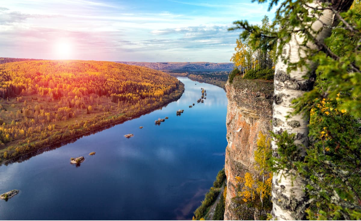
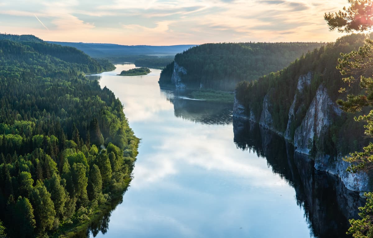
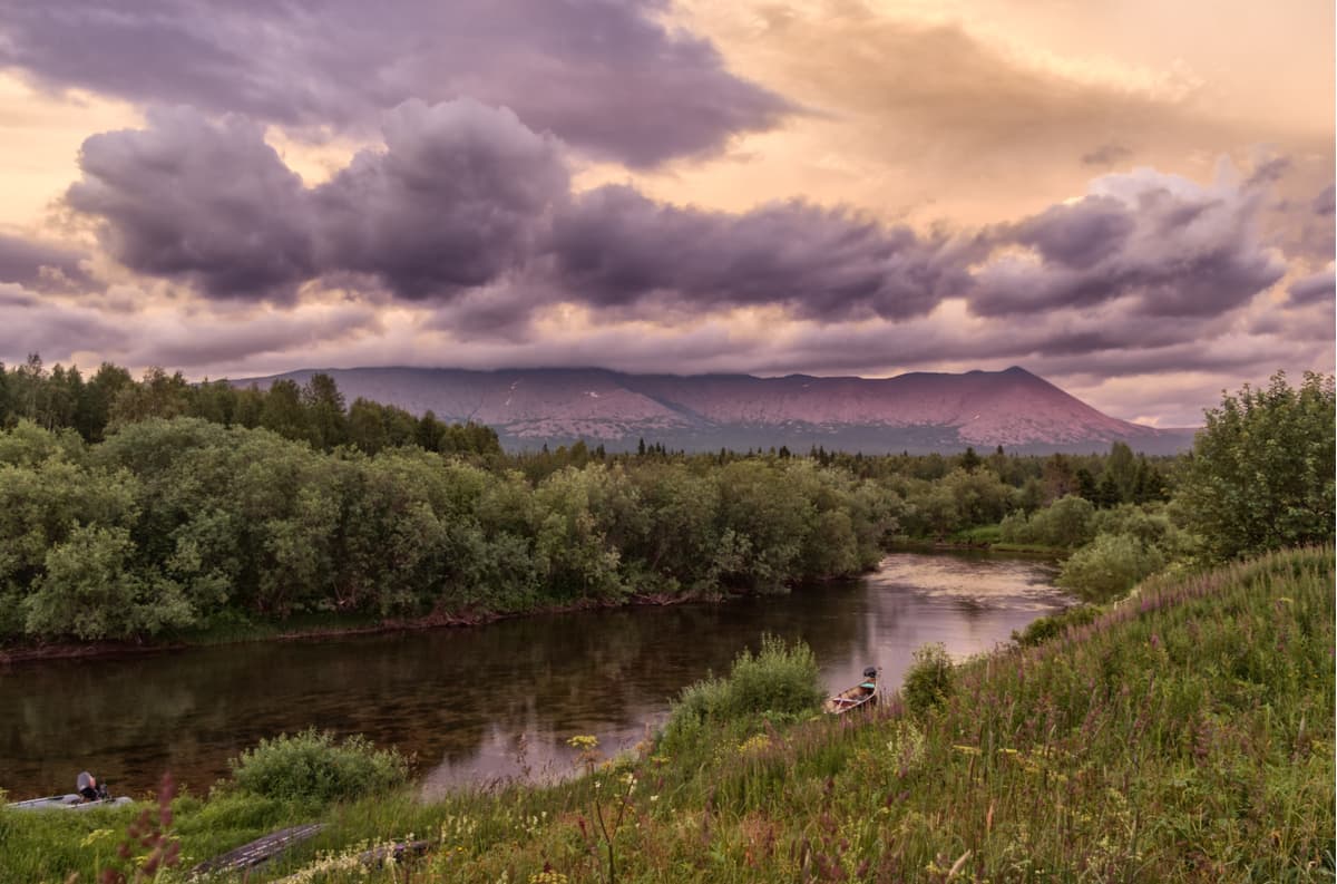
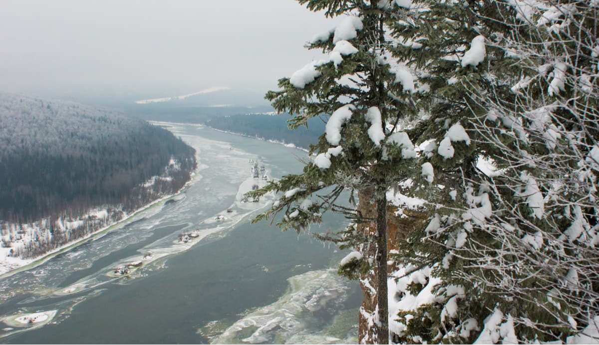
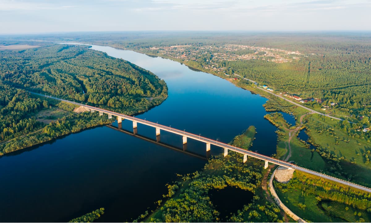
The Vishera is one of the most picturesque Ural rivers. Its source is located on the borders of the Perm Territory, the Sverdlovsk Region and the Komi Republic, on the slopes of Mount Sokloimsorrichahl (try to pronounce the notorious Eyjafjallajökull first and if you have succeeded, you can pronounce Sokloimsorrichahl with ease. Or just point your PeakVisor app at it and it will do all the job for you by marking this tongue-twister). In addition to its administrative borders, it is the border of Europe and Asia, as well as that for the watersheds of the Volga, Pechora and Ob river basins. The Vishera River is a first-order tributary of the Kama River and flows through the whole protected territory of the Reserve. Its width in the lower part of the Reserve's protected area is 80 - 100 m.

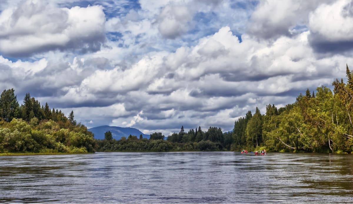
The upper reaches of the Vishera and its tributaries have a pronounced mountainous and semi-mountainous character. They have fast current, shallow depths, straight channels, clear water, large pebble and boulder soils, many rolls and rapids. The whole of the Middle Vishera (from the mouth of the Vels to the Kolva River) is mountainous, beaded lakes and low banks are more common as we approach the town of Krasnovishersk. And only the last 35 km before the Vishera flows into the Kama River, the river becomes flat. Most tourists enjoy rafting this river, the landscapes are amazing and there are many natural attractions on the banks, including the coastal rocks.
The river is a treasure chest for a traveler. In the first settlement – the village of Vels – there is the Velsovskaya cave. A 220 m long tunnel ends up with the lake of icy water which freezes in winter, the floor of the cave is covered with rubble. Just behind the village there is Fedoseev stone (70 m high) which you can climb. Farther along the route, the stones are virtually on every step – Prokofievsky stone, Dunkin, Grebeshki (Knaps), Fighter, Yabrus, Mokhovoy (with a cave and rock paintings). Near the confluence of the Pisanka River into the Vishera, there is the Pisanka Stone – the height of the rock is more than 100 m and if you climb it, the views are truly rewarding. The stone was named after numerous ancient inscriptions and drawings, which, however, have not been well preserved to this day. Farther along the river there is Sypuchi Rock, Stolby, Hole Stone, Visherogorsk settlement. Then at the confluence of the Govorukha river, there is a stone called Govorlivy. Once you are next to it, cry out to the wilderness and you will hear a very strong echo near it. A little below the stone you can see the ruins of an old big church, well preserved.
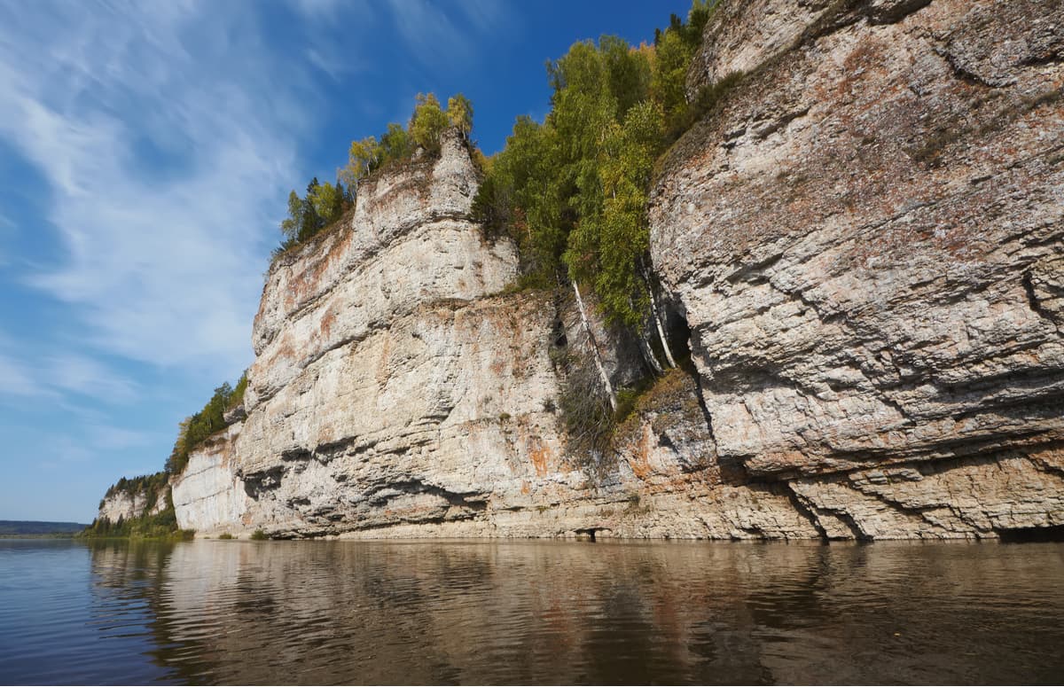
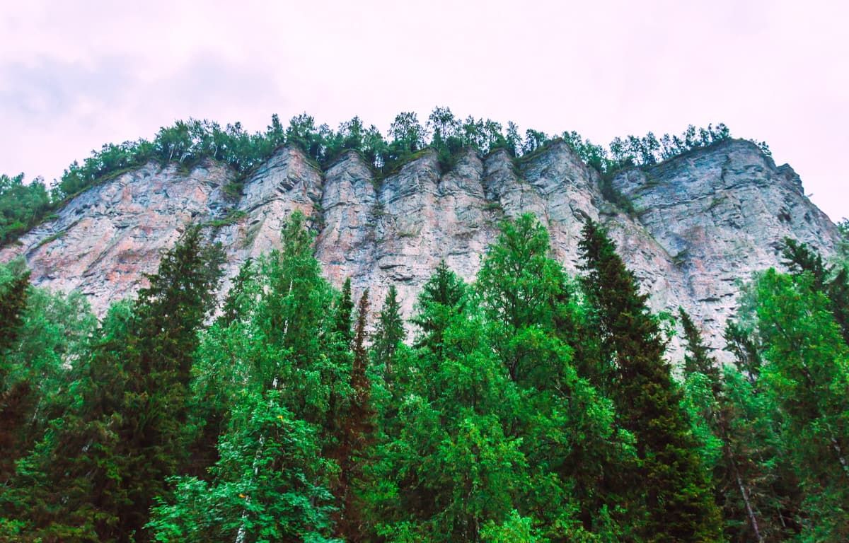
Vetlan Stone is not a common stone per se, it is a huge rocky system made up of almost vertical cliffs that start 50-70 meters above the river. This rocky ridge is 1,750m long with an average elevation of 263m a.s.l. A wooden staircase leads from the left bank to the top. Vetlan Stone is equipped with observation platforms that offer panoramic views of the local natural beauty.
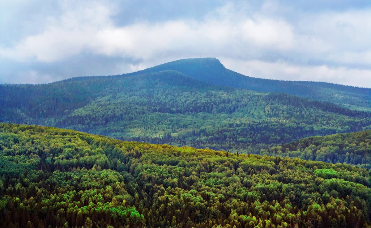
Then comes the mountain called Polyud or Polyud-stone or Polyudov ridge. It is 527 m high and you can climb it from Bakhari village after taking up a 7 km trail. The mountain is elongated, with a conical peak, slopes are rather steep, especially from the north. At any time of year from the top of the stone there are stunning views of Vetlan, Pomyanenniy Stone, the towns of Cherdyn and Krasnovishersk, as well as the Ural taiga.
There are many legends associated with Polyud. The most beautiful legend tells about the heroes of Polyud and Vetlan and their beloved girl Vishera who threw herself between the contending rivals, she turned into the river and they were petrified by surprise and grief.
On the tributaries of the Vishera River there are impressive waterfalls which sometimes reach a height of 9 meters. The most famous is the cascade of waterfalls on the Tabornaya River in the central part of the western slope of the Tulym Ridge. The Vishera itself in the upper reaches has plenty of rapids.
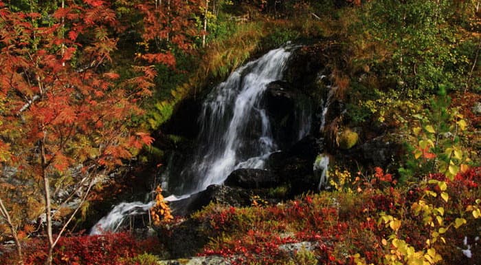
The waterfall on the Tabornaya River. Photo from official site http://www.vishersky.ru/
Tulymsky Stone is the highest peak of the Perm Territory (1469.8 m). The name of this mountain is associated with the Visher rapids which are found nearby. The word Tulym (Tulum) in Turkic means "threshold, empty, protruding stone". One of the Mansy’s names of the mountain is Yakhtel-Ya-Ner (the mountain of the Empty River). However, more often the Mansi called this ridge Louv-Ner (a Horse Mountain or a Horse Ridge). Perhaps this is due to the horse cult of the ancient Ugrian tribes. There is also a variant of deciphering the name from the Mansi word "tul" - "cloud". And indeed, this large mountain is often wrapped in clouds.
The length of the Tulym ridge is about 20 km. Most of it is covered by stone mounds and mountain tundras. There is a large number of larches growing in the area.
Along the border of the Perm and Sverdlovsk regions stretches the Molebny (Prayer) Ridge, sacred to the Mansi. This endemic tribe of the Northern Urals called this ridge Yalping Nyer (Sacred Mountain). Its northernmost part starts from the swampy sources of the Malaya Toshemka River. The Prayer Stone itself is low, gentle, covered with mountain tundra. It is famous for its numerous cliffs. Sometimes they form whole stone towns that surround the picturesque sources of the mountain rivers Vizhay, Little Niols and Middle Niols.
In the 1970s and 80s, there was a reindeer herding path here. Mansi reindeer herders from the Sverdlovsk Region used those well-trodden forest roads and mountain trails to climb high to the mountains – to the grazing fields overgrown with lavish lichens. The northern tip of Prayer Stone still exhibits old deer trails and tracks of cross-country vehicles which used to transport the herders in the Soviet times. They are all the legacy of the once busy trade road leading across the Ural Ridge.
There used to lie the southernmost glacier in the Urals – the glacier Ablizina aka Toshemsky glacier – on the eastern slope of the Prayer Stone, close to the sources of the river Bolshaya Toshemka. This small island of snow did not melt in summer but to call it a glacier with all its pertaining qualities would be an exaggeration. Therefore, glaciologists recommended to call it a stable snowflake or an glacier-ling (almost like a Hobbit Halfling), this embryo was supposed to grow into a glacier proper with time. However, the Toshemsky glacier has recently melted completely for the first time. And now, at the height of July heat, numerous picturesque waterfalls are flowing in its place.
Chuval or Chuval Stone is the Russian name for the mountain. In the past, an open hearth of stones was called chuval (also used in the meaning of "a big bag"). The Mansi called this ridge Seval-Pavyl Ner which means "the range of settlements with a chuval".
The height of Chuval Stone is 929 meters above sea level. When climbing it, you will experience a change of several natural belts. At the top of the mountain, there is a Goltz (bald mountain) belt and a mountain swamp.
Despite its modest height and appearance, the Chuval stone and the namesake ridge has a rich gold-digging history. At the end of the 19th century near the right bank of the Vishera River was discovered Chuval gold-bearing lode, adjacent to a bonanza copper vein. Chuval vein is unique, it has abnormally high content of gold, with incisions of crystals and nuggets. In addition to gold there are the following minerals: quartz, calcite, fahl ore, sphalerite, galena (lead sulphate), pyrite, silver, as well as malachite, azurite, rosasite, antimony ochre, and goethite.
The main attraction of the Chuval ridge is a large number of lonely rocks – stone idols. In the northeastern part of the range, on its plateau there are beautiful rocks shaped like those idols of Man Pupu Ner, but smaller in size. They are called the Chuvalian gods.
Photo from official site http://www.vishersky.ru/
At the pass, the trail comes to the picturesque sphinxlike idol and then descends into the canyon of the Chuvalka River. On the river bank, there is a parking lot with a canopy, a table, benches and a fireplace. Half a kilometer downstream of this place is the place called Upper Chuval Barraks. In the olden days, this place was the site of the Upper Chuval mine opened in 1898 and abandoned a decade later after the closure of the Velsov and Kutima factories. But even nowadays you can find remains of mines and pits (vertical mine workings) in the area.
Chuval Stone offers a beautiful view of the Moyva River valley and the surrounding peaks: Muraviniy (Ant Stone), Olkhovochny (Aldern), Isherim, Put Tump, Larch Ridge and Tulym Stone.
As to the present date, there are four explored karst caves in the protected area:
However, due to the karst-prone geology of the region, speleologists firmly believe they are to discover many more caves here.
Two caves are located near the Lypya Cordon. They are the Lypinskaya Cave with two entrances, about 450 m long, 300 m of which is watered, and the Dry Lypinskaya Cave, 130 m long. The longest – the Visherskaya Cave – is located on the bank of the Vishera River below the mouth of the Moyva River. The passages of the cave are formed by a system of tectonic cracks and layering cracks which together form a complex and intricate labyrinth stretching 180 m along the slope of the valley. The cave has six entrances. The Visherskaya Cave is one of the largest in the North Urals in terms of its length (about 1200 m). Nearby is the entrance to another cave - Visherskaya 2 (its length is about 200 m).
There are several cordons on the territory of the reserve for its protection as well as for nature observation. The most famous among them is the Lypya Cordon. It is famous for the beauty of the surrounding scenery. Right in front of it rises Tulymsky Stone. Nowadays, employees of the Vishersky Reserve live on the cordon.
Beautiful rocks and excellent fishing are the siren’s call for those who wish to raft down the Vishera River. It is interesting to combine the main river with rafting on its tributaries. The route along the Vishera River is suitable for active, but not that extreme pastime, so it is suitable for a tour with a family with children over 10 years old. You can raft from May to September. The best time is May and June, but bear in mind that in early May the river may not yet be freed from ice. The rafting facilities are numerous, you can hire catamarans, kayaks, inflatable boats. In summer, the river warms up well, you can sunbathe and swim. You can replenish supplies, get help and leave the route in the settlements of Vaya, Vels, Sypuchy, Visherogorsk. For tourists, the upper reaches of the Vishera River are the most appealing.
As for climbing, most fascinating are definitely Tulymsky Stone and the Chuval Ridge.
Tourists often begin rafting along the Vishera River from the 71st Block/Quarter of the Vishera Nature Reserve cordon. There is a hotel, a bathhouse, a parking lot, and a private recreation center nearby. There are no roads from the 71st Block farther into the wild, so you can get higher up to the mountains only by water, which protects the reserve from unwelcome guests. There is a poor quality dirt road from Krasnovishersk to the 71st Block . The last 27 kilometers is especially difficult, you can only cover it in an off-road vehicle. The total length of the road from Krasnovishersk is 165 km. From the 71st Block starts rafting along the Vishera River, it is also a starting point for tours to the Vishersky Nature Reserve.
The Reserve has developed the following routes:
The reserve provides the following services for the visitors:
You can visit the Museum of Nature in Krasnovishersk. There are information centres and photo exhibitions of the Reserve in Lypya and Vels villages.
The protected area of the Reserve has no permanent settlements and roads. It is 170 km away from the nearest major towns of the Perm Territory: Krasnovishersk, Solikamsk (270 km), Berezniki (300 km), Perm (480 km), and the towns of Severouralsk (80 km), Ivdel (150 km) in the Sverdlovsk Region. The settlements closest to the Reserve (Vaya and Vels villages) are located 90 and 45 km respectively from the protected area down the Vishera River in the Krasnovisherskiy Area of the Perm Territory.
To get to the Vishersky Nature Reserve, you should drive to the town of Krasnovishersk. This is where the administration of the reserve is located. Or take a bus from Perm or Solikamsk. Travel time from Perm is 6 hours, from Solikamsk is 2 hours.
The southernmost cordon of the Reserve the 71st Block can be reached from Krasnovishersk only by cross-country vehicle, the travel time will be about 7-8 hours. The services of this transportation to the 71st Block can be ordered from the Reserve.
A visit to the Vishersky Reserve requires a small fee.
The Information about prices for the services of the Reserve, how to apply for a visit to the Reserve, how to get to it, the information about the recreation centers and current routes can be found on the official website of the Vishersky Reserve http://www.vishersky.ru .


