Get PeakVisor App
Sign In
Search by GPS coordinates
- Latitude
- ° ' ''
- Longitude
- ° ' ''
- Units of Length

Yes
Cancel
❤ Wishlist ×
Choose
Delete
As the largest national park in Canada, Wood Buffalo National Park covers 44,807 square kilometers (17,300 square miles) of the northeastern part of the province of Alberta and the southern part of the Northwest Territories. The park, while known more for its flora and fauna than for its mountainous terrain, has 10 named peaks, the tallest of which is Ninishith Hills with an elevation of 303 m (993 ft).
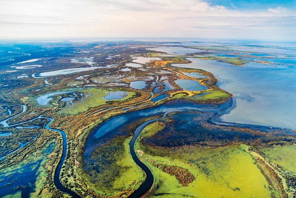
Straddling the border of Alberta and the Northwest Territories, Wood Buffalo National Park was established in 1922 to protect the world’s largest herd of free-roaming wood bison. Covering 44,807 square kilometers (17,300 square miles) the Wood Buffalo is the largest national park in Canada, beating out Quttinirpaaq National Park in Nunavut for the honor.
The park headquarters are situated in the community of Fort Smith, which is located along the banks of the Slave River, on the northeast side of the park in Northwest Territories. Fort Chipewyan has a satellite administrative office that is located on the shores of Lake Athabasca on the east side of Wood Buffalo National Park.
The Mackenzie Highway connects to Fort Smith for year-round access to the park. Winter and ice roads from Fort McMurray are available to access the park through Fort Chipewyan. Commercial flights are available to both Fort Smith and Fort Chipewyan from Edmonton, Alberta.
La Butte Creek Wildland, Richardson River Dunes, Fidler-Greywillow Wildland, and Colin-Cornwall Lakes Wildland are protected areas that are found to the east of Wood Buffalo National Park. Meanwhile, Caribou Mountains Wildland Provincial Park is located to the west and Kitaskino Nuwenëné Wildland Provincial Park is located to the south.
The park is located to the west of Lake Athabasca and to the south of Great Slave Lake, the latter of which is the second largest lake in the Northwest Territories and the deepest lake in North America. The Peace River divides the national park and the Slave River forms its eastern border.
The landscape of Wood Buffalo National Park consists of an undulating boreal plain cut by rivers and the extensive Peace-Athabasca Delta. The park has significant karst topography, salt plains, as well as Alberta’s largest springs, by volume.
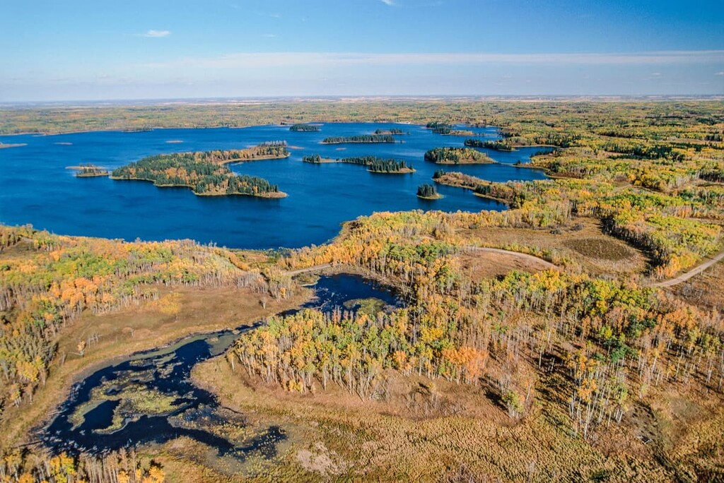
The reason for the impressive landscapes and terrain features has to do with the layers of rock that were deposited and created in this area over a billion years ago. The lowest layer is the Precambrian basement of igneous and metamorphic rocks which form the Canadian Shield. The granite of the shield is exposed at the east end of the park and dips 1,700 m (5,576 ft) below the surface in the west.
Devonian layers of marine sediment overlay the basement and are the primary bedrock in Wood Buffalo National Park. The Devonian terrain is primarily composed of limestone and gypsum-based bedrock that was deposited over 400 million years ago as marine sediment in a shallow sea that covered the area.
With the extensive limestone and gypsum bedrock, the park has some of the best karst topography in the world, which is characterized as an underground drainage system with sinkholes and caves. The karst was formed by the dissolution of limestone, dolomite, and gypsum.
The eastern side of the park has the Salt Plains which delineate the border between the limestone bedrock and the granite of the Canadian Shield. The plains are created as saline water is forced to the surface where the permeable limestone meets the impermeable granite creating salt mounds and formations as the water evaporates on the surface.
Wood Buffalo National Park lies roughly in the plains between the Caribou Mountains to the west and the Birch Hills to the south. While there are thick layers of Cretaceous sediments in the Caribou Mountains and the Birch Hills, there is only a limited area in the park with a Cretaceous layer. Erosion was a major force in determining the geology of the region and major erosive events occurred after the Devonian period.
The limited Cretaceous deposits of sandstone and shale that overlay the irregular layers of Devonian limestone are responsible for the major aquifers in the park. The topography is littered with the marks of water movement and glaciers.
During the Pleistocene, the Laurentide Ice Sheet covered the region of Wood Buffalo National Park. The ice sheet left moraines and deposits of glaciolacustrine sediments as it receded. However, as the ice melted, the region was covered by massive glacial lakes, the last of which was Lake McConnell which existed from about 12,000 to 8,000 years ago.
The massive Peace-Athabasca delta is a prominent fluvial deposit that has developed since the melting of the Laurentide Ice Sheet and the draining of the giant prehistoric glacial Lake McConnel that covered the region around Lake Athabasca, Great Bear Lake, and Great Slave Lake.
Lake McConnel and its predecessor, Peace Lake, deposited eolian, fluvial, and lacustrine sediments, including the sand dunes on the southern shore of Lake Athabasca. The Athabasca Sand Dunes Provincial Wilderness Park in Saskatchewan are the world’s largest active sand dunes north of 58 degrees in latitude.
Located to the south of Wood Buffalo National Park are the oilsands, which have been developed to extract the bitumen and refine it into oil and gas products. Gold mines and other mines are found east of the park in the rocks of the Canadian Shield, while coal deposits are found throughout the region.
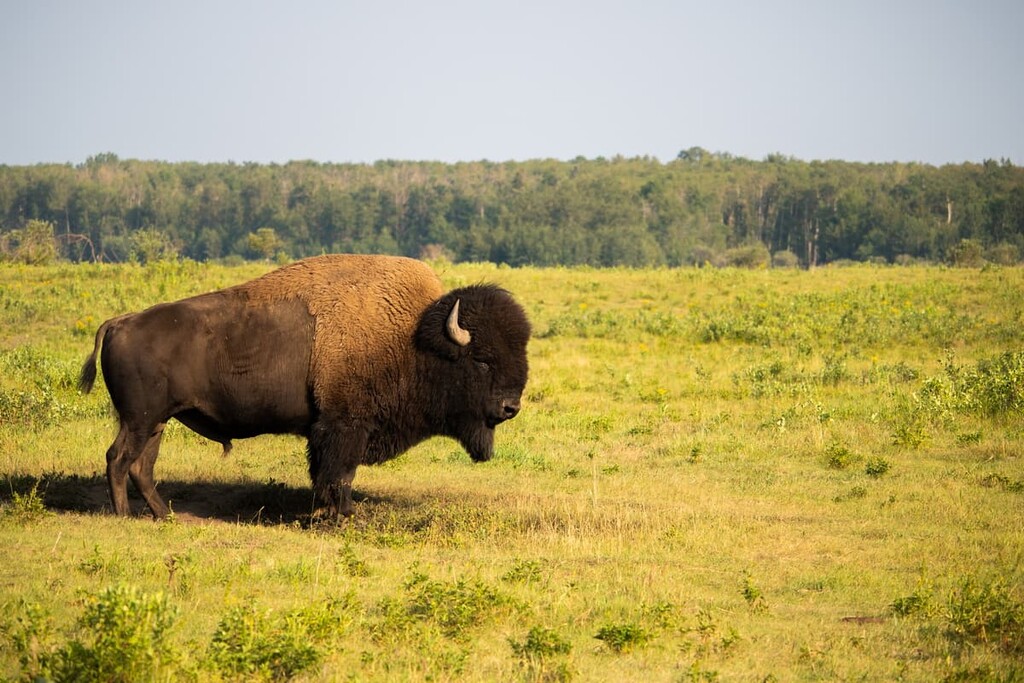
Wood Buffalo National Park was created with the intent to preserve many significant species and ecologies. As the name implies, the park was created to preserve the world’s largest herd of free-roaming wood bison. The park is also home to one of two known nesting sites, and the only natural nesting habitat, for the endangered whooping crane.
The park was designated as a UNESCO World Heritage site 1983 for its population of bison and cranes, as well as containing two special ecosystems. Wood Buffalo National Park is the largest and most ecologically complete example of Great-Plains-Boreal grassland in North America. Plus, the ecosystem of the Peace-Athabasca Delta has incredible biodiversity.
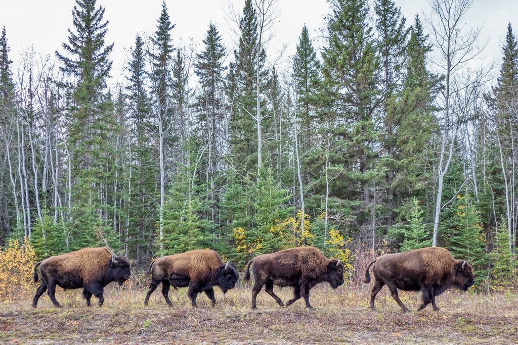
As part of the Boreal Forest Natural Region, Wood Buffalo National Park is dominated by forests where white spruce, black spruce, and jack pine are the main conifers and aspen and balsam poplar are the primary deciduous trees. Animals, such as woodland caribou inhabit the region and frequent treed fens and bogs with spruce and larch, where there is an adequate supply of food, particularly lichens.
The wood bison were a herd between 1,500 and 2,000 in 1922 when their range was protected as a park. In the late 1920s, over 6,000 plains bison were relocated to the park from the former Buffalo National Park to avoid overpopulation and mass culling at Buffalo National Park. Unfortunately, the plains bison hybridized with the wood bison and carried diseases that affected the health of the wood bison herds.
The amount of hybridization of the bison herds varies from herd to herd throughout the park. In 1957, a disease-free and relatively pure wood bison herd was discovered and 23 of them were relocated to Elk Island National Park, east of Edmonton, and are the most genetically pure wood bison remaining. Culls of the bison herds have been done in an attempt to rid the area of diseased animals.
The Peace-Athabasca Delta, which is formed as the Athabasca, Peace, and Birch Rivers come together, is one of the world’s largest freshwater deltas. The landscape is characterized by a mosaic of aquatic, shoreline, meadow, shrub, and marsh vegetation.
The aquatic areas are dominated by pondweeds while the marshes are covered in marsh reed grass. Some shrubby and forested uplands occur on terraces, islands, and levees. The sand bars are first filled with dense willow which matures into an ecosystem dominated by balsam poplar.
The park is filled with a great variety of mammal and bird species. Some of the notable mammals are the bison; however, there are also moose, black bears, muskoxen, timber wolves, cougars, wolverines, snowshoe hares, feral horses, and beavers. Located 200 km (120 mi) north of Fort Chipewyan the world’s largest beaver dam was discovered in 2007 through satellite imagery, measuring 850 m (2,790 ft) in length.
Wood Buffalo National Park is part of the traditional territory of several First Nations. There are several nations of the Northern Athabaskan languages, including the Dane-zaa (Beaver/ᑕᓀᖚ), Chipewyan (Denésoliné), and South Slavey (Dene/Dehcho), that consider this region to be part of their ancestral homelands. These nations traditionally lived throughout what is now the north of Canada in boreal forested environments.
The region is also the territory of the Saāwithiniwak (Woodland Cree). The Saāwithiniwak are believed to have migrated west during the time of recorded history as the fur trade expanded. As the fur traders reached points further west, Saāwithiniwak guides acted as intermediaries between other First Nations and the traders. The Saāwithiniwak guides and their families settled further and further west, displacing other nations such as the Dane-zaa.
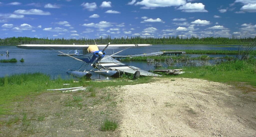
In addition to the Dene and Cree nations, the Métis also consider the region to be part of their traditional homelands. Many contemporary Métis with traditional ties to the area that is now called Wood Buffalo National Park are enrolled members of the Métis Nation of Alberta.
The region saw frequent wars between First Nations. However, the area was ravaged by a smallpox epidemic in 1781 which led to significant deaths in both the Cree and Dene.
Shortly after the epidemic, representatives of the Cree and Dene nations met on what was to be called Peace Point to agree to a peace treaty through a ceremonial pipe ceremony. The Peace River defines the border between the Dene to the north and the Cree to the south, and is named for the peace that was created.
Peter Pond was the first recorded European to have visited the area, during his travels in 1785. Pond was a fur trader, cartographer, and a founding member of the North West Company. In 1788, Alexander Mackenzie came through the region as part of his travels through the north for the North West Company. Trading posts would later be built at Fort Chipewyan and Fort Vermillion.
Fort Chipewyan is one of the oldest European settlements in Alberta. However, it only got electricity in 1959 and there is still no year-round road access to the community. The only access is still by air or by winter road from Fort Smith or Fort McMurray.
There are lots of activities available to do in Wood Buffalo National Park. There are camping, swimming, hiking, wildlife viewing, and backcountry excursion opportunities ,as well as chances to appreciate the night sky and the northern lights. The following are a few places to check out during your trip to the park:
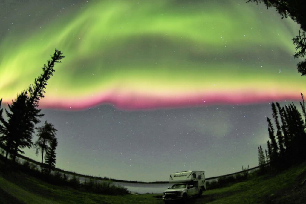
Wood Buffalo National Park was designated by the Royal Astronomical Society of Canada in 2013 as a dark-sky preserve. The park is the world’s largest dark sky preserve and was designated as such to protect the nighttime ecology for bats, nighthawks, and owls; however, it is also to create a protected area to view the night sky and in particular, the northern lights.
While camping or visiting during the evening, the night sky is darkened without interference from communities and other infrastructure that is common in the region. The aurora borealis is a magnificent display of what happens when the sun’s ejected particles interact with the magnetic field of the Earth. It is a real treat to see the northern lights and there are few places better to see them than in northern Canada and Wood Buffalo National Park.
The Karstland Trail is a short loop trail that is less than a kilometer long; however, it takes you through one of the most unique terrains and ecosystems in the park. The boardwalk trail winds through the boreal forest among collapsed sinkholes that create a sunken valley known as an uvala.
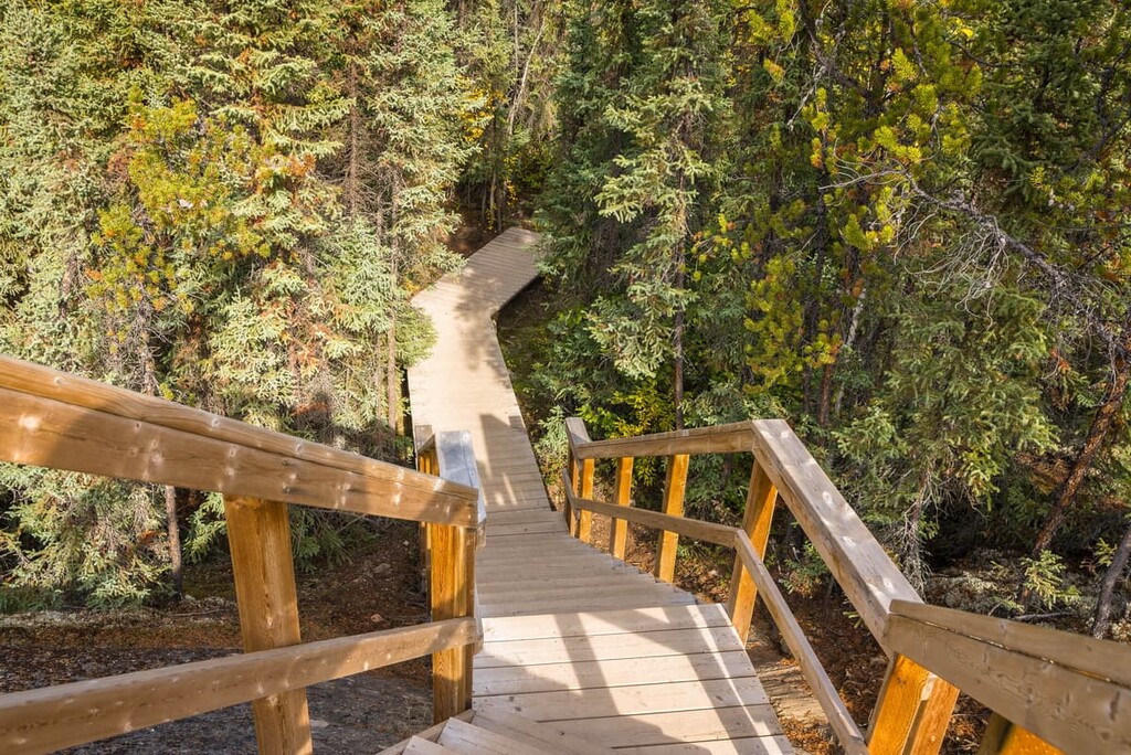
The sun shines through the canopy to help highlight the many sinkholes, caves, and other karst terrain. Also, since the ground is unstable, the trees tilt in all directions and is referred to as a “drunken forest”.
In the spring, the red-sided garter snakes can be seen emerging from the caves they’ve called home for the winter. The park is home to the world’s northernmost population of red-sided garter snakes and visitors will flock to the park to behold the spectacle of their emergence and migration to their summer grounds.
The Salt Plains are a special landscape and ecosystem created by the saline water that was left by the ancient seas that permeated the limestone bedrock and is now being forced to the surface. The briny water evaporates leaving behind the powdery landscape as well as salt mounds and formations.
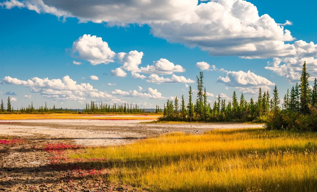
There are several ways to experience the Salt Plains. There is a short trail from Highway 5 to the Salt Plains Overlook as well as the Grosbeak Lake and Salt Pan Lake which are accessible from the Salt River Trail system. You can walk barefoot across the powdery ground or sample the brine from an underground stream. Wildlife viewing is interesting, as the animals easily leave tracks to follow across the plains.
Wood Buffalo National Park is in the far reaches of northern Alberta and part of Northwest Territories. There are several communities around the perimeter of the park that have accommodations and park offices as well as some larger communities through which the seasonal access to the park is found.
Fort Smith is located in the Northwest Territories, just north of the Alberta border and at the northeast corner of Wood Buffalo National Park. The Mackenzie Highway is a year-round road that gives access to the community and the park. The main offices and interpretive center for Wood Buffalo National Park is found in Fort Smith.
Fort Smith was built by the North West Company in the late eighteenth century at the end of a portage route that bypassed large and dangerous rapids in the Slave River. Many visitors come to Fort Smith to try themselves against the world-class Slave River rapids in kayaks and canoes. Fort Smith is home to the Northern Life Museum as well as the South Slave Friendship Festival that brings in artists and musicians from across the Northwest Territories.
Located on the eastern side of Wood Buffalo National Park and on the northern shore of Lake Athabasca, Fort Chipewyan is one of the oldest European settlements in Alberta. The community is small, with fewer than 1,000 residents; however, it is one of the main access portals to the park during the winter. While it is possible to fly into fort Chipewyan during the summer, road access is only possible by ice roads during the winter months.
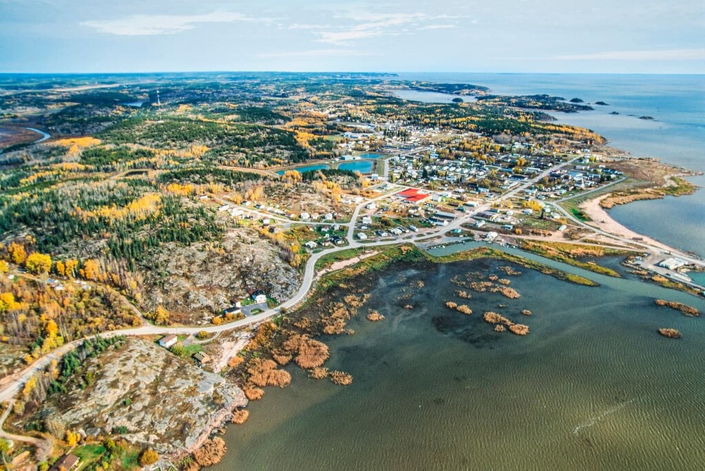
The community of Fort Vermilion was established in the same year as Fort Chipewyan and shares the honor of being one of the oldest European settlements in Alberta. The hamlet is located about 160 km (96 mi) west of Wood Buffalo National Park via Highway 58, and it was named for the vermilion-colored clays that line the banks of the Peace River.
The hamlet has several historic sites and buildings to visit. There is the Old Bay House which was home to the fort’s chief factor, as well as the Clark House, which was built for the clerk. The Trapper's Shack is a dove-tailed log house that was built in 1912 and the visitor center is hosted in a dove-tailed log house that was built in 1923.
Explore Wood Buffalo National Park with the PeakVisor 3D Map and identify its summits.


