Scan the QR code and open PeakVisor on your phone
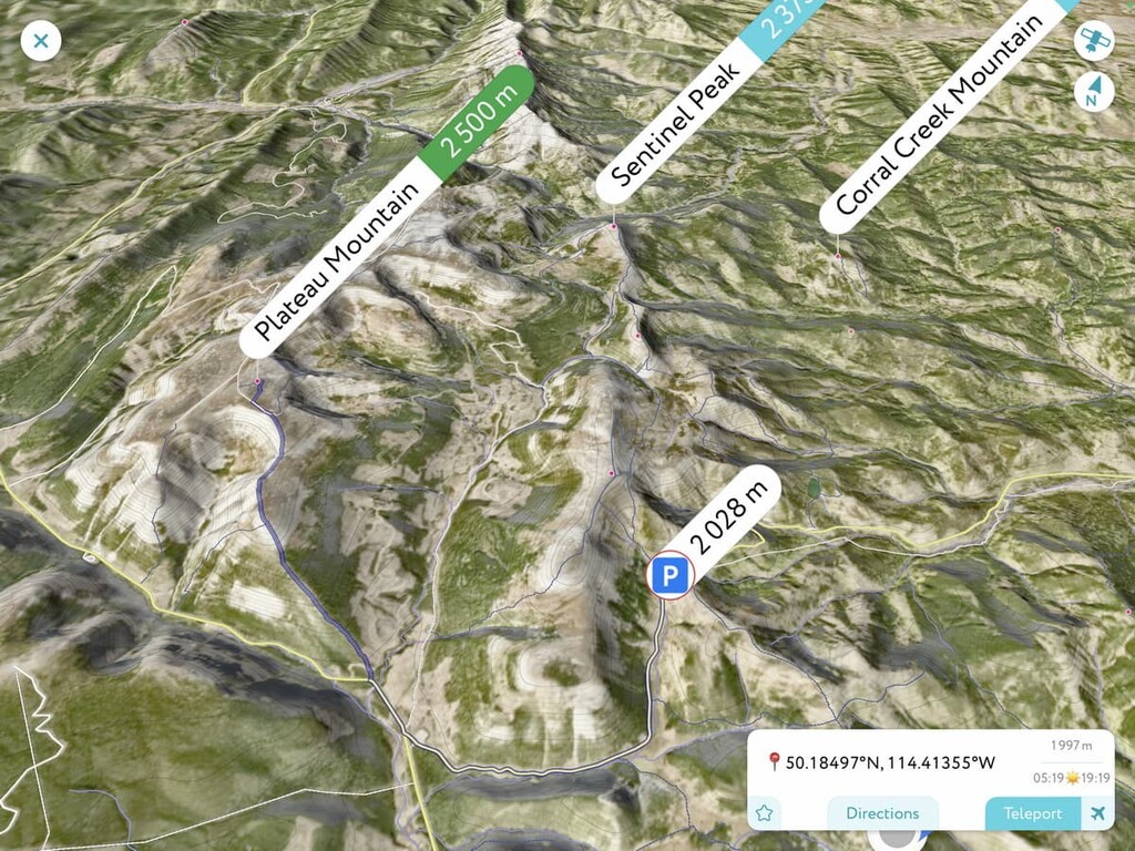
Plateau Mountain Ecological Reserve is a protected area located in the southern end of Kananaskis Country, Alberta, approximately 160 km (100 mi) to the southwest of Calgary. The reserve covers the 23 square kilometers (8.9 square miles) of Plateau Mountain and it is designed to protect the landscape's unique features. Plateau Mountain is the only mountain in the reserve, and it has an elevation of 2,500 m (8,202 ft) and 505 m (1657 ft) of prominence.
Plateau Mountain Ecological Reserve is located at the south end of Kananaskis Country in the Canadian province of Alberta. The reserve is the only ecological reserve in Kananaskis Country; however, there are many provincial parks and recreation areas nearby.
The primary road that leads to Plateau Mountain Ecological Reserve is Highway 40, which is also referred to as Kananaskis Tail and the Forestry Trunk Road on some signage. However, although Highway 40 is a beautiful drive, it’s sometimes faster to access the front ranges from Highway 22 (Cowboy Trail), which parallels the Rockies with secondary highways that lead into the mountains.
The reserve is 23 square kilometers (8.9 square miles) in size. It encompasses the plateau and most of the slopes of Plateau Mountain, while the plateau itself is a flat 14 square kilometers (5.4 square miles). There is one primary trail that leads to the plateau, which is also the access road for the oil and gas wells that are currently on the plateau.
The ecological reserve is isolated, and the nearest town is Crowsnest Pass which is located 87 km (52 mi) to the south. Calgary is located some 160 km (100 mi) to the northwest of Plateau Mountain Ecological Reserve and is the largest and closest city to the region.
Plateau Mountain Ecological Reserve is located in a highly mountainous part of Alberta. It is within driving distance of a number of other areas of public land, including the Willow Creek Public Land Use Zone (PLUZ) and the Cataract Creek PLUZ.
The formation of Plateau Mountain started about 75 million years ago as North America drifted west and collided with tectonic plates under the Pacific Ocean. As the oceanic plates subducted under the continent, the continental plate was deformed and uplifted.
The formation event for the Rocky Mountains, which is called the Laramide orogeny, stacked thick slabs of Paleozoic limestone over the younger Cretaceous sandstone and shale for about 40 million years. Over the following millions of years erosion displaced the softer rock and left the limestone peaks of the Rocky Mountains and the Livingstone Range.
The rocks of Plateau Mountain are limestone in an elongated upward structure that contains three caves with delicate ice features. At the summit of the mountain, there is a layer of hard quartz sandstone.
The topography of the Rocky Mountains was generally created during the Pleistocene glaciations, including the topography of Plateau Mountain. The topography of Plateau Mountain includes its 14 square kilometers (5.4 square miles) of near perfectly flat plateau and glacial cirques that were carved from the edges of the mountain.
While it is likely that glacial erosion formed Plateau Mountain’s flat top, it’s believed that glaciers didn’t cover the plateau during the most recent glacial maximums and that the plateau had been ice-free for over 100,000 years. Meanwhile, in general, the rest of Canada was covered by an ice sheet that was up to 1 to 3 kilometers (0.6 to 1.9 mi) thick.
Another unique feature of the plateau is that it has permafrost that is relatively close to the surface, and in fact, the permafrost level has been rising over the past decades. The permafrost creates many unique features on the plateau.
The plateau has periglacial features, such as extensive patterned ground. Patterned ground is a feature that is caused by water percolating up through the ground and the freeze/thaw cycle forces large stones to the surface. Lateral forces turn the rocks into geometric patterns.
There are large sections of hexagonal rings of rocks, sorted stone circles, polygons, steps, and frost boils. The plateau also has “Felsenmeer,” or a “rock sea,” which is a layer of angular rocks caused by frost shattering. While “Felsenmeer” is not rare in Kananaskis, as it is found on most peaks, it is unusual to see nearly 14 square kilometers (5.4 sq. mi) covered with it.
Plateau Mountain has two main types of ecology: alpine tundra on the plateau and subalpine forest on the mountainsides. The plateau is a rare environment in Alberta, and, as such, there are rare and unique ecosystems and habitats on the plateau that are found nowhere else in the province.
Since the plateau has been ice-free for over 100,000 years, some plants have had an extraordinarily long time to establish and grow. Two examples are the moss campion which has grown to unprecedented size as well as the vast fields of lichen covered rocks.
While the plateau may seem desolate and barren, there are a large variety of plant species that thrive on the mountain top. In addition to moss campion and lichen, the alpine tundra plateau also has communities of spotted saxifrage, beardtongue, sage, Baffin Island fescue, white mountain avens, shrubby cinquefoil, alpine forget-me-not, and the rare Scribner’s wheat grass.
Additional areas contain fragrant sedge, bog-sedge, northern awnless brome, yellow hedysarum and prairie selaginella. Loco-weed, willow, wandering daisy and alpine goldenrod, smooth-leaved cinquefoil, tufted hair grass, wild chives, yarrow, moss gentian, field chickweed.
The subalpine forest that dominates the slopes are full of Engelmann spruce, subalpine fir, lodgepole pine, and alpine larch. Additionally, whitebark pine is found at higher elevations. In addition to a variety of moss species, the common plants of the forest understory are blueberry, wandering daisy, mountain heliotrope, Canada buffaloberry, twinflower, juniper, and bearberry.
There are 22 resident bird species in the reserve, which include rosy finches, horned larks, white-tailed ptarmigan, golden eagles, common ravens, spruce grouse, chickadees, varied thrush, and American kestrels. Additionally, there are 49 species that visit for the summer and 5 more species that migrate through the reserve.

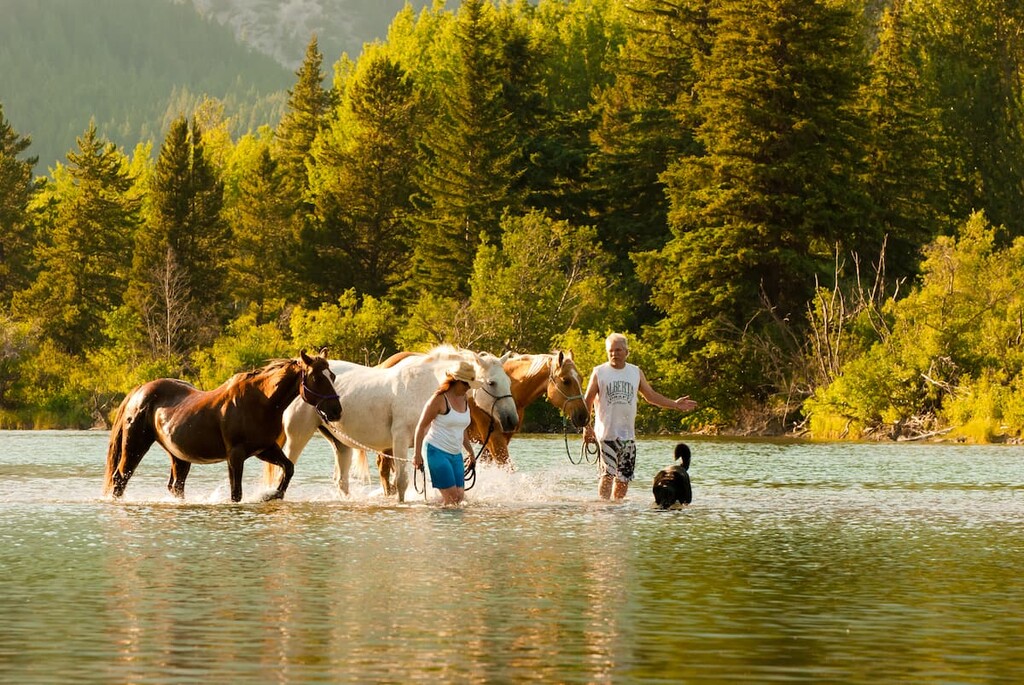
The mammals found in the ecological reserve are those that are typical to alpine and subalpine ecologies in the Rocky Mountains. Pika, hoary marmot, ground squirrels, chipmunks, pocket gopher, coyote, elk, mule deer, and rocky mountain bighorn sheep are the animals that you are most likely to encounter. The plateau is an important winter range for many herds of bighorn sheep.
While the top of Plateau Mountain was unglaciated for nearly 100,000 years, the rest of Kananaskis and Canada was covered in an ice sheet that was mostly melted by about 12,000 years ago. About 11,000 years ago, vegetation started developing in the previously glaciated valleys and animals were beginning to inhabit Kananaskis Country.
With the influx of megafauna, such as giant bison, camels, giant predator cats, and others, people began to come and hunt them. Throughout Kananaskis Country, there is evidence of near continuous human habitation for the past 11,000 years.
While it is unlikely many people inhabited Plateau Mountain for any significant time, there is evidence of wild sheep driving and hunting that dates back thousands of years. It is also possible that some of the plant species upon the plateau were used by Indigenous communities for medicinal and ceremonial purposes.
Plateau Mountain is part of the traditional territory of Metis, Tsuu T’ina, Ktunaxa, and the Blackfoot Confederacy. The area around Plateau Mountain was used for grazing as European settlers began to settle the area in the twentieth century. It wasn’t until the 1950s that local communities were commercially interested in the plateau and its possibilities for oil extraction.
The oil and gas access road opened the plateau to anybody with a vehicle, and there was a time that people could drive their cars across the length of the plateau. It was also during this time that several caves were discovered. The ice cave was gated and locked in 1972 to preserve the delicate ice structures within.

Vehicle access to the plateau became restricted in 1980 and Plateau Mountain Ecological Reserve was established in 1991 to protect the special landscape of the plateau. Currently, the only activity that is allowed on the plateau is hiking and there are no designated trails on the mountain.
Plateau Mountain has unique ecosystems and landscape features that are not found anywhere else in Alberta. Many of the landscape features on the plateau are usually only found in areas of arctic tundra. The following are a few of the reasons to visit Plateau Mountain Ecological Reserve.
There is permafrost under Plateau Mountain that is rising closer to the surface and as such, the freeze/thaw cycle creates some unique landscapes that are uncommon outside of arctic regions.
Patterned ground, which includes sorted stone circles, polygons, nets, stripes, and frost boils, can be found. Additionally, the plateau is covered with frost shattered rocks, which is common on the Kananaskis peaks; however, nearly 14 square kilometers (5.4 sq. mi) of the “rock sea” is a unique site.
There are three caves that are accessible from the scree slopes of Plateau Mountain. The ice cave was the most popular tourist site until it was closed in the 1970s. The ice cave is nearly 100 m (328 ft) long and features large ice crystals, ice sheets, and pillars of ice. The site is world-famous and is now closed to the public because the warmth from a person can cause significant destruction to the delicate ice features.
The other two caves are called January Cave and Sheep Cave. Thirty-two species of animal bones have been discovered in January Cave, the oldest of which is 33,500 years old. These two caves are not closed to the public; however, they are difficult to find and access.
Since the top of Plateau Mountain has been ice free for 100,000 years the flora present is ancient and has had much more time to grow than the same plants in the rest of Kananaskis. Some of the slow-growing lichen that carpet the plateau rocks may literally be tens of thousands of years old while the slow growing moss campion has reached unprecedented sizes upon the plateau.
The plateau is also home to many species that are usually found in tundra ecologies, much further north. Plateau Mountain Ecological Reserve presents a unique opportunity to experience the tundra at a relatively low latitude.
Plateau Mountain Ecological Reserve is not particularly close to major towns and cities so it does not get the same volume of visitors as other parts of Kananaskis Country. However, it is an incredible place to explore and worth the visit. The following are some of the major towns and cities that are close to the reserve.
Calgary is the largest city in Alberta and it is located about 160 km (100mi) to the northeast of Plateau Mountain. Thanks to its international airport and its proximity to the Rocky Mountains, Calgary is often overlooked as tourists are rushed from the airport to Banff National Park and other mountain locations.

The city has many activities to offer, in addition to friendly accommodations and delicious restaurants. Calgary promotes an active lifestyle and there are pathways that cross the entire city and connect every major park and green space, from Fish Creek Provincial Park in the south of Calgary to Nose Hill Park in the north.
There are attractions such as the Glenbow Museum, Fort Calgary, and Heritage Park that showcase local history. The annual Calgary Stampede showcases the western culture that created Calgary, while a stroll through Prince's Island Park, Kensington, and Stephen Avenue Mall showcases the modern culture of the city.
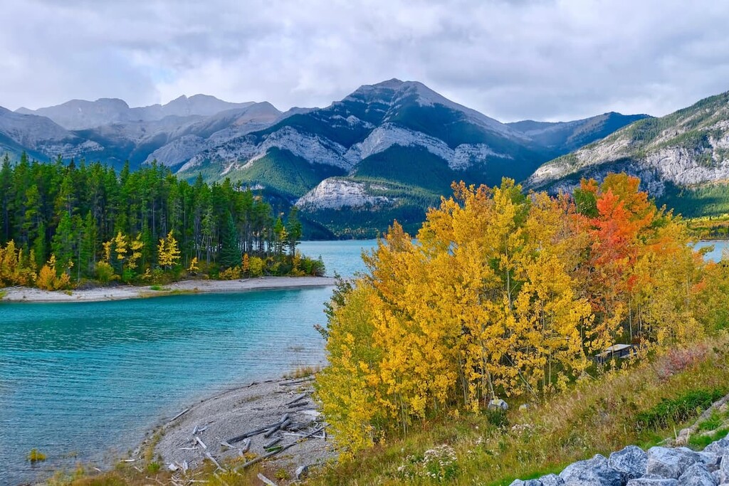
Located in the heart of the Bow Valley, Canmore is surrounded by the amazing mountains of the Three Sisters, Ha Ling, Grotto Mountain, and Mount Lawrence Grassi. While Canmore is quite far from Plateau Mountain Ecological Reserve, being 276 km (166 mi) to the north, Canmore is a major destination in the region.
The drive between Canmore and Plateau Mountain Ecological Reserve follows Highway 40, which is the same path used by First Nations and European settlers for hundreds of years. It is a beautiful drive that showcases the rugged mountains of Kananaskis.
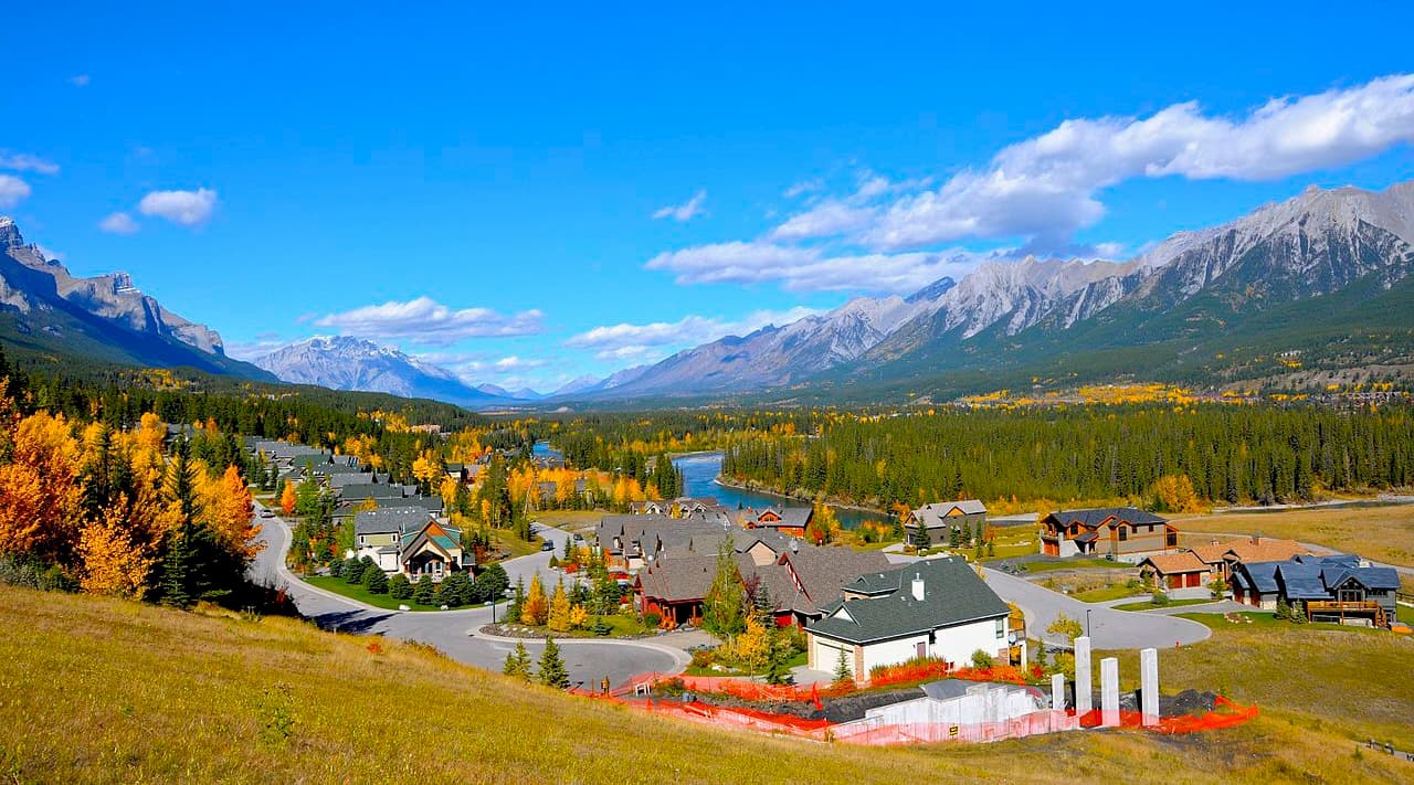
Canmore itself has grown from a failing coal town into a tourism hotspot. There are countless opportunities for outdoor recreation from the town, including hiking, mountain biking, kayaking, fishing, hunting, climbing, skiing, and many more.
Kananaskis Village is located in the Evan-Thomas Provincial Recreation Area in the heart of Kananaskis Country, Alberta. Situated 26 km (16 mi) south of Highway 1 on Highway 40, and 177 km (70 mi) north of Plateau Mountain Ecological Reserve. Accommodations in the community range from modest hostels to the more luxurious Kananaskis Lodge.
Kananaskis Village is the closest tourist destination to Plateau Mountain, and it has stores to buy supplies, food, and rent equipment such as kayaks, canoes, and mountain bikes. There is also the beautiful Kananaskis Country Golf Course, trails starting just outside your hotel, and the Nakiska Ski Area just down the road.
Some of the incredible hikes that start from the village are hikes to Ribbon Falls and Troll Falls. Kananaskis Village is a great place to make your “base camp” to explore the many nearby provincial parks and their vast mountain terrain, in any season.
Crowsnest Pass is located some 87 km (52 mi) to the south of Plateau Mountain Ecological Reserve and is the closest town to Plateau Mountain. Crowsnest Pass is a conglomerate of several communities along the Crowsnest Highway, all of which were settled as coal mining towns in the early twentieth century.
The largest communities are Coleman and Blairmore and you can find accommodations and provisions for your adventures in the area. A significant regional attraction is the Frank Slide Interpretive Centre, where you can see and hear firsthand what happened the night that Turtle Mountain fell and covered the town of Frank.