Scan the QR code and open PeakVisor on your phone
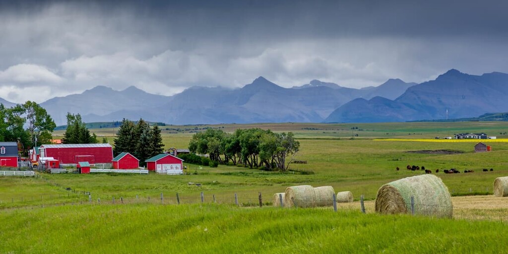
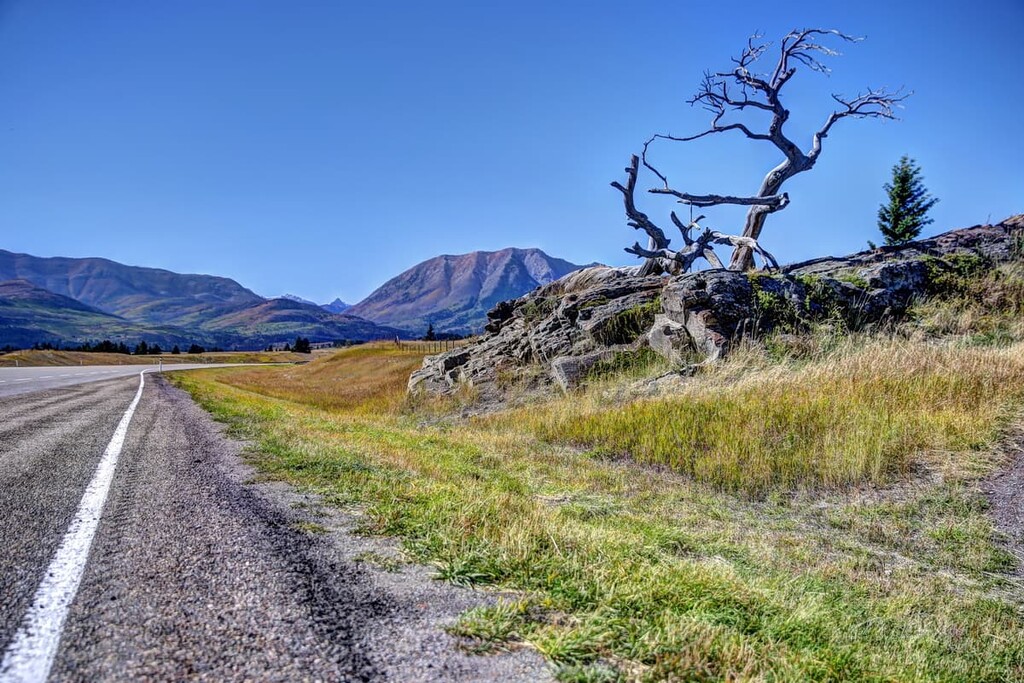
The Municipality of Crowsnest Pass is an administrative district that’s located in southern Alberta, Canada along Highway 3, next to the province’s border with British Columbia. There are 31 named mountains within the municipality of which Mount Ptolemy is the tallest (2,815 /(9,236 ft) and Mount Tecumseh (2,549 m/8,363 ft) is the most prominent.
Located along Highway 3 in southwestern Alberta, the Municipality of Crowsnest Pass contains several communities that were amalgamated into one administrative district in 1979. The main communities are Bellevue, Blairmore, Coleman, Hillcrest, and Frank. The communities of Crowsnest, Passburg, Sentinel, and Hazell are also part of the municipality; however, these communities are abandoned or only sparsely populated.
The municipality of Crowsnest Pass covers 371 sq. km (143 sq. mi) of land and has a population of about 5,500 people. The municipality is located within the Municipal District of Pincher Creek. It is named for the Crowsnest Pass, which is a mountain pass that’s located west of the municipality on the province’s border with British Columbia.
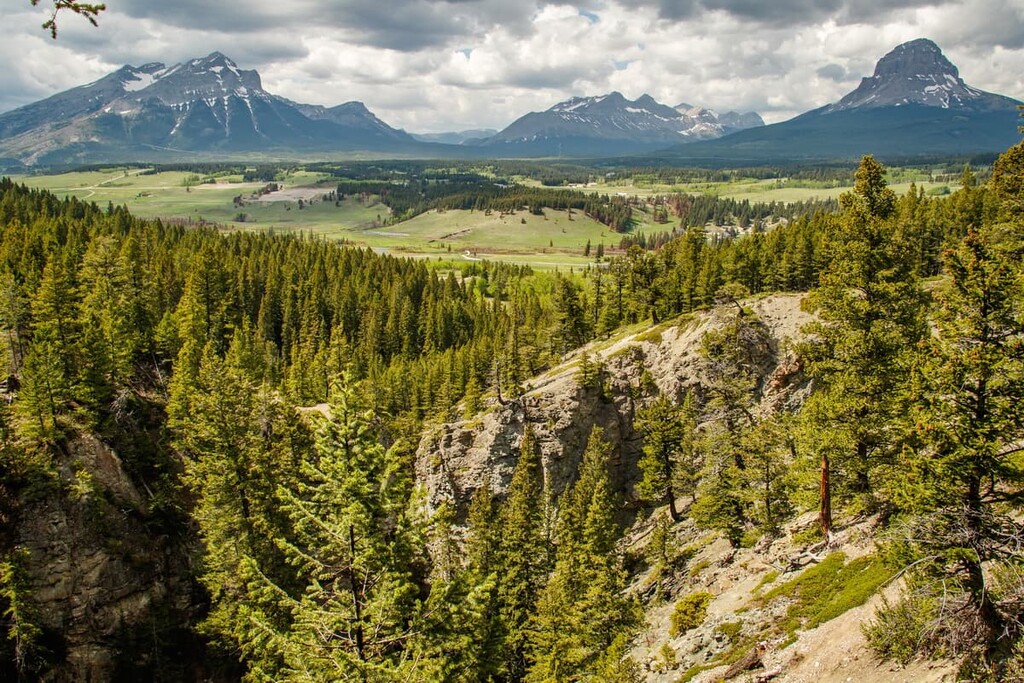
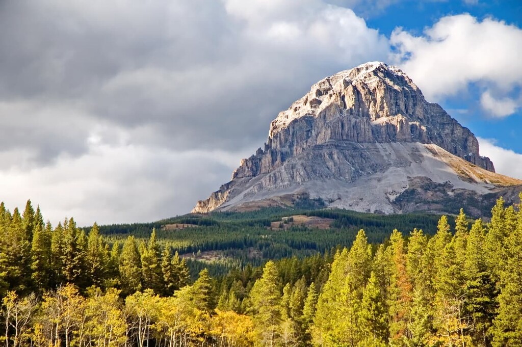
There are 29 named mountains in the immediate vicinity of Crowsnest Pass, the tallest of which is Mount Ptolemy with an elevation of 2,815 m (9,236 ft). Castle Wildland Provincial Park and Castle Provincial Park are both located to the south of the municipality while Livingstone Public Land Use Zone is located to the north.

The rocks in the municipality of Crowsnest Past tell a fascinating story of the construction of some of the terranes that make up western Canada. The general story of the mountains around Crowsnest Pass follow the same tale of creation as the rest of the Rocky Mountains; however, there are some interesting geologic features found in this area.
The Canadian Rockies typically consist of limestone and dolomite that formed 500 million years ago as layers of marine sediment off the western coast of ancient Alberta. The Paleozoic marine sediment was covered with sandstone and shale deposits during the Mesozoic.
During the Laramide orogeny, which was the primary mountain building event that created the Rocky Mountains, the layers of rock cracked and stacked under the compressive forces from continental collision. The limestone layers were pushed up and stacked along with the layers of the softer sandstone and shale.
Over time, the valleys were created as the softer Mesozoic layers of rock were eroded while the durable limestone was left behind and formed the mountains and mountain ranges that we see today. However, the mountains of Crowsnest Pass have an interesting layer that was created about 100 million years ago.
During the Sevier orogeny, which helped form the Columbia and Coast Mountains, there were some major geological events occurring in the region. During this time, oceanic plates subducted under ancient North America, adding land to the west coast in the process.
At the same time, parts of the continental crust were compressed, leading to the formation of mountains and volcanoes along the continental margins. An eruption near present day Cranbrook covered 1,800 sq. km (690 sq. mi) with 209 cubic kilometers (50 cubic miles) of lava.
During the Laramide orogeny, about 25 million years after this volcanically active period, fault thrusts pushed the layer of pyroclastic rock east to Crowsnest Pass. These pyroclastic rocks are unusual in the Canadian Rockies, and they contain melanite and analcime. The volcanic formations are also responsible for trace amounts of gold in the region.
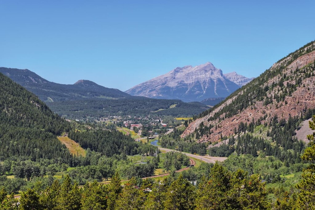
The municipality of Crowsnest Pass spans several different mountain ranges. South of Highway 3, from west to east are the Flathead Range and the Blairmore Range. North of the highway, the High Rock Range is along the Continental Divide and the Livingstone Range borders the prairies.
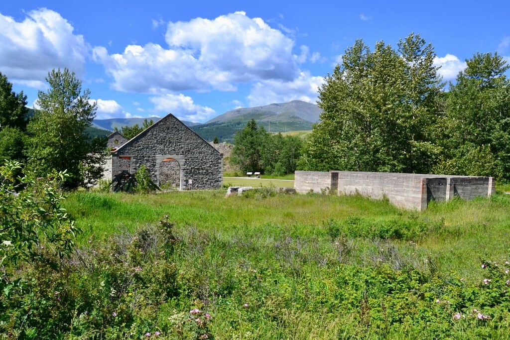
The region has major coal deposits that were the primary reason for initial settlement of the region by peoples of European descent; however, there are other resources that are currently being mined.
There are also mines harvesting deposits of decorative and construction grade clay, shale, sandstone, dolomite, and limestone. Additionally, the region has mines extracting clay for stoneware and refractory purposes, as well as mines that extract phosphate, magnetite, and sulfur.
The ecology of the municipality of Crowsnest Pass is representative of the Rocky Mountain Natural Region. There are areas of alpine ecology in the peaks, subalpine ecology along the slopes, and montane ecology in the main valley that follows Highway 3.
The alpine has the smallest quantity of flora and fauna and is typically barren rock on the mountain tops. Plant growth is limited to stunted trees, sedges, and heath because the fierce winds and prolonged cold prevent anything else from growing.
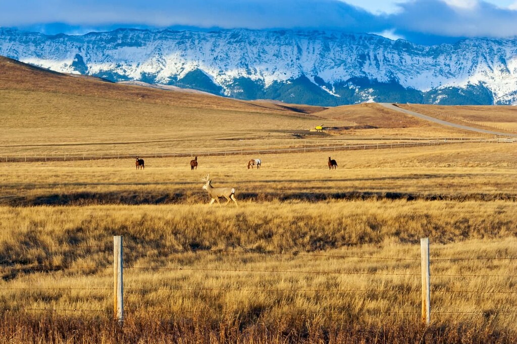
Alpine animals include some birds, like the white-tailed ptarmigan, which nest in the alpine. Additionally, there are mountain goats that use the steep cliffs and rocky outcrops to evade predators. However, a larger concentration of wildlife can be found in the region’s subalpine and montane habitats.
Black and grizzly bears, moose, elk, deer, and mountain goats are found in the region; however, the populations of these species are fairly small. Additionally, the red squirrel, beaver, porcupine, and weasel populations are also considered small.
The most common and abundant animals in the region are coyotes and Columbian ground squirrels. The trout in the rivers and creeks are plentiful and there is also an abundance of grouse.
The Rocky Mountain Natural Region has over 140 plant species that are endemic to this area. The vegetation and forests of Crowsnest Pass are vast and dense; logging was the first industry in Crowsnest Pass. Forests of spruce, pine, and balsam dominate with scattered stands of Douglas fir. There is an abundance of flowering plants in the meadows and understory.
Crowsnest Pass is located in a unique region that has served as a desirable home for humans for thousands of years. A number of Indigenous communities, who have lived in the region since time immemorial, traditionally found the location desirable because there was an abundance of animals to hunt and the climate was moderated by the winter Chinooks.
More recently, humans have been attracted to the region for its abundance of resources. The region’s resources led to the creation of many of its current settlements; however, the decreasing popularity and profitability of coal mining has threatened the region’s economy.
The Municipality Crowsnest Pass has one of the richest concentrations of archeological and cultural sites of anywhere in the Canadian Rockies. There is evidence of human occupation of the area as far back as 11,000 years ago when the glaciers started to retreat.
The earliest site is a stone ridge near the town of Frank where stone tools were discovered. The tools are 11,000 years old, and they date back to the people of the Clovis culture. The abrupt transition between the plains and the mountains likely made for good hunting, and it attracted people for thousands of years.
The low pass through the mountains facilitated easy trade across the mountains. Meanwhile, the chinook winds made for shorter and more tolerable winters in the region. Communities continued to inhabit the region after the Clovis culture, subsisting by trading with their neighbors and mining chert from the Livingstone Range for over 6,000 years.
Many different communities and cultural groups have lived in the region in recent years. The Old Cordilleran culture existed from about 9000 to 5500 BCE and originated in the Pacific Northwest. Evidence from the Old Cordilleran culture has been found near Burmis.
The Agate Basin culture existed from about 9000 to 6000 BCE and it originated on the plains. There are fourteen archaeological sites in Crowsnest Pass that preserve artifacts from the Agate Basin culture. It is believed that the Mummy Cave culture arrived in the Pass around 4000 BCE, followed by the Pelican Lake culture, which arrived around 1000 BCE.
The K’tunaxa and Piikani of the Blackfoot Confederacy inhabited the region until smallpox devastated the region’s communities in about 1730. The Crowsnest Pass is traditional territory of the Ktunaxa, Tsuu T’ina, and Blackfoot Confederacy.
Crowsnest Pass facilitated migration and trade between the mountains and the plains for thousands of years. While the pass was well known to the K’tunaxa and other First Nations, Europeans generally avoided the pass. In fact, in 1800, members of the David Thompson expedition avoided entering the pass and opted to travel through a different route over the Rockies. The first people of European descent to cross the pass were likely members of Michael Phillips’ expedition in 1873.
By 1897, the Canadian Pacific Railway had constructed the Crowsnest Line into the Kootenay District to cut off US railway incursion and create an all-Canadian route to the valuable Kootenay territory.
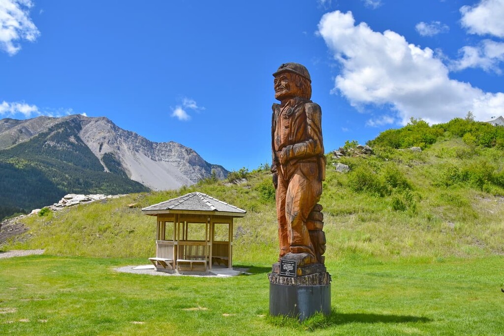
Blairmore was the first community in Crowsnest Pass, and its primary industry was initially forestry. However, within a decade the region filled with mines. As a result, most of the towns in the area, including Blairmore, Frank, Coleman, Bellevue, and Hillcrest, became mining towns.
The modern history of Crowsnest Pass is filled with colorful characters and devastating tragedies. Some of the tragedies in the Pass include the night that a portion of Turtle Mountain collapsed and covered most of the town of Frank, killing upwards of 70 people. In 1914, an underground explosion in the Hillcrest mines killed 189 miners—nearly 20% of the town's population and half the mine’s workforce.
While the Hillcrest disaster was the worst mining disaster in Canadian history, it wasn’t the only one to occur in Crowsnest Pass. In addition to mining disasters, the various communities were ravaged by fires at different times as well as floods.
Between 1916 and 1923, Crowsnest Pass was a hub for prohibition era rum-runners. In 1920, three local miners robbed a train at gunpoint hoping to find the wealthy rum-runner, Emilio “Emperor Pic” Picariello aboard. Several days later the culprits were seen in the Bellevue café and shoot-out ensued where three officers and one culprit were killed. The remaining two thieves were found and sentenced to prison.
Picariello was a colorful figure in the history of Crowsnest Pass. After emigrating from Italy, Picariello worked as an electrician, owned an Italian grocery store, worked in a macaroni factory, manufactured cigars, manufactured ice cream, and sold bottles to bottlers.
When prohibition was enacted in Alberta in 1916, Picariello was able to legally import alcohol from British Columbia through Crowsnest Pass. However, when British Columbia introduced prohibition in 1917, Picariello moved to Alberta to be closer to Montana, which allowed the sale of alcohol. He purchased Blairmore’s hotel and began to operate covertly when imports became illegal.
Picariello went to such lengths to smuggle alcohol that he excavated a room under his hotel with a tunnel leading out to the road. A player piano was used to drown out the noise of the clandestine activities. Additionally he invented many ploys to hide the alcohol from authorities while smuggling the goods across borders.
Picarriello became a respected member of the community and was elected alderman of Blairmore, despite the fact that he was widely known as a bootlegger. His philanthropy included donating food to the needy, purchasing war bonds, and supporting the families of miners when they were on strike.
However, it all came to an end in 1922 when an incident with his son led Picariello and his wife to fatally shoot a police officer. The pair were hung for murder in 1923.
Some further interesting history of Crowsnest Pass is that in 1933, Blairmore became Canada’s first city to elect a communist school board and town council. The party did things like refusing to observe Remembrance Day, instead choosing to honor the Russian Revolution. The party held power from 1933 until 1936.
Over the following decades, coal prices fluctuated and eventually declined, which led to an exodus of people from the region as they searched for jobs elsewhere. In 1979, the communities of the area were amalgamated into the Municipality of Crowsnest Pass with the intent to provide greater municipal services and housing in the region.
The community has remained small; however, interest in the region is growing as people have started to learn about and explore the region’s wilderness areas of Castle Provincial Park, Castle Wildland Provincial Park, and the Livingstone Public Land Use Zone.
While parts of the Castle wilderness have been protected areas since the early twentieth century, the spectacular landscapes, trails, and opportunities for adventure were relatively unknown outside the community until recent years.
The municipality of Crowsnest Pass has a number of spectacular wilderness and historical areas. The following are some of the historical and wilderness attractions of Crowsnest Pass that are worth visiting.
The trail to the Livingstone Range quarries is an amazing opportunity to step back in time by some 6,000 years to when humans once collected chert in the region to make stone tools. The trail is a steep 2.3 km (1.4 mi) hike up to the top of the ridge, where you are greeted with stunning views and the outcrops of chert.
While the chert deposits themselves are rather unimpressive to behold, the history behind them is fascinating. People from the Pelican Lake culture gathered chert from this ridge 1,600 years ago, just as their predecessors had done for the previous 6,500 years.
Chert is a colorful stone that has long been valued for its smooth faces, as well as the sharp edges that can be worked into the stone. However, the white, pink, purple, red, brown, and blue-black rocks that you might find during your visit should be left for future visitors to enjoy.
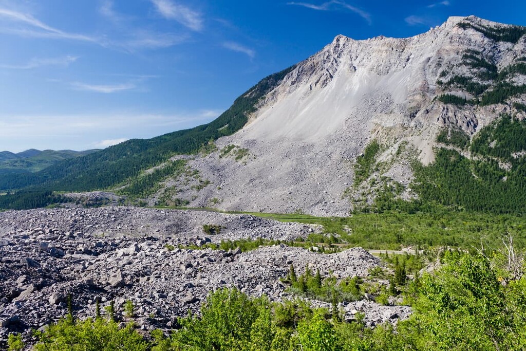
Early in the morning of April 29, 1903, about 110 million tons of limestone slid from the side of Turtle Mountain, racing across the valley and up the opposite side in less than two minutes. The slide obliterated part of the town of Frank, the railway, and the coal mine. There were an estimated 70–90 residents who perished in the event.
The Interpretive Trail is a casual 1.5 km (1 mi) trail that winds through the boulder field that lays across the valley. There are seventeen stops along the trail that teach the history and geology of the area. The trail also brings you to see some of the astonishingly large boulders that tumbled from Turtle Mountain.
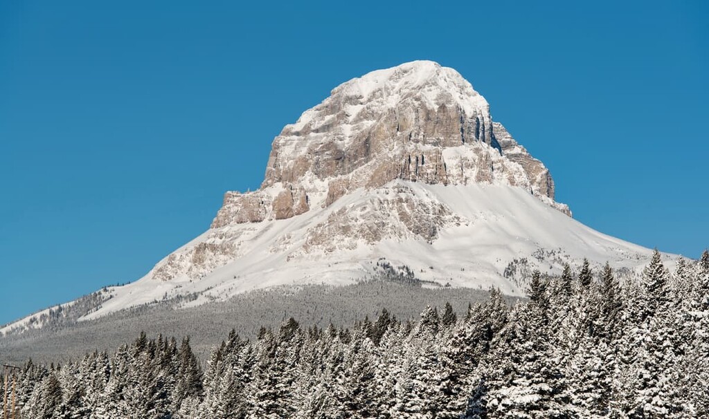
Crowsnest Mountain is an unmistakable presence on the northern horizon as you’re passing through Crowsnest Pass. There is a 7.4 km (4.4 mi) out and back trail with 1,079 m (3,539 ft) of elevation gain that takes you to the summit. Note that this is considered to be a difficult hike and it may be best classified as a scramble.
If you have the skills and the physical ability to take on “the Crow,” as locals call it, the views of the valley are stunning. Mount Tecumseh lies to the southwest, Seven Sisters Mountain is the peak due north, while Mount McLaren is due south across the valley.
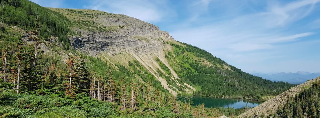
The hike to Window Mountain Lake is a popular 7.6 km (4.5 mi) trail with 335 m (1,099 ft) of elevation gain. The trail is a steady grind up the trail through the forest with intermittent viewpoints of the surrounding mountains.
The destination is a shimmering blue lake surrounded by mountains on three sides. Fishing, swimming, and a walk around the lake are all popular activities at the Window Mountain Lake. The lake is popular for picnics and there are a couple backcountry campsites available for use if you want to spend more time in the area.
Crowsnest Pass has a rich history filled with unique characters and an undeserved amount of tragedies for such a small area. There are many historic sites that bring the region’s history to life and provide a place for a reverent moment of respect for those that lost their lives working the mines. The following is a list of the provincial historic sites that you can find in Crowsnest Pass:
Crowsnest Pass is located near the Continental Divide and there are communities in British Columbia as well as Alberta that are worth including as part of a tour of the region.
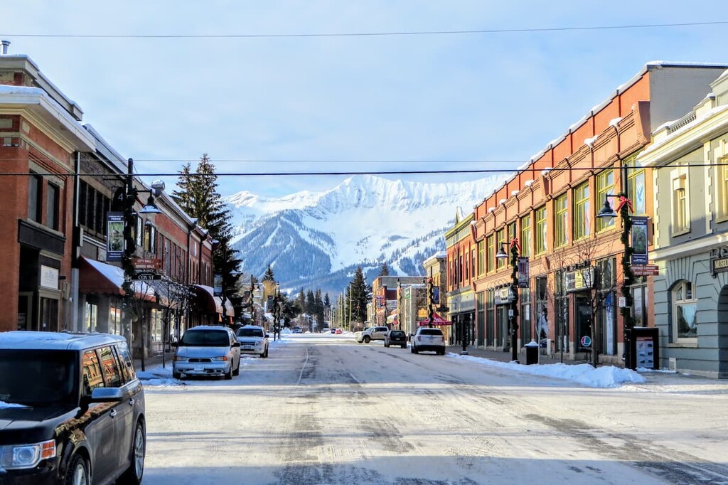
Coleman and Blairmore are the largest communities of Crowsnest Pass. The communities are located along Highway 3 and were originally settled as coal mining towns in the early twentieth century. The communities have both accommodations and various stores that are worth checking out before your adventures.
A significant regional attraction is the Frank Slide Interpretive Centre, where you can see and hear firsthand what happened the night that Turtle Mountain fell and covered the town of Frank.
Located along Highway 3, some 71 km (42 mi) to the west of Crowsnest Pass in British Columbia at the south end of the Harrison Range, the city of Fernie was founded in 1898 by William Fernie. By 1904, Fernie was incorporated as a city, and, to this day, it is the only city-class municipality to be completely surrounded by the Rocky Mountains.
Fernie has embraced the same mountain culture found in the towns of Banff and Canmore in Alberta. As a result, it’s become a tourist hotspot, especially during the winter months. Skiing is especially popular near Fernie, thanks to the Fernie Alpine Resort, which was originally created in the 1960s and has since grown to be the modern ski resort that we all know and love.
Fernie has incredible activities, amazing scenery and wildlife, and an adorable downtown filled with charming stone buildings.
Sparwood is a neat wilderness town with a fascinating history. It is located only 42 km (24 mi) to the west of Crowsnest Pass. Initially, Sparwood was nothing more than a railway stop in the late nineteenth century. It was named for the lumber that was harvested from the area and sent to the shipyards to make spars for ocean liners.
Mining coal and harvesting lumber have been the primary economic drivers of the region. Officially incorporated in 1966, Sparwood has continued to be the primary community for workers in many of the region’s mines.
The Terex Titan is a landmark worth visiting while driving along Highway 3 past Sparwood. The monstrous green truck was once the largest truck in the world and it now sits as a landmark and a salute to the history of the town.
The town of Pincher Creek is located 57 km (34 mi) to the east of Crowsnest Pass. In 1868, a group of prospectors lost a pincher (a tool for horse care) in the creek in this area. In 1874, when the North-West Mounted Police came to southern Alberta, one of them found the rusted tool in the creek and named the creek Pincher Creek.
The town's history dates back to 1876 when the North-West Mounted Police established a horse farm in the area. Within the town is the historic Kootenai Brown Pioneer Village which covers 6 acres (2.4 ha) and has 27 heritage buildings. These buildings house over 30,000 artifacts that represent what life was like for the early European settlers of the area.